
Mori Atlas logo
National parkBarrington Tops National Park

Discover a unique altitudinal vegetation gradient and ancient Gondwana rainforests.

Barrington Tops National Park: Protected Landscape, Geography, and Atlas Exploration

Barrington Tops National Park stands as a protected wilderness area within New South Wales, Australia, distinguished by its remarkable altitudinal vegetation gradient. This national park protects a vast expanse of mountainous terrain that transitions from subtropical rainforests in sheltered gullies to temperate woodlands and subalpine environments on exposed peaks, showcasing ancient geological heritage. Its unique ecology, including the southernmost subtropical rainforests and remnant Gondwana flora, offers profound insights into Australia's natural history and landscape evolution, making it a vital component for geographic and protected-area discovery.

Gondwana RainforestsWilderness AreaSubtropical RainforestAlpine EnvironmentWorld Heritage SiteBirdwatching
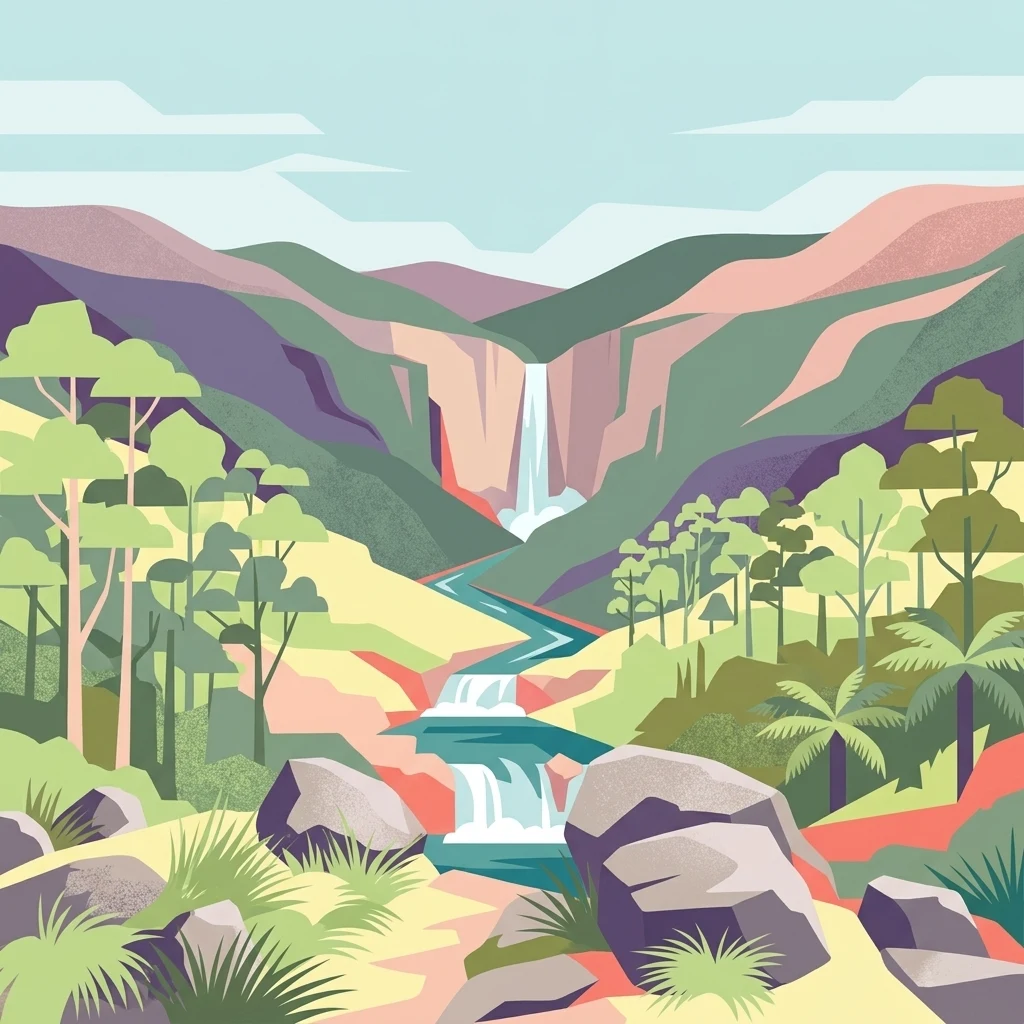
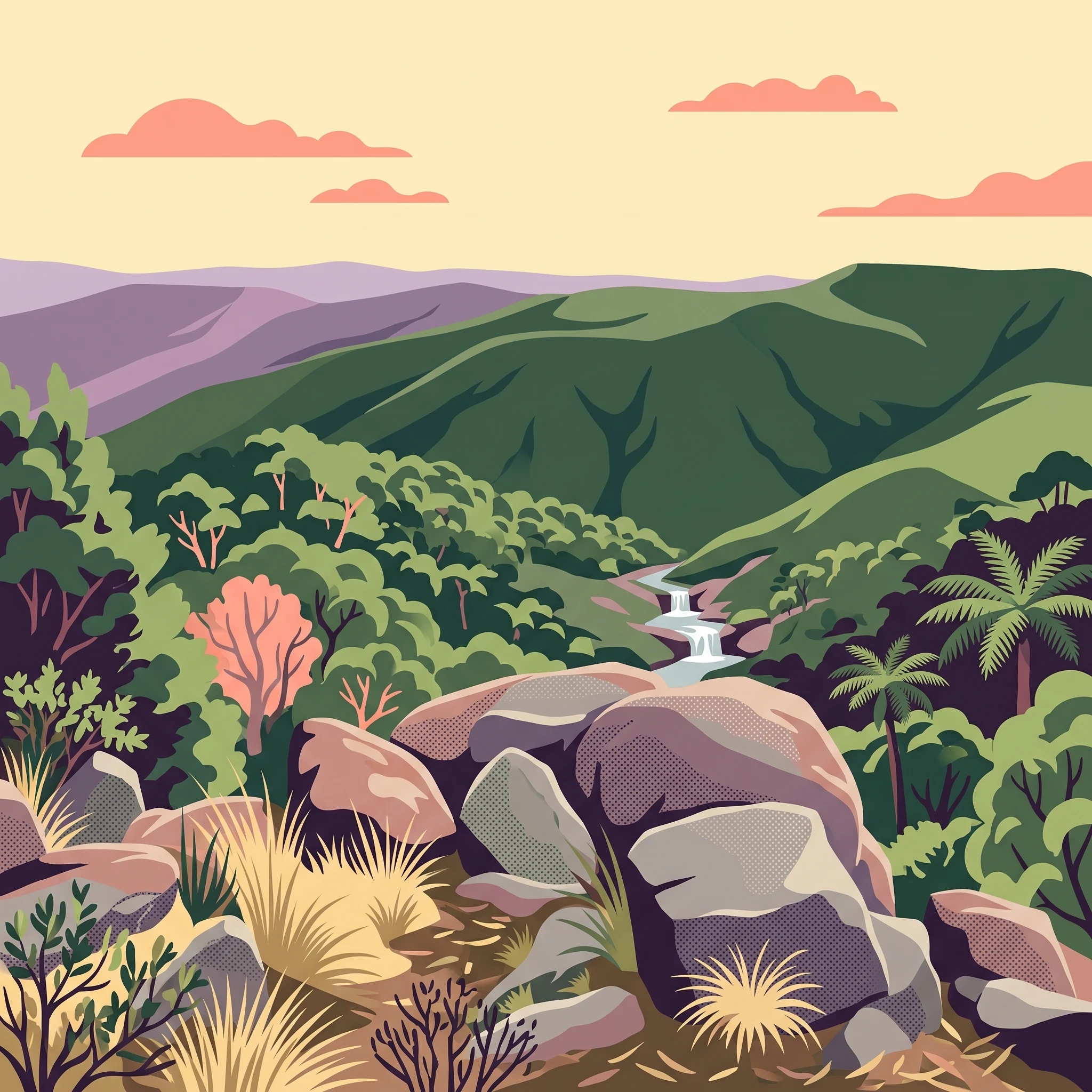
Illustrated view of a waterfall cascading through rocky terrain with forested mountains and a river

Barrington Tops National Park

National park

Park overview

Structured park overview, official facts, and landscape profile for Barrington Tops National Park

Barrington Tops National Park park facts, protected area profile, and essential visitor context

Review the core facts for Barrington Tops National Park, including designation, size, terrain, visitor scale, habitats, and operating context in one park-focused overview.

About Barrington Tops National Park

Barrington Tops National Park represents one of New South Wales premier alpine wilderness areas, offering visitors a罕见 combination of accessible natural beauty and significant ecological heritage. The park occupies a elevated plateau position within the Mount Royal Range, creating a landscape of remarkable topographic diversity. The underlying geology, composed of ancient sedimentary rocks capped with granite, has been weathered over hundreds of millions of years to produce the distinctive rounded boulder formations visible throughout the park today. This geological foundation supports an equally diverse ecological character, where visitors can traverse from subtropical rainforest valleys with towering tree ferns and ancient Antarctic beech, through temperate eucalypt forests, to subalpine heath communities on the windswept peaks. The Barrington River and Williams River systems traverse the park, providing critical aquatic habitats and contributing to the region's exceptional water purity. Access from Sydney and Newcastle makes this park a popular destination for weekend getaways, with numerous walking tracks and camping areas distributed throughout the park. The well-maintained gravel roads and designated four-wheel drive tracks allow visitors to explore both the accessible sections and more remote wilderness areas.

Quick facts and research context for Barrington Tops National Park

Barrington Tops National Park spans 765 square kilometres in northern New South Wales, situated between the towns of Scone, Singleton, Dungog, Gloucester and East Gresford. The highest peak, Brumlow Top, rises to 1,586 metres above sea level. The park is classified as IUCN Category Ib wilderness area and is managed by the NSW National Parks and Wildlife Service. Annual rainfall varies dramatically across the park, from around 750 millimetres in the northwest to exceeding 2,000 millimetres in the southeast. Snow regularly falls on the upper peaks during winter months.

Protection and recognition

Analyzing the official geographic boundaries and documented terrestrial protection framework.

Barrington Tops National Park Protection Status and Terrestrial Boundaries

Geographic datasets verify the terrestrial protection status and established conservation boundaries of Barrington Tops National Park. Analyzing official administrative records helps researchers map regional preservation networks and trace managed wilderness zones.

Protection details

Protection scope
Terrestrial
Transboundary protection
No
Park context

Deeper park guide and search-rich context for Barrington Tops National Park

Barrington Tops National Park history, landscape, wildlife, and travel context

Explore Barrington Tops National Park through its history, landscape character, ecosystems, wildlife, conservation priorities, cultural context, and seasonal travel timing in a structured park guide built for atlas discovery and search intent.

Why Barrington Tops National Park stands out

Barrington Tops is best known for its extraordinary altitudinal vegetation gradient, which supports the most southerly occurrence of subtropical rainforest in Australia. The park protects one of only two known populations of Antarctic beech in mainland Australia, a remnant of the ancient Gondwana flora that once dominated the continent. The plateau supports globally significant populations of rufous scrub-birds, considered one of Australia's most secretive and ecologically important bird species. The area is also recognized for its pristine wild rivers, exceptional air quality, and the dramatic landscape of rounded granite boulders weathering out of ancient volcanic formations.
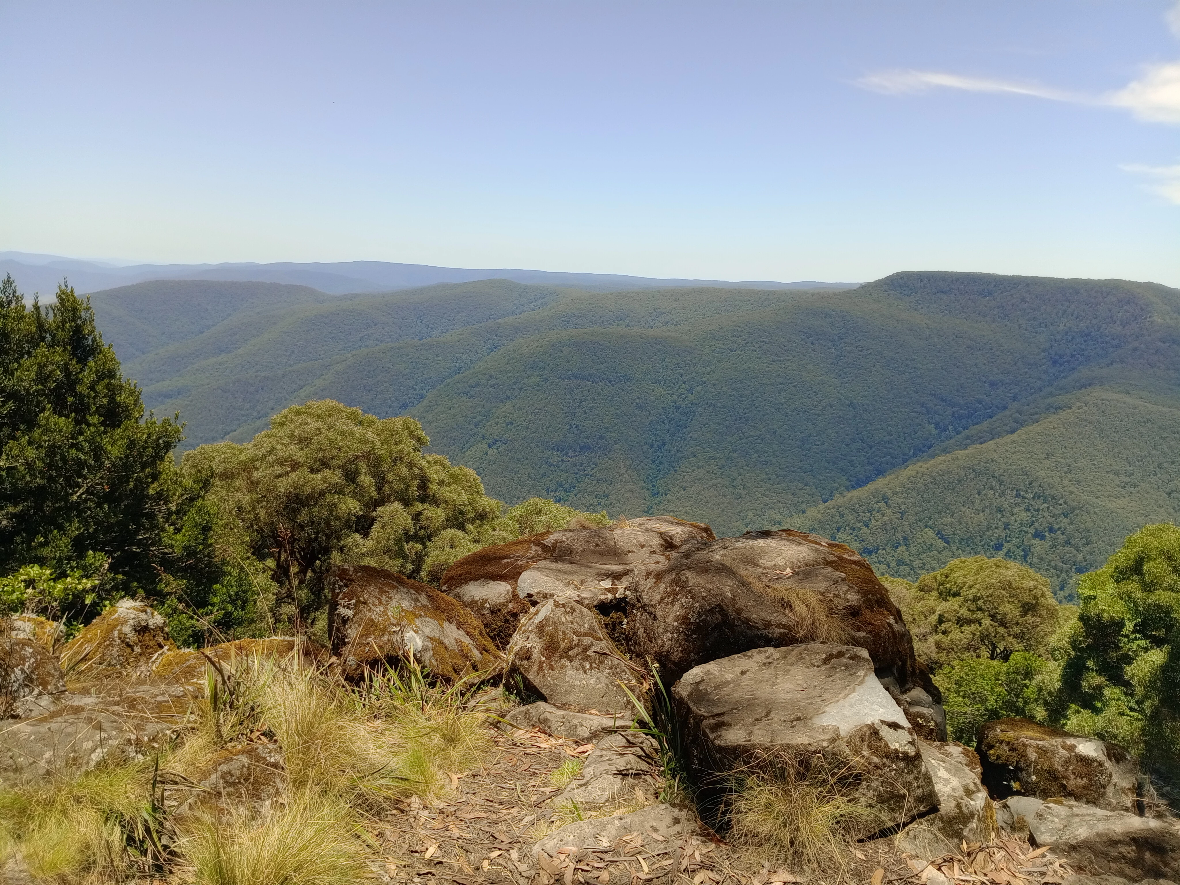
Rocky outcrops with patches of grass and trees in the foreground, overlooking a vast mountainous landscape with forested hills under a clear blue sky
Panoramic view of Barrington Tops National Park from Thunderbolt's Lookout

Barrington Tops National Park history and protected-area timeline

The Barrington Tops region has been continuously inhabited by Aboriginal peoples for thousands of years, with the traditional owners including the Gringai people of the southern valleys, the Wonnarua people of the western country, and the Worimi and Birpai peoples of the eastern side. European recognition of the area's significance came in 1969 when the land between Mount Barrington, Mount Royal and Gloucester Tops was declared Barrington Tops National Park. In 1986, the park was inscribed as part of the Gondwana Rainforests of Australia World Heritage Site, and subsequently designated as a Wilderness Area under NSW legislation. The Barrington Guest House, built in 1930 near the upper Williams River, served as a focal point for visitor accommodation until its destruction by fire in 2006. The site was purchased in 2024 by a group of previous guests with plans to make it safe for future visitation. The park has a notable aviation history, with several aircraft accidents occurring in the area due to its altitude, frequent fog, and challenging weather conditions. The most significant crash sites include Aeroplane Hill, named in recognition of these incidents.

Barrington Tops National Park landscape and geographic character

The Barrington Tops landscape is defined by its position as a high plateau nestled between the major peaks of the Mount Royal Range, part of the Great Dividing Range system. The terrain is characterised by steep ridgelines, deep gullies, and exposed rocky balds. The underlying volcanic and sedimentary geology, dating approximately 300 to 400 million years, has produced a distinctive terrain of rounded granite boulders that emerge from the hillsides and ridgelines throughout the park. The highest point, Brumlow Top, reaches 1,586 metres and provides sweeping views across the surrounding wilderness. The Barrington River and its tributaries have carved scenic valleys through the park, creating diverse microhabitats from river flats to cascading streams. The combination of altitude, exposed ridgelines, and ancient rock formations creates a landscape of particular scenic grandeur, especially when winter snow caps the peaks or spring wildflowers carpet the alpine meadows.
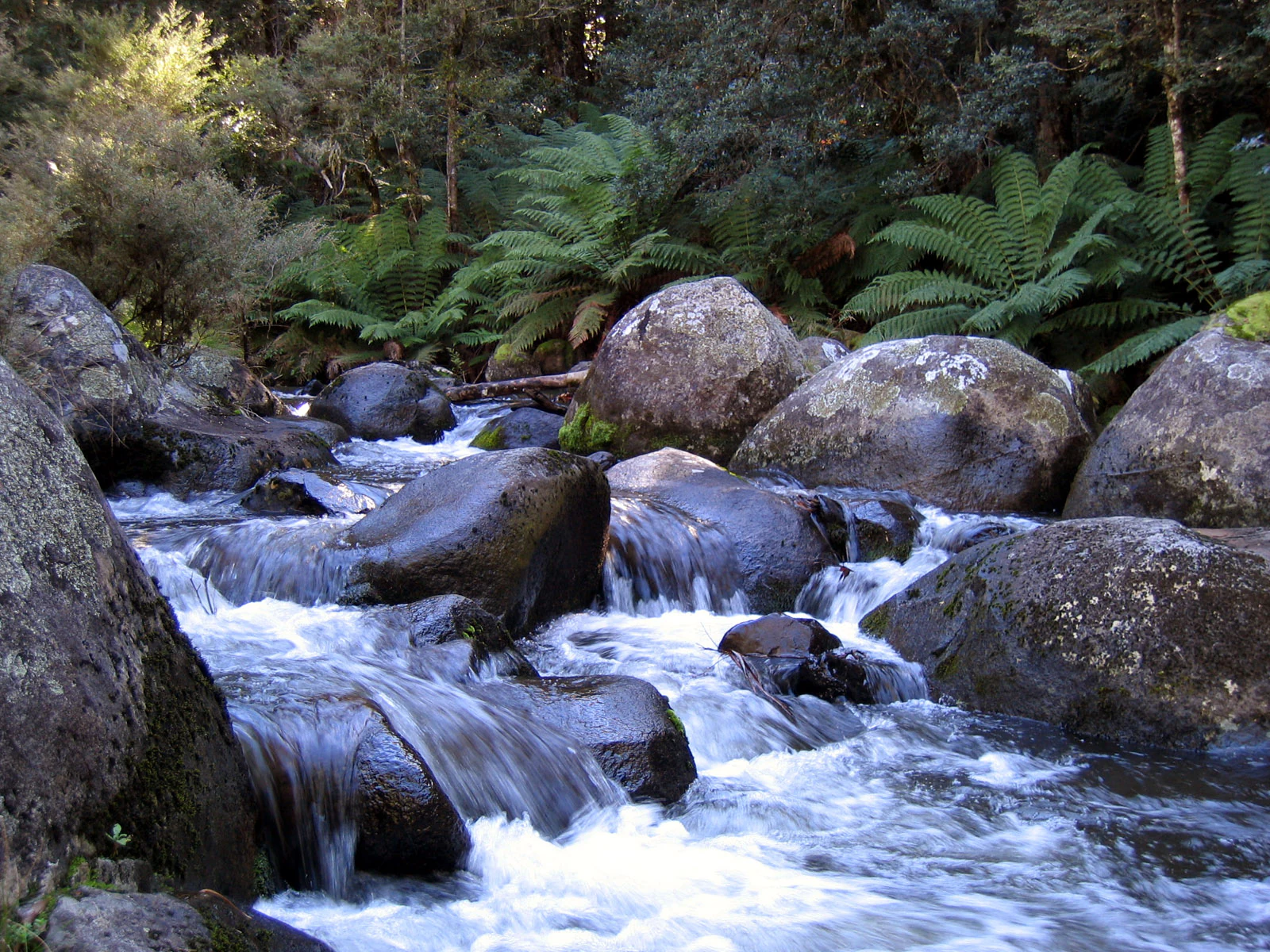
River flowing over rocks with dense forest vegetation in background
Barrington River flowing through forested terrain in Barrington Tops National Park

Barrington Tops National Park ecosystems, habitats, and plant life

The ecological diversity of Barrington Tops National Park is extraordinary for its geographic position, representing the southernmost limit of subtropical rainforest in Australia. The vegetation sequence follows a clear altitudinal zonation, with subtropical rainforests dominated by Antarctic beech, tree ferns, and dense understorey plants occupying the sheltered gullies and lower slopes. As elevation increases, these rainforests transition through temperate mixed forests featuring snow gums and a diverse understorey, to subalpine woodlands and eventually alpine heath communities on the highest peaks. The Antarctic beech forests are of particular significance, representing one of only two remaining populations of this ancient Gondwana relict species on mainland Australia. The park's moisture regime, with annual rainfall exceeding 2,000 millimetres in the southeast, supports lush moss and fern communities throughout the forest understorey. The native raspberry, native cherry, and lilli pilli provide seasonal foraging opportunities and represent the park's edible plant heritage.
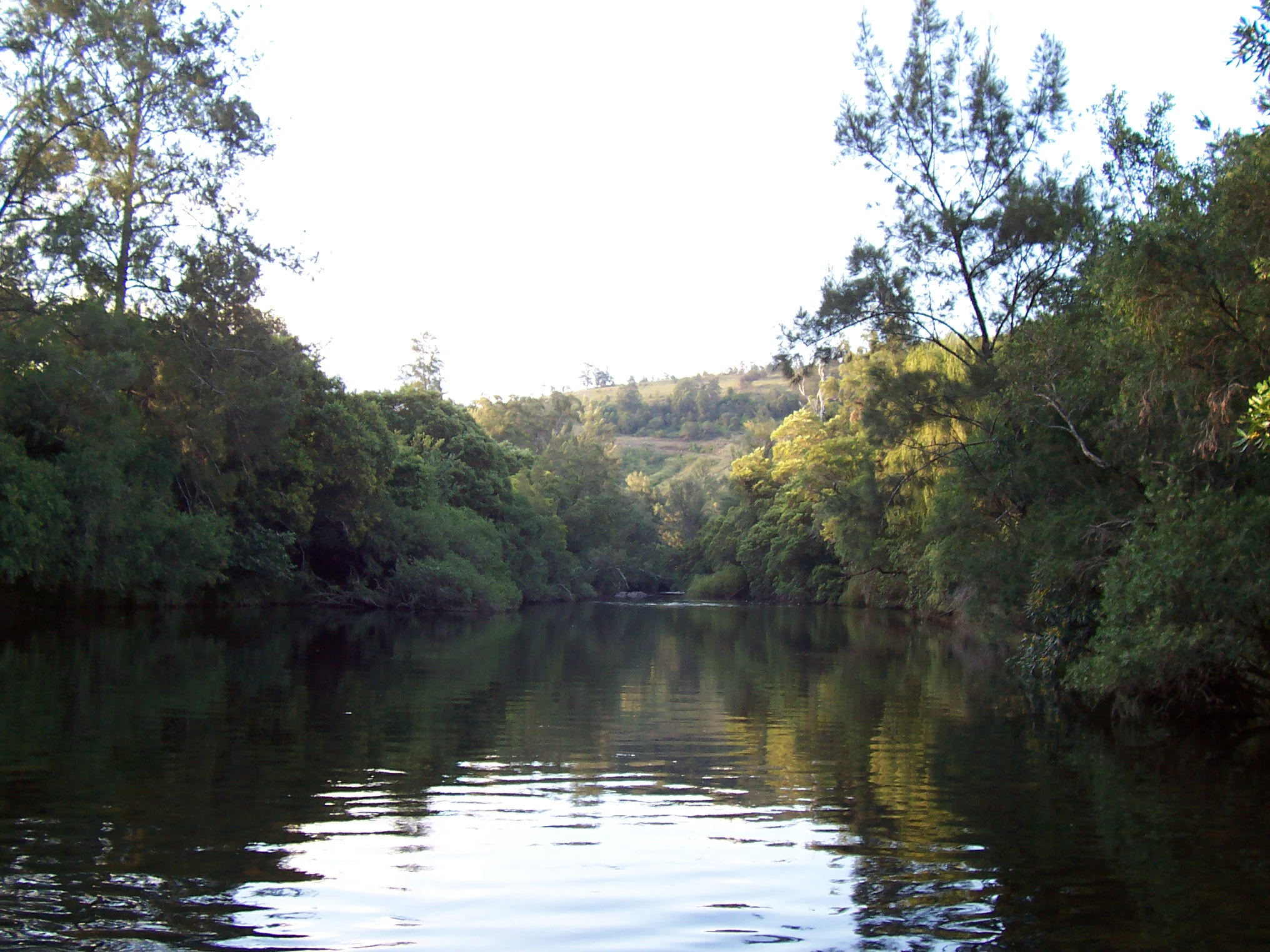
Calm river with reflections surrounded by dense green forest on both sides, with forested hills in the background
Barrington River flowing through dense forest in Barrington Tops National Park

Barrington Tops National Park wildlife and species highlights

The wildlife community of Barrington Tops reflects both the diversity of habitats present and the relative remoteness of much of the park, which has allowed sensitive species to persist largely undisturbed. The park supports a globally significant population of rufous scrub-birds, a secretive ground-dwelling bird considered one of Australia's most important conservation priorities. The bird community also includes flame robins, pale-yellow robins, paradise riflebirds, green catbirds, regent bowerbirds, and Australian logrunners. Nocturnal species are represented by barking owls and greater sooty owls, while common mammals include eastern grey kangaroos, pademelons, and echidnas. More reclusive species such as quolls, native rodents, and platypus may be encountered by patient observers. However, the park also faces challenges from invasive species including feral horses, deer, feral pigs, feral goats, foxes, and cats, with control programs underway to mitigate their ecological impact.

Barrington Tops National Park conservation status and protection priorities

Barrington Tops National Park holds significant conservation status as part of the Gondwana Rainforests of Australia World Heritage Site, recognised in 1986 for its outstanding natural heritage values and added to the Australian National Heritage List in 2007. The park is also designated as an Important Bird Area due to its globally significant population of rufous scrub-birds. The preservation of wild rivers flowing through the Barrington Tops adds another dimension to the park's conservation significance, with several river systems classified as wild rivers due to their exceptional purity. The steep terrain has naturally limited human disturbance across much of the park, helping to preserve intact ecosystems. Management efforts focus on controlling invasive species, maintaining wilderness values, and protecting the ancient geological and ecological heritage that makes this area unique.

Barrington Tops National Park cultural meaning and human context

The Barrington Tops region holds deep significance for Aboriginal peoples, with the traditional owners including the Gringai, Wornarua, Worimi, and Birpai communities. These peoples have maintained continuous connections to Country throughout the Barrington Tops area for thousands of years, with the landscape holding cultural values that extend beyond its ecological significance. European exploration and settlement of the area began in the nineteenth century, with the establishment of the Barrington Guest House in 1930 representing an early attempt to make the wilderness accessible to visitors. The region's aviation history, including multiple aircraft accidents, reflects both the hazards of the mountainous terrain and the strategic importance of the airspace. The ongoing efforts to rebuild the guest house site represent a continuation of the human relationship with this landscape.

Top sights and standout views in Barrington Tops National Park

Barrington Tops National Park offers visitors the chance to experience one of Australia's most ecologically significant wilderness areas within reasonable reach of major population centres. The Antarctic beech rainforests represent a living connection to the ancient Gondwana supercontinent, while the alpine peaks provide dramatic scenery and winter snow experiences. The network of walking tracks, from easy nature walks to challenging wilderness treks, allows visitors to explore the diverse habitats and landscapes. The wildlife viewing opportunities, particularly for birds such as the rufous scrub-bird and regent bowerbird, attract nature enthusiasts from around the world. The wild rivers and clear mountain streams support healthy aquatic ecosystems and contribute to the park's reputation for environmental purity.

Best time to visit Barrington Tops National Park

The best time to visit Barrington Tops depends on the experience sought. Summer months (December to February) offer the most reliable access to the higher elevations and are popular for camping and bushwalking, though afternoon thunderstorms can occur. Autumn (March to May) brings cooler temperatures and excellent conditions for walking, with the forest displaying seasonal colour. Winter (June to August) transforms the alpine areas with snow, creating a dramatically different landscape and drawing visitors for snow viewing, though some roads may close and conditions can be hazardous. Spring (September to November) sees wildflower displays across the alpine meadows and is a particularly beautiful time to visit, though weather can be unpredictable. The park is accessible year-round, though visitors should be prepared for rapidly changing conditions, especially at higher elevations where fog, cloud, and cold temperatures can occur in any season.

Park guides

Targeted geographic analysis and seasonal planning resources for the high plateau

Focused Guides for Barrington Tops National Park and Protected Wilderness Terrain

Selected published guides provide structured answers regarding optimal timing for high plateau excursions and weather shifts. Readers can examine seasonal visit planning details concerning mild shoulder season hiking and midwinter alpine conditions.
Monthly climate preview

Analyze monthly average temperatures and precipitation patterns measured at representative elevations

Barrington Tops National Park Climate and Long-Term Weather by Month

Long term climate normals recorded at a representative elevation of 606 meters reveal a yearly rhythm of moderate precipitation alongside average monthly mean temperatures ranging from roughly 8 to 22 degrees Celsius. Accessing the complete meteorological profile provides comprehensive monthly statistics on maximum and minimum thermal ranges to support deeper geographic analysis.
Annual mean15 °C
8 °C23 °C
Jan23°
Feb21°
Mar19°
Apr15°
May12°
Jun
Jul
Aug
Sep13°
Oct16°
Nov19°
Dec21°
Warmest month
January

22.5 °C

Coolest month
July

7.9 °C

Wettest month
February

3.4 mm/day

Driest month
August

1.3 mm/day

Park location guide

Geography guide, regional context, and park location map for Barrington Tops National Park

Barrington Tops National Park park geography, regions, and map view in Australia

Understand where Barrington Tops National Park sits in Australia through a broader geographic reading of the surrounding landscape, nearby location context, and its mapped position within the national park landscape.

How Barrington Tops National Park fits into Australia

Australia is a constitutional monarchy and federal parliamentary democracy comprising six states and ten territories. With a population of nearly 28 million, it is one of the world's most urbanised countries, with most people concentrated on the eastern seaboard. The country has a high Human Development Index and is known for its cultural diversity, ancient Aboriginal heritage, and unique wildlife.

Wider geography shaping Barrington Tops National Park in Australia

Australia occupies the entire Australian continent, the island of Tasmania, and numerous smaller islands. It is the world's flattest and driest inhabited continent, featuring vast deserts in the interior (the Outback), tropical rainforests along the eastern coast, and a coastline bordering the Indian and Pacific Oceans.

Map view of Barrington Tops National Park

Use this park location map to pinpoint Barrington Tops National Park in Australia, understand its exact geographic position, and read its mapped placement within the surrounding landscape more clearly.

Pigeon | © OpenStreetMap contributors

Location context for Barrington Tops National Park

New South Wales
Natural feature types

Explore the Named Natural Features of Barrington Tops National Park

Delve into the varied landscape of Barrington Tops National Park by examining its named peaks, valleys, and river systems. MoriAtlas provides a structured view of the terrain and ecological zones that define this significant protected area in the Mount Royal Range.
Recorded earthquake history

View Recorded Earthquake History Near Barrington Tops National Park

Access a detailed catalogue of historical earthquakes documented in the area surrounding Barrington Tops National Park. This MoriAtlas collection offers transparent access to seismic data including event magnitude and epicentre location for geographic context.

Barrington Tops National Park Earthquake Records

Catalogued events

3 events

Strongest magnitude

Magnitude 4.2

Most recent event

May 2, 2020

This history includes earthquakes recorded inside the park or within 50 km of its borders

A visual atlas of its unique altitudinal vegetation gradient and ancient geological features

Discover Barrington Tops National Park's Scenery, Terrain, and Protected Landscapes

Browse comprehensive imagery of Barrington Tops National Park, revealing its dramatic altitudinal vegetation zones, from ancient subtropical rainforests to exposed alpine plateaus. These visual references offer clear insights into the park's distinctive terrain, protected habitats, and the unique Gondwana Rainforests landscape character.

Rocky outcrops with patches of grass and trees in the foreground, overlooking a vast mountainous landscape with forested hills under a clear blue sky

Echidna with spines walking on gravel trail surrounded by rocks and greenery

River flowing over rocks with dense forest vegetation in background

Calm river with reflections surrounded by dense green forest on both sides, with forested hills in the background

Park atlas

Trace the regional geography, comparing adjacent protected landscapes across the Great Dividing Range system.

Explore Related National Parks and Protected Areas Near Barrington Tops National Park

Browse a curated list of national parks and protected areas geographically connected to Barrington Tops National Park, spanning diverse terrains and conservation landscapes. This atlas-style view facilitates comparative exploration, revealing how protected zones extend across the Hunter Valley region and the Great Dividing Range.
Protected areaNew South Wales
Park boundaries overlap#1 closest

Northwest

Barrington Tops State Conservation Area: Protected Plateau and Volcanic Landscape Context

Highland geography within the Mount Royal Range, New South Wales

This protected area represents a significant upland region in New South Wales, characterized by weathered plateau edges and cool mountain environments. The terrain supports high-altitude peat wetlands and diverse montane forests, rooted in the ancient geological legacy of the Barrington Volcano. Its protected boundaries link directly to the Gondwana Rainforests, providing essential habitat continuity across the Great Dividing Range.

Area
84.46 km²
Established
2003
Relief
Mountain
Climate
Temperate
National parkNew South Wales
Park boundaries overlap#2 closest

Southwest

Mount Royal National Park: A National Park in New South Wales for Geographic Discovery

Explore its protected boundaries and landscape context.

Mount Royal National Park is a key protected area in New South Wales, offering an opportunity to delve into its specific geographic identity and mapped landscape features. As a national park, it provides structured data for understanding protected lands within Australia. This detailed entry supports exploration of the park's unique regional context and its contribution to the broader atlas of natural landscapes.

Area
69 km²
Established
1997
IUCN
II
Relief
Mountain
Nature reserveNew South Wales
5.2 km away#3 closest

Southeast

Black Bulga State Conservation Area: Forest Geography and Protected Area Overview

A vital ecological refuge in the Hunter Region of New South Wales

Black Bulga State Conservation Area encompasses a diverse bushland mosaic of Sydney blue gum, tallowwood, and subtropical rainforest patches. This reserve highlights the abrupt shifts in terrain and vegetation typical of the Barrington Tops foothills, providing a stable habitat for koalas and various marsupials within its protected boundaries.

Area
15.54 km²
Established
2003
IUCN
Ia
Relief
Upland
State or regional parkNew South Wales
11 km away#4 closest

East

Copeland Tops State Conservation Area: Geography and Protected Land Overview in New South Wales

Mapping forest ecosystems and historic industrial relic landscapes.

Copeland Tops State Conservation Area provides a distinct look at the Hunter Region landscape, offering an unusual blend of dry rainforests with massive Moreton Bay figs and red cedar alongside expansive wet sclerophyll forests. The reserve functions as an essential habitat for koalas, wombats, and greater gliders, while the Mountain Maid gold mine remnants offer insight into the local nineteenth century history hidden within these sheltered valleys.

Area
22.01 km²
Established
2003
Relief
Upland
Scope
Terrestrial
National parkNew South Wales
19 km away#5 closest

Northeast

Woko National Park: Explore Its Protected Landscape and Geographic Boundaries

Discover the mapped terrain and regional atlas context of Woko National Park.

Woko National Park presents a unique opportunity for geographic discovery, situated within New South Wales, Australia. This detail page focuses on the park's protected landscape and its mapped boundaries, providing a clear understanding of its geographic identity. Engage with Woko National Park as a key component of the Australian national park atlas, highlighting its regional setting and natural terrain.

Area
85.98 km²
Established
1982
IUCN
II
Relief
Highland
Nature reserveNew South Wales
About 29 km away#6 closest

East

The Glen Nature Reserve: Protected Forest Geography and Mapped Sanctuary in New South Wales

Conservation-focused landscape in the Hunter Region

Covering over 2,700 hectares, The Glen Nature Reserve protects a rich mosaic of sub-tropical sclerophyll forest and creek-lined gullies in the Hunter Region. The reserve provides essential habitat for threatened wildlife and represents a key node in the protected land network of eastern New South Wales, highlighting the intersection of forest types and local watershed topography.

Area
27.5 km²
Established
1999
IUCN
Ia
Relief
Upland
National parkNew South Wales
32 km away#7 closest

North

Nowendoc National Park: Protected Area Identity and New South Wales Geography

Mapping the natural landscapes and protected boundaries within this national park.

Nowendoc National Park in New South Wales, Australia, offers a distinct protected landscape for atlas-driven discovery. This entry provides critical geographic context, detailing the park's mapped boundaries and its place within the regional terrain. Explore the specific identity of Nowendoc National Park as a protected natural area, crucial for understanding Australian conservation landscapes and geographic context.

Area
88 km²
Established
1999
IUCN
II
Relief
Upland
Nature reserveNew South Wales
About 32 km away#8 closest

Northeast

Bretti Nature Reserve: Geography and Protected Escarpment Landscapes in New South Wales

Mapped riverine corridors and wet forest ecosystems

Bretti Nature Reserve serves as a vital conservation anchor in the Hunter Region, protecting a rare mix of subtropical rainforest and wet sclerophyll forest. This detailed record maps the reserve's position along the Bernard River, illustrating its role as a landscape-scale link within the Great Eastern Escarpment's diverse mountain terrain.

Area
29.02 km²
Established
1999
IUCN
Ia
Relief
Mountain

Common questions about visiting, size, designation, and location context for Barrington Tops National Park

Barrington Tops National Park FAQs for park facts, access, geography, and protected area context

Find quick answers about Barrington Tops National Park, including protected-area facts, park geography, trail and visitor context, and how the park fits into its surrounding country and regional landscape.
MoriAtlas Explorer

Continue Your Protected Areas Search Across the Global Atlas

Deepen your exploration by continuing the structured search for national parks and protected areas worldwide. Utilize the comprehensive filtering capabilities to compare different conservation landscapes and refine your understanding of global park geography. Discover more about the distribution and characteristics of protected natural areas.

Global natural geography