Mori Atlas logo
National parkCastle Tower National Park

Explore the mapped terrain and protected boundaries of this prominent Queensland national park.

Castle Tower National Park: Queensland National Park Landscape & Geographic Context

Castle Tower National Park in Queensland, Australia, offers a unique glimpse into a protected landscape defined by rugged granite peaks and open eucalypt woodlands. Established in 1932, this national park near the Gladstone Region provides a distinct geographic identity, with Mount Stanley as its highest point. Discover the mapped terrain and the characteristic elevated landscape that distinguishes this protected area, contributing to its long-standing conservation significance within Central Queensland.

Queensland national parksGranite peaksEucalypt woodlandProtected areasCentral QueenslandGladstone Region

Castle Tower National Park

National park

Park overview

Structured park overview, official facts, and landscape profile for Castle Tower National Park

Castle Tower National Park park facts, protected area profile, and essential visitor context
Review the core facts for Castle Tower National Park, including designation, size, terrain, visitor scale, habitats, and operating context in one park-focused overview.

About Castle Tower National Park

Castle Tower National Park protects a significant area of rugged granite terrain in central Queensland, Australia. The park's defining feature is its network of granite peaks, with Mount Stanley reaching 690.9 metres above sea level as the highest point within the reserve. These formations rise from a landscape of open eucalypt woodland, creating a park of considerable scenic character despite its relatively modest total area of 49.80 square kilometres. The park's location in the Gladstone Region places it within a broader landscape of coastal and hinterland environments that are otherwise largely modified for agriculture and mining. The protected status of Castle Tower National Park has ensured the preservation of this granite peak landscape and its associated vegetation communities since 1932, making it one of Queensland's long-established protected areas.

Quick facts and research context for Castle Tower National Park

Castle Tower National Park is situated in coastal central Queensland within the Gladstone Region, spanning the boundary between the localities of Iveragh and Foreshores. The park was formally established in 1932 and is managed by the Queensland Parks and Wildlife Service, holding IUCN protected area category II status. The terrain features elevations ranging from 313 metres above sea level at the base to 690.9 metres at Mount Stanley, the park's highest peak. The vegetation is characterized by open eucalypt woodland with some hoop pine stands, creating a distinctive semi-woodland landscape typical of central Queensland.

Park context

Deeper park guide and search-rich context for Castle Tower National Park

Castle Tower National Park history, landscape, wildlife, and travel context
Explore Castle Tower National Park through its history, landscape character, ecosystems, wildlife, conservation priorities, cultural context, and seasonal travel timing in a structured park guide built for atlas discovery and search intent.

Why Castle Tower National Park stands out

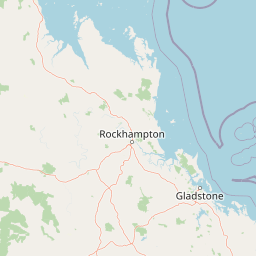
Castle Tower National Park is best known for its prominent granite peak formations, particularly Mount Castle Tower, which is visible from Lake Awoonga located nearby. The park's dramatic elevated terrain and relatively isolated character distinguish it within the Gladstone Region. The combination of exposed granite summits rising above eucalypt woodland creates a distinctive landscape that has attracted conservation protection for over nine decades.

Castle Tower National Park history and protected-area timeline

Castle Tower National Park was established in 1932, representing an early commitment by the Queensland government to protecting notable natural landscapes within the state. The park's creation reflects historical recognition of the granite peak formations around Mount Castle Tower as a landscape worthy of formal protection. Management responsibility rests with the Queensland Parks and Wildlife Service, which oversees the park's conservation mandate. The requirement for permission to access the park through adjacent property owned by the Gladstone Area Water Board has helped maintain the park's relatively undeveloped character over the decades.

Castle Tower National Park landscape and geographic character

The landscape of Castle Tower National Park is defined by granite bedrock formations creating a series of prominent peaks and ridges. The terrain rises sharply from the surrounding plains, with Mount Stanley at 690.9 metres representing the highest elevation. The general park elevation sits around 313 metres above sea level, with significant variation across the rocky ridgelines and slopes. The open eucalypt woodland dominates the lower slopes and valley areas, while the exposed granite surfaces of the peaks support limited vegetation, creating a contrast between the vegetated lower terrain and the bare rock summits.

Castle Tower National Park ecosystems, habitats, and plant life

The park's vegetation is characterized by open eucalypt woodland, representing a common vegetation type across central Queensland. Scattered stands of hoop pine add compositional diversity to the woodland, occurring in pockets where conditions support this conifer species. The combination of eucalypt woodland with hoop pine patches creates a heterogeneous forest structure across the park. The granite peak environments support distinct ecological conditions compared to the woodland slopes, with exposed rock surfaces and associated specialized plant communities.

Castle Tower National Park wildlife and species highlights

While specific wildlife details are limited in available sources, the open eucalypt woodland and granite peak environments of Castle Tower National Park provide habitat for various Australian native species typical of central Queensland. The maintained vegetation cover and relative isolation of the park support ecological communities that have persisted through the surrounding modified landscapes.

Castle Tower National Park conservation status and protection priorities

Castle Tower National Park holds IUCN protected area category II status, designating it as a national park focused on ecosystem protection and biodiversity conservation. The park's protected status since 1932 has preserved the granite peak landscape and associated eucalypt woodland communities. The park contributes to the conservation network within the Gladstone Region, protecting natural values in an area otherwise largely converted to other land uses.

Top sights and standout views in Castle Tower National Park

The most notable highlight of Castle Tower National Park is the dramatic granite peak of Mount Castle Tower, which can be viewed from Lake Awoonga, creating a scenic backdrop to the reservoir. The park's highest peak, Mount Stanley, offers elevated terrain within a relatively compact protected area. The combination of exposed granite summits rising above eucalypt woodland creates a distinctive visual landscape. The limited access and lack of formal visitor facilities contribute to a remote, undeveloped wilderness character uncommon among more accessible Queensland national parks.

Best time to visit Castle Tower National Park

The park can be visited year-round given its location in central Queensland. The warmer months from October through March bring higher temperatures typical of the subtropics, while winter from June to August offers milder conditions. Visitors should note that access requires prior permission from the Gladstone Area Water Board, and there are no formal visitor facilities within the park. The lack of established trails means visitors should be prepared for self-guided exploration of the remote terrain.

Park location guide

Geography guide, regional context, and park location map for Castle Tower National Park

Castle Tower National Park park geography, regions, and map view in Australia
Understand where Castle Tower National Park sits in Australia through a broader geographic reading of the surrounding landscape, nearby location context, and its mapped position within the national park landscape.

How Castle Tower National Park fits into Australia

Australia is a constitutional monarchy and federal parliamentary democracy comprising six states and ten territories. With a population of nearly 28 million, it is one of the world's most urbanised countries, with most people concentrated on the eastern seaboard. The country has a high Human Development Index and is known for its cultural diversity, ancient Aboriginal heritage, and unique wildlife.

Wider geography shaping Castle Tower National Park in Australia

Australia occupies the entire Australian continent, the island of Tasmania, and numerous smaller islands. It is the world's flattest and driest inhabited continent, featuring vast deserts in the interior (the Outback), tropical rainforests along the eastern coast, and a coastline bordering the Indian and Pacific Oceans.

Map view of Castle Tower National Park

Use this park location map to pinpoint Castle Tower National Park in Australia, understand its exact geographic position, and read its mapped placement within the surrounding landscape more clearly.

Pigeon | © OpenStreetMap contributors

Location context for Castle Tower National Park

Queensland
Park atlas

Explore the regional protected landscapes and national parks near Castle Tower National Park.

Explore Other National Parks and Protected Areas Near Castle Tower National Park, Central Queensland
After exploring Castle Tower National Park, continue discovering other national parks and protected areas situated within its surrounding Central Queensland geography. Compare granite peak formations, eucalypt woodlands, and diverse conservation landscapes to trace the regional spread of protected terrain and understand local ecology.
National parkQueensland

Wild Cattle Island National Park: Queensland National Park and Protected Landscape Discovery

Mapped boundaries and regional geographic context for exploration.

Wild Cattle Island National Park, situated in Queensland, Australia, is identified as a national park focused on preserving its natural landscape. This page provides a detailed view of its protected area status and geographic placement within the broader Australian context. Users can explore the park's specific mapped boundaries and its relation to Queensland's diverse terrain, supporting structured discovery for those interested in protected lands and their regional atlas representation.

Area
5.8 km²
Established
1992
IUCN
II
Relief
Lowland
National parkQueensland

Mount Colosseum National Park: Queensland's Premier Protected Landscape Discovery

Mapped natural terrain and regional geographic context.

Mount Colosseum National Park offers a detailed view into Australia's protected natural areas, specifically within the state of Queensland. This entry focuses on its identity as a national park, providing essential context for its mapped boundaries, surrounding regional geography, and the unique character of its natural landscape. It serves as a key reference for understanding the park's protected status and geographic significance.

Area
8.4 km²
Established
1977
IUCN
II
Relief
Mountain
National parkQueensland

Kroombit Tops National Park: Protected Landscape and Queensland Geography Atlas

Explore mapped terrain and regional park context in Australia.

This entry for Kroombit Tops National Park details its role as a protected natural area within Queensland, Australia. Users can engage with its geographic setting, understand its mapped boundaries, and explore its place within the regional landscape. This resource supports discovery through an atlas lens, focusing on the park's specific terrain and its contribution to the broader protected areas of northeastern Australia. It is designed for users interested in the geographic identity and mapped context of natural conservation areas.

Area
74.6 km²
Established
1974
IUCN
II
Relief
Upland
Watercolor illustration showing green trees and distant hills under a pastel sky
National parkQueensland

Eurimbula National Park: Central Queensland's Diverse Coastal Protected Landscape

Explore mapped terrain and protected ecosystem boundaries.

Eurimbula National Park in Queensland is an exceptional example of a protected coastal wilderness, featuring a remarkable array of habitats including mangroves, littoral rainforests, and extensive paperbark wetlands. Its diverse landscape supports significant biodiversity and offers a clear representation of central Queensland's natural heritage. Understanding Eurimbula National Park's geography through its mapped protected area helps situate its ecological importance within the broader Australian atlas.

Area
125 km²
Established
1977
IUCN
II
Relief
Lowland
National parkQueensland

Bulburin National Park: Central Queensland's Significant Subtropical Rainforest Preserve

Mapped protected landscape and ecological refuge.

Bulburin National Park represents the most substantial remaining area of subtropical rainforest in central Queensland, established as a protected national park. Its dense forest ecosystem provides crucial habitat for numerous species, including endangered marsupials and notable birdlife. Exploring Bulburin National Park reveals a distinct natural landscape within Queensland, offering insights into regional conservation and the geographic distribution of vital protected areas.

Established
2015
IUCN
II
Relief
Lowland
Climate
Subtropical
National parkQueensland

Deepwater National Park: Queensland National Park Geography and Protected Landscape

Explore mapped boundaries and regional geographic context.

Deepwater National Park represents a vital point of discovery within Queensland's extensive geography. As a designated national park, it provides crucial insights into protected landscape identity and mapped features. This page serves as a focused entry for understanding the park's specific geographic setting and its contribution to the atlas of Australian protected areas, offering a clear view of its distinct regional context.

Area
43.9 km²
Established
1988
IUCN
II
Relief
Lowland
National parkQueensland

Cania Gorge National Park: A Distinct Queensland National Park with Dramatic Sandstone Cliff Formations

Explore mapped gorge terrain, rock art sites, and diverse Queensland landscapes.

Cania Gorge National Park represents a significant protected area within Queensland, Australia, distinguished by its dramatic 70-meter sandstone cliffs and the ancient Aboriginal rock art found within its caves. The park's rugged gorge terrain, shaped by Three Moon Creek, offers a unique geographic context and landscape to explore. Its mapped boundaries encompass diverse ecological communities and geological features, making it a focal point for understanding regional park identity and natural heritage within Queensland's broader atlas.

Area
30 km²
Established
1977
IUCN
II
Relief
Upland
National parkQueensland

Rundle Range National Park: Queensland's National Park Protected Landscape Exploration

Explore its mapped boundaries and regional geographic context.

Delve into the protected landscape of Rundle Range National Park, a designated national park situated within Queensland, Australia. This entry provides focused insights into its geographic setting, mapped park boundaries, and its significance as a protected area. It is designed to aid in understanding the park's specific natural context and its place within the broader Queensland regional geography for detailed atlas discovery.

Area
21.7 km²
Established
1993
IUCN
II
Scope
Terrestrial

Common questions about visiting, size, designation, and location context for Castle Tower National Park

Castle Tower National Park FAQs for park facts, access, geography, and protected area context
Find quick answers about Castle Tower National Park, including protected-area facts, park geography, trail and visitor context, and how the park fits into its surrounding country and regional landscape.
MoriAtlas Explorer

Continue Your Protected Areas Search Across the Global Atlas

Deepen your exploration by continuing the structured search for national parks and protected areas worldwide. Utilize the comprehensive filtering capabilities to compare different conservation landscapes and refine your understanding of global park geography. Discover more about the distribution and characteristics of protected natural areas.

Global natural geography