Mori Atlas logo
National parkGarden Route National Park

Map the diverse protected terrain of ancient forests, dramatic coastlines, and lake systems.

Garden Route National Park: South Africa's Premier National Park for Coastal and Forest Landscapes

Garden Route National Park represents a critical protected area within South Africa, offering unparalleled opportunities for atlas-based exploration of its unique geography. Spanning a significant portion of the country's southern seaboard, this national park merges rugged coastal cliffs and pristine beaches with ancient indigenous forests and intricate lake systems. Its year-round rainfall supports exceptional biodiversity, making it a distinctive feature on any map of natural landscapes in Africa. Discover the mapped boundaries and geographic context of this expansive conservation area.

Coastal National ParkIndigenous ForestSouth AfricaFynbos BiomeLake SystemNational Park

Garden Route National Park

National park

Park overview

Structured park overview, official facts, and landscape profile for Garden Route National Park

Garden Route National Park park facts, protected area profile, and essential visitor context

Review the core facts for Garden Route National Park, including designation, size, terrain, visitor scale, habitats, and operating context in one park-focused overview.

About Garden Route National Park

Garden Route National Park represents one of South Africa's most ecologically diverse and scenically varied protected areas, stretching along the country's southern coast within the renowned Garden Route region. The park's creation in 2009 unified several previously separate conservation areas, creating a continuous corridor of protected land that encompasses coastal mountains, indigenous forests, lakes, estuaries, and dramatic oceanfront. The park is administered by South African National Parks and serves as a flagship for conservation in the region, protecting habitats that support numerous endemic species found nowhere else on Earth. Visitors to the park experience a landscape where dense forest canopy meets rugged sea cliffs, where tranquil lakes connect through winding waterways, and where the constant sound of waves provides a backdrop to one of Africa's most beautiful coastal wilderness areas.

Quick facts and research context for Garden Route National Park

Garden Route National Park encompasses roughly 1,210 square kilometers along South Africa's southern coast, incorporating three primary sections: Tsitsikamma, Knysna, and Wilderness. The park was formally established in 2009 through the consolidation of previously separate protected areas and now protects approximately 605 square kilometers of indigenous forest. It is administered by South African National Parks and features a temperate climate with consistent precipitation throughout the year, a characteristic that makes it distinctive within the African continent. The park includes significant archaeological sites, multiple lake systems, and serves as a corridor connecting several adjacent marine and terrestrial protected areas.

Protection and recognition

Documented conservation frameworks and biosphere reserve designations in South Africa

Garden Route National Park Protection Status and Official Designations

Visitors and researchers can review the designated protection status, establishment history from 2009, and mixed management scope of Garden Route National Park. Official atlas records highlight the integration of the park within the wider Garden Route UNESCO Biosphere Reserve.

International recognition

Protection details

Protection scope
Mixed
Designated year
2009
Transboundary protection
No
Core area
2,123.75 km²
Buffer area
2,880.32 km²
Park context

Deeper park guide and search-rich context for Garden Route National Park

Garden Route National Park history, landscape, wildlife, and travel context

Explore Garden Route National Park through its history, landscape character, ecosystems, wildlife, conservation priorities, cultural context, and seasonal travel timing in a structured park guide built for atlas discovery and search intent.

Why Garden Route National Park stands out

Garden Route National Park is best known for its spectacular combination of ancient indigenous forests and dramatic coastal scenery. The Tsitsikamma section preserves an 80-kilometer stretch of pristine coastline featuring some of South Africa's most impressive ocean cliffs and the famous Storms River Mouth. The park contains one of the largest contiguous blocks of indigenous forest in South Africa, home to rare species and old-growth trees. The Otter Trail, one of South Africa's most celebrated hiking routes, traverses the park's rugged terrain. The Wilderness section protects a chain of five interconnected lakes and wetlands, while the Bloukrans Bridge near the park offers the world's highest commercial bungee jump at 216 meters.

Garden Route National Park history and protected-area timeline

Garden Route National Park was officially established on 6 March 2009 through the merger of three previously separate protected areas: Tsitsikamma National Park, Wilderness National Park, and the Knysna National Lake Area, along with various parcels of state-owned land. This consolidation created a unified conservation entity spanning the administrative boundaries of both Western Cape and Eastern Cape provinces. Prior to formal national park status, these individual areas had been protected under various designations for decades, with Tsitsikamma and Wilderness having achieved national park status in earlier decades. The amalgamation reflected a growing recognition that ecological systems function as connected networks rather than isolated fragments, and that protecting biodiversity requires contiguous landscapes rather than fragmented reserves.

Garden Route National Park landscape and geographic character

The Garden Route National Park encompasses a remarkable variety of coastal and mountainous terrain along South Africa's southern seaboard. The Tsitsikamma section preserves an 80-kilometer stretch of dramatic coastline characterized by towering sea cliffs, secluded beaches, and the spectacular Storms River Mouth where a river breaches the coastal mountains to meet the Indian Ocean. The Wilderness section centers on a chain of five interconnected lakes formed by the Touw River system, including Island Lake, Swartvlei, and the Serpentine waterway that links them. The landscape transitions from coastal dunes and beaches through progressively older indigenous forest up the slopes of the coastal mountains. The park includes archaeologically significant sites where evidence of human habitation dates back centuries.

Garden Route National Park ecosystems, habitats, and plant life

The Garden Route National Park protects one of Africa's most significant blocks of indigenous forest within the Knysna-Amatole montane forests ecosystem. This forest complex covers approximately 605 square kilometers within the park's boundaries, representing one of the largest continuous areas of old-growth forest in South Africa. The park's unique climate, receiving rainfall throughout the year unlike most of Africa which experiences distinct wet and dry seasons, supports exceptional biodiversity and allows for lush vegetation that defines the Garden Route's character. The Wilderness section alone protects three major zones of indigenous forest alongside four distinct types of fynbos, the characteristic Cape floral kingdom vegetation characterized by diverse shrubland species adapted to the region's Mediterranean climate.

Garden Route National Park wildlife and species highlights

The indigenous forests and diverse habitats of Garden Route National Park support a rich array of wildlife species. The forest environment provides crucial habitat for endangered species including the Knysna seahorse found in the park's aquatic systems. The park's lakes and estuaries serve as important bird habitat and support populations of waterfowl and migratory species. Coastal waters within the park's marine zones contain diverse fish populations and marine mammals. The forest canopy supports numerous bird species endemic to the region, while smaller mammals occupy the understory and forest floor. The combination of forest, fynbos, freshwater, and marine habitats creates an ecological matrix that supports species adapted to each distinct environment.

Garden Route National Park conservation status and protection priorities

Garden Route National Park plays a critical role in conserving South Africa's unique coastal forest ecosystems, which are under pressure from development and land conversion throughout the region. The park protects portions of the Knysna-Amatole montane forests, a biodiversity hotspot with numerous endemic species. The consolidation of multiple protected areas into a single national park created ecological corridors allowing species to move between previously fragmented habitats, strengthening genetic connectivity and ecosystem resilience. The park's marine protected areas along its coastline contribute to ocean conservation. The presence of archaeologically significant sites adds cultural heritage to the conservation mandate, preserving evidence of human interaction with this landscape over centuries.

Garden Route National Park cultural meaning and human context

The Garden Route region has been home to indigenous peoples for millennia, and the park contains archaeologically significant sites that document this long human presence in the landscape. The area around Wilderness and the lake system held significance for local communities, and the Tsitsikamma coast was traversed by generations of people before European colonization. The modern park encompasses land that was historically used by pastoralists and other communities whose relationship with this landscape shaped its character. The town of Wilderness and surrounding communities maintain connections to the park, and tourism has become central to the regional economy in the decades since conservation protections were established.

Top sights and standout views in Garden Route National Park

Garden Route National Park offers several standout features that distinguish it among South Africa's protected areas. The Tsitsikamma coastline provides spectacular coastal scenery with the iconic Storms River Mouth representing one of the most photographed locations in the region. The Otter Trail hiking route attracts outdoor enthusiasts from around the world, offering multi-day access to the park's most scenic terrain. The Wilderness lake system provides unique paddling and birdwatching opportunities through a network of waterways threading through indigenous forest. The park's indigenous forests rank among the most significant in Africa, home to species found nowhere else. The Bloukrans Bridge bungee jump near the park's boundary offers an extreme adventure option for visitors seeking additional thrill.

Best time to visit Garden Route National Park

Garden Route National Park can be visited year-round due to its temperate climate and consistent rainfall, though different seasons offer distinct experiences. The summer months from November through March typically bring warmer temperatures and longer days, making this period popular for hiking and outdoor activities. Winter months from June through August see increased rainfall but also lush, verdant forest scenery and fewer visitors. The park's year-round rainfall means there is no true dry season, so visitors should be prepared for precipitation at any time. Spring and early summer bring fynbos flowering, while autumn offers pleasant temperatures and often clearer skies. The shoulder seasons of spring and autumn often provide ideal conditions for exploring the park's trails and waterways.
Monthly climate preview

Long-term temperature ranges and precipitation averages for the South African conservation area

Garden Route National Park Monthly Climate Normals and Weather Patterns

Long-term climate data recorded at a representative elevation of 349 meters shows mild annual temperature patterns with mean monthly averages ranging from 13.2 degrees to 21 degrees Celsius. Exploring the complete month-by-month profile reveals detailed historical trends for minimum and maximum temperatures alongside daily precipitation averages.
Annual mean17 °C
13 °C21 °C
Jan21°
Feb21°
Mar20°
Apr18°
May16°
Jun14°
Jul13°
Aug13°
Sep15°
Oct16°
Nov18°
Dec20°
Warmest month
February

21 °C

Coolest month
July

13.2 °C

Wettest month
November

1.9 mm/day

Driest month
May

1.1 mm/day

Park location guide

Geography guide, regional context, and park location map for Garden Route National Park

Garden Route National Park park geography, regions, and map view in South Africa

Understand where Garden Route National Park sits in South Africa through a broader geographic reading of the surrounding landscape, nearby location context, and its mapped position within the national park landscape.

How Garden Route National Park fits into South Africa

South Africa is the southernmost country in Africa, spanning 1.22 million km² with a population of over 63 million. The country operates with three capital cities, Pretoria (executive), Cape Town (legislative), and Bloemfontein (judicial), and is renowned for its biodiversity, national parks, and multicultural society.

Wider geography shaping Garden Route National Park in South Africa

South Africa occupies the southernmost region of Africa, with coastline along both the Atlantic Ocean to the west and the Indian Ocean to the east. The interior features elevated plateaus including the Highveld, with the Drakensberg escarpment marking the eastern highlands. The country shares borders with Namibia, Botswana, Zimbabwe, Mozambique, Eswatini, and Lesotho.

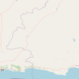
Map view of Garden Route National Park

Use this park location map to pinpoint Garden Route National Park in South Africa, understand its exact geographic position, and read its mapped placement within the surrounding landscape more clearly.

Pigeon | © OpenStreetMap contributors

Location context for Garden Route National Park

Eastern CapeWestern Cape
Natural feature types

Map the Natural Features and Geographic Landmarks of Garden Route National Park

Continue geographic discovery by analyzing the specific natural landmarks, water systems, and forest terrain that form the identity of Garden Route National Park. MoriAtlas provides a clear structure for examining these coastal and montane features in the context of the broader South African landscape.
Park atlas

Map the regional protected landscapes and national parks across South Africa's southern coastal geography.

Discover Nearby National Parks and Protected Areas Surrounding Garden Route National Park

Explore a curated selection of national parks and protected areas located near Garden Route National Park, encompassing coastal reserves, indigenous forests, and diverse mountain landscapes. Compare these protected areas to understand regional geography, conservation patterns, and the broader spread of natural heritage across South Africa's Western and Eastern Cape.
National parkSouth Africa
About 0 km away#1 closest

East

Tsitsikamma National Park: South Africa's Protected Coastal Forest and Terrain

Explore the unique mapped landscape and protected area boundaries.

Tsitsikamma National Park in South Africa is defined by its striking coastal geography, where ancient indigenous forests descend towards rugged shores. This national park is a prime example of a protected landscape that showcases the dynamic interface between land and sea, featuring dramatic cliffs and iconic river mouths. Understanding its mapped boundaries and diverse terrain provides critical context for regional geographic exploration and the study of conservation areas within South Africa.

Established
2009
IUCN
II
Relief
Mixed relief
Climate
Mediterranean
National parkSouth Africa
About 0.2 km away#2 closest

Knysna National Lake Area National Park: A Protected Landscape in South Africa

Explore its mapped boundaries and regional natural geography.

Knysna National Lake Area National Park is a key protected area in South Africa, offering a focused lens for understanding national park geography and protected landscapes. This entry provides an atlas-centric perspective on its landscape context, mapped terrain, and its significance as a distinct natural area within the broader South African geography. Explore the structured details of this park's protected boundaries and its contribution to the country's conservation map.

Access
Easy access
Scope
Mixed
Water
Water-dominated
National parkWestern Cape
About 0.2 km away#3 closest

Wilderness National Park: National Park in Western Cape Province, South Africa

Explore mapped protected areas and regional geography.

Wilderness National Park stands as a significant protected area within the Western Cape province of South Africa. This page provides a detailed view of its role as a national park, emphasizing its geographic placement and mapped boundaries. Understand the park's contribution to the region's natural landscape and its significance within the broader atlas of protected lands.

Area
1,210 km²
Established
2009
Relief
Lowland
Access
Easy access
Wildlife reserveWestern Cape
About 58 km away#4 closest

West

Gondwana Game Reserve: Geographic Overview of a Southern Cape Rewilding Landscape

Protected mountain and coastal savanna terrain in the Western Cape

Gondwana Game Reserve represents a deliberate conservation effort to restore large mammal populations to the southern coast of South Africa. Situated near the Garden Route, the reserve encompasses a complex mosaic of open plains, rolling hills, and mountain vistas, providing essential habitat connectivity for diverse wildlife species within a protected and managed ecosystem.

Area
110 km²
Relief
Mountain
Climate
Mediterranean
Access
Access unknown
Nature reserveWestern Cape
About 61 km away#5 closest

West

Gamkaberg Nature Reserve: An Atlas Overview of Mountain Geography and Protected Biomes

A vital conservation landscape within the Western Cape of South Africa.

Gamkaberg Nature Reserve stands as a focal point for ecological research and conservation in the Little Karoo. Defined by a rugged mountain range and deep gorges, the reserve protects the critical habitat of the Cape mountain zebra. Its landscape reveals an unusual overlap of four Cape biomes, offering a deep look into the regional geography and biological history of the South African interior.

Area
94 km²
Established
1974
Relief
Mountain
Climate
Mediterranean
Biosphere reserveWestern Cape
About 78 km away#6 closest

West

Gouritz Cluster Biosphere Reserve: Geographic Overview and Protected Area Boundaries

A diverse protected landscape spanning the Western Cape coastline to high mountain ridges.

Spanning from the southern African coast into the interior mountain ranges, this biosphere reserve captures an unmatched variety of landforms including estuaries, rocky headlands, and arid Karoo basins. It serves as a vital protected system for threatened species and endemic flora, representing one of the most ecologically significant landscapes within the Cape Floristic Region.

Area
31,878.9 km²
Established
2015
Relief
Mixed relief
Climate
Mediterranean
National parkEastern Cape
114 km away#7 closest

East

Addo Elephant National Park: South African National Park with Diverse Protected Landscapes

Explore its geographic context and unique Big Seven megafauna habitats.

Addo Elephant National Park is a crucial protected landscape within South Africa's Eastern Cape, covering approximately 1,640 square kilometers of varied terrain including karoo plains, coastal dunes, and marine protected areas. Its identity is deeply tied to the successful recovery of elephant populations and its distinction as the only African national park where all Big Seven megafauna can be observed in their natural surroundings. Discover the park's geographic spread, landscape diversity, and its role as a premier conservation area.

Area
1,640 km²
Established
1931
IUCN
II
Visitors
305.5K annual
Protected areaWestern Cape Province
About 152 km away#8 closest

West

Boosmansbos Wilderness Area: Geographic Atlas and Protected Landscape Overview

Rugged Langeberg mountain terrain and endemic floral corridors

Boosmansbos Wilderness Area stands as a major protected block in the eastern Langeberg range. This profile maps the diverse topography, ranging from rocky mountain ridges to moist valley forests. Learn about the geographic significance of this wilderness, which encompasses rare botanical species and serves as a vital transition zone between fynbos and indigenous forest habitats within the Western Cape.

Area
142 km²
Relief
Mountain
Climate
Mediterranean
Access
Moderate access

Common questions about visiting, size, designation, and location context for Garden Route National Park

Garden Route National Park FAQs for park facts, access, geography, and protected area context

Find quick answers about Garden Route National Park, including protected-area facts, park geography, trail and visitor context, and how the park fits into its surrounding country and regional landscape.
MoriAtlas Explorer

Continue Your Protected Areas Search Across the Global Atlas

Deepen your exploration by continuing the structured search for national parks and protected areas worldwide. Utilize the comprehensive filtering capabilities to compare different conservation landscapes and refine your understanding of global park geography. Discover more about the distribution and characteristics of protected natural areas.

Global natural geography