Mori Atlas logo
National parkPorongurup National Park

Discover the mapped terrain and protected landscape of a billion-year-old mountain system.

Porongurup National Park: Ancient Granite Peaks and Karri Forest Atlas of Western Australia

Porongurup National Park stands as a remarkable protected area in Western Australia, showcasing an ancient mountain system formed over 1.2 billion years ago. This national park features dramatic granite peaks rising sharply from the surrounding plains, creating a unique topographic and landscape context within the region. Explore the park's exceptional biodiversity, its significant karri forest outlier ecosystem, and its ancient geological formations, offering a distinctive atlas-level view of Western Australia's natural heritage and mapped terrain.

Granite MountainsKarri ForestAncient GeologySouthwest Australia Biodiversity HotspotNoongar Cultural HeritageNature Hiking

Porongurup National Park

National park

Park overview

Structured park overview, official facts, and landscape profile for Porongurup National Park

Porongurup National Park park facts, protected area profile, and essential visitor context
Review the core facts for Porongurup National Park, including designation, size, terrain, visitor scale, habitats, and operating context in one park-focused overview.

About Porongurup National Park

Porongurup National Park protects a mountain range of extraordinary geological and ecological significance in the Great Southern region of Western Australia. The Porongurup Range stands as a monumental reminder of Earth's ancient past, with its granite domes and peaks representing the eroded remnants of a massive igneous intrusion that occurred during the Mesoproterozoic Era approximately 1.2 billion years ago. These weathered granite formations create a landscape unlike anywhere else in Western Australia, where the predominant terrain consists of flat lateritic plains and coastal dunes rather than mountain terrain. The park's elevation provides cooler and moister microclimates than the surrounding lowlands, supporting ecological communities that would otherwise be impossible at this latitude. The karri forest that blankets the lower slopes represents a significant biogeographic anomaly, existing far to the east of its core distribution in the southwest of the state. This forest thrives in the nutrient-rich granitic soils known locally as karri loam, where the combination of altitude, moisture, and soil chemistry creates ideal growing conditions for these majestic trees that can reach heights exceeding 80 meters. The park's significance extends beyond its natural values to encompass deep cultural meaning for the Noongar people, for whom the Porongurup Range represents a sacred site of profound spiritual importance.

Quick facts and research context for Porongurup National Park

Porongurup National Park covers 26.21 square kilometers of the ancient Porongurup Range in Western Australia's Great Southern region. The range consists of porphyritic granite dome peaks formed approximately 1.2 billion years ago when Antarctica collided with Australia. During the late Cretaceous period, when sea levels were around 100 meters higher than present, the range existed as an isolated island surrounded by ocean. The park was officially gazetted in 1971 and has since expanded from its original 1,157 hectares to 2,511 hectares. It is recognized on both the Register of the National Estate and the Australian National Heritage List. The park contains over 700 native plant species, with at least nine species found nowhere else on Earth.

Park context

Deeper park guide and search-rich context for Porongurup National Park

Porongurup National Park history, landscape, wildlife, and travel context
Explore Porongurup National Park through its history, landscape character, ecosystems, wildlife, conservation priorities, cultural context, and seasonal travel timing in a structured park guide built for atlas discovery and search intent.

Why Porongurup National Park stands out

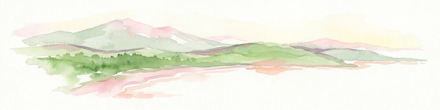
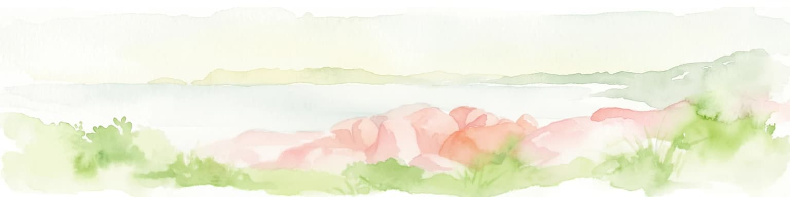
Porongurup National Park is best known for its dramatic ancient granite peaks that form a stark mountain landscape rising from the surrounding flat Western Australian plains. The park features the iconic Granite Skywalk at Castle Rock, a steel viewing platform offering panoramic vistas over the karri forest below. The Porongurup Range represents Earth's ancient geological history, with granite formations dating back over a billion years. The park contains one of the most easterly occurrences of karri forest, a towering eucalyptus species typically restricted to the cooler southwest corner of the state. Its exceptional plant diversity includes more than 700 species, while the combination of ancient geology, unique flora, and Noongar cultural heritage makes it a significant site in Western Australia's natural landscape.

Porongurup National Park history and protected-area timeline

The Porongurup Range holds deep cultural significance for the Mineng and Koreng sub-groups of the Noongar people, who have inhabited this region for thousands of years. According to Noongar understanding, the name Porongurup (or Borrongup) translates to 'totem' in the Noongar language, referring to the animal or plant inherited from one's parents at birth. This connection underscores the spiritual importance of the range as a sacred site to Aboriginal people. European exploration of the area began in 1802 when vessels passing near Albany first sighted the distinctive mountain peaks. Agricultural development of the surrounding region commenced around 1859 when vegetables were first cultivated on the southern slopes of the range. The valuable karri and jarrah timber resources were exploited from the 1880s onward, with extensive timber leases granted across the area. These leases began to be withdrawn in 1925, eventually leading to the protection of the area as a national park. Porongurup National Park was officially gazetted in 1971 with an initial area of 1,157 hectares. Subsequent expansions have increased the protected area to its current size of 2,511 hectares. The park received formal recognition on the Register of the National Estate in 1978 and was subsequently listed on the Australian National Heritage List in 2009, acknowledging its outstanding natural and cultural significance.

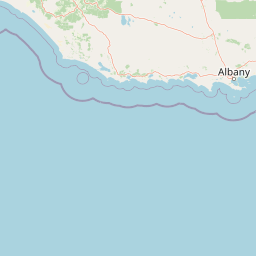
Porongurup National Park landscape and geographic character

The Porongurup Range extends approximately 15 kilometers from east to west, consisting of a remarkable cluster of porphyritic granite peaks that have been weathered and eroded into characteristic dome shapes. These ancient granite intrusions formed when the Antarctic continent collided with Australia during the Stenian Period of the Mesoproterozoic Era, creating a substantial reservoir of molten granite that eventually cooled and crystallized beneath the Earth's surface. Over subsequent hundreds of millions of years, erosional processes have stripped away the overlying rock layers, exposing the granite core that now forms the dramatic peaks visible today. The highest point, Devils Slide, rises to 670 meters above sea level, with Nancy's Peak reaching 644 meters and Castle Rock at approximately 558 meters. During the late Cretaceous period when global sea levels were approximately 100 meters higher than present, the Porongurup Range existed as an isolated island surrounded by the ancient sea that extended across what is now the southern Wheatbelt region. The surrounding plains are characterized by lateritic soils typical of the Southwest Australian landscape, supporting mixed jarrah and marri forest in the lower elevations. The exposed granite summits support distinctive mossy herbland communities adapted to the harsh conditions of high exposure, frequent waterlogging, and temperature extremes.

Porongurup National Park ecosystems, habitats, and plant life

The ecological character of Porongurup National Park is defined by its remarkable plant diversity and the unique juxtaposition of vegetation communities across its altitudinal gradient. The park supports over 700 native plant species and at least 300 macrofungi species, with at least nine plant species found nowhere else on Earth. The flora includes diverse families such as heaths (Ericaceae), particularly beard-heaths (Leucopogon), and an impressive array of pea family members (Fabaceae) including flame-peas (Chorizema), bitter-peas (Daviesia and Bossiaea), and poison-peas (Gastrolobium). The native myrtles (Myrtaceae), pimeleas (Thymelaeaceae), and members of the Banksia and Grevillea group (Proteales) are well represented. The park is particularly significant for its diversity of lilies, orchids, and iris family members. The karri forest on the granitic soils represents a remarkable outlier ecosystem, existing hundreds of kilometers east of its typical southwest distribution in the cape region. On the lateritic soils of the lower slopes, a mixed forest of jarrah and marri predominates, while the exposed summits support an open mossy herbland adapted to the harsh conditions. The granite peaks create their own microclimates through topographic rainfall and cooler temperatures, maintaining moist conditions that support these unique vegetation communities.

Porongurup National Park wildlife and species highlights

Porongurup National Park supports a diverse fauna community that reflects the park's position within the Southwest Australia Biodiversity Hotspot. Mammal species present include the western grey kangaroo, brushtail possum, pygmy possum, mardo (yellow-footed antechinus), bush rat, quenda (southern brown bandicoot), and the honey possum, a tiny marsupial that feeds exclusively on nectar. The bird population is particularly notable, with 71 species recorded including the red-eared firetail and Baudin's black cockatoo, both species of conservation concern. At least 17 reptile species inhabit the park, including the King's skink, the southern heath monitor (Rosenberg's monitor), and the marbled gecko. Amphibians including several tree frog and southern frog species are also present. The invertebrate fauna includes remarkable Gondwanan relictual species such as the Porongurup trapdoor spider (Cataxia bolganupensis) and other trapdoor spiders, land snails of the genus Bothriembryon, and giant earthworms. Additional invertebrates include peacock spiders, velvet worms (Onychophora), and the social crab spider, reflecting the ancient evolutionary origins of the park's fauna.

Porongurup National Park conservation status and protection priorities

Porongurup National Park is recognized as a significant conservation area within Australia's protected estate, acknowledged through its listing on both the Register of the National Estate and the Australian National Heritage List. The park lies within the Southwest Australia Biodiversity Hotspot, one of 34 global biodiversity hotspots noted for their exceptional plant and animal diversity. The protection of the Porongurup Range is particularly important given that it represents an isolated island of montane vegetation within an otherwise flat landscape, supporting species and communities found nowhere else. At least nine plant species are endemic to the park, underscoring its irreplaceable conservation value. The karri forest ecosystem, existing at its easternmost limits within the park, represents a significant conservation priority as an outlier population at the edge of the species' range. The park's fauna includes several species of conservation significance, and its invertebrate communities contain ancient Gondwanan relictual species that have persisted since the breakup of the ancient supercontinent. Management challenges include fire risk, with a major fire in 2007 burning approximately 95% of the park, and the need to balance visitor access with conservation of the park's sensitive ecological communities.

Porongurup National Park cultural meaning and human context

The Porongurup Range holds profound cultural significance for the Mineng and Koreng (also spelled Goreng) sub-groups of the Noongar people, the traditional owners of the land in the Great Southern region of Western Australia. According to Noongar tradition, Porongurup (or Borrongup) means 'totem' in the Noongar language, referring to the animal or plant that individuals inherit from their maternal and paternal lines at birth. This name reflects the deep spiritual connection between the Noongar people and this landscape, which has been recognized as their most sacred site in the region. The range's importance to Aboriginal people predates European settlement by thousands of years, and the area continues to hold cultural meaning for contemporary Noongar communities. This cultural heritage adds an important dimension to the park's significance beyond its geological and ecological values, representing the enduring relationship between Indigenous Australians and the Australian landscape.

Top sights and standout views in Porongurup National Park

The Porongurup Range offers visitors a striking landscape of ancient granite peaks rising dramatically from the surrounding plains. The Granite Skywalk at Castle Rock provides panoramic views over the karri forest and broader Great Southern landscape. Hiking trails traverse the range, with Devil's Slide and Nancy's Peak offering rewarding summit experiences. The Tree in the Rock and Balancing Rock represent iconic natural formations. The karri forest, representing an outlier ecosystem hundreds of kilometers from its typical range, creates a dramatic backdrop. The park's biodiversity, with over 700 plant species and 71 bird species, supports exceptional nature observation opportunities. The Noongar cultural heritage adds depth to the visitor experience.

Best time to visit Porongurup National Park

The Porongurup Range can be visited year-round, though the cooler months from April to October coincide with the period of highest rainfall and offer the most pleasant conditions for hiking. Winter brings regular precipitation that maintains the moisture-dependent karri forest and creates the characteristic misty atmosphere around the peaks. Summer months (December to February) are warm, with daytime temperatures on the surrounding plains averaging around 26°C, though the elevated terrain of the range provides some cooling relief. The summer dry season sees minimal rainfall, with only around 75-110mm total precipitation during the November to March period. Snow has occasionally fallen on the peaks, most notably in October 1992 and June 1956, though such events are rare. The spring flowering season (September to November) offers particularly impressive botanical displays as the heath and orchid species come into bloom. The 2007 fire burned approximately 95% of the park, and recovery continues to reshape the landscape, creating new ecological dynamics for visitors to observe.

Park location guide

Geography guide, regional context, and park location map for Porongurup National Park

Porongurup National Park park geography, regions, and map view in Australia
Understand where Porongurup National Park sits in Australia through a broader geographic reading of the surrounding landscape, nearby location context, and its mapped position within the national park landscape.

How Porongurup National Park fits into Australia

Australia is a constitutional monarchy and federal parliamentary democracy comprising six states and ten territories. With a population of nearly 28 million, it is one of the world's most urbanised countries, with most people concentrated on the eastern seaboard. The country has a high Human Development Index and is known for its cultural diversity, ancient Aboriginal heritage, and unique wildlife.

Wider geography shaping Porongurup National Park in Australia

Australia occupies the entire Australian continent, the island of Tasmania, and numerous smaller islands. It is the world's flattest and driest inhabited continent, featuring vast deserts in the interior (the Outback), tropical rainforests along the eastern coast, and a coastline bordering the Indian and Pacific Oceans.

Map view of Porongurup National Park

Use this park location map to pinpoint Porongurup National Park in Australia, understand its exact geographic position, and read its mapped placement within the surrounding landscape more clearly.

Pigeon | © OpenStreetMap contributors

Location context for Porongurup National Park

Great SouthernWestern Australia
Park atlas

Discover the broader regional park geography, comparing Porongurup National Park with other protected areas and their surrounding landscapes.

Explore Nearby Protected Areas and National Parks Surrounding Porongurup National Park
Continue your exploration of Western Australia's protected areas by discovering other national parks and protected landscapes near Porongurup National Park, including sites with similar ancient geology or unique forest ecosystems. Comparing these regional parks offers valuable geographic context for understanding the broader spread of conservation efforts and diverse natural features across the Great Southern region.
National parkWestern Australia

Gull Rock National Park: Protected Landscape and Geographic Atlas Exploration

Discover mapped boundaries and natural terrain in Western Australia.

Gull Rock National Park serves as a key protected area for exploring the geographic diversity of Western Australia. As a national park, it offers a focal point for understanding mapped landscape features, conservation boundaries, and the unique natural terrain of the region. This entry provides essential context for atlas-based discovery of protected lands across Australia.

Area
21.04 km²
Established
2006
IUCN
II
Relief
Lowland
National parkWestern Australia

Hassell National Park National Park: Mapped Protected Landscape in Western Australia

Explore the geographic identity and park boundaries of Hassell National Park.

Hassell National Park offers a focused view of protected natural landscapes within Western Australia. This atlas entry details the park's specific geographic scope and its designation as a national park, providing essential context for understanding its mapped features and regional landscape. Explore how Hassell National Park contributes to the protected area geography of the state.

Area
12.65 km²
Established
1971
IUCN
II
Scope
Mixed
National parkWestern Australia

Torndirrup National Park National Park: Mapped Boundaries and Regional Landscape Context

Explore protected lands within Western Australia's geography.

Torndirrup National Park serves as a significant protected natural area, offering valuable insights into the geographic character of Western Australia. This detailed entry focuses on its mapped boundaries and its role as a protected landscape, providing essential context for atlas-based exploration of Australia's diverse regions and natural terrains.

Area
39.36 km²
Established
1918
IUCN
II
Visitors
250K annual
National parkWestern Australia

Waychinicup National Park: National Park Protected Landscape Atlas Entry

Explore Western Australia's mapped natural landscapes and park geography.

Gain a structured understanding of Waychinicup National Park as a key protected landscape within Western Australia. This detailed atlas entry focuses on its geographic distribution and mapped boundaries, providing essential context for regional park and natural landscape exploration. Discover the unique characteristics of this national park's setting and its place within the broader mapped terrain.

Area
39.82 km²
Established
1990
IUCN
II
Relief
Mixed relief
National parkGreat Southern

Mount Lindesay National Park: Australian National Park Protected Landscape Details

Explore mapped boundaries and regional geographic context in Great Southern.

Gain a structured understanding of Mount Lindesay National Park, a designated national park in Australia's Great Southern region. This detail view focuses on its protected landscape identity, mapped geographic features, and its place within the nation's network of conservation areas. Discover the specific terrain and regional atlas context that makes this park a distinct element of Australia's natural geography.

Area
395.73 km²
Established
2004
IUCN
II
Relief
Mountain
Watercolor illustration of rolling hills, mountains, and a coastal body of water
National parkWestern Australia

West Cape Howe National Park: Western Australia's Southernmost Coastal Protected Landscape

Explore dramatic sea cliffs, ancient karri forests, and Torbay Head.

West Cape Howe National Park offers a distinct protected landscape experience in Western Australia, highlighted by its position at mainland Australia's southernmost point, Torbay Head. This park showcases a rugged 23-kilometer stretch of the Southern Ocean coastline, featuring towering sea cliffs that descend to pristine beaches and rocky shores. Inland, visitors find ancient karri forests and diverse vegetation types, contributing to a rich mosaic of protected habitats. Its geographic significance and unique coastal terrain make it a key destination for understanding regional protected area geography.

Area
36.05 km²
Established
1985
IUCN
II
Relief
Lowland
Watercolor illustration of a coastal landscape with green vegetation, pink rock formations, and a calm body of water
National parkWestern Australia

William Bay National Park: Mapped Protected Area in Western Australia's Geography

Explore its national park boundaries and regional landscape context.

Delve into the protected landscape of William Bay National Park, a designated national park situated within the diverse geography of Western Australia. This resource provides critical information on its mapped boundaries and its role as a protected natural area. Understand the park's specific geographic setting and its contribution to the regional atlas of conservation landscapes, essential for detailed park and landscape discovery.

Area
17.34 km²
Established
1971
IUCN
II
Visitors
238K annual
National parkGreat Southern

Mount Roe National Park: Detailed Protected Landscape and Geographic Exploration

Mapped boundaries and natural terrain of this national park.

Mount Roe National Park offers a distinct protected landscape for atlas exploration, situated within the geographic scope of the Great Southern region. This detail page provides a structured view of the park's mapped boundaries and its natural terrain. Understand how Mount Roe National Park contributes to the regional geography and the overall map of protected areas in Australia.

Area
1,278 km²
Established
2004
IUCN
II
Scope
Terrestrial

Common questions about visiting, size, designation, and location context for Porongurup National Park

Porongurup National Park FAQs for park facts, access, geography, and protected area context
Find quick answers about Porongurup National Park, including protected-area facts, park geography, trail and visitor context, and how the park fits into its surrounding country and regional landscape.
MoriAtlas Explorer

Continue Your Protected Areas Search Across the Global Atlas

Deepen your exploration by continuing the structured search for national parks and protected areas worldwide. Utilize the comprehensive filtering capabilities to compare different conservation landscapes and refine your understanding of global park geography. Discover more about the distribution and characteristics of protected natural areas.

Global natural geography