Por qué destaca Parque Nacional de la Auen del Danubio
El Parque Nacional de la Auen del Danubio se distingue principalmente por ser uno de los últimos ecosistemas de llanura aluvial a gran escala y relativamente intactos de Europa Central. El parque protege hábitats críticos de bosques de ribera que han desaparecido en gran medida del corredor del Danubio debido a siglos de ingeniería fluvial y desarrollo. Los humedales albergan varias especies en peligro de extinción, como el tritón crestado del Danubio, la tortuga de estanque europea y el águila pescadora. El parque también contiene notables puntos de acceso a la biodiversidad en la zona de Lobau, donde microclimas únicos sustentan orquídeas raras y otras comunidades vegetales especializadas. La historia de la creación del parque es igualmente notable, surgiendo del histórico Movimiento de Hainburg de 1984, cuando miles de austriacos ocuparon los humedales para evitar la construcción de una presa.
Historia de Parque Nacional de la Auen del Danubio y cronología del área protegida
La creación del Parque Nacional Donau-Auen representa una de las victorias de conservación ambiental más significativas de Austria. Hasta el siglo XIX, el Danubio seguía siendo un río indómito con una extensa dinámica de llanura aluvial. A partir de ese siglo, una ingeniería fluvial extensiva alteró drásticamente el equilibrio natural, con muchos brazos laterales represados de modo que ahora solo llevan agua en épocas de crecida. La construcción de centrales hidroeléctricas en la década de 1950 creó una cadena de presas casi ininterrumpida a lo largo del Danubio austriaco. En 1984, los planes para la central hidroeléctrica de Hainburg amenazaron con destruir uno de los dos tramos de flujo libre restantes del Danubio en Austria. Grupos ecologistas organizaron protestas en todo el país, lo que condujo a la ocupación de los humedales de Hainburg por miles de ciudadanos de todas las edades y profesiones, el llamado "Movimiento Hainburg". Tras los intentos de la policía por desalojar a los manifestantes, el Gobierno Federal declaró una pausa en diciembre de 1984, y en enero de 1985 el Tribunal Supremo austriaco prohibió la tala posterior. La petición Konrad Lorenz-Volksbegehren, firmada por 353.906 personas en marzo de 1985, exigió la prohibición de grandes centrales eléctricas y la creación de un parque nacional. En julio de 1986, el Tribunal Administrativo anuló los derechos de agua para la central eléctrica proyectada. Posteriormente, se realizaron estudios científicos que revelaron más especies de peces de las que se conocían hasta entonces. El 27 de octubre de 1996, se firmó un tratado estatal entre la República de Austria y los estados federales de Viena y Baja Austria, estableciendo oficialmente el parque nacional. En octubre de 2016, el parque se amplió en 277 hectáreas para conmemorar su 20 aniversario.
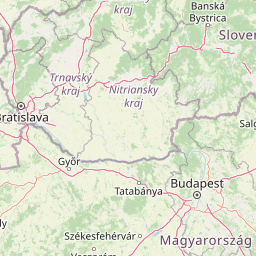
Paisaje y carácter geográfico de Parque Nacional de la Auen del Danubio
El paisaje de la Auen del Danubio se define por la interacción dinámica entre el río y su llanura aluvial. El terreno consiste principalmente en zonas ribereñas bajas que históricamente experimentaron inundaciones regulares, creando un complejo mosaico de humedales, bosques y canales abiertos. El parque incluye el canal principal del Danubio, así como numerosos canales laterales, lagos en forma de herradura y canales en desuso que una vez transportaron el flujo del río durante diferentes períodos hidrológicos. La llanura aluvial está flanqueada por diques construidos alrededor de 1900, que separaron el canal principal de muchos de sus canales laterales históricos. El paisaje presenta característicos bosques de Auen —bosques de ribera dominados por sauces, álamos y alisos que prosperan en el terreno periódicamente inundado. Los prados húmedos y las zonas pantanosas alternan con terrenos más altos que albergan tipos de bosques más secos. El ancho máximo del parque es inferior a cuatro kilómetros, pero se extiende 38 kilómetros a lo largo del corredor fluvial. El área de Lobau, dentro de Viena, contiene zonas de microclima particularmente únicas conocidas como "Heißlände" —bolsas secas y cálidas de pastizales que albergan raras especies de plantas termófilas, incluidas varias variedades de orquídeas.
Ecosistemas, hábitats y flora de Parque Nacional de la Auen del Danubio
El carácter ecológico del Parque Nacional de la Auen del Danubio se centra en sus ecosistemas de bosques de ribera, que representan algunos de los hábitats más biodiversos de Europa Central. El parque protege más de 700 especies de plantas superiores, que van desde árboles y arbustos característicos de ribera hasta especies especializadas de praderas aluviales. Las comunidades de bosques de Auen consisten en bosques de sauces y álamos en zonas inundadas regularmente, que transitan a bosques de robles, fresnos y olmos en terrenos más altos que rara vez se inundan. Los humedales albergan extensos cañaverales y vegetación pantanosa, mientras que los microclimas secos únicos en la zona de Lobau albergan comunidades especializadas de plantas xerotérmicas, incluidas raras orquídeas. La posición del parque a lo largo del corredor de migración del Danubio lo hace crucial para las aves migratorias, mientras que la diversidad de hábitats sustenta una extraordinaria variedad de especies de invertebrados. La dinámica hidrológica del río, incluidas las inundaciones estacionales y la conexión entre el canal principal y los canales laterales, mantiene los procesos ecológicos que sustentan este ecosistema de ribera. Los proyectos de restauración desde 2002 han trabajado para reconectar los canales laterales con el Danubio principal, permitiendo que las dinámicas de inundación naturales regresen a porciones de la llanura aluvial.
Vida silvestre y especies destacadas de Parque Nacional de la Auen del Danubio
El Parque Nacional de los Humedales del Danubio alberga una notable biodiversidad, con más de 30 especies de mamíferos, 100 especies de aves nidificantes, 8 especies de reptiles, 13 especies de anfibios y aproximadamente 50 especies de peces. El recuento total de especies, incluidos insectos y otros invertebrados, se estima en más de 5.000. Entre las especies de fauna más características, el castor europeo ha recolonizado el parque y ahora mantiene poblaciones activas en toda la llanura aluvial, con presas visibles a lo largo de las vías fluviales. El pigargo europeo, la rapaz más grande de Europa, caza en los humedales y anida en los bosques de ribera. El tritón crestado del Danubio, una subespecie distintiva adaptada a los hábitats de humedal del parque, representa una de las poblaciones de anfibios más significativas de la región. La tortuga europea de estanque, aunque rara, persiste en los canales laterales de aguas lentas y las lagunas de meandro. El martín pescador común se puede observar cazando a lo largo de las vías fluviales, mientras que el pez sol europeo ocupa los canales laterales y las zonas de marisma más someras. La diversidad de insectos, particularmente aquellos asociados con la madera muerta y los hábitats acuáticos, contribuye sustancialmente a la biodiversidad general y al funcionamiento ecológico del ecosistema de la llanura aluvial.
Estado de conservación y prioridades de protección de Parque Nacional de la Auen del Danubio
El Parque Nacional de la Auen del Danubio representa un importante bastión de conservación para los ecosistemas de ribera de Europa Central. El área protegida preserva lo que queda de la llanura aluvial histórica del Danubio, un paisaje que ha sido en gran medida eliminado del corredor fluvial a través de siglos de ingeniería, canalización y desarrollo. Como una de las dos últimas secciones de flujo libre del Danubio en Austria, el parque mantiene procesos ecológicos esenciales para la biodiversidad acuática y de ribera. La designación del parque como área protegida de Categoría II de la UICN y su estatus como sitio Ramsar desde 1983 reflejan su importancia internacional para la conservación. El trabajo de conservación dentro del parque incluye la gestión del hábitat, programas de protección de especies y, en particular, la restauración de las dinámicas naturales del río. El programa LIFE+ ha apoyado importantes proyectos de restauración que reconectan los canales laterales con el río principal, permitiendo que las dinámicas de inundación regeneren los hábitats de la llanura aluvial. Los planes prevén la eliminación del 50% de los diques entre Viena y la frontera oriental, restaurando los procesos hidrológicos naturales en gran parte de la llanura aluvial restante.
Significado cultural y contexto humano de Parque Nacional de la Auen del Danubio
El paisaje de la Auen del Danubio ha sido moldeado por la interacción humana durante milenios, y la llanura aluvial ha proporcionado recursos y oportunidades de asentamiento a lo largo de la historia. El área contiene evidencia arqueológica de presencia humana, y las comunidades a lo largo del río tienen conexiones tradicionales con las tierras de Auen. El parque abarca varios asentamientos históricos y castillos, sobre todo Schloss Orth, que sirve como centro de visitantes y data del período medieval. El Movimiento de Hainburg que condujo a la creación del parque representa un capítulo importante en la conciencia ambiental austriaca y sigue siendo un punto de referencia cultural importante para la conservación en el país. El parque también se encuentra cerca del asentamiento romano de Carnuntum, uno de los sitios arqueológicos más importantes de Austria, aunque este se encuentra justo fuera del área protegida. Las prácticas tradicionales de uso de la tierra, incluida la silvicultura de llanuras aluviales y la gestión de praderas, han influido en el paisaje actual, y la gestión del parque continúa considerando el patrimonio cultural de la región.
Lugares imprescindibles y vistas destacadas de Parque Nacional de la Auen del Danubio
El Parque Nacional de la Auen del Danubio es un testimonio del exitoso activismo ambiental de base en Europa, habiendo sido establecido tras las emblemáticas protestas de Hainburg de 1984, que vieron a miles de personas ocupar los humedales. El parque protege uno de los últimos ecosistemas de ribera a gran escala en Europa Central, con sus bosques de llanura aluvial, humedales y canales fluviales que representan hábitats que han desaparecido en gran medida del corredor del Danubio. Los puntos destacados de la fauna incluyen poblaciones reintroducidas de castores, águilas pescadoras anidando y el raro tritón crestado del Danubio. Las instalaciones para visitantes en Schloss Orth ofrecen estaciones de observación submarina, recorridos guiados por guardabosques y excursiones en barcas tradicionales de madera. El área de Lobau contiene microclimas únicos que albergan orquídeas en peligro de extinción y otras especies termófilas. Los proyectos de restauración fluvial en curso tienen como objetivo devolver la dinámica natural de inundación a partes significativas de la llanura aluvial, sentando un modelo para la restauración ecológica a gran escala en Europa.
Mejor época para visitar Parque Nacional de la Auen del Danubio
El Parque Nacional de la Auen del Danubio ofrece experiencias distintas en cada estación, y cada época del año revela diferentes aspectos del ecosistema de la llanura aluvial. La primavera trae los característicos pulsos de inundación cuando el deshielo y las lluvias elevan los niveles del Danubio, creando espectaculares paisajes acuáticos con canales y humedales que se fusionan en extensas áreas anegadas, una demostración dramática del dinámico sistema fluvial que protege el parque. Este es un momento excelente para observar aves acuáticas y migratorias que regresan a la región. El verano ofrece condiciones cálidas ideales para explorar los senderos del bosque y observar castores activos durante las horas de luz más largas, aunque las poblaciones de mosquitos pueden ser significativas en las áreas de humedales. El otoño ofrece una colorida exhibición cuando los bosques de Auen se tiñen de dorado y ámbar, y menos visitantes hacen de este un momento tranquilo para la exploración. El invierno, aunque más tranquilo, ofrece oportunidades para observar los patrones de la fauna a medida que la llanura aluvial se vacía y las huellas de los animales se vuelven visibles en la nieve. El centro de visitantes de Schloss Orth opera todo el año y proporciona orientación para explorar el parque independientemente de la estación.