Mori Atlas logo
National parkKaraburun-Sazan Marine Park

Explore the dramatic limestone cliffs, island ecosystems, and marine geography of this vital protected area.

Karaburun-Sazan Marine Park: Albania's Premier National Park and Protected Marine Landscape

(Parku Detar Karaburun-Sazan)

Karaburun-Sazan Marine Park represents Albania's singular national park, safeguarding a significant coastal and island territory in southwestern Vlorë County. Established to protect a distinctive marine and terrestrial ecosystem, this park encompasses approximately 125 square kilometers of varied landforms, including dramatic limestone cliffs, deep canyons, hidden caves, and secluded bays along the Ionian and Adriatic Seas. Its designation as an Important Bird Area, Important Plant Area, and Specially Protected Area of Mediterranean Importance underscores its crucial role in regional biodiversity and landscape conservation.

marine parkislandsMediterranean coastlimestone cliffsIonian SeaAdriatic Sea

Karaburun-Sazan Marine Park

National park

Park overview

Structured park overview, official facts, and landscape profile for Karaburun-Sazan Marine Park

Karaburun-Sazan Marine Park park facts, protected area profile, and essential visitor context
Review the core facts for Karaburun-Sazan Marine Park, including designation, size, terrain, visitor scale, habitats, and operating context in one park-focused overview.

About Karaburun-Sazan Marine Park

Karaburun-Sazan Marine Park represents Albania's flagship marine protected area, established to preserve a unique coastal ecosystem where the Adriatic and Ionian Seas meet near the strategic Strait of Otranto. The park encompasses both the Karaburun Peninsula, a hilly landmass forming the geological continuation of the Ceraunian Mountains, and Sazan Island, Albania's largest island spanning 5.7 square kilometers. The marine park covers approximately 125 square kilometers and extends one nautical mile along the coastline, protecting a complex mosaic of terrestrial and marine habitats.

The landscape is defined by dramatic relief including mountains, steep cliffs, deep canyons, accessible caves, and numerous bays along the peninsula's western shore. The peninsula's crests follow a northwest-southeast line with distinct peaks broken by irregular slopes, while the coastal landscape features rough calcareous limestone cliffs that dip vertically into the Ionian Sea. Sazan Island is primarily composed of limestone rocks formed during the Cretaceous period, separated from the peninsula by the narrow Mezokanal channel. The island's climate stands apart as subtropical rather than Mediterranean, with warmer winters and hotter summers than typical for the region.

The park's ecological significance is underscored by its designation as an Important Bird Area and Important Plant Area, as well as its classification as a Specially Protected Areas of Mediterranean Importance under the Barcelona Convention. This international recognition reflects the park's exceptional biodiversity and the presence of ecosystems and habitats specific to the Mediterranean Basin. The protected area supports hundreds of documented species across mammals, birds, reptiles, amphibians, and invertebrates, with several endangered or threatened species calling the park home.

Quick facts and research context for Karaburun-Sazan Marine Park

Karaburun-Sazan Marine Park occupies the Karaburun Peninsula and Sazan Island in Vlorë County, southwestern Albania, where the Adriatic and Ionian Seas converge near the Strait of Otranto. The park was designated on April 28, 2010, under IUCN category II as a national park, and is managed by Albania's National Agency of Protected Areas. The peninsula forms a geological continuation of the Ceraunian Mountains, rising steeply along the Ionian Coast with peaks reaching nearly 1,500 meters. Sazan Island, the largest in Albania, features a unique subtropical climate distinct from the typical Mediterranean regime, with warm winters and hot summers resembling conditions found in southern Crete, Tunisia, and Egypt. The park supports exceptional biodiversity with over 70 mammal species, 144 bird species, 36 reptile species, and 11 amphibian species documented across its terrestrial and marine environments.

Park context

Deeper park guide and search-rich context for Karaburun-Sazan Marine Park

Karaburun-Sazan Marine Park history, landscape, wildlife, and travel context
Explore Karaburun-Sazan Marine Park through its history, landscape character, ecosystems, wildlife, conservation priorities, cultural context, and seasonal travel timing in a structured park guide built for atlas discovery and search intent.

Why Karaburun-Sazan Marine Park stands out

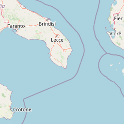
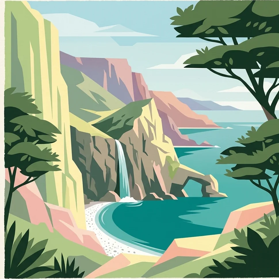
Karaburun-Sazan Marine Park is best known for its remarkable convergence of Mediterranean and subtropical ecosystems within a dramatic cliff-and-island landscape. The park protects Albania's largest island, Sazan, with its unusual subtropical climate and Cretaceous limestone geology, alongside the rugged Karaburun Peninsula featuring vertical limestone cliffs that drop directly into the sea. The marine environment hosts critically endangered species including the Mediterranean monk seal and three species of sea turtles, while the terrestrial habitats support diverse Mediterranean maquis vegetation and significant bird populations. The park also contains historical attractions including ancient Greek and Roman shipwrecks, the rock inscriptions of Grama Bay carved by sailors over centuries, and underwater caves and canyons that provide refuge for marine life.

Overview image of Karaburun-Sazan Marine Park showing what the park is best known for
Visual overview of what makes Karaburun-Sazan Marine Park a notable national park destination.

Karaburun-Sazan Marine Park history and protected-area timeline

Karaburun-Sazan Marine Park was officially designated on April 28, 2010, establishing Albania's first and only national marine park. The creation of the protected area reflected growing recognition of the ecological and geological significance of the Karaburun Peninsula and Sazan Island along Albania's southwestern coast. The peninsula had previously been designated as a Natural Reserve, while Sazan Island operated as a military zone under government control for decades.

A significant development occurred in July 2015 when Sazan Island was opened to the public by the National Coastline Agency, marking the first time civilians could access the island in the post-communist era. This opening created new opportunities for tourism and scientific research while maintaining appropriate protections for the island's sensitive ecosystems. The park is governed by Albania's National Agency of Protected Areas, which oversees management and conservation activities across the marine park's terrestrial and maritime territories.

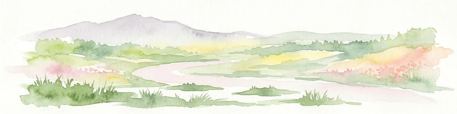
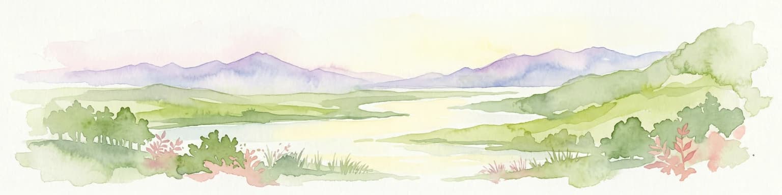
Karaburun-Sazan Marine Park landscape and geographic character

The Karaburun-Sazan Marine Park encompasses an exceptional diversity of landforms shaped by geological processes spanning multiple eras. The Karaburun Peninsula forms a mountainous terrain extending approximately 24 kilometers in length and 4 to 7 kilometers in width, with elevations reaching nearly 1,500 meters above sea level at Maja e Shendelliut, the park's highest peak. Other notable summits include Maja Ali Hila at 1,318 meters, Maja Çadëri at 839 meters, Maja Flamurit at 826 meters, and Maja e Ilqes at 733 meters.

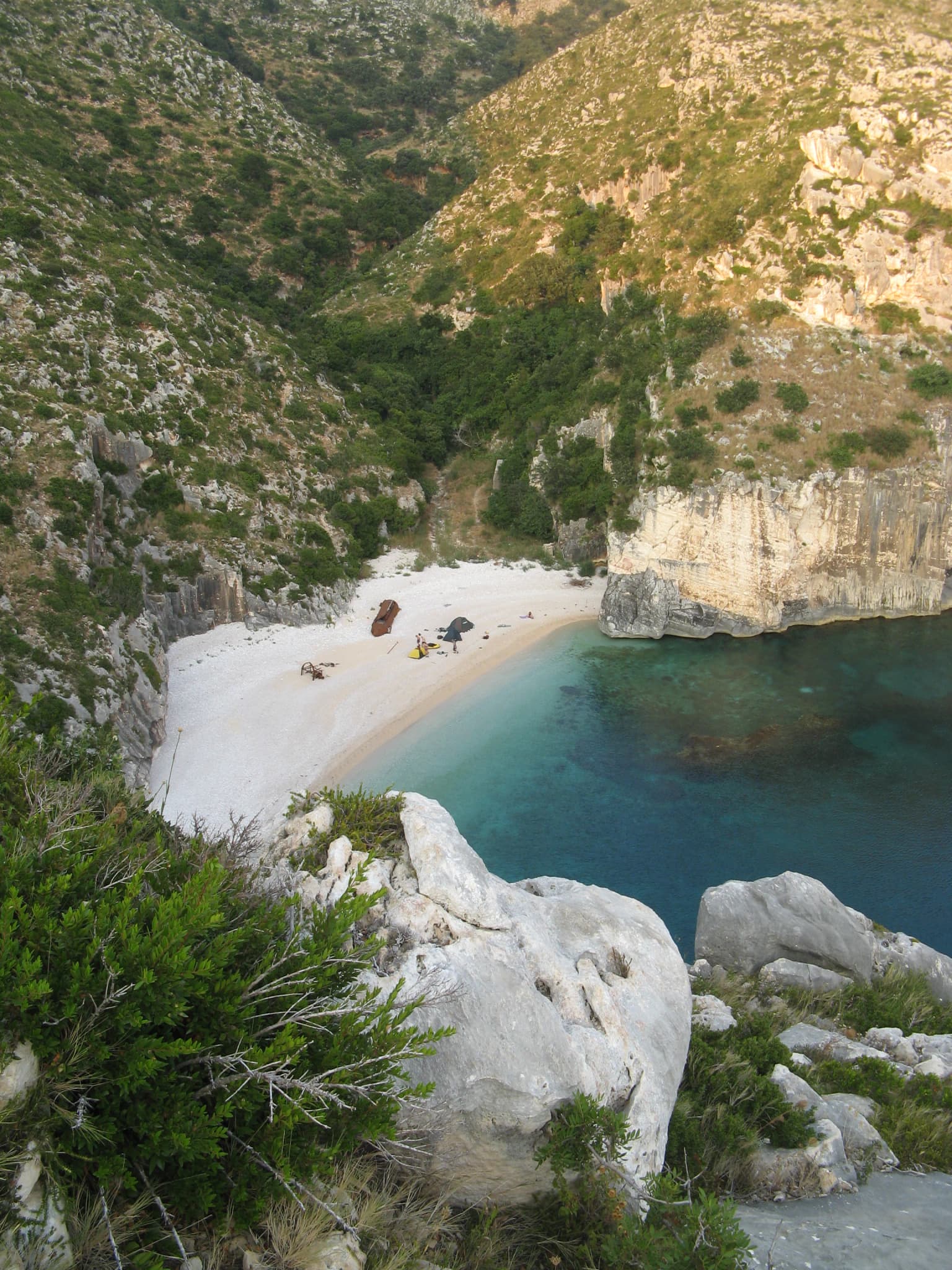
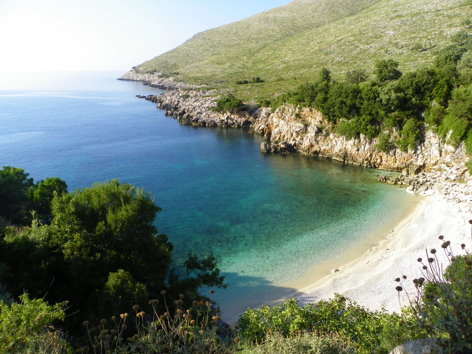
The peninsula belongs to the Ceraunian Mountains, a range rising steeply along the Albanian Ionian Sea Coast. The western slopes descend sharply into the Ionian Sea, creating a dramatic coastal landscape of vertical limestone cliffs. The geological composition includes Paleozoic schist formations, Mesozoic limestone and marble deposits, with carbonic limestone from the Mesozoic period dominating the terrain. The southern portion of the peninsula, known as Reza e Kanalit, features a narrow and steep platform extending toward the Dukat Valley near Orikum.

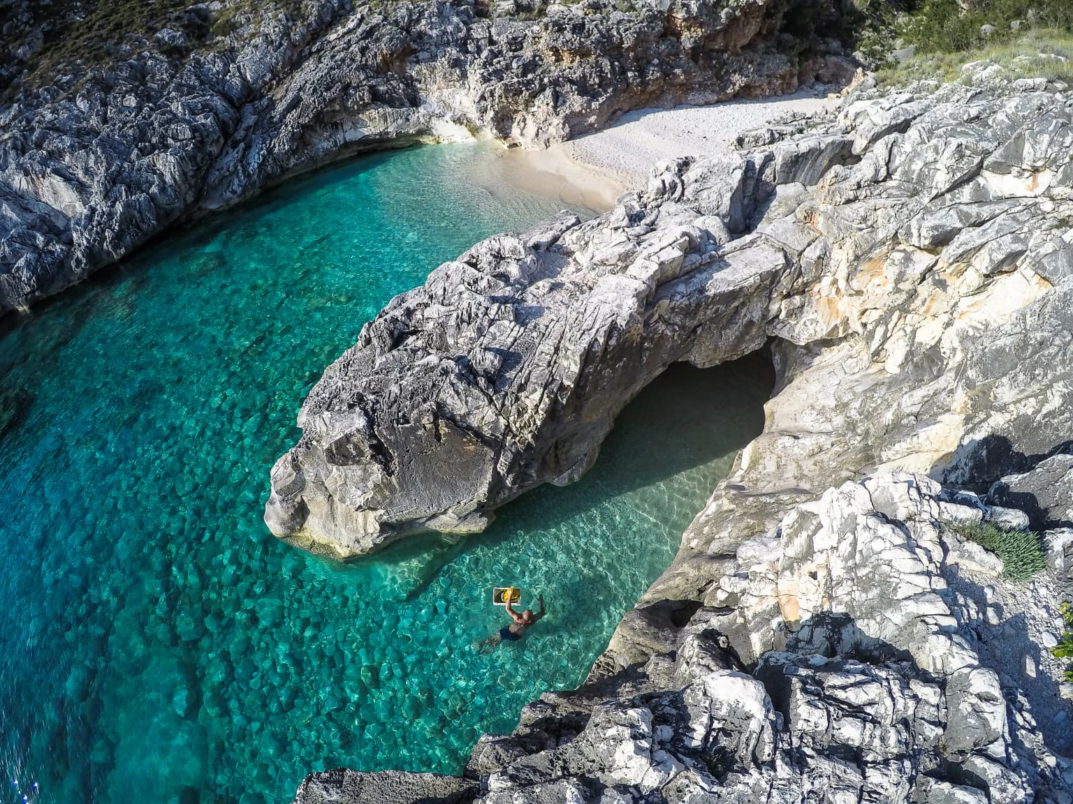
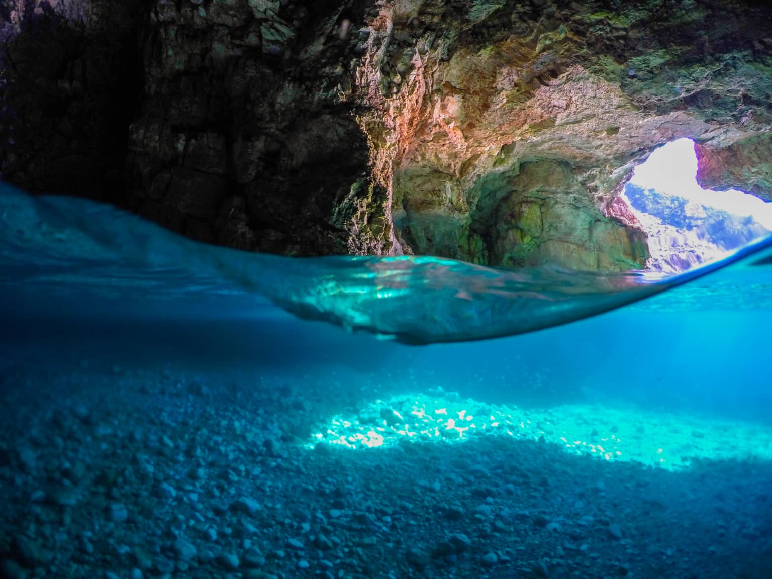
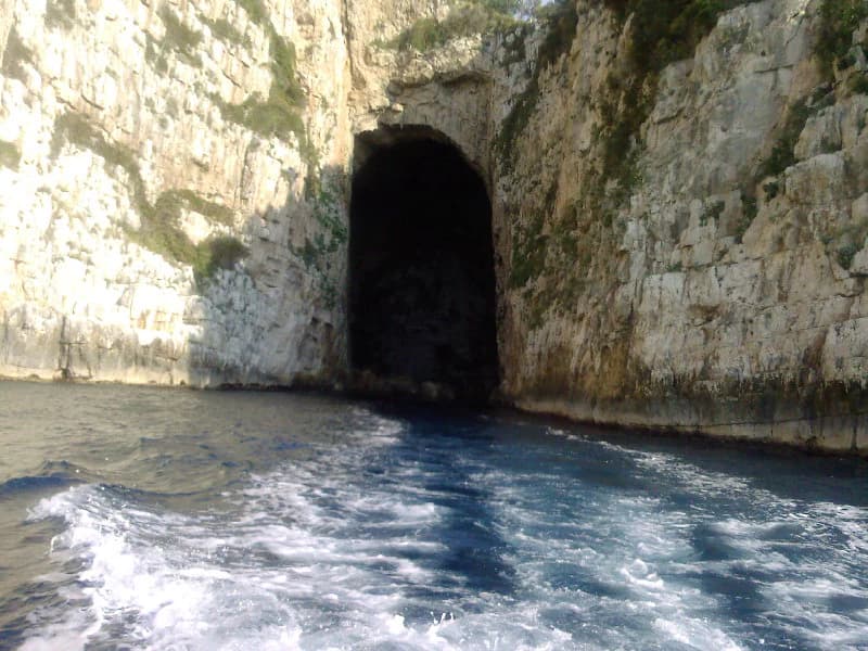
Sazan Island, Albania's largest island, measures 4.8 kilometers in length and 2.7 kilometers in width. The island is surrounded by the Adriatic Sea to the north and the Ionian Sea to the south. The Mezokanal channel provides a narrow natural separation between the island and peninsula. The island's western rocks are primarily Cretaceous in age, while the eastern portion consists of limestone formed during the Burdigalian age. The coastal landscape features numerous bays including the Bay of Grama and Bay of Brisani, as well as underwater caves and canyons that appear at great depths.

Clear turquoise water in a coastal cove with rocky shorelines and lush green forested hills in the background
Gjiri Brisanit, a natural cove within Karaburun-Sazan Marine Park

Karaburun-Sazan Marine Park ecosystems, habitats, and plant life

The park falls within the Illyrian deciduous forests terrestrial ecoregion of the Palearctic realm, part of the Mediterranean forests, woodlands, and scrub biome. This positioning creates favorable conditions for diverse Mediterranean vegetation communities. The coastal areas feature rocky shores with significant calcareous limestone cliffs properly covered with Mediterranean maquis vegetation, characterized by dominance of lentisk, kermes oak, and Phoenicean juniper. The western coasts are incised by caves and canyons and characterized by high vertical cliffs that appear underwater at great depths, dotted with specialized plant species including sea fennel, statice, and caper bush.

The marine environment features extensive Posidonia oceanica meadows, a Mediterranean endemic seagrass that hosts macrofauna including sponges, cnidarians, bryozoans, and mollusks. This seagrass ecosystem is critical for marine biodiversity and serves as an important indicator of water quality. The park's phytogeographical position within the Illyrian deciduous forests ecoregion contributes to its significance as a biodiversity hotspot within the broader Mediterranean Basin, supporting plant species representative of both Mediterranean and more temperate forest communities.

A coastal bay with white sand beach, turquoise water, rocky cliffs, and green vegetation viewed from an elevated vantage point
Grama Bay in Karaburun-Sazan Marine Park, Albania

Karaburun-Sazan Marine Park wildlife and species highlights

Karaburun-Sazan Marine Park supports exceptional terrestrial and marine biodiversity documented across multiple taxonomic groups. The park is home to at least 70 species of mammals, 144 species of birds, 36 species of reptiles, 11 species of amphibians, and 167 species of invertebrates. The terrestrial mammalian fauna includes golden jackal, wildcat, chamois, roe deer, wild boar, European badger, and Eurasian otter, along with smaller mammals such as red squirrel, hazel dormouse, and Thomas's pine vole. Sazan Island supports eight species of bats, including the widespread Kuhl's pipistrelle and Nathusius's pipistrelle, as well as the relatively rare Mediterranean long-eared bat.

The marine environment hosts significant populations of endangered species. Three species of sea turtles nest along the park's pristine beaches: the loggerhead sea turtle, green sea turtle, and leatherback sea turtle. Dolphins are regularly observed, including the short-beaked common dolphin and common bottlenose dolphin, with the endangered sperm whale also reported in park waters. Most notably, the Mediterranean monk seal, one of the world's most endangered mammals, uses the inaccessible caves and canyons of the park as refuge, making the marine park critical for survival of this species in the Mediterranean.

Coastal bay with clear turquoise water, sandy beach, rocky cliffs, and green vegetation
Turquoise coastal bay with rocky cliffs and green coastline in Karaburun-Sazan Marine Park

Karaburun-Sazan Marine Park conservation status and protection priorities

Karaburun-Sazan Marine Park holds significant conservation importance at both national and international levels as Albania's only marine national park. The park has been designated as an Important Bird Area and Important Plant Area, recognizing its exceptional value for biodiversity conservation. Under the Barcelona Convention, the marine park has been classified as a Specially Protected Areas of Mediterranean Importance, providing international framework for protection and management of its unique marine and coastal ecosystems.

The protection of Sazan Island is particularly significant given its role as a refuge for the critically endangered Mediterranean monk seal, one of the rarest marine mammals in the world. The park's diverse habitats, from Mediterranean maquis-covered cliffs to underwater seagrass meadows, support species assemblages specific to the Mediterranean Basin. The convergence of subtropical and Mediterranean climate influences creates unique ecological conditions that support species found nowhere else in Albania. Effective conservation of this marine park contributes to broader regional efforts to protect Mediterranean biodiversity and maintain ecosystem services.

Karaburun-Sazan Marine Park cultural meaning and human context

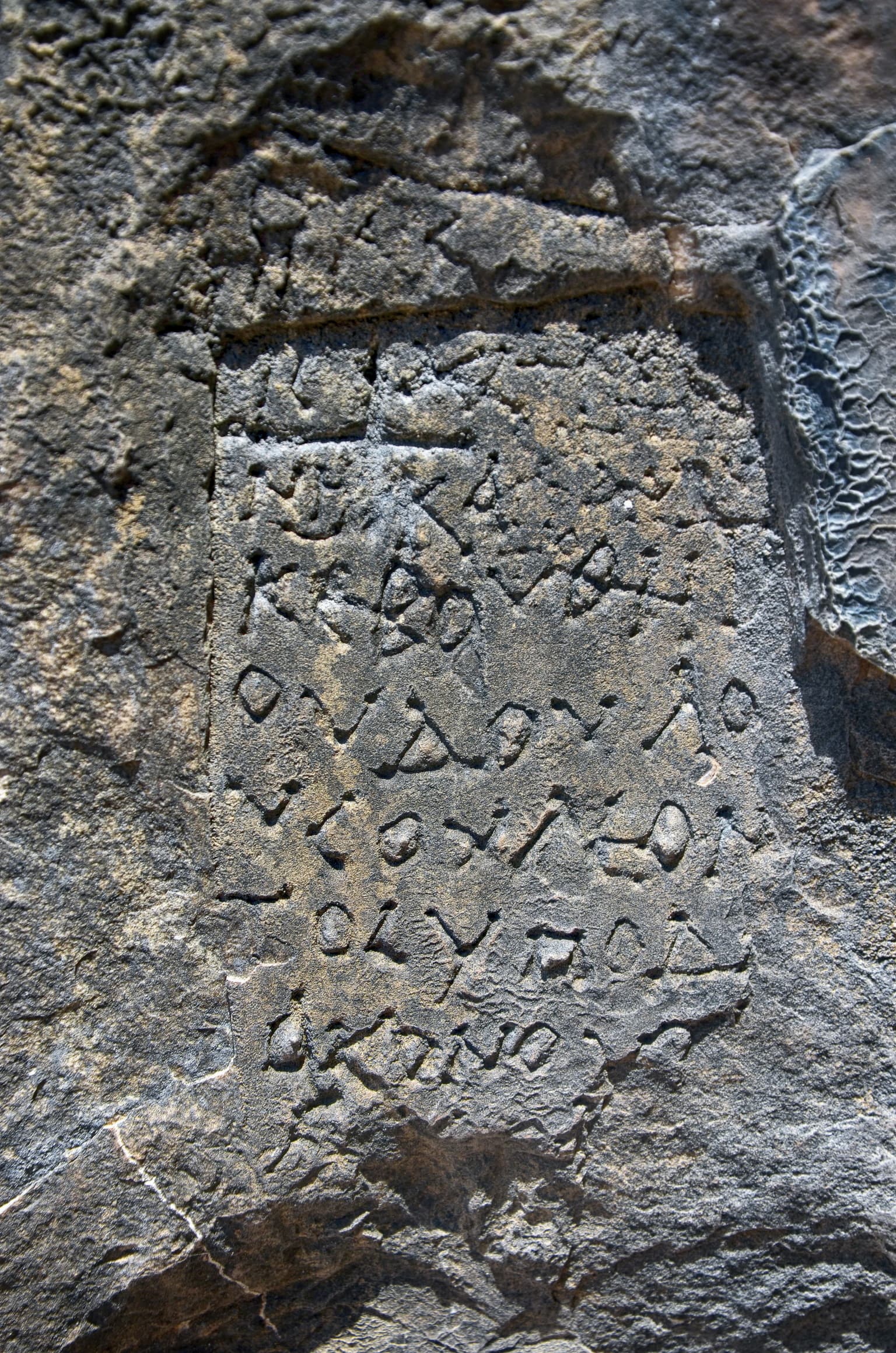
The Karaburun-Sazan Marine Park contains meaningful historical and cultural elements embedded in its coastal landscape. The Bay of Grama features ancient rock inscriptions carved by sailors over centuries, providing tangible evidence of historical maritime activity along this stretch of coastline. The underwater environment contains ruins of sunken ancient Greek, Roman, and World War II ships, creating an underwater archaeological landscape of significant historical interest.

The park's proximity to military installations has historically limited public access, particularly to Sazan Island, which functioned as a restricted military zone for decades. The 2015 opening of Sazan Island to the public marked a transition from military to civilian use, creating new opportunities for cultural tourism while maintaining conservation protections. The peninsula's rugged terrain and remote character have historically limited human settlement and development, contributing to the preservation of natural landscapes relatively free from intensive human disturbance.

Close-up of ancient carved inscriptions on a weathered rock face
Ancient carved inscriptions on a weathered rock face

Top sights and standout views in Karaburun-Sazan Marine Park

Karaburun-Sazan Marine Park stands as Albania's premier marine protected area combining dramatic limestone cliffs, a significant island ecosystem, and exceptional biodiversity. The park protects the largest island in Albania, Sazan, with its unique subtropical climate and Cretaceous limestone geology distinct from typical Mediterranean conditions. The convergence of Adriatic and Ionian marine environments supports critical populations of endangered species including the Mediterranean monk seal and multiple sea turtle species. Underwater attractions include ancient shipwrecks, rich marine fauna, and spectacular caves visible beneath the surface. The park's international designations as an Important Bird Area and Specially Protected Area of Mediterranean Importance reflect its ecological significance within the broader Mediterranean Basin.

Underwater scene showing cave entrance with rocky walls, clear blue water, and sunlit seabed
Underwater view of Dafine Cave entrance in Karaburun-Sazan Marine Park, Albania

Best time to visit Karaburun-Sazan Marine Park

The marine park experiences a Mediterranean climate with mean temperatures ranging from 8-10°C in January to 24-26°C in July and annual precipitation between 1,000-1,200 millimeters. The summer months offer the warmest conditions for swimming and marine activities, though spring and autumn provide comfortable temperatures for hiking and wildlife observation. The winter season brings rainfall but offers fewer visitors and the opportunity to observe different aspects of the park's ecology. Given the park's proximity to military installations, visitors should check current access requirements and consider hiring professional local guides, particularly for underwater exploration.

Park location guide

Geography guide, regional context, and park location map for Karaburun-Sazan Marine Park

Karaburun-Sazan Marine Park park geography, regions, and map view in Albania
Understand where Karaburun-Sazan Marine Park sits in Albania through a broader geographic reading of the surrounding landscape, nearby location context, and its mapped position within the national park landscape.

How Karaburun-Sazan Marine Park fits into Albania

Albania is a unitary parliamentary republic in Southeast Europe, situated on the Balkan Peninsula along the Adriatic and Ionian coastal regions. With a population of approximately 2.4 million people, it borders Montenegro, Kosovo, North Macedonia, and Greece. The country features varied landscapes ranging from the Albanian Alps to fertile coastal plains, with Tirana as its capital and largest city.

Wider geography shaping Karaburun-Sazan Marine Park in Albania

Albania occupies the western part of the Balkan Peninsula in Southeast Europe. The country features a varied terrain with rugged mountain ranges including the Albanian Alps (Accursed Mountains), Korab, Skanderbeg Mountains, Pindus, and Ceraunian Mountains. Fertile lowland plains extend along the Adriatic and Ionian coastal regions. The country borders Montenegro to the northwest, Kosovo to the northeast, North Macedonia to the east, and Greece to the south.

Map view of Karaburun-Sazan Marine Park

Use this park location map to pinpoint Karaburun-Sazan Marine Park in Albania, understand its exact geographic position, and read its mapped placement within the surrounding landscape more clearly.

Pigeon | © OpenStreetMap contributors

Location context for Karaburun-Sazan Marine Park

Vlorë County

Visually Explore Karaburun-Sazan Marine Park's Diverse Coastal Terrain, Island Habitats, and Protected Marine Environments

Karaburun-Sazan Marine Park Photos: Explore Dramatic Coastal Landscapes and Marine Protected Area Scenery
Browse the visual gallery of Karaburun-Sazan Marine Park to understand its distinctive convergence of Mediterranean and subtropical ecosystems, dramatic limestone cliffs, and vital marine habitats. These images provide essential insights into the park's diverse terrain, from Sazan Island's unique geology to the rugged Karaburun Peninsula, offering a deeper atlas-style comprehension of its protected landscape.

Aerial view of a rocky coastal cove with clear turquoise water, a small sandy beach, and a person swimming near the shore

Clear turquoise water in a coastal cove with rocky shorelines and lush green forested hills in the background

A coastal bay with white sand beach, turquoise water, rocky cliffs, and green vegetation viewed from an elevated vantage point

Coastal bay with clear turquoise water, sandy beach, rocky cliffs, and green vegetation

A dolphin leaping from ocean water with splashes

Close-up of ancient carved inscriptions on a weathered rock face

Underwater scene showing cave entrance with rocky walls, clear blue water, and sunlit seabed

Rocky cliffs with a dark cave entrance opening to the sea

Park atlas

Browse surrounding coastal landscapes and diverse marine ecosystems for regional park comparison.

Discover Nearby Protected Areas and Marine Parks: A Geographic Atlas Beyond Karaburun-Sazan Marine Park
Continue your park discovery beyond Karaburun-Sazan Marine Park by exploring other protected areas across the Albanian coastline and broader Mediterranean region. Compare diverse marine ecosystems, limestone cliff geographies, and island conservation landscapes to understand their regional context and unique features.
National parkVlorë County

Llogara National Park: Vlorë County's Dramatic Ceraunian Mountain Protected Landscape

Explore Albania's rugged national park geography and mapped terrain.

Llogara National Park stands as a vital protected area within Vlorë County, Albania, renowned for its spectacular Ceraunian Mountain topography. This page provides access to detailed geographic information, highlighting the park's unique landscape characteristics, from alpine peaks to coastal vistas. Discover the mapped extent of this national park and its significance within the regional geography, perfect for structured atlas exploration.

Area
17.69 km²
Established
1966
IUCN
II
Relief
Mountain
Watercolor painting showing hills, green fields, a body of water, and vegetation under a soft sky
National park

Divjakë-Karavasta National Park: Albania's Expansive Coastal Wetland and Pelican Breeding Site

Mapping Albania's largest Mediterranean lagoon and its vital bird sanctuaries.

Divjakë-Karavasta National Park is a key protected coastal wetland in western Albania, centered around Karavasta Lagoon, one of the largest in the Mediterranean. This Ramsar site provides critical habitats for numerous bird species, including a globally significant population of the endangered Dalmatian pelican, making it a premier destination for understanding regional wetland geography and protected area dynamics.

Area
222.3 km²
Established
2007
IUCN
II
Relief
Lowland
Watercolor painting showing mountains, a river, and vegetation
National park

Tomorr Mountain National Park: Sacred Peak & Karst Protected Landscape in Albania

Explore Albania's dramatic mountain geography and protected areas.

Tomorr Mountain National Park offers a unique exploration of southern Albania's dramatic limestone anticline. Dominated by the sacred Mount Tomorr and featuring the spectacular Osum Canyon, this national park provides insight into karst terrain, old-growth forests, and significant biodiversity. Discover its mapped boundaries and regional geographic context within the Pindus Mountains for structured atlas exploration.

Area
271.855 km²
Established
1956
IUCN
II
Relief
Mountain
Watercolor landscape painting showing a lake, distant mountains, and vegetation
National parkVlorë County

Butrint National Park: Archaeological Heritage and Mediterranean Wetland Landscape

Explore its unique geography and protected park boundaries.

Butrint National Park presents a singular opportunity for geographic and protected-area discovery, showcasing an unparalleled fusion of ancient history and ecological richness. Located in Albania's Vlorë County, this national park encompasses Lake Butrint, coastal lagoons, and vital wetland habitats, recognized internationally for their biodiversity. Through MoriAtlas, users can explore the mapped extent of this unique landscape, understand its role within regional geography, and uncover the interplay between its preserved archaeological sites and the surrounding Mediterranean environment.

Area
94.244 km²
Established
2000
IUCN
II
Relief
Lowland
Watercolor painting of a landscape with green fields, scattered trees, and rolling hills under a light sky
National parkGjirokastër County

Fir of Hotovë-Dangëlli National Park: Ancient Forests & Mountain Wilderness Atlas

Explore a premier protected landscape in Gjirokastër County, Albania.

Fir of Hotovë-Dangëlli National Park stands as a monumental protected area, celebrated for its exceptional old-growth Hotova Fir forests, which are a rare Mediterranean plant relic. This national park in Gjirokastër County offers a detailed look at a vast mountainous terrain, featuring dramatic canyons like Lengarica Canyon, and serving as a critical habitat for diverse wildlife. MoriAtlas provides structured geographic context for this significant landscape, highlighting its mapped boundaries and role as a key component of regional protected area networks.

Area
360.038 km²
Established
2008
IUCN
II
Relief
Mountain
National park

Dajti Mountain National Park: Albania's Accessible Protected Mountain Landscape for Geographic Discovery

Explore the mapped terrain and diverse ecosystems of this significant national park.

Dajti Mountain National Park is a prime example of a protected mountain landscape central to Albania's geography. Situated near Tirana, its rugged karst topography, steep limestone ridges, and varied elevation create distinct ecological zones. This atlas-focused entry details the park's terrain, notable geological features like Pellumbas Cave, and its role as a significant protected area offering rich mapped landscape context.

Area
293.84 km²
Established
1966
IUCN
II
Relief
Mountain
National park

Vikos-Aoös National Park: Deepest Gorge and Protected Mountain Landscape Atlas

Discover protected area boundaries and regional geography in Epirus.

Vikos-Aoös National Park in Greece's Pindus mountains is a premier destination for exploring dramatic natural geography. Best known for the Vikos Gorge, considered the world's deepest canyon relative to its width, the park also features towering alpine peaks like Mount Tymphe, glacial lakes such as Drakolimni, and rich botanical diversity. As a UNESCO Geopark and part of the Natura 2000 network, it safeguards critical habitats, including significant brown bear populations. This park offers a profound look into protected landscapes, offering detailed geographic context and mapped terrain for atlas-based discovery.

Area
126 km²
Established
1973
IUCN
II
Visitors
100K annual
Watercolor illustration of mountains, a lake, and rolling hills with grassy vegetation.
National parkElbasan County

Shebenik National Park: Mapped Protected Landscape and Glacial Terrain Atlas

Explore Elbasan County's significant mountain wilderness and protected natural features.

Shebenik National Park is a protected national park in Elbasan County, Albania, notable for its dramatic glacial terrain and extensive ancient forests. This park offers a deep dive into Albania's natural landscape, featuring 14 glacial lakes and serving as vital habitat. Its position within the Balkan Peninsula's geography makes it a key point of reference for understanding protected areas and mountain wilderness within a structured atlas.

Area
345.079 km²
Established
2008
IUCN
II
Relief
Mountain

Common questions about visiting, size, designation, and location context for Karaburun-Sazan Marine Park

Karaburun-Sazan Marine Park FAQs for park facts, access, geography, and protected area context
Find quick answers about Karaburun-Sazan Marine Park, including protected-area facts, park geography, trail and visitor context, and how the park fits into its surrounding country and regional landscape.
MoriAtlas Explorer

Continue Your Protected Areas Search Across the Global Atlas

Deepen your exploration by continuing the structured search for national parks and protected areas worldwide. Utilize the comprehensive filtering capabilities to compare different conservation landscapes and refine your understanding of global park geography. Discover more about the distribution and characteristics of protected natural areas.

Global natural geography