
Por qué destaca Parque Nacional Kwiambal
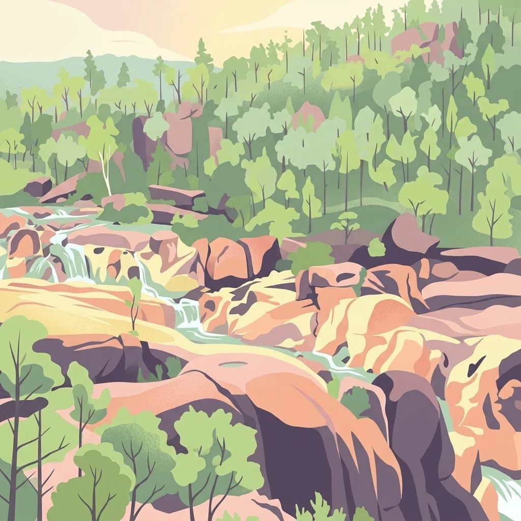
El Parque Nacional Kwiambal es más conocido por su dramático paisaje fluvial y las icónicas MacIntyre Falls, donde convergen los ríos Severn y Macintyre. La geología de granito expuesta del parque crea un paisaje visual distintivo de formaciones rocosas erosionadas y terreno cubierto de rocas. El sistema de cuevas de Ashford añade interés espeleológico a los activos naturales del parque. Estas características combinadas hacen del parque un destino notable para la recreación basada en la naturaleza en el noroeste de New England.

Historia de Parque Nacional Kwiambal y cronología del área protegida
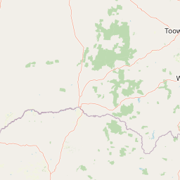
El Parque Nacional Kwiambal fue declarado oficialmente el 10 de mayo de 2000, estableciendo el área como un parque nacional protegido bajo la gestión del Servicio de Parques Nacionales y Vida Silvestre de Nueva Gales del Sur. La declaración inicial describía el parque como comprendiendo el condado de Arrawatta, las parroquias de Ena, Limestone y Severn, con una superficie original de aproximadamente 1,301 hectáreas. Trabajos posteriores de relevamiento de vegetación, en particular un informe de 2008 del Dr. John T. Hunter, documentaron la extensión del parque en aproximadamente 6,517 hectáreas, lo que indica que el área protegida abarca una superficie terrestre mayor de la registrada inicialmente. La creación del parque reflejó el creciente reconocimiento del valor de conservación de los sistemas fluviales de la región, los paisajes graníticos y la necesidad de proteger el área de las cataratas MacIntyre y los entornos naturales circundantes.
Paisaje y carácter geográfico de Parque Nacional Kwiambal
El paisaje del Parque Nacional Kwiambal está definido por su terreno dominado por el granito, con formaciones rocosas expuestas que crean un telón de fondo de rocas erosionadas y crestas escarpadas en toda la reserva. Los valles fluviales de los ríos Severn y Macintyre han tallado caminos a través de este paisaje de granito, siendo la característica más dramática MacIntyre Falls, donde convergen estas corrientes de agua. El terreno que rodea los corredores fluviales presenta rápidos, pozas y cascadas que animan el paisaje con agua corriente. Entre los sistemas fluviales, el parque contiene áreas de terreno más suavemente ondulado, aunque los afloramientos de granito siguen siendo un elemento visual constante en toda la reserva. La combinación de agua corriente, afloramientos rocosos y vegetación nativa crea un carácter de parque natural que es distintivo dentro de la región de New England.
Ecosistemas, hábitats y flora de Parque Nacional Kwiambal
El entorno natural del Parque Nacional Kwiambal abarca una mezcla de comunidades vegetales adaptadas a los suelos basados en granito y las zonas ribereñas a lo largo de los ríos del parque. El parque se encuentra dentro de una zona de transición paisajística más amplia, y aunque los detalles específicos de la vegetación son limitados en el material fuente, el parque alberga la biodiversidad típica de New England, incluidas comunidades de bosques y arboledas en las áreas más resguardadas. Los sistemas fluviales proporcionan importantes hábitats acuáticos y corredores ribereños que sustentan ensamblajes vegetales distintos adaptados a la disponibilidad regular de agua. Los afloramientos de granito albergan comunidades vegetales especializadas capaces de sobrevivir en suelos delgados y superficies rocosas expuestas. Estos diversos tipos de hábitat contribuyen al valor ecológico general de la reserva.
Vida silvestre y especies destacadas de Parque Nacional Kwiambal
El Parque Nacional Kwiambal alberga poblaciones de vida silvestre típicas de la región de New England, en Nueva Gales del Sur. Los sistemas fluviales del parque proporcionan hábitat para diversas especies acuáticas y atraen avifauna a lo largo de los corredores ribereños. La observación de aves se identifica como una actividad para los visitantes dentro del parque, lo que indica la presencia de una fauna aviar diversa. La mezcla de hábitats boscosos, entornos fluviales y afloramientos rocosos sustenta una variedad de especies terrestres. El estatus de protección del área ayuda a preservar los hábitats de la vida silvestre y los corredores de movimiento dentro del paisaje agrícola más amplio de la región.
Estado de conservación y prioridades de protección de Parque Nacional Kwiambal
El Parque Nacional Kwiambal contribuye a la red de conservación en el norte de Nueva Gales del Sur al proteger un paisaje de ríos, cascadas y terreno de granito que de otro modo podría haber sido degradado por el desarrollo ganadero o agrícola. La designación del parque como área protegida de Categoría II de la UICN refleja su importancia nacional y la intención de preservar sus valores naturales. La protección de las cuencas del río Severn y del río Macintyre dentro del límite del parque ayuda a mantener la calidad del agua y la salud de los ecosistemas acuáticos. Los paisajes de granito y los hábitats asociados representan valores de conservación que se benefician de la protección formal dentro del sistema de parques nacionales.
Significado cultural y contexto humano de Parque Nacional Kwiambal
El material fuente no proporciona información detallada sobre el patrimonio cultural indígena o el uso humano histórico del área del Parque Nacional Kwiambal. El parque se encuentra dentro de la región más amplia de New England, que tiene asociaciones indígenas, aunque el contexto cultural específico para esta área protegida en particular no está documentado en la información disponible.
Lugares imprescindibles y vistas destacadas de Parque Nacional Kwiambal
Los aspectos más destacados del Parque Nacional Kwiambal incluyen las espectaculares MacIntyre Falls en la confluencia de los ríos Severn y Macintyre, los omnipresentes afloramientos de granito que dan forma al carácter visual del parque y las Cuevas de Ashford para aquellos interesados en las formaciones geológicas. El parque ofrece diversas oportunidades recreativas, como nadar en las pozas del río, andar en bicicleta de montaña por senderos, pescar en los sistemas fluviales y observar aves a lo largo de los corredores ribereños. La disponibilidad de alojamiento dentro o cerca del parque lo convierte en un destino práctico para visitas prolongadas para explorar las características naturales del noroeste de New England.
Mejor época para visitar Parque Nacional Kwiambal
El mejor momento para visitar el Parque Nacional Kwiambal sería, en general, durante los meses más frescos de otoño e invierno en el hemisferio sur, aproximadamente de marzo a agosto, cuando las temperaturas son más agradables para la exploración al aire libre y el paisaje conserva su carácter verde. Los meses de verano pueden traer altas temperaturas a la región de New England, lo que podría hacer que las actividades al aire libre sean menos cómodas. El parque se puede visitar durante todo el año, aunque los visitantes deben tener en cuenta que las condiciones de los ríos y la accesibilidad pueden variar con los patrones de lluvia estacionales. Las cascadas y las pozas del río probablemente serán más impresionantes después de períodos de lluvia, mientras que los meses más secos pueden resultar en un flujo de agua reducido.