Why Montaña de Yoro National Park stands out
Montaña de Yoro National Park is best known for its cloud forest ecosystems at high elevation, representing one of the more significant protected areas in Honduras for mid-montane biodiversity conservation. The park's elevation range places it in a critical zone for cloud forest preservation in Central America, where moisture-laden clouds sustain unique vegetation communities and support specialized wildlife species. Its establishment in 1987 reflected Honduras' commitment to protecting representative samples of its diverse forest types, particularly the increasingly threatened cloud forest habitats of the region.
Montaña de Yoro National Park history and protected-area timeline
Montaña de Yoro National Park was established on January 1, 1987, representing a continuation of Honduras' efforts during the late twentieth century to establish a comprehensive national park system. The park's creation followed a broader pattern of protected area designation across Central America during this period, as governments responded to growing awareness of deforestation rates and biodiversity loss. The park was originally designated under the name Montaña de Yoro National Park, though the current official name appears as Montañade Yoro National Park in some administrative records. The establishment of this protected area reflected recognition that Honduras' highland forests, while less dramatically scenic than some other regions, harbored significant biological value warranting formal protection.
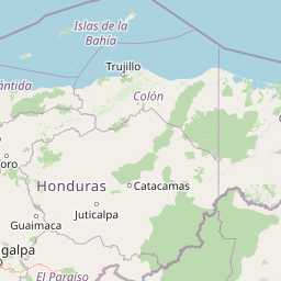
Montaña de Yoro National Park landscape and geographic character
The physical landscape of Montaña de Yoro National Park is characterized by mountainous terrain typical of the Honduran highlands, with elevations ranging from 1,800 to 2,245 meters above sea level. The park's topography features the rugged, dissected terrain common to Central American mountain ranges, with steep slopes and narrow valleys carved by erosional processes. At these elevations, the landscape is typically enveloped in persistent cloud cover for much of the year, a climatic condition that defines the cloud forest ecosystem. The terrain supports streams and drainage systems that feed into broader watershed networks serving downstream communities. The combination of high elevation, steep terrain, and persistent moisture creates the conditions for a distinctive landscape character quite different from the tropical lowlands that dominate much of Honduras.
Montaña de Yoro National Park ecosystems, habitats, and plant life
The ecological character of Montaña de Yoro National Park is defined by cloud forest formations that develop at elevations between approximately 1,500 and 2,500 meters in this portion of Central America. These forests are characterized by frequent cloud immersion, epiphytic plant communities including numerous bromeliads, orchids, and mosses, and a dense canopy structure adapted to cool, perpetually moist conditions. The park's elevation range positions it within a critical zone for biodiversity, supporting species assemblages that differ distinctly from both the lowland tropical forests below and the higher elevation pine-oak forests found at still greater altitudes. The persistent cloud cover supports high humidity levels that enable unusual plant adaptations and create conditions favorable for specialized invertebrate and amphibian communities.
Montaña de Yoro National Park wildlife and species highlights
While detailed species inventories for Montaña de Yoro National Park are not extensively documented in readily available sources, the cloud forest ecosystem at this elevation in Honduras typically supports diverse wildlife communities. The park's protected status provides refuge for bird species characteristic of Central American highlands, including various trogon, tanager, and hummingbird species. The epiphyte-rich canopy supports invertebrate communities, while the cool, moist conditions favor amphibian populations that are often highly sensitive to habitat disturbance. The importance of such protected areas for wildlife conservation in Honduras cannot be overstated, as the country's cloud forest habitats have experienced significant reduction across their historic extent.
Montaña de Yoro National Park conservation status and protection priorities
Montaña de Yoro National Park represents a meaningful contribution to regional conservation efforts within the Mesoamerican biodiversity hotspot. The park's cloud forest ecosystem is increasingly recognized as globally significant yet highly threatened, making protected areas like this essential for maintaining ecological processes and species populations. The IUCN Category II designation indicates management approaches oriented toward ecosystem preservation while allowing for some sustainable use activities consistent with national park status. The park's location in Honduras places it within a country that has experienced substantial forest loss, making the conservation of remaining intact forest blocks particularly valuable. This protected area contributes to the broader network of Central American parks that collectively help maintain habitat connectivity across the isthmus.
Montaña de Yoro National Park cultural meaning and human context
The cultural context of Montaña de Yoro National Park is linked to the broader history of the Yoro region in north-central Honduras. The park exists within a landscape that has been inhabited by various indigenous and mestizo communities over centuries, though the specific cultural heritage associated with the park's immediate area is not extensively documented in available sources. The region's name derives from the department of Yoro, which encompasses both the park and surrounding agricultural landscapes. Like many Central American protected areas, the park exists within a context where conservation objectives must balance against regional development pressures and the livelihood needs of local communities.
Top sights and standout views in Montaña de Yoro National Park
The defining highlight of Montaña de Yoro National Park is its cloud forest ecosystem at high elevation, representing one of the more significant protected areas in Honduras for this increasingly rare habitat type. The park's substantial extent of 154.8 square kilometers provides meaningful habitat protection within a country where cloud forest coverage has diminished substantially. The elevation range spanning from 1,800 to 2,245 meters encompasses a vertical ecological gradient that supports distinct community types. The park's establishment in 1987 reflects a commitment to preserving representative examples of Honduras' diverse forest ecosystems, with the protected area serving as a repository of biological diversity in the Mesoamerican hotspot.
Best time to visit Montaña de Yoro National Park
The optimal period for visiting Montaña de Yoro National Park coincides with the dry season typical of Central America's Pacific slope, generally spanning from November through April. During these months, visitor access is typically more feasible and trail conditions more favorable. However, the cloud forest environment means that moisture is a persistent feature regardless of season, and visitors should expect damp conditions throughout the year. The park's high elevation results in cooler temperatures than the surrounding lowlands, requiring appropriate layered clothing. The wet season from May through October brings increased precipitation but also the most dramatic cloud immersion in the forest, which many visitors find to be the defining atmospheric experience of cloud forest environments.