Mori Atlas logo
National parkØvre Pasvik National Park

Discover the mapped boundaries and distinct boreal geography of this unique Arctic wilderness.

Øvre Pasvik National Park: Norway's Pristine Siberian Taiga Protected Landscape

(Øvre Pasvik nasjonalpark)

Øvre Pasvik National Park represents a significant protected area within Norway's northern geography, distinguished by its exceptionally rare and intact Siberian taiga ecosystem. This national park offers a unique look into old-growth Scots pine forests, expansive wetland systems, and a remarkably flat landscape compared to typical Norwegian terrain. Serving as a vital component of the transboundary Pasvik–Inari Trilateral Park, Øvre Pasvik National Park provides a crucial mapped context for understanding Europe's northern boreal conservation landscapes and their intricate natural systems.

National ParkTaiga ForestOld-Growth ForestBoreal EcosystemTransboundary Protected AreaBrown Bear Habitat

Øvre Pasvik National Park

National park

Park overview

Structured park overview, official facts, and landscape profile for Øvre Pasvik National Park

Øvre Pasvik National Park park facts, protected area profile, and essential visitor context
Review the core facts for Øvre Pasvik National Park, including designation, size, terrain, visitor scale, habitats, and operating context in one park-focused overview.

About Øvre Pasvik National Park

Øvre Pasvik National Park preserves a distinctive boreal wilderness in Norway's far north, representing one of the last intact examples of Siberian taiga ecology in Western Europe. The park occupies the southwestern portion of the Pasvikdalen valley, a landscape shaped by glacial processes and characterized by its remarkably flat terrain, rolling hills, and extensive wetland systems. The protection of this area was first proposed in 1936 by author Carl Schøyen, though conservation at the national level was not achieved until 1970, with significant expansion occurring in 2003 when the adjacent Øvre Pasvik Landscape Protection Area was established. The park forms a critical component of the Pasvik–Inari Trilateral Park network, connecting Norwegian, Russian, and Finnish protected areas into a coherent transboundary conservation unit that allows wildlife movement across international borders. The park's remoteness and lack of development infrastructure have helped preserve its wilderness character, though the national park center at Svanhovd provides visitor information and educational resources. The landscape reflects a complex geological history, with granite and gneiss bedrock underlying thin soils, while post-glacial rebound has shaped the terrain over the past 5,000 years since the valley transitioned from a fjord system to terrestrial landscape.

Quick facts and research context for Øvre Pasvik National Park

Øvre Pasvik National Park is located in Finnmark, Norway's northernmost county, approximately 90 kilometers south of Kirkenes near the Russian border. The park occupies the southwestern portion of the Pasvikdalen valley, with its western boundary coinciding with the Finland-Norway border. The landscape is characterized by remarkably flat terrain for Norwegian standards, dominated by old-growth Scots pine forest covering roughly half the park area, interspersed with numerous shallow lakes, tarns, and peat bogs. The tallest peak is Kolfjellet at 260 meters above sea level. The park experiences a dry climate with approximately 350 millimeters of annual precipitation and severe winters that have recorded temperatures as low as -45°C. The area benefits from 60 days of midnight sun during summer. The park contains Treriksrøysa, the tripoint cairn marking the intersection of Finland, Norway, and Russia.

Park context

Deeper park guide and search-rich context for Øvre Pasvik National Park

Øvre Pasvik National Park history, landscape, wildlife, and travel context
Explore Øvre Pasvik National Park through its history, landscape character, ecosystems, wildlife, conservation priorities, cultural context, and seasonal travel timing in a structured park guide built for atlas discovery and search intent.

Why Øvre Pasvik National Park stands out

Øvre Pasvik is best known for its pristine Siberian taiga ecosystem, which represents one of the most northerly and intact examples of this boreal forest type in Europe. The park protects significant populations of brown bear, which hibernate within its boundaries, and maintains one of Norway's strongest moose populations. The old-growth Scots pine forests, with trees typically reaching 300 to 400 years of age and some exceeding 800 years, constitute a rare and ecologically valuable woodland ecosystem. The park also stands out as a transboundary conservation area, forming part of the Pasvik, Inari Trilateral Park that links protected landscapes across Norway, Russia, and Finland. The presence of the Treriksrøysa tripoint cairn, where three nations meet, adds a unique geopolitical dimension to the park's natural significance.

High-altitude view of turquoise lake with snow-dusted mountains, rocky slopes, and winding river in valley
Panoramic view of turquoise lake surrounded by snow-capped mountains and rocky terrain

Øvre Pasvik National Park history and protected-area timeline

The protection of Øvre Pasvik began with a proposal from author Carl Schøyen in 1936, who submitted his vision for a national park to the Ministry of Agriculture. At that time, the Norwegian government opposed conservation efforts, preferring to exploit natural resources. Schøyen renewed his proposal in the late 1940s, and in 1951, the year of his death, the Director of Forestry administratively protected approximately 70 square kilometers within what would later become the national park. The national park was officially established on February 6, 1970, covering 66 square kilometers. In the late 1960s, proposals to construct a highway through Pasvikdalen to Ivalo in Finland renewed interest in formal park designation, and while the road was never approved, the national park creation proceeded. The park was significantly expanded on August 23, 2003, when the adjacent Øvre Pasvik Landscape Protection Area was also established, creating a continuous protected landscape connecting to Russia's Pasvik Nature Reserve and Finland's Vätsäri Wilderness Area. A local management board was established in 2011, and the national park center opened in 2001 at Svanhovd.

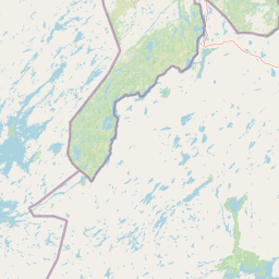
Øvre Pasvik National Park landscape and geographic character

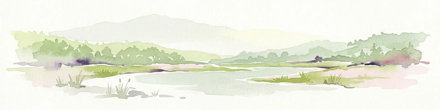
The physical landscape of Øvre Pasvik National Park is defined by its exceptionally flat terrain, which distinguishes it from much of Norway's mountainous topography. The valley floor consists of large rolling hills covered in forest, interspersed with shallow lakes and numerous small tarns. Approximately twenty percent of the park is covered by water, with Ellenvatnet being the largest lake, centrally located and drained from the north, featuring two enclosed southern bays called Parvatn and Skinnposevatnet. Ødevatnet, in the southeastern portion of the park, is the second-largest lake and lies within a deep geological fault that gives it an elongated profile. The park rises slightly toward the west, with Kolfjoldet reaching 260 meters above sea level as the highest point. The terrain is dotted with vegetation-less flat scree deposits, and the overall landscape offers few orientation markers, making lakes and creeks essential navigational references. The underlying geology consists primarily of granite gneisses, with schist appearing in the northern regions, while the thin soil cover means bedrock is visible only on cliff faces and hillocks.

Øvre Pasvik National Park ecosystems, habitats, and plant life

The ecological character of Øvre Pasvik is defined by its boreal taiga ecosystem, representing a Siberian forest type that extends into far northern Norway. The park is dominated by old-growth Scots pine forest, which covers approximately half of the protected area and constitutes one of the most significant such woodlands in Northern Europe. These forests have an extremely slow lifecycle, with typical trees living between 300 and 400 years, while the oldest recorded pine was 820 years old when felled in 1896. The forest understory transitions into extensive bog systems, with many former lakes having gradually filled with peat over millennia since the last glacial period. The park supports approximately 190 species of flowering plants characteristic of the Siberian taiga, including the marsh Labrador tea, which occurs in only three locations throughout Norway. The dry climate, receiving only 350 millimeters of annual precipitation, creates conditions unfavorable for many plant species found elsewhere in Norway, while simultaneously limiting the spread of Norway spruce, which appears only sporadically in small clusters.

Øvre Pasvik National Park wildlife and species highlights

The wildlife community of Øvre Pasvik reflects its position at the crossroads of Scandinavian and Siberian faunal provinces. Brown bears regularly den and hibernate within the park, with two to four females giving birth in the park and landscape protection area annually, while bears also transit between Russia and Finland through the area. Moose populations have increased substantially and now exert significant influence on forest regeneration through their browsing. Reindeer husbandry occurs within the park during winter months, with herds moving to Varangerfjorden for summer grazing. The park supports eight fish species in its lakes, with Northern pike and European perch being most abundant, while brown trout arrived in the area approximately 8,000 years ago following the last glacial period. Birdlife is particularly notable, featuring species typical of the Siberian taiga that are uncommon elsewhere in Norway, including Siberian jay, pine grosbeak, Bohemian waxwing, and the great grey owl. The park also provides habitat for rare species such as Laxmann's shrew, one of very few locations in Norway where this small mammal is found.

Øvre Pasvik National Park conservation status and protection priorities

Øvre Pasvik National Park serves as a critical conservation anchor in one of Europe's most important transboundary protected area networks. The park's inclusion in the Pasvik–Inari Trilateral Park creates a continuous protected corridor spanning Norway, Russia, and Finland, facilitating wildlife movement across international borders and protecting ecological processes that transcend political boundaries. The old-growth Scots pine forests represent a conservation priority due to their ecological maturity, slow regeneration rates, and historical role in maintaining ecosystem processes including wildfire dynamics. The park's brown bear population benefits from the connected landscape that allows movement between Russian and Finnish territories, while the lake systems and wetlands provide important habitat for migratory waterfowl. The management framework, overseen by a local political board with representation from Sør-Varanger Municipality, Finnmark County, and the Sami Parliament, reflects the multi-stakeholder approach needed for effective stewardship of this northern wilderness area.

Øvre Pasvik National Park cultural meaning and human context

The Pasvikdalen valley has been inhabited since the Stone Age, with archaeological evidence from the Komsa culture dating to approximately 4000 BC. Around 2300 BC, immigration from Finland brought Skolt Sami communities who practiced reindeer husbandry as the primary land use for centuries. Norwegian settlement began around 1850, with the first land grants for farming occurring in 1874 following road construction along the valley. Russian immigration followed on the opposite side of the border. The landscape underwent dramatic change in the mid-20th century when Soviet authorities depopulated the Russian side after 1945 and developed hydroelectric infrastructure along the Pasvikelva. The park's position at the tripoint of Norway, Finland, and Russia gives it ongoing geopolitical significance, with military activity in the border area and special considerations for visitors regarding international boundary protocols. Treriksrøysa, the cairn marking the three-country junction, remains accessible from the park.

Top sights and standout views in Øvre Pasvik National Park

Øvre Pasvik National Park offers a rare opportunity to experience pristine Siberian taiga wilderness in Western Europe, with old-growth pine forests, extensive wetland systems, and wildlife including brown bear and moose. The park's transboundary location at the Finland-Norway-Russia border makes it uniquely significant, with the Treriksrøysa tripoint cairn accessible from within the park. The midnight sun illuminates the landscape for 60 summer days, while winter brings extreme cold and the aurora borealis. The absence of marked trails and developed facilities preserves a true wilderness character for experienced hikers, while the national park center at Svanhovd provides educational context for understanding this northern ecosystem.

Best time to visit Øvre Pasvik National Park

The optimal time to experience Øvre Pasvik National Park depends on visitor preferences for season and activity. Summer months offer the midnight sun phenomenon, with approximately 60 days of continuous daylight, allowing extended exploration of the trail-free landscape. The dry summer conditions provide comfortable hiking weather, though the lack of marked trails requires GPS navigation. Autumn brings the opportunity to harvest cloudberries and observe the fall coloration of the pine forests, while September may offer early aurora viewing opportunities as darkness returns. Winter transforms the landscape into a snowy wilderness suitable for skiing, with extreme cold temperatures requiring proper equipment but offering unique solitude and wildlife tracking opportunities. Spring arrives late in this northern latitude, with May and June bringing the transition from snow cover to the growing season. The park can be visited year-round, though the extreme winter temperatures and lack of facilities require self-sufficiency and appropriate preparation.

Park location guide

Geography guide, regional context, and park location map for Øvre Pasvik National Park

Øvre Pasvik National Park park geography, regions, and map view in Norway
Understand where Øvre Pasvik National Park sits in Norway through a broader geographic reading of the surrounding landscape, nearby location context, and its mapped position within the national park landscape.

How Øvre Pasvik National Park fits into Norway

Norway, officially the Kingdom of Norway, is a Nordic country in Northern Europe located on the Scandinavian Peninsula. It encompasses mainland Norway, the Arctic islands of Svalbard and Jan Mayen, and maintains dependencies including Bouvet Island and Antarctic claims. The country has a population of about 5.6 million and is bordered by Sweden, Finland, and Russia. Norway is a unitary parliamentary constitutional monarchy with Oslo as its capital and largest city.

Wider geography shaping Øvre Pasvik National Park in Norway

Norway occupies the western and northern portions of the Scandinavian Peninsula in Northern Europe. The country shares a long eastern border with Sweden, and borders Finland and Russia to the northeast. Norway has an extensive coastline facing the Skagerrak, North Sea, Norwegian Sea, and Barents Sea. The terrain is predominantly mountainous with numerous fjords along the coastline.

Map view of Øvre Pasvik National Park

Use this park location map to pinpoint Øvre Pasvik National Park in Norway, understand its exact geographic position, and read its mapped placement within the surrounding landscape more clearly.

Pigeon | © OpenStreetMap contributors

Location context for Øvre Pasvik National Park

FinnmarkSør-Varanger Municipality

Mapped Scenery of Øvre Pasvik National Park's Old-Growth Taiga Forests, Boreal Wetlands, and Arctic Terrain

Visual Guide to Øvre Pasvik National Park: Explore Northern Norway's Unique Taiga Landscapes
Discover detailed imagery showcasing the distinctive landscapes of Øvre Pasvik National Park, from its ancient Scots pine taiga forests to extensive shallow lakes and unique bog systems. These visual references offer clear insights into the park's pristine boreal ecosystem, helping to contextualize its protected status and transboundary wilderness character.

High-altitude view of turquoise lake with snow-dusted mountains, rocky slopes, and winding river in valley

Park atlas

Trace connected protected landscapes across the boreal regions of Northern Norway, Finland, and Russia.

Explore Nearby National Parks and Protected Areas Surrounding Øvre Pasvik National Park
Browse other national parks and protected areas geographically proximate to Øvre Pasvik National Park, exploring a wider range of boreal landscapes and conservation efforts in the tripoint region. Comparing these nearby protected areas provides valuable geographic context for understanding the unique taiga ecosystem of the Pasvik, Inari Trilateral Park and surrounding Northern Europe.
National parkLapland

Urho Kekkonen National Park: Detailed Map and Protected Landscape Exploration in Lapland

Discover Finland's expansive Arctic wilderness and fell terrain.

Urho Kekkonen National Park represents a significant portion of Finland's protected Arctic landscape, offering a rich opportunity for geographic and atlas-based discovery. This national park in Lapland showcases dramatic fell formations, boreal forests, and extensive wetlands, with mapped boundaries that define its wild eastern reaches and more accessible western trails. Users can explore the unique terrain and understand its place within the broader regional geography, appreciating the vastness of this protected natural area.

Area
2,550 km²
Established
1983
IUCN
II
Visitors
435.9K annual
National parkFinnmark

Varangerhalvøya National Park: Explore Finnmark's Unique Subarctic Protected Landscape

Mapped tundra, wetlands, and Arctic fox conservation.

Varangerhalvøya National Park offers a compelling atlas exploration of Norway's northeasternmost protected landscapes. This national park in Finnmark is distinguished by its subarctic terrain, featuring expansive tundra, diverse wetlands, and a unique ecological position where multiple biomes converge. It is a critical habitat for the Arctic fox and a vital Important Bird Area, providing deep insights into protected area geography and landscape context for those studying regional conservation and natural formations.

Area
1,804.1 km²
Established
2006
IUCN
II
Relief
Lowland
National parkFinland

Lemmenjoki National Park: Finland's Protected Landscape Geography

Explore mapped park boundaries and regional natural context.

Lemmenjoki National Park is a vital protected area situated within Finland's vast northern geography. This page details its designation as a national park, offering a clear view of its mapped boundaries and landscape character. Users can explore the park's geographic context within Finland and understand its contribution to the region's network of conservation lands, facilitating structured atlas-style discovery.

Area
2,850 km²
Established
1956
IUCN
Ib
Visitors
21.1K annual
National parkKarasjok Municipality

Anárjohka National Park: Mapped Subarctic Wilderness and Protected Landscape

Explore Norway's Finnmarksvidda plateau geography.

Anárjohka National Park, a protected area in Norway's Finnmark region, offers a compelling atlas-level view of subarctic wilderness. The park's landscape is defined by its location on the Finnmarksvidda plateau, featuring rolling birch woodlands, open pine barrens, and extensive wetlands, all mapped within its protected boundaries. This park provides a crucial point of discovery for understanding regional geography, natural terrain, and the interconnectedness of protected lands across northern Europe.

Area
1,409 km²
Established
1976
IUCN
II
Relief
Mixed relief
National park

Stabbursdalen National Park: Protected Arctic Landscape and Northernmost Pine Forest Atlas

Explore Finnmark's unique geography and protected terrain.

Stabbursdalen National Park preserves a remarkable ecological boundary, featuring the planet's northernmost Scots pine woodland within a dramatic Arctic landscape. This protected area offers a deep dive into rugged mountain terrain, river valley formations, and vital wetland habitats. As a key component of Norway's protected lands, it provides essential context for understanding regional geography and the limits of forest ecosystems on the mapped landscape.

Area
747 km²
Established
1970
IUCN
II
Relief
Mixed relief
Watercolor painting showing rolling hills, forests, and distant mountains under a soft sky
National parkLapland

Pallas-Yllästunturi National Park: Lapland's Premier Protected Fell Landscape for Atlas Exploration

Explore its ancient mountain geography and mapped protected area.

Pallas-Yllästunturi National Park presents a unique atlas of Lapland's ancient geography, characterized by a vast chain of rounded fells that are the remnants of three-billion-year-old mountains. As Finland's most popular national park, it offers a deep dive into protected landscape discovery, showcasing diverse boreal forests, mires, and exceptional fell terrain. Understand its geographic scope and protected boundaries for comprehensive map-based exploration.

Area
1,020 km²
Established
2005
IUCN
II
Visitors
598.8K annual
Watercolor illustration showing a lake, rolling hills, and vegetation.
National parkLapland

Pyhä-Luosto National Park: Ancient Geological Heritage and Fell Landscape

Explore Lapland's southernmost large fell system and deep gorges.

Pyhä-Luosto National Park offers a unique window into Finland's deep geological past and its boreal ecosystems. As a protected area, it encompasses a prominent chain of twelve fells composed of two-billion-year-old quartzite, showcasing the southernmost large fell system in the country. The park's landscape is further defined by features like Isokuru, Finland's deepest gorge, and extensive old-growth forests, providing rich context for map-based discovery and regional geographic understanding within Lapland.

Area
142 km²
Established
2005
IUCN
II
Visitors
198.9K annual
National parkMurmansk Oblast

Khibiny National Park: Arctic National Park with Mapped Protected Boundaries in Murmansk Oblast

Explore Murmansk Oblast's unique protected landscape and regional geography.

Delve into the geography and protected landscape of Khibiny National Park, a significant national park situated in Russia's Murmansk Oblast. This resource provides essential details for understanding the park's mapped boundaries, its arctic terrain, and its position within the broader context of the Kola Peninsula's natural geography. Explore Khibiny National Park as a key protected area and a crucial element for atlas-based discovery of Russia's northwestern regions.

Area
848 km²
Established
2018
IUCN
II
Relief
Mountain

Common questions about visiting, size, designation, and location context for Øvre Pasvik National Park

Øvre Pasvik National Park FAQs for park facts, access, geography, and protected area context
Find quick answers about Øvre Pasvik National Park, including protected-area facts, park geography, trail and visitor context, and how the park fits into its surrounding country and regional landscape.
MoriAtlas Explorer

Continue Your Protected Areas Search Across the Global Atlas

Deepen your exploration by continuing the structured search for national parks and protected areas worldwide. Utilize the comprehensive filtering capabilities to compare different conservation landscapes and refine your understanding of global park geography. Discover more about the distribution and characteristics of protected natural areas.

Global natural geography