Por qué destaca Parque Nacional de Päijänne
El Parque Nacional de Päijänne es conocido por su carácter de naturaleza de islas y sus diversos paisajes de archipiélago en el segundo lago más grande de Finlandia. Las islas vírgenes del parque, que van desde crestas de playas arenosas hasta acantilados rocosos, ofrecen una experiencia distintiva de exploración de islas boreales. La isla más grande, Kelvenne, con su red de lagunas protegidas, es especialmente famosa como destino de navegación. El dramático acantilado de Haukkasalo, que se eleva más de 30 metros, es la característica geológica más imponente del parque y alberga un sitio histórico de pintura rupestre. La antigua base geológica, con rocas de más de dos mil millones de años, confiere a las islas un carácter único entre las áreas protegidas finlandesas.
Historia de Parque Nacional de Päijänne y cronología del área protegida
El Parque Nacional de Päijänne se estableció en 1993 como parte de la expansión de la red de parques nacionales de Finlandia a principios de la década de 1990. La creación del parque reflejó el creciente reconocimiento del valor ecológico y paisajístico del archipiélago meridional del lago Päijänne, que durante mucho tiempo había servido como zona recreativa para los residentes del sur de Finlandia. La designación de protección tenía como objetivo preservar las islas naturales permitiendo al mismo tiempo los usos tradicionales y el acceso continuos. La gestión del parque recae en Metsähallitus, la entidad estatal finlandesa responsable de los parques nacionales y otras áreas protegidas. El parque ha desarrollado infraestructuras, incluidas rutas y plataformas de observación, como la torre de observación en la isla de Päijätsalo, aunque algunas instalaciones, como la torre, requirieron trabajos de restauración en los últimos años. La zona tiene conexiones históricas con comunidades pesqueras tradicionales, y Haapasaari alberga lo que se describe como la última edificación de granja pesquera que queda en la región sur de Päijänne.
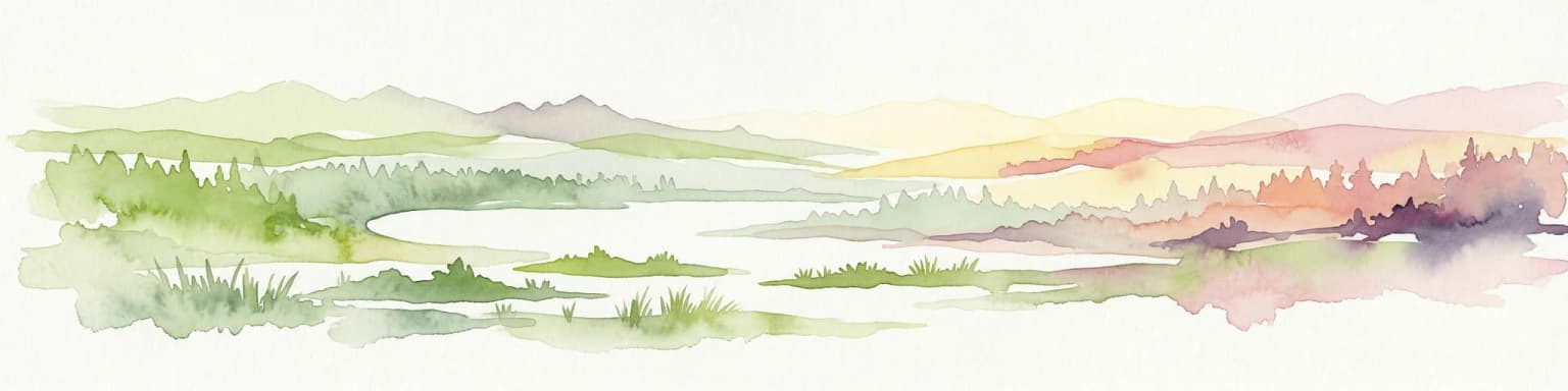
Paisaje y carácter geográfico de Parque Nacional de Päijänne
El paisaje del Parque Nacional de Päijänne está definido por su entorno insular dentro del Lago Päijänne, el segundo lago más grande de Finlandia con una superficie total de más de 1.000 kilómetros cuadrados. Las islas del parque exhiben dos caracteres geológicos distintos: las antiguas islas rocosas y de morrena que forman el núcleo del archipiélago, y las formaciones de depósitos glaciares más recientes que incluyen cordilleras de esker y áreas de playa. Las antiguas islas de roca base, particularmente evidentes en Haukkasalo e Iso Lammassaari, representan algunas de las formaciones rocosas más antiguas de Finlandia, con una antigüedad superior a los dos mil millones de años. El alivio más dramático se encuentra en Haukkasalo, donde un muro de acantilado se eleva más de 30 metros sobre el lago, la pared rocosa más alta del parque. Kelvenne, la isla más grande, presenta un paisaje distintivo de cordilleras de playa y bahías de lagunas protegidas formadas por depresiones de marmitas que se desarrollaron durante la última Edad de Hielo. Pulkkilanharju es una notable formación de esker que atraviesa el archipiélago, representando depósitos de agua de deshielo glacial que crearon largas características en forma de cresta a través del paisaje.
Ecosistemas, hábitats y flora de Parque Nacional de Päijänne
El Parque Nacional de Päijänne protege ecosistemas boreales de islas característicos de los entornos lacustres del sur de Finlandia. Las islas albergan comunidades forestales típicas de la región, incluidos bosques de coníferas con piceas y pinos, junto con áreas de bosque mixto. Los hábitats insulares proporcionan importantes áreas de anidación y reproducción para aves acuáticas y especies de aves asociadas con entornos lacustres. Los diversos entornos de la orilla, desde costas rocosas hasta playas arenosas y sistemas de lagunas, sustentan variadas comunidades de plantas adaptadas a las condiciones insulares. El entorno acuático del Lago Päijänne que rodea las islas contribuye al carácter ecológico general del parque, ya que el vasto tamaño del lago crea condiciones para comunidades litorales y pelágicas especializadas.
Vida silvestre y especies destacadas de Parque Nacional de Päijänne
La fauna del Parque Nacional de Päijänne refleja el entorno boreal de islas lacustres del sur de Finlandia. Las islas y las aguas circundantes proporcionan hábitat para diversas especies de aves acuáticas que anidan en las islas del lago y en bahías resguardadas. Los diversos entornos de la orilla atraen a especies de aves asociadas a hábitats de humedales y bordes de lagos. Las porciones boscosas de las islas más grandes albergan fauna típica del bosque boreal, incluyendo diversas aves cantoras, ardillas y pequeños mamíferos. Las aguas del lago contienen poblaciones de peces que tradicionalmente han sustentado actividades de pesca en la región, con la herencia pesquera del área reflejada en estructuras históricas como la granja de pesca en Haapasaari.
Estado de conservación y prioridades de protección de Parque Nacional de Päijänne
El Parque Nacional de Päijänne sirve como un área protegida importante para los ecosistemas de archipiélagos lacustres de Finlandia. La designación del parque protege el carácter no urbanizado de aproximadamente 50 islas, preservando hábitats naturales que de otro modo podrían enfrentar presiones de desarrollo en la poblada región lacustre del sur de Finlandia. La protección de estas islas ayuda a mantener los valores de biodiversidad asociados con los entornos insulares lacustres, incluido el hábitat de anidación de aves acuáticas coloniales y las comunidades naturales de la orilla. Las características geológicas, incluidas las antiguas formaciones de roca base y las estructuras de depósitos glaciares, representan valores científicos y educativos que la designación del parque ayuda a preservar. El parque también contribuye a la red de conservación más amplia en Päijät-Häme, conectándose con otras áreas protegidas de la región.
Significado cultural y contexto humano de Parque Nacional de Päijänne
El archipiélago de Päijänne ha sustentado históricamente comunidades pesqueras tradicionales, y el lago ha servido como una pesquería importante para las poblaciones locales. Haapasaari contiene lo que se identifica como el último edificio de granja pesquera de las operaciones pesqueras tradicionales en el sur de Päijänne, lo que representa la conexión cultural entre las comunidades locales y el entorno del lago. El parque abarca porciones de islas que siguen habitadas, manteniendo el carácter del paisaje cultural del archipiélago en general mientras protege los valores naturales de las islas no desarrolladas. La torre de observación en Päijätsalo refleja el patrimonio turístico y recreativo de la zona, aunque la estructura recientemente requirió trabajos de restauración.
Lugares imprescindibles y vistas destacadas de Parque Nacional de Päijänne
El Parque Nacional de Päijänne destaca como una experiencia distintiva de naturaleza de islas en el sur de Finlandia, ofreciendo a los visitantes la oportunidad de explorar un archipiélago lacustre con antiguas bases geológicas y diversos paisajes insulares. La isla más grande, Kelvenne, con su costa salpicada de lagunas, representa un punto culminante particular para los visitantes con barcos o kayaks, proporcionando fondeaderos protegidos y acceso a la playa. El dramático acantilado de Haukkasalo, que se eleva más de 30 metros y presenta una pintura rupestre prehistórica, ofrece interés tanto escénico como cultural. La geología del parque, con rocas de más de dos mil millones de años, proporciona una conexión tangible con la antigua historia geológica de Finlandia. La oportunidad de saltar de isla en isla a través de una cadena de islas vírgenes, accesible solo en barco, distingue este parque de las áreas protegidas continentales de Finlandia dominadas por bosques.
Mejor época para visitar Parque Nacional de Päijänne
La mejor época para visitar el Parque Nacional de Päijänne coincide con la breve pero agradable temporada de verano en Finlandia, típicamente de junio a agosto, cuando los servicios de navegación a las islas operan con regularidad y las condiciones para la recreación al aire libre son más favorables. Las temporadas intermedias, de finales de primavera y principios de otoño, ofrecen condiciones más tranquilas para los visitantes que buscan una exploración más solitaria, aunque los servicios de acceso pueden ser reducidos y las condiciones climáticas más variables. La visita invernal es limitada dado el entorno insular y las condiciones del hielo en el lago, aunque el archipiélago cubierto de nieve tiene su propio atractivo austero para los visitantes de invierno con el equipo y la experiencia adecuados.