

Mori Atlas logo
National parkChitral National Park

Discover the mapped boundaries and dramatic mountain geography of this vital national park.

Chitral National Park: Pakistan's Protected Alpine Wilderness in the Hindu Kush Range

(Chitral Gol National Park)

Chitral National Park represents a significant protected landscape within Pakistan's Hindu Kush region. This national park offers an atlas-driven view into its rugged alpine terrain, spanning elevations from 1,450 to 5,000 meters. Users can explore the park's distinct geographic features, from glacial formations and alpine meadows to cedar forests, understanding its role as a critical habitat for endangered markhor and snow leopards.

Alpine meadowsMountain parksMarkhor habitatSnow leopard territoryHindu KushProtected forest
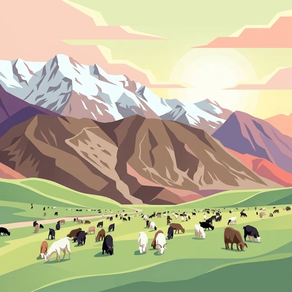
Stylized illustration of a mountainous landscape with green hills, snow-capped peaks, and cattle grazing under a pastel sky

Chitral National Park

National park

Park overview

Structured park overview, official facts, and landscape profile for Chitral Gol National Park

Chitral Gol National Park park facts, protected area profile, and essential visitor context

Review the core facts for Chitral Gol National Park, including designation, size, terrain, visitor scale, habitats, and operating context in one park-focused overview.

About Chitral Gol National Park

Chitral Gol National Park represents one of Pakistan's premier mountain protected areas, located in the far north of Khyber-Pakhtunkhwa province near the border with Afghanistan. The park occupies a strategic position in the Hindu Kush range, a mountain system that forms part of the greater Himalayan ecological region. The protected area encompasses three principal valleys, each offering distinct ecological characteristics and scenic beauty. Glaciers within the park feed numerous springs that converge into streams, ultimately flowing eastward into the Chitral River system. The landscape transitions from forested lower slopes dominated by cedar trees through alpine meadows to permanent snow and rock at higher elevations. The park's biodiversity is remarkable for a relatively compact area, supporting both endangered large mammals and a diversity of smaller species. The governance structure involves the Wildlife and Parks Department of Pakistan, though the park's legal status has experienced complications stemming from its history as private Mehtar property. Access requires traveling the narrow and sometimes dangerous mountain road from Chitral town, with the route becoming particularly risky during the rainy season.

Quick facts and research context for Chitral Gol National Park

Chitral Gol National Park lies in Lower Chitral District, approximately two hours drive from Chitral town, along the Chitral River in Khyber-Pakhtunkhwa province. The park covers 7,750 hectares and was established in 1984 under the governance of the Wildlife and Parks Department of Pakistan. The elevation range from 1,450 to 5,000 meters creates diverse habitats from river valleys to alpine zones. The park is known for protecting the endangered markhor goat, snow leopard, Siberian ibex, and Himalayan black bear. The area was historically the private hunting grounds of the Mehtar of Chitral until 1983. Average annual rainfall reaches 462mm, with winter snow persisting on high peaks until June.

Protection and recognition

Verifying documented terrestrial management scope and official regional protection framework details

Chitral National Park Protection Status and Terrestrial Conservation Designation

Explores the official terrestrial protection status and documented geographic management scope of Chitral National Park. Documented classification data and established conservation boundaries provide essential geographic context for analyzing regional habitat preservation efforts.

Protection details

Protection scope
Terrestrial
Transboundary protection
No
Park context

Deeper park guide and search-rich context for Chitral Gol National Park

Chitral Gol National Park history, landscape, wildlife, and travel context

Explore Chitral Gol National Park through its history, landscape character, ecosystems, wildlife, conservation priorities, cultural context, and seasonal travel timing in a structured park guide built for atlas discovery and search intent.

Why Chitral Gol National Park stands out

Chitral Gol National Park is best known for its population of the endangered markhor, a large wild goat with distinctive spiraling horns that is a flagship species for conservation in the western Himalayas. The park is also notable for providing habitat to snow leopards, making it one of the important protected areas for this elusive apex predator. The combination of alpine meadows, glacial valleys, and cedar forests creates a visually striking mountain landscape. The historic Birmoghlasht Summer Fort, perched at over 2,800 meters elevation, adds cultural significance to the natural setting, representing the former princely state of Chitral's heritage.
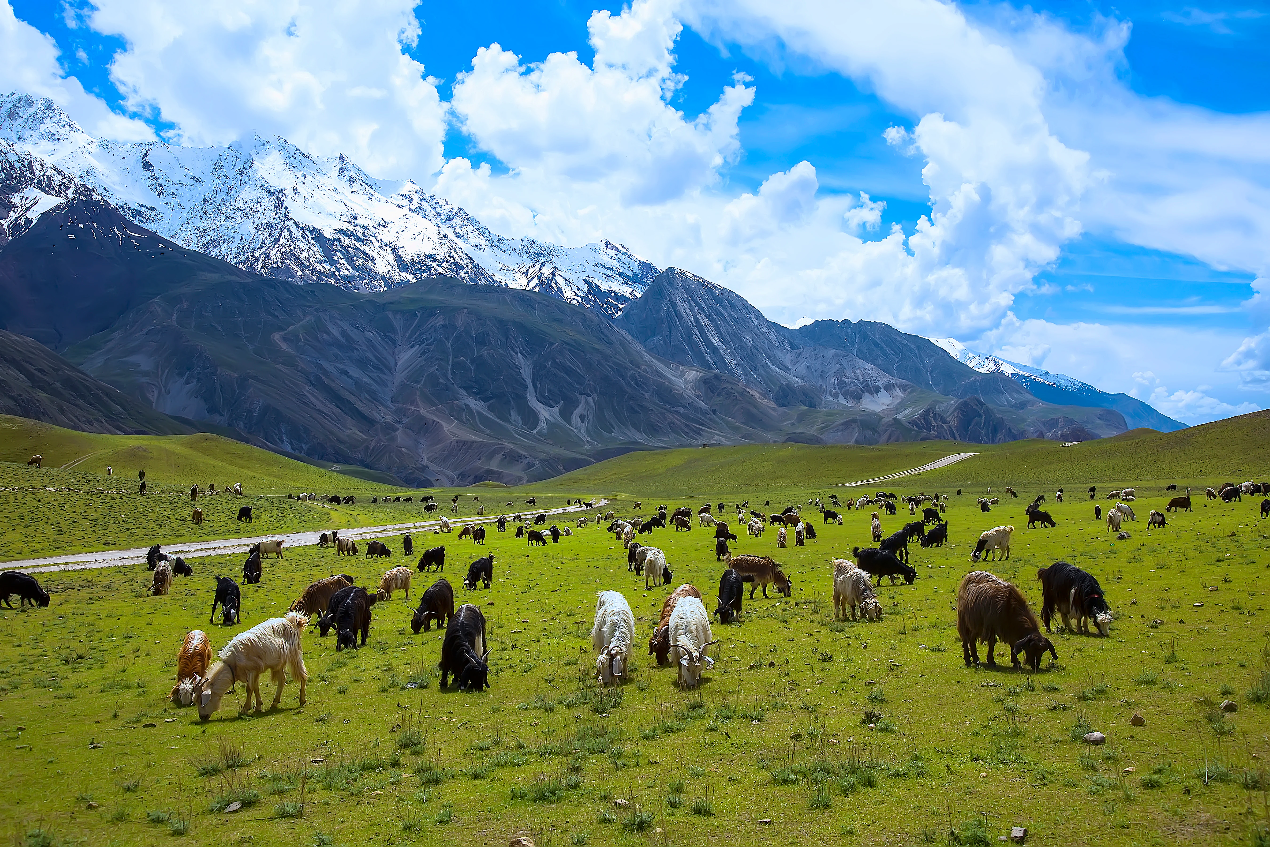
Grassland meadow with numerous domestic goats grazing, surrounded by rugged snow-capped mountains under a partly cloudy sky.
Vast green meadows with grazing domestic goats under snow-capped mountains in Chitral National Park.

Chitral Gol National Park history and protected-area timeline

The history of Chitral Gol National Park is deeply intertwined with the political history of the Chitral region. Until 1983, the area comprising what is now the park functioned as the private property of the former Mehtar, the ruler of the princely state of Chitral. The Mehtar dynasty, known historically as the Katoor dynasty, maintained control over this mountain valley as their personal hunting grounds and summer retreat. In 1984, the Government of Pakistan established the area as a national park, transitioning from private princely ownership to public protected status. However, this transition has not been without complication. The legal status of the park has remained in dispute since the establishment, with ongoing litigation between heirs of the former Mehtar and the Government of Pakistan regarding ownership and property rights. This legal dispute represents a common challenge in converting historical princely hunting preserves into modern protected areas. The Birmoghlasht section of the park preserves the physical remains of this royal heritage, including the summer fort where the Mehtar and family would relocate during warmer months to hold court and escape the lower valley heat.

Chitral Gol National Park landscape and geographic character

The physical landscape of Chitral Gol National Park exemplifies the dramatic topography of the western Hindu Kush. The terrain is characterized by steep, V-shaped valleys carved by glacial and fluvial processes, with the park spanning an extraordinary elevation gradient of over 3,500 meters. The lower elevations around 1,450 meters feature relatively gentler terrain along the river corridors, transitioning into increasingly rugged and steep slopes as elevation increases. Multiple glaciers persist in the higher zones, serving as critical water sources for the spring systems that emerge throughout the park. These springs combine to form streams that flow for approximately 18 kilometers before joining the Chitral River. The park contains several alpine meadows that provide seasonal grazing grounds and stunning floral displays during the summer months. Cedar trees form prominent forest cover in the middle elevations, while the highest zones support only sparse vegetation adapted to harsh alpine conditions. The surrounding peaks remain snow-covered well into June, creating a dramatic backdrop of white-capped mountains that define the park's visual identity.

Chitral Gol National Park ecosystems, habitats, and plant life

The ecological character of Chitral Gol National Park reflects its position at the intersection of several distinct habitat zones within the Himalayan region. The park's elevation gradient supports a progression from riverine forest communities through mixed coniferous forests dominated by cedar to alpine meadows and ultimately to nival zones above the snow line. This vertical zonation creates remarkable biodiversity within a relatively compact area. The cedar forests represent particularly significant habitat, providing cover and foraging grounds for numerous species. The streams and watercourses supported by glacial melt and spring systems create riparian corridors that contrast with the surrounding干燥 landscape. The meadow areas become particularly important during the summer months when they provide lush vegetation for grazing wildlife. The overall ecosystem remains relatively intact due to the protected status, though the ongoing legal disputes have complicated management efforts.

Chitral Gol National Park wildlife and species highlights

The wildlife community of Chitral Gol National Park includes several species of significant conservation concern. The park serves as primary habitat for the markhor, an endangered wild goat species characterized by its impressive spiraling horns, which represents one of the park's most notable conservation values. The snow leopard, a rare and elusive apex predator of the high mountains, also inhabits the park, preying upon the various ungulate species present. Other large mammals include the Siberian ibex, a mountain goat well adapted to steep terrain, and the Ladakh urial, a wild sheep species of the region. The Himalayan black bear occupies forested areas, while the Himalayan wolf ranges throughout the terrain. Smaller mammals present include the red fox, Eurasian otter, and yellow-throated marten. This assemblage of species represents a complete predator-prey community characteristic of healthy Himalayan mountain ecosystems.

Chitral Gol National Park conservation status and protection priorities

Chitral Gol National Park holds significant conservation value as a protected area within Pakistan's national park system, designated under IUCN Category II. The park's primary conservation significance derives from its role as habitat for the endangered markhor, a species whose population has declined throughout its range due to hunting pressure and habitat loss. Protecting viable populations of this flagship species requires maintaining the diverse habitats and prey bases that support the broader ecological community. The presence of snow leopard populations further elevates the park's conservation importance, as this species faces mounting threats across its range. The park's inclusion within Pakistan's protected area network provides formal recognition of its ecological values, though effective conservation faces challenges from the ongoing legal disputes regarding land status and the difficulties of managing remote mountain terrain. The protection of watersheds feeding the Chitral River adds a downstream dimension of conservation value for communities beyond the park boundaries.

Chitral Gol National Park cultural meaning and human context

The cultural context of Chitral Gol National Park is inseparable from the history of the Chitral region as a princely state. The park contains the Birmoghlasht area, which preserves the summer fort constructed by the former Mehtar of Chitral. This structure, standing at an elevation exceeding 2,800 meters, served as the summer seat of the royal family during the era of the Chitral princely state. The Mehtar and his household would relocate to Birmoghlasht during summer months to escape the heat of the lower valley and conduct official business in the cool mountain setting. The fort was positioned to overlook the entire Chitral valley below, reflecting both the practical surveillance needs and the symbolic authority of the ruling family. Beyond this royal heritage, the broader Chitral region is home to distinct cultural communities with traditions shaped by the mountain environment. The park's landscape has been shaped by centuries of human presence and use, though the protected status now limits extractive activities within its boundaries.

Top sights and standout views in Chitral Gol National Park

The markhor populations of Chitral Gol represent one of the park's most significant attractions for wildlife enthusiasts and conservationists, offering opportunities to observe this endangered species in its natural mountain habitat. The snow leopard, though difficult to spot, draws dedicated wildlife photographers and researchers to the park. The Birmoghlasht Summer Fort provides a unique cultural heritage element, standing as a tangible link to Chitral's princely past while offering panoramic views over the surrounding landscape. The alpine meadows during summer months display remarkable floral diversity and provide excellent trekking opportunities. The dramatic mountain scenery, with snow-covered peaks visible from the valley floors, creates a visually spectacular environment that distinguishes this park from lower-elevation protected areas. The glacial streams and waterfalls add dynamic natural elements to the landscape.

Best time to visit Chitral Gol National Park

The optimal visiting period for Chitral Gol National Park extends from late spring through early autumn, roughly May through September, when weather conditions are most favorable for mountain travel. Summer months bring relatively warm temperatures in the valleys and comfortable conditions for trekking and wildlife viewing. The alpine meadows reach their peak flowering during July and August, creating particularly attractive conditions for nature enthusiasts. However, the monsoon season brings increased rainfall, particularly in September when precipitation concentrates on the higher peaks, and in November when valley rainfall becomes more common. Winter conditions are harsh, with temperatures dropping well below freezing and heavy snowfall closing access to higher elevations. The snow-covered peaks remain visually striking until June, so early summer visits offer the advantage of seeing both snow and summer greenery. The road to the park becomes dangerous during rainy periods, requiring careful timing of visits to avoid difficult travel conditions.

Monthly climate preview

Long-term representative monthly averages and temperature ranges for Chitral National Park

Chitral National Park Climate Normals: Annual Temperature and Precipitation Rhythm

Chitral National Park exhibits measured long-term temperature swings alongside recorded monthly precipitation patterns from a representative high-elevation coordinate. Reviewing the complete twelve-month profile provides deeper analytical context for understanding local climate variations.
Annual mean-1 °C
-13 °C11 °C
Jan-13°
Feb-12°
Mar-7°
Apr-1°
May
Jun
Jul11°
Aug11°
Sep
Oct
Nov-5°
Dec-10°
Warmest month
July

11.2 °C

Coolest month
January

-13.3 °C

Wettest month
April

1.7 mm/day

Driest month
June

0.4 mm/day

Park location guide

Geography guide, regional context, and park location map for Chitral Gol National Park

Chitral Gol National Park park geography, regions, and map view in Pakistan

Understand where Chitral Gol National Park sits in Pakistan through a broader geographic reading of the surrounding landscape, nearby location context, and its mapped position within the national park landscape.

How Chitral Gol National Park fits into Pakistan

Pakistan, officially the Islamic Republic of Pakistan, is a federal parliamentary Islamic republic in South Asia. It is the fifth-most populous country and the 33rd-largest by area. The country gained independence from British India in 1947 and has a diverse history spanning ancient civilizations including Mehrgarh and the Indus Valley Civilisation. Pakistan shares maritime borders with Oman and is bounded by the Arabian Sea, Gulf of Oman, and several neighboring countries.

Wider geography shaping Chitral Gol National Park in Pakistan

Pakistan is located in South Asia, bordered by the Arabian Sea to the south, the Gulf of Oman to the southwest, and shares land borders with India to the east, Afghanistan to the west, Iran to the southwest, and China to the northeast. The country also shares a maritime border with Oman in the Gulf of Oman. The Wakhan Corridor in Afghanistan separates Pakistan from Tajikistan in the northwest.

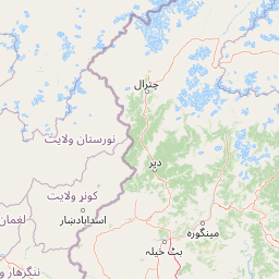
Map view of Chitral Gol National Park

Use this park location map to pinpoint Chitral Gol National Park in Pakistan, understand its exact geographic position, and read its mapped placement within the surrounding landscape more clearly.

Pigeon | © OpenStreetMap contributors

Location context for Chitral Gol National Park

Khyber Pakhtunkhwa

Trace the visual identity of this Pakistani national park, showcasing its rugged mountain terrain and unique alpine ecosystems.

Chitral National Park Photos: Explore Majestic Mountain Landscapes and Protected Area Scenery

Browse comprehensive images that visually capture Chitral National Park's dramatic Hindu Kush landscapes, from snow-capped peaks to dense cedar forests and alpine meadows. Explore key protected area features like glacial valleys, river corridors, and the crucial habitats for markhor and snow leopards to gain a deeper geographic understanding.

Grassland meadow with numerous domestic goats grazing, surrounded by rugged snow-capped mountains under a partly cloudy sky.

Snow-covered mountain peaks, green valley, dirt road, and grazing animals

Park atlas

Compare mountain parks and protected landscapes across Pakistan's Hindu Kush, tracing alpine terrain and wildlife conservation zones.

Explore National Parks and Protected Areas Near Chitral National Park in the Hindu Kush

After exploring Chitral National Park, browse other national parks and protected areas within Pakistan's rugged Hindu Kush, revealing diverse alpine ecosystems and high-altitude wildlife habitats. Compare these conservation landscapes to deepen your geographic understanding of the Western Himalayas, tracing interconnected mountain ranges and vital wildlife corridors for species like markhor.
National parkPakistan
About 82 km away#1 closest

East

Hundrap-Shandur National Park: Pakistan National Park Atlas and Protected Landscape

Discover mapped boundaries and regional geography for this park.

Hundrap-Shandur National Park is a protected area in Pakistan, designated as a national park. Its geographic identity and mapped landscape context are crucial for understanding the country's conservation network. This MoriAtlas entry provides detailed information about the park's spatial representation, regional setting, and its significance as a mapped natural landscape within Pakistan's atlas.

IUCN
II
National parkAfghanistan
About 112 km away#2 closest

Northeast

Wakhan National Park: Afghanistan's Protected Landscape for Geographic Atlas Exploration

Mapped boundaries and regional terrain context.

Wakhan National Park is a designated national park in Afghanistan, offering critical insights into the country's rugged, mountainous geography. This page provides an atlas-level view of its protected landscape, detailing its geographic scope and mapped boundaries. Explore Wakhan National Park to understand its role within the broader regional context of Central and South Asia's natural terrain.

Area
10,910.1 km²
Established
2014
IUCN
II
Relief
Mountain
National parkAfghanistan
About 120 km away#3 closest

Southwest

Nuristan National Park: Afghanistan National Park Protected Landscape

Mapped geography and regional terrain context

Explore Nuristan National Park, an important national park within Afghanistan. This protected area offers insights into the country's mountainous geography and its conservation landscape. Understand its mapped boundaries and its role within the broader regional context for atlas-driven discovery.

Area
5,733.07 km²
Established
2020
IUCN
II
Relief
Mountain
National parkKhyber Pakhtunkhwa
About 157 km away#4 closest

East

Manglot National Park: Protected Landscape Identity and Mapped Geography in Khyber Pakhtunkhwa

Explore its natural terrain and protected boundaries.

Manglot National Park is a designated national park offering a distinct protected landscape within the Khyber Pakhtunkhwa region. This entry focuses on its geographic setting, providing an atlas-style perspective of its mapped boundaries and the surrounding natural terrain. Understand its role as a protected area and its contribution to the regional geography, supporting detailed landscape exploration.

Area
7.11 km²
Established
1990
IUCN
II
Relief
Mixed relief
National parkKhyber Pakhtunkhwa
About 188 km away#5 closest

Northeast

Broghil Valley National Park: High-Altitude Protected Landscape and Alpine Wilderness in Pakistan

Explore mapped terrain with glacial lakes and diverse mountain ecosystems.

Broghil Valley National Park, a national park in Pakistan's Khyber Pakhtunkhwa province, is a vast high-altitude wilderness defined by its dramatic glacial topography, numerous freshwater lakes, and vital peatland ecosystems. Situated near the Afghanistan border, this protected area offers an exceptional landscape for exploring remote mountain biodiversity and understanding the geography of Pakistan's northern frontier. Its unique terrain provides critical habitat within the Central Asian mountain range.

Area
1,348 km²
Established
2010
IUCN
II
Relief
Mountain
National parkKhyber Pakhtunkhwa
About 213 km away#6 closest

Southeast

Saiful Muluk National Park: Mapped Protected Landscape and Alpine Terrain in Pakistan

Discover the geography and protected boundaries of this Himalayan national park.

Saiful Muluk National Park in Khyber Pakhtunkhwa, Pakistan, is a key protected area characterized by its stunning alpine lake and dramatic Himalayan topography. This entry details the park's geographic scope, mapped landscape features, and its role as a critical national park. Understand the unique subalpine forests and meadow habitats that define this mountainous region and its protected status.

Area
880 km²
Established
2003
IUCN
II
Relief
Mountain
National parkAzad Jammu and Kashmir
About 237 km away#7 closest

Southeast

Machiara National Park: A Protected National Park in Pakistan's Himalayas

Explore mapped terrain and mountain biodiversity.

Machiara National Park, located in Azad Jammu and Kashmir, Pakistan, is a designated national park preserving unique Himalayan ecosystems. This atlas-focused exploration details the park's protected landscape, encompassing steep slopes, forested ridges, and varied terrain. Discover its significance for wildlife conservation and its position within the broader regional geography, offering a clear view of its mapped natural features.

Area
135.33 km²
Established
1996
IUCN
II
Relief
Mountain
National parkPakistan
About 242 km away#8 closest

Southeast

Lulusar-Dudipatsar National Park: Pakistan's Dramatic Western Himalayan Protected Area

Explore alpine lakes, mountain scenery, and protected landscape geography.

Lulusar-Dudipatsar National Park stands as a remarkable protected landscape within Pakistan's Western Himalayas. The park's geography is defined by towering peaks and a series of pristine glacial lakes, including the iconic Dudipatsar and Lulusar lakes. Users can explore its mapped terrain and understand its significance as a high-altitude ecosystem and a key component of Pakistan's protected areas network.

Established
2003
IUCN
II
Relief
Mountain
Climate
Alpine

Common questions about visiting, size, designation, and location context for Chitral Gol National Park

Chitral Gol National Park FAQs for park facts, access, geography, and protected area context

Find quick answers about Chitral Gol National Park, including protected-area facts, park geography, trail and visitor context, and how the park fits into its surrounding country and regional landscape.
MoriAtlas Explorer

Continue Your Protected Areas Search Across the Global Atlas

Deepen your exploration by continuing the structured search for national parks and protected areas worldwide. Utilize the comprehensive filtering capabilities to compare different conservation landscapes and refine your understanding of global park geography. Discover more about the distribution and characteristics of protected natural areas.

Global natural geography