Mori Atlas logo
Countries

Discover mapped protected landscapes and regional natural terrain across Kazakhstan.

Kazakhstan National Parks and Protected Areas: A Geographic Atlas for Exploration

Kazakhstan, a vast Central Asian country, hosts a diverse array of national parks and protected areas, each contributing to its unique geographic tapestry. This atlas-entry point allows for structured exploration of Kazakhstan's protected lands, showcasing their mapped boundaries and regional distribution. Navigate through the diverse natural terrain, from expansive steppes to mountainous regions, to understand the country's conservation landscapes and their place within the broader geography.

Related tags

Central Asian countrylandlocked countryformer Soviet republicpresidential republictranscontinental country
About

Explore the extensive network of protected landscapes and conservation zones mapped across Central Asia's largest nation.

Discover National Parks and Protected Areas Across Kazakhstan's Vast Geography
MoriAtlas offers a structured geographic overview of Kazakhstan's national parks and diverse protected areas. Explore the mapped distribution of these significant conservation landscapes, spanning vast steppes and mountain ranges, to understand their regional context and natural heritage within Central Asia.

Kazakhstan is a Central Asian country spanning vast steppes and plains, bordered by Russia, China, Kyrgyzstan, Uzbekistan, and Turkmenistan, with a coastline along the Caspian Sea. It gained independence from the Soviet Union in 1991 and has a population of approximately 20.5 million people. The country is officially secular but predominantly Muslim, with Kazakh and Russian as official languages.

Largest city:Almaty
Currency code:KZT
ISO code:KZ
Parks count
15
Capital
Astana
Area
2,724,900 km²
Population
20,495,975 (2,026)

Coastal
Island
Mountainous
Landlocked
Park atlas15 parks

Discover Kazakhstan's diverse protected areas, from vast steppes to mountain ranges, through detailed geographic mapping and park lists.

Explore National Parks and Protected Areas in Kazakhstan: Your Atlas for Central Asian Protected Landscapes
Explore Kazakhstan's national parks and diverse protected areas across its vast Central Asian geography, from the Caspian Sea to its eastern mountain ranges. This structured atlas view provides comprehensive details for each conservation landscape, allowing for in-depth discovery of unique terrain, ecological features, and regional context within the country's protected land.
National park

Peneda-Gerês National Park: A Distinct Protected Landscape in Northern Portugal

Granite peaks, glacial valleys, and cultural heritage mapped.

Peneda-Gerês National Park represents a cornerstone of protected landscapes in Portugal, celebrated for its rugged granite mountains and deep glacial valleys sculpted over millennia. This national park showcases a rare ecological transition zone with unique endemic species and features dramatic waterfalls and pristine river systems. The park's rich cultural tapestry, interwoven with its natural environment, offers a compelling subject for atlas-based geographic discovery and landscape exploration.

Area
695.93 km²
Established
1971
IUCN
II
Visitors
92.8K annual
Watercolor illustration showing rolling hills, distant mountains, and sparse vegetation
National parkAlmaty Region

Altyn-Emel National Park: A Protected Landscape of Singing Dunes and Lunar Mountains

Explore unique geological wonders and ancient Saka history.

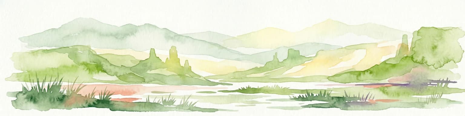
Discover Altyn-Emel National Park, a prominent national park located in Kazakhstan's Almaty Region. This protected area showcases an extraordinary diversity of landscapes, from the echoing Singing Dunes to the otherworldly Aktau mountains, often referred to as the 'lunar mountains' due to their vivid mineral hues. As a vital conservation zone, it safeguards Central Asian steppe ecosystems and significant Iron Age archaeological sites, offering a rich tapestry of natural beauty and historical depth for atlas exploration.

Area
4,600 km²
Established
1996
IUCN
II
Relief
Mixed relief
Watercolor painting of a river landscape with green mountains, grasses, and a stream
National parkAlmaty Region

Charyn National Park: Protected Landscape Atlas and Mapped Terrain in Almaty Region

Explore its dramatic canyons and ancient Sogdian ash groves.

Charyn National Park offers a compelling exploration of Central Asia's dramatic natural heritage, centered around its spectacular canyon system. This protected area, situated in Kazakhstan's Almaty Region, features towering red rock walls and unique geological formations carved by the Charyn River. The park is also notable for preserving one of the world's northernmost stands of ancient Sogdian ash trees, a vital link to prehistoric ecosystems. Users can discover the park's mapped boundaries, diverse terrain, and distinct landscape features, making it a key destination for geographic and atlas-based discovery.

Area
1,250 km²
Established
2004
Relief
Mountain
Climate
Arid
Watercolor painting of a river, hills, and trees with pink and yellow sky tones
National parkAlmaty Region

Ile-Alatau National Park: Protected Landscape Atlas and Almaty Region Geography

Mapped boundaries, diverse ecosystems, and mountain wilderness.

Ile-Alatau National Park is a key protected area in the Almaty Region of Kazakhstan, preserving a vast expanse of the Tian Shan mountain system. This national park showcases a dramatic vertical landscape, encompassing everything from lowland woodlands and relict spruce forests to expansive alpine meadows and glacial terrains. Its mapped boundaries define critical habitat for diverse wildlife and offer a profound insight into the complex ecological dynamics of high-altitude environments, making it an essential destination for atlas-based geographic discovery.

Area
2,000 km²
Established
1996
Relief
Mixed relief
Climate
Alpine
Watercolor painting of a landscape with green forests, hills, and a body of water
National parkAqmola Region

Burabay State National Nature Park: Mapped Granite Hills and Forested Terrain Atlas

Explore protected landscapes in Kazakhstan's Aqmola Region.

Burabay State National Nature Park presents a unique protected landscape within the Kokshetau Massif of Kazakhstan's Aqmola Region. This atlas-focused entry details the park's distinctive terrain, featuring ancient granite outcrops and rolling hills draped in pine and birch forests. Understand the mapped boundaries and geographic setting of this national park, renowned for its scenic lakes and significant geological formations, offering rich context for protected-area discovery.

Area
1,299.35 km²
Established
2000
IUCN
II
Relief
Mixed relief
National parkEast Kazakhstan Region

Katon-Karagay National Park: Discover Kazakhstan's Largest Protected Mountain Landscape

Explore the geography and park boundaries of East Kazakhstan's premier national park.

Katon-Karagay National Park, the largest national park in Kazakhstan, offers a deep dive into the protected landscapes of the Southern Altai Mountains. This page provides essential geographic context, detailing the park's terrain, its significance as a protected area within East Kazakhstan Region, and its role in mapping the natural contours of this ecologically diverse mountain system. Understand the park's boundaries and its contribution to regional conservation.

Area
6,435 km²
Established
2001
IUCN
II
Relief
Mountain
Watercolor illustration of a mountain lake with forests, distant mountains, and calm water reflecting the scenery
National parkAlmaty Region

Kolsay Lakes National Park: Discover Protected Alpine Lakes in Almaty Region

Mapped Tian Shan mountain geography and glacial lake context.

Kolsay Lakes National Park is a significant protected area within the Almaty Region, celebrated for its breathtaking chain of three alpine lakes, often referred to as the 'Pearls of Tien Shan.' This national park showcases the rugged beauty of the Tian Shan mountains, with dramatic valleys, dense spruce forests, and pristine glacial waters. Understanding its geographic setting and mapped boundaries reveals the unique ecological and landscape value of this protected natural area.

Area
1,619 km²
Established
2007
IUCN
II
Relief
Mountain
National parkKazakhstan

Bayanaul National Park: Kazakhstan's First National Park Mapped Landscape

Explore granite mountains, unique lakes, and striking rock formations.

Bayanaul National Park, situated in Kazakhstan's Pavlodar Province, represents a significant protected area renowned for its extraordinary granite mountain landscape. Established as the country's first national park, it showcases unique erosion-shaped rock formations, diverse vegetation including rare pines, and four significant freshwater lakes. This park offers a distinct visual tapestry of mountainous terrain and geological wonders within the broader Central Asian geography, making it a key destination for atlas-based discovery.

Area
684.53 km²
Established
1985
IUCN
II
Watercolor painting depicting a mountain range, lake, and grassy foreground under a pale sky
National parkAlmaty Region

Zhongar-Alatau National Park: Protected Mountain Landscape and Genetic Heritage Atlas

Almaty Region's critical wild apple forest and glaciated terrain.

Zhongar-Alatau National Park in Kazakhstan's Almaty Region is a significant protected landscape renowned for its role in conserving the genetic origins of cultivated apples. The park encompasses dramatic glaciated mountain ranges, deep canyons, and diverse ecosystems within the Dzungarian Alatau. Its mapped boundaries define an area vital for protecting unique wild fruit tree species, including the Sievers apple, and preserving the distinctive alpine terrain of southeastern Kazakhstan, offering rich context for geographic exploration.

Area
36 km²
Established
2010
IUCN
II
Relief
Mountain
Watercolor illustration of a mountainous landscape with green hills, trees, and a river in the foreground
National parkKazakhstan

Karkaraly State National Nature Park: Kazakhstan's Mountain-Forest Protected Area

Discover unique geology, archaeology, and regional landscape context.

Delve into the distinctive protected landscape of Karkaraly State National Nature Park, situated in Kazakhstan's Karaganda Region. This park preserves a rare mountain-forest ecosystem with dramatic granite formations, ancient archaeological sites, and lakes, presenting a rich geographic contrast to the surrounding Kazakh Steppe. MoriAtlas provides structured insights into Karkaraly State National Nature Park's unique terrain, its conservation value, and its position within the broader regional geography of Central Asia.

Area
1,121.2 km²
Established
1998
IUCN
II
Relief
Mountain
Watercolor painting of a landscape featuring green hills, grassy foreground, and distant mountains under a soft sky
National parkSouth Kazakhstan Region

Sayram-Ugam National Park: Protected Landscape and Geographic Context in South Kazakhstan

Explore dramatic alpine terrain and ancient juniper forests.

Delve into Sayram-Ugam National Park, a protected national park situated in the South Kazakhstan Region. This expansive area showcases striking mountain topography with seven natural altitude zones, from mountain steppe to permanent snowfields. It is distinguished by its vast juniper forests and serves as a crucial conservation site for wild fruit and nut tree genetic diversity, offering a unique lens for understanding Central Asian mountain ecology and landscape context.

Area
1,490 km²
Established
2007
IUCN
II
Relief
Mountain
Watercolor illustration of a landscape with green hills, a body of water, and grassy foreground under a pink-hued sky
National parkAqmola Region

Kokshetau National Park: A Protected Granite Mountain and Forest-Steppe Landscape in Kazakhstan

Explore Aqmola Region's unique protected geography and mapped terrain.

Kokshetau National Park stands as a remarkable protected landscape within Kazakhstan, defined by its ancient granite mountains and its unique position as a forest-steppe island surrounded by open plains. This national park preserves a rich tapestry of boreal forests, lake-filled depressions, and geological wonders, including some of the planet's most ancient rock formations. MoriAtlas provides a structured view of Kokshetau National Park, detailing its mapped boundaries and geographic context within the Aqmola Region, offering users a deep dive into its protected area identity and ecological significance.

Area
1,821 km²
Established
1996
IUCN
II
Relief
Upland
Landscape and environment

Understand how Kazakhstan is shaped by terrain, ecosystems, and seasonal conditions

Kazakhstan geography, nature, climate, and landscape context for park-focused travel research
Explore the physical geography, natural setting, and climate patterns of Kazakhstan through a location-first overview built for travel research, national park discovery, and broader regional context. This section helps explain how landscapes, habitats, and environmental conditions shape what people search for, where they travel, and how they experience protected areas in Kazakhstan.

Kazakhstan geography and landscape

Kazakhstan occupies a vast territory in Central Asia, extending into Eastern Europe. Its terrain consists largely of hilly plateaus and plains, with lowlands covering about a third of the area. The southern and eastern regions are mountainous. The country borders Russia to the north and west, China to the east, Kyrgyzstan to the southeast, Uzbekistan to the south, and Turkmenistan to the southwest. It has a coastline along the Caspian Sea.

Kazakhstan nature and environment

Kazakhstan features diverse landscapes including vast steppes, plains, and mountainous regions in the south and east. The country has low population density with fewer than 8 people per square kilometer, leaving large areas of natural habitat.

Kazakhstan climate and seasonal conditions

Kazakhstan has a continental climate with significant temperature variations between seasons.

Explore this place

Related topics and popular queries

Ways to explore Kazakhstan
Useful phrases, related topics, and discovery prompts connected to Kazakhstan.
where is Kazakhstanwhat is KazakhstanKazakhstan capital cityKazakhstan geography and climateKazakhstan population and demographicsKazakhstan independence 1991Kazakhstan countryCentral Asialandlocked nationRepublic of KazakhstanKazakh SSRCentral Asian geographyKazakhstan population
Park map

Visualize the geographic distribution of national parks and protected areas throughout Kazakhstan's vast geography.

Kazakhstan National Parks Map: Explore Protected Areas and Mapped Geography
Preview the map of Kazakhstan to understand where its national parks and protected areas are situated, offering a geographic overview of their placement across the country's diverse landscapes. This atlas view is essential for visualizing the spatial context of conservation efforts and planning deeper geographic explorations of Central Asian park terrain.

Explore common questions regarding Kazakhstan's protected landscapes, park geography, and conservation across its diverse Central Asian terrain.

Frequently Asked Questions About National Parks and Protected Areas in Kazakhstan
Discover essential facts about Kazakhstan's national parks and protected areas, detailing their geographic spread across the country's vast Central Asian steppes, mountains, and Caspian Sea regions. These common questions offer vital context for tracing Kazakhstan's diverse conservation landscapes and regional park geography for in-depth atlas exploration.
Other countries

Expand your park discovery by comparing protected landscapes and mapped geographies across countries neighboring Kazakhstan.

Explore Central Asian National Parks and Protected Areas Beyond Kazakhstan
Explore national parks and designated protected areas across countries within Central Asia and adjacent regions, building upon your geographic context from Kazakhstan. This atlas perspective facilitates comprehensive comparisons of conservation landscapes, diverse ecological zones, and protected area distributions beyond individual country boundaries.

Russia: National Parks and Protected Areas Atlas for Geographic Exploration

Investigate Russia's extensive network of national parks and protected areas through a structured geographic lens. This atlas entry point allows for detailed exploration of mapped landscapes and conservation zones, highlighting their regional context and distribution across the vast Russian Federation. Understand the breadth of protected natural territories from a country-wide perspective, facilitating deeper geographic discovery.

64 parks

Ukraine National Parks and Protected Areas: Browse Mapped Landscapes

MoriAtlas facilitates a detailed geographic exploration of Ukraine's national parks and protected areas. This destination provides a structured overview of the country's conservation landscapes, allowing users to visually grasp their distribution and regional context. Understand the breadth of Ukraine's natural heritage through an atlas lens, supporting discovery of its unique geography and protected territories.

49 parks

Explore Protected Landscapes: National Parks and Protected Areas of Turkey

Delve into the geography of Turkey with this atlas-style exploration of its national parks and protected areas. Understand the distribution of these significant natural landscapes, view their mapped boundaries, and appreciate the diverse terrain they encompass. This resource offers a structured way to navigate and discover the breadth of protected lands across Turkey, providing essential context for regional geography and conservation efforts.

42 parks

Azerbaijan's National Parks and Protected Areas: A Mapped Geographic Overview

Navigate the diverse protected areas and national parks within Azerbaijan. This atlas view focuses on the geographic distribution and mapped boundaries of its natural landscapes, offering a structured way to understand the country's conservation areas and their regional context for detailed exploration.

9 parks

Discover National Parks and Protected Areas Across Estonia | Geographic Atlas Overview

Navigate Estonia's protected natural areas, from national parks to conservation zones, with a geography-first approach. MoriAtlas presents a structured atlas view, highlighting the mapped boundaries and regional context of these important landscapes. This resource is ideal for understanding the geographic spread and ecological significance of protected lands within Estonia.

4 parks

Kosovo National Parks and Protected Areas: Geographic Atlas and Landscape Context

Navigate the protected natural areas of Kosovo through an atlas lens. This entry provides a comprehensive geographic overview, highlighting the distribution of national parks and protected lands. Understand the unique landscape features and regional context of conservation efforts within Kosovo, ideal for structured map-based exploration.

2 parks

Belarus National Parks and Protected Landscapes: Geographic Atlas Overview

MoriAtlas offers a detailed atlas view of Belarus, focusing on its national parks and protected areas. Understand the geographic spread and mapped boundaries of conserved regions, providing essential context for exploring the nation's natural landscapes. This resource is designed for users seeking structured information on protected lands and their spatial relationships.

2 parks

Moldova National Parks and Protected Areas: Mapped Geographic Context and Distribution

MoriAtlas provides a comprehensive atlas view of Moldova's protected areas and national parks. Delve into the geographic structure, understand the distribution of natural reserves, and examine the landscape context for each protected region within the country. This resource enables detailed map-based discovery and a structured understanding of Moldova's natural heritage.

1 park
MoriAtlas Explorer

Continue Your Global Geographic Exploration with MoriAtlas Park Discovery

Dive deeper into the world's protected landscapes and national parks through MoriAtlas's structured atlas interface. Discover how continents and countries are organized, and how individual park geography fits into the broader map. Our platform is built for understanding the distribution and context of protected areas worldwide, facilitating your journey through global natural geography.

Global natural geography