Mori Atlas logo
National parkTarbagatai National Park

Discover the mapped boundaries and unique ecosystems of this significant protected area.

Tarbagatai National Park: Protected Wild Fruit Forests & Mountain-Steppe Landscape in East Kazakhstan

Tarbagatai National Park, established in 2018 within East Kazakhstan Region, protects a vital mountain-steppe ecosystem along the Tarbagatai mountain range. This national park spans approximately 136,367 hectares, safeguarding unique, genetically isolated stands of wild fruit trees that represent an ancient natural heritage. Its terrain encompasses the southern slopes of the Tarbagatai ridge, the Karabas and Arkaly Mountains, and the river valleys of Urzhar and Emel, creating a diverse landscape that is crucial for regional biodiversity and geographic context.

Mountain-steppe ecosystemWild fruit tree forestsEastern KazakhstanProtected areaMountain rangesBiodiversity hotspot

Tarbagatai National Park

National park

Park overview

Structured park overview, official facts, and landscape profile for Tarbagatai National Park

Tarbagatai National Park park facts, protected area profile, and essential visitor context
Review the core facts for Tarbagatai National Park, including designation, size, terrain, visitor scale, habitats, and operating context in one park-focused overview.

About Tarbagatai National Park

Tarbagatai National Park occupies a significant ecological position in eastern Kazakhstan, established specifically to preserve a mountainous landscape that combines steppe grasslands with forested slopes and river valley ecosystems. The park's territory follows the Tarbagatai Mountain range along its southern face, extending across approximately 250 kilometers of mountainous terrain with additional coverage of the Karabas and Arkaly ranges. The Urzhar and Emel river valleys cut through the park, providing crucial water sources and riparian habitats that support the broader ecosystem. The establishment of Tarbagatai in 2018 reflected Kazakhstan's growing commitment to biodiversity conservation, creating a protected framework for an area that had previously lacked formal national park status despite its ecological significance. The park's isolation from commercial agriculture has allowed its wild fruit tree populations to evolve without genetic dilution, making these forests particularly valuable for conservation and scientific understanding.

Quick facts and research context for Tarbagatai National Park

Tarbagatai National Park is located in the East Kazakhstan Region, with its headquarters near the town of Urzhar. The park encompasses the Tarbagatai Mountain range, which stretches approximately 250 kilometers west-to-east beginning about 70 kilometers southeast of Ayagoz. Established on June 27, 2018, it operates under the management of the Ministry of Agriculture of the Republic of Kazakhstan and holds IUCN Category II protected area status. The region supports remarkable biodiversity with over 1,600 vascular plant species, 270 bird species, 80 mammal species, 23 reptile species, and 19 fish species documented within the park boundaries.

Park context

Deeper park guide and search-rich context for Tarbagatai National Park

Tarbagatai National Park history, landscape, wildlife, and travel context
Explore Tarbagatai National Park through its history, landscape character, ecosystems, wildlife, conservation priorities, cultural context, and seasonal travel timing in a structured park guide built for atlas discovery and search intent.

Why Tarbagatai National Park stands out

Tarbagatai National Park is distinguished by its protection of wild fruit tree forests that have remained genetically isolated from commercial orchard varieties. These ancient stands represent a living repository of fruit tree genetics that predates modern agricultural cultivation, offering researchers and conservationists valuable insight into the evolutionary history and natural diversity of fruit-bearing species. The park's mountain-steppe character, spanning the Tarbagatai ridge and surrounding mountain systems, creates a unique transitional ecosystem where forest, steppe, and alpine environments meet, supporting the remarkable species diversity that defines this protected landscape.

Tarbagatai National Park history and protected-area timeline

Tarbagatai National Park was officially established on June 27, 2018, representing a relatively recent addition to Kazakhstan's protected area network. The creation of the park was driven by recognition of the ecological significance of the Tarbagatai mountain region, particularly its wild fruit tree forests that had remained genetically isolated from cultivated varieties. Prior to national park status, the area existed within a broader framework of regional environmental protection but lacked the dedicated institutional structure and dedicated conservation mandate that national park designation provides. The park now operates under the administration of the Ministry of Agriculture of the Republic of Kazakhstan, which manages its conservation objectives, research activities, and ongoing protection of the region's biodiversity.

Tarbagatai National Park landscape and geographic character

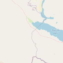
The Tarbagatai landscape is defined by the mountain range after which the park is named, a ridge that runs approximately 250 kilometers in a west-to-east orientation beginning roughly 70 kilometers southeast of the regional center of Ayagoz. The main body of the park occupies the southern slopes of this ridge, where the terrain transitions from steppe grasslands at lower elevations through forested slopes to alpine zones at higher elevations. Beyond the central Tarbagatai range, the park also encompasses portions of the Karabas Mountains and Arkaly Mountains, adding topographic diversity to the protected landscape. The Urzhar and Emel rivers have carved valleys through the mountainous terrain, creating riparian corridors that add ecological variety and serve as important water sources for both wildlife and the surrounding landscape.

Tarbagatai National Park ecosystems, habitats, and plant life

The Tarbagatai region supports an ecosystem of remarkable botanical diversity, with over 1,600 species of vascular plants documented within the park boundaries. The most distinctive ecological feature is the presence of wild fruit tree stands that have evolved in isolation from commercial agricultural varieties, representing genetic lineages that predate modern horticulture. These forests occupy a transitional zone between the steppe environments of the broader region and the higher-elevation forest communities, creating a unique habitat mosaic. The humid continental climate with its warm summer period supports productive vegetation growth, while the seasonal temperature variation creates the conditions for diverse plant communities adapted to these cyclical changes.

Tarbagatai National Park wildlife and species highlights

Tarbagatai National Park supports impressive vertebrate diversity, with documented populations including 270 bird species, 80 mammal species, 23 reptile species, and 19 fish species. This wealth of wildlife reflects the diverse habitats present within the park, from steppe grasslands to forested slopes and riparian corridors. The bird species community includes both resident species and migratory visitors that utilize the park as a seasonal habitat. The mammalian fauna represents the typical Central Asian mountain-steppe assemblage, while the fish populations in the Urzhar and Emel rivers sustain aquatic food webs within the park's boundaries.

Tarbagatai National Park conservation status and protection priorities

The establishment of Tarbagatai National Park addresses significant conservation priorities in eastern Kazakhstan. The protection of genetically isolated wild fruit tree forests represents a conservation objective of particular importance, as these populations contain genetic material that could prove valuable for agricultural research, breeding programs, and understanding of fruit tree evolution. The park's designation as an IUCN Category II protected area places it within the international framework of national parks that emphasize ecosystem protection and biodiversity preservation while allowing for limited human use consistent with conservation objectives. Beyond the wild fruit trees, the broader protection of the Tarbagatai mountain-steppe ecosystem preserves habitats for the hundreds of plant and animal species documented within the park.

Tarbagatai National Park cultural meaning and human context

The park is situated within the East Kazakhstan Region, an area with deep cultural connections to the Kazakh steppe traditions and pastoral heritage. The name Tarbagatai derives from the Kazakh language, reflecting the indigenous identity of the region. The town of Urzhar serves as the nearest population center to the park and represents the local communities whose relationship with this landscape predates its national park designation. The mountain-steppe environment has supported traditional land use patterns including pastoral activities, though the national park status now governs the relationship between human communities and the protected ecosystem.

Top sights and standout views in Tarbagatai National Park

The wild fruit tree forests of Tarbagatai represent the park's most significant conservation feature, offering genetic isolation that distinguishes these populations from commercial orchards across the region. The 250-kilometer Tarbagatai mountain range provides a dramatic backdrop for the protected landscape, while the diversity of habitats from steppe to alpine zones supports the extraordinary species counts that make this park notable within Kazakhstan's protected area network. The park's establishment in 2018 reflects contemporary conservation priorities and positions this mountain-steppe ecosystem as a priorities for ongoing protection.

Best time to visit Tarbagatai National Park

The summer months offer the warmest conditions for visiting Tarbagatai National Park, with the humid continental climate providing pleasant conditions for exploration of the mountain landscapes. The warm summer period, defined by at least four months averaging above 10°C, creates ideal conditions for viewing the park's diverse flora in full growth. The seasonal variation in temperature means that each season offers a distinctly different experience of the landscape, with spring and autumn providing transitional conditions that showcase the changing character of the mountain-steppe environment.

Park location guide

Geography guide, regional context, and park location map for Tarbagatai National Park

Tarbagatai National Park park geography, regions, and map view in Kazakhstan
Understand where Tarbagatai National Park sits in Kazakhstan through a broader geographic reading of the surrounding landscape, nearby location context, and its mapped position within the national park landscape.

How Tarbagatai National Park fits into Kazakhstan

Kazakhstan is a Central Asian country spanning vast steppes and plains, bordered by Russia, China, Kyrgyzstan, Uzbekistan, and Turkmenistan, with a coastline along the Caspian Sea. It gained independence from the Soviet Union in 1991 and has a population of approximately 20.5 million people. The country is officially secular but predominantly Muslim, with Kazakh and Russian as official languages.

Wider geography shaping Tarbagatai National Park in Kazakhstan

Kazakhstan occupies a vast territory in Central Asia, extending into Eastern Europe. Its terrain consists largely of hilly plateaus and plains, with lowlands covering about a third of the area. The southern and eastern regions are mountainous. The country borders Russia to the north and west, China to the east, Kyrgyzstan to the southeast, Uzbekistan to the south, and Turkmenistan to the southwest. It has a coastline along the Caspian Sea.

Map view of Tarbagatai National Park

Use this park location map to pinpoint Tarbagatai National Park in Kazakhstan, understand its exact geographic position, and read its mapped placement within the surrounding landscape more clearly.

Pigeon | © OpenStreetMap contributors

Location context for Tarbagatai National Park

East Kazakhstan Region
Park atlas

Explore the regional spread of protected mountain-steppe landscapes and diverse ecosystems throughout Eastern Kazakhstan, providing further park discovery.

Discover Adjacent National Parks and Protected Areas Near Tarbagatai National Park
Discover other national parks and protected areas in Eastern Kazakhstan, focusing on adjacent mountain-steppe ecosystems and similar landscapes to Tarbagatai National Park. Comparing these conservation landscapes provides rich geographic context, enabling you to trace regional ecological patterns and understand broader protected-area networks.
Watercolor painting depicting a mountain range, lake, and grassy foreground under a pale sky
National parkAlmaty Region

Zhongar-Alatau National Park: Protected Mountain Landscape and Genetic Heritage Atlas

Almaty Region's critical wild apple forest and glaciated terrain.

Zhongar-Alatau National Park in Kazakhstan's Almaty Region is a significant protected landscape renowned for its role in conserving the genetic origins of cultivated apples. The park encompasses dramatic glaciated mountain ranges, deep canyons, and diverse ecosystems within the Dzungarian Alatau. Its mapped boundaries define an area vital for protecting unique wild fruit tree species, including the Sievers apple, and preserving the distinctive alpine terrain of southeastern Kazakhstan, offering rich context for geographic exploration.

Area
36 km²
Established
2010
IUCN
II
Relief
Mountain
National parkEast Kazakhstan Region

Katon-Karagay National Park: Discover Kazakhstan's Largest Protected Mountain Landscape

Explore the geography and park boundaries of East Kazakhstan's premier national park.

Katon-Karagay National Park, the largest national park in Kazakhstan, offers a deep dive into the protected landscapes of the Southern Altai Mountains. This page provides essential geographic context, detailing the park's terrain, its significance as a protected area within East Kazakhstan Region, and its role in mapping the natural contours of this ecologically diverse mountain system. Understand the park's boundaries and its contribution to regional conservation.

Area
6,435 km²
Established
2001
IUCN
II
Relief
Mountain
Watercolor illustration showing rolling hills, distant mountains, and sparse vegetation
National parkAlmaty Region

Altyn-Emel National Park: A Protected Landscape of Singing Dunes and Lunar Mountains

Explore unique geological wonders and ancient Saka history.

Discover Altyn-Emel National Park, a prominent national park located in Kazakhstan's Almaty Region. This protected area showcases an extraordinary diversity of landscapes, from the echoing Singing Dunes to the otherworldly Aktau mountains, often referred to as the 'lunar mountains' due to their vivid mineral hues. As a vital conservation zone, it safeguards Central Asian steppe ecosystems and significant Iron Age archaeological sites, offering a rich tapestry of natural beauty and historical depth for atlas exploration.

Area
4,600 km²
Established
1996
IUCN
II
Relief
Mixed relief
Watercolor painting of a river landscape with green mountains, grasses, and a stream
National parkAlmaty Region

Charyn National Park: Protected Landscape Atlas and Mapped Terrain in Almaty Region

Explore its dramatic canyons and ancient Sogdian ash groves.

Charyn National Park offers a compelling exploration of Central Asia's dramatic natural heritage, centered around its spectacular canyon system. This protected area, situated in Kazakhstan's Almaty Region, features towering red rock walls and unique geological formations carved by the Charyn River. The park is also notable for preserving one of the world's northernmost stands of ancient Sogdian ash trees, a vital link to prehistoric ecosystems. Users can discover the park's mapped boundaries, diverse terrain, and distinct landscape features, making it a key destination for geographic and atlas-based discovery.

Area
1,250 km²
Established
2004
Relief
Mountain
Climate
Arid
Watercolor illustration of a mountainous landscape with green hills, trees, and a river in the foreground
National parkKazakhstan

Karkaraly State National Nature Park: Kazakhstan's Mountain-Forest Protected Area

Discover unique geology, archaeology, and regional landscape context.

Delve into the distinctive protected landscape of Karkaraly State National Nature Park, situated in Kazakhstan's Karaganda Region. This park preserves a rare mountain-forest ecosystem with dramatic granite formations, ancient archaeological sites, and lakes, presenting a rich geographic contrast to the surrounding Kazakh Steppe. MoriAtlas provides structured insights into Karkaraly State National Nature Park's unique terrain, its conservation value, and its position within the broader regional geography of Central Asia.

Area
1,121.2 km²
Established
1998
IUCN
II
Relief
Mountain
National parkAltai Republic

Saylyugemsky National Park: Discover its Protected Landscape and Geographic Significance in Altai Republic

Mapped boundaries and regional landscape context within the Altai Republic.

Delve into Saylyugemsky National Park, a designated national park situated within the vast geographic expanse of Russia's Altai Republic. This canonical page provides detailed insights into its protected landscape, meticulously mapped boundaries, and its contribution to the regional geography. MoriAtlas focuses on structured geographic discovery, enabling a deeper understanding of Saylyugemsky National Park's place within the atlas of protected areas and natural landscapes.

Area
1,183.8 km²
Established
2012
IUCN
II
Relief
Mountain
Watercolor illustration of a mountain lake with forests, distant mountains, and calm water reflecting the scenery
National parkAlmaty Region

Kolsay Lakes National Park: Discover Protected Alpine Lakes in Almaty Region

Mapped Tian Shan mountain geography and glacial lake context.

Kolsay Lakes National Park is a significant protected area within the Almaty Region, celebrated for its breathtaking chain of three alpine lakes, often referred to as the 'Pearls of Tien Shan.' This national park showcases the rugged beauty of the Tian Shan mountains, with dramatic valleys, dense spruce forests, and pristine glacial waters. Understanding its geographic setting and mapped boundaries reveals the unique ecological and landscape value of this protected natural area.

Area
1,619 km²
Established
2007
IUCN
II
Relief
Mountain
National parkKazakhstan

Bayanaul National Park: Kazakhstan's First National Park Mapped Landscape

Explore granite mountains, unique lakes, and striking rock formations.

Bayanaul National Park, situated in Kazakhstan's Pavlodar Province, represents a significant protected area renowned for its extraordinary granite mountain landscape. Established as the country's first national park, it showcases unique erosion-shaped rock formations, diverse vegetation including rare pines, and four significant freshwater lakes. This park offers a distinct visual tapestry of mountainous terrain and geological wonders within the broader Central Asian geography, making it a key destination for atlas-based discovery.

Area
684.53 km²
Established
1985
IUCN
II

Common questions about visiting, size, designation, and location context for Tarbagatai National Park

Tarbagatai National Park FAQs for park facts, access, geography, and protected area context
Find quick answers about Tarbagatai National Park, including protected-area facts, park geography, trail and visitor context, and how the park fits into its surrounding country and regional landscape.
MoriAtlas Explorer

Continue Your Protected Areas Search Across the Global Atlas

Deepen your exploration by continuing the structured search for national parks and protected areas worldwide. Utilize the comprehensive filtering capabilities to compare different conservation landscapes and refine your understanding of global park geography. Discover more about the distribution and characteristics of protected natural areas.

Global natural geography