Mori Atlas logo
National parkKaton-Karagay National Park

Mapping the protected boundaries and diverse terrain of the largest national park in East Kazakhstan.

Katon-Karagay National Park: Kazakhstan's Premier Protected Landscape in the Southern Altai Mountains

(Katonqarağai memlekettık ūlttyq tabiği parkı)

Katon-Karagay National Park, situated in the dramatic Southern Altai Mountains of East Kazakhstan, represents a significant protected landscape at the convergence of Central Asian and Siberian geographies. This vast national park, established in 2001, spans over 643,000 hectares, safeguarding glaciated peaks, pristine alpine meadows, and ancient forested valleys. Its geographic position makes it a crucial area for understanding regional biodiversity and the mapped contours of one of Central Asia's most ecologically rich mountain systems.

National ParksKazakhstanAltai MountainsMountain LandscapesGlaciated PeaksAlpine Meadows

Katon-Karagay National Park

National park

Park overview

Structured park overview, official facts, and landscape profile for Katon-Karagay National Park

Katon-Karagay National Park park facts, protected area profile, and essential visitor context
Review the core facts for Katon-Karagay National Park, including designation, size, terrain, visitor scale, habitats, and operating context in one park-focused overview.

About Katon-Karagay National Park

Katon-Karagay National Park represents one of Central Asia's most significant protected landscapes, established to preserve the extraordinary biodiversity and dramatic terrain of Kazakhstan's portion of the Southern Altai Mountains. The park occupies a strategic position at the western edge of the Altai range, where the mountains form a natural boundary between the Siberian taiga to the north and the arid landscapes of Mongolia and Xinjiang to the south. This transitional position has created remarkably diverse ecological conditions within a relatively compact area, with vegetation zones ranging from birch and larch forests at lower elevations through sub-alpine pine and birch woodlands to alpine meadows and nival zones above 2,800 meters. The park's terrain is characterized by steep, glacially sculpted valleys, dramatic cirques, and extensive moraine systems that record the region's paleoglacial history. Several major river systems originate within the park boundaries, fed by glacier melt and snowmelt from the high peaks. The park is administered by the Committee of Forestry and Fauna of the Ministry of Agriculture of Kazakhstan and operates under a zoning system that designates approximately 24% of its territory as a strict nature reserve while allowing controlled recreation and scientific research in the remaining areas.

Quick facts and research context for Katon-Karagay National Park

Katon-Karagay National Park covers 643,477 hectares in the East Kazakhstan Region, making it the largest protected area in Kazakhstan. The park was established on June 1, 2001, and was integrated into the transnational Altai Park with Russia in 2011, subsequently becoming a UNESCO Biosphere Reserve in 2014. Approximately 34% of the park is forested, with the remainder consisting of mountain meadows, rocky slopes, and glaciers. The landscape is characterized by steep glacial terrain including trough-shaped valleys, cirques, and moraines, with Kokkol Falls at 80 meters being the largest waterfall in the Altai Mountains. The park lies at the intersection of the Altai alpine meadow and tundra ecoregions and the Altai steppe and semi-desert ecoregions.

Park context

Deeper park guide and search-rich context for Katon-Karagay National Park

Katon-Karagay National Park history, landscape, wildlife, and travel context
Explore Katon-Karagay National Park through its history, landscape character, ecosystems, wildlife, conservation priorities, cultural context, and seasonal travel timing in a structured park guide built for atlas discovery and search intent.

Why Katon-Karagay National Park stands out

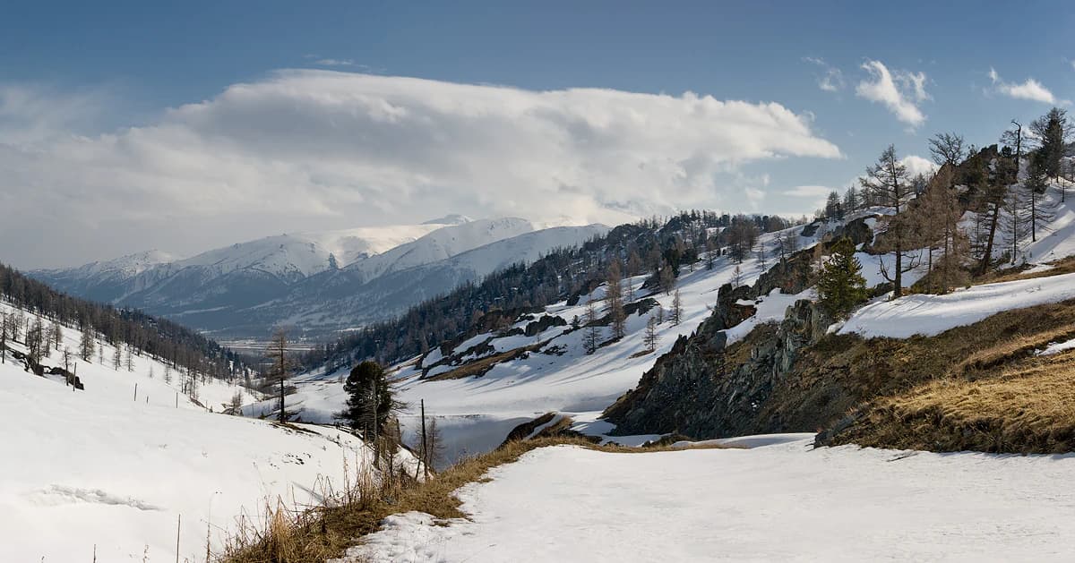
Katon-Karagay is best known for its position as Kazakhstan's largest national park and its location at the convergence of four countries. The park protects the Altai Mountains' most dramatic landscapes, including glaciated peaks exceeding 3,000 meters, pristine alpine meadows, and old-growth Siberian pine and larch forests. It is notable for housing the headwaters of major river systems and for the rare wildlife that inhabits its diverse elevations, including confirmed snow leopard presence. The park also contains Kokkol Falls, the tallest waterfall in the entire Altai Mountains region.

Katon-Karagay National Park history and protected-area timeline

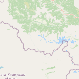
Katon-Karagay National Park was established on June 1, 2001, becoming Kazakhstan's largest national park by area. The creation of this protected area reflected Kazakhstan's commitment to preserving its mountainous heritage and the unique ecosystems of the Altai region. In 2011, the park was integrated into the transnational protected area network known as the Altai Park, which coordinates conservation efforts across the Russian and Kazakh portions of the mountains. This cross-border collaboration recognized that the Altai ecosystem transcends national boundaries and requires coordinated management. A significant milestone came in 2014 when the park was designated as the Katon-Karagay Biosphere Reserve by UNESCO's Man-and-the-Biosphere program, acknowledging its importance as a model of mountain conservation and sustainable development. The park is located in Katonkaragay District of East Kazakhstan Region, approximately 1,000 kilometers southeast of the capital city of Astana.

Katon-Karagay National Park landscape and geographic character

The landscape of Katon-Karagay National Park is defined by its position in the Southern Altai Mountains, a range that forms the northeastern boundary of Central Asia. The park encompasses dramatic mountainous terrain with peaks often exceeding 3,000 meters above sea level, with the highest points reaching into the nival zone where permanent snow and glaciers persist. The terrain exhibits classic glacial geomorphology including U-shaped trough valleys, steep-sided cirques, and extensive glacial moraines that characterize the upper catchments of the major river systems. The park is bordered to the north by the Altai Republic of Russia, to the southeast by China, and includes portions of the Sarymsakty and Tarbagatai ranges along its southern boundary. Approximately one-third of the park area is covered by forest, while the remaining territory consists of alpine meadows, rocky slopes, and glacier-covered terrain. The Kokkol Falls, dropping 80 meters, represents the most spectacular hydrological feature and is recognized as the largest waterfall in the Altai Mountains.

Katon-Karagay National Park ecosystems, habitats, and plant life

The natural environment of Katon-Karagay reflects its position at a critical biogeographic crossroads between the Siberian and Central Asian domains. The park spans two major ecoregions: the Altai alpine meadow and tundra, and the Altai steppe and semi-desert, each contributing distinct ecological character. The vegetation is arranged in four distinct altitudinal zones that together represent a complete gradient from steppe through forest to alpine tundra. The mountain-forest zone below 1,200 meters supports birch and larch-aspen forests with extensive grass and shrub understory. The sub-alpine zone from 1,200 to 2,300 meters features the most common trees as Siberian pine, larch, and birch interspersed with species-rich meadows of grasses, sedges, and blueberries. The tundra-mountain belt from 2,100 to 2,800 meters presents moss and lichen-covered stones with shrubs and grassy tundra vegetation. Above 2,800 meters, the nival zone supports only small communities of lichen and hardy alpine species such as Snow Primrose and Altai Buttercup in the crevices of snowfields and glaciers. This vertical zonation creates extraordinary habitat diversity within the park's boundaries.

Katon-Karagay National Park wildlife and species highlights

The wildlife community of Katon-Karagay National Park includes remarkable diversity given its relatively compact area. Scientists have documented 363 species of vertebrates within the park, including 284 bird species, 65 mammal species, 6 reptile species, 2 amphibian species, and 6 fish species. The mammal community includes characteristic taiga species such as wolves, foxes, roe deer, and brown bears, alongside smaller species including various shrews. The park has gained particular significance for its role in snow leopard conservation, with camera trap footage captured in January 2021 confirming the presence of this elusive apex predator in the Altai mountains. This documented sighting represents one of the northernmost confirmed records of snow leopard in their range and highlights the park's importance for protecting species that straddle the boundary between Siberian and Central Asian ecosystems. The bird fauna includes both Siberian forest species and steppe species adapted to the alpine meadows, with several rare species protected under Kazakhstan's Red Book.

Katon-Karagay National Park conservation status and protection priorities

Katon-Karagay National Park serves as a cornerstone of Kazakhstan's protected area network and represents a critical node in the broader Altai conservation landscape. The park's inclusion in the UNESCO Man-and-the-Biosphere program as the Katon-Karagay Biosphere Reserve in 2014 acknowledges its dual role in biodiversity preservation and sustainable development. The transboundary collaboration formalized through the Altai Park agreement with Russia in 2011 reflects growing recognition that effective conservation of the Altai ecosystem requires coordinated effort across national boundaries. The park's zoning system allocates 24% of its territory as a strict nature reserve where ecosystems can function with minimal human intervention, while the remaining 76% accommodates controlled recreation, scientific research, and restricted economic activity compatible with conservation objectives. The presence of snow leopard and other protected species underscores the park's significance for maintaining viable populations of species that require large, contiguous habitat areas.

Katon-Karagay National Park cultural meaning and human context

The landscape of Katon-Karagay has been shaped by centuries of human presence and traditional land use. The park contains traces of the Great Silk Road's northern branch, which passed through the mountain valleys connecting East and West. The Berel Scythian burial site, located within the park boundaries, represents significant cultural heritage dating to ancient nomadic civilizations. Traditional maral (red deer) husbandry has historically been practiced in the region, with the Kazakh name Katon-Karagay itself reflecting the local toponymy. The park encompasses parts of the Bukhtarma river valley, an area that has supported pastoral communities and seasonal migration routes for generations. These cultural dimensions add depth to the park's identity beyond its purely ecological significance, representing a landscape where human history and natural processes have interacted over millennia.

Top sights and standout views in Katon-Karagay National Park

Katon-Karagay National Park offers visitors access to the most dramatic mountain landscapes in Kazakhstan, with the Altai region's highest peaks, deepest valleys, and most spectacular waterfalls. The park's size and ecological diversity provide exceptional opportunities for exploring multiple habitat types within a single visit, from birch forest的低地 to glacier-scraped alpine zones. The confirmation of snow leopard presence in 2021 has added particular significance for wildlife enthusiasts and conservation-minded visitors. The park's status as Kazakhstan's largest national park, combined with its UNESCO Biosphere Reserve designation and transboundary protection framework, positions it as a model for mountain conservation in Central Asia. The Kokkol Falls at 80 meters remains the standout natural attraction, while the glaciated passes and panoramic mountain vistas define the park's character.

Best time to visit Katon-Karagay National Park

The most favorable time to visit Katon-Karagay National Park is during the summer months from June through August, when temperatures are moderate at mid-elevations and the high mountain trails are accessible. July temperatures average around 9.5°C at typical visitor elevations, with precipitation concentrated in the summer months. Winter visits are challenging due to the harsh continental climate, with January temperatures dropping to -26°C and heavy snow covering the terrain. The shoulder seasons of late spring and early autumn offer different attractions, with spring bringing wildflower displays in the sub-alpine meadows and autumn featuring the golden larch forests that paint the valleys in vivid colors. The park's high elevation means that weather can change rapidly, and visitors should be prepared for conditions ranging from warm valley temperatures to cold, windy conditions above the treeline.

Park location guide

Geography guide, regional context, and park location map for Katon-Karagay National Park

Katon-Karagay National Park park geography, regions, and map view in Kazakhstan
Understand where Katon-Karagay National Park sits in Kazakhstan through a broader geographic reading of the surrounding landscape, nearby location context, and its mapped position within the national park landscape.

How Katon-Karagay National Park fits into Kazakhstan

Kazakhstan is a Central Asian country spanning vast steppes and plains, bordered by Russia, China, Kyrgyzstan, Uzbekistan, and Turkmenistan, with a coastline along the Caspian Sea. It gained independence from the Soviet Union in 1991 and has a population of approximately 20.5 million people. The country is officially secular but predominantly Muslim, with Kazakh and Russian as official languages.

Wider geography shaping Katon-Karagay National Park in Kazakhstan

Kazakhstan occupies a vast territory in Central Asia, extending into Eastern Europe. Its terrain consists largely of hilly plateaus and plains, with lowlands covering about a third of the area. The southern and eastern regions are mountainous. The country borders Russia to the north and west, China to the east, Kyrgyzstan to the southeast, Uzbekistan to the south, and Turkmenistan to the southwest. It has a coastline along the Caspian Sea.

Map view of Katon-Karagay National Park

Use this park location map to pinpoint Katon-Karagay National Park in Kazakhstan, understand its exact geographic position, and read its mapped placement within the surrounding landscape more clearly.

Pigeon | © OpenStreetMap contributors

Location context for Katon-Karagay National Park

East Kazakhstan Region
Park atlas

Explore Protected Landscapes, Mountainous Terrain, and Regional Context Beyond Katon-Karagay National Park

Explore Nearby Protected Areas Around Katon-Karagay National Park and the Altai Mountains
After exploring Katon-Karagay National Park, continue your geographic discovery by browsing other protected areas within Kazakhstan and across the broader Altai Mountain region. This contextual view helps compare diverse mountain landscapes, glaciated peaks, and alpine ecosystems, tracing connected conservation efforts around this Central Asian crossroads.
National parkAltai Republic

Saylyugemsky National Park: Discover its Protected Landscape and Geographic Significance in Altai Republic

Mapped boundaries and regional landscape context within the Altai Republic.

Delve into Saylyugemsky National Park, a designated national park situated within the vast geographic expanse of Russia's Altai Republic. This canonical page provides detailed insights into its protected landscape, meticulously mapped boundaries, and its contribution to the regional geography. MoriAtlas focuses on structured geographic discovery, enabling a deeper understanding of Saylyugemsky National Park's place within the atlas of protected areas and natural landscapes.

Area
1,183.8 km²
Established
2012
IUCN
II
Relief
Mountain
National parkTashtagolsky District

Shorsky National Park: Protected Landscape and National Park Geography

Discover the mapped terrain and regional context of Shorsky National Park.

Shorsky National Park is a key protected area within the Tashtagolsky District, nestled in the mountainous terrain of Southern Siberia. This page serves as an entry point for understanding its role as a national park, focusing on its geographic boundaries and landscape context. MoriAtlas allows for detailed map-based exploration of Shorsky National Park, highlighting its significance within the regional geography and the broader atlas of protected lands in Russia.

Area
4,180 km²
Established
1989
IUCN
II
National parkEast Kazakhstan Region

Tarbagatai National Park: Protected Landscape and Wild Fruit Tree Forests in East Kazakhstan Region

Explore the mapped boundaries and ecosystem of this national park.

Tarbagatai National Park is a protected area in East Kazakhstan recognized for its unique role in conserving wild fruit tree forests that have maintained genetic isolation. This national park provides a detailed view of a mountain-steppe ecosystem across the Tarbagatai mountain range, Karabas Mountains, and Arkaly Mountains, along with the Urzhar and Emel river valleys. Its establishment in 2018 highlights its importance for biodiversity and the study of natural forest genetics, offering significant geographic context for regional protected land exploration.

Area
1,364 km²
Established
2018
IUCN
II
Relief
Mountain
Watercolor painting showing a river flowing through a forested area with distant hills, using soft green, blue, and yellow tones
National parkAltai Krai

Salair National Park: Mapped Protected Landscape and Geographic Features in Altai Krai

Discover the unique dark taiga terrain and relict flora.

Salair National Park is a significant protected area in Altai Krai, Russia, renowned for its exceptionally biodiverse dark taiga forests, often called the "rainforest of Siberia." Established in 2020, the park spans the western slopes of the Salair Ridge, covering about 161,000 hectares of gentle low mountain terrain. Its landscape is characterized by rounded mountains, a network of ravines, and the preservation of pre-glacial relict plant species. This national park offers a vital contrast to the surrounding agricultural areas, highlighting its role in conserving unique Siberian forest ecosystems and their historic flora.

Area
1,612 km²
Established
2020
IUCN
II
Relief
Upland
Watercolor painting of green trees, rolling hills, a pink and yellow sunset sky, and a single tree on the right
National parkKrasnoyarsk Krai

Shushensky Bor National Park: Mapped Geography of a Siberian Protected Forest

Explore the protected landscape and regional context of Krasnoyarsk Krai.

Shushensky Bor National Park serves as a critical protected area within the vast geography of Krasnoyarsk Krai, Russia, offering detailed insights into Siberia's ecological transition zones. This national park meticulously maps the shift from the Minusinsk basin forest-steppe to the dramatic mountain taiga of the Western Sayan range. Users can explore its varied terrain, from gentler northern steppe-influenced lands to the rugged slopes of the Borus Massive, all within a defined protected landscape. The proximity to the Sayano-Shushenskoye Reservoir further defines its unique geographic setting, providing context for its conservation importance and natural beauty.

Area
392 km²
Established
1995
IUCN
II
Relief
Mountain
Watercolor painting depicting a mountain range, lake, and grassy foreground under a pale sky
National parkAlmaty Region

Zhongar-Alatau National Park: Protected Mountain Landscape and Genetic Heritage Atlas

Almaty Region's critical wild apple forest and glaciated terrain.

Zhongar-Alatau National Park in Kazakhstan's Almaty Region is a significant protected landscape renowned for its role in conserving the genetic origins of cultivated apples. The park encompasses dramatic glaciated mountain ranges, deep canyons, and diverse ecosystems within the Dzungarian Alatau. Its mapped boundaries define an area vital for protecting unique wild fruit tree species, including the Sievers apple, and preserving the distinctive alpine terrain of southeastern Kazakhstan, offering rich context for geographic exploration.

Area
36 km²
Established
2010
IUCN
II
Relief
Mountain
National parkKazakhstan

Bayanaul National Park: Kazakhstan's First National Park Mapped Landscape

Explore granite mountains, unique lakes, and striking rock formations.

Bayanaul National Park, situated in Kazakhstan's Pavlodar Province, represents a significant protected area renowned for its extraordinary granite mountain landscape. Established as the country's first national park, it showcases unique erosion-shaped rock formations, diverse vegetation including rare pines, and four significant freshwater lakes. This park offers a distinct visual tapestry of mountainous terrain and geological wonders within the broader Central Asian geography, making it a key destination for atlas-based discovery.

Area
684.53 km²
Established
1985
IUCN
II
National parkKrasnoyarsk Krai

Krasnoyarsk Pillars National Park: Geographic Atlas and Protected Landscape Exploration

Discover mapped terrain and regional park context in Siberia.

This detailed entry for Krasnoyarsk Pillars National Park offers an in-depth look at its identity as a protected landscape within Krasnoyarsk Krai. It provides structured geographic information, focusing on mapped boundaries and the park's position within the vast Siberian terrain. Users can leverage this data for atlas exploration, gaining a clear understanding of the park's physical dimensions and its role in the regional geography of Russia. Explore the unique landscape character and mapped context of this significant national park.

Area
471.54 km²
Established
2019
IUCN
II
Visitors
200K annual

Common questions about visiting, size, designation, and location context for Katon-Karagay National Park

Katon-Karagay National Park FAQs for park facts, access, geography, and protected area context
Find quick answers about Katon-Karagay National Park, including protected-area facts, park geography, trail and visitor context, and how the park fits into its surrounding country and regional landscape.
MoriAtlas Explorer

Continue Your Protected Areas Search Across the Global Atlas

Deepen your exploration by continuing the structured search for national parks and protected areas worldwide. Utilize the comprehensive filtering capabilities to compare different conservation landscapes and refine your understanding of global park geography. Discover more about the distribution and characteristics of protected natural areas.

Global natural geography