Mori Atlas logo
National parkAltai Tavan Bogd National Park

Discover the mapped boundaries and regional geography of this expansive national park.

Altai Tavan Bogd National Park: Protected Landscape in Bayan-Ölgii Province

(Altai five saints nature complex)

Altai Tavan Bogd National Park represents a significant protected area within the mountainous terrain of Mongolia's western Bayan-Ölgii Province. As a designated national park, its boundaries encompass a crucial part of the Altai Mountains, offering a unique geographic context for exploration. This park serves as a vital component of the region's natural landscape, providing structured data for understanding its mapped terrain and protected status.

Alpine mountainsRock art and petroglyphsGlacial lakesSnow leopard habitatWorld Heritage SiteTransboundary protected area

Altai Tavan Bogd National Park

National park

Park overview

Structured park overview, official facts, and landscape profile for Altai Tavan Bogd National Park

Altai Tavan Bogd National Park park facts, protected area profile, and essential visitor context
Review the core facts for Altai Tavan Bogd National Park, including designation, size, terrain, visitor scale, habitats, and operating context in one park-focused overview.

About Altai Tavan Bogd National Park

Altai Tavan Bogd National Park represents one of Mongolia's most geographically isolated and ecologically intact protected areas, situated in the far western corner of the country where the Altai Mountains achieve their greatest vertical relief. The park's core encompasses the slopes and valleys descending south from the Tavan Bogd ridge, a massive glaciated granite wall that marks the continental triple boundary with Russia to the north and China to the west. This positioning at the crossroads of three nations has made the region a meeting ground for diverse ecological communities and human cultures over thousands of years. The park's landscape transitions dramatically from alpine tundra and permanent snowfields above 3,500 meters through krummholz shrubland and subalpine meadows to forest-steppe valleys where birch and larch woodland occurs in limited patches. The three principal lakes, Khoton, Khurgan and Dayan, occupy glacial basins at elevations around 2,000 meters and serve as critical habitat for migratory waterfowl and the park's iconic wildlife. Beyond its natural values, the park contains one of the most significant prehistoric art complexes in Eurasia, with the Tsagaan Salaa rock paintings spanning a period from the Bronze Age through the Turkic era, depicting hunting scenes, celestial symbols, and animal figures that offer rare insight into the spiritual world of ancient nomadic peoples.

Quick facts and research context for Altai Tavan Bogd National Park

Altai Tavan Bogd National Park was established in 1996 and holds IUCN Category II protection as a national park. The park sits at the junction of the Russian, Chinese, and Mongolian borders in the western Altai Mountains, with Tavan Bogd reaching 4,374 meters as Mongolia's highest peak. Three major glacial lakes, Khoton, Khurgan, and Dayan, dot the park's northern sector. The protected area is administered by Mongolia's Ministry of Environment and Green Development.

Park context

Deeper park guide and search-rich context for Altai Tavan Bogd National Park

Altai Tavan Bogd National Park history, landscape, wildlife, and travel context
Explore Altai Tavan Bogd National Park through its history, landscape character, ecosystems, wildlife, conservation priorities, cultural context, and seasonal travel timing in a structured park guide built for atlas discovery and search intent.

Why Altai Tavan Bogd National Park stands out

The park is best known for two exceptional features that distinguish it across all of Central Asia. First, the Tavan Bogd massif itself, a dramatic wall of five granite peaks that form the spiritual and geographic heart of the Altai range, sacred to local Kazakh herders and revered as a place of pilgrimage. Second, the UNESCO World Heritage-listed Petroglyphic Complexes of the Mongolian Altai, which include the Tsagaan Salaa Rock Paintings featuring over 10,000 cave drawings distributed across 15 kilometers of river valley, alongside Turkic standing stones and burial monuments that document millennia of human presence in these highlands.

Altai Tavan Bogd National Park history and protected-area timeline

Altai Tavan Bogd National Park was officially designated in 1996 as part of Mongolia's expanding network of protected areas during the country's post-socialist environmental policy reforms. The creation of the park recognized both the exceptional ecological value of the western Altai frontier and the urgent need to preserve the region's extraordinary archaeological heritage. Prior to formal protection, the Tavan Bogd region had long served as traditional grazing land for Kazakh herders who maintain seasonal camps throughout the park's lower valleys, their presence documented by the very petroglyphs and standing stones that the park now protects. The park's establishment coincided with growing international recognition of the Mongolian Altai's cultural significance, eventually leading to the inscription of the Petroglyphic Complexes as a UNESCO World Heritage Site spanning multiple protected zones within the park's boundaries.

Altai Tavan Bogd National Park landscape and geographic character

The park's landscape is defined by the imposing presence of Tavan Bogd, a five-peaked granite ridge that forms the highest terrain in Mongolia with summits exceeding 4,300 meters. The massif's peaks, named Nairamdal, Malchin, Bürged, Öngö, and Altan, are the remnants of ancient granite domes sculptured by Pleistocene glaciation into the sharp arêtes and deep cirques visible today. Below the permanent snowline, the terrain descends through a series of nested glacial valleys, many still bearing the scalloped walls and terminal moraines of past ice advances. Three large lakes, Khoton, Khurgan and Dayan, occupy basins carved by glacial action and now fed by snowmelt from the surrounding peaks. The lakes are connected by the Khovd River system and are surrounded by marshy meadowland that supports the park's diverse bird populations. The southern portions of the park transition into more open terrain where rolling steppe meets the mountain front, creating a complex mosaic of habitats across a gradient of over 2,500 meters of elevation.

Altai Tavan Bogd National Park ecosystems, habitats, and plant life

The ecological character of Altai Tavan Bogd reflects its position at the juncture of several biogeographic provinces, combining Siberian taiga elements with Central Asian steppe and High Asian alpine fauna. The park spans multiple ecological zones from the cold desert-steppe of the lake basins through subalpine shrubland and forest to true alpine tundra and permanent snowfields. The vegetation communities include alpine meadows dominated by sedge and grass species in moisture-receiving valleys, dwarf birch and Siberian juniper scrub on sheltered slopes, and sparse lichen-covered rock communities at the highest elevations. These diverse habitats support a remarkable concentration of large mammals, with the park serving as one of the last strongholds for snow leopards in Mongolia alongside populations of ibex, argali sheep, red deer, and moose. The lakes and wetlands provide critical breeding habitat for waterfowl including whooper swans and various duck species, while the cliffs and rock faces host breeding populations of golden eagles and the secretive snow cock.

Altai Tavan Bogd National Park wildlife and species highlights

The mammal fauna of Altai Tavan Bogd represents one of the most significant assemblages of large alpine species remaining in Central Asia. Snow leopards persist in the high rocky terrain above the treeline, though they remain elusive and difficult to survey with certainty. Ibex navigate the steep cliff bands with remarkable agility and are the park's most commonly observed mountain ungulate. Argali sheep, the largest wild sheep species in the world, occupy the more open alpine slopes and have been the focus of conservation efforts to maintain viable populations in the face of hunting pressure. Red deer and moose inhabit the forest-steppe transition zone in the park's southern reaches, while the smaller beech marten represents the park's complement of mesocarnivores. The avian community includes the golden eagle, venerated in Kazakh falconry traditions and still trained by local hunters, along with the snow cock which inhabits the alpine rock fields. The three lakes support populations of native fish and serve as staging areas for migratory waterfowl moving between breeding grounds in the Russian Altai and wintering areas further south.

Altai Tavan Bogd National Park conservation status and protection priorities

Altai Tavan Bogd holds IUCN Category II designation as a national park, reflecting its primary mandate to protect natural ecosystems while allowing for sustainable use by local communities. The park's exceptional biodiversity values, particularly the presence of snow leopard and argali populations, have drawn attention from international conservation organizations working to secure viable populations of these threatened species across their Central Asian range. The parallel protection of the Petroglyphic Complexes of the Mongolian Altai as a UNESCO World Heritage Site, with its component zones falling within the park boundaries, creates a unique dual mandate for both natural and cultural heritage preservation. Management challenges include the remoteness of the site, the needs of traditional Kazakh herding communities who hold grazing rights within the park, and the pressures exerted by illegal hunting and wildlife trade that threaten species like the snow leopard. The park's inclusion within the broader transboundary Altai region creates opportunities for international cooperation in wildlife monitoring and habitat connectivity, though the actualization of such cooperation remains limited.

Altai Tavan Bogd National Park cultural meaning and human context

The cultural landscape of Altai Tavan Bogd reflects millennia of continuous human presence in these high mountain valleys, preserved most visibly in the extraordinary rock art complexes that constitute one of Central Asia's greatest archaeological treasures. The Tsagaan Salaa rock paintings, featuring over 10,000 figures distributed across 15 kilometers of river valley, document a remarkable sequence of artistic traditions from the Neolithic period through the Bronze Age and into the Turkic era of the first millennium. These images depict hunting scenes with bowmen pursuing ibex and deer, astronomical symbols, and anthropomorphic figures that provide rare visual documentation of the spiritual beliefs and daily life of ancient peoples inhabiting these remote highlands. Additionally, the park contains numerous Turkic standing stones, or balbals, arranged in lines or circles near burial sites that mark the presence of medieval Turkic nomads. Contemporary Kazakh communities maintain seasonal herding camps throughout the park's lower valleys, continuing traditions of livestock husbandry that have shaped the landscape for generations and maintaining cultural connections to the land that encompasses their ancestral territory and sacred mountain.

Top sights and standout views in Altai Tavan Bogd National Park

Altai Tavan Bogd stands as one of Mongolia's most comprehensively significant protected areas, combining the drama of the Altai's highest peaks, the ecological richness of a biogeographic crossroads, and the profound human heritage preserved in thousands of years of rock art. The five granite peaks of Tavan Bogd rising above glacial valleys and pristine lakes create an iconic mountain landscape recognized as sacred by local communities. The Tsagaan Salaa petroglyphs, with their tens of thousands of ancient images, constitute one of the largest and most important rock art complexes in Eurasia and anchor the park's World Heritage designation. The presence of snow leopard, ibex, and argali in the park's high terrain represents a rare opportunity to observe some of Central Asia's most emblematic wildlife in a relatively intact alpine ecosystem.

Best time to visit Altai Tavan Bogd National Park

The most favorable season for visiting Altai Tavan Bogd spans from late June through early September, when the alpine weather stabilizes and the high mountain passes become accessible. Summer temperatures in the valleys reach comfortable levels while the higher elevations remain cool, and the long daylight hours allow extended exploration of the park's remote terrain. The summer months coincide with the brief flowering of alpine meadows and the active season for wildlife observation, though snow leopards remain elusive regardless of season. The shoulder seasons of May and October offer possibilities for those seeking fewer visitors and the dramatic atmosphere of early winter conditions settling over the mountains, though many trails and facilities are closed during these transition periods. Winter access to the park is extremely limited due to harsh conditions and the practical challenges of reaching the remote western region during the snowbound months.
Park location guide

Geography guide, regional context, and park location map for Altai Tavan Bogd National Park

Altai Tavan Bogd National Park park geography, regions, and map view in Mongolia
Understand where Altai Tavan Bogd National Park sits in Mongolia through a broader geographic reading of the surrounding landscape, nearby location context, and its mapped position within the national park landscape.

How Altai Tavan Bogd National Park fits into Mongolia

Mongolia is a landlocked sovereign state in East Asia, known for its vast steppe landscapes, nomadic culture, and historical significance as the heartland of the Mongol Empire founded by Genghis Khan in 1206. The country has a population of approximately 3.5 million people and is the world's most sparsely populated sovereign state. Ulaanbaatar is the capital and largest city, home to roughly half the population.

Wider geography shaping Altai Tavan Bogd National Park in Mongolia

Mongolia is located in East Asia, landlocked between Russia to the north and China to the south. The country occupies the Mongolian Plateau and features diverse terrain including grassy steppe, mountains in the north and west, and the Gobi Desert in the south. It covers 1,564,116 km2, making it the second largest landlocked country in the world.

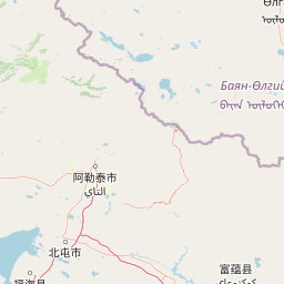
Map view of Altai Tavan Bogd National Park

Use this park location map to pinpoint Altai Tavan Bogd National Park in Mongolia, understand its exact geographic position, and read its mapped placement within the surrounding landscape more clearly.

Pigeon | © OpenStreetMap contributors

Location context for Altai Tavan Bogd National Park

Bayan-Ölgii Province
Park atlas

Explore the regional protected-area spread and connected landscapes surrounding Altai Tavan Bogd

Discover Nearby National Parks and Protected Areas Around Altai Tavan Bogd National Park
Discover other national parks and protected areas near Altai Tavan Bogd National Park, mapping the diverse alpine mountain terrain and glacial valleys of the Central Asian Altai. This regional overview helps compare similar protected landscapes, offering deeper geographic context for major conservation sites, ancient rock art, and critical wildlife habitats.
Watercolor painting showing green mountains, valleys, and a winding river under a light sky
National parkAltai Republic

Saylyugemsky National Park: Discover its Protected Landscape and Geographic Significance in Altai Republic

Mapped boundaries and regional landscape context within the Altai Republic.

Delve into Saylyugemsky National Park, a designated national park situated within the vast geographic expanse of Russia's Altai Republic. This canonical page provides detailed insights into its protected landscape, meticulously mapped boundaries, and its contribution to the regional geography. MoriAtlas focuses on structured geographic discovery, enabling a deeper understanding of Saylyugemsky National Park's place within the atlas of protected areas and natural landscapes.

Area
1,183.8 km²
Established
2012
IUCN
II
Relief
Mountain
Watercolor painting of a river flowing through forested hills with mountains in the background under a sunset sky
National parkEast Kazakhstan Region

Katon-Karagay National Park: Discover Kazakhstan's Largest Protected Mountain Landscape

Explore the geography and park boundaries of East Kazakhstan's premier national park.

Katon-Karagay National Park, the largest national park in Kazakhstan, offers a deep dive into the protected landscapes of the Southern Altai Mountains. This page provides essential geographic context, detailing the park's terrain, its significance as a protected area within East Kazakhstan Region, and its role in mapping the natural contours of this ecologically diverse mountain system. Understand the park's boundaries and its contribution to regional conservation.

Area
6,435 km²
Established
2001
IUCN
II
Relief
Mountain
National parkBayan-Ölgii Province

Tsambagarav Uul National Park: Mapped Protected Landscape in Bayan-Ölgii

Explore its geographic context and park boundaries.

Tsambagarav Uul National Park offers a detailed look at a significant protected landscape situated in Mongolia's western Bayan-Ölgii Province. This national park's boundaries are mapped to provide context within the broader Altai Mountains region. Users can explore the park's geographic setting, understanding its contribution to the protected natural areas of western Mongolia and its significance for regional landscape studies.

Area
1,110 km²
Established
2000
IUCN
II
Relief
Mountain
National parkKhovd Province

Bulgan Gol-Ikh Ongog National Park: Khovd Province's Vital Riparian Protected Landscape

Mapped geography of river valley, wetlands, and desert steppe.

Bulgan Gol-Ikh Ongog National Park is a designated national park situated in the Khovd Province of western Mongolia, focusing on the preservation of the Bulgan River valley. This protected landscape features a distinctive desert steppe environment interwoven with extensive riparian wetlands, islands, and river channels. The park is ecologically significant as a crucial migratory bird stopover point, supporting diverse habitats that highlight the transition from mountainous sources to the flatter valley floor, offering unique atlas-level geographic insight.

Area
2,461 km²
Established
2011
IUCN
II
Relief
Lowland
National parkBayan-Ölgii Province

Munkhkhairkhan National Park: Alpine Glacial Landscape & Protected Area

Explore the mapped geography of western Mongolia's high peaks.

Munkhkhairkhan National Park protects the dramatic alpine environment surrounding Mönkhkhairkhan Mountain, Mongolia's second-highest peak. This national park showcases spectacular glacial valleys and steep, rock-strewn slopes characteristic of the Mongol-Altai Mountains. As a key protected landscape in Bayan-Ölgii Province, it offers a distinct view into Mongolia's high-elevation ecosystems and their unique mapped boundaries for atlas exploration.

Area
5,061 km²
Established
2011
IUCN
II
Relief
Mountain
Watercolor painting of a river flowing through a valley with forested hills and distant mountains
National parkTashtagolsky District

Shorsky National Park: Protected Landscape and National Park Geography

Discover the mapped terrain and regional context of Shorsky National Park.

Shorsky National Park is a key protected area within the Tashtagolsky District, nestled in the mountainous terrain of Southern Siberia. This page serves as an entry point for understanding its role as a national park, focusing on its geographic boundaries and landscape context. MoriAtlas allows for detailed map-based exploration of Shorsky National Park, highlighting its significance within the regional geography and the broader atlas of protected lands in Russia.

Area
4,180 km²
Established
1989
IUCN
II
Relief
Mountain
National parkUvs Province

Khan-Khokhi Khyargas Mountain National Park: Mapped Boundaries and Protected Landscape

Uvs Province National Park Geography

Khan-Khokhi Khyargas Mountain National Park is a designated national park offering critical insights into Mongolia's protected natural landscapes. This entry supports structured geographic discovery, detailing the park's mapped boundaries and its environmental context within Uvs Province. Engage with the park's identity as a protected area, uncovering its role in the regional atlas and its unique contribution to the mapped terrain.

Area
3,413 km²
Established
2000
IUCN
II
Relief
Mountain
Watercolor painting of green trees, rolling hills, a pink and yellow sunset sky, and a single tree on the right
National parkKrasnoyarsk Krai

Shushensky Bor National Park: Mapped Geography of a Siberian Protected Forest

Explore the protected landscape and regional context of Krasnoyarsk Krai.

Shushensky Bor National Park serves as a critical protected area within the vast geography of Krasnoyarsk Krai, Russia, offering detailed insights into Siberia's ecological transition zones. This national park meticulously maps the shift from the Minusinsk basin forest-steppe to the dramatic mountain taiga of the Western Sayan range. Users can explore its varied terrain, from gentler northern steppe-influenced lands to the rugged slopes of the Borus Massive, all within a defined protected landscape. The proximity to the Sayano-Shushenskoye Reservoir further defines its unique geographic setting, providing context for its conservation importance and natural beauty.

Area
392 km²
Established
1995
IUCN
II
Relief
Mountain

Common questions about visiting, size, designation, and location context for Altai Tavan Bogd National Park

Altai Tavan Bogd National Park FAQs for park facts, access, geography, and protected area context
Find quick answers about Altai Tavan Bogd National Park, including protected-area facts, park geography, trail and visitor context, and how the park fits into its surrounding country and regional landscape.
MoriAtlas Explorer

Continue Your Protected Areas Search Across the Global Atlas

Deepen your exploration by continuing the structured search for national parks and protected areas worldwide. Utilize the comprehensive filtering capabilities to compare different conservation landscapes and refine your understanding of global park geography. Discover more about the distribution and characteristics of protected natural areas.

Global natural geography