
Mori Atlas logo
National parkKhar Us Nuur National Park

A vast network of freshwater lakes, interior islands, and arid steppe within the Great Lakes Basin

Khar Us Nuur National Park: Mapped Geography and Protected Wetland Landscapes in Khovd Province

(Khar Us nuuriin baigaliin cogcolbort gazar)

Khar Us Nuur National Park represents a significant protected unit in western Mongolia, encompassing a unique chain of interconnected lakes including Khar-Us, Khar, and Dörgön. This expansive wetland environment, fed by the Khovd River, creates a vital mosaic of reed marshes, saline basins, and island habitats. Surrounded by the rugged slopes of the Altai Mountains and the semi-arid grasslands of the Great Lakes Basin, the park serves as a critical geographic confluence of mountain, desert, and aquatic terrain.

national parkMongoliaKhovd ProvinceGreat Lakes Basinfreshwater lakessaline lake
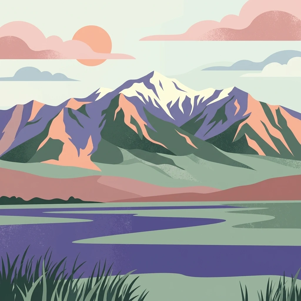
A stylized flat-art illustration showing a tranquil lake in the foreground with tall grasses; behind the lake, a mountain range with snowy peaks rises under a soft sky with a pale sun and clouds.

Khar Us Nuur National Park

National park

Park overview

Structured park overview, official facts, and landscape profile for Khar Us Nuur National Park

Khar Us Nuur National Park park facts, protected area profile, and essential visitor context

Review the core facts for Khar Us Nuur National Park, including designation, size, terrain, visitor scale, habitats, and operating context in one park-focused overview.

About Khar Us Nuur National Park

Khar Us Nuur National Park protects one of the most distinctive wetland landscapes in Mongolia. Located in Khovd Province in the country's far west, the park is anchored by three large lakes that occupy parts of the Great Lakes Basin, a region otherwise defined by dry steppe and the foothills of the Altai Mountains. The interplay of open water, marshland, and arid surroundings creates a sharp ecological contrast that defines the park's identity.

The principal lake, Khar-Us Nuur, is a broad freshwater body that stretches for around 70 kilometers at its longest extent. It is fed by the Khovd River through a delta on its western side, a process that sustains the lake's freshwater character and nourishes the surrounding wetlands. Within Khar-Us Nuur lies the large island Agbash, which adds an interior terrestrial habitat to an otherwise aquatic-dominated scene. Immediately to the east lies the smaller freshwater Khar Lake, and further southeast, connected by a canal, sits the saline Dörgön Lake. Together, the three lakes represent different stages and chemistries of water within one connected system.

At the southern edge of Khar-Us Nuur, the terrain rises sharply to Mount Jargalant, a peak reaching close to 3,800 meters that frames the lake basin with high mountain scenery. Beyond the lakes and marshes, the surrounding landscape consists of semi-arid desert steppe, giving the protected area a layered geography of water, wetland, mountain, and dry grassland.

The park's value extends well beyond its scenery. The reed beds and marshes bordering the lakes serve as a critical breeding and staging area for waterbirds, supporting a bird list that exceeds 200 species. The protected area was officially established in 1997 and is managed as part of Mongolia's national park system under the Ministry of Environment and Green Development, reflecting its national and international conservation importance within the Great Lakes Basin.

Quick facts and research context for Khar Us Nuur National Park

Khar Us Nuur National Park lies in Khovd Province, western Mongolia, within the Great Lakes Basin desert steppe ecoregion. The park covers roughly 8,500 square kilometers and centers on a system of three connected lakes: the freshwater Khar-Us Nuur and Khar Lake, and the saline Dörgön Lake.

The protected area combines lake, marsh, island, and mountain habitats. The principal lake, Khar-Us Nuur, is fed by the Khovd River through a western delta and contains the large island of Agbash, while Mount Jargalant rises on its southern shore. The climate is cold and semi-arid, with long, freezing winters during which the lakes are frozen for roughly half the year.

The park was established in 1997 and is administered by Mongolia's Ministry of Environment and Green Development. It is recognized primarily for the international importance of its wetland bird habitats, supported by over 200 recorded bird species and extensive reed-bed breeding grounds.

Protection and recognition

Documented terrestrial protection scope and conservation designation facts

Khar Us Nuur National Park Protection Status and International Recognition

Khar Us Nuur National Park maintains a documented terrestrial protection scope without imported international recognition sources or regional transboundary designations. Structured protected area data provides clear insight into official conservation status, management frameworks, and baseline administrative details.

Protection details

Protection scope
Terrestrial
Park context

Deeper park guide and search-rich context for Khar Us Nuur National Park

Khar Us Nuur National Park history, landscape, wildlife, and travel context

Explore Khar Us Nuur National Park through its history, landscape character, ecosystems, wildlife, conservation priorities, cultural context, and seasonal travel timing in a structured park guide built for atlas discovery and search intent.

Why Khar Us Nuur National Park stands out

The park is best known for its chain of three large lakes set against a backdrop of semi-arid steppe and Altai mountain scenery. Together with their bordering marshes, these lakes form one of the most important wetland bird habitats in western Mongolia, hosting over two hundred bird species including globally threatened waterbirds such as the white-headed duck, Dalmatian pelican, and swan goose. It is also recognized for the scale and diversity of its landscapes within a single protected area. Freshwater lakes, saline basins, reed beds, a large interior island, and high mountain slopes all come together here, making the park a concentrated showcase of the Great Lakes Basin's natural character.
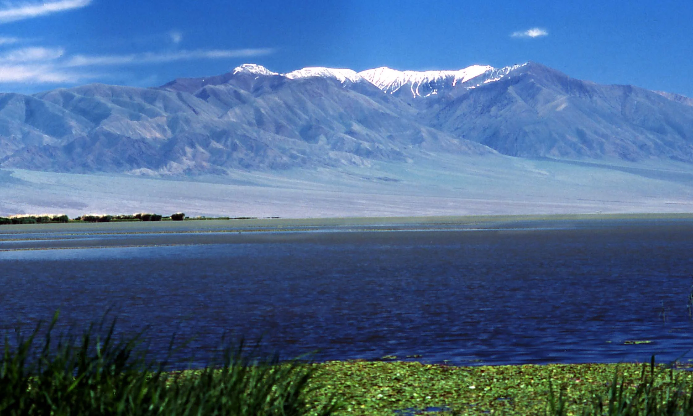
A wide view of a large, dark blue lake in the foreground with a tall, snow-capped mountain range in the background under a clear sky.
Jargalant Mountain rising above the waters of Khar Us Nuur.

Khar Us Nuur National Park history and protected-area timeline

Khar Us Nuur National Park was formally established in 1997 as part of Mongolia's broader effort to protect representative landscapes and ecosystems outside the country's better-known northern and eastern reserves. The lakes it protects had long held regional significance for wildlife, particularly as breeding habitat for waterbirds, but their conservation status was formalized only in the late twentieth century.

Geologically, the present-day lakes are remnants of a much larger single body of water that existed in the region roughly 5,000 years ago. As that lake shrank and fragmented under a drying climate, the current chain of Khar-Us Nuur, Khar Lake, and Dörgön Lake emerged as the principal surviving waterbodies in the Great Lakes Basin of western Mongolia.

In the 1960s, muskrat were introduced to the lakes and marshes for fur production. The population has since grown considerably, and the species now exerts ongoing pressure on the reed beds that are central to the park's birdlife and ecological character, adding a long-running management challenge to the park's history.

Khar Us Nuur National Park landscape and geographic character

The landscape of Khar Us Nuur National Park is defined by the alternation between open water and dry land. Three large lakes form the core of the protected area, with Khar-Us Nuur as the dominant feature. At about 1,850 square kilometers in extent and stretching around 70 kilometers at its longest axis, it is the largest of the three lakes by a wide margin. The freshwater character of Khar-Us is maintained by the Khovd River, which enters the lake through a well-developed delta on the western shore.

Within Khar-Us Nuur, the island of Agbash covers roughly 274 square kilometers, providing an unusual enclosed habitat of steppe and lakeshore within the lake itself. Immediately east of Khar-Us sits Khar Lake, a smaller freshwater body covering around 565 square kilometers. Beyond it, connected by a canal, lies Dörgön Lake, a saline waterbody of about 300 square kilometers, marking a clear shift in water chemistry along the chain.

The southern edge of the lake basin rises to Mount Jargalant, a prominent Altai peak reaching approximately 3,800 meters in elevation. Beyond the lakes and their bordering marshes, the surrounding terrain is predominantly semi-arid desert steppe, characteristic of the Great Lakes Basin. The result is a landscape where high mountains, broad freshwater and saline lakes, interior islands, and arid grasslands coexist within a single protected unit.

Khar Us Nuur National Park ecosystems, habitats, and plant life

The ecosystems of Khar Us Nuur National Park reflect the meeting of water and steppe in the Great Lakes Basin. The dominant habitat type is open lake and wetland, with extensive reed marshes along the shorelines of Khar-Us Nuur and Khar Lake shaping much of the ecological character. These marshes are dominated by Phragmites, the tall common reed that forms dense beds across the lake margins.

Beyond the wetlands, the protected area incorporates large tracts of semi-arid desert steppe. Vegetation in these areas is shaped by limited precipitation, averaging around 120 millimeters per year, and by long winters when the lakes freeze over for roughly half the year. At higher elevations, the slopes of Mount Jargalant and the surrounding Altai foothills add upland habitats that contrast with both the wetlands and the open steppe.

The mix of freshwater lakes, saline lake, marshland, island steppe, and mountain slopes supports a notable concentration of biodiversity. Although the climate is cold and dry, the presence of persistent open water and extensive reed habitat allows the wetland zones to function as regional biodiversity hotspots within an otherwise arid landscape.

Khar Us Nuur National Park wildlife and species highlights

The wildlife significance of Khar Us Nuur National Park is closely tied to its lakes and marshes. More than 200 bird species have been recorded in the park, making it one of the most important wetland bird areas in western Mongolia and a regional stronghold for waterbirds that depend on large reed-bed systems.

Among the notable species are globally threatened and near-threatened waterbirds. The endangered white-headed duck occurs here, while the near-threatened Dalmatian pelican was once a regular breeder in the park, though in more recent years it has been recorded primarily as a passage visitor. The vulnerable swan goose is also among the species for which the park's marshes hold conservation importance.

The lakes additionally support distinctive fish life, including three endemic species such as the narrow-headed Altai osman. A non-native addition to the fauna is the muskrat, introduced in the 1960s for fur production. The muskrat population has expanded substantially and now places significant pressure on the reed beds, an interaction that has become an important feature of the park's modern wildlife management challenges.

Khar Us Nuur National Park conservation status and protection priorities

Khar Us Nuur National Park is classified as an IUCN Category II protected area, recognizing it as a national park of national-level importance. Its conservation significance is rooted in the international importance of its wetland habitats, particularly the reed marshes that ring the lakes and support a rich community of breeding and migratory waterbirds.

The park is situated within the Great Lakes Basin desert steppe ecoregion and plays a key role in protecting representative landscapes of this part of western Mongolia. By maintaining a connected system of freshwater and saline lakes surrounded by intact steppe and Altai mountain slopes, the park helps conserve the ecological contrasts that define the region.

A persistent conservation challenge concerns the introduced muskrat population. Originally brought into the area for fur production in the 1960s, muskrats have become well established and now affect the very reed beds that support the park's internationally important birdlife. Managing this interaction between invasive species and sensitive wetland habitat remains a central element of the park's conservation agenda.

Top sights and standout views in Khar Us Nuur National Park

Khar Us Nuur National Park's strongest points of distinction are its three large interconnected lakes and the surrounding reed marshes that host over 200 bird species. The presence of globally threatened species such as the white-headed duck, Dalmatian pelican, and swan goose gives the park clear international conservation relevance.

Equally notable is the geographic setting. Within a single protected area, visitors encounter freshwater and saline lakes, the large interior island of Agbash, the bordering semi-arid steppe of the Great Lakes Basin, and the high slopes of the Altai Mountains, including Mount Jargalant on the southern shore of Khar-Us Nuur.

Best time to visit Khar Us Nuur National Park

The park experiences a cold semi-arid climate, with winters long enough for the lakes to remain frozen from roughly November through April. As a result, late spring through autumn is the most natural window for experiencing the lakes in open water and for observing the breeding and staging waterbirds that depend on the reed marshes.

Summer brings milder temperatures and the most active wildlife behavior around the wetlands, while the shoulder seasons of late spring and early autumn offer quieter conditions and marked changes in light across the lake basins. Winter visits would mean the lakes are frozen and wildlife activity is reduced, and therefore are less suitable for typical park experiences centered on water and birdlife.
Monthly climate preview

Long term temperature and precipitation records across representative terrain coordinates

Khar Us Nuur National Park Climate Normals and Annual Weather Patterns

Khar Us Nuur National Park exhibits a measured annual cycle featuring severe subzero winter minimums alongside warm summer maximums and low daily precipitation throughout the year. Reviewing the complete twelve month climate profile reveals detailed long term temperature swings and precipitation variations across the representative coordinate.
Annual mean3 °C
-17 °C21 °C
Jan-17°
Feb-13°
Mar-4°
Apr
May12°
Jun19°
Jul21°
Aug18°
Sep11°
Oct
Nov-7°
Dec-15°
Warmest month
July

20.8 °C

Coolest month
January

-17.2 °C

Wettest month
July

1.2 mm/day

Driest month
January

0.1 mm/day

Park location guide

Geography guide, regional context, and park location map for Khar Us Nuur National Park

Khar Us Nuur National Park park geography, regions, and map view in Mongolia

Understand where Khar Us Nuur National Park sits in Mongolia through a broader geographic reading of the surrounding landscape, nearby location context, and its mapped position within the national park landscape.

How Khar Us Nuur National Park fits into Mongolia

Mongolia is a landlocked sovereign state in East Asia, known for its vast steppe landscapes, nomadic culture, and historical significance as the heartland of the Mongol Empire founded by Genghis Khan in 1206. The country has a population of approximately 3.5 million people and is the world's most sparsely populated sovereign state. Ulaanbaatar is the capital and largest city, home to roughly half the population.

Wider geography shaping Khar Us Nuur National Park in Mongolia

Mongolia is located in East Asia, landlocked between Russia to the north and China to the south. The country occupies the Mongolian Plateau and features diverse terrain including grassy steppe, mountains in the north and west, and the Gobi Desert in the south. It covers 1,564,116 km2, making it the second largest landlocked country in the world.

Map view of Khar Us Nuur National Park

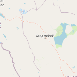
Use this park location map to pinpoint Khar Us Nuur National Park in Mongolia, understand its exact geographic position, and read its mapped placement within the surrounding landscape more clearly.

Pigeon | © OpenStreetMap contributors

Location context for Khar Us Nuur National Park

Khovd Province

Visual reference for the lakes, reed marshes, and mountain terrain of western Mongolia

Khar Us Nuur National Park Photos: Landscape Scenery and Habitats

Protected area photography reveals the complex geography of interconnected lakes, expansive reed beds, and high Altai mountain slopes. Visual documentation highlights the distinct natural environment and varied habitats sustaining diverse wetland wildlife.

A wide view of a large, dark blue lake in the foreground with a tall, snow-capped mountain range in the background under a clear sky.

Park atlas

Compare regional protected landscapes, wetland habitats, and mountain ecosystems across western Mongolia.

Exploring Other Parks Near Khar Us Nuur National Park and Surrounding Protected Areas

Continue your geographic exploration by examining other protected areas near Khar Us Nuur National Park and the surrounding region. Comparing adjacent park geography reveals broader environmental patterns across the Great Lakes Basin and Altai mountain catchments.
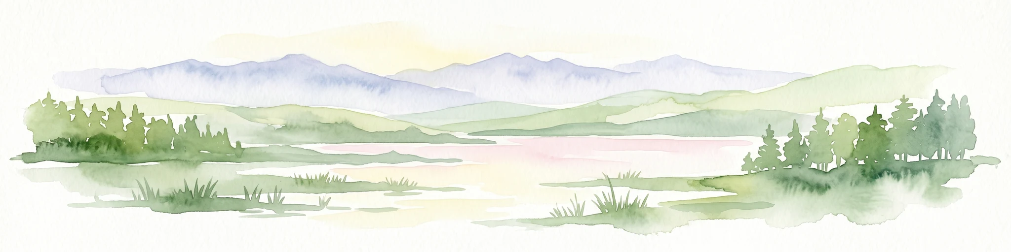
Watercolor illustration of a lake with mountains in the background, surrounded by trees and grass
National parkMongolia
Mapped park locations coincide#1 closest

Har Us Nuur National Park: A Mapped Protected Landscape in Mongolia's Vast Geography

Explore the geography and atlas context of this national park.

Har Us Nuur National Park is a designated national park offering a unique protected landscape within Mongolia. This page provides context for exploring its geographic features, mapped boundaries, and its significance within the broader atlas of protected areas in East Asia. Understanding Har Us Nuur National Park contributes to a structured appreciation of Mongolia's natural terrains and regional conservation landscapes.

Area
8,503 km²
Established
1997
Relief
Mixed relief
Climate
Arid
Protected areaUvs Province
About 82 km away#2 closest

Northeast

Airag Lake Protected Area: Geographic Context and Steppe Wetland Mapping

Hydrological features within the Uvs Province regional landscape

Airag Lake serves as a critical freshwater habitat in the Uvs Province of western Mongolia. This detailed overview covers the lake's shallow basin, its seasonal thermal patterns, and the outflow canal connecting it to the broader Great Lakes Depression system, providing an essential look at this unique steppe wetland environment.

Area
143.3 km²
Established
1999
A watercolor painting of a serene lakeshore with soft green grass in the foreground, a still lake reflecting soft pink and beige tones, and light green hills in the distance.
National parkUvs Province
About 105 km away#3 closest

Northeast

Khyargas Lake National Park: Geography and Protected Area Mapping in Western Mongolia

A comprehensive look at saline and freshwater steppe ecosystems.

Khyargas Lake National Park, situated in Uvs Province, offers a rare glimpse into the saline and freshwater lake systems of the Mongolian steppe. This protected area encompasses an endorheic basin characterized by its wide, open shoreline and unique ecological contrast. Use our atlas to analyze the mapped terrain and the expansive, undisturbed wetlands that define this notable region of western Mongolia.

Area
3,328 km²
Established
2000
Relief
Lowland
Climate
Arid
National parkBayan-Ölgii Province
About 138 km away#4 closest

West

Tsambagarav Uul National Park: Mapped Protected Landscape in Bayan-Ölgii

Explore its geographic context and park boundaries.

Tsambagarav Uul National Park offers a detailed look at a significant protected landscape situated in Mongolia's western Bayan-Ölgii Province. This national park's boundaries are mapped to provide context within the broader Altai Mountains region. Users can explore the park's geographic setting, understanding its contribution to the protected natural areas of western Mongolia and its significance for regional landscape studies.

Area
1,110 km²
Established
2000
IUCN
II
Relief
Mountain
National parkBayan-Ölgii Province
About 146 km away#5 closest

South

Munkhkhairkhan National Park: Alpine Glacial Landscape & Protected Area

Explore the mapped geography of western Mongolia's high peaks.

Munkhkhairkhan National Park protects the dramatic alpine environment surrounding Mönkhkhairkhan Mountain, Mongolia's second-highest peak. This national park showcases spectacular glacial valleys and steep, rock-strewn slopes characteristic of the Mongol-Altai Mountains. As a key protected landscape in Bayan-Ölgii Province, it offers a distinct view into Mongolia's high-elevation ecosystems and their unique mapped boundaries for atlas exploration.

Area
5,061 km²
Established
2011
IUCN
II
Relief
Mountain
National parkUvs Province
About 195 km away#6 closest

Northeast

Khan-Khokhi Khyargas Mountain National Park: Mapped Boundaries and Protected Landscape

Uvs Province National Park Geography

Khan-Khokhi Khyargas Mountain National Park is a designated national park offering critical insights into Mongolia's protected natural landscapes. This entry supports structured geographic discovery, detailing the park's mapped boundaries and its environmental context within Uvs Province. Engage with the park's identity as a protected area, uncovering its role in the regional atlas and its unique contribution to the mapped terrain.

Area
3,413 km²
Established
2000
IUCN
II
Relief
Mountain
National parkZavkhan Province
About 214 km away#7 closest

East

Ulaagchinii Khar Nuur National Park: Protected National Park in Zavkhan Province

Mapped landscape context and regional geographic setting.

As a dedicated national park, Ulaagchinii Khar Nuur National Park serves as a key protected area within Zavkhan Province. This detail page provides an atlas-oriented view of its mapped boundaries and its role in the regional geography of western Mongolia. Understand the park's specific protected landscape characteristics and its contribution to the mapped natural terrain of the Khangai Mountain region.

Area
2,594 km²
Established
2010
IUCN
II
Relief
Mixed relief
National parkBayan-Ölgii Province
About 240 km away#8 closest

West

Altai Tavan Bogd National Park: Protected Mountainous Landscape in Bayan-Ölgii

Explore mapped geography and protected terrain.

Altai Tavan Bogd National Park, situated in Mongolia's Bayan-Ölgii Province, offers a detailed view of a significant protected natural area. This park is defined by its mountainous geography, forming a key part of the Altai range. Users can explore its mapped boundaries and understand its role as a protected landscape within the western Mongolian atlas.

Area
6,362 km²
Established
1996
IUCN
II
Relief
Mountain

Common questions about visiting, size, designation, and location context for Khar Us Nuur National Park

Khar Us Nuur National Park FAQs for park facts, access, geography, and protected area context

Find quick answers about Khar Us Nuur National Park, including protected-area facts, park geography, trail and visitor context, and how the park fits into its surrounding country and regional landscape.
MoriAtlas Explorer

Continue Your Protected Areas Search Across the Global Atlas

Deepen your exploration by continuing the structured search for national parks and protected areas worldwide. Utilize the comprehensive filtering capabilities to compare different conservation landscapes and refine your understanding of global park geography. Discover more about the distribution and characteristics of protected natural areas.

Global natural geography