Mori Atlas logo
National parkKhan-Khokhi Khyargas Mountain National Park

Discover the mapped landscape and regional context of this Mongolian national park.

Khan-Khokhi Khyargas Mountain National Park: Protected Area, Geography, and Atlas Exploration

Khan-Khokhi Khyargas Mountain National Park stands as a significant protected area within the vast geography of Uvs Province, Mongolia. This page offers an atlas-focused exploration of the park's identity, providing insights into its mapped boundaries and natural landscape context. Users can delve into the geographic significance of this national park, understanding its place within regional conservation efforts and how it contributes to the broader mapped terrain of Mongolia.

Protected MountainsSacred MountainsConiferous ForestsAlpine MeadowsSteppe EcosystemsGlacial Landscapes

Khan-Khokhi Khyargas Mountain National Park

National park

Park overview

Structured park overview, official facts, and landscape profile for Khan-Khokhi Khyargas Mountain National Park

Khan-Khokhi Khyargas Mountain National Park park facts, protected area profile, and essential visitor context
Review the core facts for Khan-Khokhi Khyargas Mountain National Park, including designation, size, terrain, visitor scale, habitats, and operating context in one park-focused overview.

About Khan-Khokhi Khyargas Mountain National Park

Khan-Khokhi Khyargas Mountain National Park occupies a significant position in northwestern Mongolia's protected area network, encompassing the westernmost reaches of the Khangai Mountain range. The park's establishment in 2000 reflected growing recognition of the region's ecological and cultural value, formalizing protections for a landscape that had long held significance in Mongolian tradition. The mountains themselves rise dramatically from the surrounding steppe, with their flat-topped summits and steep glacial valleys creating a distinctive silhouette against the semi-arid plains. The park lies approximately 20 kilometers north of Khyargas Nuur National Park, with which it forms a complementary protected area complex addressing different aspects of the region's natural diversity. Beyond its ecological credentials, the park preserves tangible evidence of historical human activity through ancient burial mounds distributed across the landscape, linking contemporary conservation efforts to centuries of cultural continuity.

Quick facts and research context for Khan-Khokhi Khyargas Mountain National Park

Located in Uvs Province in far northwestern Mongolia, Khan-Khokhi Khyargas Mountain National Park covers 3,413 square kilometers of Khangai Mountain terrain. The park was established in 2000 and is managed as an IUCN Category II protected area. The highest peak, Altan Duulga, reaches 2,928 meters above sea level. The mountains are culturally significant as one of the ten sacred mountains of Mongolia and contain ancient burial mounds. The area experiences a cold semi-arid climate typical of steppe environments.

Park context

Deeper park guide and search-rich context for Khan-Khokhi Khyargas Mountain National Park

Khan-Khokhi Khyargas Mountain National Park history, landscape, wildlife, and travel context
Explore Khan-Khokhi Khyargas Mountain National Park through its history, landscape character, ecosystems, wildlife, conservation priorities, cultural context, and seasonal travel timing in a structured park guide built for atlas discovery and search intent.

Why Khan-Khokhi Khyargas Mountain National Park stands out

Khan-Khokhi Khyargas Mountain National Park is best known for its status as one of the ten sacred mountains of Mongolia, a designation that reflects both the landscape's spiritual importance and its enduring role in Mongolian cultural identity. The park is distinguished by its dramatic altitudinal gradient that produces dramatically different ecosystems on north and south facing slopes. The northern slopes support rich mountain forests of Siberian larch and Siberian pine, while the southern slopes give way to desert and semi-arid vegetation. This contrast, visible across relatively short distances, makes the park a compelling example of how aspect and precipitation patterns shape Central Asian mountain ecosystems.

Khan-Khokhi Khyargas Mountain National Park history and protected-area timeline

Khan-Khokhi Khyargas Mountain National Park was established in 2000 as part of Mongolia's expanding network of protected areas during the country's transition period following the end of the socialist era. The creation of the park reflected a broader recognition among Mongolian policymakers of the need to protect the nation's mountain ecosystems and sacred cultural sites. The park was placed under the management of the Ministry of Environment and Green Development, which continues to oversee its conservation mandate. The designation of the Khan Khukhii mountains as one of the ten sacred mountains of Mongolia predates the formal protected area establishment by centuries, rooted in traditional Mongolian beliefs that elevated certain natural features to positions of spiritual significance. This cultural framework provided an informal layer of protection that long preceded formal legal designation.

Khan-Khokhi Khyargas Mountain National Park landscape and geographic character

The landscape of Khan-Khokhi Khyargas Mountain National Park is defined by its position at the western terminus of the Khangai Mountains, a major mountain system of central Asia that influences regional climate and hydrology. The terrain is characterized by flat-topped mountain summits and steep, often dramatic slopes that have been shaped by past glacial activity. Altan Duulga, the park's highest point at 2,928 meters, provides sweeping views across the protected area and demonstrates the elevation range that contributes to the park's ecological diversity. The mountains function as a geographic divider, separating the Uvs Depression to the north, a basin that contains Mongolia's largest lake and a UNESCO World Heritage Site, from the Khyargas Lake depression to the south. This positioning gives the park significance beyond its boundaries as a watershed and ecological transition zone.

Khan-Khokhi Khyargas Mountain National Park ecosystems, habitats, and plant life

The nature of Khan-Khokhi Khyargas Mountain National Park is defined by a pronounced precipitation gradient created by aspect differences between north and south facing slopes. The northern slopes of the Khan Khukhii Mountains receive approximately 300 millimeters of precipitation annually, supporting a vertical zonation of ecosystems that progresses from steppe grasslands at lower elevations through forested zones of Siberian larch and Siberian pine to alpine meadows at higher elevations. This diversity of habitats within a relatively compact area makes the park ecologically significant. In contrast, the southern slopes receive roughly half the precipitation at around 150 millimeters per year, supporting desert and semi-arid desert vegetation communities that contrast sharply with the verdant northern slopes. This ecological asymmetry, where two very different natural environments exist in close proximity separated only by a mountain ridge, exemplifies the complex environmental patterns found throughout Mongolia's mountain landscapes.

Khan-Khokhi Khyargas Mountain National Park wildlife and species highlights

The diverse habitats within Khan-Khokhi Khyargas Mountain National Park support corresponding communities of wildlife adapted to the park's various ecological zones. The forested northern slopes provide habitat for species associated with Siberian taiga ecosystems, including various species of deer, small mammals, and bird species that migrate through the altitudinal gradient. The steppe and alpine zones each support their own distinctive faunal assemblages adapted to those specific conditions. While the Wikipedia source does not provide detailed species lists, the presence of significant forest cover and the protected status of the area create conditions that support biodiversity in this region of Mongolia, which lies at the crossroads of Siberian and Central Asian ecological provinces.

Khan-Khokhi Khyargas Mountain National Park conservation status and protection priorities

Khan-Khokhi Khyargas Mountain National Park represents an important contribution to Mongolia's conservation framework, protecting a mountain landscape that would otherwise face pressures from grazing, development, and resource extraction. The park's IUCN Category II designation as a national park indicates its primary objective of protecting ecological processes and natural biodiversity while also allowing for sustainable visitation and environmental education. The combination of ecological significance, with its diverse forest and steppe communities, and cultural importance, as one of the ten sacred mountains, creates a conservation context that extends beyond purely biological considerations to encompass holistic landscape protection. The presence of ancient burial mounds adds an archaeological dimension to the conservation value, as these cultural heritage sites require protection alongside natural features.

Khan-Khokhi Khyargas Mountain National Park cultural meaning and human context

Khan-Khokhi Khyargas Mountain National Park holds profound cultural significance within Mongolia as one of the ten sacred mountains, a traditional designation that reflects centuries of spiritual and cultural practices tied to the landscape. This sacred status has provided informal protection for the mountains across generations, preserving both natural and cultural values long before formal legal protections were established. The ancient burial mounds found throughout the park represent tangible evidence of human presence in this landscape spanning many centuries, connecting contemporary visitors to the historical communities that inhabited this region. The mountains' role as a traditional sacred site integrates ecological conservation with cultural heritage in a way characteristic of Mongolian approaches to landscape protection, where natural and spiritual values are often interconnected.

Top sights and standout views in Khan-Khokhi Khyargas Mountain National Park

The most distinctive highlights of Khan-Khokhi Khyargas Mountain National Park include its status as one of Mongolia's ten sacred mountains, the dramatic ecological contrast between forested northern slopes and desert southern slopes within a single protected area, and the presence of ancient burial mounds that document centuries of human history. The park's position at the western edge of the Khangai Mountains creates a mountainous landscape of considerable scenic value, with Altan Duulga's 2,928-meter summit providing high-elevation recreation opportunities. The vertical ecosystem gradient from steppe through coniferous forest to alpine meadows offers ecological diversity rare in this semi-arid region of Asia.

Best time to visit Khan-Khokhi Khyargas Mountain National Park

The best time to visit Khan-Khokhi Khyargas Mountain National Park would be during the summer months when temperatures are most comfortable for hiking and exploration, and when the alpine meadows are at their most vibrant. The cold semi-arid climate means that summers are warm but brief, while winters are long and very cold with significant snow cover at higher elevations. The shoulder seasons of spring and autumn offer different experiences, with spring bringing green-up across the steppe and autumn displaying the characteristic colors of the larch forests. Visitors seeking to experience the full ecological diversity of the park should consider that the northern and southern slopes offer very different conditions, with the forested north being more hospitable during hot summer months while the southern slopes are best explored during cooler times of year.
Park location guide

Geography guide, regional context, and park location map for Khan-Khokhi Khyargas Mountain National Park

Khan-Khokhi Khyargas Mountain National Park park geography, regions, and map view in Mongolia
Understand where Khan-Khokhi Khyargas Mountain National Park sits in Mongolia through a broader geographic reading of the surrounding landscape, nearby location context, and its mapped position within the national park landscape.

How Khan-Khokhi Khyargas Mountain National Park fits into Mongolia

Mongolia is a landlocked sovereign state in East Asia, known for its vast steppe landscapes, nomadic culture, and historical significance as the heartland of the Mongol Empire founded by Genghis Khan in 1206. The country has a population of approximately 3.5 million people and is the world's most sparsely populated sovereign state. Ulaanbaatar is the capital and largest city, home to roughly half the population.

Wider geography shaping Khan-Khokhi Khyargas Mountain National Park in Mongolia

Mongolia is located in East Asia, landlocked between Russia to the north and China to the south. The country occupies the Mongolian Plateau and features diverse terrain including grassy steppe, mountains in the north and west, and the Gobi Desert in the south. It covers 1,564,116 km2, making it the second largest landlocked country in the world.

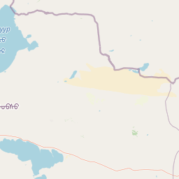
Map view of Khan-Khokhi Khyargas Mountain National Park

Use this park location map to pinpoint Khan-Khokhi Khyargas Mountain National Park in Mongolia, understand its exact geographic position, and read its mapped placement within the surrounding landscape more clearly.

Pigeon | © OpenStreetMap contributors

Location context for Khan-Khokhi Khyargas Mountain National Park

Uvs Province
Park atlas

Compare diverse protected areas, tracing mapped mountain geography and ecological transitions in the broader Khangai Mountains region.

Explore Related Parks and Protected Landscapes Near Khan-Khokhi Khyargas Mountain National Park
Expand your geographic understanding of Central Asia by browsing other national parks and protected areas near Khan-Khokhi Khyargas Mountain National Park. Continue comparing protected landscapes, examining how distinct mountain ranges, forest zones, and high-altitude ecosystems are preserved across Mongolia.
National parkZavkhan Province

Ulaagchinii Khar Nuur National Park: Protected National Park in Zavkhan Province

Mapped landscape context and regional geographic setting.

As a dedicated national park, Ulaagchinii Khar Nuur National Park serves as a key protected area within Zavkhan Province. This detail page provides an atlas-oriented view of its mapped boundaries and its role in the regional geography of western Mongolia. Understand the park's specific protected landscape characteristics and its contribution to the mapped natural terrain of the Khangai Mountain region.

Area
2,594 km²
Established
2010
IUCN
II
Relief
Mixed relief
National parkZavkhan Province

Tarvagatai Nuruu National Park: Zavkhan Province Protected Landscape Atlas

Unique steppe-to-forest transition and mountainous terrain.

Tarvagatai Nuruu National Park represents a critical protected area within Mongolia's Zavkhan Province, noted for its expansive mountainous terrain and significant ecological diversity. The park's landscape is defined by the Tarvagatai Range, featuring flat-topped ridges, glacial valleys, and dramatic elevation changes. It masterfully showcases the transition from semi-arid steppe to dense coniferous forests, highlighting a visually striking ecological boundary anchored by the prominence of Mount Otgontenger, the highest peak in the Khangai Mountains.

Area
5,467 km²
Established
2000
IUCN
II
Relief
Mountain
National parkBayan-Ölgii Province

Tsambagarav Uul National Park: Mapped Protected Landscape in Bayan-Ölgii

Explore its geographic context and park boundaries.

Tsambagarav Uul National Park offers a detailed look at a significant protected landscape situated in Mongolia's western Bayan-Ölgii Province. This national park's boundaries are mapped to provide context within the broader Altai Mountains region. Users can explore the park's geographic setting, understanding its contribution to the protected natural areas of western Mongolia and its significance for regional landscape studies.

Area
1,110 km²
Established
2000
IUCN
II
Relief
Mountain
National parkBayan-Ölgii Province

Munkhkhairkhan National Park: Alpine Glacial Landscape & Protected Area

Explore the mapped geography of western Mongolia's high peaks.

Munkhkhairkhan National Park protects the dramatic alpine environment surrounding Mönkhkhairkhan Mountain, Mongolia's second-highest peak. This national park showcases spectacular glacial valleys and steep, rock-strewn slopes characteristic of the Mongol-Altai Mountains. As a key protected landscape in Bayan-Ölgii Province, it offers a distinct view into Mongolia's high-elevation ecosystems and their unique mapped boundaries for atlas exploration.

Area
5,061 km²
Established
2011
IUCN
II
Relief
Mountain
National parkMongolia

Khorgo-Terkhiin Tsagaan Nuur National Park: Mongolian National Park Protected Landscape Atlas

Mapped geographic context and protected land identity in Mongolia.

Khorgo-Terkhiin Tsagaan Nuur National Park is a designated national park in Mongolia, offering a valuable component of the country's protected lands. This detailed entry focuses on its geographic position and mapped boundaries, providing essential context for understanding its unique landscape within the vast Mongolian plateau. Explore the protected area's distinct identity and its contribution to the regional natural geography, fostering a deeper appreciation for the mapped terrain.

Area
8 km²
Established
1965
IUCN
II
Relief
Mountain
Watercolor painting of green trees, rolling hills, a pink and yellow sunset sky, and a single tree on the right
National parkKrasnoyarsk Krai

Shushensky Bor National Park: Mapped Geography of a Siberian Protected Forest

Explore the protected landscape and regional context of Krasnoyarsk Krai.

Shushensky Bor National Park serves as a critical protected area within the vast geography of Krasnoyarsk Krai, Russia, offering detailed insights into Siberia's ecological transition zones. This national park meticulously maps the shift from the Minusinsk basin forest-steppe to the dramatic mountain taiga of the Western Sayan range. Users can explore its varied terrain, from gentler northern steppe-influenced lands to the rugged slopes of the Borus Massive, all within a defined protected landscape. The proximity to the Sayano-Shushenskoye Reservoir further defines its unique geographic setting, providing context for its conservation importance and natural beauty.

Area
392 km²
Established
1995
IUCN
II
Relief
Mountain
National parkKhovd Province

Bulgan Gol-Ikh Ongog National Park: Khovd Province's Vital Riparian Protected Landscape

Mapped geography of river valley, wetlands, and desert steppe.

Bulgan Gol-Ikh Ongog National Park is a designated national park situated in the Khovd Province of western Mongolia, focusing on the preservation of the Bulgan River valley. This protected landscape features a distinctive desert steppe environment interwoven with extensive riparian wetlands, islands, and river channels. The park is ecologically significant as a crucial migratory bird stopover point, supporting diverse habitats that highlight the transition from mountainous sources to the flatter valley floor, offering unique atlas-level geographic insight.

Area
2,461 km²
Established
2011
IUCN
II
Relief
Lowland
National parkBayan-Ölgii Province

Altai Tavan Bogd National Park: Protected Mountainous Landscape in Bayan-Ölgii

Explore mapped geography and protected terrain.

Altai Tavan Bogd National Park, situated in Mongolia's Bayan-Ölgii Province, offers a detailed view of a significant protected natural area. This park is defined by its mountainous geography, forming a key part of the Altai range. Users can explore its mapped boundaries and understand its role as a protected landscape within the western Mongolian atlas.

Area
6,362 km²
Established
1996
IUCN
II
Relief
Mountain

Common questions about visiting, size, designation, and location context for Khan-Khokhi Khyargas Mountain National Park

Khan-Khokhi Khyargas Mountain National Park FAQs for park facts, access, geography, and protected area context
Find quick answers about Khan-Khokhi Khyargas Mountain National Park, including protected-area facts, park geography, trail and visitor context, and how the park fits into its surrounding country and regional landscape.
MoriAtlas Explorer

Continue Your Protected Areas Search Across the Global Atlas

Deepen your exploration by continuing the structured search for national parks and protected areas worldwide. Utilize the comprehensive filtering capabilities to compare different conservation landscapes and refine your understanding of global park geography. Discover more about the distribution and characteristics of protected natural areas.

Global natural geography