Mori Atlas logo
National parkKhorgo-Terkhiin Tsagaan Nuur National Park

Discover the geography and mapped boundaries of this national park in Mongolia.

Khorgo-Terkhiin Tsagaan Nuur National Park: Mapped Protected Landscape in Mongolia

Khorgo-Terkhiin Tsagaan Nuur National Park represents a significant protected area within Mongolia's expansive natural geography. This page provides an atlas-style view, detailing the park's mapped boundaries and its place within the broader Mongolian plateau landscape. Understand the protected land's geographic identity and its role as a national park in East Asia, offering a foundational understanding for landscape exploration.

Volcanic landscapeMountain lakeBird habitatWetlandsForest steppeCentral Mongolia

Khorgo-Terkhiin Tsagaan Nuur National Park

National park

Park overview

Structured park overview, official facts, and landscape profile for Khorgo-Terkhiin Tsagaan Nuur National Park

Khorgo-Terkhiin Tsagaan Nuur National Park park facts, protected area profile, and essential visitor context
Review the core facts for Khorgo-Terkhiin Tsagaan Nuur National Park, including designation, size, terrain, visitor scale, habitats, and operating context in one park-focused overview.

About Khorgo-Terkhiin Tsagaan Nuur National Park

Khorgo-Terkhiin Tsagaan Nuur National Park protects one of Mongolia's most geologically distinctive landscapes, where volcanic activity has shaped a dramatic mountain environment unlike typical steppe terrain. The park centers on Terkhiin Tsagaan Lake, a oligotrophic freshwater lake stretching roughly 15 kilometers through a valley formed by ancient volcanic forces. The lake reaches a maximum depth of 20 meters, though approximately 40% of its bottom lies at depths less than 2 meters, creating shallow wetland conditions along its margins that support rich biodiversity. Rising prominently to the east of the lake, Khorgo Mountain represents the remains of a recently extinct volcano within the Taryatu-Chulutu volcanic field. The mountain's volcanic origins are evident in the surrounding lava fields that create a stark, rugged landscape contrasting with the more typical rolling hills and forest steppe found throughout the broader Khangai region. The park occupies a strategic position within the Khangai Mountains, a mountain range that plays a crucial role in Mongolia's ecological diversity by supporting forest ecosystems at more northern latitudes than the country's eastern steppes. This mountainous terrain receives somewhat more precipitation than surrounding lowlands, supporting vegetation communities that include both grassland and forested areas across the transitional forest steppe zone.

Quick facts and research context for Khorgo-Terkhiin Tsagaan Nuur National Park

Khorgo-Terkhiin Tsagaan Nuur National Park is located in Tariat District of Arkhangai Province in north central Mongolia, situated within the Tarvagatai Range of the Khangai Mountains. The park centers on Terkhiin Tsagaan Lake, a freshwater oligotrophic lake approximately 15 kilometers long with a maximum depth of 20 meters, formed in a volcanically-created valley. Khorgo Mountain, an extinct volcano, rises about 4 kilometers east of the lake and last erupted around 8,000 BCE. The park covers 773 hectares and was established in 1965, administered by Mongolia's Ministry of Environment and Green Development. The area falls within the Selenge-Orkhon forest steppe ecoregion and experiences a cold semi-arid climate.

Park context

Deeper park guide and search-rich context for Khorgo-Terkhiin Tsagaan Nuur National Park

Khorgo-Terkhiin Tsagaan Nuur National Park history, landscape, wildlife, and travel context
Explore Khorgo-Terkhiin Tsagaan Nuur National Park through its history, landscape character, ecosystems, wildlife, conservation priorities, cultural context, and seasonal travel timing in a structured park guide built for atlas discovery and search intent.

Why Khorgo-Terkhiin Tsagaan Nuur National Park stands out

Khorgo-Terkhiin Tsagaan Nuur is best known for its dramatic volcanic landscape featuring the extinct Khorgo volcano and the scenic Terkhiin Tsagaan Lake set within the Khangai Mountains. The park provides critical habitat for breeding waterfowl, with the lake's western marshlands serving as an important staging area for species including bar-headed goose, ruddy shelduck, and red-breasted merganser. The combination of volcanic terrain, mountain lake, and wetland makes this a distinctive protected area within Mongolia's forest steppe zone.

Khorgo-Terkhiin Tsagaan Nuur National Park history and protected-area timeline

Khorgo-Terkhiin Tsagaan Nuur was established as a protected national park in 1965, reflecting Mongolia's early commitment to conserving distinctive natural landscapes within its territory. The park's creation recognized not only the scenic value of the volcanic lake and mountain landscape but also the ecological importance of the wetland habitats along Terkhiin Tsagaan's western end. Mongolia has maintained the park under the administration of the Ministry of Environment and Green Development, ensuring ongoing protection of the area's natural values. The park's designation during Mongolia's socialist era reflected a conservation tradition that predates modern environmental frameworks, with the country recognizing the importance of protecting representative examples of its diverse landscapes from relatively early in its national development.

Khorgo-Terkhiin Tsagaan Nuur National Park landscape and geographic character

The landscape of Khorgo-Terkhiin Tsagaan Nuur is defined by its volcanic origins and mountainous setting within the Khangai Mountains. The terrain features a central valley where Terkhiin Tsagaan Lake occupies a depression formed through volcanic processes, surrounded by rolling hills blanketed in steppe and forest steppe vegetation. The lake itself is approximately 15 kilometers in length, sitting at an elevation that places it within the mountain environment rather than the vast steppes that dominate much of Mongolia. Immediately east of the lake, Khorgo Mountain rises as a prominent volcanic cone, its slopes and surrounding area characterized by extensive lava fields that represent the preserved evidence of significant volcanic eruptions. The park lies within the Tarvagatai Range of the Khangai Mountains, positioned in the valley systems of the Chuluut River and Suman River. This combination of lake, mountain, and river valley creates a landscape of considerable topographic variety within a relatively limited area, offering views that range from the lake's open water to the rocky, dark surfaces of volcanic rock formations.

Khorgo-Terkhiin Tsagaan Nuur National Park ecosystems, habitats, and plant life

The park lies within the Selenge-Orkhon forest steppe ecoregion, a transitional zone between Mongolia's extensive grasslands and the forested mountain environments found at higher elevations or more northern latitudes. The vegetation around the lake and throughout the surrounding hills reflects this transitional character, combining grassland species with scattered forest patches across the landscape. The lake itself supports a freshwater ecosystem with fish populations typical of northern Eurasian waters, including various cyprinid species, pike, and perch. These fish communities represent the lacustrine ecology that develops in Mongolia's mountain lakes, providing both resident species and supporting food chains for predatory birds. The climate classification as cold semi-arid reflects the continental conditions of this interior Asian location, with annual precipitation averaging between 100 and 200 millimeters, most of which falls during the brief summer months of July and August.

Khorgo-Terkhiin Tsagaan Nuur National Park wildlife and species highlights

Khorgo-Terkhiin Tsagaan Nuur supports important wildlife populations, particularly for avian species that utilize the lake and its associated marshlands. The marshes along the western end of Terkhiin Tsagaan Lake provide crucial breeding habitat for waterfowl species, with bar-headed goose, ruddy shelduck, and red-breasted merganser among the birds documented as breeding in these wetland areas. The presence of these species indicates the ecological significance of the lake's littoral zones, where shallow water and emergent vegetation create suitable conditions for nest construction and brood rearing. Beyond waterfowl, the lake's fish populations support piscivorous birds and contribute to the overall ecological productivity of the aquatic system. The surrounding forest steppe environment supports the mammalian and terrestrial bird communities typical of Mongolia's mountain habitats, though the park is particularly notable for its wetland-dependent species.

Khorgo-Terkhiin Tsagaan Nuur National Park conservation status and protection priorities

The national park designation provides legal protection for this distinctive volcanic landscape and its associated ecosystems, recognizing both the area's scenic value and its ecological significance. The marshes at the western end of the lake have been identified as particularly important for bird conservation, serving as breeding and staging areas for migratory waterfowl within the Central Asian flyway. This wetland habitat function elevates the park's conservation importance beyond its volcanic and scenic features, as these marshlands support species that depend on healthy freshwater wetland environments during critical periods of their annual cycle. The park's inclusion within the Selenge-Orkhon forest steppe ecoregion also connects it to broader conservation frameworks for Mongolia's mountain forest steppe habitats, which represent distinctive ecological communities within the country's diverse protected area network.

Khorgo-Terkhiin Tsagaan Nuur National Park cultural meaning and human context

The park is situated within Tariat District of Arkhangai Province, a region with traditional pastoral land use patterns typical of Mongolia's central mountain zones. The area has historically supported livestock grazing by local communities, and the landscape reflects the long interaction between human activities and the natural environment in this part of Mongolia. The park protects an area that holds significance beyond its ecological values, as the volcanic landscape and mountain lake have likely held place-based meanings for local communities over generations. The Mongolian name Тэрхийн Цагаан нуур directly translates to indicate the lake's identity within the local geographic context.

Top sights and standout views in Khorgo-Terkhiin Tsagaan Nuur National Park

The defining highlights of Khorgo-Terkhiin Tsagaan Nuur include the dramatic volcanic landscape centered on Khorgo Mountain and its ancient lava fields, the scenic oligotrophic lake set within mountain terrain, and the critical bird habitat provided by the lake's western marshes. The park offers a rare glimpse of volcanic terrain within Mongolia's interior, providing a distinctive landscape that contrasts with the more typical steppe environments that dominate much of the country. The combination of mountain lake, extinct volcano, and wetland makes this a compact but ecologically diverse protected area.

Best time to visit Khorgo-Terkhiin Tsagaan Nuur National Park

The summer months of July and August represent the warmest period and coincide with the peak of annual precipitation, offering the most productive season for experiencing the park's landscapes when vegetation is most verdant and wildlife activity is highest. These months also correspond with the breeding season for waterfowl in the lake's marshes, making summer the optimal period for observing the park's avian residents. The cold semi-arid climate means that other seasons bring more extreme conditions, with winter temperatures dropping well below freezing across the mountainous terrain. Spring and autumn provide transitional conditions that may suit visitors seeking fewer crowds, though the park's high-elevation setting means that shoulder seasons can bring variable weather conditions.
Park location guide

Geography guide, regional context, and park location map for Khorgo-Terkhiin Tsagaan Nuur National Park

Khorgo-Terkhiin Tsagaan Nuur National Park park geography, regions, and map view in Mongolia
Understand where Khorgo-Terkhiin Tsagaan Nuur National Park sits in Mongolia through a broader geographic reading of the surrounding landscape, nearby location context, and its mapped position within the national park landscape.

How Khorgo-Terkhiin Tsagaan Nuur National Park fits into Mongolia

Mongolia is a landlocked sovereign state in East Asia, known for its vast steppe landscapes, nomadic culture, and historical significance as the heartland of the Mongol Empire founded by Genghis Khan in 1206. The country has a population of approximately 3.5 million people and is the world's most sparsely populated sovereign state. Ulaanbaatar is the capital and largest city, home to roughly half the population.

Wider geography shaping Khorgo-Terkhiin Tsagaan Nuur National Park in Mongolia

Mongolia is located in East Asia, landlocked between Russia to the north and China to the south. The country occupies the Mongolian Plateau and features diverse terrain including grassy steppe, mountains in the north and west, and the Gobi Desert in the south. It covers 1,564,116 km2, making it the second largest landlocked country in the world.

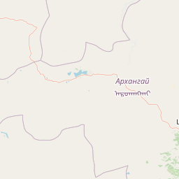
Map view of Khorgo-Terkhiin Tsagaan Nuur National Park

Use this park location map to pinpoint Khorgo-Terkhiin Tsagaan Nuur National Park in Mongolia, understand its exact geographic position, and read its mapped placement within the surrounding landscape more clearly.

Pigeon | © OpenStreetMap contributors

Location context for Khorgo-Terkhiin Tsagaan Nuur National Park

Arkhangai Province
Park atlas

Compare adjacent protected landscapes and trace the geographic spread of conservation areas within Mongolia's Khangai Mountains.

Explore Other National Parks and Protected Areas Near Khorgo-Terkhiin Tsagaan Nuur National Park
Browse national parks and protected areas near Khorgo-Terkhiin Tsagaan Nuur National Park, enabling direct comparison of their diverse volcanic landscapes, mountain lakes, and critical wetland ecosystems. Examine the regional distribution of protected landscapes across Central Mongolia, understanding their distinct geographical context within the Khangai Mountains.
National parkMongolia

Khangai Nuruu National Park: Discover Mongolia's Protected Mountain Landscape and Atlas Context

Explore mapped boundaries and diverse ecosystems across its terrain.

Khangai Nuruu National Park stands as a vast national park in central Mongolia, characterized by its diverse protected landscapes and significant geographic scope. Spanning the Khangai Mountains, it presents a remarkable ecological transition from alpine meadows and taiga forests to steppe and riparian environments. This park offers a rich atlas exploration opportunity, highlighting its mapped boundaries and the unique regional geography that defines its protected status, making it a key point of discovery for understanding Mongolian conservation areas.

Area
8,885 km²
Established
1996
IUCN
II
Relief
Mountain
National parkZavkhan Province

Tarvagatai Nuruu National Park: Zavkhan Province Protected Landscape Atlas

Unique steppe-to-forest transition and mountainous terrain.

Tarvagatai Nuruu National Park represents a critical protected area within Mongolia's Zavkhan Province, noted for its expansive mountainous terrain and significant ecological diversity. The park's landscape is defined by the Tarvagatai Range, featuring flat-topped ridges, glacial valleys, and dramatic elevation changes. It masterfully showcases the transition from semi-arid steppe to dense coniferous forests, highlighting a visually striking ecological boundary anchored by the prominence of Mount Otgontenger, the highest peak in the Khangai Mountains.

Area
5,467 km²
Established
2000
IUCN
II
Relief
Mountain
National parkMongolia

Khogno Khan National Park: A National Park with Distinct Mongolian Landscape Identity

Explore its mapped terrain and regional geographic context.

Khogno Khan National Park is a designated national park offering a specific focus for protected landscape discovery. Users can explore its geographic placement within Mongolia and understand its role as a mapped natural area. The park's identity as a protected territory provides critical context for those interested in the atlas of East Asian landscapes and regional geography, highlighting a distinct area for geographic study.

Area
841 km²
Established
2003
IUCN
II
Relief
Mountain
National parkZavkhan Province

Ulaagchinii Khar Nuur National Park: Protected National Park in Zavkhan Province

Mapped landscape context and regional geographic setting.

As a dedicated national park, Ulaagchinii Khar Nuur National Park serves as a key protected area within Zavkhan Province. This detail page provides an atlas-oriented view of its mapped boundaries and its role in the regional geography of western Mongolia. Understand the park's specific protected landscape characteristics and its contribution to the mapped natural terrain of the Khangai Mountain region.

Area
2,594 km²
Established
2010
IUCN
II
Relief
Mixed relief
National parkMongolia

Ikh Bogd Uul National Park: Explore Mongolia's Protected Landscape and Geography

Discover mapped terrain and protected area context.

Ikh Bogd Uul National Park offers a unique window into Mongolia's protected landscapes. This page delves into the park's specific geographic setting, its mapped boundaries, and its character as a national park. Users can explore the foundational data for understanding its natural terrain and its role within the country's conservation atlas, providing a concrete basis for geographic discovery and appreciating the scope of protected areas in the region.

Area
2,629 km²
Established
2008
IUCN
II
Relief
Mountain
National parkUvs Province

Khan-Khokhi Khyargas Mountain National Park: Mapped Boundaries and Protected Landscape

Uvs Province National Park Geography

Khan-Khokhi Khyargas Mountain National Park is a designated national park offering critical insights into Mongolia's protected natural landscapes. This entry supports structured geographic discovery, detailing the park's mapped boundaries and its environmental context within Uvs Province. Engage with the park's identity as a protected area, uncovering its role in the regional atlas and its unique contribution to the mapped terrain.

Area
3,413 km²
Established
2000
IUCN
II
Relief
Mountain
National parkBuryatia

Tunkinsky National Park National Park: Protected Landscape and Geographic Context in Buryatia

Discover mapped park boundaries and regional terrain.

Delve into Tunkinsky National Park, a significant protected national park situated in the Buryatia region of Russia. This detail page provides a geographic overview, highlighting the park's mapped boundaries and its place within the surrounding natural landscape. Understand its designation as a protected area, offering a focused entry point for atlas-based discovery of its specific terrain and regional importance.

Area
11,837 km²
IUCN
II
Relief
Mountain
Climate
Boreal
National parkÖmnögovi Province

Gobi Gurvansaikhan National Park: National Park Protected Landscape and Geographic Atlas

Mapped terrain and regional geography of this Mongolian protected area.

Navigate the atlas-focused details of Gobi Gurvansaikhan National Park, a key protected area situated in Ömnögovi Province. This entry provides essential geographic context, detailing the park's mapped boundaries and its role within the regional landscape. Understand the distinct terrain and environmental geography that define this Mongolian national park, offering a structured foundation for atlas-based discovery and learning about conservation landscapes.

Area
27,000 km²
Established
1993
IUCN
II
Relief
Mountain

Common questions about visiting, size, designation, and location context for Khorgo-Terkhiin Tsagaan Nuur National Park

Khorgo-Terkhiin Tsagaan Nuur National Park FAQs for park facts, access, geography, and protected area context
Find quick answers about Khorgo-Terkhiin Tsagaan Nuur National Park, including protected-area facts, park geography, trail and visitor context, and how the park fits into its surrounding country and regional landscape.
MoriAtlas Explorer

Continue Your Protected Areas Search Across the Global Atlas

Deepen your exploration by continuing the structured search for national parks and protected areas worldwide. Utilize the comprehensive filtering capabilities to compare different conservation landscapes and refine your understanding of global park geography. Discover more about the distribution and characteristics of protected natural areas.

Global natural geography
Khorgo-Terkhiin Tsagaan Nuur National Park: Mongolia Protected Area Atlas