

Mori Atlas logo
National parkIkh Bogd Uul National Park

Discover the geographic context and mapped boundaries of this significant national park.

Ikh Bogd Uul National Park: Mongolia's Protected Landscape and Mapped Terrain

Ikh Bogd Uul National Park represents a significant protected area within Mongolia's expansive geography. This page provides detailed information for understanding the park's specific mapped landscape, its protected boundaries, and its place within the broader regional context. Explore the unique terrain and natural features that define this national park, essential for anyone researching Mongolia's protected lands and atlas-driven geographic discovery.

Alpine EnvironmentsMountain National ParksMongolia Protected AreasAltai MountainsMontane SteppeWildlife Conservation

Ikh Bogd Uul National Park

National park

Park overview

Structured park overview, official facts, and landscape profile for Ikh Bogd Uul National Park

Ikh Bogd Uul National Park park facts, protected area profile, and essential visitor context
Review the core facts for Ikh Bogd Uul National Park, including designation, size, terrain, visitor scale, habitats, and operating context in one park-focused overview.

About Ikh Bogd Uul National Park

Ikh Bogd Uul National Park represents a crucial protected landscape in Mongolia's southern mountain systems, established to conserve the unique alpine environments of the Altai-Gobi Mountains. The park's core identity derives from Ikh Bogd itself, a mountain of considerable spiritual and ecological significance whose name translates as Great Saint, reflecting its prominence in the regional landscape. The protected area creates a vital ecological corridor connecting high-altitude alpine zones with the surrounding steppe and desert environments that characterize much of southwestern Mongolia. This altitudinal gradient supports a diverse range of habitats, from semi-arid plains through montane meadows to the windswept alpine plateau above. The establishment in 2008 reflected growing recognition within Mongolia of the need to protect these montane ecosystems and the species they support, particularly in light of increasing pressures from climate change and pastoral activity across the broader Gobi region.

Quick facts and research context for Ikh Bogd Uul National Park

Ikh Bogd Uul National Park occupies 2,629 square kilometers in the Bayankhongor aimag of southern Mongolia, protecting the highest peaks of the Altai-Gobi Mountains. The park was established in 2008 under IUCN category II. The terrain is characterized by a flat plateau ridgeline culminating in Tergun-Bogd, the principal summit. Cold semi-arid climate prevails, with montane steppe and subalpine meadows dominating middle elevations while the highest terrain is essentially bare. The area supports around 500 vascular plant species and serves as important habitat for steppe bird species and threatened mammals like the argali and Pallas's cat.

Park context

Deeper park guide and search-rich context for Ikh Bogd Uul National Park

Ikh Bogd Uul National Park history, landscape, wildlife, and travel context
Explore Ikh Bogd Uul National Park through its history, landscape character, ecosystems, wildlife, conservation priorities, cultural context, and seasonal travel timing in a structured park guide built for atlas discovery and search intent.

Why Ikh Bogd Uul National Park stands out

Ikh Bogd Uul is most prominently known for harboring the highest mountain in the Altai-Gobi range, creating a dramatic alpine environment within Mongolia's generally arid southwestern landscape. The park protects critical habitat for the near-threatened argali, one of the world's largest wild sheep species, as well as the elusive Pallas's cat, a small feline with a remarkably wide but scattered distribution across Central Asian steppe and montane zones. The combination of high-altitude alpine meadows, montane steppe, and the presence of rare species makes this park a significant conservation area within Mongolia's protected area network.

Ikh Bogd Uul National Park history and protected-area timeline

Ikh Bogd Uul National Park was formally established in 2008 as part of Mongolia's expanding protected areas network during a period of significant investment in nature conservation. The creation of the park responded to growing concerns about the conservation status of Mongolia's mountain ecosystems and the species that depend on them, particularly the argali populations that had experienced declining numbers across their range. The park came under the management authority of Mongolia's Ministry of Environment and Green Development, which administers the nation's system of protected areas. The designation reflected scientific assessments identifying the Altai-Gobi Mountains as an important biogeographic zone supporting species found nowhere else in Mongolia, with the high peaks representing critical habitat for species with limited distribution in the country.

Ikh Bogd Uul National Park landscape and geographic character

The landscape of Ikh Bogd Uul National Park is defined by the distinctive geology and topography of the Altai-Gobi Mountains, which extend southeastward from the greater Altai range into Mongolia as a chain of thin, elevated ridges. The Ikh Bogd ridge itself is capped by a remarkably flat plateau, atop which rises Tergun-Bogd, the highest point at 3,957 meters above sea level. This alpine terrain creates a stark visual contrast with the vast semi-arid deserts and steppes that extend to both the north and south of the mountain mass. The middle and upper elevations feature rocky outcrops, alpine meadows, and montane steppe vegetation, while the highest portions of the plateau are essentially devoid of vegetation, exposed to the harsh conditions of true alpine environments. The visual drama of the landscape is enhanced by the mountain's isolation, standing as a dramatic sentinel above the surrounding Gobi terrain.

Ikh Bogd Uul National Park ecosystems, habitats, and plant life

The ecological character of Ikh Bogd Uul National Park reflects its position at the intersection of multiple habitat types, creating a montane environment distinct from the surrounding arid lowlands. Middle and high elevations support a mosaic of alpine meadows and montane steppe, with vegetation adapted to the cold semi-arid climate and relatively thin soils of the mountain slopes. As of 2007, scientific surveys had documented approximately 500 species of vascular plants representing 218 genera and 51 families within the park boundaries. This botanical diversity supports the broader ecosystem function of the area, providing the foundation for the wildlife communities that inhabit the park. The transition from desert and steppe environments at lower elevations to true alpine conditions at higher elevations creates a vertically stratified habitat system that supports diverse species assemblages across relatively short geographic distances.

Ikh Bogd Uul National Park wildlife and species highlights

Ikh Bogd Uul National Park provides crucial habitat for several notable species, most prominently the argali, a large wild sheep species classified as near-threatened and representing one of the largest members of the genus Ovis. The park also supports populations of Pallas's cat, a small and secretive feline species that, despite its relatively wide distribution across Central Asia, remains elusive and poorly understood in many parts of its range. The area holds particular significance for birdlife, serving as an important site for Eurasian steppe bird species including the vulnerable white-throated bush chat, Henderson's ground jay, and the Altai snowcock. This avifaunal community reflects the park's position at the boundary between steppe and alpine environments, supporting species with different habitat requirements within the protected area.

Ikh Bogd Uul National Park conservation status and protection priorities

The establishment of Ikh Bogd Uul National Park reflects recognition of the area's conservation significance within Mongolia's protected areas framework. The park protects critical habitat for species of conservation concern, including the near-threatened argali and the specialized avifauna of the steppe and alpine zones. The protected area status helps buffer these species from pressures associated with pastoral activity and other land uses that affect much of the surrounding Gobi region. The park's inclusion in Mongolia's national park system under IUCN category II indicates management objectives focused on both ecosystem conservation and the maintenance of natural processes, while allowing for sustainable use where appropriate. The cold semi-arid climate and the complexity of habitats from desert to alpine create a conservation environment that requires ongoing attention to the ecological transitions that characterize this mountain system.

Ikh Bogd Uul National Park cultural meaning and human context

The name Ikh Bogd, translating as Great Saint, reflects the cultural significance of this mountain within the traditional landscape of the region. The Altai Mountains hold deep cultural meaning for Mongolian communities, and prominent peaks like Ikh Bogd have historically served as landmarks and spiritual sites within the broader cultural geography of the area. The park lies within the Bayankhongor aimag, a region historically associated with pastoralnomadic communities whose relationship with the mountain landscape spans generations. While the park itself is managed primarily for conservation purposes, this cultural context provides important background for understanding the landscape's significance beyond its ecological values.

Top sights and standout views in Ikh Bogd Uul National Park

The park's defining highlight remains the Ikh Bogd mountain itself, the highest peak in the Altai-Gobi range, offering a dramatic alpine landscape unlike any other in Mongolia's southwesternProtected Areas. The presence of argali and Pallas's cat provides exceptional wildlife viewing opportunities for patient observers, while the birdlife including Altai snowcock and Henderson's ground jay offers particular interest for ornithologists. The transition from semi-arid desert through montane steppe to alpine meadow creates remarkable ecological diversity within a relatively compact protected area, making the park an excellent destination for understanding Mongolia's montane ecosystems.

Best time to visit Ikh Bogd Uul National Park

The most favorable period for visiting Ikh Bogd Uul National Park typically spans the summer months from June through August, when temperatures are warmest and the high-altitude environments are most accessible. During this period, the alpine meadows are in flower and wildlife activity is at its peak, though visitors should be prepared for rapid weather changes characteristic of mountain environments. Spring and autumn offer different experiences, with spring bringing green-up across the lower elevations and autumn potentially offering clearer skies and fewer visitors. Winter visits are challenging due to harsh conditions at altitude, though the stark beauty of the snow-covered landscape may appeal to experienced winter travelers.
Park location guide

Geography guide, regional context, and park location map for Ikh Bogd Uul National Park

Ikh Bogd Uul National Park park geography, regions, and map view in Mongolia
Understand where Ikh Bogd Uul National Park sits in Mongolia through a broader geographic reading of the surrounding landscape, nearby location context, and its mapped position within the national park landscape.

How Ikh Bogd Uul National Park fits into Mongolia

Mongolia is a landlocked sovereign state in East Asia, known for its vast steppe landscapes, nomadic culture, and historical significance as the heartland of the Mongol Empire founded by Genghis Khan in 1206. The country has a population of approximately 3.5 million people and is the world's most sparsely populated sovereign state. Ulaanbaatar is the capital and largest city, home to roughly half the population.

Wider geography shaping Ikh Bogd Uul National Park in Mongolia

Mongolia is located in East Asia, landlocked between Russia to the north and China to the south. The country occupies the Mongolian Plateau and features diverse terrain including grassy steppe, mountains in the north and west, and the Gobi Desert in the south. It covers 1,564,116 km2, making it the second largest landlocked country in the world.

Map view of Ikh Bogd Uul National Park

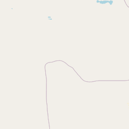
Use this park location map to pinpoint Ikh Bogd Uul National Park in Mongolia, understand its exact geographic position, and read its mapped placement within the surrounding landscape more clearly.

Pigeon | © OpenStreetMap contributors
Park atlas

Compare Ikh Bogd Uul's Unique Alpine Setting with Related Protected Areas Across Mongolia's Regional Geography

Explore Other Nearby Protected Areas Around Ikh Bogd Uul National Park, Mongolia
Browse other national parks and protected areas near Ikh Bogd Uul National Park, discovering the varied montane and semi-arid landscapes of southern Mongolia. This allows for detailed geographic comparison, revealing how protected areas preserve distinct ecosystems within the Altai-Gobi mountain range and surrounding Gobi terrain.
National parkÖmnögovi Province

Gobi Gurvansaikhan National Park: National Park Protected Landscape and Geographic Atlas

Mapped terrain and regional geography of this Mongolian protected area.

Navigate the atlas-focused details of Gobi Gurvansaikhan National Park, a key protected area situated in Ömnögovi Province. This entry provides essential geographic context, detailing the park's mapped boundaries and its role within the regional landscape. Understand the distinct terrain and environmental geography that define this Mongolian national park, offering a structured foundation for atlas-based discovery and learning about conservation landscapes.

Area
27,000 km²
Established
1993
IUCN
II
Relief
Mountain
National parkMongolia

Khangai Nuruu National Park: Discover Mongolia's Protected Mountain Landscape and Atlas Context

Explore mapped boundaries and diverse ecosystems across its terrain.

Khangai Nuruu National Park stands as a vast national park in central Mongolia, characterized by its diverse protected landscapes and significant geographic scope. Spanning the Khangai Mountains, it presents a remarkable ecological transition from alpine meadows and taiga forests to steppe and riparian environments. This park offers a rich atlas exploration opportunity, highlighting its mapped boundaries and the unique regional geography that defines its protected status, making it a key point of discovery for understanding Mongolian conservation areas.

Area
8,885 km²
Established
1996
IUCN
II
Relief
Mountain
National parkMongolia

Khorgo-Terkhiin Tsagaan Nuur National Park: Mongolian National Park Protected Landscape Atlas

Mapped geographic context and protected land identity in Mongolia.

Khorgo-Terkhiin Tsagaan Nuur National Park is a designated national park in Mongolia, offering a valuable component of the country's protected lands. This detailed entry focuses on its geographic position and mapped boundaries, providing essential context for understanding its unique landscape within the vast Mongolian plateau. Explore the protected area's distinct identity and its contribution to the regional natural geography, fostering a deeper appreciation for the mapped terrain.

Area
8 km²
Established
1965
IUCN
II
Relief
Mountain
National parkMongolia

Khogno Khan National Park: A National Park with Distinct Mongolian Landscape Identity

Explore its mapped terrain and regional geographic context.

Khogno Khan National Park is a designated national park offering a specific focus for protected landscape discovery. Users can explore its geographic placement within Mongolia and understand its role as a mapped natural area. The park's identity as a protected territory provides critical context for those interested in the atlas of East Asian landscapes and regional geography, highlighting a distinct area for geographic study.

Area
841 km²
Established
2003
IUCN
II
Relief
Mountain
National parkZavkhan Province

Tarvagatai Nuruu National Park: Zavkhan Province Protected Landscape Atlas

Unique steppe-to-forest transition and mountainous terrain.

Tarvagatai Nuruu National Park represents a critical protected area within Mongolia's Zavkhan Province, noted for its expansive mountainous terrain and significant ecological diversity. The park's landscape is defined by the Tarvagatai Range, featuring flat-topped ridges, glacial valleys, and dramatic elevation changes. It masterfully showcases the transition from semi-arid steppe to dense coniferous forests, highlighting a visually striking ecological boundary anchored by the prominence of Mount Otgontenger, the highest peak in the Khangai Mountains.

Area
5,467 km²
Established
2000
IUCN
II
Relief
Mountain
National parkZavkhan Province

Ulaagchinii Khar Nuur National Park: Protected National Park in Zavkhan Province

Mapped landscape context and regional geographic setting.

As a dedicated national park, Ulaagchinii Khar Nuur National Park serves as a key protected area within Zavkhan Province. This detail page provides an atlas-oriented view of its mapped boundaries and its role in the regional geography of western Mongolia. Understand the park's specific protected landscape characteristics and its contribution to the mapped natural terrain of the Khangai Mountain region.

Area
2,594 km²
Established
2010
IUCN
II
Relief
Mixed relief
National parkBayan-Ölgii Province

Munkhkhairkhan National Park: Alpine Glacial Landscape & Protected Area

Explore the mapped geography of western Mongolia's high peaks.

Munkhkhairkhan National Park protects the dramatic alpine environment surrounding Mönkhkhairkhan Mountain, Mongolia's second-highest peak. This national park showcases spectacular glacial valleys and steep, rock-strewn slopes characteristic of the Mongol-Altai Mountains. As a key protected landscape in Bayan-Ölgii Province, it offers a distinct view into Mongolia's high-elevation ecosystems and their unique mapped boundaries for atlas exploration.

Area
5,061 km²
Established
2011
IUCN
II
Relief
Mountain
National parkUvs Province

Khan-Khokhi Khyargas Mountain National Park: Mapped Boundaries and Protected Landscape

Uvs Province National Park Geography

Khan-Khokhi Khyargas Mountain National Park is a designated national park offering critical insights into Mongolia's protected natural landscapes. This entry supports structured geographic discovery, detailing the park's mapped boundaries and its environmental context within Uvs Province. Engage with the park's identity as a protected area, uncovering its role in the regional atlas and its unique contribution to the mapped terrain.

Area
3,413 km²
Established
2000
IUCN
II
Relief
Mountain

Common questions about visiting, size, designation, and location context for Ikh Bogd Uul National Park

Ikh Bogd Uul National Park FAQs for park facts, access, geography, and protected area context
Find quick answers about Ikh Bogd Uul National Park, including protected-area facts, park geography, trail and visitor context, and how the park fits into its surrounding country and regional landscape.
MoriAtlas Explorer

Continue Your Protected Areas Search Across the Global Atlas

Deepen your exploration by continuing the structured search for national parks and protected areas worldwide. Utilize the comprehensive filtering capabilities to compare different conservation landscapes and refine your understanding of global park geography. Discover more about the distribution and characteristics of protected natural areas.

Global natural geography