Mori Atlas logo
National parkYellowstone National Park

Discover the mapped boundaries and regional natural landscape context of this key US protected area.

Yellowstone National Park: National Park Protected Landscape & Geographic Atlas

Yellowstone National Park stands as a significant protected area, offering a unique window into the natural geography and landscape of Wyoming. As a designated US national park, its vast protected boundaries and distinct terrain are central to understanding regional geographic patterns. This page serves as an atlas-focused entry point, detailing the park's spatial identity and its significance within the broader context of North American protected lands.

geothermal featuressupervolcanonational parkNorth Americabison herdwolf reintroduction

Yellowstone National Park

National park

Park overview

Structured park overview, official facts, and landscape profile for Yellowstone National Park

Yellowstone National Park park facts, protected area profile, and essential visitor context

Review the core facts for Yellowstone National Park, including designation, size, terrain, visitor scale, habitats, and operating context in one park-focused overview.

About Yellowstone National Park

Yellowstone National Park represents a landmark in global conservation history as the world's first national park, established in 1872 through the Yellowstone National Park Protection Act signed by President Ulysses S. Grant. The park's creation established a revolutionary concept: setting aside natural landscapes for public benefit and enjoyment rather than private exploitation. This pioneering idea influenced protected area movements worldwide and established the model for the modern national park system. The park's significance extends far beyond its historical first status. Its volcanic geology creates a landscape of extraordinary dynamic processes, with ongoing hydrothermal activity powered by the massive magma chamber beneath the Yellowstone Plateau. The geothermal areas, particularly the Upper Geyser Basin with Old Faithful and the Norris Geyser Basin, attract millions of visitors who witness the powerful demonstrations of Earth's internal heat. The park also holds immense ecological value as the core of the Greater Yellowstone Ecosystem, a 20-million-acre region that represents the largest intact ecosystem in the northern temperate zone. This ecosystem supports remarkable biodiversity and serves as a model for large-landscape conservation. Yellowstone's management history reflects evolving approaches to conservation, from early challenges with poaching and resource exploitation through military administration to the establishment of the National Park Service in 1917 and the sophisticated ecological management practices of today.

Quick facts and research context for Yellowstone National Park

Yellowstone National Park occupies roughly 2.2 million acres spanning Wyoming, Montana, and Idaho. The park sits at an average elevation of 8,000 feet above sea level on the Yellowstone Plateau, surrounded by mountain ranges including the Gallatin, Absaroka, and Teton ranges. Yellowstone Lake, covering 87,040 acres, is the largest high-elevation lake in North America at 7,733 feet. The park contains more than 10,000 geothermal features, including over 1,000 geysers, representing more than two-thirds of the world's geysers. Approximately 80% of the park is forested, predominantly with lodgepole pine, while 5% is covered by rivers and lakes. The Continental Divide of North America runs diagonally through the southwestern part of the park.

Protection and recognition

Mapping the terrestrial scope, historic designation records, and international recognition frameworks.

Yellowstone National Park Protected Area Designation and UNESCO World Heritage Status

Researchers can examine the terrestrial protection status and historical establishment records of Yellowstone National Park, which was formally designated in 1978. Accessing verified datasets, including the official UNESCO World Heritage status, provides essential geographic context for analyzing North American protected areas.

International recognition

Protection details

Protection scope
Terrestrial
Designated year
1978
Transboundary protection
No
Park context

Deeper park guide and search-rich context for Yellowstone National Park

Yellowstone National Park history, landscape, wildlife, and travel context

Explore Yellowstone National Park through its history, landscape character, ecosystems, wildlife, conservation priorities, cultural context, and seasonal travel timing in a structured park guide built for atlas discovery and search intent.

Why Yellowstone National Park stands out

Yellowstone is best known for its unparalleled geothermal wonders. The park contains the world's largest concentration of active geysers, with Old Faithful being the most famous, erupting approximately every 90 minutes. The Yellowstone Caldera, a massive supervolcano, dominates the park's geology and fuels the hydrothermal system that creates geysers, hot springs, mudpots, and fumaroles. The park is also famous for its remarkable wildlife viewing opportunities, featuring the largest public bison herd in the United States, healthy populations of grizzly bears and gray wolves following successful reintroduction, and abundant elk herds. The Grand Canyon of the Yellowstone, with its colorful walls carved by the Yellowstone River, provides another iconic landscape. The combination of volcanic forces, thermal features, and abundant wildlife makes Yellowstone one of the most distinctive and biologically significant protected areas in the world.

Yellowstone National Park history and protected-area timeline

The human history of Yellowstone spans at least 11,000 years, with Native Americans including the Bannock, Shoshone, Nez Perce, Blackfeet, Crow, Salish, and Kootenai tribes using the region for hunting and fishing. Paleolithic Clovis culture peoples left evidence of their presence through obsidian tools found in the region, with obsidian from Yellowstone traded across great distances. European-American exploration began in the early 19th century when John Colter, a member of the Lewis and Clark Expedition, passed through the area in 1807-1808 and described geothermal features that were dismissed as myth. Over the following decades, reports from mountain men like Jim Bridger told of boiling mud and steaming rivers, but these were largely ignored. The first detailed scientific expeditions in the late 1860s and early 1870s, including the Cook-Folsom-Peterson Expedition and the Hayden Geological Survey of 1871, provided comprehensive documentation that convinced Congress to establish the park. The Act of Dedication signed in 1872 reserved the land as a public park for the benefit and enjoyment of the people. Early management proved challenging, with Nathaniel Langford serving as the first superintendent without salary or staff, leaving the park vulnerable to poaching and exploitation. The U.S. Army assumed management in 1886, constructing Fort Yellowstone and implementing protections that allowed wildlife populations to recover. In 1917, administration transferred to the newly created National Park Service, which adopted many of the Army's management principles. The park's history includes significant events like the 1988 fires that burned one-third of the park, the reintroduction of wolves in the 1990s, and ongoing conservation efforts balancing visitor access with ecological preservation.

Yellowstone National Park landscape and geographic character

Yellowstone National Park occupies a roughly square parcel of volcanic complex that sits primarily in northwestern Wyoming, with approximately 96% within Wyoming, 3% in Montana, and 1% in Idaho. The park spans 63 miles north to south and 54 miles west to east, covering 2.2 million acres, an area larger than Rhode Island or Delaware. The park sits on the Yellowstone Plateau at an average elevation of 8,000 feet, bounded by mountain ranges of the Middle Rockies including the Gallatin Range to the northwest, the Beartooth Mountains in the north, the Absaroka Range to the east, the Teton Range to the south, and the Madison Range to the west. Eagle Peak rises to 11,358 feet as the park's highest point, while Reese Creek at 5,282 feet marks the lowest elevation. The landscape features three deep canyons carved through volcanic tuff by rivers over the last 640,000 years, most notably the Grand Canyon of the Yellowstone with its colorful walls. Yellowstone Lake covers 87,040 acres at 7,733 feet elevation, making it the largest high-elevation lake in North America, with depths reaching 400 feet and 110 miles of shoreline. The park contains 290 waterfalls of at least 15 feet, with the Lower Falls of the Yellowstone River at 308 feet being the tallest. Forests of lodgepole pine cover approximately 80% of the land area, with the remaining areas consisting primarily of grassland.

Yellowstone National Park ecosystems, habitats, and plant life

Yellowstone National Park is part of the South Central Rockies forests ecoregion, with subalpine forest being the most abundant biome. The park supports over 69,000 species of native vascular plants, with lodgepole pine forests dominating 80% of forested areas. Other conifers including subalpine fir, Engelmann spruce, Rocky Mountain Douglas-fir, and whitebark pine occur in scattered groves throughout the park. Deciduous species like quaking aspen and willows are common in riparian areas and meadows. The park contains one of the world's largest petrified forests, with ancient trees buried by volcanic ash and gradually replaced by minerals. The geothermal areas support unique microbial life, including extremophile bacteria like Thermus aquaticus, discovered in Yellowstone hot springs and crucial for developing DNA replication technology through Taq polymerase. The park's position on the Snake River Plain and at the confluence of three major mountain ranges creates diverse habitats from subalpine forests to grasslands to aquatic environments. The Greater Yellowstone Ecosystem, which the park anchors, represents the largest remaining nearly intact ecosystem in the Earth's northern temperate zone.

Yellowstone National Park wildlife and species highlights

Yellowstone is widely considered the finest megafauna habitat in the lower 48 states, with approximately 60 species of mammals documented. The park contains all three of North America's large canids: gray wolves, coyotes, and foxes, with the reintroduced wolf population now stable at approximately 108 individuals in 9 packs. Both black bears and grizzly bears thrive in the park, with an estimated 700 grizzly bears in the Greater Yellowstone Ecosystem. The Yellowstone bison herd, the largest public herd in the United States, numbers approximately 6,000 individuals, representing one of the last remaining wild bison populations. Elk populations exceed 30,000, representing the largest population of any large mammal species in the park and undertaking the largest mammalian migration in the continental United States. Other species include moose, mule deer, white-tailed deer, mountain goats, pronghorn, and bighorn sheep. The park supports 311 species of birds, including 26 nesting pairs of bald eagles documented in 1999, as well as rare species like whooping cranes, trumpeter swans, and peregrine falcons. Eighteen species of fish inhabit Yellowstone waters, with the Yellowstone cutthroat trout being highly significant. Reptiles include seven species and amphibians four species.

Yellowstone National Park conservation status and protection priorities

Yellowstone was designated as a UNESCO World Heritage Site in 1978 and an International Biosphere Reserve in 1976, reflecting its global significance. The park was placed on the List of World Heritage in Danger from 1995 to 2003 due to impacts from tourism, wildlife disease, and invasive species. The park faces ongoing conservation challenges, including the threat of invasive lake trout in Yellowstone Lake that prey on native cutthroat trout, and the spread of non-native plant species in high-visitation areas. The successful wolf reintroduction program, completed in the 1990s, represents one of the most significant conservation victories, with the wolf population stabil at approximately 108 individuals across 9 packs. The reintroduction has had profound ecological effects, influencing elk behavior and allowing aspen forest recovery. The 1988 fires, which burned over one-third of the park, prompted major changes in fire management policy, leading to the current approach of evaluating natural fires for ecological benefit. The park continues to manage the challenge of maintaining viable wildlife populations while accommodating millions of annual visitors and addressing issues like brucellosis in bison and elk. The Greater Yellowstone Ecosystem management approach emphasizes landscape-level conservation beyond park boundaries.

Yellowstone National Park cultural meaning and human context

The Yellowstone region has been home to Native American peoples for at least 11,000 years, with tribes including the Bannock, Shoshone, Nez Perce, Blackfeet, Crow, Salish, and Kootenai utilizing the area for hunting, fishing, and gathering. The Sheepeaters, a band of Eastern Shoshone, were the only year-round residents before the park's establishment, though they were effectively excluded during the 1870s and 1880s following treaty negotiations. The Nez Perce band's flight through the park in 1877 during their retreat from the U.S. Army, including a brief encounter with tourists and the naming of Nez Perce Creek, represents a significant historical episode. The park contains over 1,000 documented archaeological sites and 1,106 historic structures, including National Historic Landmarks like Obsidian Cliff and several buildings. The Heritage and Research Center in Gardiner, Montana houses the park's museum collection, archives, research library, and archaeology laboratory. Yellowstone's establishment reflected broader 19th-century ideas about preserving natural wonders for public benefit, influenced by romantic notions of nature and emerging conservation philosophy. The park contains structures representing various eras of American park management, from early rustic architecture to Mission 66 modernism.

Top sights and standout views in Yellowstone National Park

Yellowstone National Park offers an unparalleled combination of geological wonders, ecological diversity, and historical significance that makes it one of the world's most remarkable protected areas. The hydrothermal features, including Old Faithful and the Grand Prismatic Spring, demonstrate Earth's powerful internal forces in visually spectacular displays. The wildlife viewing opportunities, particularly the large mammals like bison, elk, bears, and wolves, provide encounters with North America's iconic fauna. The landscape diversity, from the colorful depths of the Grand Canyon of the Yellowstone to the vast expanse of Yellowstone Lake beneath caldera rims, creates endless photographic opportunities. The park's status as the world's first national park adds historical resonance to every visit. The successful recovery of wolves and the ecological changes they have induced represent a living demonstration of conservation principles in action. The petrified forests and volcanic formations tell a story of geological processes spanning millions of years. Whether exploring the backcountry, observing wildlife from the Lamar Valley, watching geysers erupt, or simply experiencing the vast silence of this remarkable landscape, Yellowstone offers experiences that define the American national park ideal.

Best time to visit Yellowstone National Park

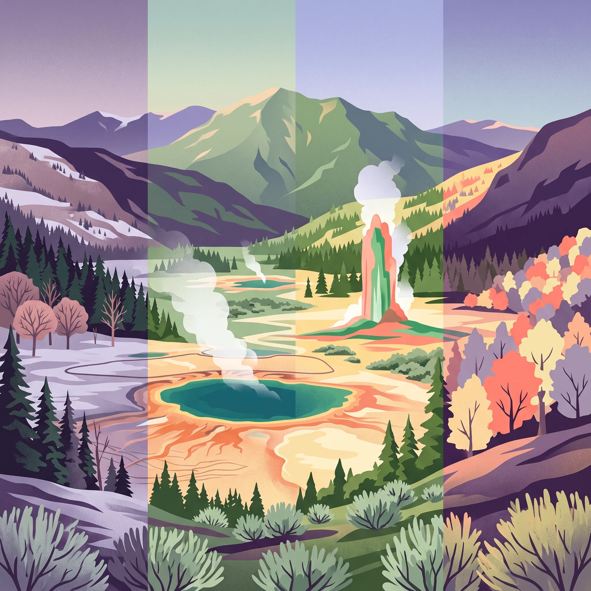
Yellowstone can be visited year-round, though each season offers distinctly different experiences. Summer, from June through September, brings the highest visitation and the warmest temperatures, with daytime highs in the 70s Fahrenheit and excellent access to all areas of the park. This is the prime season for wildlife viewing, with animals active in the mornings and evenings, and for exploring the backcountry. However, summer also brings crowds, with July being the busiest month, and traffic jams both from visitors and road construction are common. Fall brings fewer visitors and the possibility of seeing elk rutting season, but some facilities begin closing and winter approach brings uncertainty. Winter transforms the park into a quiet wonderland, with snow-covered landscapes and geysers steaming in the cold air, though access is limited to the road from Gardiner to Cooke City and most areas require guided snowmobile or snow coach tours. Spring, particularly May and June, offers a transitional experience with wildlife giving birth, lower crowds, and wildflowers blooming, though some roads remain closed until mid-May. The shoulder seasons of May and September often provide the best balance of accessibility, wildlife viewing opportunities, and fewer crowds.
Park guides

Addressing key questions about timing and seasonal entry across the plateau.

Geographic Planning Guides for Yellowstone National Park

Navigating a massive volcanic landscape requires structured geographic insights to help clarify seasonal dynamics. Dedicated resources clarify visit planning to help determine the best time to visit for optimal wildlife viewing and road access.
When to Visit Yellowstone National Park: Seasonal Guide for Planning Your Trip
Visit Planning

When to Visit Yellowstone National Park: Seasonal Guide for Planning Your Trip

Determine your travel timing based on weather, geothermal access, wildlife patterns, and historical climate trends across the Yellowstone ecosystem.

Planning a trip to Yellowstone requires navigating the distinct environmental demands of a high-altitude, volcanic landscape where weather remains a primary factor in access and daily operations. This guide interprets long-term climate normals and seasonal ecosystem shifts to help visitors match their specific goals—such as peak wildlife activity, geothermal sightseeing, or backcountry hiking—with the corresponding, evidence-based periods of the year. By understanding the transition from the harsh, snow-bound winter months to the accessible yet short summer window, travelers can make informed decisions about when to encounter the diverse conditions within this vast protected area. Because the park spans high-elevation volcanic terrain, visitors should expect significant shifts in temperature, daylight hours, and precipitation between months. This record uses historical climate data to outline typical patterns, yet acknowledges that actual road closures, permit requirements, and service availability are subject to annual changes and weather-related events. Readers must verify current operational statuses with the National Park Service before finalizing their travel dates to ensure that their chosen itinerary aligns with actual conditions at the time of arrival.

Best Time to Visit
Monthly climate preview

Long term temperature trends and monthly precipitation averages across Wyoming terrain

Yellowstone National Park Monthly Climate Normals and Weather Averages

Decades of climate data from a representative elevation of 2437 meters reveal sharp thermal swings, from freezing winter conditions to warm summer days with varying daily precipitation. Exploring the full monthly averages provides a structured view of seasonal transitions and long term temperature ranges across the year.
Annual mean0 °C
-12 °C14 °C
Jan-12°
Feb-11°
Mar-7°
Apr-3°
May
Jun
Jul14°
Aug14°
Sep
Oct
Nov-7°
Dec-12°
Warmest month
July

14.5 °C

Coolest month
December

-12.2 °C

Wettest month
December

2.9 mm/day

Driest month
August

1.3 mm/day

Park location guide

Geography guide, regional context, and park location map for Yellowstone National Park

Yellowstone National Park park geography, regions, and map view in United States of America

Understand where Yellowstone National Park sits in United States of America through a broader geographic reading of the surrounding landscape, nearby location context, and its mapped position within the national park landscape.

How Yellowstone National Park fits into United States of America

The United States of America is a federal presidential republic and one of the world's largest countries by area and population. It consists of 50 states across a vast territory spanning multiple time zones, with its capital in Washington, D.C. and largest city in New York City. The nation has a diverse economy, influential political system, and significant cultural and military presence globally.

Wider geography shaping Yellowstone National Park in United States of America

The United States occupies a vast territory in North America, bordered by Canada to the north and Mexico to the south. The 48 contiguous states stretch from the Atlantic to the Pacific Ocean, while Alaska occupies the northwestern region and Hawaii is an archipelago in the Pacific. The country encompasses diverse terrain including the Rocky Mountains, Appalachian Mountains, Great Plains, and extensive river systems.

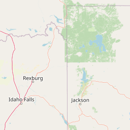
Map view of Yellowstone National Park

Use this park location map to pinpoint Yellowstone National Park in United States of America, understand its exact geographic position, and read its mapped placement within the surrounding landscape more clearly.

Pigeon | © OpenStreetMap contributors

Location context for Yellowstone National Park

IdahoMontanaWyoming
Natural feature types

Examine the Geologic and Natural Landmark Index for Yellowstone National Park

Access a structured inventory of natural features located within or adjacent to the Yellowstone National Park boundaries. MoriAtlas provides a clear geographic context for the volcanic landforms, hydrothermal sites, and water systems that characterize this iconic protected area. Start exploring the physical landscape and complex topography of the park today.
Recorded earthquake history

Examine the Historical Record of Earthquakes Near Yellowstone National Park

Explore the comprehensive MoriAtlas dataset of documented seismic activity surrounding Yellowstone National Park. Review individual event details, including magnitude and epicentre distance, to understand the historical pattern of recorded motion in this protected region.

Yellowstone National Park Earthquake History

Catalogued events

412 events

Strongest magnitude

Magnitude 5.9

Most recent event

Jul 16, 2026

This history includes earthquakes recorded inside the park or within 50 km of its borders

Park atlas

Map and compare the vast protected landscapes and park geography within the greater Yellowstone region.

Explore National Parks and Protected Areas Surrounding Yellowstone National Park

After exploring Yellowstone National Park's unique geothermal and wildlife features, continue your journey to browse other national parks and protected areas in the surrounding Rocky Mountain region. Comparing these diverse conservation landscapes provides valuable geographic context for understanding the broader ecological connections and varied terrains of North America's iconic protected zones.
Wildlife reserveMontana
Park boundaries overlap#1 closest

Northwest

Lee Metcalf Wilderness: Geographic Profile and Protected Landscape Boundaries in Montana

Mapping rugged alpine terrain across four distinct mountainous units

Located in southwestern Montana, the Lee Metcalf Wilderness serves as a cornerstone of ecological connectivity within the Greater Yellowstone Ecosystem. Spanning over 250,000 acres, this protected area features a unique fragmented geography consisting of the Bear Trap Canyon, Spanish Peaks, Taylor-Hilgard, and Monument Mountains units. The landscape is defined by its roadless mountain ridges, forested slopes, and deep river corridors, providing essential sanctuary for large mammal populations.

Area
1,029.07 km²
Established
1983
IUCN
Ib
Relief
Mountain
Protected landscapeWyoming
Park boundaries overlap#2 closest

East

Shoshone National Forest: A Comprehensive Map and Geography of America's Oldest National Forest

Rugged wilderness and glacial peaks in Wyoming

Discover the immense geographic scale of Shoshone National Forest, which protects a diverse landscape ranging from sagebrush valleys to 13,000-foot granite summits. This atlas overview details its role within the Greater Yellowstone Ecosystem and its expansive, federally designated wilderness areas, offering a clear perspective on its volcanic and glacial terrain.

Area
9,992.69 km²
Established
1891
IUCN
VI
Visitors
500K annual
Wildlife reserveWyoming
1.8 km away#3 closest

Southwest

Jedediah Smith Wilderness: Protected Alpine Terrain and Teton Range Geography

Glacially sculpted high-country basins in western Wyoming

Spanning the western face of the Teton Range, the Jedediah Smith Wilderness serves as a federally protected buffer for iconic mountain landscapes. The region features dramatic cirques, hanging valleys, and dense subalpine forest habitats, forming an essential, roadless link within the broader Greater Yellowstone Ecosystem. Explore the terrain features and structural geography that define this remote high-country wilderness area.

Area
499.59 km²
Established
1984
IUCN
Ib
Relief
Mountain
National parkUnited States of America
5.4 km away#4 closest

South

Grand Teton National Park: Protected Landscape and Geographic Atlas Exploration

Explore the mapped terrain and regional park geography.

Grand Teton National Park is a protected landscape offering rich geographic discovery opportunities within the United States of America. This detailed entry facilitates an atlas-style exploration of its mapped boundaries, the surrounding regional geography, and its identity as a significant national park. Understand the specific landscape context and discover its placement within the broader natural terrain of North America.

Area
1,300 km²
Established
1929
IUCN
II
Visitors
2.8M annual
Nature reserveBeaverhead County
44 km away#5 closest

West

Red Rock Lakes Wilderness: Nature Reserve and Wetland Geography in Beaverhead County

High elevation marshes and protected water basins.

Red Rock Lakes Wilderness preserves an extensive high-elevation wetland complex in Beaverhead County, Montana. This nature reserve, characterized by shallow lake basins and forested mountain ridges, serves as a vital ecological corridor in the Northern Rockies. Its protected landscape offers a study in water-driven geography, where remote marshes and reflective lakes define the terrain's character.

Area
130.9 km²
Established
1976
IUCN
Ib
Relief
Upland
Protected landscapeWyoming
76 km away#6 closest

Southeast

Fitzpatrick Wilderness: Exploring the Rugged Protected Landscapes of Western Wyoming

A core alpine environment within the Wind River Range.

Fitzpatrick Wilderness represents one of the most uncompromisingly wild segments of the Wind River Range, featuring persistent glaciers, dramatic U-shaped valleys, and high granite spires. This protected landscape offers a deep look into the alpine geography of Wyoming, preserved under the Wilderness Act to maintain its rugged character, remote glacial cirques, and intricate mountain ecosystems.

Area
803.4 km²
Established
1976
IUCN
Ib
Relief
Mountain
Protected landscapeMontana
113 km away#7 closest

North

Helena-Lewis and Clark National Forest: Geographic Overview and Protected Area Map

Montana wilderness spanning the Continental Divide

Spanning from the rolling eastern plains to the crest of the Northern Rockies, Helena-Lewis and Clark National Forest serves as a massive protected landscape in central Montana. This forest system protects eight unique mountain ranges and critical wilderness corridors, offering a comprehensive look at the ecological transition zones of the American Mountain West.

Area
11,000 km²
Established
1897
Relief
Mountain
Climate
Temperate
Protected landscapeMontana
123 km away#8 closest

East

Bighorn Canyon National Recreation Area: Maps and Protected Landscape Geography

A reservoir-anchored protected area in the Montana high desert

Defined by its striking contrast between deep blue reservoir water and sheer canyon walls, Bighorn Canyon National Recreation Area protects an essential arid landscape in the Mountain West. This region encompasses portions of the Pryor Mountains and the historic Bad Pass Trail, offering a window into the intersection of vast high-desert plains and rugged mountain terrain.

Area
486.82 km²
Established
1966
Visitors
217.7K annual
Relief
Upland

Common questions about visiting, size, designation, and location context for Yellowstone National Park

Yellowstone National Park FAQs for park facts, access, geography, and protected area context

Find quick answers about Yellowstone National Park, including protected-area facts, park geography, trail and visitor context, and how the park fits into its surrounding country and regional landscape.
MoriAtlas Explorer

Continue Your Protected Areas Search Across the Global Atlas

Deepen your exploration by continuing the structured search for national parks and protected areas worldwide. Utilize the comprehensive filtering capabilities to compare different conservation landscapes and refine your understanding of global park geography. Discover more about the distribution and characteristics of protected natural areas.

Global natural geography