Mori Atlas logo
National parkFuji-Hakone-Izu National Park

Discover the diverse geography, protected boundaries, and natural landscapes of this expansive Japanese national park.

Fuji-Hakone-Izu National Park: Japan's Iconic National Park, Volcanic Terrain, and Mapped Landscape

Fuji-Hakone-Izu National Park represents a vital protected landscape within Japan, celebrated for its dramatic volcanic geography and expansive natural features. This detailed atlas entry helps you explore the park's core identity, from the iconic silhouette of Mount Fuji and the surrounding Fuji Five Lakes to the geothermal wonders of Hakone and the unique volcanic islands of the Izu chain. Understand the geographic scope and the mapped boundaries that define this significant natural area.

volcanic landscapehot springsislandsmountain landscapecoastal sceneryalpine environment

Fuji-Hakone-Izu National Park

National park

Park overview

Structured park overview, official facts, and landscape profile for Fuji-Hakone-Izu National Park

Fuji-Hakone-Izu National Park park facts, protected area profile, and essential visitor context
Review the core facts for Fuji-Hakone-Izu National Park, including designation, size, terrain, visitor scale, habitats, and operating context in one park-focused overview.

About Fuji-Hakone-Izu National Park

Fuji-Hakone-Izu National Park represents one of Japan's most significant protected landscapes, encompassing a remarkable arc of diverse terrain that extends from the iconic peak of Mount Fuji southward through the mountainous Izu Peninsula and across the volcanic Izu Islands into the Pacific Ocean. The park's establishment in 1936 marked a foundational moment in Japan's national park system, with Mount Fuji and the Hakone region chosen as inaugural protected areas that would showcase Japan's natural heritage to citizens and visitors alike. The 1950 expansion to include the Izu Islands reflected growing recognition that these volcanic islands possessed ecological and scenic values worthy of national protection. Today the park encompasses an extraordinary variety of landscapes within its 1,227 square kilometers: the symmetrical cone of Mount Fuji rises to 3,776 meters as Japan's highest peak, while at its base the five lakes of Kawaguchi, Yamanaka, Sai, Shoji, and Motosu provide mirror-like reflections of the mountain in all seasons. The Hakone region features volcanic terrain where hot springs bubble from the earth, steam vents mark active geothermal zones, and Lake Ashi sits in a volcanic caldera surrounded by mountains. The Izu Peninsula maintains a mountainous interior crossed by hiking trails while its Pacific coast features dramatic cliffs and scenic promontories. The Izu Islands, stretching several hundred kilometers south from the main island of Honshu, are themselves a chain of volcanic islands including Izu Ōshima, Niijima, Shikinejima, Miyakejima, Mikurajima, and Hachijō-jima, each offering distinctive landscapes shaped by ongoing volcanic activity and erosion.

Quick facts and research context for Fuji-Hakone-Izu National Park

Fuji-Hakone-Izu National Park covers approximately 1,227 square kilometers across central Honshu and extends south through the Izu Islands chain. Established on February 1, 1936 as one of Japan's first four national parks, it was originally named Fuji-Hakone National Park before expanding to include the Izu Islands in 1950. The park is administered by Japan's Ministry of the Environment and holds IUCN Category II protected area designation. Its four main regions include the Mount Fuji area with its famous five lakes, the volcanic and hot spring region of Hakone, the mountainous Izu Peninsula with its coastal landscapes, and the volcanic Izu Islands stretching hundreds of kilometers into the Pacific. The park protects everything from alpine ecosystems at Mount Fuji's slopes to subtropical forests and marine environments around the southern islands.

Park context

Deeper park guide and search-rich context for Fuji-Hakone-Izu National Park

Fuji-Hakone-Izu National Park history, landscape, wildlife, and travel context
Explore Fuji-Hakone-Izu National Park through its history, landscape character, ecosystems, wildlife, conservation priorities, cultural context, and seasonal travel timing in a structured park guide built for atlas discovery and search intent.

Why Fuji-Hakone-Izu National Park stands out

Fuji-Hakone-Izu National Park is best known for containing Mount Fuji, one of Japan's most recognizable cultural symbols and a sacred mountain that has inspired artists and pilgrims for centuries. The park is equally famous for its extensive hot spring resorts in the Hakone area and along the Izu Peninsula, where volcanic activity provides natural onsen waters that have drawn visitors for centuries. The Fuji Five Lakes at the base of Mount Fuji provide the park's most iconic views, while the Izu Islands offer a different character entirely, with volcanic landscapes, rugged coastlines, and excellent scuba diving opportunities in clear Pacific waters. The park's remarkable geographic diversity, spanning from snow-capped mountain peaks to subtropical island environments within a single protected area, makes it uniquely significant in Japan's national park system.

Fuji-Hakone-Izu National Park history and protected-area timeline

Fuji-Hakone-Izu National Park was established on February 2, 1936, as Fuji-Hakone National Park, making it one of the first four national parks created in Japan following the passage of the National Parks Law in 1931. The selection of Mount Fuji and the Hakone region for this inaugural designation reflected both the areas' exceptional natural beauty and their profound cultural significance in Japanese history and spirituality. Mount Fuji had long been a site of religious pilgrimage and artistic inspiration, while Hakone's hot springs had developed as a traditional resort destination since the Edo period. In 1950, the park underwent significant expansion when the Izu Islands were incorporated into the protected area, a change that necessitated revising the park's name to Fuji-Hakone-Izu National Park to reflect this southern extension. This expansion recognized that the volcanic islands possessed unique ecological and scenic values distinct from the mountain and lake landscapes of central Honshu. The park's proximity to Tokyo, Japan's largest metropolitan area, has made it the most visited national park in Japan since its establishment, with millions of domestic and international visitors drawn annually to experience its diverse landscapes, hot springs, and natural wonders.

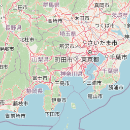
Fuji-Hakone-Izu National Park landscape and geographic character

The landscape of Fuji-Hakone-Izu National Park encompasses an extraordinary diversity of terrain shaped by volcanic activity, erosion, and the collision of mountain, lake, coastal, and island environments. At the park's heart stands Mount Fuji, a nearly perfect conical stratovolcano that rises 3,776 meters above sea level and dominates the surrounding landscape with its snow-capped peak visible from great distances across the Kanto Plain. The Fuji Five Lakes, formed by ancient volcanic activity and subsequent damming of rivers, create a series of scenic water bodies at the mountain's base, their calm waters providing the classic reflective views of Mount Fuji that appear in countless photographs and artworks. The Hakone area features a volcanic landscape characterized by steaming vents, hot springs, and the caldera lake known as Lake Ashi, formed in the crater of an ancient volcano. The Owakudani valley displays active sulfurous hot springs and steam vents that attest to ongoing geothermal activity beneath the surface. The Izu Peninsula presents a mountainous spine of volcanic hills and mountains, including Mount Amagi, with deeply indented coastlines where rugged cliffs meet the Pacific Ocean. The Jogasaki coast exemplifies this dramatic shoreline with its sheer cliffs and pounding surf. The Izu Islands represent the park's most distant and distinctive landscape, a chain of volcanic islands rising from the Pacific Ocean, each with its own character shaped by past and present volcanic activity, with features ranging from volcanic calderas and lava formations to tropical coastlines and coral reefs.

Fuji-Hakone-Izu National Park ecosystems, habitats, and plant life

The nature of Fuji-Hakone-Izu National Park reflects the extraordinary environmental diversity created by the park's vast north-south extent and elevation range from sea level to 3,776 meters. Around Mount Fuji and in the higher elevations of the Hakone and Izu Peninsula regions, temperate forest communities predominate with species including Japanese beech, Japanese cedar, and various conifers adapted to cooler conditions. The Aokigahara forest at the northwestern base of Mount Fuji is particularly notable, a dense woodland growing on volcanic soil that has developed over centuries. As the park extends southward through the Izu Peninsula and into the Izu Islands, the vegetation transitions progressively toward subtropical communities, with warm-temperate forests featuring evergreen oaks, Japanese cypress, and increasingly tropical species on the southern islands. The Izu Islands themselves possess distinctive flora shaped by their volcanic origins and oceanic isolation, with endemic plant species adapted to the island environments. Marine environments around the Izu Islands support coral communities and tropical fish species in clearer Pacific waters, while the coastal areas feature diverse intertidal zones and kelp forests. Wetland areas, exemplified by the Hakone Botanical Garden of Wetlands, preserve specialized habitats for water-loving plant communities.

Fuji-Hakone-Izu National Park wildlife and species highlights

The wildlife of Fuji-Hakone-Izu National Park benefits from the protected status of diverse habitats spanning multiple ecological zones, though detailed species documentation is limited in the available source material. The forest environments throughout the park provide habitat for various bird species and small mammals, while the lake environments support waterfowl and fish populations. The Izu Islands, situated along potential migratory routes in the Pacific, offer opportunities for birdwatching with both resident and migratory species. Marine environments around the Izu Islands support diverse fish communities, coral formations, and other marine life that attract scuba divers to the clear waters. The park's varied elevations create opportunities for observing different ecological communities, from alpine species adapted to the harsh conditions near Mount Fuji's summit to subtropical marine life in the island waters. The protected area status helps preserve these wildlife communities despite the high visitation levels that characterize the park.

Fuji-Hakone-Izu National Park conservation status and protection priorities

Fuji-Hakone-Izu National Park was established as one of Japan's first national parks in 1936, reflecting a pioneering commitment to protecting the nation's most significant natural landscapes. The park's designation as an IUCN Category II protected area indicates its primary purpose of preserving natural ecosystems while allowing for sustainable recreation and environmental education. The conservation challenges facing the park are substantial given its status as Japan's most visited national park, with millions of annual visitors creating pressure on natural resources and requiring careful management of impacts. The park encompasses a range of sensitive environments from alpine zones around Mount Fuji to marine ecosystems around the Izu Islands, each requiring specific management approaches. Ongoing volcanic activity on several of the Izu Islands, including Izu Ōshima which remains an active volcano, adds complexity to conservation planning and requires monitoring of geological hazards. The protection of scenic views, particularly the iconic perspectives of Mount Fuji across the Five Lakes, requires coordination with surrounding lands outside the park boundaries. Japan's national park system continues to evolve in its approaches to balancing conservation with public enjoyment, and Fuji-Hakone-Izu serves as a model for managing high-use protected areas.

Fuji-Hakone-Izu National Park cultural meaning and human context

Fuji-Hakone-Izu National Park is deeply intertwined with Japanese cultural history, particularly through the central presence of Mount Fuji, which has held religious significance in Japan for centuries as a sacred mountain Shinto shrine at its summit and a destination for pilgrimage journeys. The mountain appears throughout Japanese art, literature, and poetry as a symbol of national identity and natural beauty, with the view across the Five Lakes representing one of the most celebrated scenes in Japanese visual culture. Hakone developed as a hot spring resort destination during the Edo period when the Old Tōkaidō Road connected Edo (modern Tokyo) to Kyoto, and travelers would stop to bathe in the therapeutic waters. The historic route passes through the park area, preserving a cultural landscape that connects to Japan's pre-modern travel traditions. The Izu Peninsula and Islands have their own cultural heritage tied to maritime traditions, fishing communities, and the distinctive island lifestyles that have developed in relative isolation from the main island. The park's creation in 1936 reflected a modern concept of national parks that sought to preserve natural heritage while making it accessible to contemporary society, building on older traditions of appreciating scenic landscapes that were central to Japanese aesthetics.

Top sights and standout views in Fuji-Hakone-Izu National Park

Fuji-Hakone-Izu National Park offers an exceptional concentration of highlights within a single protected area, beginning with Mount Fuji itself, whose iconic symmetrical cone and snow-capped peak represent one of Japan's most recognizable symbols. The Fuji Five Lakes provide accessible and stunning viewpoints for experiencing the mountain, with Lake Kawaguchi offering particularly famous reflections. Hakone's hot spring resorts present opportunities for traditional onsen bathing surrounded by mountain scenery, while the Owakudani geothermal area showcases active steam vents and volcanic activity. Lake Ashi in Hakone, a caldera lake with views of surrounding mountains, is accessible via cable car and offers scenic boat cruises. The Izu Islands extend the park's character far to the south, where volcanic islands like Izu Ōshima provide distinctive landscapes and the clear Pacific waters support scuba diving at sites like the Izu Ocean Park with its famous underwater post box. The Jogasaki coast on the Izu Peninsula presents dramatic Pacific coastline views from a scenic walking trail.

Best time to visit Fuji-Hakone-Izu National Park

The best time to visit Fuji-Hakone-Izu National Park depends on the specific experiences sought, though spring and autumn generally offer the most favorable conditions across most of the park. The period from April through June brings mild temperatures, clear skies, and the spectacular scenery of cherry blossoms in spring followed by fresh green foliage in early summer, while autumn from October through November offers crisp air, autumn colors painting the forests, and some of the clearest views of Mount Fuji. Summer months can be crowded and feature both hot temperatures in the lowlands and unpredictable weather on the mountain, though this is also the season when the Fuji Five Lakes are most vibrant with visitors. Winter transforms the park, particularly Mount Fuji, which acquires its characteristic snow cap and offers different scenic appeal, though some facilities may have reduced hours. The Izu Islands can be enjoyed year-round due to their milder climate, though summer brings warmer ocean temperatures for swimming and diving while winter offers fewer crowds and clear visibility for underwater activities. Visitors planning to climb Mount Fuji should be aware that the official climbing season is limited to July and August when mountain huts and facilities are operational.

Park location guide

Geography guide, regional context, and park location map for Fuji-Hakone-Izu National Park

Fuji-Hakone-Izu National Park park geography, regions, and map view in Japan
Understand where Fuji-Hakone-Izu National Park sits in Japan through a broader geographic reading of the surrounding landscape, nearby location context, and its mapped position within the national park landscape.

How Fuji-Hakone-Izu National Park fits into Japan

Japan is an island nation in East Asia comprising over 14,000 islands in the Pacific Ocean. The country operates as a unitary parliamentary constitutional monarchy with Emperor Naruhito as the reigning monarch and Prime Minister Sanae Takaichi leading the government. With a population of approximately 123 million, Japan is the world's 11th most populous country and a major economic power with one of the strongest militaries, though it has constitutionally renounced its right to declare war.

Wider geography shaping Fuji-Hakone-Izu National Park in Japan

Japan is an island nation in the Pacific Ocean, bordered to the west by the Sea of Japan and extending from the Sea of Okhotsk in the north to the East China Sea in the south. The Japanese archipelago lies off the northeast coast of the Asian mainland. Approximately 75% of Japan's terrain is mountainous and heavily forested, with agricultural land and urbanized populations concentrated along the eastern coastal plains. The country is divided into 47 administrative prefectures and eight traditional regions.

Map view of Fuji-Hakone-Izu National Park

Use this park location map to pinpoint Fuji-Hakone-Izu National Park in Japan, understand its exact geographic position, and read its mapped placement within the surrounding landscape more clearly.

Pigeon | © OpenStreetMap contributors

Location context for Fuji-Hakone-Izu National Park

Kanagawa PrefectureShizuoka PrefectureTokyo MetropolisYamanashi Prefecture
Park atlas

Compare surrounding protected areas; trace volcanic landscapes, hot springs, and island ecosystems.

Explore Other National Parks and Protected Areas Near Fuji-Hakone-Izu National Park
After exploring Fuji-Hakone-Izu National Park, browse other national parks and protected areas across central Japan, extending from its volcanic mountains to its subtropical islands. This atlas-style view allows for detailed comparison of diverse conservation landscapes, revealing connections between distinct regional park geographies.
National parkChūbu region

Minami Alps National Park: A Protected Alpine Wilderness in Japan's Chūbu Region

Discover its dramatic peaks and vital river headwaters.

Minami Alps National Park offers a profound exploration into Japan's high-altitude natural geography. As a national park, it preserves a dramatic alpine environment defined by glacially carved terrain and multiple peaks exceeding 3000 meters. This protected landscape serves as a vital watershed, safeguarding the origins of major river systems and showcasing a rugged mountain character distinct from more accessible areas, ideal for understanding protected wildlands.

Area
357.52 km²
Established
1964
IUCN
II
National parkKantō region

Oze National Park National Park: A Key Protected Landscape in the Kantō Region

Explore its mapped geography and protected area context.

Oze National Park is a designated national park in Japan's Kantō region, offering a prime example of a protected landscape. This page provides detailed insights into its geographic setting and mapped boundaries, contributing to a structured understanding of regional natural terrain. Users can delve into the park's specific identity as a conservation area and its significance within the broader atlas of Japanese geography and protected lands.

Area
372.22 km²
Established
2007
IUCN
V
National parkIshikawa Prefecture

Hakusan National Park: Sacred Mountain Protected Landscape in Ishikawa Prefecture

Mapped alpine terrain and volcanic geography for protected area discovery.

Hakusan National Park offers a unique exploration of Japan's sacred mountain heritage and alpine natural beauty. This protected landscape, centered on Mount Haku, features distinct volcanic terrain, crater lakes, and exceptional alpine flora. Users can explore the park's mapped boundaries, understand its place within Ishikawa Prefecture's geography, and appreciate its role as a significant UNESCO Biosphere Reserve for detailed atlas-based discovery.

Area
477 km²
Established
1962
IUCN
II
National parkKansai

Yoshino-Kumano National Park: Protected National Park with Sacred Mountain Landscapes and Ancient Routes

Explore mapped park boundaries, gorges, and pilgrimage routes in Kansai.

Yoshino-Kumano National Park, a significant national park in Japan's Kansai region, invites exploration of its protected landscapes, which are deeply intertwined with spiritual heritage. Discover the park's rugged mountain terrain, ancient cypress and cedar forests, dramatic gorges like Dorokyō Gorge, and iconic coastal areas. This park is a vital entry for understanding Japan's confluence of natural geography and cultural pilgrimage, offering rich context for mapped landscape discovery.

Area
616.04 km²
Established
1936
IUCN
II
National parkJapan

Setonaikai National Park: Japan's Premier Island Archipelago and Coastal Protected Landscape

Explore the unique marine geography and mapped island environments.

Setonaikai National Park is Japan's largest national park, renowned for its stunning marine environment within the Seto Inland Sea. This protected area features approximately 3,000 islands, showcasing weathered granite formations, coastal forests, and dynamic tidal phenomena like the Naruto whirlpools. The park offers a unique atlas-style exploration of island geography, coastal landscapes, and significant cultural sites, making it a cornerstone of Japan's protected natural heritage.

Area
669.34 km²
Established
1934
IUCN
II
National parkJapan

Towada-Hachimantai National Park: Mapping Japan's Volcanic and Alpine Protected Landscapes

Explore the geography of this northern Honshu national park.

Towada-Hachimantai National Park offers a unique atlas perspective on Japan's dynamic volcanic geology and alpine ecosystems. This national park protects a vast expanse of rugged terrain, featuring the iconic caldera of Lake Towada and the expansive volcanic plateaus of the Hachimantai region. Understanding its mapped boundaries reveals the distribution of its characteristic landscapes, from old-growth beech forests along river valleys to subalpine environments crowning volcanic peaks, providing a deep dive into its protected natural geography.

Area
855.34 km²
Established
1936
IUCN
II
National parkNagasaki Prefecture

Unzen-Amakusa National Park: Volcanic Terrain and Island Geography

Explore Nagasaki Prefecture's Protected Landscape

Unzen-Amakusa National Park represents a significant protected area within Japan's geography, characterized by the imposing presence of Mount Unzen and the distinct maritime environment of the Amakusa islands. This national park offers an opportunity to study volcanic landscapes, coastal formations, and the rich cultural history intertwined with its natural setting. Understanding its mapped boundaries and geographic context provides valuable insight into Japan's protected lands and regional landscape diversity.

Area
282.79 km²
Established
1934
IUCN
II
National parkHokkaido

Shikotsu-Tōya National Park: Hokkaido's Premier Volcanic National Park with Caldera Lakes

Explore mapped terrain, geothermal features, and active volcanoes.

Shikotsu-Tōya National Park, located in Hokkaido, Japan, is a prime example of a protected area defined by its intense volcanic geology. The park features prominent caldera lakes, including Lake Shikotsu and Lake Tōya, surrounded by active volcanic cones and dramatic geothermal landscapes. Its distinctive terrain makes it a key destination for understanding regional geography and the mapped protected areas of Japan's northern island, offering a unique glimpse into dynamic geological processes.

Area
994.73 km²
Established
1949
IUCN
II

Common questions about visiting, size, designation, and location context for Fuji-Hakone-Izu National Park

Fuji-Hakone-Izu National Park FAQs for park facts, access, geography, and protected area context
Find quick answers about Fuji-Hakone-Izu National Park, including protected-area facts, park geography, trail and visitor context, and how the park fits into its surrounding country and regional landscape.
MoriAtlas Explorer

Continue Your Protected Areas Search Across the Global Atlas

Deepen your exploration by continuing the structured search for national parks and protected areas worldwide. Utilize the comprehensive filtering capabilities to compare different conservation landscapes and refine your understanding of global park geography. Discover more about the distribution and characteristics of protected natural areas.

Global natural geography