Mori Atlas logo
National parkMinami Alps National Park

Explore the dramatic peaks, glacially carved terrain, and vital river headwaters of this protected national park.

Minami Alps National Park: Japan's Premier Alpine Protected Landscape and Wilderness Atlas

Minami Alps National Park represents a significant protected wilderness area within Japan's Chūbu region, characterized by its spectacular alpine terrain and status as a critical watershed. This park encompasses some of the nation's highest peaks, offering a rugged mountain landscape shaped by glaciers and elevation. Its protected status safeguards vital river headwaters and diverse alpine ecosystems, providing a rich context for geographic exploration and understanding of Japan's natural heritage.

Alpine MountainsJapanese AlpsIUCN Category IIOld-growth ForestsWilderness AreaRiver Headwaters

Minami Alps National Park

National park

Park overview

Structured park overview, official facts, and landscape profile for Minami Alps National Park

Minami Alps National Park park facts, protected area profile, and essential visitor context
Review the core facts for Minami Alps National Park, including designation, size, terrain, visitor scale, habitats, and operating context in one park-focused overview.

About Minami Alps National Park

Minami Alps National Park represents one of Japan's most significant alpine protected areas, encompassing a spectacular mountainous landscape in the heart of Honshū. The Akaishi Mountains, which form the core of the park, are part of the broader Japanese Alps mountain system and contain some of the country's highest and most rugged terrain. Unlike the more developed alpine areas of neighboring regions, Minami Alps has retained a distinctly remote and wilderness character, with minimal visitor infrastructure and access limited to those with mountaineering experience. The park's elevation gradient, spanning from around 1000 meters to peaks exceeding 3000 meters, creates a remarkable transition through distinct ecological zones. At lower elevations, extensive forests of Japanese beech dominate the landscape, while higher areas give way to Japanese stone pine and hemlock spruce forests that have evolved to survive in the harsh subalpine conditions. Above the tree line, alpine vegetation adapted to extreme wind, cold, and short growing seasons blankets the rocky terrain. The park's significance extends beyond its natural beauty to encompass critical watershed functions, as the snowmelt and precipitation that collect within its boundaries feed the headwaters of the Fuji, Ōi, and Tenryū Rivers. These river systems flow through densely populated regions of central Japan, providing water resources that support agriculture, industry, and domestic use for millions of residents. The protection of these headwaters was a central motivation behind the park's establishment in 1964, ensuring the long-term health of these vital water systems.

Quick facts and research context for Minami Alps National Park

Minami Alps National Park occupies a mountainous region in the Chūbu region of central Honshū, Japan. The park is centered on the Akaishi Mountains, a range featuring seven peaks above 3000 meters. The protected area spans three prefectures and serves as the source of three major river systems. The park was established in 1964 under IUCN category II protection. Visitor facilities are minimal, with access typically requiring mountaineering experience and proper equipment. The ecosystem supports both subalpine forest types and alpine zones, with Japanese beech forests at lower elevations transitioning to stone pine and spruce at higher altitudes.

Park context

Deeper park guide and search-rich context for Minami Alps National Park

Minami Alps National Park history, landscape, wildlife, and travel context
Explore Minami Alps National Park through its history, landscape character, ecosystems, wildlife, conservation priorities, cultural context, and seasonal travel timing in a structured park guide built for atlas discovery and search intent.

Why Minami Alps National Park stands out

Minami Alps National Park is best known for its dramatic alpine scenery and status as one of Japan's premier high-mountain wilderness areas. The park protects seven peaks exceeding 3000 meters, creating a spectacular backdrop of jagged ridgelines, rock faces, and remote valleys. It is renowned for preserving old-growth beech forests, subalpine conifer stands, and the rare Japanese serow, a goat-antelope species that inhabits the steep mountain slopes. The park also shelters the rock ptarmigan, a bird species adapted to the harsh alpine environment. Its significance as a watershed, feeding three major rivers that support millions of people downstream, adds to its ecological importance.

Mt. Kitadake and Mt. Senjogatake from Mt. Nakashirane

Minami Alps National Park history and protected-area timeline

Minami Alps National Park was officially established on June 1, 1964, as part of Japan's post-war expansion of protected area designation. During the rapid economic growth of the 1950s and 1960s, Japan began systematically identifying and protecting outstanding natural areas to preserve biodiversity, scenic beauty, and ecological functions. The Akaishi Mountains were recognized as possessing exceptional natural value due to their impressive peaks, unique ecosystems, and critical watershed function. The park was designated under IUCN Category II, reflecting its primary purpose of protecting natural ecosystems while allowing for limited compatible use. Unlike many Japanese national parks that developed extensive tourism infrastructure, Minami Alps was purposefully maintained as a wilderness area with minimal development. This approach reflected both the challenging terrain and the desire to preserve the area's wild character. The park's boundaries were drawn to encompass the core of the Akaishi Mountains and the critical headwater zones of the three major river systems, creating a coherent protection unit that addresses both conservation and watershed management objectives.

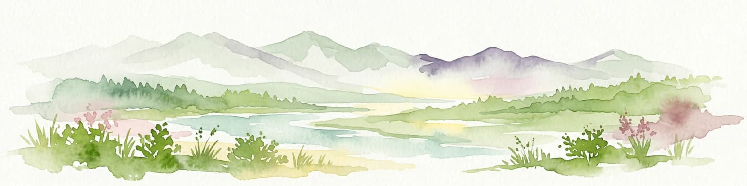
Minami Alps National Park landscape and geographic character

The landscape of Minami Alps National Park is defined by the dramatic, glacially-carved terrain of the Akaishi Mountains. Seven peaks rise above 3000 meters, creating a spectacular alpine environment with steep-sided valleys, jagged ridgelines, and exposed rock faces. The highest summits include Mount Senjō at 3032 meters, Mount Kita at 3196 meters (the second-highest peak in the Akaishi range), Mount Aino at 3192 meters, and Mount Akaishi at 3120 meters. Between these major peaks, numerous subsidiary ridges and spurs create a complex terrain that has been shaped by past glacial activity and ongoing erosion. The valleys carved by ancient glaciers now contain streams and rivers that flow outward from the central heights, eventually joining the three major river systems whose headwaters originate within the park. The combination of high relief, significant elevation range, and the presence of perennial snow and ice on the highest peaks gives this landscape a distinctly alpine character that differs markedly from the lower-elevation mountains of surrounding regions.

Minami Alps National Park ecosystems, habitats, and plant life

The ecological character of Minami Alps National Park is shaped by its dramatic elevation range and the transition from subalpine to alpine conditions. Japanese beech forests dominate the lower elevations, forming extensive stands that represent some of the finest examples of this forest type in Japan. Above the beech zone, Japanese stone pine and hemlock spruce create a subalpine forest layer that is particularly well-developed on the slopes and valley floors. At the highest elevations, above the tree line, alpine meadows and rocky terrain support specialized vegetation adapted to the extreme conditions. The park's position in central Honshū places it at a biogeographic crossroads, with species from both northern and southern Japan meeting in this mountain environment. This unique positioning contributes to the park's biodiversity significance, as the range of habitats supports a variety of plant and animal communities that would not be found together in either warmer or colder regions.

Minami Alps National Park wildlife and species highlights

The wildlife community of Minami Alps National Park reflects its position as a wilderness area with limited human disturbance. The Japanese serow, known locally as kamoshika, represents the largest and most characteristic large mammal in the park, inhabiting the steep mountain slopes and forest edges throughout the year. This goat-antelope species is endemic to Japan and is recognized as a natural monument requiring protection. The rock ptarmigan, a bird species that migrates to high elevations during the breeding season, is notable for its seasonal color change and adaptation to the harsh alpine environment. Larger mammals present in the park include the Asiatic black bear, wild boar, and sika deer, all of which occupy the forested areas at various elevations. The combination of old-growth forest habitat, minimal human disturbance, and the presence of diverse elevation zones creates conditions suitable for a range of species, though the park's remote and rugged character means that wildlife viewing opportunities are limited compared to more accessible protected areas.

Minami Alps National Park conservation status and protection priorities

Minami Alps National Park plays a crucial role in protecting both Japan's alpine biodiversity and critical water resources. The park's watershed function, providing the headwaters for three major river systems that serve millions of downstream users, represents one of its most significant conservation values. Protection of these headwaters ensures water quality and helps regulate flow patterns that are essential for agricultural, industrial, and domestic water supply across the Chūbu region. The old-growth beech forests within the park are increasingly rare in Japan, as development and forestry have removed most of the nation's original forest cover. These forests provide habitat for numerous species and contribute to soil stability on the steep mountain slopes. The Japanese serow population, while stable within the park boundaries, faces pressure from habitat loss and fragmentation in lower-elevation areas, making the protected alpine habitat increasingly important for the species' long-term survival. The park's minimal development approach, while limiting tourism opportunities, has effectively preserved the area's wilderness character and the ecological processes that depend on relatively unmodified conditions.

Minami Alps National Park cultural meaning and human context

The Akaishi Mountains have been significant in Japanese religious and cultural traditions for centuries, as the mountains have been viewed as sacred spaces associated with Shugendo, the mountain worship practice of Japan's traditional folk religion. The area's remoteness and dramatic scenery contributed to its spiritual significance, with various peaks and locations serving as sites for pilgrimage and meditation. While Minami Alps National Park does not contain explicit cultural heritage sites of the type found in some Japanese parks, the broader landscape context includes traditional relationships between local communities and the mountain environment. The prefectures surrounding the park, particularly Shizuoka, Yamanashi, and Nagano, each have distinct regional identities shaped by their relationship with the mountains and the rivers that originate in this high terrain. The park's establishment in 1964 also reflects a post-war Japanese cultural shift toward environmental awareness and the recognition that certain landscapes warrant protection for future generations.

Top sights and standout views in Minami Alps National Park

The seven peaks exceeding 3000 meters create a spectacular alpine environment that is the primary draw for experienced mountaineers and hikers. The old-growth Japanese beech forests at lower elevations offer a different but equally significant natural experience, with massive trees and a cathedral-like forest floor. The Japanese serow, while difficult to observe, represents a conservation success story and serves as a symbol of the park's wilderness character. The watershed protection function, while not visually dramatic, represents one of the park's most important contributions to regional sustainability. The sense of remoteness and the absence of developed tourist infrastructure differentiate Minami Alps from more accessible Japanese parks, offering a genuine wilderness experience for those with the skills and preparation to venture into this high mountain environment.

Best time to visit Minami Alps National Park

The optimal season for visiting Minami Alps National Park runs from mid-summer through early autumn, typically July through September, when the high mountain trails are snow-free and conditions are most suitable for alpine hiking and mountaineering. The winter months bring heavy snowfall and extreme conditions that make the park effectively inaccessible except for specialized winter mountaineering. Spring and early summer feature lingering snow and unstable weather that can pose hazards for unprepared visitors. The brief summer season offers the best combination of accessibility and relatively stable weather, though afternoon thunderstorms are common and visitors should be prepared for rapid weather changes. The lack of developed facilities means that all visitors must be self-sufficient and prepared for backcountry conditions regardless of the season. Those seeking to experience the park's natural values should plan their visit around the narrow window of suitable conditions and ensure they have appropriate equipment, navigation skills, and knowledge of the mountain environment.

Park location guide

Geography guide, regional context, and park location map for Minami Alps National Park

Minami Alps National Park park geography, regions, and map view in Japan
Understand where Minami Alps National Park sits in Japan through a broader geographic reading of the surrounding landscape, nearby location context, and its mapped position within the national park landscape.

How Minami Alps National Park fits into Japan

Japan is an island nation in East Asia comprising over 14,000 islands in the Pacific Ocean. The country operates as a unitary parliamentary constitutional monarchy with Emperor Naruhito as the reigning monarch and Prime Minister Sanae Takaichi leading the government. With a population of approximately 123 million, Japan is the world's 11th most populous country and a major economic power with one of the strongest militaries, though it has constitutionally renounced its right to declare war.

Wider geography shaping Minami Alps National Park in Japan

Japan is an island nation in the Pacific Ocean, bordered to the west by the Sea of Japan and extending from the Sea of Okhotsk in the north to the East China Sea in the south. The Japanese archipelago lies off the northeast coast of the Asian mainland. Approximately 75% of Japan's terrain is mountainous and heavily forested, with agricultural land and urbanized populations concentrated along the eastern coastal plains. The country is divided into 47 administrative prefectures and eight traditional regions.

Map view of Minami Alps National Park

Use this park location map to pinpoint Minami Alps National Park in Japan, understand its exact geographic position, and read its mapped placement within the surrounding landscape more clearly.

Pigeon | © OpenStreetMap contributors

Location context for Minami Alps National Park

Chūbu regionNagano PrefectureShizuoka PrefectureYamanashi Prefecture

Explore the dramatic mountain terrain, high-altitude habitats, and distinctive protected-area character of Japan's Akaishi Mountains through immersive visuals.

Minami Alps National Park Photos: Visual Guide to Alpine Landscapes and Wilderness Scenery
Gain a comprehensive visual understanding of Minami Alps National Park's rugged alpine environment, featuring its towering peaks, glacially carved valleys, and ancient forests. High-quality imagery helps clarify the park's wilderness identity, distinct ecosystems, and the conservation value of its headwater regions within central Honshū.

Mt. Kitadake and Mt. Senjogatake from Mt. Nakashirane

Park atlas

Explore similar alpine landscapes and regional conservation areas for geographic comparison.

Discover Other National Parks and Protected Areas Near Minami Alps National Park, Japan
Explore other national parks and protected areas geographically close to Minami Alps National Park across central Honshū, Japan. Comparing these diverse mountain protected areas helps you trace their regional spread and understand the interconnectedness of high-altitude conservation landscapes.
National parkJapan

Fuji-Hakone-Izu National Park: Japan's Premier National Park with Diverse Volcanic Landscapes and Mapped Geography

Explore volcanic terrain, hot springs, islands, and Mount Fuji's iconic protected boundaries.

Fuji-Hakone-Izu National Park is a vast and diverse protected area in Japan, anchored by the iconic Mount Fuji. This national park features a remarkable range of volcanic landscapes, including natural hot springs, rugged coastlines, and the unique Izu Islands extending into the Pacific. Delve into its mapped geography and protected landscape identity for a comprehensive atlas-style understanding of this significant natural asset within Japan.

Area
1,227 km²
Established
1936
IUCN
II
National parkIshikawa Prefecture

Hakusan National Park: Sacred Mountain Protected Landscape in Ishikawa Prefecture

Mapped alpine terrain and volcanic geography for protected area discovery.

Hakusan National Park offers a unique exploration of Japan's sacred mountain heritage and alpine natural beauty. This protected landscape, centered on Mount Haku, features distinct volcanic terrain, crater lakes, and exceptional alpine flora. Users can explore the park's mapped boundaries, understand its place within Ishikawa Prefecture's geography, and appreciate its role as a significant UNESCO Biosphere Reserve for detailed atlas-based discovery.

Area
477 km²
Established
1962
IUCN
II
National parkKantō region

Oze National Park National Park: A Key Protected Landscape in the Kantō Region

Explore its mapped geography and protected area context.

Oze National Park is a designated national park in Japan's Kantō region, offering a prime example of a protected landscape. This page provides detailed insights into its geographic setting and mapped boundaries, contributing to a structured understanding of regional natural terrain. Users can delve into the park's specific identity as a conservation area and its significance within the broader atlas of Japanese geography and protected lands.

Area
372.22 km²
Established
2007
IUCN
V
National parkKansai

Yoshino-Kumano National Park: Protected National Park with Sacred Mountain Landscapes and Ancient Routes

Explore mapped park boundaries, gorges, and pilgrimage routes in Kansai.

Yoshino-Kumano National Park, a significant national park in Japan's Kansai region, invites exploration of its protected landscapes, which are deeply intertwined with spiritual heritage. Discover the park's rugged mountain terrain, ancient cypress and cedar forests, dramatic gorges like Dorokyō Gorge, and iconic coastal areas. This park is a vital entry for understanding Japan's confluence of natural geography and cultural pilgrimage, offering rich context for mapped landscape discovery.

Area
616.04 km²
Established
1936
IUCN
II
National parkJapan

Setonaikai National Park: Japan's Premier Island Archipelago and Coastal Protected Landscape

Explore the unique marine geography and mapped island environments.

Setonaikai National Park is Japan's largest national park, renowned for its stunning marine environment within the Seto Inland Sea. This protected area features approximately 3,000 islands, showcasing weathered granite formations, coastal forests, and dynamic tidal phenomena like the Naruto whirlpools. The park offers a unique atlas-style exploration of island geography, coastal landscapes, and significant cultural sites, making it a cornerstone of Japan's protected natural heritage.

Area
669.34 km²
Established
1934
IUCN
II
National parkJapan

Towada-Hachimantai National Park: Mapping Japan's Volcanic and Alpine Protected Landscapes

Explore the geography of this northern Honshu national park.

Towada-Hachimantai National Park offers a unique atlas perspective on Japan's dynamic volcanic geology and alpine ecosystems. This national park protects a vast expanse of rugged terrain, featuring the iconic caldera of Lake Towada and the expansive volcanic plateaus of the Hachimantai region. Understanding its mapped boundaries reveals the distribution of its characteristic landscapes, from old-growth beech forests along river valleys to subalpine environments crowning volcanic peaks, providing a deep dive into its protected natural geography.

Area
855.34 km²
Established
1936
IUCN
II
National parkNagasaki Prefecture

Unzen-Amakusa National Park: Volcanic Terrain and Island Geography

Explore Nagasaki Prefecture's Protected Landscape

Unzen-Amakusa National Park represents a significant protected area within Japan's geography, characterized by the imposing presence of Mount Unzen and the distinct maritime environment of the Amakusa islands. This national park offers an opportunity to study volcanic landscapes, coastal formations, and the rich cultural history intertwined with its natural setting. Understanding its mapped boundaries and geographic context provides valuable insight into Japan's protected lands and regional landscape diversity.

Area
282.79 km²
Established
1934
IUCN
II
National parkSouth Korea

Juwangsan National Park: Protected Mountain Landscape and Regional Geography in South Korea

Mapped terrain, park boundaries, and natural landscapes.

Juwangsan National Park is a protected natural area situated within South Korea's Taebaek mountain range, renowned for its steep valleys, waterfalls, and dense forests. This park offers a rich landscape context, showcasing dramatic ridgelines and providing a significant example of South Korea's protected mountain terrain. Discover its geographic placement, mapped protected boundaries, and the unique natural and cultural elements that define this national park.

Area
107.42 km²
Established
1976
IUCN
II

Common questions about visiting, size, designation, and location context for Minami Alps National Park

Minami Alps National Park FAQs for park facts, access, geography, and protected area context
Find quick answers about Minami Alps National Park, including protected-area facts, park geography, trail and visitor context, and how the park fits into its surrounding country and regional landscape.
MoriAtlas Explorer

Continue Your Protected Areas Search Across the Global Atlas

Deepen your exploration by continuing the structured search for national parks and protected areas worldwide. Utilize the comprehensive filtering capabilities to compare different conservation landscapes and refine your understanding of global park geography. Discover more about the distribution and characteristics of protected natural areas.

Global natural geography