Mori Atlas logo
National parkYoshino-Kumano National Park

Discover mapped park boundaries, ancient forests, and pilgrimage routes across Kansai's dramatic terrain.

Yoshino-Kumano National Park: Japan's Sacred Mountain Protected Landscape in Kansai

Yoshino-Kumano National Park stands as a premier protected national park within Japan's Kansai region, safeguarding a vast territory of profound spiritual significance and natural beauty. This park encompasses sacred mountain peaks, ancient pilgrimage trails, and diverse natural landscapes, offering a rich geographic context for atlas exploration. Users can explore the park's mapped boundaries, understand its unique terrain including dramatic gorges and coastal areas, and discover how this protected area is interwoven with Japan's cultural heritage.

Mountain ParksSacred SitesCherry BlossomsPilgrimage RoutesOld-Growth ForestsCoastal Parks

Yoshino-Kumano National Park

National park

Park overview

Structured park overview, official facts, and landscape profile for Yoshino-Kumano National Park

Yoshino-Kumano National Park park facts, protected area profile, and essential visitor context
Review the core facts for Yoshino-Kumano National Park, including designation, size, terrain, visitor scale, habitats, and operating context in one park-focused overview.

About Yoshino-Kumano National Park

Yoshino-Kumano National Park represents one of Japan's most significant protected areas where natural landscapes intertwine deeply with cultural and religious traditions spanning more than a millennium. The park spans a vast territory across the mountainous interior of the Kii Peninsula, protecting ecosystems that range from subalpine zones on the highest peaks to subtropical marine environments along the Pacific coastline. The protection of this landscape was prioritized early in Japan's national park system due to both its ecological importance and its profound spiritual significance to Japanese culture. The park's establishment in 1936 reflected a growing recognition that these mountain forests, sacred shrines, and ancient pilgrimage routes required formal protection to preserve their integrity for future generations. Today, the park continues to serve as a living cultural landscape where visitors can experience both the natural wonders of Japan's central mountain range and the enduring spiritual traditions that have shaped this region.

Quick facts and research context for Yoshino-Kumano National Park

Yoshino-Kumano National Park covers approximately 616 square kilometers across Mie, Nara, and Wakayama Prefectures in the Kansai region of central Japan. The park was established on February 1, 1936, making it one of Japan's older national parks. It contains parts of the UNESCO World Heritage Site known as the Sacred Sites and Pilgrimage Routes in the Kii Mountain Range. The park encompasses diverse terrain from alpine peaks exceeding 1,900 meters to marine coastal environments along the Pacific coast.

Park context

Deeper park guide and search-rich context for Yoshino-Kumano National Park

Yoshino-Kumano National Park history, landscape, wildlife, and travel context
Explore Yoshino-Kumano National Park through its history, landscape character, ecosystems, wildlife, conservation priorities, cultural context, and seasonal travel timing in a structured park guide built for atlas discovery and search intent.

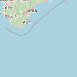
Why Yoshino-Kumano National Park stands out

The park is best known for Mount Yoshino, which hosts one of Japan's most renowned cherry blossom viewing sites with approximately 30,000 cherry trees covering its slopes in spectacular fashion each spring. The park also protects the sacred Kumano Hongū Taisha shrine and the surrounding Kumano Sanzan (three great shrines) complex that has been a center of pilgrimage for over 1,000 years. The Nachi Falls, one of Japan's most photographed waterfalls, and the dramatic coastal geology of Kushimoto Marine Park further distinguish this park. The ancient pilgrimage trails that traverse the park connect these spiritual sites through centuries-old routes穿过原始森林和高山地区.

Yoshino-Kumano National Park history and protected-area timeline

Yoshino-Kumano National Park was established on February 1, 1936, as part of Japan's second wave of national park designations following the creation of Nikko National Park in 1934. The early establishment of this park reflects the special recognition given to the Kii Mountain Range's combination of outstanding natural beauty and profound spiritual significance. The park was created during a period when Japan was developing its modern conservation framework, and the selection of this area highlighted the country's understanding that natural and cultural heritage could not be separated in many of its most treasured landscapes. The subsequent inclusion of the park's sacred sites and pilgrimage routes within the UNESCO World Heritage designation in 2004 further cemented international recognition of the area's universal value. The park's boundaries have been refined over the decades to balance protection of critical ecosystems with sustainable use by local communities and pilgrims.

Yoshino-Kumano National Park landscape and geographic character

The park's landscape is defined by the rugged, heavily forested peaks of the Kii Mountain Range, which rises dramatically from the Pacific coast to elevations exceeding 1,900 meters at Mount Ōdaigahara. Deep river valleys have carved through the mountainous terrain, creating spectacular gorges such as Dorokyō Gorge where rushing waters tumble over ancient rocks beneath towering forest canopies. The coastal sections of the park feature dramatic cliffs and rocky headlands where the mountains meet the sea, particularly around Kushimoto Marine Park. Mount Yoshino presents a distinctive landscape of forested slopes that each spring transform into a sea of pink and white cherry blossoms, a phenomenon that has been documented in Japanese poetry and art since the Heian period. The terrain includes rocky ridgelines, cascading waterfalls including the famous Nachi Falls, and ancient forest stands of Japanese cypress and cedar that have grown for centuries.

Yoshino-Kumano National Park ecosystems, habitats, and plant life

The park protects a remarkable diversity of habitats across its altitudinal range, from coastal marine environments to subalpine forest communities. The mountain forests of the Kii Peninsula represent some of the most extensive remaining old-growth forests in Japan, dominated by Japanese cypress, Japanese cedar, and Japanese beech that create a densely forested landscape. These forests support complex ecological communities adapted to the region's high rainfall and moderate temperatures. The marine environments along the park's Pacific coast feature clear waters and diverse seafloor habitats that support tropical and temperate species where the Kuroshio Current brings warmth from the south. The park's inclusion in the UNESCO World Heritage designation reflects the global significance of these ecosystems and the traditional management practices that have maintained their health for centuries.

Yoshino-Kumano National Park wildlife and species highlights

The park's extensive forests provide habitat for numerous species of birds, mammals, and other wildlife characteristic of Japan's central mountain regions. The old-growth forests support populations of Japanese serow and Japanese macaque, which are commonly observed throughout the park's higher elevations. Birdlife includes various species of thrushes, warblers, and woodpeckers that thrive in the diverse forest structure, as well as birds of prey such as mountain hawk-eagles that soar above the ridgelines. The marine environments around Kushimoto support populations of sea turtles, dolphin pods, and diverse fish species that attract both researchers and snorkelers. The rivers and streams throughout the park provide habitat for freshwater fish and amphibians, while the wet microclimates created by the region's high precipitation support diverse invertebrate communities.

Yoshino-Kumano National Park conservation status and protection priorities

Yoshino-Kumano National Park plays a crucial role in protecting some of Japan's most significant natural and cultural landscapes within a single protected area. The park's ecosystems represent a conservation priority due to the combination of high biodiversity values and the cultural heritage that depends on maintaining the landscape's traditional character. The forest communities within the park have been managed for centuries under traditional practices that have maintained old-growth characteristics across large areas, providing lessons in sustainable relationships between human communities and natural systems. The UNESCO World Heritage designation for the Sacred Sites and Pilgrimage Routes in the Kii Mountain Range brought additional international attention and resources for conservation efforts within the park. Ongoing management focuses on balancing the needs of the park's natural systems with the continued practice of traditional pilgrimage and sustainable use by local communities.

Yoshino-Kumano National Park cultural meaning and human context

The cultural significance of this landscape cannot be overstated, as the Kii Mountain Range has been a center of religious practice and pilgrimage for over a thousand years. The Kumano Sanzan, three great shrines centered on Kumano Hongū Taisha, represents one of Japan's oldest and most important pilgrimage traditions, drawing millions of practitioners over the centuries. The ancient trails that connect these sacred sites, known as the Kumano Kodo pilgrimage routes, traverse the heart of the national park and are recognized as UNESCO World Heritage. Mount Yoshino's cherry blossoms have been celebrated in Japanese poetry and art since at least the Heian period, making this landscape one of the country's most culturally resonant natural sites. The continued practice of pilgrimage along these ancient routes, combined with seasonal cherry blossom viewing traditions, maintains living cultural connections to this landscape that span more than thirty generations.

Top sights and standout views in Yoshino-Kumano National Park

The park offers visitors an exceptional combination of natural wonders and cultural experiences that distinguish it from other Japanese protected areas. Mount Yoshino's spring cherry blossom spectacle remains one of the country's most iconic seasonal displays, while the Kumano pilgrimage routes provide opportunities to walk along ancient trails that have been used for centuries. The Nachi Falls, which plunges 133 meters in a single graceful cascade, stands as one of Japan's most photographed natural landmarks and is closely associated with the adjacent Kumano Hongū Taisha shrine. The coastal marine environments around Kushimoto offer excellent snorkeling and diving in clear waters teeming with tropical fish species. The deep forests and mountain peaks provide rewarding hiking experiences through landscapes that have shaped Japanese spiritual and artistic traditions.

Best time to visit Yoshino-Kumano National Park

The park can be visited throughout the year, though different seasons offer distinctly different experiences. Spring, particularly late March through early April, brings the famous cherry blossom season to Mount Yoshino when the entire mountain transforms into a pink and white wonderland, though this period also brings the largest crowds. Summer months offer lush green forests and comfortable temperatures for hiking, while the coastal areas provide refreshing relief from mountain heat. Autumn brings spectacular fall color to the park's deciduous forests, particularly in October and November, as the maples and other species turn brilliant shades of red and gold. Winter offers a quieter experience with snow-dusted peaks and frozen waterfalls, though some trails may be difficult to access. The pilgrimage routes can be walked in any season, though spring and autumn typically provide the most comfortable conditions.

Park location guide

Geography guide, regional context, and park location map for Yoshino-Kumano National Park

Yoshino-Kumano National Park park geography, regions, and map view in Japan
Understand where Yoshino-Kumano National Park sits in Japan through a broader geographic reading of the surrounding landscape, nearby location context, and its mapped position within the national park landscape.

How Yoshino-Kumano National Park fits into Japan

Japan is an island nation in East Asia comprising over 14,000 islands in the Pacific Ocean. The country operates as a unitary parliamentary constitutional monarchy with Emperor Naruhito as the reigning monarch and Prime Minister Sanae Takaichi leading the government. With a population of approximately 123 million, Japan is the world's 11th most populous country and a major economic power with one of the strongest militaries, though it has constitutionally renounced its right to declare war.

Wider geography shaping Yoshino-Kumano National Park in Japan

Japan is an island nation in the Pacific Ocean, bordered to the west by the Sea of Japan and extending from the Sea of Okhotsk in the north to the East China Sea in the south. The Japanese archipelago lies off the northeast coast of the Asian mainland. Approximately 75% of Japan's terrain is mountainous and heavily forested, with agricultural land and urbanized populations concentrated along the eastern coastal plains. The country is divided into 47 administrative prefectures and eight traditional regions.

Map view of Yoshino-Kumano National Park

Use this park location map to pinpoint Yoshino-Kumano National Park in Japan, understand its exact geographic position, and read its mapped placement within the surrounding landscape more clearly.

Pigeon | © OpenStreetMap contributors

Location context for Yoshino-Kumano National Park

KansaiMie PrefectureNara PrefectureWakayama Prefecture
Park atlas

Trace the Spread of Japan's Mountain, Coastal, and Sacred Forest Protected Landscapes Surrounding Yoshino-Kumano National Park

Explore Other National Parks Near Yoshino-Kumano, Tracing Japan's Kansai Region Protected Areas
Browse national parks and protected areas near Yoshino-Kumano, expanding your discovery across Japan's Kii Peninsula and its diverse mountain and coastal landscapes. Compare nearby protected areas to trace the regional spread of Japan's conservation landscapes, understanding their geographic context and unique natural features.
National parkJapan

Setonaikai National Park: Japan's Premier Island Archipelago and Coastal Protected Landscape

Explore the unique marine geography and mapped island environments.

Setonaikai National Park is Japan's largest national park, renowned for its stunning marine environment within the Seto Inland Sea. This protected area features approximately 3,000 islands, showcasing weathered granite formations, coastal forests, and dynamic tidal phenomena like the Naruto whirlpools. The park offers a unique atlas-style exploration of island geography, coastal landscapes, and significant cultural sites, making it a cornerstone of Japan's protected natural heritage.

Area
669.34 km²
Established
1934
IUCN
II
Visitors
40.6M annual
National parkChūgoku region

Daisen-Oki National Park: A National Park within the Chūgoku Region's Protected Landscape Atlas

Mapped geography and protected land context.

Gain a structured understanding of Daisen-Oki National Park, a designated national park situated in Japan's Chūgoku region. This entry focuses on its precise geographic location, mapped protected boundaries, and its role within a broader landscape atlas. Explore the fundamental geographic characteristics that define this key natural area, providing essential context for regional and national park discovery.

Area
694.105 km²
Established
1936
IUCN
II
Visitors
9.3M annual
Watercolor illustration of a mountain landscape with a lake, grasses, and flowers
National parkIshikawa Prefecture

Hakusan National Park: Sacred Mountain Protected Landscape in Ishikawa Prefecture

Mapped alpine terrain and volcanic geography for protected area discovery.

Hakusan National Park offers a unique exploration of Japan's sacred mountain heritage and alpine natural beauty. This protected landscape, centered on Mount Haku, features distinct volcanic terrain, crater lakes, and exceptional alpine flora. Users can explore the park's mapped boundaries, understand its place within Ishikawa Prefecture's geography, and appreciate its role as a significant UNESCO Biosphere Reserve for detailed atlas-based discovery.

Area
477 km²
Established
1962
IUCN
II
Relief
Mountain
Watercolor painting of green and pink mountain ranges with forested foreground and distant peaks.
National parkChūbu region

Minami Alps National Park: A Protected Alpine Wilderness in Japan's Chūbu Region

Discover its dramatic peaks and vital river headwaters.

Minami Alps National Park offers a profound exploration into Japan's high-altitude natural geography. As a national park, it preserves a dramatic alpine environment defined by glacially carved terrain and multiple peaks exceeding 3000 meters. This protected landscape serves as a vital watershed, safeguarding the origins of major river systems and showcasing a rugged mountain character distinct from more accessible areas, ideal for understanding protected wildlands.

Area
357.52 km²
Established
1964
IUCN
II
Relief
Mountain
National parkJapan

Ashizuri-Uwakai National Park: Japan's National Park Protected Landscape

Explore the mapped geography and protected area context.

Delve into the protected landscape identity of Ashizuri-Uwakai National Park, a key national park located in Japan. This page provides essential context for understanding its mapped boundaries, its geographic placement within the Japanese archipelago, and its role as a designated protected area. It is designed to offer a structured view of the park's natural terrain and its significance for regional atlas exploration, serving as a gateway to detailed landscape context.

Area
113.45 km²
Established
1972
IUCN
II
Relief
Mixed relief
National parkJapan

Fuji-Hakone-Izu National Park: Japan's Premier National Park with Diverse Volcanic Landscapes and Mapped Geography

Explore volcanic terrain, hot springs, islands, and Mount Fuji's iconic protected boundaries.

Fuji-Hakone-Izu National Park is a vast and diverse protected area in Japan, anchored by the iconic Mount Fuji. This national park features a remarkable range of volcanic landscapes, including natural hot springs, rugged coastlines, and the unique Izu Islands extending into the Pacific. Delve into its mapped geography and protected landscape identity for a comprehensive atlas-style understanding of this significant natural asset within Japan.

Area
1,227 km²
Established
1936
IUCN
II
Visitors
11.3M annual
National parkSaitama Prefecture

Chichibu-Tama-Kai National Park: Mapped Protected Landscape and Regional Geography

Explore the geographic identity of this national park.

Discover Chichibu-Tama-Kai National Park through its protected landscape features and geographic setting. This page provides detailed atlas context, focusing on the park's mapped boundaries and its contribution to the regional geography of Saitama Prefecture. Understand the unique character and structural significance of this national park for comprehensive geographic discovery.

Area
1,216 km²
Established
1950
IUCN
II
Relief
Mountain
National parkJapan

Myōkō-Togakushi Renzan National Park: Mapped Protected Landscape Geography in Japan

Explore the park's regional terrain and protected area context.

Delve into the geographic specificities of Myōkō-Togakushi Renzan National Park, a key protected landscape in Japan. This entry focuses on its mapped terrain, regional setting, and the atlas-value of understanding its protected boundaries. Gain clarity on the park's distinct natural geography and its contribution to the broader protected area network.

Area
397.72 km²
Established
2015
IUCN
II
Relief
Mountain

Common questions about visiting, size, designation, and location context for Yoshino-Kumano National Park

Yoshino-Kumano National Park FAQs for park facts, access, geography, and protected area context
Find quick answers about Yoshino-Kumano National Park, including protected-area facts, park geography, trail and visitor context, and how the park fits into its surrounding country and regional landscape.
MoriAtlas Explorer

Continue Your Protected Areas Search Across the Global Atlas

Deepen your exploration by continuing the structured search for national parks and protected areas worldwide. Utilize the comprehensive filtering capabilities to compare different conservation landscapes and refine your understanding of global park geography. Discover more about the distribution and characteristics of protected natural areas.

Global natural geography