Mori Atlas logo
National parkUnzen-Amakusa National Park

Explore the dramatic geography, mapped boundaries, and cultural intersections of this Japanese National Park.

Unzen-Amakusa National Park: A Volcanic and Coastal Protected Landscape in Nagasaki

(Unzen-Amakusa Kokuritsu Kōen)

Unzen-Amakusa National Park, situated within Nagasaki Prefecture, Japan, offers a compelling journey into a landscape shaped by powerful volcanic forces and intricate island geography. This national park preserves a unique environment where Mount Unzen's active stratovolcano dominates the Shimabara Peninsula, juxtaposed against the rugged Amakusa islands scattered across the Yatsushiro Sea. Established as one of Japan's earliest protected areas, its territory encompasses a remarkable blend of volcanic terrain, coastal features, and historically significant sites.

Volcanic landscapesActive volcanoChristian heritageIsland ecosystemsKyushuCoastal parks

Unzen-Amakusa National Park

National park

Park overview

Structured park overview, official facts, and landscape profile for Unzen-Amakusa National Park

Unzen-Amakusa National Park park facts, protected area profile, and essential visitor context
Review the core facts for Unzen-Amakusa National Park, including designation, size, terrain, visitor scale, habitats, and operating context in one park-focused overview.

About Unzen-Amakusa National Park

Unzen-Amakusa National Park presents a compelling combination of volcanic geology, coastal ecosystems, and cultural significance that distinguishes it among Japan's national parks. The park's core lies around Mount Unzen, a towering stratovolcano that dominates the Shimabara Peninsula and has shaped the surrounding landscape through repeated eruptions over centuries. The mountain's most recent major activity occurred between 1991 and 1995, when a series of pyroclastic flows caused significant damage and loss of life, making it one of Japan's deadliest volcanic disasters.

Extending eastward from the volcanic peninsula, the Amakusa islands rise from the Yatsushiro Sea as a chain of rugged, mountainous landmasses with steep coastal cliffs, hidden coves, and productive marine waters. These islands historically served as refuge for persecuted Christians during the Edo period, and the park contains numerous sites related to this hidden religious heritage. The area represents a unique intersection of natural volcanic processes and human cultural adaptation, where communities learned to live with the ever-present possibility of volcanic activity while maintaining religious traditions forbidden by the central government.

The park's accessibility from major population centers in southern Japan makes it a significant destination for both scientific study and cultural tourism. Visitors can explore volcanic landscapes, walk through areas shaped by recent eruptions, and trace the footsteps of hidden Christian communities who preserved their faith in this isolated corner of the country.

Quick facts and research context for Unzen-Amakusa National Park

Unzen-Amakusa National Park covers approximately 283 square kilometers across Nagasaki, Kumamoto, and Kagoshima prefectures on Kyushu Island. The park was established in March 1934 and redesignated in its current form in 1956 after expansion. It encompasses Mount Unzen, an active volcano whose 1991-1995 eruption produced devastating pyroclastic flows, alongside the Amakusa archipelago of islands in the Yatsushiro Sea. The area falls under IUCN Category II protection as a national park and is managed by Japan's Ministry of the Environment.

Park context

Deeper park guide and search-rich context for Unzen-Amakusa National Park

Unzen-Amakusa National Park history, landscape, wildlife, and travel context
Explore Unzen-Amakusa National Park through its history, landscape character, ecosystems, wildlife, conservation priorities, cultural context, and seasonal travel timing in a structured park guide built for atlas discovery and search intent.

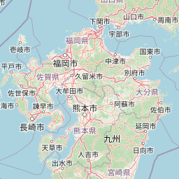
Why Unzen-Amakusa National Park stands out

Unzen-Amakusa is best known for its dramatic volcanic landscape centered on Mount Unzen, one of Japan's most active and dangerous volcanoes. The park also preserves the Amakusa islands, a chain of rugged volcanic islands with distinctive coastlines, cliffs, and marine environments. Beyond its natural features, the park is notable for its deep connection to Japan's hidden Christian history, encompassing sites related to the Kakure Kirishitan who maintained their faith through centuries of prohibition. The juxtaposition of volcanic fire and religious perseverance gives this park a distinctive character within Japan's protected areas.

Unzen-Amakusa National Park history and protected-area timeline

Unzen-Amakusa National Park traces its origins to March 1934, when it was initially established as Unzen National Park, making it one of Japan's first national parks created under the country's pioneering conservation framework. The original designation reflected the area's exceptional volcanic landscapes and the recognition that Mount Unzen and its surroundings warranted national-level protection.

The park underwent significant expansion in 1956, when the Amakusa islands and surrounding marine areas were incorporated into the protected zone, leading to the renaming as Unzen-Amakusa National Park. This expansion reflected a growing understanding of the interconnectedness between volcanic terrestrial environments and the surrounding marine ecosystems. The park's boundaries have continued to evolve as conservation priorities have shifted and as the understanding of the region's ecological and cultural values has deepened.

Unzen-Amakusa National Park landscape and geographic character

The landscape of Unzen-Amakusa National Park is defined by the powerful interplay between volcanic processes and marine environments. Mount Unzen rises as a prominent stratovolcano, its slopes carved by past eruptions and its crater still capable of producing the pyroclastic flows that make it one of Japan's most hazardous peaks. The volcanic terrain includes lava domes, ash deposits, and the stark, recovery-stage landscapes left by the 1990s eruptions where vegetation is gradually returning.

The Amakusa islands present a contrasting but equally dramatic landscape of rugged, steep-sided volcanic mountains rising directly from the sea. Coastal cliffs drop sharply into productive waters, while the islands' interiors contain rolling hills and small valleys. The Yatsushiro Sea between the islands and the mainland creates a distinct marine environment influenced by warm currents from the south. This combination of dramatic upland terrain and productive marine waters gives the park a diverse physical character that supports varied ecosystems.

Unzen-Amakusa National Park ecosystems, habitats, and plant life

The ecological character of Unzen-Amakusa reflects the park's position in southern Kyushu's warm temperate zone. The lower slopes of Mount Unzen support dense forests of Japanese cedar and cypress, while higher elevations give way to mixed hardwood forests. The volcanic soils, despite their recent disturbance, support opportunistic vegetation that is gradually reclaiming the eruption-affected areas, demonstrating the resilience of forest ecosystems in this region.

The Amakusa islands contain distinctive coastal and marine habitats. The surrounding waters support rich fish populations, coral communities in warmer months, and important marine bird habitats. The islands' isolated position has allowed some species to develop local adaptations, and the combination of terrestrial and marine environments within a single protected area creates unusual ecological diversity. The park's elevation range from sea level to over 1,500 meters at Mount Unzen's peak contributes to habitat diversity across different vegetation zones.

Unzen-Amakusa National Park wildlife and species highlights

Unzen-Amakusa supports representative wildlife of southern Japan's warm temperate forests and marine environments. The terrestrial habitats shelter populations of Japanese macaques, deer, and smaller mammals, while the forests provide important bird habitat for both resident species and migratory visitors. The avian community includes various thrushes, warblers, and raptors that use the diverse forest environments.

The marine environments surrounding the Amakusa islands are particularly significant for seabirds and for fish species that inhabit the productive waters of the Yatsushiro Sea. The coastal cliffs serve as nesting sites for seabirds, and the underwater environments support diverse fish communities. While the park is not known for any single flagship species of exceptional rarity, the combination of forested slopes, volcanic terrain, and productive marine waters creates a coherent ecosystem that supports biodiversity across multiple habitat types.

Unzen-Amakusa National Park conservation status and protection priorities

Unzen-Amakusa National Park represents an important conservation designation for southern Japan's volcanic and coastal ecosystems. The park's protection encompasses not only the terrestrial volcanic landscapes but also the surrounding marine environments, recognizing that effective conservation must address both land and sea. The IUCN Category II designation reflects the park's role in protecting outstanding natural landscapes while allowing sustainable use.

The volcanic nature of the park presents unique management challenges, as Mount Unzen remains an active volcano with ongoing monitoring and hazard mitigation requirements. Conservation efforts must balance visitor access with safety considerations while working to protect the ecological values of the area. The presence of culturally significant sites related to Japan's Christian heritage adds another dimension to conservation planning, as both natural and cultural values require consideration in park management.

Unzen-Amakusa National Park cultural meaning and human context

The cultural landscape of Unzen-Amakusa carries profound significance rooted in Japan's complex religious history. The Amakusa islands and surrounding coastal areas became refuge for Kakure Kirishitan—hidden Christians—during the Edo period when Christianity was banned and practitioners faced persecution. These communities developed unique practices that blended Catholic traditions with local customs, maintaining their faith in secret for over two centuries until religious freedom was restored in the late 19th century.

The park encompasses numerous sites related to this hidden Christian heritage, including locations where communities gathered for secret worship, places associated with martyrs and missionaries, and areas where the distinctive cultural practices of the Kakure Kirishitan were preserved. This cultural dimension transforms the park from a purely natural landscape into a place where geological processes and human spiritual history intersect. The resilience of these communities in the face of volcanic danger and religious persecution creates a compelling narrative that enriches the park's identity.

Top sights and standout views in Unzen-Amakusa National Park

The defining highlights of Unzen-Amakusa National Park include the dramatic volcanic landscape of Mount Unzen, with its history of active eruptions and ongoing geological processes. The Amakusa islands offer a contrasting maritime environment with rugged coastlines, traditional fishing communities, and cultural sites related to Japan's hidden Christian history. The park's combination of natural volcanic beauty and profound human cultural story makes it distinctive among Japan's protected areas.

Best time to visit Unzen-Amakusa National Park

The best time to visit Unzen-Amakusa National Park depends on interests and tolerance for different conditions. Spring and autumn offer comfortable temperatures and generally stable weather, making these seasons popular for hiking and outdoor exploration. Summer brings warmer temperatures and the opportunity to enjoy the marine environments around the Amakusa islands, though this is also the typhoon season. Winter can be cold but often clear, offering different perspectives on the volcanic landscapes. Those interested in the cultural aspects related to Christian heritage may find that any season provides meaningful access to the significant sites within the park.

Park location guide

Geography guide, regional context, and park location map for Unzen-Amakusa National Park

Unzen-Amakusa National Park park geography, regions, and map view in Japan
Understand where Unzen-Amakusa National Park sits in Japan through a broader geographic reading of the surrounding landscape, nearby location context, and its mapped position within the national park landscape.

How Unzen-Amakusa National Park fits into Japan

Japan is an island nation in East Asia comprising over 14,000 islands in the Pacific Ocean. The country operates as a unitary parliamentary constitutional monarchy with Emperor Naruhito as the reigning monarch and Prime Minister Sanae Takaichi leading the government. With a population of approximately 123 million, Japan is the world's 11th most populous country and a major economic power with one of the strongest militaries, though it has constitutionally renounced its right to declare war.

Wider geography shaping Unzen-Amakusa National Park in Japan

Japan is an island nation in the Pacific Ocean, bordered to the west by the Sea of Japan and extending from the Sea of Okhotsk in the north to the East China Sea in the south. The Japanese archipelago lies off the northeast coast of the Asian mainland. Approximately 75% of Japan's terrain is mountainous and heavily forested, with agricultural land and urbanized populations concentrated along the eastern coastal plains. The country is divided into 47 administrative prefectures and eight traditional regions.

Map view of Unzen-Amakusa National Park

Use this park location map to pinpoint Unzen-Amakusa National Park in Japan, understand its exact geographic position, and read its mapped placement within the surrounding landscape more clearly.

Pigeon | © OpenStreetMap contributors

Location context for Unzen-Amakusa National Park

Kagoshima PrefectureKumamoto PrefectureNagasaki Prefecture
Park atlas

Explore the Regional Spread of Conservation Landscapes Across Kyushu's Volcanic and Coastal Terrain

Discover Other National Parks and Protected Areas Near Unzen-Amakusa National Park
Continue your park exploration from Unzen-Amakusa National Park by browsing other national parks and protected areas across southern Kyushu, including its unique volcanic terrain, active coasts, and island ecosystems. This contextual view helps you compare the geographic spread of Japan's conservation landscapes, understanding their positions within regional and national park atlases.
National parkKagoshima Prefecture

Yakushima National Park: Ancient Cedar Forests and Volcanic Mountain Landscape

Discover the mapped boundaries and protected area geography.

Yakushima National Park, situated in Kagoshima Prefecture, is a prime example of protected island geography, renowned for its ancient yakusugi cedar trees and dramatic mountainous terrain. The park's protected status covers over 32,000 hectares, featuring peaks over 1,900 meters and significant biodiversity. This atlas-focused entry helps users grasp the park's unique landscape context, its position within Japan's protected areas, and the essence of its natural environment for geographic exploration.

Area
325.53 km²
Established
2012
IUCN
II
National parkJapan

Setonaikai National Park: Japan's Premier Island Archipelago and Coastal Protected Landscape

Explore the unique marine geography and mapped island environments.

Setonaikai National Park is Japan's largest national park, renowned for its stunning marine environment within the Seto Inland Sea. This protected area features approximately 3,000 islands, showcasing weathered granite formations, coastal forests, and dynamic tidal phenomena like the Naruto whirlpools. The park offers a unique atlas-style exploration of island geography, coastal landscapes, and significant cultural sites, making it a cornerstone of Japan's protected natural heritage.

Area
669.34 km²
Established
1934
IUCN
II
National parkJeju Province

Hallasan National Park: South Korea's Highest Mountain National Park on Jeju

Volcanic Terrain and Mapped Protected Boundaries

Hallasan National Park encompasses South Korea's highest mountain, a massive shield volcano on Jeju Island. This page details the park's protected landscape, from sub-tropical forests to alpine environments, and its prominent role within Jeju Province's geography. Discover its mapped terrain and unique geological features, including the summit crater lake Baekrokdam.

Area
153.11 km²
Established
1970
IUCN
II
Relief
Mountain
National parkSouth Korea

Juwangsan National Park: Protected Mountain Landscape and Regional Geography in South Korea

Mapped terrain, park boundaries, and natural landscapes.

Juwangsan National Park is a protected natural area situated within South Korea's Taebaek mountain range, renowned for its steep valleys, waterfalls, and dense forests. This park offers a rich landscape context, showcasing dramatic ridgelines and providing a significant example of South Korea's protected mountain terrain. Discover its geographic placement, mapped protected boundaries, and the unique natural and cultural elements that define this national park.

Area
107.42 km²
Established
1976
IUCN
II
National parkGyeongsangbuk-do

Woraksan National Park: A Key National Park in Gyeongsangbuk-do's Regional Geography

Discover its mapped mountain terrain and protected landscape identity.

Woraksan National Park offers a detailed view of protected mountain landscapes within South Korea's Gyeongsangbuk-do region. The park is characterized by its prominent Mount Worak, steep ridgelines, and dense forested terrain, contributing significantly to the nation's network of protected areas. Users can explore the geographic context, mapped boundaries, and ecological significance of this vital national park, understanding its place in the broader regional atlas and natural landscape context.

Area
287.78 km²
Established
1984
IUCN
II
Relief
Mountain
National parkKansai

Yoshino-Kumano National Park: Protected National Park with Sacred Mountain Landscapes and Ancient Routes

Explore mapped park boundaries, gorges, and pilgrimage routes in Kansai.

Yoshino-Kumano National Park, a significant national park in Japan's Kansai region, invites exploration of its protected landscapes, which are deeply intertwined with spiritual heritage. Discover the park's rugged mountain terrain, ancient cypress and cedar forests, dramatic gorges like Dorokyō Gorge, and iconic coastal areas. This park is a vital entry for understanding Japan's confluence of natural geography and cultural pilgrimage, offering rich context for mapped landscape discovery.

Area
616.04 km²
Established
1936
IUCN
II
National parkIshikawa Prefecture

Hakusan National Park: Sacred Mountain Protected Landscape in Ishikawa Prefecture

Mapped alpine terrain and volcanic geography for protected area discovery.

Hakusan National Park offers a unique exploration of Japan's sacred mountain heritage and alpine natural beauty. This protected landscape, centered on Mount Haku, features distinct volcanic terrain, crater lakes, and exceptional alpine flora. Users can explore the park's mapped boundaries, understand its place within Ishikawa Prefecture's geography, and appreciate its role as a significant UNESCO Biosphere Reserve for detailed atlas-based discovery.

Area
477 km²
Established
1962
IUCN
II
National parkChūbu region

Minami Alps National Park: A Protected Alpine Wilderness in Japan's Chūbu Region

Discover its dramatic peaks and vital river headwaters.

Minami Alps National Park offers a profound exploration into Japan's high-altitude natural geography. As a national park, it preserves a dramatic alpine environment defined by glacially carved terrain and multiple peaks exceeding 3000 meters. This protected landscape serves as a vital watershed, safeguarding the origins of major river systems and showcasing a rugged mountain character distinct from more accessible areas, ideal for understanding protected wildlands.

Area
357.52 km²
Established
1964
IUCN
II

Common questions about visiting, size, designation, and location context for Unzen-Amakusa National Park

Unzen-Amakusa National Park FAQs for park facts, access, geography, and protected area context
Find quick answers about Unzen-Amakusa National Park, including protected-area facts, park geography, trail and visitor context, and how the park fits into its surrounding country and regional landscape.
MoriAtlas Explorer

Continue Your Protected Areas Search Across the Global Atlas

Deepen your exploration by continuing the structured search for national parks and protected areas worldwide. Utilize the comprehensive filtering capabilities to compare different conservation landscapes and refine your understanding of global park geography. Discover more about the distribution and characteristics of protected natural areas.

Global natural geography