Mori Atlas logo
National parkTowada-Hachimantai National Park

Discover the mapped boundaries and rugged terrain of this northern Honshu national park.

Towada-Hachimantai National Park: Japan's Volcanic Landscapes and Caldera Lake Protected Area

(Towada-Hachimantai Kokuritsu Kōen)

Towada-Hachimantai National Park represents a significant protected landscape in Japan's Tōhoku region, safeguarding a representative cross-section of northern alpine and volcanic terrain. This national park, established in 1936, encompasses two distinct zones: the Towada-Hakkōda area centered on the stunning caldera lake, and the Hachimantai volcanic zone with its characteristic peaks. Its protected boundaries cover a diverse geography, from the serene waters of Lake Towada and the Oirase River valley to the rugged slopes of numerous volcanic mountains, offering rich opportunities for landscape discovery.

Volcanic landscapesCaldera lakeOld-growth beech forestMountain peaksRiver valleysAlpine environments

Towada-Hachimantai National Park

National park

Park overview

Structured park overview, official facts, and landscape profile for Towada-Hachimantai National Park

Towada-Hachimantai National Park park facts, protected area profile, and essential visitor context
Review the core facts for Towada-Hachimantai National Park, including designation, size, terrain, visitor scale, habitats, and operating context in one park-focused overview.

About Towada-Hachimantai National Park

Towada-Hachimantai National Park occupies a special place among Japan's national parks as one of the original four parks established under the National Parks Law of 1931, with official designation coming on February 1, 1936. The park's dual structure reflects the geological reality of the region, where two separate volcanic systems have created distinct landscape characters that nonetheless share the common heritage of Japan's volcanic alpine environments. The Towada-Hakkōda section preserves a landscape shaped by the ancient Towada caldera, with Lake Towada serving as a hydrological anchor and spiritual touchstone for the region. The lake's deep blue waters and surrounding steep cliffs create a visually striking scene that has been celebrated in Japanese art and literature for centuries. The Oirase River, originating from Lake Towada's northeastern shore, flows through a V-shaped valley that has become synonymous with the park's scenic character. The Hachimantai section to the south presents a different aspect of volcanic landscape, with its ensemble of peaks including Mount Hachimantai itself, the imposing Mount Iwate, and the sacred peak of Akita Komagatake. These mountains support a range of alpine and subalpine ecosystems that transition with elevation from mixed forest through coniferous belt to alpine meadows. Tamagawa Hot Spring, one of Japan's notable hot spring areas, provides a natural interface between the volcanic geology and human use of the landscape.

Quick facts and research context for Towada-Hachimantai National Park

Towada-Hachimantai National Park spans three prefectures in Japan's Tōhoku region and contains two major volcanic highland zones. The park was one of Japan's earliest protected areas, established in 1936 under the National Parks Law. Lake Towada, a caldera lake of significant depth and clarity, forms the centerpiece of the northern park section. The Oirase River flows from the lake through a steep-sided valley, offering one of the park's most scenic river corridors. The southern Hachimantai zone features a cluster of stratovolcanoes and volcanic plateaus with associated hot springs. The park falls under IUCN Category II classification for national parks.

Park context

Deeper park guide and search-rich context for Towada-Hachimantai National Park

Towada-Hachimantai National Park history, landscape, wildlife, and travel context
Explore Towada-Hachimantai National Park through its history, landscape character, ecosystems, wildlife, conservation priorities, cultural context, and seasonal travel timing in a structured park guide built for atlas discovery and search intent.

Why Towada-Hachimantai National Park stands out

Towada-Hachimantai is best known for its dramatic contrast between the tranquil, mirror-like surface of Lake Towada set against the backdrop of forested volcanic peaks, and the rugged alpine terrain of the Hachimantai volcanic zone. The Oirase River valley, with its cascading rapids and dense beech forests, represents one of the finest examples of untouched montane riverine ecosystems in Japan. The park also protects significant areas of subalpine vegetation and hosts a collection of dormant and active volcanoes that shape the characteristic skylines of both park sections.

Towada-Hachimantai National Park history and protected-area timeline

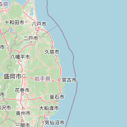
Towada-Hachimantai was among the first cohort of Japanese national parks, reflecting the growing awareness in early 20th century Japan of the need to preserve outstanding natural landscapes. The park's establishment in 1936 came during a period of increasing environmental consciousness and followed the passage of the National Parks Law in 1931. The original park boundaries have been adjusted over the decades to better protect core areas while accommodating local land use patterns. The dual-area structure was maintained, recognizing that the Towada-Hakkōda and Hachimantai zones, while geographically separated, together represent the range of volcanic highland ecosystems found in northern Honshu. Management authority rests with the Ministry of the Environment, with coordination among the three prefectural governments whose territories the park encompasses.

Towada-Hachimantai National Park landscape and geographic character

The park's landscape is fundamentally shaped by volcanic activity, with the two major zones presenting contrasting expressions of this geological heritage. The Towada-Hakkōda area centers on Lake Towada, a caldera lake formed through a complex volcanic history, now occupying a basin surrounded by steep walls that rise 400 to 500 meters above the water. The lake covers approximately 61 square kilometers and reaches depths exceeding 327 meters, making it one of Japan's deepest. The surrounding Hakkōda Mountains form a rugged volcanic massif with several peaks exceeding 1,500 meters. The Oirase River valley cuts deeply into the landscape, with the river descending from Lake Towada through a series of rapids and waterfalls that are particularly impressive during the snowmelt season. The Hachimantai zone features a more dispersed volcanic landscape where multiple stratovolcanoes and volcanic plateaus create a complex terrain. The plateau surfaces and gentle slopes contrast with the steeper cone shapes of individual peaks, while deep valleys radiate from the high ground carrying drainage to broader valley systems.

Towada-Hachimantai National Park ecosystems, habitats, and plant life

The ecological character of Towada-Hachimantai reflects the transitional position of the Tōhoku region between Japan's warm-temperate and cool-temperate zones. Vegetation transitions with elevation from evergreen broadleaf forests at lower elevations through mixed forest to coniferous forest and ultimately to subalpine communities at the highest elevations. The beech forests along the Oirase River valley are particularly notable, representing some of the finest old-growth beech forest remaining in Japan. These forests support a complex understory and provide habitat for numerous species. The volcanic soils and varied topography create diverse microhabitats, while the presence of Lake Towada adds a significant lacustrine element to the park's ecological diversity. The Hachimantai zone's higher elevation and more exposed positions favor subalpine species, with alpine meadows and krummholz vegetation occurring near the peaks.

Towada-Hachimantai National Park wildlife and species highlights

The diverse habitats within Towada-Hachimantai support a corresponding diversity of wildlife species. The old-growth beech and mixed forests provide ideal habitat for Japanese serow, a species endemic to Japan's mountains that remains relatively common within the park. Japanese macaques also inhabit the forest zones, often observable in groups near the Oirase River valley. Birdlife is particularly well-represented, with species including the Japanese green woodpecker, varied tit, and brown dipper along the river corridors. The lake supports waterfowl and provides foraging habitat for fish-eating species. The subalpine zones host species adapted to harsher conditions, including rock ptarmigan in the highest terrain. The streams and rivers contain populations of native char and masu salmon, reflecting the healthy aquatic environments maintained by the protected area status.

Towada-Hachimantai National Park conservation status and protection priorities

Towada-Hachimantai serves as a critical conservation anchor for the Tōhoku region's volcanic highland ecosystems. The park protects representative examples of Japan's montane and subalpine environments, preserving ecological processes and species populations that would otherwise face pressure from development and resource extraction. The old-growth forest sections, particularly the beech-dominated stands along the Oirase River, represent conservation priorities given the general scarcity of such ecosystems in Japan. Lake Towada's relatively pristine condition, maintained through strict protection of its watershed, demonstrates the effectiveness of the national park framework in preserving water quality and aquatic ecosystems. The volcanic landscapes, while shaped by natural disturbance processes, benefit from protection that prevents inappropriate development in sensitive alpine zones.

Towada-Hachimantai National Park cultural meaning and human context

The landscape of Towada-Hachimantai carries deep cultural significance in the Tōhoku region. Lake Towada has been a place of spiritual importance, with the area around the lake's northeastern shore containing shrines and places of worship. The mountain peaks of the Hachimantai zone, particularly Akita Komagatake, hold religious significance as sacred mountains that have been the focus of pilgrimage traditions. The hot spring areas, notably Tamagawa Onsen, have been places of bathing and healing for centuries. The park encompasses lands traditionally associated with communities in Aomori, Iwate, and Akita Prefectures, and the place names throughout the area reflect the cultural heritage of these local populations.

Top sights and standout views in Towada-Hachimantai National Park

The most iconic views in Towada-Hachimantai come from the shores and rim of Lake Towada, where the lake's dramatic setting among volcanic peaks creates scenes of considerable beauty. The Oirase River trail following the river from the lake through its spectacular valley provides one of Japan's classic Nature Trail experiences, with waterfalls, rapids, and ancient forest. The ascent to the Hachimantai plateau and the surrounding volcanic peaks offers access to alpine environments uncommon in Japan's national park system. The seasonal变化 of the park provide distinctly different experiences, from the fresh greens of early summer through the vibrant autumn colors of the beech forests to the winter snowscape that transforms the high country.

Best time to visit Towada-Hachimantai National Park

The park can be visited throughout the year, with each season offering distinctive experiences. Summer brings the most reliable access to trail systems and offers the opportunity to see the park's diverse flora in flower, with the alpine zones at their most accessible. Autumn transforms the lower elevations with brilliant foliage, particularly along the Oirase River where the beech and mixed forests create spectacular color displays. Winter closes the higher trails but offers opportunities for snow-based activities in designated areas, while the lake and surrounding mountains present starkly beautiful winter landscapes. Spring brings the gradual snowmelt and the emergence of new vegetation, though conditions can be changeable as the season transitions.

Park location guide

Geography guide, regional context, and park location map for Towada-Hachimantai National Park

Towada-Hachimantai National Park park geography, regions, and map view in Japan
Understand where Towada-Hachimantai National Park sits in Japan through a broader geographic reading of the surrounding landscape, nearby location context, and its mapped position within the national park landscape.

How Towada-Hachimantai National Park fits into Japan

Japan is an island nation in East Asia comprising over 14,000 islands in the Pacific Ocean. The country operates as a unitary parliamentary constitutional monarchy with Emperor Naruhito as the reigning monarch and Prime Minister Sanae Takaichi leading the government. With a population of approximately 123 million, Japan is the world's 11th most populous country and a major economic power with one of the strongest militaries, though it has constitutionally renounced its right to declare war.

Wider geography shaping Towada-Hachimantai National Park in Japan

Japan is an island nation in the Pacific Ocean, bordered to the west by the Sea of Japan and extending from the Sea of Okhotsk in the north to the East China Sea in the south. The Japanese archipelago lies off the northeast coast of the Asian mainland. Approximately 75% of Japan's terrain is mountainous and heavily forested, with agricultural land and urbanized populations concentrated along the eastern coastal plains. The country is divided into 47 administrative prefectures and eight traditional regions.

Map view of Towada-Hachimantai National Park

Use this park location map to pinpoint Towada-Hachimantai National Park in Japan, understand its exact geographic position, and read its mapped placement within the surrounding landscape more clearly.

Pigeon | © OpenStreetMap contributors

Location context for Towada-Hachimantai National Park

Akita PrefectureAomori PrefectureIwate PrefectureTōhoku
Park atlas

Trace connected protected landscapes and compare adjacent national parks, exploring the diverse volcanic terrain of Northern Honshu.

Explore Nearby National Parks and Related Protected Areas Beyond Towada-Hachimantai National Park
After learning about Towada-Hachimantai National Park, continue your exploration by comparing other national parks and protected areas within Japan's Northern Honshu region. Discover how diverse volcanic terrains, ancient forests, and significant caldera lakes are protected, gaining a broader understanding of regional park geography and conservation efforts.
National parkHokkaido

Shikotsu-Tōya National Park: Hokkaido's Premier Volcanic National Park with Caldera Lakes

Explore mapped terrain, geothermal features, and active volcanoes.

Shikotsu-Tōya National Park, located in Hokkaido, Japan, is a prime example of a protected area defined by its intense volcanic geology. The park features prominent caldera lakes, including Lake Shikotsu and Lake Tōya, surrounded by active volcanic cones and dramatic geothermal landscapes. Its distinctive terrain makes it a key destination for understanding regional geography and the mapped protected areas of Japan's northern island, offering a unique glimpse into dynamic geological processes.

Area
994.73 km²
Established
1949
IUCN
II
National parkHokkaido

Hidakasanmyaku-Erimo-Tokachi National Park: Japan's Largest Protected Landscape Atlas

Volcanic peaks, coastal cliffs, and Hokkaido's expansive geography.

Hidakasanmyaku-Erimo-Tokachi National Park represents Japan's largest national park, offering a comprehensive exploration of its protected landscape. This vast area in Hokkaido combines the rugged topography of the Hidaka volcanic mountain range with the striking maritime environment of Cape Erimo. Users can explore detailed geographic contexts, understand the park's extensive boundaries, and appreciate its role as a crucial protected natural area at the intersection of alpine and coastal ecosystems.

Area
2,456.68 km²
Established
2024
IUCN
II
National parkJapan

Daisetsuzan National Park: Japan's Premier Volcanic Alpine Protected Landscape

Explore Hokkaido's largest national park and its vast mountain terrain.

Daisetsuzan National Park is a monumental protected area, covering extensive mountainous territory in Hokkaido, Japan. This national park is characterized by its dramatic volcanic geography, featuring numerous peaks over 2,000 meters and a rugged backcountry that defines Japan's northern alpine wilderness. Delve into the mapped boundaries and regional context of this significant protected landscape to understand its unique geological identity and ecological importance.

Area
2,267.64 km²
Established
1934
IUCN
II
National parkHokkaido

Kushiro-Shitsugen National Park: Protected Wetland Ecosystems and Landscape

Explore the mapped terrain of eastern Hokkaido's vital peatlands.

Kushiro-Shitsugen National Park is a national park in eastern Hokkaido, Japan, safeguarding the nation's largest wetland and peatland. The park encompasses the expansive Kushiro Wetlands, characterized by vast reedbeds and a network of meandering rivers, making it a critical habitat for species like the endangered red-crowned crane. This protected area offers a unique landscape for understanding Japan's freshwater ecosystems and their geographic distribution within the region.

Area
268.61 km²
Established
1987
IUCN
II
National parkKantō region

Oze National Park National Park: A Key Protected Landscape in the Kantō Region

Explore its mapped geography and protected area context.

Oze National Park is a designated national park in Japan's Kantō region, offering a prime example of a protected landscape. This page provides detailed insights into its geographic setting and mapped boundaries, contributing to a structured understanding of regional natural terrain. Users can delve into the park's specific identity as a conservation area and its significance within the broader atlas of Japanese geography and protected lands.

Area
372.22 km²
Established
2007
IUCN
V
National parkHokkaido

Rishiri-Rebun-Sarobetsu National Park: Volcanic Islands and Coastal Wetlands of Northern Hokkaido

Explore its mapped geography and unique subarctic alpine flora.

Rishiri-Rebun-Sarobetsu National Park in Hokkaido, Japan, offers a unique exploration of dramatic volcanic islands and vital coastal wetland ecosystems. This protected area showcases striking geological formations, from the conical peaks of Rishiri and Rebun islands to the vast peat bogs of the Sarobetsu Plain. Its subarctic environment supports a rich tapestry of alpine flora, providing a distinct case study in protected landscape geography and mapping for the region.

Area
241.66 km²
Established
1974
IUCN
II
National parkHokkaido

Shiretoko National Park: Hokkaido's Protected Natural Landscape and Geography

Explore mapped boundaries and regional park context.

Shiretoko National Park, designated as a national park in Hokkaido, Japan, serves as a vital point for understanding regional geography and protected landscape exploration. This entry offers a structured view of the park's geographic scope, focusing on its mapped boundaries and natural terrain. Discover how Shiretoko National Park contributes to the broader atlas of conservation lands in the Hokkaido region, providing context for its unique ecological and geographic significance.

Area
386.36 km²
Established
1964
IUCN
II
National parkIshikawa Prefecture

Hakusan National Park: Sacred Mountain Protected Landscape in Ishikawa Prefecture

Mapped alpine terrain and volcanic geography for protected area discovery.

Hakusan National Park offers a unique exploration of Japan's sacred mountain heritage and alpine natural beauty. This protected landscape, centered on Mount Haku, features distinct volcanic terrain, crater lakes, and exceptional alpine flora. Users can explore the park's mapped boundaries, understand its place within Ishikawa Prefecture's geography, and appreciate its role as a significant UNESCO Biosphere Reserve for detailed atlas-based discovery.

Area
477 km²
Established
1962
IUCN
II

Common questions about visiting, size, designation, and location context for Towada-Hachimantai National Park

Towada-Hachimantai National Park FAQs for park facts, access, geography, and protected area context
Find quick answers about Towada-Hachimantai National Park, including protected-area facts, park geography, trail and visitor context, and how the park fits into its surrounding country and regional landscape.
MoriAtlas Explorer

Continue Your Protected Areas Search Across the Global Atlas

Deepen your exploration by continuing the structured search for national parks and protected areas worldwide. Utilize the comprehensive filtering capabilities to compare different conservation landscapes and refine your understanding of global park geography. Discover more about the distribution and characteristics of protected natural areas.

Global natural geography