Mori Atlas logo
National parkDaisetsuzan National Park

Discover the vast volcanic terrain and protected alpine wilderness of Hokkaido's premier national park.

Daisetsuzan National Park: Japan's Largest National Park Alpine Landscape Atlas

Daisetsuzan National Park represents a significant protected landscape within Japan, encompassing 2,267 square kilometers of rugged mountainous terrain across Hokkaido's central region. This national park is defined by sixteen peaks exceeding 2,000 meters and three major volcanic mountain groups, offering a unique atlas of stratovolcanoes and alpine environments. Its vast protected area provides a clear geographic context for understanding Japan's northern alpine wilderness and its distinct geological features.

Volcanic mountainsAlpine environmentsNational parkHokkaido wildernessBrown bear habitatAlpine meadows

Daisetsuzan National Park

National park

Park overview

Structured park overview, official facts, and landscape profile for Daisetsuzan National Park

Daisetsuzan National Park park facts, protected area profile, and essential visitor context
Review the core facts for Daisetsuzan National Park, including designation, size, terrain, visitor scale, habitats, and operating context in one park-focused overview.

About Daisetsuzan National Park

Daisetsuzan National Park represents one of Japan's most significant protected mountain wilderness areas, encompassing a vast volcanic landscape in the heart of Hokkaido. The park's creation in 1934 marked a milestone in Japanese conservation history, establishing protection for a landscape that had long been revered as a sacred mountain environment. The geological foundation of the park consists of three volcanic mountain groups, each containing stratovolcanoes that have built up over geological time as successive vents became active and constructed peaks before becoming dormant. The Daisetsuzan Volcanic Group in the north contains the park's most dramatic elevations, including Mount Asahi, which at 2,290 meters stands as the absolute highest point in Hokkaido. The Tokachi Volcanic Group occupies the southwestern portion of the park, lying north of the Yubari and Hidaka Mountains, while the Shikaribetsu Volcanic Group dominates the eastern section around Mount Ishikari. These volcanic groups surround a central highland area centered on Mount Tomuraushi, creating a complex mountain landscape that offers both accessible alpine environments and true wilderness backcountry. The park's significance extends beyond its geological features to encompass remarkable biodiversity, with the forests supporting characteristic subalpine tree species and the alpine zones protecting specialized plant communities that have adapted to the harsh high-elevation environment.

Quick facts and research context for Daisetsuzan National Park

Daisetsuzan National Park spans Kamikawa and Tokachi subprefectures in central Hokkaido, encompassing three volcanic mountain groups around a central highland dominated by Mount Tomuraushi. The park contains 16 peaks over 2,000 meters, with Mount Asahi being Hokkaido's highest point. The Ishikari River, Japan's third-longest river, originates from Mount Ishikari within the park and flows for 268 kilometers across Hokkaido. The park includes several onsen hot spring resorts at Asahidake, Sōunkyō, and Tenninkyo, providing visitor access to the volcanic landscape. The park receives approximately 6 million visitors annually and was Japan's largest national park until the establishment of Hidakasanmyaku-Erimo-Tokachi National Park in 2024.

Park context

Deeper park guide and search-rich context for Daisetsuzan National Park

Daisetsuzan National Park history, landscape, wildlife, and travel context
Explore Daisetsuzan National Park through its history, landscape character, ecosystems, wildlife, conservation priorities, cultural context, and seasonal travel timing in a structured park guide built for atlas discovery and search intent.

Why Daisetsuzan National Park stands out

Daisetsuzan National Park is best known for its dramatic volcanic alpine landscape featuring towering peaks, pristine alpine meadows, and remote backcountry wilderness. The park protects Hokkaido's highest mountains and offers exceptional alpine environments including the rare pika mammal and significant brown bear populations. Half of all alpine plant species found in Hokkaido grow within the park, reflecting its ecological significance as a center of alpine biodiversity. The park's three volcanic mountain groups, particularly the Daisetsuzan Volcanic Group with Mount Asahi, define the landscape and create a distinctive alpine experience unlike any other protected area in Japan.

Daisetsuzan National Park history and protected-area timeline

Daisetsuzan National Park was established on December 4, 1934, making it one of Japan's oldest national parks and a pioneering effort in the country's protected area system. The park's creation reflected a growing recognition in early 20th century Japan of the need to preserve significant natural landscapes, particularly those with cultural and spiritual significance. The name Daisetsuzan, meaning 'great snowy mountains,' has long described this high-altitude environment where snow persists well into the summer months on many peaks. Prior to national park designation, the area had been recognized for its scenic and spiritual importance, with the volcanic peaks serving as objects of reverence in the indigenous Ainu cultural context. The establishment of the park preceded modern environmental legislation and represented an early attempt to balance resource use with conservation in Japan's mountainous regions. Over the decades since its creation, the park has maintained its core protection while adapting management approaches to accommodate increasing visitor interest in Japan's mountain environments.

Daisetsuzan National Park landscape and geographic character

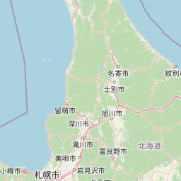
The landscape of Daisetsuzan National Park is defined by its volcanic origins, with three distinct volcanic mountain groups creating a dramatic skyline of stratovolcano peaks rising above subalpine forests and alpine meadows. The Daisetsuzan Volcanic Group forms the northern core of the park, containing the highest peaks including Mount Asahi, which at 2,290 meters is not only the park's highest summit but the highest point in all of Hokkaido. These peaks are composed of volcanic material built up through successive eruptions, with the characteristic conical shapes of stratovolcanoes dominating the horizon. The Tokachi Volcanic Group extends across the southwestern portion of the park, featuring Mount Tokachi as its central peak, while the Shikaribetsu Volcanic Group occupies the eastern section around Mount Ishikari, from which the Ishikari River originates. This river, at 268 kilometers the longest in Hokkaido and third-longest in all of Japan, emerges from the volcanic slopes and flows across the island to the Sea of Japan. Around these volcanic groups, a central highland area centered on Mount Tomuraushi provides more rolling alpine terrain, while the transition between volcanic peaks and forested valleys creates diverse scenic environments. Alpine meadows dot the higher elevations, providing seasonal color across the landscape.

Daisetsuzan National Park ecosystems, habitats, and plant life

Daisetsuzan National Park supports remarkable ecological diversity, with the combination of volcanic terrain, alpine elevations, and subalpine forests creating multiple distinct habitat types. The forest environment is dominated by two conifer species characteristic of northern Japan: Picea jezoensis, known as the Jezo spruce, and Abies sachalinensis, the Sakhalin fir. These species form extensive subalpine forests that clothe the mountain slopes below the alpine zone. The park is particularly significant for its alpine plant communities, supporting approximately 225 of the 450 alpine plant species recorded across all of Hokkaido, making it the single most important area for alpine flora preservation on the island. The alpine meadows above the treeline provide habitat for specialized species adapted to harsh conditions including strong winds, low temperatures, and heavy winter snowpack. The park also contains wetland areas and natural ponds that add to the habitat diversity, supporting species characteristic of high-elevation aquatic environments.

Daisetsuzan National Park wildlife and species highlights

The wildlife of Daisetsuzan National Park includes several species of notable conservation significance within the Japanese context. Brown bears inhabit the park, representing one of the last substantial populations of this species in Japan where the bear holds cultural significance as a symbol of wilderness. The pika, a small mammal with distinctive short limbs, rounded ears, and lack of external tail, occupies the alpine rock fields and meadow areas, representing a species that has become a characteristic inhabitant of the park's high-elevation environments. The forested areas provide habitat for various bird species and smaller mammals, while the alpine zones support their own distinct communities of invertebrates and small vertebrates adapted to the harsh mountain conditions. The ecological structure of the park, moving from subalpine forests through krummholz zones to alpine meadows and rock fields, creates a vertical zonation that supports diverse wildlife communities at different elevations.

Daisetsuzan National Park conservation status and protection priorities

Daisetsuzan National Park holds significant conservation importance as Japan's largest national park and a crucial protected area for alpine and subalpine ecosystems on Hokkaido. The protection of the park's volcanic mountain landscape preserves not only geological and scenic values but also critical habitat for species that depend on the unique combination of high elevation, volcanic soils, and relatively undisturbed conditions. The park's role in protecting half of Hokkaido's alpine plant species underscores its exceptional botanical significance, while the presence of brown bears represents a keystone species that requires large tracts of undeveloped wilderness. The national park designation provides a framework for managing visitor use while maintaining the ecological integrity of the volcanic mountain environment, though the challenge of balancing access with conservation remains ongoing. As Japan's oldest large mountain protected area, Daisetsuzan serves as a reference point for mountain conservation approaches in the country.

Daisetsuzan National Park cultural meaning and human context

The landscape of Daisetsuzan National Park holds cultural significance in the context of Hokkaido's indigenous Ainu heritage, with the volcanic peaks having been objects of spiritual significance in Ainu belief systems before Japanese settlement and development of the island. The mountains were traditionally considered sacred sites, and the alpine environment was interwoven with Ainu understanding of the relationship between human communities and the natural world. The establishment of the national park in 1934 occurred during a period of rapid development and assimilation in Hokkaido, and the creation of protected areas sometimes conflicted with traditional land use patterns. The park also incorporates hot spring areas that have been developed for visitor use, including Asahidake Onsen, Sōunkyō Onsen, and Tenninkyo Onsen, representing a Japanese tradition of onsen culture that has adapted to the volcanic landscape. The Ainu heritage of the region provides an important cultural context for understanding the historical relationship between human communities and the mountain environment.

Top sights and standout views in Daisetsuzan National Park

Daisetsuzan National Park offers exceptional highlights including the ascent of Mount Asahi, Hokkaido's highest peak, providing access to dramatic volcanic alpine scenery. The park's network of trails through alpine meadows and around volcanic peaks offers diverse hiking experiences, from accessible day hikes to challenging multi-day backcountry routes. The onsen hot spring resorts provide relaxation and cultural immersion, allowing visitors to experience traditional Japanese hot spring bathing while surrounded by mountain scenery. The opportunity to observe wildlife including brown bears and pikas in their natural mountain habitat represents a significant draw for nature enthusiasts. The park's exceptional alpine plant communities, particularly visible during the brief summer blooming season, showcase remarkable botanical diversity in a dramatic volcanic setting.

Best time to visit Daisetsuzan National Park

The best time to visit Daisetsuzan National Park depends on the type of experience sought, with each season offering distinct character. Summer months from July through September bring the most accessible conditions, with snow retreating from most trails and alpine meadows in full bloom, though afternoon thunderstorms are common in the high country. The brief summer season represents peak hiking opportunity when the alpine environment is most accessible and the famous alpine flowers create spectacular displays across the meadows. Autumn in September and October offers the possibility of seeing autumn foliage in the subalpine forests and experiencing fewer crowds, though early winter weather can arrive suddenly at higher elevations. Winter transforms the park into a snow-covered wilderness, with backcountry skiing and winter mountaineering possible for experienced visitors, though many facilities close during the winter months. The spring season sees variable conditions as snow melts and new hiking routes open, though trail conditions can be uncertain during this transition period.

Park location guide

Geography guide, regional context, and park location map for Daisetsuzan National Park

Daisetsuzan National Park park geography, regions, and map view in Japan
Understand where Daisetsuzan National Park sits in Japan through a broader geographic reading of the surrounding landscape, nearby location context, and its mapped position within the national park landscape.

How Daisetsuzan National Park fits into Japan

Japan is an island nation in East Asia comprising over 14,000 islands in the Pacific Ocean. The country operates as a unitary parliamentary constitutional monarchy with Emperor Naruhito as the reigning monarch and Prime Minister Sanae Takaichi leading the government. With a population of approximately 123 million, Japan is the world's 11th most populous country and a major economic power with one of the strongest militaries, though it has constitutionally renounced its right to declare war.

Wider geography shaping Daisetsuzan National Park in Japan

Japan is an island nation in the Pacific Ocean, bordered to the west by the Sea of Japan and extending from the Sea of Okhotsk in the north to the East China Sea in the south. The Japanese archipelago lies off the northeast coast of the Asian mainland. Approximately 75% of Japan's terrain is mountainous and heavily forested, with agricultural land and urbanized populations concentrated along the eastern coastal plains. The country is divided into 47 administrative prefectures and eight traditional regions.

Map view of Daisetsuzan National Park

Use this park location map to pinpoint Daisetsuzan National Park in Japan, understand its exact geographic position, and read its mapped placement within the surrounding landscape more clearly.

Pigeon | © OpenStreetMap contributors

Location context for Daisetsuzan National Park

Hokkaido
Park atlas

Explore Japan's Northern Alpine Landscapes and Compare Protected Geographic Regions Across Hokkaido

Discover Other National Parks and Protected Areas Near Daisetsuzan National Park
Continue your exploration of Japan's protected areas by browsing other national parks and protected landscapes adjacent to Daisetsuzan National Park, extending across Hokkaido's expansive volcanic mountain ranges. This geographic overview helps compare diverse alpine environments, subalpine forests, and wilderness regions, offering richer context for wider protected area discovery within Japan.
National parkHokkaido

Kushiro-Shitsugen National Park: Protected Wetland Ecosystems and Landscape

Explore the mapped terrain of eastern Hokkaido's vital peatlands.

Kushiro-Shitsugen National Park is a national park in eastern Hokkaido, Japan, safeguarding the nation's largest wetland and peatland. The park encompasses the expansive Kushiro Wetlands, characterized by vast reedbeds and a network of meandering rivers, making it a critical habitat for species like the endangered red-crowned crane. This protected area offers a unique landscape for understanding Japan's freshwater ecosystems and their geographic distribution within the region.

Area
268.61 km²
Established
1987
IUCN
II
National parkHokkaido

Hidakasanmyaku-Erimo-Tokachi National Park: Japan's Largest Protected Landscape Atlas

Volcanic peaks, coastal cliffs, and Hokkaido's expansive geography.

Hidakasanmyaku-Erimo-Tokachi National Park represents Japan's largest national park, offering a comprehensive exploration of its protected landscape. This vast area in Hokkaido combines the rugged topography of the Hidaka volcanic mountain range with the striking maritime environment of Cape Erimo. Users can explore detailed geographic contexts, understand the park's extensive boundaries, and appreciate its role as a crucial protected natural area at the intersection of alpine and coastal ecosystems.

Area
2,456.68 km²
Established
2024
IUCN
II
National parkHokkaido

Shikotsu-Tōya National Park: Hokkaido's Premier Volcanic National Park with Caldera Lakes

Explore mapped terrain, geothermal features, and active volcanoes.

Shikotsu-Tōya National Park, located in Hokkaido, Japan, is a prime example of a protected area defined by its intense volcanic geology. The park features prominent caldera lakes, including Lake Shikotsu and Lake Tōya, surrounded by active volcanic cones and dramatic geothermal landscapes. Its distinctive terrain makes it a key destination for understanding regional geography and the mapped protected areas of Japan's northern island, offering a unique glimpse into dynamic geological processes.

Area
994.73 km²
Established
1949
IUCN
II
National parkHokkaido

Shiretoko National Park: Hokkaido's Protected Natural Landscape and Geography

Explore mapped boundaries and regional park context.

Shiretoko National Park, designated as a national park in Hokkaido, Japan, serves as a vital point for understanding regional geography and protected landscape exploration. This entry offers a structured view of the park's geographic scope, focusing on its mapped boundaries and natural terrain. Discover how Shiretoko National Park contributes to the broader atlas of conservation lands in the Hokkaido region, providing context for its unique ecological and geographic significance.

Area
386.36 km²
Established
1964
IUCN
II
National parkHokkaido

Rishiri-Rebun-Sarobetsu National Park: Volcanic Islands and Coastal Wetlands of Northern Hokkaido

Explore its mapped geography and unique subarctic alpine flora.

Rishiri-Rebun-Sarobetsu National Park in Hokkaido, Japan, offers a unique exploration of dramatic volcanic islands and vital coastal wetland ecosystems. This protected area showcases striking geological formations, from the conical peaks of Rishiri and Rebun islands to the vast peat bogs of the Sarobetsu Plain. Its subarctic environment supports a rich tapestry of alpine flora, providing a distinct case study in protected landscape geography and mapping for the region.

Area
241.66 km²
Established
1974
IUCN
II
National parkJapan

Towada-Hachimantai National Park: Mapping Japan's Volcanic and Alpine Protected Landscapes

Explore the geography of this northern Honshu national park.

Towada-Hachimantai National Park offers a unique atlas perspective on Japan's dynamic volcanic geology and alpine ecosystems. This national park protects a vast expanse of rugged terrain, featuring the iconic caldera of Lake Towada and the expansive volcanic plateaus of the Hachimantai region. Understanding its mapped boundaries reveals the distribution of its characteristic landscapes, from old-growth beech forests along river valleys to subalpine environments crowning volcanic peaks, providing a deep dive into its protected natural geography.

Area
855.34 km²
Established
1936
IUCN
II
National parkPrimorsky Krai

Bikin National Park: A Vast Protected Landscape in Primorsky Krai's Sikhote-Alin Mountains

Explore Russia's largest old-growth forest and Amur tiger stronghold.

Bikin National Park is a monumental protected area safeguarding the largest remaining tract of old-growth temperate rainforest in the Northern Hemisphere. Situated within Primorsky Krai, it serves as a vital refuge for an estimated 10% of the world's wild Amur tigers, making its mapped boundaries essential for conservation. Recognized as a World Heritage Site, the park's extensive forests and complex terrain offer a unique glimpse into one of Asia's last great wilderness areas, supporting unparalleled biodiversity and crucial ecological processes.

Area
11,600 km²
Established
2015
IUCN
II
Relief
Mountain
Watercolor painting of a landscape featuring green forests, distant mountains, and a body of water in the foreground
National parkPrimorsky Krai

Udegeyskaya Legenda National Park: National Park with Mapped Protected Boundaries

Explore Protected Landscape Geography in Primorsky Krai

Gain an atlas-level understanding of Udegeyskaya Legenda National Park, a designated national park situated in Russia's Primorsky Krai. This resource provides insights into the park's geographic setting and the extent of its protected landscape. It is designed for users interested in the mapped features and regional context of protected natural areas, offering a clear view of the park's role within its geographic domain.

Area
1,037 km²
Established
2007
IUCN
II
Relief
Mountain

Common questions about visiting, size, designation, and location context for Daisetsuzan National Park

Daisetsuzan National Park FAQs for park facts, access, geography, and protected area context
Find quick answers about Daisetsuzan National Park, including protected-area facts, park geography, trail and visitor context, and how the park fits into its surrounding country and regional landscape.
MoriAtlas Explorer

Continue Your Protected Areas Search Across the Global Atlas

Deepen your exploration by continuing the structured search for national parks and protected areas worldwide. Utilize the comprehensive filtering capabilities to compare different conservation landscapes and refine your understanding of global park geography. Discover more about the distribution and characteristics of protected natural areas.

Global natural geography