Mori Atlas logo
National parkKushiro-Shitsugen National Park

Discover the mapped geography and unique ecosystems of this vast protected peatland.

Kushiro-Shitsugen National Park: Japan's Premier Wetland Protected Landscape in Hokkaido

Kushiro-Shitsugen National Park offers an unparalleled opportunity to explore one of Japan's most significant natural treasures. Located in eastern Hokkaido, this national park protects the country's largest tract of marshland and an extensive peatland ecosystem. Visitors can delve into the mapped geography of the Kushiro Wetlands, understanding its unique landscape characterized by vast reedbeds, meandering rivers, and vital habitats for iconic wildlife.

WetlandsPeatlandBirdwatchingRed-crowned CraneRamsar SiteReedbeds

Kushiro-Shitsugen National Park

National park

Park overview

Structured park overview, official facts, and landscape profile for Kushiro-Shitsugen National Park

Kushiro-Shitsugen National Park park facts, protected area profile, and essential visitor context
Review the core facts for Kushiro-Shitsugen National Park, including designation, size, terrain, visitor scale, habitats, and operating context in one park-focused overview.

About Kushiro-Shitsugen National Park

Kushiro-Shitsugen National Park occupies the eastern portion of Hokkaido island, protecting a vast wetland system that forms the heart of the Kushiro Plain. The park's defining feature is the Kushiro Wetlands, a dynamic landscape shaped by the Kushiro River as it winds across the plain, creating interconnected channels, marsh pools, and reed-dominated wetlands. The wetlands represent a rare remaining example of Japan's historical wetland landscapes, much of which were drained for agriculture and development during the 20th century. Strict access limitations help preserve the sensitive peatland environment and the traditional landscape character typical of Hokkaido. The park provides visitors with observation decks, boardwalk trails, and visitor centers that offer ecological interpretation while minimizing impact on the fragile wetland systems. The area's international significance is underscored by its Ramsar Convention designation, recognizing it as a wetland of international importance.

Quick facts and research context for Kushiro-Shitsugen National Park

Kushiro-Shitsugen National Park spans approximately 268.61 square kilometers of wetlands in eastern Hokkaido. The park protects Japan's largest reedbed ecosystems and contains over 600 plant species. It was designated as a Ramsar site in 1980, making it Japan's first wetland to receive this international conservation recognition. The park is managed by Japan's Ministry of the Environment and receives around 460,000 visitors annually. Key wildlife includes the red-crowned crane, huchen (Sakhalin taimen), Siberian salamander, and numerous waterfowl species.

Park context

Deeper park guide and search-rich context for Kushiro-Shitsugen National Park

Kushiro-Shitsugen National Park history, landscape, wildlife, and travel context
Explore Kushiro-Shitsugen National Park through its history, landscape character, ecosystems, wildlife, conservation priorities, cultural context, and seasonal travel timing in a structured park guide built for atlas discovery and search intent.

Why Kushiro-Shitsugen National Park stands out

Kushiro-Shitsugen is best known for protecting Japan's most extensive wetlands and peatland ecosystems. The park is famous for its populations of the red-crowned crane (Tancho), an iconic species that has become a symbol of the region. It contains the largest continuous reedbed areas in Japan, creating a distinctive landscape of waving grasses, slow-moving waterways, and raised peat bogs. The wetlands also served as the visual inspiration for the 2014 Studio Ghibli animated film When Marnie Was There, bringing international attention to this unique landscape.

Kushiro Marsh Panorama
Panorama of Kushiro Marsh wetland in Hokkaido, taken September 9, 2014, from observation platforms within Kushiro Shitsugen National Park.

Kushiro-Shitsugen National Park history and protected-area timeline

The protection of Kushiro-Shitsugen began in 1967 when the wetlands were designated as a national natural monument, recognizing their ecological importance and the presence of red-crowned cranes. In 1924, a small population of red-crowned cranes, previously thought to be extinct in Japan since the Meiji era, was discovered in the wetlands, galvanizing conservation efforts. The area received formal natural monument status in 1935 as the Kushiro Red-crowned Crane Breeding Ground. Throughout the latter half of the 20th century, the protected status was expanded, with the wetlands becoming Japan's first Ramsar Convention registered wetland in 1980. The national park was officially established on 31 July 1987, incorporating the core wetland area and surrounding landscape. Subsequent development included the establishment of visitor centers: Onnenai Visitor Center opened in 1992, the Toro Lake Eco-Museum Center in 1997, and the Shiratoro Natural Information馆 in 2006.

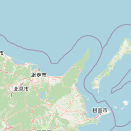
Kushiro-Shitsugen National Park landscape and geographic character

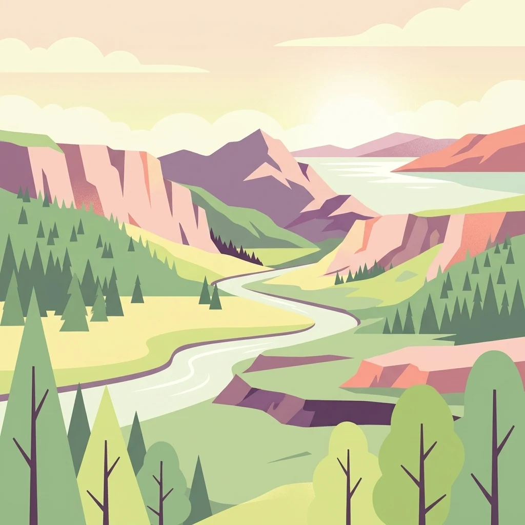
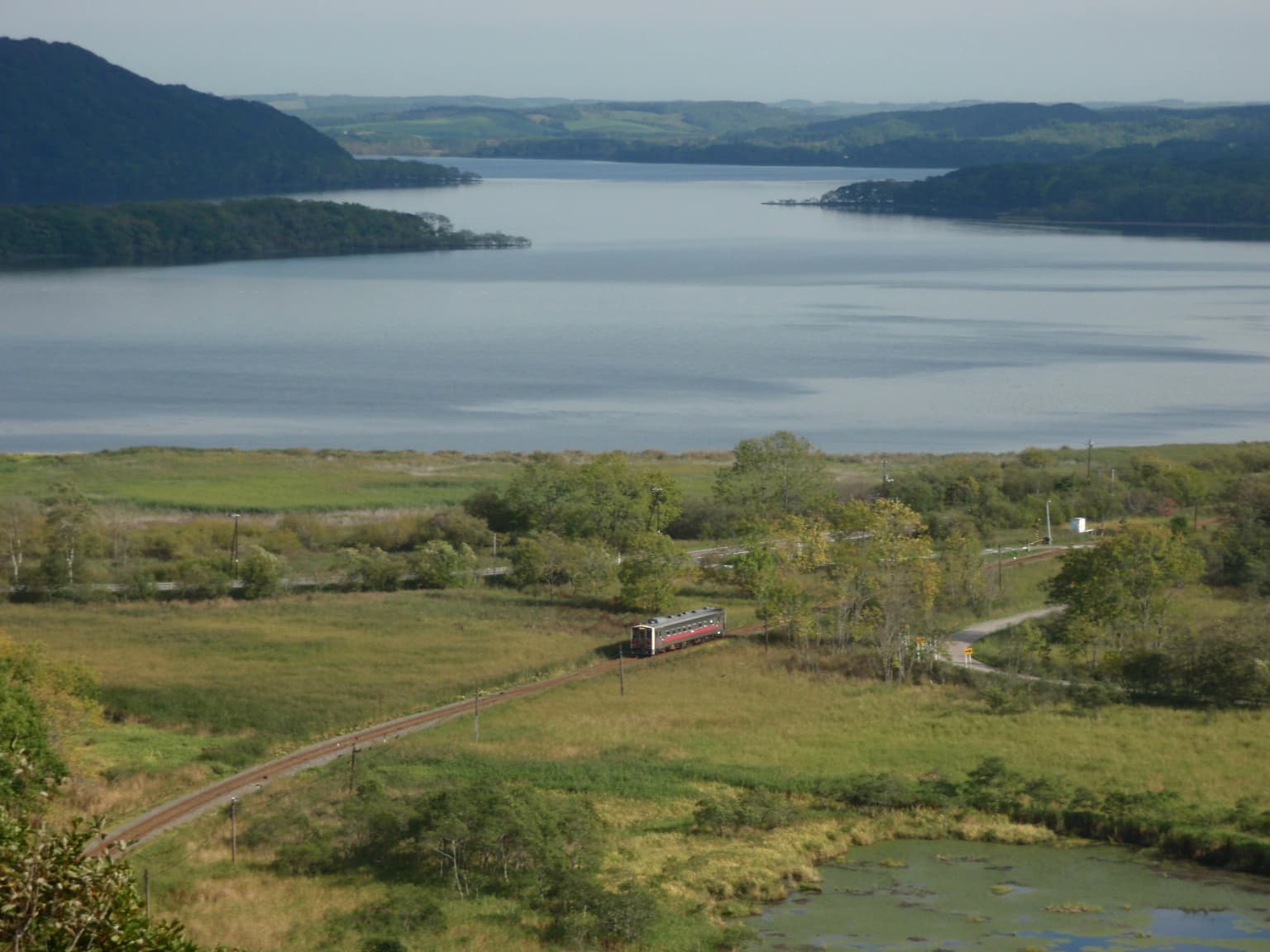
The park landscape is dominated by the Kushiro Wetlands, a vast lowland wetland system spanning over 268 square kilometers. The terrain consists of flat to gently undulating peatland, with the meandering Kushiro River creating a network of channels, oxbow lakes, and marsh pools throughout the park. The wetlands feature extensive reedbeds dominated by Phragmites australis, interspersed with sedge communities and moss-covered peat bogs. The eastern section of the park contains three coastal lagoon lakes formed from ancient sea inlets: Toro Lake, Shiratoro Pond, and Tatsukuru Lake. These lakes provide open water habitats within the wetland complex and support diverse waterbird populations. The landscape is remarkably flat, with minimal topographic variation, creating vast horizons of reed and sky that change dramatically with the seasons.

Senmo Line, Lake Touro
Lake Touro with JR Hokkaido Senmo Line railway track.

Kushiro-Shitsugen National Park ecosystems, habitats, and plant life

The park protects one of Japan's most significant wetland ecosystems, characterized by interconnected habitats of reedbeds, sedge marshes, peat moss wetlands, and black alder thickets. The wetland system supports over 600 plant species, creating a botanically diverse environment. The peatland substrate, formed over thousands of years, stores significant carbon and represents a rare habitat type in Japan. The free-flowing river channels, scattered lakes, and varying water depths create a heterogeneous wetland environment that supports distinct ecological communities. The Ramsar-designated peatland with raised bogs represents an especially rare ecosystem type, with specialized vegetation adapted to acidic, nutrient-poor conditions.

Kushiro Wetland Observation Deck

Kushiro-Shitsugen National Park wildlife and species highlights

Kushiro-Shitsugen provides critical habitat for several notable species, most famously the red-crowned crane (Grus japonensis), known locally as the Tancho. This endangered species uses the wetlands for breeding and wintering, and has become an icon of Japanese conservation success. The park also supports the huchen, also known as the Sakhalin taimen (Hucho perryi), a large predatory freshwater fish that inhabits the river systems. The Siberian salamander (Salamandrella keyserlingii) and a distinctive subspecies of dragonfly (Leucorrhinus intermedia ijimai) are also protected within the park. The wetlands support diverse waterfowl populations, with numerous duck, goose, and swan species utilizing the area during migration. The varied wetland habitats, from open water to dense reedbeds, provide breeding and foraging grounds for this avian community.

Kushiro Wetland winter.JPG
Kushiro Wetland and Akan-Fuji

Kushiro-Shitsugen National Park conservation status and protection priorities

The park holds significant conservation importance as Japan's largest protected wetland area and its first Ramsar Convention site. The strict protection status reflects the need to preserve both the ecological integrity of the wetland ecosystem and the critical habitat for endangered species like the red-crowned crane. The peatland ecosystems store substantial carbon reserves, and their preservation contributes to broader climate regulation objectives. The park faces ongoing challenges from development pressure, including a proposed megasolar project near the park boundary that has raised concerns among environmental groups about potential impacts on the sensitive wetland ecosystem. Management efforts focus on balancing conservation with sustainable visitor access through designated facilities and trails.

Kushiro-Shitsugen National Park cultural meaning and human context

The Kushiro Wetlands hold deep cultural significance in the region, particularly concerning the red-crowned crane which appears in local folklore and traditional practices. The discovery of surviving cranes in 1924 marked a turning point in conservation awareness and led to sustained protection efforts. The wetlands' cultural landscape has been recognized through various designations, and the area gained international attention when it served as the visual model for the setting of the 2014 Studio Ghibli film When Marnie Was There, introducing the landscape to global audiences. Local communities in the surrounding towns of Kushiro, Kushiro, Shibecha, and Tsurui maintain connections to the wetland landscape and participate in conservation management through the Kushiro-Shitsugen National Park Liaison Council.

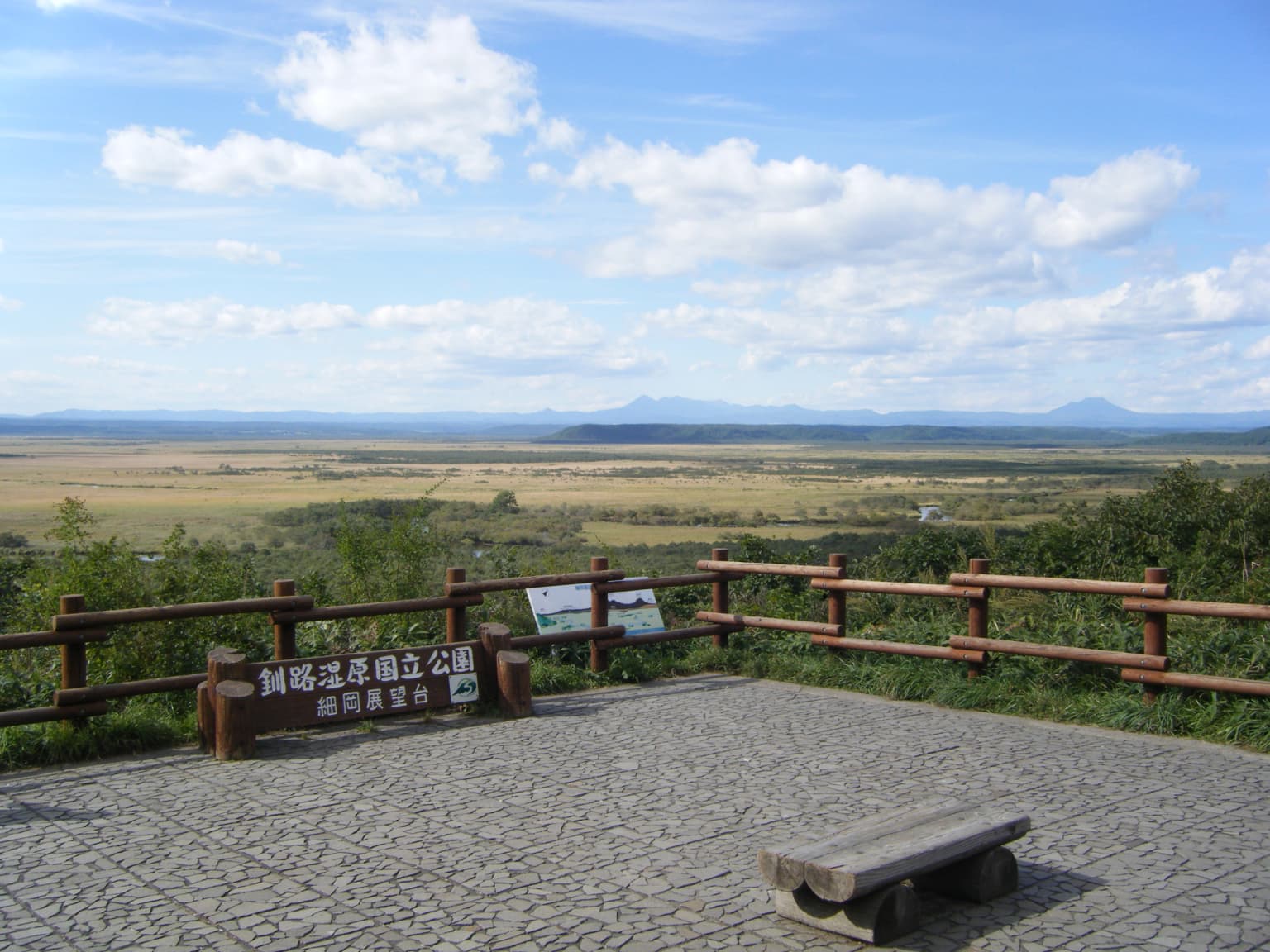
Top sights and standout views in Kushiro-Shitsugen National Park

Kushiro-Shitsugen stands as Japan's premier wetland conservation area, protecting the nation's largest reedbeds and serving as the primary habitat for the endangered red-crowned crane. The park offers exceptional wetland scenery from multiple observation decks including the Hosooka Observatory and Kushiro City Wetland Observatory. The network of visitor centers provides educational opportunities about wetland ecology and crane conservation. The wetlands' appearance in a major Studio Ghibli film has enhanced its cultural recognition internationally. The strict access limitations help preserve the pristine character of this rare lowland wetland ecosystem.

Best time to visit Kushiro-Shitsugen National Park

The park can be visited throughout the year, with each season offering distinct experiences. Summer brings full reedbed growth and active wildlife viewing, with cranes and waterfowl visible throughout the wetlands. Autumn offers the characteristic golden coloring of the reeds and is a popular season for photography. Winter transforms the wetlands into a stark white landscape, with frozen marsh pools and the dramatic sight of red-crowned cranes standing in snow-covered fields, though access to some areas may be limited. Spring brings the return of cranes to their breeding grounds and the awakening of the wetland ecosystem. The shoulder seasons of late spring and early autumn generally offer comfortable weather and optimal conditions for wildlife observation.

Park location guide

Geography guide, regional context, and park location map for Kushiro-Shitsugen National Park

Kushiro-Shitsugen National Park park geography, regions, and map view in Japan
Understand where Kushiro-Shitsugen National Park sits in Japan through a broader geographic reading of the surrounding landscape, nearby location context, and its mapped position within the national park landscape.

How Kushiro-Shitsugen National Park fits into Japan

Japan is an island nation in East Asia comprising over 14,000 islands in the Pacific Ocean. The country operates as a unitary parliamentary constitutional monarchy with Emperor Naruhito as the reigning monarch and Prime Minister Sanae Takaichi leading the government. With a population of approximately 123 million, Japan is the world's 11th most populous country and a major economic power with one of the strongest militaries, though it has constitutionally renounced its right to declare war.

Wider geography shaping Kushiro-Shitsugen National Park in Japan

Japan is an island nation in the Pacific Ocean, bordered to the west by the Sea of Japan and extending from the Sea of Okhotsk in the north to the East China Sea in the south. The Japanese archipelago lies off the northeast coast of the Asian mainland. Approximately 75% of Japan's terrain is mountainous and heavily forested, with agricultural land and urbanized populations concentrated along the eastern coastal plains. The country is divided into 47 administrative prefectures and eight traditional regions.

Map view of Kushiro-Shitsugen National Park

Use this park location map to pinpoint Kushiro-Shitsugen National Park in Japan, understand its exact geographic position, and read its mapped placement within the surrounding landscape more clearly.

Pigeon | © OpenStreetMap contributors

Location context for Kushiro-Shitsugen National Park

Hokkaido

Visual journey through extensive reedbeds, meandering rivers, and peatland habitats, understanding the unique protected-area character of eastern Hokkaido.

Kushiro-Shitsugen National Park Photos: Explore Japan's Largest Wetlands and Wildlife Scenery
Browse a detailed visual collection of Kushiro-Shitsugen National Park, showcasing its vast wetland ecosystems, iconic red-crowned cranes, and distinctive peatland terrain. Understanding these protected landscapes through imagery provides crucial context for its unique conservation value and geographic identity in Japan.

Kushiro Marsh Panorama

Kushiro Marsh from Hosooka Observatory

Senmo Line, Lake Touro

Kushiro Wetland Observation Deck

Kushiro Wetland winter.JPG

Kushiro-Shitsugen National Park, Hosooka Observation Deck

Park atlas

Trace the geographic context and regional spread of national parks, comparing diverse protected landscapes across Eastern Hokkaido.

Explore Nearby National Parks and Protected Areas Beyond Kushiro-Shitsugen National Park
Browse other national parks and protected areas located in the vicinity of Kushiro-Shitsugen National Park, revealing a broader network of conservation landscapes across Eastern Hokkaido. Use this geographic overview to compare different park characteristics, trace regional protected area distribution, and discover adjacent natural terrain.
National parkHokkaido

Shiretoko National Park: Hokkaido's Protected Natural Landscape and Geography

Explore mapped boundaries and regional park context.

Shiretoko National Park, designated as a national park in Hokkaido, Japan, serves as a vital point for understanding regional geography and protected landscape exploration. This entry offers a structured view of the park's geographic scope, focusing on its mapped boundaries and natural terrain. Discover how Shiretoko National Park contributes to the broader atlas of conservation lands in the Hokkaido region, providing context for its unique ecological and geographic significance.

Area
386.36 km²
Established
1964
IUCN
II
National parkJapan

Daisetsuzan National Park: Japan's Premier Volcanic Alpine Protected Landscape

Explore Hokkaido's largest national park and its vast mountain terrain.

Daisetsuzan National Park is a monumental protected area, covering extensive mountainous territory in Hokkaido, Japan. This national park is characterized by its dramatic volcanic geography, featuring numerous peaks over 2,000 meters and a rugged backcountry that defines Japan's northern alpine wilderness. Delve into the mapped boundaries and regional context of this significant protected landscape to understand its unique geological identity and ecological importance.

Area
2,267.64 km²
Established
1934
IUCN
II
National parkHokkaido

Hidakasanmyaku-Erimo-Tokachi National Park: Japan's Largest Protected Landscape Atlas

Volcanic peaks, coastal cliffs, and Hokkaido's expansive geography.

Hidakasanmyaku-Erimo-Tokachi National Park represents Japan's largest national park, offering a comprehensive exploration of its protected landscape. This vast area in Hokkaido combines the rugged topography of the Hidaka volcanic mountain range with the striking maritime environment of Cape Erimo. Users can explore detailed geographic contexts, understand the park's extensive boundaries, and appreciate its role as a crucial protected natural area at the intersection of alpine and coastal ecosystems.

Area
2,456.68 km²
Established
2024
IUCN
II
National parkHokkaido

Shikotsu-Tōya National Park: Hokkaido's Premier Volcanic National Park with Caldera Lakes

Explore mapped terrain, geothermal features, and active volcanoes.

Shikotsu-Tōya National Park, located in Hokkaido, Japan, is a prime example of a protected area defined by its intense volcanic geology. The park features prominent caldera lakes, including Lake Shikotsu and Lake Tōya, surrounded by active volcanic cones and dramatic geothermal landscapes. Its distinctive terrain makes it a key destination for understanding regional geography and the mapped protected areas of Japan's northern island, offering a unique glimpse into dynamic geological processes.

Area
994.73 km²
Established
1949
IUCN
II
National parkHokkaido

Rishiri-Rebun-Sarobetsu National Park: Volcanic Islands and Coastal Wetlands of Northern Hokkaido

Explore its mapped geography and unique subarctic alpine flora.

Rishiri-Rebun-Sarobetsu National Park in Hokkaido, Japan, offers a unique exploration of dramatic volcanic islands and vital coastal wetland ecosystems. This protected area showcases striking geological formations, from the conical peaks of Rishiri and Rebun islands to the vast peat bogs of the Sarobetsu Plain. Its subarctic environment supports a rich tapestry of alpine flora, providing a distinct case study in protected landscape geography and mapping for the region.

Area
241.66 km²
Established
1974
IUCN
II
National parkJapan

Towada-Hachimantai National Park: Mapping Japan's Volcanic and Alpine Protected Landscapes

Explore the geography of this northern Honshu national park.

Towada-Hachimantai National Park offers a unique atlas perspective on Japan's dynamic volcanic geology and alpine ecosystems. This national park protects a vast expanse of rugged terrain, featuring the iconic caldera of Lake Towada and the expansive volcanic plateaus of the Hachimantai region. Understanding its mapped boundaries reveals the distribution of its characteristic landscapes, from old-growth beech forests along river valleys to subalpine environments crowning volcanic peaks, providing a deep dive into its protected natural geography.

Area
855.34 km²
Established
1936
IUCN
II
National parkPrimorsky Krai

Bikin National Park: A Vast Protected Landscape in Primorsky Krai's Sikhote-Alin Mountains

Explore Russia's largest old-growth forest and Amur tiger stronghold.

Bikin National Park is a monumental protected area safeguarding the largest remaining tract of old-growth temperate rainforest in the Northern Hemisphere. Situated within Primorsky Krai, it serves as a vital refuge for an estimated 10% of the world's wild Amur tigers, making its mapped boundaries essential for conservation. Recognized as a World Heritage Site, the park's extensive forests and complex terrain offer a unique glimpse into one of Asia's last great wilderness areas, supporting unparalleled biodiversity and crucial ecological processes.

Area
11,600 km²
Established
2015
IUCN
II
Relief
Mountain
Watercolor painting of a landscape featuring green forests, distant mountains, and a body of water in the foreground
National parkPrimorsky Krai

Udegeyskaya Legenda National Park: National Park with Mapped Protected Boundaries

Explore Protected Landscape Geography in Primorsky Krai

Gain an atlas-level understanding of Udegeyskaya Legenda National Park, a designated national park situated in Russia's Primorsky Krai. This resource provides insights into the park's geographic setting and the extent of its protected landscape. It is designed for users interested in the mapped features and regional context of protected natural areas, offering a clear view of the park's role within its geographic domain.

Area
1,037 km²
Established
2007
IUCN
II
Relief
Mountain

Common questions about visiting, size, designation, and location context for Kushiro-Shitsugen National Park

Kushiro-Shitsugen National Park FAQs for park facts, access, geography, and protected area context
Find quick answers about Kushiro-Shitsugen National Park, including protected-area facts, park geography, trail and visitor context, and how the park fits into its surrounding country and regional landscape.
MoriAtlas Explorer

Continue Your Protected Areas Search Across the Global Atlas

Deepen your exploration by continuing the structured search for national parks and protected areas worldwide. Utilize the comprehensive filtering capabilities to compare different conservation landscapes and refine your understanding of global park geography. Discover more about the distribution and characteristics of protected natural areas.

Global natural geography