Mori Atlas logo
National parkShikotsu-Tōya National Park

Discover the protected national park's mapped boundaries, active volcanoes, and unique Hokkaido geography.

Shikotsu-Tōya National Park: Volcanic Terrain, Caldera Lakes, and Geothermal Landscapes in Hokkaido

(Shikotsu Tōya Kokuritsu Kōen)

Shikotsu-Tōya National Park stands as a protected national park in Hokkaido, Japan, renowned for its dynamic volcanic geography and stunning caldera lakes. Centered around Lake Shikotsu and Lake Tōya, this park showcases an impressive array of active volcanic formations, including Mount Usu and Mount Yōtei, shaping a landscape rich in geothermal features and forest ecosystems. Its mapped terrain offers an exceptional atlas-style exploration of Japan's raw, powerful natural geology and regional protected lands.

Volcanic landscapeCaldera lakesHot springsHokkaidoForest ecosystemsGeothermal features

Shikotsu-Tōya National Park

National park

Park overview

Structured park overview, official facts, and landscape profile for Shikotsu-Tōya National Park

Shikotsu-Tōya National Park park facts, protected area profile, and essential visitor context
Review the core facts for Shikotsu-Tōya National Park, including designation, size, terrain, visitor scale, habitats, and operating context in one park-focused overview.

About Shikotsu-Tōya National Park

Shikotsu-Tōya National Park occupies a significant position in Hokkaido's protected area network, representing the volcanic and geothermal character of Japan's northern island. The park's defining features are its two namesake caldera lakes: Lake Shikotsu, encircled by active volcanoes including Mount Tarumae and Mount Eniwa, and Lake Tōya, which sits within the Tōya Caldera alongside Mount Usu. The volcanic origin of these landscapes continues to shape the park's character through ongoing geothermal activity, visible in the numerous hot springs that bubble throughout the area. The park is administratively divided into distinct zones by the Japanese Ministry of Environment, including the Mount Yōtei area, the Lake Tōya and Mount Usu zone, the Lake Shikotsu region, and areas around Jōzan-kei Gorge and the Noboribetsu hot springs. This geographic diversity supports a range of habitats from lakeside wetlands to forested slopes, while the accessibility from Sapporo and Chitose makes the park one of Hokkaido's most visited protected areas. The park's establishment in 1949 reflected post-war Japan's commitment to preserving its natural heritage, and it continues to serve as an important site for environmental education and scientific research into volcanic processes.

Quick facts and research context for Shikotsu-Tōya National Park

Shikotsu-Tōya National Park covers roughly 994 square kilometers in southwestern Hokkaido, centered on two volcanic caldera lakes. The park was established in 1949 and contains three visitor centers serving the Lake Shikotsu, Lake Tōya, and Noboribetsu hot spring areas. The landscape is dominated by active volcanic formations including Mount Yōtei, Mount Usu, and Mount Tarumae. The park lies within easy reach of Sapporo and can be accessed via Chitose Airport and nearby train connections. The area features mixed forests of coniferous and deciduous species adapted to the cool northern climate.

Park context

Deeper park guide and search-rich context for Shikotsu-Tōya National Park

Shikotsu-Tōya National Park history, landscape, wildlife, and travel context
Explore Shikotsu-Tōya National Park through its history, landscape character, ecosystems, wildlife, conservation priorities, cultural context, and seasonal travel timing in a structured park guide built for atlas discovery and search intent.

Why Shikotsu-Tōya National Park stands out

Shikotsu-Tōya National Park is best known for its spectacular volcanic caldera lakes, particularly Lake Shikotsu and Lake Tōya, which give the park its name. The region is distinguished by its active volcanic landscape, including the Mount Usu area where new volcanic formations like Mount Shōwa-shinzan emerged from the plain as a result of eruptions beginning in 1944. The park is also renowned for its hot spring resorts, particularly Noboribetsu, which features the dramatic Jigokudani (Hell Valley) thermal area. The combination of accessible volcanic geology, scenic caldera lakes surrounded by active volcanoes, and traditional Japanese hot spring culture creates a distinctive national park that serves both scientific and recreational purposes.

Shikotsu-Tōya National Park history and protected-area timeline

Shikotsu-Tōya National Park was established on May 16, 1949, during a period when Japan was developing its modern national park system following the devastation of World War II. The designation recognized both the outstanding natural beauty and the scientific importance of Hokkaido's volcanic landscape. The park was named for its two central caldera lakes, Shikotsu and Tōya, which had long been recognized as geologically significant features. Prior to national park designation, the area had been inhabited and used by local communities for centuries, particularly around the hot spring regions that became centers of relaxation and healing. The post-war period saw increased scientific interest in the volcanic processes observable in the park, particularly at Mount Usu where successive eruptions since 1944 have created new landforms including the distinctive Mount Shōwa-shinzan. Over the decades, the park has developed infrastructure to support visitors, including the establishment of three visitor centers that provide environmental education and interpretation services. The park's proximity to Sapporo and Chitose has made it a model for integrating conservation with accessible outdoor recreation.

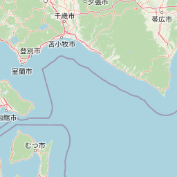
Shikotsu-Tōya National Park landscape and geographic character

The landscape of Shikotsu-Tōya National Park is fundamentally shaped by volcanic activity, with caldera formations, volcanic peaks, and geothermal features defining its character. Lake Shikotsu occupies a caldera formed by ancient volcanic eruptions and is encircled by a ring of active volcanoes including Mount Tarumae rising to 1,041 meters and Mount Eniwa reaching 1,320 meters. Lake Tōya similarly fills a caldera depression and is surrounded by volcanic terrain, with Mount Usu and the relatively young Mount Shōwa-shinzan standing as active volcanic cones. Mount Yōtei, a symmetrical stratovolcano, forms a prominent landmark visible from many parts of the park and represents one of Hokkaido's most recognizable peaks. The terrain includes deeply incised valleys such as Hōhei Gorge (Hōheikyō) and the Jōzan-kei area, where stream erosion has carved dramatic channels through the volcanic rock. Near Noboribetsu, the landscape takes on an especially dramatic character where geothermal activity has created the Jigokudani area, a terrain of steaming vents, sulfurous vents, and mineral-stained ground that resembles a volcanic underworld. The park also includes areas of relatively flat terrain between volcanic features where forest communities have developed.

Shikotsu-Tōya National Park ecosystems, habitats, and plant life

The ecological character of Shikotsu-Tōya National Park reflects the cool temperate climate of northern Hokkaido and the diverse habitats created by its volcanic landscape. The park supports mixed forests composed of coniferous species including Ezo spruce and Sakhalin fir alongside deciduous trees such as Mongolian oak and Japanese elm. Siberian dwarf pines occur in higher elevation zones, while the subalpine environment supports characteristic alpine vegetation including Labrador tea and blue mountainheath. These forest communities provide habitat for a range of mammal species including Japanese deer, Yezo sika deer, Hokkaido squirrels, brown alpine hares, and Ezo red foxes. The lake environments attract waterfowl including spotbill ducks and tufted ducks, while bird species such as Japanese scops owl and black woodpecker inhabit the forested areas. The combination of volcanic terrain, forest ecosystems, lake wetlands, and geothermal areas creates a mosaic of habitats that supports biodiversity while remaining accessible for environmental education and scientific study.

Shikotsu-Tōya National Park wildlife and species highlights

The wildlife of Shikotsu-Tōya National Park reflects the forest-dominant character of Hokkaido's natural landscapes. Large mammals include Japanese deer and Yezo sika deer, which are commonly observed in forested areas and meadows throughout the park. The Ezo red fox, a subspecies adapted to Hokkaido's climate, persists in the park's woodland environments. Smaller mammals include Hokkaido squirrels and brown alpine hares, both well-adapted to the seasonal variations of the northern environment. The park's bird community features species associated with forest habitats such as the Japanese scops owl and black woodpecker, while the lake environments attract waterfowl including spotbill ducks and tufted ducks. The diverse habitats from lakeshore to subalpine zones support a range of species, though the park is not known for particularly rare or endangered species concentrations. Instead, the wildlife value lies in the opportunity to observe typical Hokkaido forest and lake ecosystems in a relatively accessible setting.

Shikotsu-Tōya National Park conservation status and protection priorities

Shikotsu-Tōya National Park serves important conservation functions within Hokkaido's protected area network, preserving representative examples of the island's volcanic landscape ecology. The protection of caldera lake ecosystems, active volcanic terrain, and mixed forest communities ensures that these interconnected habitats remain intact for future generations. The park's designation as IUCN Category II reflects its primary purpose of protecting natural ecosystems while permitting sustainable recreation and environmental education. The presence of ongoing volcanic activity, visible at Mount Usu and the Noboribetsu geothermal area, makes the park particularly valuable for scientific study of volcanic processes and crater formation. Visitor centers at Lake Shikotsu, Lake Tōya, and the Toyako area provide interpretation services that help visitors understand the park's geological and ecological significance. The integration of hot spring resorts within the park boundaries presents management challenges but also demonstrates how human use and natural protection can coexist in Japanese conservation practice.

Shikotsu-Tōya National Park cultural meaning and human context

The Shikotsu-Tōya region has a long human history intertwined with its volcanic landscape, particularly evident in the hot spring culture that remains central to the area's identity. Noboribetsu hot spring, one of Hokkaido's most famous thermal resorts, has developed around the geothermal vents of the Jigokudani area, where visitors have bathed in the mineral-rich waters for generations. This tradition of thermal bathing reflects the Japanese cultural practice of onsen use, which views hot springs as places for relaxation, healing, and spiritual refreshment. The area around Jōzan-kei has historically been associated with Buddhist monastic settlement, and the gorge retains cultural significance as a scenic and spiritual landscape. The park lies within the traditional territory of Ainu communities, the indigenous peoples of Hokkaido, though the English-language Wikipedia source provides limited detail on this aspect. The proximity to Sapporo has influenced the development of the park as a recreational area for urban residents seeking escape to natural environments, creating a pattern of regular visitation that connects city dwellers with the volcanic landscapes of their home island.

Top sights and standout views in Shikotsu-Tōya National Park

Shikotsu-Tōya National Park offers several standout features that distinguish it within Hokkaido's park system. The dual caldera lakes, Lake Shikotsu and Lake Tōya, provide spectacular scenery framed by volcanic peaks, with Lake Shikotsu being particularly noted for its deep blue waters encircled by mountains. The active volcanic landscape around Mount Usu and the emergence of Mount Shōwa-shinzan since 1944 offer rare opportunities to observe volcanic formation processes in progress. The Noboribetsu hot springs, particularly the dramatic Jigokudani geothermal area, represent one of Hokkaido's most impressive thermal landscapes. Mount Yōtei, with its iconic symmetrical cone, serves as a scenic landmark visible from throughout the park. The combination of these natural features with accessible visitor infrastructure makes the park an excellent introduction to Hokkaido's volcanic landscapes.

Best time to visit Shikotsu-Tōya National Park

The best time to visit Shikotsu-Tōya National Park depends on what visitors hope to experience, though the park is accessible year-round. Summer months from June through September offer warm temperatures ideal for hiking, lake activities, and hot spring bathing, with the green forest landscapes providing a classic alpine character. Autumn brings spectacular fall foliage as the deciduous trees change color, creating vibrant orange and red displays around the lakes and valleys. Winter transforms the park into a snowy wonderland, with the volcanic peaks often dusted in snow and the hot springs offering a particularly appealing contrast against the cold air. Spring provides a season of renewal as snow melts and new growth appears, though this period can be brief. The park's proximity to Sapporo means it can be visited as a day trip or extended stay, and each season offers distinctly different visual and experiential qualities.

Park location guide

Geography guide, regional context, and park location map for Shikotsu-Tōya National Park

Shikotsu-Tōya National Park park geography, regions, and map view in Japan
Understand where Shikotsu-Tōya National Park sits in Japan through a broader geographic reading of the surrounding landscape, nearby location context, and its mapped position within the national park landscape.

How Shikotsu-Tōya National Park fits into Japan

Japan is an island nation in East Asia comprising over 14,000 islands in the Pacific Ocean. The country operates as a unitary parliamentary constitutional monarchy with Emperor Naruhito as the reigning monarch and Prime Minister Sanae Takaichi leading the government. With a population of approximately 123 million, Japan is the world's 11th most populous country and a major economic power with one of the strongest militaries, though it has constitutionally renounced its right to declare war.

Wider geography shaping Shikotsu-Tōya National Park in Japan

Japan is an island nation in the Pacific Ocean, bordered to the west by the Sea of Japan and extending from the Sea of Okhotsk in the north to the East China Sea in the south. The Japanese archipelago lies off the northeast coast of the Asian mainland. Approximately 75% of Japan's terrain is mountainous and heavily forested, with agricultural land and urbanized populations concentrated along the eastern coastal plains. The country is divided into 47 administrative prefectures and eight traditional regions.

Map view of Shikotsu-Tōya National Park

Use this park location map to pinpoint Shikotsu-Tōya National Park in Japan, understand its exact geographic position, and read its mapped placement within the surrounding landscape more clearly.

Pigeon | © OpenStreetMap contributors

Location context for Shikotsu-Tōya National Park

Hokkaido
Park atlas

Browse Hokkaido's diverse protected landscapes, volcanic terrain, and geothermal features beyond Shikotsu-Tōya.

Discover Other National Parks and Protected Areas in Hokkaido Near Shikotsu-Tōya National Park
Explore national parks and protected areas near Shikotsu-Tōya National Park, comparing Hokkaido's distinctive volcanic landscapes, caldera lakes, and geothermal features. Gain regional context and an expanded atlas view by tracing connected conservation landscapes and understanding the broader protected-area geography of Japan's northern island.
National parkHokkaido

Hidakasanmyaku-Erimo-Tokachi National Park: Japan's Largest Protected Landscape Atlas

Volcanic peaks, coastal cliffs, and Hokkaido's expansive geography.

Hidakasanmyaku-Erimo-Tokachi National Park represents Japan's largest national park, offering a comprehensive exploration of its protected landscape. This vast area in Hokkaido combines the rugged topography of the Hidaka volcanic mountain range with the striking maritime environment of Cape Erimo. Users can explore detailed geographic contexts, understand the park's extensive boundaries, and appreciate its role as a crucial protected natural area at the intersection of alpine and coastal ecosystems.

Area
2,456.68 km²
Established
2024
IUCN
II
National parkJapan

Daisetsuzan National Park: Japan's Premier Volcanic Alpine Protected Landscape

Explore Hokkaido's largest national park and its vast mountain terrain.

Daisetsuzan National Park is a monumental protected area, covering extensive mountainous territory in Hokkaido, Japan. This national park is characterized by its dramatic volcanic geography, featuring numerous peaks over 2,000 meters and a rugged backcountry that defines Japan's northern alpine wilderness. Delve into the mapped boundaries and regional context of this significant protected landscape to understand its unique geological identity and ecological importance.

Area
2,267.64 km²
Established
1934
IUCN
II
National parkJapan

Towada-Hachimantai National Park: Mapping Japan's Volcanic and Alpine Protected Landscapes

Explore the geography of this northern Honshu national park.

Towada-Hachimantai National Park offers a unique atlas perspective on Japan's dynamic volcanic geology and alpine ecosystems. This national park protects a vast expanse of rugged terrain, featuring the iconic caldera of Lake Towada and the expansive volcanic plateaus of the Hachimantai region. Understanding its mapped boundaries reveals the distribution of its characteristic landscapes, from old-growth beech forests along river valleys to subalpine environments crowning volcanic peaks, providing a deep dive into its protected natural geography.

Area
855.34 km²
Established
1936
IUCN
II
National parkHokkaido

Kushiro-Shitsugen National Park: Protected Wetland Ecosystems and Landscape

Explore the mapped terrain of eastern Hokkaido's vital peatlands.

Kushiro-Shitsugen National Park is a national park in eastern Hokkaido, Japan, safeguarding the nation's largest wetland and peatland. The park encompasses the expansive Kushiro Wetlands, characterized by vast reedbeds and a network of meandering rivers, making it a critical habitat for species like the endangered red-crowned crane. This protected area offers a unique landscape for understanding Japan's freshwater ecosystems and their geographic distribution within the region.

Area
268.61 km²
Established
1987
IUCN
II
National parkHokkaido

Rishiri-Rebun-Sarobetsu National Park: Volcanic Islands and Coastal Wetlands of Northern Hokkaido

Explore its mapped geography and unique subarctic alpine flora.

Rishiri-Rebun-Sarobetsu National Park in Hokkaido, Japan, offers a unique exploration of dramatic volcanic islands and vital coastal wetland ecosystems. This protected area showcases striking geological formations, from the conical peaks of Rishiri and Rebun islands to the vast peat bogs of the Sarobetsu Plain. Its subarctic environment supports a rich tapestry of alpine flora, providing a distinct case study in protected landscape geography and mapping for the region.

Area
241.66 km²
Established
1974
IUCN
II
National parkHokkaido

Shiretoko National Park: Hokkaido's Protected Natural Landscape and Geography

Explore mapped boundaries and regional park context.

Shiretoko National Park, designated as a national park in Hokkaido, Japan, serves as a vital point for understanding regional geography and protected landscape exploration. This entry offers a structured view of the park's geographic scope, focusing on its mapped boundaries and natural terrain. Discover how Shiretoko National Park contributes to the broader atlas of conservation lands in the Hokkaido region, providing context for its unique ecological and geographic significance.

Area
386.36 km²
Established
1964
IUCN
II
National parkPrimorsky Krai

Zov Tigra National Park: National Park Protected Area and Mapped Landscape

Explore the protected lands and regional geography of Primorsky Krai.

Zov Tigra National Park represents a vital protected area within Russia's Primorsky Krai region. This detailed atlas entry provides specific insights into its mapped boundaries, geographic setting, and status as a national park. Understand the park's landscape context and its role within the broader regional geography, facilitating structured discovery for geographers and park explorers alike.

Area
834 km²
Established
2007
IUCN
II
Relief
Mountain
Watercolor painting of a landscape featuring green forests, distant mountains, and a body of water in the foreground
National parkPrimorsky Krai

Udegeyskaya Legenda National Park: National Park with Mapped Protected Boundaries

Explore Protected Landscape Geography in Primorsky Krai

Gain an atlas-level understanding of Udegeyskaya Legenda National Park, a designated national park situated in Russia's Primorsky Krai. This resource provides insights into the park's geographic setting and the extent of its protected landscape. It is designed for users interested in the mapped features and regional context of protected natural areas, offering a clear view of the park's role within its geographic domain.

Area
1,037 km²
Established
2007
IUCN
II
Relief
Mountain

Common questions about visiting, size, designation, and location context for Shikotsu-Tōya National Park

Shikotsu-Tōya National Park FAQs for park facts, access, geography, and protected area context
Find quick answers about Shikotsu-Tōya National Park, including protected-area facts, park geography, trail and visitor context, and how the park fits into its surrounding country and regional landscape.
MoriAtlas Explorer

Continue Your Protected Areas Search Across the Global Atlas

Deepen your exploration by continuing the structured search for national parks and protected areas worldwide. Utilize the comprehensive filtering capabilities to compare different conservation landscapes and refine your understanding of global park geography. Discover more about the distribution and characteristics of protected natural areas.

Global natural geography