Mori Atlas logo
National parkHidakasanmyaku-Erimo-Tokachi National Park

Discover volcanic peaks and dramatic coastal geography across a vast protected mountain-to-sea corridor.

Hidakasanmyaku-Erimo-Tokachi National Park: Japan's Largest Protected Landscape in Hokkaido

(日高山脈襟裳十勝国立公園)

Hidakasanmyaku-Erimo-Tokachi National Park, Japan's most expansive national park, encompasses the rugged Hidaka Mountains and the iconic Cape Erimo on Hokkaido's Pacific coast. This protected landscape spans over 2,400 square kilometers, offering a unique atlas perspective on the integration of volcanic alpine terrain with dramatic maritime environments. Explore the mapped boundaries of this recently established park, which serves as a vital ecological corridor and a significant representation of northern Japan's natural heritage.

Volcanic mountainsCoastal cliffsBird migrationAlpine ecosystemsNewly designated national parkHokkaido

Hidakasanmyaku-Erimo-Tokachi National Park

National park

Park overview

Structured park overview, official facts, and landscape profile for Hidakasanmyaku-Erimo-Tokachi National Park

Hidakasanmyaku-Erimo-Tokachi National Park park facts, protected area profile, and essential visitor context
Review the core facts for Hidakasanmyaku-Erimo-Tokachi National Park, including designation, size, terrain, visitor scale, habitats, and operating context in one park-focused overview.

About Hidakasanmyaku-Erimo-Tokachi National Park

Hidakasanmyaku-Erimo-Tokachi National Park represents a significant addition to Japan's national park system, not only for its size but for its representation of Hokkaido's diverse landscapes within a single protected area. The park occupies a transition zone between the island's interior mountain backbone and its eastern Pacific coastline, encompassing ecological gradients from subalpine zones to coastal heathlands and marine environments. The Hidaka Mountains, which form the park's central spine, are a volcanic range created by tectonic activity along the convergent boundary between the Pacific and North American plates. These mountains support distinctive alpine and subalpine vegetation communities adapted to the harsh conditions of northern Japan. Cape Erimo extends into the Pacific Ocean, creating a landscape of exposed headlands, sea cliffs, and coastal wetlands that support migratory bird populations and marine biodiversity. The park's large territory and recent expansion reflect an evolving conservation philosophy in Japan that emphasizes ecological connectivity and landscape-level protection rather than isolated preserve designation.

Quick facts and research context for Hidakasanmyaku-Erimo-Tokachi National Park

Hidakasanmyaku-Erimo-Tokachi National Park occupies south-central Hokkaido, Japan's northernmost main island. The park was elevated to full national park status in June 2024, expanding its protected area from 1,034 to 2,457 square kilometers. It encompasses the Hidaka Mountains, a volcanic mountain range extending north-south through central Hokkaido, and includes Cape Erimo, a distinctive coastal promontory along the Pacific coast. The park falls under IUCN Category II protection and is administered by Japan's Ministry of the Environment. Thirteen municipalities share territory within the park's boundaries, including Erimo, Hidaka, Samani, Urakawa, and Obihiro.

Park context

Deeper park guide and search-rich context for Hidakasanmyaku-Erimo-Tokachi National Park

Hidakasanmyaku-Erimo-Tokachi National Park history, landscape, wildlife, and travel context
Explore Hidakasanmyaku-Erimo-Tokachi National Park through its history, landscape character, ecosystems, wildlife, conservation priorities, cultural context, and seasonal travel timing in a structured park guide built for atlas discovery and search intent.

Why Hidakasanmyaku-Erimo-Tokachi National Park stands out

The park is distinguished by its remarkable geographic diversity, protecting both a significant mountain range and a coastal peninsula within a single protected area. The Hidaka Mountains feature rugged volcanic peaks including Mount Poroshiri and represent an important north-south ecological corridor in Hokkaido. Cape Erimo, at the park's southern tip, is known for its dramatic sea cliffs, exposed maritime landscapes, and important bird migration pathways. The park's recent expansion made it Japan's largest national park, symbolizing a new approach to comprehensive landscape-scale conservation that connects alpine, forest, and coastal ecosystems.

Hidakasanmyaku-Erimo-Tokachi National Park history and protected-area timeline

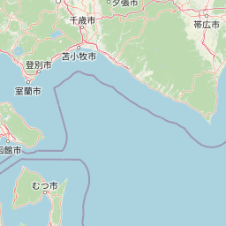
The protected area that would become Hidakasanmyaku-Erimo-Tokachi National Park has undergone a gradual evolution in its protection status over more than seven decades. Erimo Prefectural Park was established in 1950, providing initial recognition of the area's natural values. In 1958, this was redesignated as Erimo Prefectural Natural Park, strengthening regulatory protections. The area achieved quasi-national park status on 1 October 1981, when it was renamed Hidaka-sanmyaku Erimo Quasi-National Park, reflecting recognition of its regional significance beyond Hokkaido. The most significant transformation occurred on 25 June 2024, when the park was elevated to full national park status and renamed to reflect its expanded territory that now incorporates portions of the Tokachi plain region. This expansion increased the protected area by approximately 1,400 square kilometers, more than doubling its size and incorporating additional mountain and lowland ecosystems that had previously lacked formal protection.

Hidakasanmyaku-Erimo-Tokachi National Park landscape and geographic character

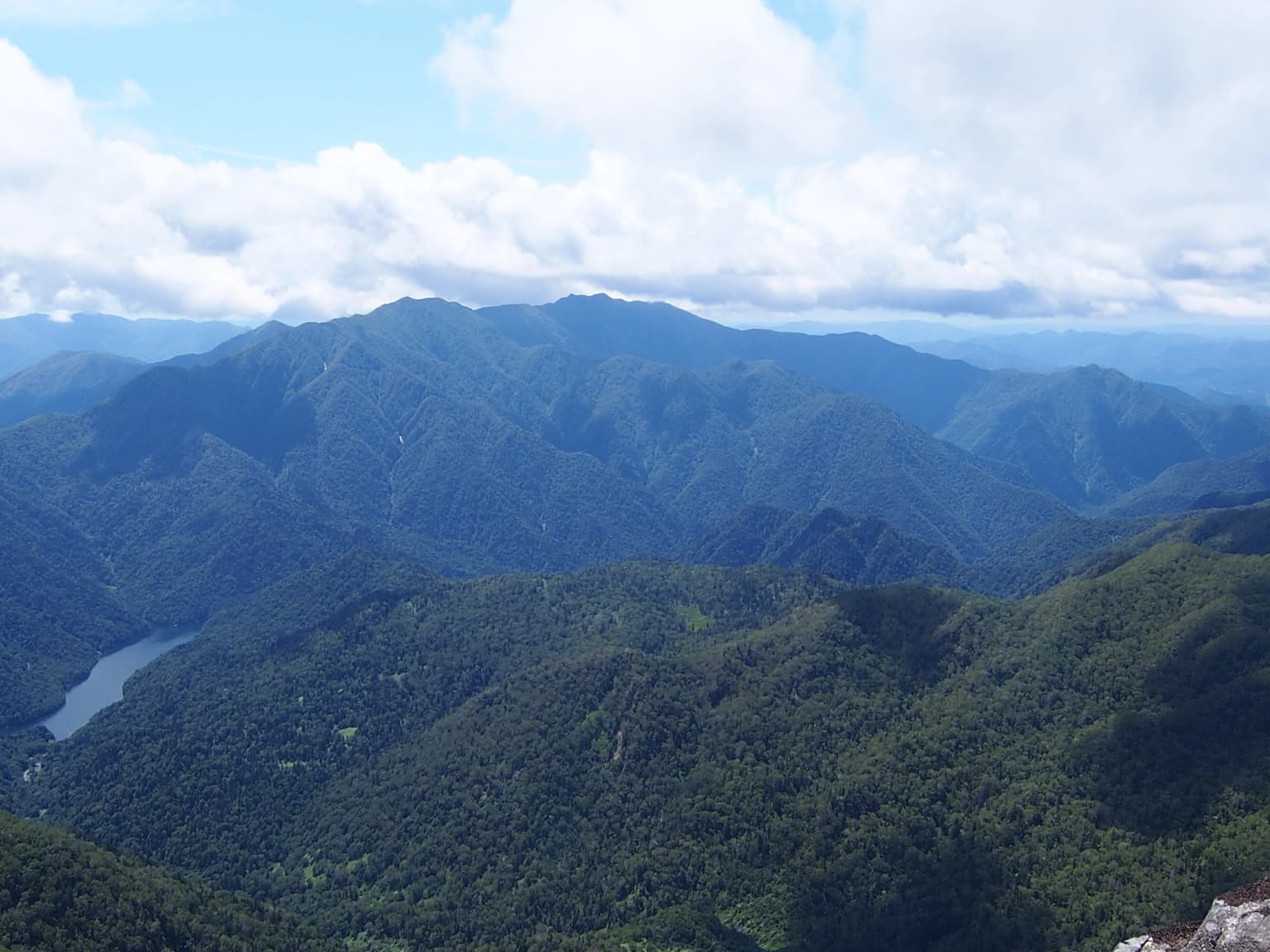
The park encompasses a remarkable range of landforms spanning from volcanic mountain peaks to exposed coastal headlands. The Hidaka Mountains extend in a north-south orientation through the park's interior, reaching elevations exceeding 2,000 meters and presenting a landscape of steep ridges, volcanic summits, and steep-sided valleys carved by glacial and fluvial processes. The range forms a visual and ecological spine dividing eastern and western Hokkaido. At the park's southern extent, Cape Erimo projects into the Pacific Ocean as a dramatic peninsula of sea cliffs, wave-cut platforms, and coastal heath. The transition between these mountain and coastal environments creates diverse scenery including forested slopes, alpine meadows, coastal cliffs, and wave-swept shores. The park's landscape is characterized by the interaction between volcanic terrain, tectonic landforms, and the powerful maritime influences of the North Pacific.

Hidakasanmyaku-Erimo-Tokachi National Park ecosystems, habitats, and plant life

The park protects a spectrum of ecological zones reflecting Hokkaido's position as Japan's most northern major island and its transition between temperate and subarctic conditions. The Hidaka Mountains host subalpine and alpine vegetation communities including scrub heath, alpine meadows, and coniferous forest associations adapted to the long, cold winters and high snowfall of northern Japan. The coastal environments around Cape Erimo feature distinctive maritime heath communities shaped by salt-laden winds and exposed conditions. The park lies along important bird migration routes, with coastal wetlands and headlands serving as staging areas for migratory species moving between breeding grounds in Siberia and wintering areas in East Asia. The ecological diversity encompassed within the park's expanded boundaries reflects a comprehensive approach to protecting the interconnected systems that maintain biodiversity across Hokkaido's varied terrain.

Hidakasanmyaku-Erimo-Tokachi National Park wildlife and species highlights

The park supports wildlife populations characteristic of northern Japan's mountainous and coastal environments. The Hidaka Mountains provide habitat for species adapted to subalpine conditions, including various small mammals and bird species that utilize the alpine and forest zones. The coastal environments of Cape Erimo are particularly significant for avian wildlife, with the headland serving as a notable location for migratory bird observation and resting during seasonal movements along the East Asian Australasian flyway. The marine waters adjacent to the cape support coastal and pelagic species associated with the cold currents flowing northward along the Pacific coast of Hokkaido. The combination of protected mountain habitats and coastal environments within a single large protected area supports ecological connectivity that benefits wildlife populations requiring access to different seasonal resources.

Hidakasanmyaku-Erimo-Tokachi National Park conservation status and protection priorities

The elevation of Hidakasanmyaku-Erimo-Tokachi to full national park status in 2024 represents a significant advancement in Japan's conservation framework. The doubling of the protected area through boundary expansion demonstrates a commitment to landscape-scale conservation that extends protection beyond individual scenic features to encompass entire ecological systems. The park's designation as IUCN Category II reflects international standards for national park protection, emphasizing ecosystem conservation and natural heritage preservation while providing for compatible human use. The inclusion of the Hidaka Mountains, which had not previously been represented in Japan's national park system, fills an important gap in the country's protected area network. The park's coastal component at Cape Erimo adds representation of Pacific coast ecosystems to Hokkaido's conservation estate.

Hidakasanmyaku-Erimo-Tokachi National Park cultural meaning and human context

The park encompasses territory historically associated with Ainu communities, the indigenous peoples of Hokkaido. The Hidaka Mountains and surrounding lowlands were traditionally inhabited and utilized by Ainu people, and place names throughout the region reflect Ainu language origins. Several of the municipalities within the park boundaries, including Biratori, have populations with strong Ainu cultural heritage. The landscape holds significance beyond its ecological values as a cultural landscape shaped by long human habitation and traditional land use practices. Contemporary communities within the park region maintain connections to local heritage while engaging with modern land management and conservation frameworks.

Top sights and standout views in Hidakasanmyaku-Erimo-Tokachi National Park

The park's defining characteristic is the combination of mountain and coastal landscapes within Japan's largest national park territory. Mount Poroshiri and other volcanic peaks of the Hidaka Mountains provide iconic summits and alpine scenery. Cape Erimo offers dramatic coastal landscapes with sea cliffs, exposed headlands, and important bird migration viewing opportunities. The recent expansion that created Japan's newest national park reflects contemporary conservation priorities and provides comprehensive protection for an under-represented mountain ecosystem. The park fills a gap in Hokkaido's protected area network by bringing the Hidaka Mountains into the national park system for the first time.

Best time to visit Hidakasanmyaku-Erimo-Tokachi National Park

Hokkaido's northern position ensures distinct seasonal contrasts that shape the visitor experience throughout the year. Summer months offer the most accessible conditions for mountain exploration, with alpine trails and mountain hiking routes at their most approachable. The coastal areas around Cape Erimo are particularly striking during clear weather when the dramatic sea cliffs and Pacific horizons are fully visible. Autumn brings the characteristic autumnal colors to the forests and offers crisp, clear conditions for landscape photography. Winter transforms the high country into a snow-covered wilderness, while the coastal areas remain accessible but experience harsh maritime conditions. The shoulder seasons of late spring and early autumn generally offer the most comfortable conditions for combining mountain and coastal exploration within the park.

Park location guide

Geography guide, regional context, and park location map for Hidakasanmyaku-Erimo-Tokachi National Park

Hidakasanmyaku-Erimo-Tokachi National Park park geography, regions, and map view in Japan
Understand where Hidakasanmyaku-Erimo-Tokachi National Park sits in Japan through a broader geographic reading of the surrounding landscape, nearby location context, and its mapped position within the national park landscape.

How Hidakasanmyaku-Erimo-Tokachi National Park fits into Japan

Japan is an island nation in East Asia comprising over 14,000 islands in the Pacific Ocean. The country operates as a unitary parliamentary constitutional monarchy with Emperor Naruhito as the reigning monarch and Prime Minister Sanae Takaichi leading the government. With a population of approximately 123 million, Japan is the world's 11th most populous country and a major economic power with one of the strongest militaries, though it has constitutionally renounced its right to declare war.

Wider geography shaping Hidakasanmyaku-Erimo-Tokachi National Park in Japan

Japan is an island nation in the Pacific Ocean, bordered to the west by the Sea of Japan and extending from the Sea of Okhotsk in the north to the East China Sea in the south. The Japanese archipelago lies off the northeast coast of the Asian mainland. Approximately 75% of Japan's terrain is mountainous and heavily forested, with agricultural land and urbanized populations concentrated along the eastern coastal plains. The country is divided into 47 administrative prefectures and eight traditional regions.

Map view of Hidakasanmyaku-Erimo-Tokachi National Park

Use this park location map to pinpoint Hidakasanmyaku-Erimo-Tokachi National Park in Japan, understand its exact geographic position, and read its mapped placement within the surrounding landscape more clearly.

Pigeon | © OpenStreetMap contributors

Location context for Hidakasanmyaku-Erimo-Tokachi National Park

Hokkaido
Park atlas

Trace connected conservation landscapes and regional park geography across Hokkaido, Japan

Explore Other National Parks and Protected Areas Near Hidakasanmyaku-Erimo-Tokachi National Park
Discover more national parks and protected areas across Hokkaido and the surrounding region, building on the unique geographic context of Hidakasanmyaku-Erimo-Tokachi National Park. Compare varied conservation landscapes, trace regional park networks, and map the spread of protected mountain and coastal terrain for deeper atlas-style understanding.
National parkJapan

Daisetsuzan National Park: Japan's Premier Volcanic Alpine Protected Landscape

Explore Hokkaido's largest national park and its vast mountain terrain.

Daisetsuzan National Park is a monumental protected area, covering extensive mountainous territory in Hokkaido, Japan. This national park is characterized by its dramatic volcanic geography, featuring numerous peaks over 2,000 meters and a rugged backcountry that defines Japan's northern alpine wilderness. Delve into the mapped boundaries and regional context of this significant protected landscape to understand its unique geological identity and ecological importance.

Area
2,267.64 km²
Established
1934
IUCN
II
National parkHokkaido

Kushiro-Shitsugen National Park: Protected Wetland Ecosystems and Landscape

Explore the mapped terrain of eastern Hokkaido's vital peatlands.

Kushiro-Shitsugen National Park is a national park in eastern Hokkaido, Japan, safeguarding the nation's largest wetland and peatland. The park encompasses the expansive Kushiro Wetlands, characterized by vast reedbeds and a network of meandering rivers, making it a critical habitat for species like the endangered red-crowned crane. This protected area offers a unique landscape for understanding Japan's freshwater ecosystems and their geographic distribution within the region.

Area
268.61 km²
Established
1987
IUCN
II
National parkHokkaido

Shikotsu-Tōya National Park: Hokkaido's Premier Volcanic National Park with Caldera Lakes

Explore mapped terrain, geothermal features, and active volcanoes.

Shikotsu-Tōya National Park, located in Hokkaido, Japan, is a prime example of a protected area defined by its intense volcanic geology. The park features prominent caldera lakes, including Lake Shikotsu and Lake Tōya, surrounded by active volcanic cones and dramatic geothermal landscapes. Its distinctive terrain makes it a key destination for understanding regional geography and the mapped protected areas of Japan's northern island, offering a unique glimpse into dynamic geological processes.

Area
994.73 km²
Established
1949
IUCN
II
National parkJapan

Towada-Hachimantai National Park: Mapping Japan's Volcanic and Alpine Protected Landscapes

Explore the geography of this northern Honshu national park.

Towada-Hachimantai National Park offers a unique atlas perspective on Japan's dynamic volcanic geology and alpine ecosystems. This national park protects a vast expanse of rugged terrain, featuring the iconic caldera of Lake Towada and the expansive volcanic plateaus of the Hachimantai region. Understanding its mapped boundaries reveals the distribution of its characteristic landscapes, from old-growth beech forests along river valleys to subalpine environments crowning volcanic peaks, providing a deep dive into its protected natural geography.

Area
855.34 km²
Established
1936
IUCN
II
National parkHokkaido

Shiretoko National Park: Hokkaido's Protected Natural Landscape and Geography

Explore mapped boundaries and regional park context.

Shiretoko National Park, designated as a national park in Hokkaido, Japan, serves as a vital point for understanding regional geography and protected landscape exploration. This entry offers a structured view of the park's geographic scope, focusing on its mapped boundaries and natural terrain. Discover how Shiretoko National Park contributes to the broader atlas of conservation lands in the Hokkaido region, providing context for its unique ecological and geographic significance.

Area
386.36 km²
Established
1964
IUCN
II
National parkHokkaido

Rishiri-Rebun-Sarobetsu National Park: Volcanic Islands and Coastal Wetlands of Northern Hokkaido

Explore its mapped geography and unique subarctic alpine flora.

Rishiri-Rebun-Sarobetsu National Park in Hokkaido, Japan, offers a unique exploration of dramatic volcanic islands and vital coastal wetland ecosystems. This protected area showcases striking geological formations, from the conical peaks of Rishiri and Rebun islands to the vast peat bogs of the Sarobetsu Plain. Its subarctic environment supports a rich tapestry of alpine flora, providing a distinct case study in protected landscape geography and mapping for the region.

Area
241.66 km²
Established
1974
IUCN
II
National parkKantō region

Oze National Park National Park: A Key Protected Landscape in the Kantō Region

Explore its mapped geography and protected area context.

Oze National Park is a designated national park in Japan's Kantō region, offering a prime example of a protected landscape. This page provides detailed insights into its geographic setting and mapped boundaries, contributing to a structured understanding of regional natural terrain. Users can delve into the park's specific identity as a conservation area and its significance within the broader atlas of Japanese geography and protected lands.

Area
372.22 km²
Established
2007
IUCN
V
Watercolor painting of a landscape featuring green forests, distant mountains, and a body of water in the foreground
National parkPrimorsky Krai

Udegeyskaya Legenda National Park: National Park with Mapped Protected Boundaries

Explore Protected Landscape Geography in Primorsky Krai

Gain an atlas-level understanding of Udegeyskaya Legenda National Park, a designated national park situated in Russia's Primorsky Krai. This resource provides insights into the park's geographic setting and the extent of its protected landscape. It is designed for users interested in the mapped features and regional context of protected natural areas, offering a clear view of the park's role within its geographic domain.

Area
1,037 km²
Established
2007
IUCN
II
Relief
Mountain

Common questions about visiting, size, designation, and location context for Hidakasanmyaku-Erimo-Tokachi National Park

Hidakasanmyaku-Erimo-Tokachi National Park FAQs for park facts, access, geography, and protected area context
Find quick answers about Hidakasanmyaku-Erimo-Tokachi National Park, including protected-area facts, park geography, trail and visitor context, and how the park fits into its surrounding country and regional landscape.
MoriAtlas Explorer

Continue Your Protected Areas Search Across the Global Atlas

Deepen your exploration by continuing the structured search for national parks and protected areas worldwide. Utilize the comprehensive filtering capabilities to compare different conservation landscapes and refine your understanding of global park geography. Discover more about the distribution and characteristics of protected natural areas.

Global natural geography