Mori Atlas logo
National parkMunkhkhairkhan National Park

Discover the glacial terrain and alpine geography of Mongolia's second-highest peak.

Munkhkhairkhan National Park: Mongolian National Park Atlas & Mapped Landscape

Munkhkhairkhan National Park represents a vital protected landscape in western Mongolia, centered around the towering Mönkhkhairkhan Mountain. This national park offers an in-depth exploration of high-altitude terrain, glacial valleys, alpine meadows, and the unique geography of the Mongol-Altai Mountains. Use this atlas entry to understand the park's mapped boundaries and its significance as a conservation anchor within Bayan-Ölgii Province.

Alpine MountainsGlacial LandscapeProtected ForestWestern MongoliaLarch ForestAltai Mountains

Munkhkhairkhan National Park

National park

Park overview

Structured park overview, official facts, and landscape profile for Munkhkhairkhan National Park

Munkhkhairkhan National Park park facts, protected area profile, and essential visitor context

Review the core facts for Munkhkhairkhan National Park, including designation, size, terrain, visitor scale, habitats, and operating context in one park-focused overview.

About Munkhkhairkhan National Park

Munkhkhairkhan National Park occupies a significant position in western Mongolia's environmental landscape, protecting a mountain ecosystem that rises dramatically from the surrounding semi-arid terrain. The park's territory encompasses approximately 5,061 square kilometers of mountainous and valley terrain, organized around the ridge of Mönkhkhairkhan Mountain which runs for roughly 90 kilometers in a northwest-to-southeast direction. The park's width of about 30 kilometers captures the river systems and glacial valleys that descend from the high peaks, creating a complex landscape of distinct ecological zones. The Noyon peak of Mönkhkhairkhan reaches 4,362 meters above sea level, making it the second-highest summit in Mongolia and a prominent geographic landmark visible across the western Gobi region. The park's establishment in 2011 reflects Mongolia's commitment to preserving its high-altitude ecosystems and the watershed functions these mountains provide. The Ministry of Environment and Green Development manages the protected area, which serves as an ecological corridor connecting various habitat types from the valley floors to the permanent snowfields of the highest peaks.

Quick facts and research context for Munkhkhairkhan National Park

Munkhkhairkhan National Park covers 5,061 square kilometers across Bayan-Ölgii and Khovd provinces in western Mongolia. The park is centered on Mönkhkhairkhan Mountain, Mongolia's second-highest peak at 4,362 meters. The protected area follows a 90-kilometer northwest-to-southeast alignment along the mountain ridge, with a width of about 30 kilometers that captures river valleys and lakes. The region experiences a cold semi-arid climate typical of high-elevation steppe zones, with annual precipitation between 76 and 158 millimeters. The park contains approximately 15 square kilometers of larch forest in the lowest valley areas, one of the more restricted forest types in this part of Mongolia.

Protection and recognition

Documenting official terrestrial protection scope and regional conservation data

Munkhkhairkhan National Park Protected Area Designation and Terrestrial Status

Detailed geography profiles outline the official terrestrial protection status and documented designation history of Munkhkhairkhan National Park. Evaluating established conservation records assists researchers in understanding land management frameworks and regional environmental networks.

Protection details

Protection scope
Terrestrial
Transboundary protection
No
Park context

Deeper park guide and search-rich context for Munkhkhairkhan National Park

Munkhkhairkhan National Park history, landscape, wildlife, and travel context

Explore Munkhkhairkhan National Park through its history, landscape character, ecosystems, wildlife, conservation priorities, cultural context, and seasonal travel timing in a structured park guide built for atlas discovery and search intent.

Why Munkhkhairkhan National Park stands out

Munkhkhairkhan National Park is best known for protecting Mönkhkhairkhan Mountain, Mongolia's second-highest peak, and its surrounding glacial landscape. The mountain features prominent glaciers and snowfields that have carved steep rock and gravel slopes across the high-altitude terrain. The park represents one of the most significant alpine protected areas in western Mongolia, preserving a transition zone between the harsh desert-steppe environments of the Gobi and the higher-elevation mountain systems. Its combination of extreme elevation, glacial geography, and relatively accessible forest communities makes it distinctive within Mongolia's protected area network.

Munkhkhairkhan National Park history and protected-area timeline

Munkhkhairkhan National Park was established in 2011 as part of Mongolia's expanding national park network designed to protect the country's most ecologically significant landscapes. The creation of the park recognized the special character of the Mongol-Altai Mountains in western Mongolia, a region that had previously lacked formal protection despite its ecological and watershed importance. The park was designated under Mongolia's protected area legislation and assigned to the Ministry of Environment and Green Development for management oversight. The selection of this area for protection reflected growing scientific understanding of the region's biodiversity values, particularly the unique combination of glacial alpine terrain, larch forest pockets, and steppe communities that characterize the mountain environment. The park's relatively recent establishment means it represents contemporary conservation priorities in Mongolia, which has progressively expanded its protected area estate since the 1990s to include representative examples of all major ecosystem types.

Munkhkhairkhan National Park landscape and geographic character

The landscape of Munkhkhairkhan National Park is dominated by the dramatic alpine terrain of Mönkhkhairkhan Mountain, a massive peak whose upper reaches hold glaciers and permanent snowfields. The mountain rises as a prominent sentinel above the surrounding semi-arid basin lands, creating a striking visual contrast between the snow-capped summit and the干燥 steppe below. Glacial activity has sculpted the upper slopes into steep terrain of exposed rock and gravel, with characteristic U-shaped valleys radiating outward from the high peaks. The park encompasses approximately 90 kilometers of mountain ridge with a width that extends to about 30 kilometers, taking in the river systems that originate in the glacial zones and descend through valleys to the lower foothills. The lower elevations feature rolling terrain transitional between the mountains and the broader steppe environment, with vegetation that shifts from forest through shrubland to open grassland as elevation decreases. The park's position along the China-Mongolia border places it at a geographic crossroads between the Siberian-influenced northern mountains and the more desert-influenced southern plateau regions.

Munkhkhairkhan National Park ecosystems, habitats, and plant life

The ecological character of Munkhkhairkhan National Park reflects its position at the crossroads of several biogeographic influences. The lower elevations and valley floors support shrub-dominated communities including sagebrush and other dry steppe vegetation types, creating a characteristic semi-arid grassland appearance across much of the park's accessible terrain. As elevation increases, the vegetation transitions through mountain meadow zones characterized by grasses such as Koeleria, which create productive alpine grassland communities in theprotected moisture zones. The most distinctive ecological feature within the park is the presence of approximately 15 square kilometers of larch forest along the rivers in the lowest valley areas. These larch stands represent one of the more restricted forest types in western Mongolia and provide important habitat structure in an otherwise largely open landscape. The cold semi-arid climate classification indicates a steppe environment that receives more precipitation than true desert but remains strongly limited by moisture availability, with at least one month averaging below freezing and annual precipitation between 76 and 158 millimeters.

Munkhkhairkhan National Park wildlife and species highlights

The wildlife community of Munkhkhairkhan National Park reflects the park's position in western Mongolia's diverse mountainous terrain. The combination of alpine habitats, forest pockets, and steppe environments supports a variety of species adapted to the harsh continental climate and extreme seasonal temperature variations. The larch forests provide important cover and foraging habitat for forest-dependent species, while the alpine meadows and steppe zones support species adapted to more open terrain. The park's location in the Mongol-Altai Mountains places it within a region that serves as a migration corridor for species moving between northern and southern ranges, and the protected status helps maintain habitat connectivity across this mountainous landscape. While the Wikipedia source provides limited specific information on wildlife species, the diverse habitat mosaic from valley forests through meadows to alpine rock suggests the park supports a representative community of Mongolian mountain fauna.

Munkhkhairkhan National Park conservation status and protection priorities

Munkhkhairkhan National Park represents an important conservation achievement for Mongolia, protecting a mountain ecosystem that had previously lacked formal protected status. The park's designation as an IUCN Category II protected area reflects its primary purpose of preserving natural landscapes and the ecological processes they support. The protection of Mönkhkhairkhan Mountain and its surrounding landscape helps maintain watershed functions that are critical for downstream communities and ecosystems in this water-limited region. The larch forest areas within the park represent a particularly valuable conservation target, as these forests are limited in extent across western Mongolia and provide important ecological functions. The park also protects representative examples of the cold semi-arid steppe environment and the transition zones between different habitat types, contributing to Mongolia's commitment to maintaining ecological diversity across its territory. The 2011 establishment date reflects relatively recent conservation priorities and represents continued expansion of the country's protected area network.

Munkhkhairkhan National Park cultural meaning and human context

Munkhkhairkhan National Park is located in a culturally significant region of western Mongolia that is home to Kazakh minority communities. The Bayan-Ölgii Province where part of the park is situated has a predominantly Kazakh population, and the area retains strong traditional cultural practices including livestock husbandry and distinctive architectural and artistic traditions. The landscape has been used by pastoral communities for generations, and the protected area exists within this ongoing cultural landscape rather than in isolation from human activity. The park's proximity to the China-Mongolia border also gives it strategic significance, and the border region has historically served as a zone of cultural exchange and interaction between Mongolian and other Central Asian communities. Place names in the region, including Mönkhkhairkhan itself, reflect the Mongolian language heritage of the area.

Best time to visit Munkhkhairkhan National Park

The most favorable season for visiting Munkhkhairkhan National Park is during the summer months of June through August, when temperatures are warmest and the high-elevation terrain is most accessible. Summer brings the mountain meadows into bloom and offers the most stable weather conditions for trekking and exploration. The shoulder seasons of May and September can also provide good conditions, though weather becomes less predictable and temperatures drop significantly at higher elevations. Winter visits are challenging due to extreme cold, heavy snowfall in the mountains, and limited access to many areas of the park. The cold semi-arid climate means that precipitation is low year-round, but summer thunderstorms can occur and visitors should be prepared for rapid weather changes in alpine environments. The best time to see the mountain's glacial scenery is during late summer when snow coverage is minimal and the rock formations are most visible.
Monthly climate preview

Long-term temperature and precipitation cycles in Bayan-Ölgii Province

Average Temperatures and Monthly Climate Normals for Munkhkhairkhan National Park

Long-term climatology data from a representative elevation of 2304 meters reveals a semi-arid mountain climate marked by severe sub-zero winters and brief, mild summers. Accessing the full monthly breakdown provides detailed temperature variances and daily precipitation averages spanning a thirty-year observation period.
Annual mean-1 °C
-17 °C15 °C
Jan-17°
Feb-14°
Mar-8°
Apr
May
Jun12°
Jul15°
Aug12°
Sep
Oct-1°
Nov-9°
Dec-15°
Warmest month
July

14.6 °C

Coolest month
January

-17.4 °C

Wettest month
July

1 mm/day

Driest month
January

0.1 mm/day

Park location guide

Geography guide, regional context, and park location map for Munkhkhairkhan National Park

Munkhkhairkhan National Park park geography, regions, and map view in Mongolia

Understand where Munkhkhairkhan National Park sits in Mongolia through a broader geographic reading of the surrounding landscape, nearby location context, and its mapped position within the national park landscape.

How Munkhkhairkhan National Park fits into Mongolia

Mongolia is a landlocked sovereign state in East Asia, known for its vast steppe landscapes, nomadic culture, and historical significance as the heartland of the Mongol Empire founded by Genghis Khan in 1206. The country has a population of approximately 3.5 million people and is the world's most sparsely populated sovereign state. Ulaanbaatar is the capital and largest city, home to roughly half the population.

Wider geography shaping Munkhkhairkhan National Park in Mongolia

Mongolia is located in East Asia, landlocked between Russia to the north and China to the south. The country occupies the Mongolian Plateau and features diverse terrain including grassy steppe, mountains in the north and west, and the Gobi Desert in the south. It covers 1,564,116 km2, making it the second largest landlocked country in the world.

Map view of Munkhkhairkhan National Park

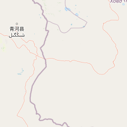
Use this park location map to pinpoint Munkhkhairkhan National Park in Mongolia, understand its exact geographic position, and read its mapped placement within the surrounding landscape more clearly.

Pigeon | © OpenStreetMap contributors

Location context for Munkhkhairkhan National Park

Bayan-Ölgii ProvinceKhovd Province
Park atlas

Compare nearby protected areas and trace the regional geography across the Altai Mountains system in Western Mongolia.

Discover Other National Parks and Protected Areas Near Munkhkhairkhan National Park, Mongolia

Explore national parks and protected areas found within the wider geographic context of Munkhkhairkhan National Park, expanding your atlas discovery across Western Mongolia's diverse mountain and steppe landscapes. Compare their unique alpine terrain, glacial features, and conservation profiles to understand the regional spread of protected areas within the broader Altai Mountains system.
National parkKhovd Province
About 143 km away#1 closest

Southwest

Bulgan Gol-Ikh Ongog National Park: Khovd Province's Vital Riparian Protected Landscape

Mapped geography of river valley, wetlands, and desert steppe.

Bulgan Gol-Ikh Ongog National Park is a designated national park situated in the Khovd Province of western Mongolia, focusing on the preservation of the Bulgan River valley. This protected landscape features a distinctive desert steppe environment interwoven with extensive riparian wetlands, islands, and river channels. The park is ecologically significant as a crucial migratory bird stopover point, supporting diverse habitats that highlight the transition from mountainous sources to the flatter valley floor, offering unique atlas-level geographic insight.

Area
2,461 km²
Established
2011
IUCN
II
Relief
Lowland
Watercolor illustration of a lake with mountains in the background, surrounded by trees and grass
National parkMongolia
About 146 km away#2 closest

North

Har Us Nuur National Park: A Mapped Protected Landscape in Mongolia's Vast Geography

Explore the geography and atlas context of this national park.

Har Us Nuur National Park is a designated national park offering a unique protected landscape within Mongolia. This page provides context for exploring its geographic features, mapped boundaries, and its significance within the broader atlas of protected areas in East Asia. Understanding Har Us Nuur National Park contributes to a structured appreciation of Mongolia's natural terrains and regional conservation landscapes.

Area
8,503 km²
Established
1997
Relief
Mixed relief
Climate
Arid
National parkKhovd Province
About 146 km away#3 closest

North

Khar Us Nuur National Park: Geographic and Protected Area Map of Western Mongolia

Wetland habitats and mountain-fed basins in Khovd Province

Khar Us Nuur National Park offers a comprehensive view of the Great Lakes Basin ecology, where freshwater delta inflows meet saline lakes and high mountain catchments. The park is defined by its diverse terrain, ranging from the extensive Agbash island and reed-fringed shorelines to the prominent southern slopes of the Altai Mountains. This protected area is essential for understanding the hydrological and ecological connectivity of the region.

Area
8,503 km²
Established
1997
IUCN
II
Relief
Mixed relief
Nature reserveAltay Prefecture
About 166 km away#4 closest

Southwest

Xinjiang Bulgan Beaver National Nature Reserve: Regional Geography and Protected Landscape Map

Exploring riverine habitats in the Altay Prefecture foothills.

This protected area centers on a narrow, vital corridor along the Bulgan River. Discover how the riparian forests, freshwater meadows, and valley plains of this nature reserve provide a refuge for the Mengxin beaver. The mapping details a unique, species-focused sanctuary situated along the Sino-Mongolian border within the broader Altai Mountain landscape.

Area
50 km²
Established
1980
Relief
Upland
Climate
Arid
National parkBayan-Ölgii Province
About 219 km away#5 closest

Northwest

Tsambagarav Uul National Park: Mapped Protected Landscape in Bayan-Ölgii

Explore its geographic context and park boundaries.

Tsambagarav Uul National Park offers a detailed look at a significant protected landscape situated in Mongolia's western Bayan-Ölgii Province. This national park's boundaries are mapped to provide context within the broader Altai Mountains region. Users can explore the park's geographic setting, understanding its contribution to the protected natural areas of western Mongolia and its significance for regional landscape studies.

Area
1,110 km²
Established
2000
IUCN
II
Relief
Mountain
Protected areaUvs Province
About 220 km away#6 closest

North

Airag Lake Protected Area: Geographic Context and Steppe Wetland Mapping

Hydrological features within the Uvs Province regional landscape

Airag Lake serves as a critical freshwater habitat in the Uvs Province of western Mongolia. This detailed overview covers the lake's shallow basin, its seasonal thermal patterns, and the outflow canal connecting it to the broader Great Lakes Depression system, providing an essential look at this unique steppe wetland environment.

Area
143.3 km²
Established
1999
National parkUvs Province
About 247 km away#7 closest

North

Khyargas Lake National Park: Geography and Protected Area Mapping in Western Mongolia

A comprehensive look at saline and freshwater steppe ecosystems.

Khyargas Lake National Park, situated in Uvs Province, offers a rare glimpse into the saline and freshwater lake systems of the Mongolian steppe. This protected area encompasses an endorheic basin characterized by its wide, open shoreline and unique ecological contrast. Use our atlas to analyze the mapped terrain and the expansive, undisturbed wetlands that define this notable region of western Mongolia.

Area
3,328 km²
Established
2000
Relief
Lowland
Climate
Arid
National parkBayan-Ölgii Province
About 254 km away#8 closest

Northwest

Altai Tavan Bogd National Park: Protected Mountainous Landscape in Bayan-Ölgii

Explore mapped geography and protected terrain.

Altai Tavan Bogd National Park, situated in Mongolia's Bayan-Ölgii Province, offers a detailed view of a significant protected natural area. This park is defined by its mountainous geography, forming a key part of the Altai range. Users can explore its mapped boundaries and understand its role as a protected landscape within the western Mongolian atlas.

Area
6,362 km²
Established
1996
IUCN
II
Relief
Mountain

Common questions about visiting, size, designation, and location context for Munkhkhairkhan National Park

Munkhkhairkhan National Park FAQs for park facts, access, geography, and protected area context

Find quick answers about Munkhkhairkhan National Park, including protected-area facts, park geography, trail and visitor context, and how the park fits into its surrounding country and regional landscape.
MoriAtlas Explorer

Continue Your Protected Areas Search Across the Global Atlas

Deepen your exploration by continuing the structured search for national parks and protected areas worldwide. Utilize the comprehensive filtering capabilities to compare different conservation landscapes and refine your understanding of global park geography. Discover more about the distribution and characteristics of protected natural areas.

Global natural geography