Mori Atlas logo
National parkBulgan Gol-Ikh Ongog National Park

Atlas exploration of western Mongolia's critical riparian ecosystems and desert steppe terrain.

Bulgan Gol-Ikh Ongog National Park: Protected River Valley Landscape in Khovd Province

Bulgan Gol-Ikh Ongog National Park represents a significant protected area within Khovd Province, western Mongolia, celebrated for its extensive river valley and vital wetland habitats. Established to preserve the unique ecological corridor formed by the Bulgan River, this national park showcases a dramatic contrast between arid desert steppe and lush riparian zones. Its geography is shaped by the meandering river system, creating islands and marshes that serve as a critical stopover for migratory birds along the East Asian flyway, offering rich context for atlas-based landscape discovery.

National ParkWetlandsRiparian EcosystemMigratory BirdsDesert SteppeRiver Valley

Bulgan Gol-Ikh Ongog National Park

National park

Park overview

Structured park overview, official facts, and landscape profile for Bulgan Gol-Ikh Ongog National Park

Bulgan Gol-Ikh Ongog National Park park facts, protected area profile, and essential visitor context
Review the core facts for Bulgan Gol-Ikh Ongog National Park, including designation, size, terrain, visitor scale, habitats, and operating context in one park-focused overview.

About Bulgan Gol-Ikh Ongog National Park

Bulgan Gol-Ikh Ongog National Park protects a remarkable riverine ecosystem in one of Mongolia's most remote western provinces. The park centers on the Bulgan River, which originates in the Altai Mountains and flows westward across a broad, flat valley floor before crossing into China and reaching Ulungur Lake. Unlike the surrounding desert steppe, which receives minimal precipitation and supports sparse vegetation, the river valley supports a rich complex of wetlands, reed beds, and riparian shrub communities that form as the river meanders and divides into multiple channels and islands. This hydrological pattern creates diverse habitat types within a relatively compact area, from open water channels to seasonally flooded marshes and stable island forests. The park was established in 2011 to safeguard these sensitive wetland ecosystems and the biodiversity they support, particularly the migratory bird populations that depend on this corridor during their long-distance journeys between breeding areas in Siberia and wintering grounds in East and Southeast Asia.

Quick facts and research context for Bulgan Gol-Ikh Ongog National Park

The park is located in Khovd Province in western Mongolia, spanning roughly 2,461 square kilometers along the Bulgan River as it flows from the Altai Mountains toward the border with China. Established in 2011 and managed by Mongolia's Ministry of Environment and Green Development, the park protects a cold semi-arid ecosystem characterized by desert steppe vegetation and extensive riparian wetlands. The area holds IUCN Category II protected area status, designation that reflects its national park designation and conservation significance. The Bulgan River Valley serves as a critical corridor for biodiversity in a region where surface water and wetland habitats are otherwise scarce.

Park context

Deeper park guide and search-rich context for Bulgan Gol-Ikh Ongog National Park

Bulgan Gol-Ikh Ongog National Park history, landscape, wildlife, and travel context
Explore Bulgan Gol-Ikh Ongog National Park through its history, landscape character, ecosystems, wildlife, conservation priorities, cultural context, and seasonal travel timing in a structured park guide built for atlas discovery and search intent.

Why Bulgan Gol-Ikh Ongog National Park stands out

Bulgan Gol-Ikh Ongog National Park is best known as a crucial stopover site for migratory birds traveling along the East Asian flyway. The wetlands and river channels provide essential resting and feeding habitat for waterfowl during their seasonal migrations between breeding and wintering grounds. The park protects populations of several vulnerable species, including the eastern imperial eagle and the swan goose, both of which are listed as vulnerable on the IUCN Red List. The park's riparian wetlands, with their reed beds and shrub thickets, represent one of the most important wetland complexes in western Mongolia, supporting ecological functions that extend far beyond the park's boundaries.

Bulgan gol.jpg
Bulgan Gol river (Urungu)

Bulgan Gol-Ikh Ongog National Park history and protected-area timeline

Bulgan Gol-Ikh Ongog National Park was established in 2011 by the Government of Mongolia, designated under IUCN Category II as a national park. The creation of the protected area reflected growing recognition of the ecological importance of the Bulgan River Valley as a biodiversity corridor in western Mongolia. The park is managed by the Ministry of Environment and Green Development of Mongolia, which oversees protection and conservation activities within its boundaries. Prior to national park designation, the area had been recognized for its ecological significance, particularly as a wetland complex supporting migratory bird populations. The establishment formalized protections for the river corridor and its associated wetlands, creating a framework for sustainable management of this important ecosystem.

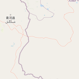
Bulgan Gol-Ikh Ongog National Park landscape and geographic character

The physical landscape of Bulgan Gol-Ikh Ongog National Park is defined by the Bulgan River and its extensive valley system. The river originates in the Altai Mountains, Mongolia's highest mountain range, and flows westward across a relatively flat valley floor that allows the watercourse to meander extensively. This meandering pattern causes the river to divide repeatedly, creating numerous islands, braided channels, and adjacent wetlands throughout the valley. The surrounding terrain consists of desert steppe, characterized by sparse vegetation and arid conditions typical of western Mongolia's cold semi-arid climate. The contrast between the river corridor and the surrounding landscape is striking: while the steppe supports only drought-tolerant grasses and scattered shrubs, the wetlands along the river support dense reed beds and willow thickets. The park's position at the transition between mountainous source areas and the flat valley floor gives it a distinctive character as a riparian oasis in an otherwise dry landscape.

Bulgan Gol-Ikh Ongog National Park ecosystems, habitats, and plant life

The ecological character of Bulgan Gol-Ikh Ongog National Park centers on its riparian wetlands and desert steppe habitats. The Bulgan River Valley supports a complex of wetland types, including permanent open water channels, seasonal floodplains, reed beds, and shrub-dominated riparian zones. These wetlands exist within a matrix of desert steppe that receives limited precipitation and experiences extreme temperature variations typical of continental interior climates. The vegetation in the river valley contrasts sharply with the surrounding steppe, where sparse grasses and drought-adapted shrubs dominate. Along the river channels, common reed and other wetland plants form extensive beds that provide cover and food for wildlife. The riparian shrub communities, dominated by species adapted to periodic flooding, create additional habitat complexity. This combination of wetland and steppe habitats within a single protected area supports ecological diversity that would not exist without the river corridor.

Bulgan Gol-Ikh Ongog National Park wildlife and species highlights

Bulgan Gol-Ikh Ongog National Park supports significant wildlife populations, particularly birds that depend on the wetland habitats during migration. The park serves as an important stopover for migratory waterfowl traveling along the East Asian flyway, providing essential resting and feeding habitat as birds move between breeding grounds in northern Asia and wintering areas in warmer regions. Notable species include the swan goose, a vulnerable species that uses the wetlands during migration, and the eastern imperial eagle, also listed as vulnerable and found hunting in the valley. The lesser kestrel, though not classified as vulnerable, breeds in the area and hunts over the wetlands and surrounding steppe. The park also supports the Eurasian beaver, which has colonized the river and contributes to the wetland ecosystem through its dam-building activities. Fish and other aquatic organisms in the river channels support the food web that sustains these bird populations.

Bulgan Gol-Ikh Ongog National Park conservation status and protection priorities

The protection of Bulgan Gol-Ikh Ongog National Park addresses critical conservation needs in western Mongolia's desert steppe biome. The park's wetlands represent rare and valuable habitat in a region where surface water is scarce, making the river corridor essential for biodiversity persistence. The area's importance as a migratory bird stopover qualifies it as a key site for international bird conservation, supporting species that travel across multiple countries during their annual cycles. The presence of vulnerable species, including the eastern imperial eagle and swan goose, adds conservation urgency, as these populations face pressures throughout their ranges. The IUCN Category II national park designation provides a framework for management that balances protection with sustainable use, recognizing the area's ecological significance while allowing for appropriate management activities.

Top sights and standout views in Bulgan Gol-Ikh Ongog National Park

The standout features of Bulgan Gol-Ikh Ongog National Park include its extensive wetland complex along the Bulgan River, where the river splits into numerous channels, islands, and riparian marshes. The park provides critical habitat for migratory birds, including vulnerable species such as the eastern imperial eagle and swan goose, making it a significant site for birdwatching and ornithological study during migration seasons. The contrast between the river valley's lush wetlands and the surrounding desert steppe creates a distinctive landscape that is visually striking in the context of western Mongolia's generally arid terrain. The presence of Eurasian beavers in the river system adds ecological interest, as their activities influence wetland hydrology and habitat structure.

Best time to visit Bulgan Gol-Ikh Ongog National Park

The best time to visit Bulgan Gol-Ikh Ongog National Park is during spring and early summer, when migratory birds pass through the valley and wetland vegetation is at its most vibrant. Spring migration, typically from April through May, brings large numbers of waterfowl to the wetlands, providing excellent birdwatching opportunities. Summer months offer warm conditions and full wetland habitat, though temperatures can be extreme. Autumn migration, from September into October, also brings bird activity as species move south. Winter conditions are harsh, with cold temperatures and frozen waterways limiting access and wildlife viewing. The park can be visited year-round, but spring and autumn offer the most rewarding wildlife experiences.

Park location guide

Geography guide, regional context, and park location map for Bulgan Gol-Ikh Ongog National Park

Bulgan Gol-Ikh Ongog National Park park geography, regions, and map view in Mongolia
Understand where Bulgan Gol-Ikh Ongog National Park sits in Mongolia through a broader geographic reading of the surrounding landscape, nearby location context, and its mapped position within the national park landscape.

How Bulgan Gol-Ikh Ongog National Park fits into Mongolia

Mongolia is a landlocked sovereign state in East Asia, known for its vast steppe landscapes, nomadic culture, and historical significance as the heartland of the Mongol Empire founded by Genghis Khan in 1206. The country has a population of approximately 3.5 million people and is the world's most sparsely populated sovereign state. Ulaanbaatar is the capital and largest city, home to roughly half the population.

Wider geography shaping Bulgan Gol-Ikh Ongog National Park in Mongolia

Mongolia is located in East Asia, landlocked between Russia to the north and China to the south. The country occupies the Mongolian Plateau and features diverse terrain including grassy steppe, mountains in the north and west, and the Gobi Desert in the south. It covers 1,564,116 km2, making it the second largest landlocked country in the world.

Map view of Bulgan Gol-Ikh Ongog National Park

Use this park location map to pinpoint Bulgan Gol-Ikh Ongog National Park in Mongolia, understand its exact geographic position, and read its mapped placement within the surrounding landscape more clearly.

Pigeon | © OpenStreetMap contributors

Location context for Bulgan Gol-Ikh Ongog National Park

Khovd Province

Explore key landscapes, unique wetland habitats, and the vivid natural scenery defining this vital protected area in the arid desert steppe of Mongolia.

Bulgan Gol-Ikh Ongog National Park Photos: Visual Guide to Western Mongolia's Riverine Landscapes
Visually explore the distinctive landscapes of Bulgan Gol-Ikh Ongog National Park, featuring its vital wetland complexes, meandering river channels, and the contrasting desert steppe. These park images offer crucial insights into the protected area's unique ecological character and its significance as a riparian oasis and critical habitat for migratory birds in Western Mongolia.

Bulgan gol.jpg

Park atlas

Trace regional protected landscapes and compare adjacent river valleys or desert steppe ecosystems in Western Mongolia.

Discover Other National Parks and Protected Areas Near Bulgan Gol-Ikh Ongog National Park in Western Mongolia
Browse a curated selection of national parks and protected areas located in close geographic proximity or within similar riparian and desert steppe environments surrounding Bulgan Gol-Ikh Ongog National Park. Compare their unique conservation values, wetland systems, and arid landscapes to understand the broader ecological network across Western Mongolia's vast terrain.
National parkBayan-Ölgii Province

Munkhkhairkhan National Park: Alpine Glacial Landscape & Protected Area

Explore the mapped geography of western Mongolia's high peaks.

Munkhkhairkhan National Park protects the dramatic alpine environment surrounding Mönkhkhairkhan Mountain, Mongolia's second-highest peak. This national park showcases spectacular glacial valleys and steep, rock-strewn slopes characteristic of the Mongol-Altai Mountains. As a key protected landscape in Bayan-Ölgii Province, it offers a distinct view into Mongolia's high-elevation ecosystems and their unique mapped boundaries for atlas exploration.

Area
5,061 km²
Established
2011
IUCN
II
National parkAltai Republic

Saylyugemsky National Park: Discover its Protected Landscape and Geographic Significance in Altai Republic

Mapped boundaries and regional landscape context within the Altai Republic.

Delve into Saylyugemsky National Park, a designated national park situated within the vast geographic expanse of Russia's Altai Republic. This canonical page provides detailed insights into its protected landscape, meticulously mapped boundaries, and its contribution to the regional geography. MoriAtlas focuses on structured geographic discovery, enabling a deeper understanding of Saylyugemsky National Park's place within the atlas of protected areas and natural landscapes.

Area
1,183.8 km²
Established
2012
IUCN
II
Relief
Mountain
National parkEast Kazakhstan Region

Katon-Karagay National Park: Discover Kazakhstan's Largest Protected Mountain Landscape

Explore the geography and park boundaries of East Kazakhstan's premier national park.

Katon-Karagay National Park, the largest national park in Kazakhstan, offers a deep dive into the protected landscapes of the Southern Altai Mountains. This page provides essential geographic context, detailing the park's terrain, its significance as a protected area within East Kazakhstan Region, and its role in mapping the natural contours of this ecologically diverse mountain system. Understand the park's boundaries and its contribution to regional conservation.

Area
6,435 km²
Established
2001
IUCN
II
Relief
Mountain
National parkZavkhan Province

Tarvagatai Nuruu National Park: Zavkhan Province Protected Landscape Atlas

Unique steppe-to-forest transition and mountainous terrain.

Tarvagatai Nuruu National Park represents a critical protected area within Mongolia's Zavkhan Province, noted for its expansive mountainous terrain and significant ecological diversity. The park's landscape is defined by the Tarvagatai Range, featuring flat-topped ridges, glacial valleys, and dramatic elevation changes. It masterfully showcases the transition from semi-arid steppe to dense coniferous forests, highlighting a visually striking ecological boundary anchored by the prominence of Mount Otgontenger, the highest peak in the Khangai Mountains.

Area
5,467 km²
Established
2000
IUCN
II
National parkEast Kazakhstan Region

Tarbagatai National Park: Protected Landscape and Wild Fruit Tree Forests in East Kazakhstan Region

Explore the mapped boundaries and ecosystem of this national park.

Tarbagatai National Park is a protected area in East Kazakhstan recognized for its unique role in conserving wild fruit tree forests that have maintained genetic isolation. This national park provides a detailed view of a mountain-steppe ecosystem across the Tarbagatai mountain range, Karabas Mountains, and Arkaly Mountains, along with the Urzhar and Emel river valleys. Its establishment in 2018 highlights its importance for biodiversity and the study of natural forest genetics, offering significant geographic context for regional protected land exploration.

Area
1,364 km²
Established
2018
IUCN
II
Relief
Mountain
Watercolor painting of green trees, rolling hills, a pink and yellow sunset sky, and a single tree on the right
National parkKrasnoyarsk Krai

Shushensky Bor National Park: Mapped Geography of a Siberian Protected Forest

Explore the protected landscape and regional context of Krasnoyarsk Krai.

Shushensky Bor National Park serves as a critical protected area within the vast geography of Krasnoyarsk Krai, Russia, offering detailed insights into Siberia's ecological transition zones. This national park meticulously maps the shift from the Minusinsk basin forest-steppe to the dramatic mountain taiga of the Western Sayan range. Users can explore its varied terrain, from gentler northern steppe-influenced lands to the rugged slopes of the Borus Massive, all within a defined protected landscape. The proximity to the Sayano-Shushenskoye Reservoir further defines its unique geographic setting, providing context for its conservation importance and natural beauty.

Area
392 km²
Established
1995
IUCN
II
Relief
Mountain
National parkTashtagolsky District

Shorsky National Park: Protected Landscape and National Park Geography

Discover the mapped terrain and regional context of Shorsky National Park.

Shorsky National Park is a key protected area within the Tashtagolsky District, nestled in the mountainous terrain of Southern Siberia. This page serves as an entry point for understanding its role as a national park, focusing on its geographic boundaries and landscape context. MoriAtlas allows for detailed map-based exploration of Shorsky National Park, highlighting its significance within the regional geography and the broader atlas of protected lands in Russia.

Area
4,180 km²
Established
1989
IUCN
II
National parkMongolia

Khangai Nuruu National Park: Discover Mongolia's Protected Mountain Landscape and Atlas Context

Explore mapped boundaries and diverse ecosystems across its terrain.

Khangai Nuruu National Park stands as a vast national park in central Mongolia, characterized by its diverse protected landscapes and significant geographic scope. Spanning the Khangai Mountains, it presents a remarkable ecological transition from alpine meadows and taiga forests to steppe and riparian environments. This park offers a rich atlas exploration opportunity, highlighting its mapped boundaries and the unique regional geography that defines its protected status, making it a key point of discovery for understanding Mongolian conservation areas.

Area
8,885 km²
Established
1996
IUCN
II

Common questions about visiting, size, designation, and location context for Bulgan Gol-Ikh Ongog National Park

Bulgan Gol-Ikh Ongog National Park FAQs for park facts, access, geography, and protected area context
Find quick answers about Bulgan Gol-Ikh Ongog National Park, including protected-area facts, park geography, trail and visitor context, and how the park fits into its surrounding country and regional landscape.
MoriAtlas Explorer

Continue Your Protected Areas Search Across the Global Atlas

Deepen your exploration by continuing the structured search for national parks and protected areas worldwide. Utilize the comprehensive filtering capabilities to compare different conservation landscapes and refine your understanding of global park geography. Discover more about the distribution and characteristics of protected natural areas.

Global natural geography