
Mori Atlas logo
National parkKhyargas Lake National Park

Discover the geographic extent and protected steppe ecosystems of a significant Mongolian saline lake system.

Khyargas Lake National Park: Mapping the Saline and Freshwater Landscapes of Western Mongolia

Khyargas Lake National Park preserves a vast, interconnected landscape in the heart of western Mongolia, defined by the distinctive pairing of the saline Khyargas Nuur and the freshwater Airag Lake. This protected area within Uvs Province captures the raw character of the Great Lakes depression, where vast, open steppe meets complex lake basins. Through our mapped atlas, examine the boundaries and terrain of this endorheic region, which serves as a vital corridor for wetland ecosystems and arid grassland environments.

salt lakeendorheic lakesteppewetlandsbirdwatchinglake ecosystem
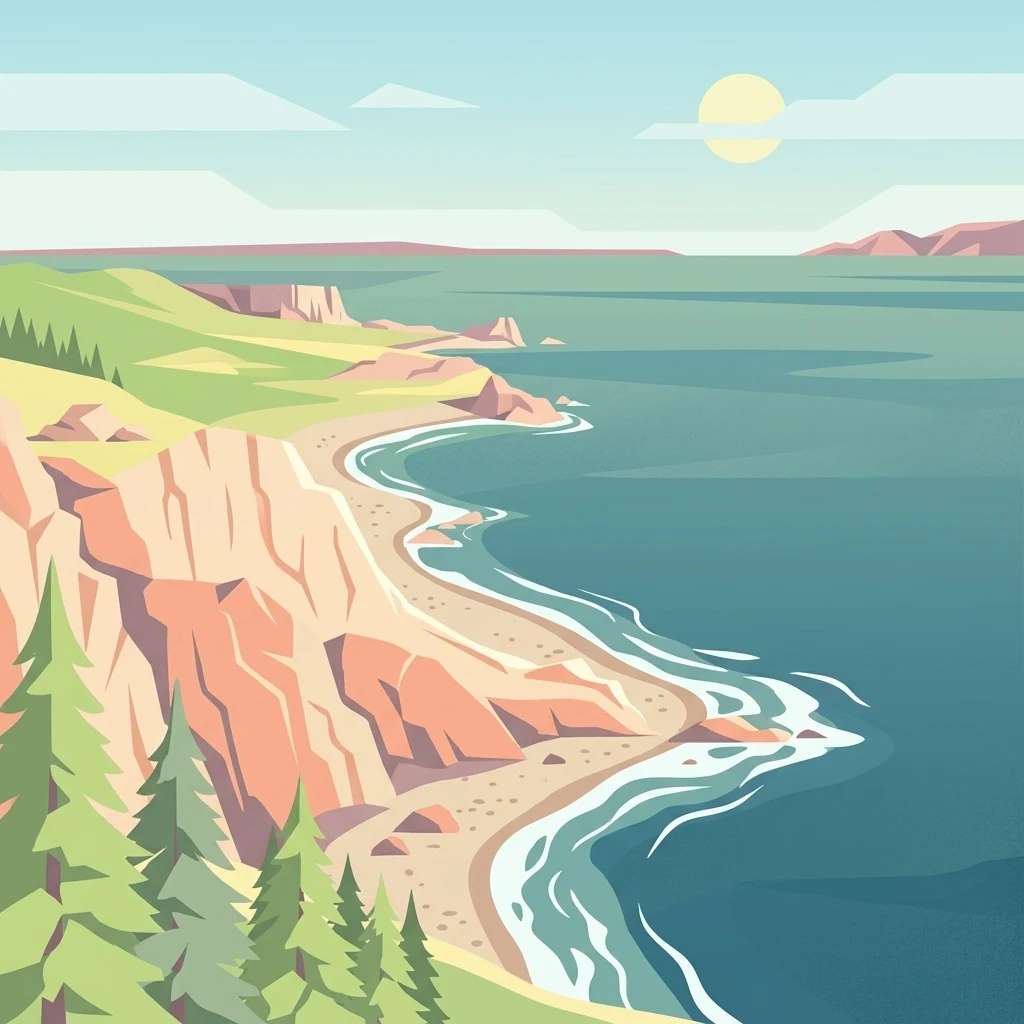
A digital illustration of a calm, blue lake meeting a sandy beach backed by reddish rock cliffs, with evergreen trees in the foreground and a pale yellow sun in the sky.

Khyargas Lake National Park

National park

Park overview

Structured park overview, official facts, and landscape profile for Khyargas Lake National Park

Khyargas Lake National Park park facts, protected area profile, and essential visitor context

Review the core facts for Khyargas Lake National Park, including designation, size, terrain, visitor scale, habitats, and operating context in one park-focused overview.

About Khyargas Lake National Park

Khyargas Lake National Park is a protected area in western Mongolia that takes its identity from Khyargas Nuur, a substantial salt lake in Uvs Province. The park lies in the Khyargas district and sits within the broader Great Lakes region of Mongolia, an area defined by alternating saline and freshwater basins amid vast stretches of steppe. The park's boundaries are built around the lake itself, the surrounding terrestrial landscape, and the adjacent freshwater Airag Lake to the south.

The lake is endorheic, with no outflow, meaning that water arriving through the Zavkhan River system via Airag Lake is balanced only by evaporation across the lake's surface. This produces a saline basin with shallow to moderately deep waters, set in a continental climate that includes long cold winters, short summers, and high rates of evaporation that contribute to the lake's chemistry. The lake stretches tens of kilometers across, occupying a large surface area within the park, and its flat open shoreline is a defining visual feature.

Beyond the lake itself, the park protects dry steppe and semi-arid landscapes typical of the western Mongolian lowlands. This combination of open grassland and saline lake habitats gives the park a distinctive identity, separating it from the forested and mountainous national parks further north and east in Mongolia. The park is part of a wider regional mosaic of protected natural areas that includes Uvs Nuur and other lake-and-steppe reserves.

Established in 2000, the park represents a relatively modern recognition of the ecological importance of these lake-and-steppe systems. By bringing Khyargas Nuur and Airag Nuur together in a single protected area, the park helps ensure that both the saline and freshwater components of the system are managed as one connected landscape rather than as isolated features.

Quick facts and research context for Khyargas Lake National Park

Khyargas Lake National Park is located in Khyargas district of Uvs Province, in western Mongolia, and was established in 2000. The park covers roughly 3,328 square kilometers and is built around the salt lake Khyargas Nuur, with the freshwater Airag Lake included within its boundaries as well.

The lake at the heart of the park is an endorheic salt lake fed by the Zavkhan River via Airag Lake. It lies at an elevation of around 1,028 meters above sea level and is part of Mongolia's broader Great Lakes region, where saline and freshwater basins coexist across an arid steppe landscape.

Protection and recognition

Documented terrestrial protection scope, management records, and formal status details

Khyargas Lake National Park Protection Status and International Recognition Data

Khyargas Lake National Park protection status details compile documented terrestrial conservation scopes and designation records. Systematic records track established management parameters, official recognition frameworks, and baseline administrative data.

Protection details

Protection scope
Terrestrial
Transboundary protection
No
Park context

Deeper park guide and search-rich context for Khyargas Lake National Park

Khyargas Lake National Park history, landscape, wildlife, and travel context

Explore Khyargas Lake National Park through its history, landscape character, ecosystems, wildlife, conservation priorities, cultural context, and seasonal travel timing in a structured park guide built for atlas discovery and search intent.

Why Khyargas Lake National Park stands out

Khyargas Lake National Park is best known for protecting one of Mongolia's major salt lakes, Khyargas Nuur, set within an unbroken expanse of western Mongolian steppe. The park is recognized for the unusual pairing of a large saline endorheic lake with a smaller freshwater lake, Airag Nuur, right next to it. The saline character of the main lake, the arid continental climate, and the wide, open setting define much of the park's identity. It is also notable as part of the chain of large lakes that characterize the western Mongolian landscape, including nearby Uvs Nuur, giving the park its sense of remoteness and ecological contrast.
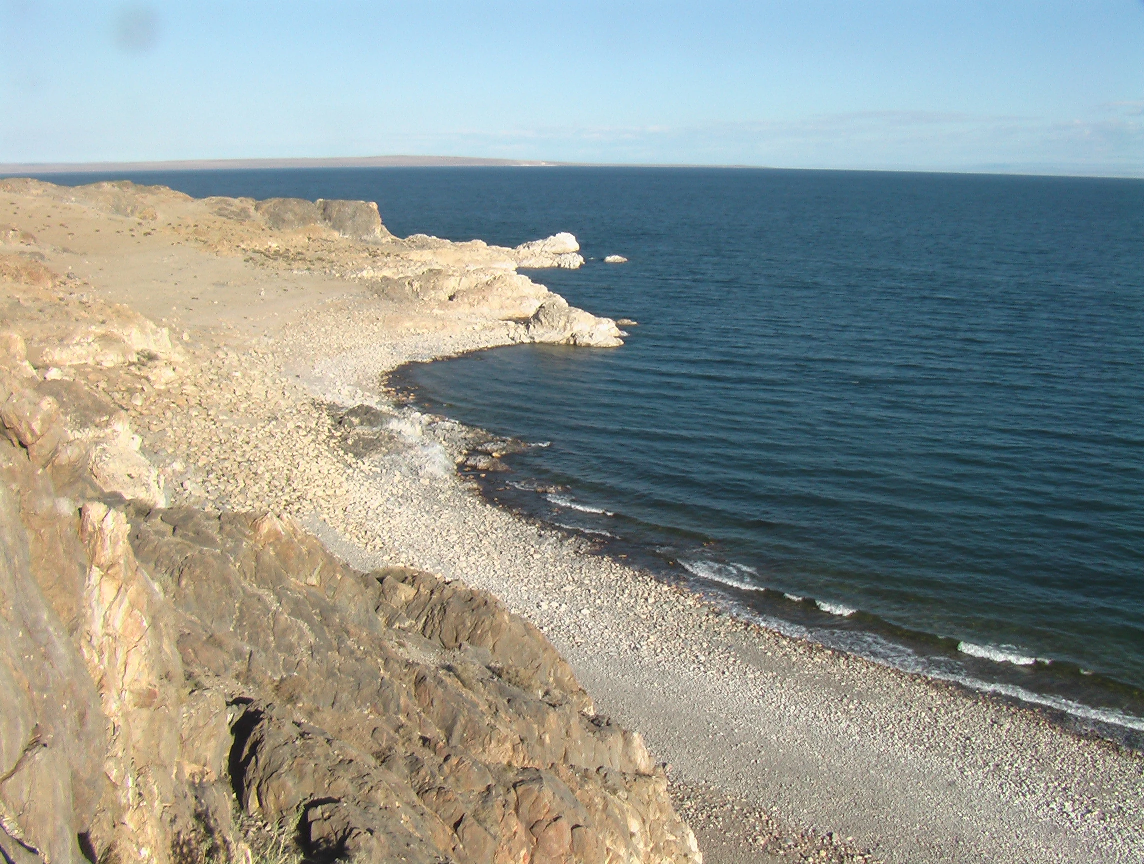
A wide view of the rocky, arid shoreline of Khyargas Lake in Mongolia, with deep blue water meeting a pebble-covered coast under a clear sky.
The southeastern shore of Khyargas Lake, showing its characteristic rocky beach and clear, deep blue water.

Khyargas Lake National Park history and protected-area timeline

Khyargas Lake National Park was officially established in 2000 as a protected area centered on the salt lake Khyargas Nuur. The park's creation reflected growing recognition in the late 20th and early 21st centuries of the ecological importance of Mongolia's lake systems, particularly the saline and freshwater basins in the remote west of the country.

The protected area was designed to include not only the saline Khyargas Lake itself but also the adjacent freshwater Airag Lake, recognizing the ecological relationship between the two basins through the inflow of the Zavkhan River. Since its establishment, the park has functioned as part of the wider network of protected landscapes in Uvs Province, including reserves around the much larger Uvs Lake further north.

Khyargas Lake National Park landscape and geographic character

The landscape of Khyargas Lake National Park is defined by the broad, flat expanse of Khyargas Nuur itself, a wide salt lake lying in a shallow depression surrounded by open steppe. The lake's shoreline is gentle and largely featureless, reflecting the low relief of the surrounding region, with no significant mountain ranges rising directly from the lakeshore. The result is a sweeping, open visual character that emphasizes the size of both the lake and the surrounding grasslands.

Beyond the lake's edge, the park extends across semi-arid steppe and gently undulating terrain typical of the Great Lakes region of western Mongolia. The freshwater Airag Lake sits just to the south, adding a softer, freshwater counterpart to the saline main lake. Across the park, the terrain is shaped by the continental climate, with sparse vegetation cover and long sightlines across the basin.

Khyargas Lake National Park ecosystems, habitats, and plant life

Khyargas Lake National Park lies within the broader Great Lakes depression of Mongolia, where a chain of saline and freshwater basins interrupt an otherwise continuous stretch of steppe. The park's natural character is shaped by this fundamental contrast: the saline, endorheic main lake held in a basin without outflow, and a connected but ecologically distinct freshwater lake to the south. This combination gives the park an unusual ecological profile for Mongolia.

The surrounding terrestrial environment is dominated by steppe and semi-arid grassland adapted to the dry continental climate. Vegetation is sparse and adapted to high evaporation rates and limited precipitation, and the soil and water chemistry of the saline lake influences the biology of its immediate shoreline. The lake's water balance depends heavily on inflow from the Zavkhan River through Airag Lake, balanced against strong evaporation in summer months.

Together, the saline and freshwater lake environments, along with the surrounding dry steppe, make up the park's ecological system. This mosaic contrasts with the alpine and taiga ecosystems found in other parts of Mongolia, giving the park a distinctive position within the country's range of protected environments.

Khyargas Lake National Park wildlife and species highlights

Khyargas Lake National Park supports wildlife characteristic of the steppe and saline lake environments of western Mongolia. The lake attracts waterbirds adapted to saline and brackish conditions, while the surrounding grasslands provide habitat for steppe-dwelling species typical of this part of Central Asia. The combination of open steppe and open water creates a setting where wetland, lakeshore, and grassland fauna can occur in close proximity.

The saline character of Khyargas Nuur means that the lake's wildlife communities are different from those of fully freshwater lakes in the region, while the neighboring freshwater Airag Lake supports a different ecological community. The park's position within the broader Great Lakes region also connects it ecologically with surrounding protected areas and important bird habitats of the western Mongolian lowlands.

Khyargas Lake National Park conservation status and protection priorities

Khyargas Lake National Park protects a significant example of the saline lake and steppe landscapes that characterize western Mongolia. By including both saline Khyargas Nuur and freshwater Airag Nuur within its boundaries, the park helps preserve the contrasting ecological processes that occur where endorheic saline basins and freshwater basins sit side by side and exchange water.

The park's establishment in 2000 reflected an understanding that these lake systems, together with the surrounding steppe, form a single ecological unit rather than separate features. The protected area also contributes to the broader conservation network of the Great Lakes region, which supports migratory waterbirds and preserves some of the most intact steppe landscapes in Mongolia. Conservation value is further tied to the park's role in maintaining water balance and protecting representative habitat across a large area of a sparsely populated region.

Khyargas Lake National Park cultural meaning and human context

The region around Khyargas Lake National Park lies in the Khyargas district of Uvs Province, a part of western Mongolia historically associated with nomadic pastoralism. The lake and the surrounding steppe have long provided grazing resources for traditional Mongolian herding communities, and the wider Uvs Province region is home to distinct cultural traditions linked to the lake landscapes and steppe environment.

The name "Khyargas," applied both to the lake and the district, forms an integral part of local place identity in this part of Mongolia. While the park itself is primarily established for natural conservation, its landscape continues to reflect the long-standing relationship between nomadic land use and the natural systems of the western Mongolian lowlands.

Top sights and standout views in Khyargas Lake National Park

Khyargas Lake National Park's strongest point of distinction is its protection of a major endorheic salt lake combined with the adjacent freshwater Airag Lake, creating a paired saline-freshwater system within a single reserve. The park also showcases the sweeping, open character of the Mongolian Great Lakes region, where vast, unbroken steppe meets large lake basins.

Its relatively recent establishment in 2000 and its more than 3,000 square kilometer footprint underscore the scale at which Mongolia has begun to protect these lake-steppe landscapes. For visitors and researchers, the park represents a clear example of how a single protected area can capture both lake and steppe environments within one continuous setting.

Best time to visit Khyargas Lake National Park

Khyargas Lake National Park lies in a region with a strongly continental climate, where winter brings severe cold and heavy ice cover on the lake, and summer brings warmer temperatures and the highest rates of evaporation. Late spring through early autumn generally offers the most accessible conditions for visiting the lake and the surrounding steppe, when the landscape is free of snow and waterbird activity around the saline and freshwater shorelines tends to be most visible.

Summer is also the season when travel conditions across the surrounding steppe are typically easier, though visitors should expect dry conditions and significant temperature variation between day and night. Winter visits into the area are difficult because of extreme cold and limited infrastructure in this remote part of western Mongolia.
Monthly climate preview

Long term monthly temperature and precipitation averages for Uvs Province

Khyargas Lake National Park Climate Normals and Annual Weather Rhythm

Khyargas Lake National Park records sustained sub zero winter temperatures alongside warm summer maximums accompanied by low daily precipitation totals. Examining the complete monthly climate normals reveals the full twelve month cycle of temperature and moisture variations across the representative coordinate.
Annual mean3 °C
-18 °C22 °C
Jan-18°
Feb-14°
Mar-4°
Apr
May13°
Jun20°
Jul22°
Aug19°
Sep12°
Oct
Nov-7°
Dec-16°
Warmest month
July

21.9 °C

Coolest month
January

-18.4 °C

Wettest month
July

1.3 mm/day

Driest month
January

0.1 mm/day

Park location guide

Geography guide, regional context, and park location map for Khyargas Lake National Park

Khyargas Lake National Park park geography, regions, and map view in Mongolia

Understand where Khyargas Lake National Park sits in Mongolia through a broader geographic reading of the surrounding landscape, nearby location context, and its mapped position within the national park landscape.

How Khyargas Lake National Park fits into Mongolia

Mongolia is a landlocked sovereign state in East Asia, known for its vast steppe landscapes, nomadic culture, and historical significance as the heartland of the Mongol Empire founded by Genghis Khan in 1206. The country has a population of approximately 3.5 million people and is the world's most sparsely populated sovereign state. Ulaanbaatar is the capital and largest city, home to roughly half the population.

Wider geography shaping Khyargas Lake National Park in Mongolia

Mongolia is located in East Asia, landlocked between Russia to the north and China to the south. The country occupies the Mongolian Plateau and features diverse terrain including grassy steppe, mountains in the north and west, and the Gobi Desert in the south. It covers 1,564,116 km2, making it the second largest landlocked country in the world.

Map view of Khyargas Lake National Park

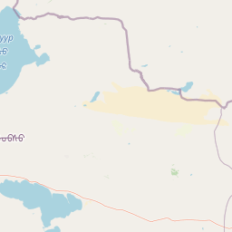
Use this park location map to pinpoint Khyargas Lake National Park in Mongolia, understand its exact geographic position, and read its mapped placement within the surrounding landscape more clearly.

Pigeon | © OpenStreetMap contributors

Location context for Khyargas Lake National Park

Uvs Province

Visual reference of saline lake basins and western Mongolian steppe environments

Khyargas Lake National Park Photos and Landscape Scenery

Visual documentation captures the wide salt lake basin and open steppe terrain defining Khyargas Lake National Park. Detailed photography reveals the unique pairing of endorheic saline waters with adjacent freshwater habitats across the protected region.

A wide view of the rocky, arid shoreline of Khyargas Lake in Mongolia, with deep blue water meeting a pebble-covered coast under a clear sky.

Park atlas

Compare regional lake basins and surrounding steppe landscapes across western Mongolia

Explore Protected Areas and Other Parks Near Khyargas Lake National Park

Continue geographic discovery by browsing protected natural areas and regional reserves connected to the western Mongolian steppe. Comparing adjacent lake ecosystems provides broader context for the endorheic basins and wetland habitats found across this remote region.
Protected areaUvs Province
About 28 km away#1 closest

South

Airag Lake Protected Area: Geographic Context and Steppe Wetland Mapping

Hydrological features within the Uvs Province regional landscape

Airag Lake serves as a critical freshwater habitat in the Uvs Province of western Mongolia. This detailed overview covers the lake's shallow basin, its seasonal thermal patterns, and the outflow canal connecting it to the broader Great Lakes Depression system, providing an essential look at this unique steppe wetland environment.

Area
143.3 km²
Established
1999
National parkUvs Province
About 105 km away#2 closest

East

Khan-Khokhi Khyargas Mountain National Park: Mapped Boundaries and Protected Landscape

Uvs Province National Park Geography

Khan-Khokhi Khyargas Mountain National Park is a designated national park offering critical insights into Mongolia's protected natural landscapes. This entry supports structured geographic discovery, detailing the park's mapped boundaries and its environmental context within Uvs Province. Engage with the park's identity as a protected area, uncovering its role in the regional atlas and its unique contribution to the mapped terrain.

Area
3,413 km²
Established
2000
IUCN
II
Relief
Mountain
Watercolor illustration of a lake with mountains in the background, surrounded by trees and grass
National parkMongolia
About 105 km away#3 closest

Southwest

Har Us Nuur National Park: A Mapped Protected Landscape in Mongolia's Vast Geography

Explore the geography and atlas context of this national park.

Har Us Nuur National Park is a designated national park offering a unique protected landscape within Mongolia. This page provides context for exploring its geographic features, mapped boundaries, and its significance within the broader atlas of protected areas in East Asia. Understanding Har Us Nuur National Park contributes to a structured appreciation of Mongolia's natural terrains and regional conservation landscapes.

Area
8,503 km²
Established
1997
Relief
Mixed relief
Climate
Arid
A soft watercolor illustration featuring marsh grasses in the foreground, calm water, and layered mountain ranges in the background under a pale sky.
National parkKhovd Province
About 105 km away#4 closest

Southwest

Khar Us Nuur National Park: Geographic and Protected Area Map of Western Mongolia

Wetland habitats and mountain-fed basins in Khovd Province

Khar Us Nuur National Park offers a comprehensive view of the Great Lakes Basin ecology, where freshwater delta inflows meet saline lakes and high mountain catchments. The park is defined by its diverse terrain, ranging from the extensive Agbash island and reed-fringed shorelines to the prominent southern slopes of the Altai Mountains. This protected area is essential for understanding the hydrological and ecological connectivity of the region.

Area
8,503 km²
Established
1997
IUCN
II
Relief
Mixed relief
National parkZavkhan Province
About 183 km away#5 closest

Southeast

Ulaagchinii Khar Nuur National Park: Protected National Park in Zavkhan Province

Mapped landscape context and regional geographic setting.

As a dedicated national park, Ulaagchinii Khar Nuur National Park serves as a key protected area within Zavkhan Province. This detail page provides an atlas-oriented view of its mapped boundaries and its role in the regional geography of western Mongolia. Understand the park's specific protected landscape characteristics and its contribution to the mapped natural terrain of the Khangai Mountain region.

Area
2,594 km²
Established
2010
IUCN
II
Relief
Mixed relief
National parkBayan-Ölgii Province
About 187 km away#6 closest

West

Tsambagarav Uul National Park: Mapped Protected Landscape in Bayan-Ölgii

Explore its geographic context and park boundaries.

Tsambagarav Uul National Park offers a detailed look at a significant protected landscape situated in Mongolia's western Bayan-Ölgii Province. This national park's boundaries are mapped to provide context within the broader Altai Mountains region. Users can explore the park's geographic setting, understanding its contribution to the protected natural areas of western Mongolia and its significance for regional landscape studies.

Area
1,110 km²
Established
2000
IUCN
II
Relief
Mountain
National parkBayan-Ölgii Province
About 247 km away#7 closest

South

Munkhkhairkhan National Park: Alpine Glacial Landscape & Protected Area

Explore the mapped geography of western Mongolia's high peaks.

Munkhkhairkhan National Park protects the dramatic alpine environment surrounding Mönkhkhairkhan Mountain, Mongolia's second-highest peak. This national park showcases spectacular glacial valleys and steep, rock-strewn slopes characteristic of the Mongol-Altai Mountains. As a key protected landscape in Bayan-Ölgii Province, it offers a distinct view into Mongolia's high-elevation ecosystems and their unique mapped boundaries for atlas exploration.

Area
5,061 km²
Established
2011
IUCN
II
Relief
Mountain
National parkBayan-Ölgii Province
About 308 km away#8 closest

West

Altai Tavan Bogd National Park: Protected Mountainous Landscape in Bayan-Ölgii

Explore mapped geography and protected terrain.

Altai Tavan Bogd National Park, situated in Mongolia's Bayan-Ölgii Province, offers a detailed view of a significant protected natural area. This park is defined by its mountainous geography, forming a key part of the Altai range. Users can explore its mapped boundaries and understand its role as a protected landscape within the western Mongolian atlas.

Area
6,362 km²
Established
1996
IUCN
II
Relief
Mountain

Common questions about visiting, size, designation, and location context for Khyargas Lake National Park

Khyargas Lake National Park FAQs for park facts, access, geography, and protected area context

Find quick answers about Khyargas Lake National Park, including protected-area facts, park geography, trail and visitor context, and how the park fits into its surrounding country and regional landscape.
MoriAtlas Explorer

Continue Your Protected Areas Search Across the Global Atlas

Deepen your exploration by continuing the structured search for national parks and protected areas worldwide. Utilize the comprehensive filtering capabilities to compare different conservation landscapes and refine your understanding of global park geography. Discover more about the distribution and characteristics of protected natural areas.

Global natural geography