Mori Atlas logo
National parkKolsay Lakes National Park

Explore the mapped boundaries and glacial geography of this iconic Tian Shan national park.

Kolsay Lakes National Park: A Pristine Protected Landscape in Kazakhstan's Almaty Region

Kolsay Lakes National Park represents a key protected landscape within Kazakhstan's Almaty Region, offering a unique window into the dramatic geography of the Tian Shan mountains. This national park is defined by its spectacular chain of three alpine lakes, formed by ancient landslides, set amidst steep valleys and coniferous forests. MoriAtlas provides the geographic context and mapped boundaries necessary to understand Kolsay Lakes National Park's distinct identity as a premier protected area.

alpine lakesTian Shan mountainsnational parkKazakhstanmountain hikingglacial lakes
Stylized illustration of a mountain lake with pine forests, rocky cliffs, and snow-capped peaks under a colorful sky

Kolsay Lakes National Park

National park

Park overview

Structured park overview, official facts, and landscape profile for Kolsay Lakes National Park

Kolsay Lakes National Park park facts, protected area profile, and essential visitor context
Review the core facts for Kolsay Lakes National Park, including designation, size, terrain, visitor scale, habitats, and operating context in one park-focused overview.

About Kolsay Lakes National Park

Kolsay Lakes National Park occupies a striking position in the Tian Shan Mountains of southeastern Kazakhstan, within the Almaty Region between the Raiymbek and Talgar districts. The park's defining feature is its chain of mountain lakes, which are strung along the Kolsay River as it flows northward out of the high peaks. The three main Kolsay Lakes—Lower, Middle, and Upper—rise in altitude from 1,818 meters to 2,850 meters, creating a vertical sequence of distinct landscapes. Lower Kolsay is the most accessible, with nearby accommodations and campsites, while Middle Kolsay, known locally as Mynzholky meaning "1000 years old," is considered the most scenic of the trio. Upper Kolsay sits in a world of spruce forest and alpine meadows, six kilometers beyond the middle lake and close to the Sary-Bulak pass leading into Kyrgyzstan. Separate from this chain but within the park boundaries lies Lake Kaindy, located eleven kilometers east along the Chilik River, formed in 1911 when an earthquake-triggered landslide blocked a mountain gorge. The park's 162,000-hectare territory spans elevations from roughly 1,800 to 3,500 meters above sea level, encompassing the full ecological gradient from mountain steppe through coniferous forest to alpine meadows.

Quick facts and research context for Kolsay Lakes National Park

Kolsay Lakes National Park is located in the Almaty Region of southeastern Kazakhstan, on the northern slopes of the Tian Shan Mountains. The park protects three main lakes along the Kolsay River—Lower, Middle, and Upper Kolsay Lakes—plus the separate Lake Kaindy to the east. The lakes range in altitude from 1,818 meters to 2,850 meters, with Middle Kolsay being the largest and deepest. The park was established in 2007 and covers approximately 162,000 hectares. It is part of the UNESCO World Network of Biosphere Reserves, with 72% of its territory under strict protection.

Park context

Deeper park guide and search-rich context for Kolsay Lakes National Park

Kolsay Lakes National Park history, landscape, wildlife, and travel context
Explore Kolsay Lakes National Park through its history, landscape character, ecosystems, wildlife, conservation priorities, cultural context, and seasonal travel timing in a structured park guide built for atlas discovery and search intent.

Why Kolsay Lakes National Park stands out

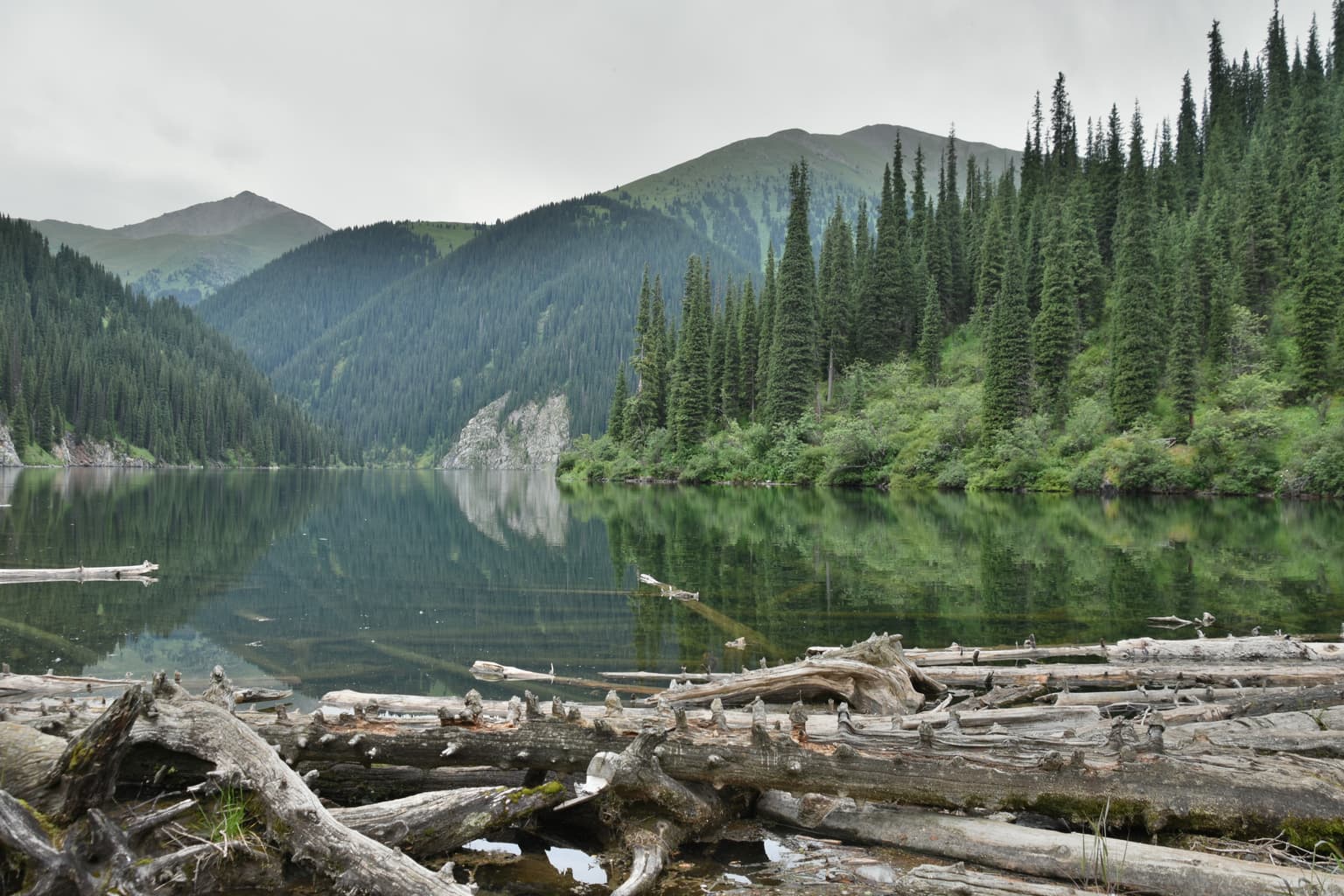
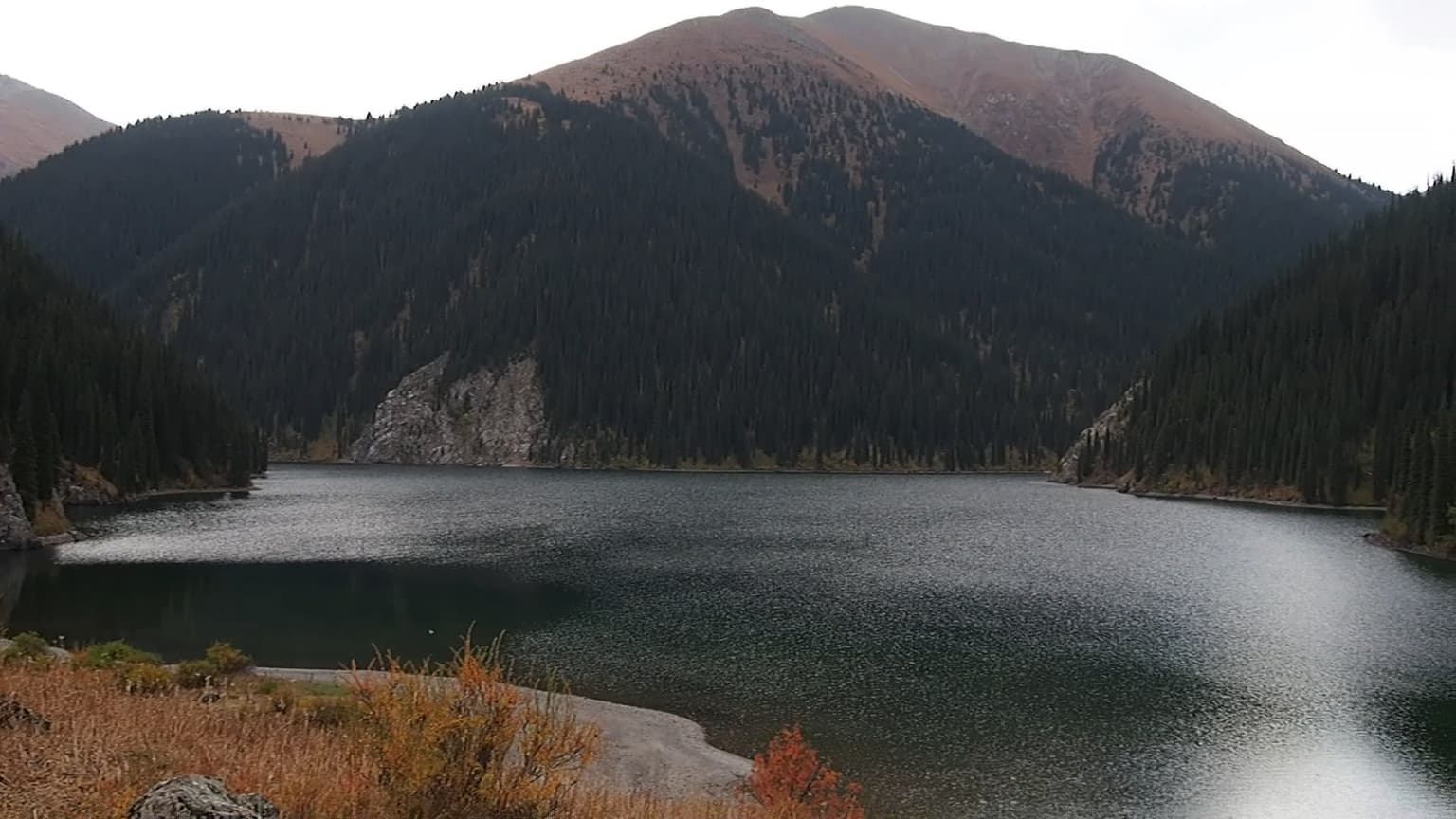
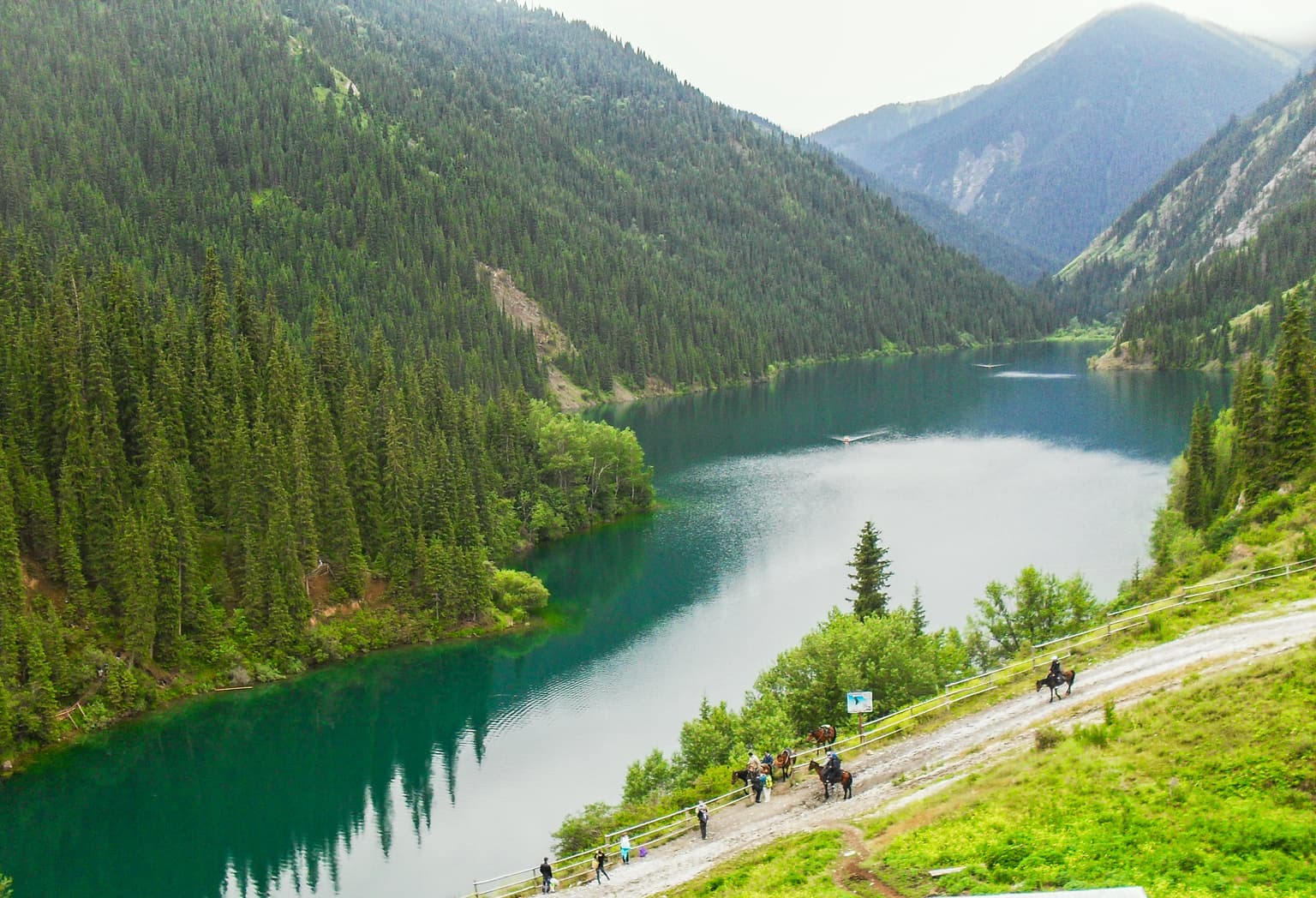
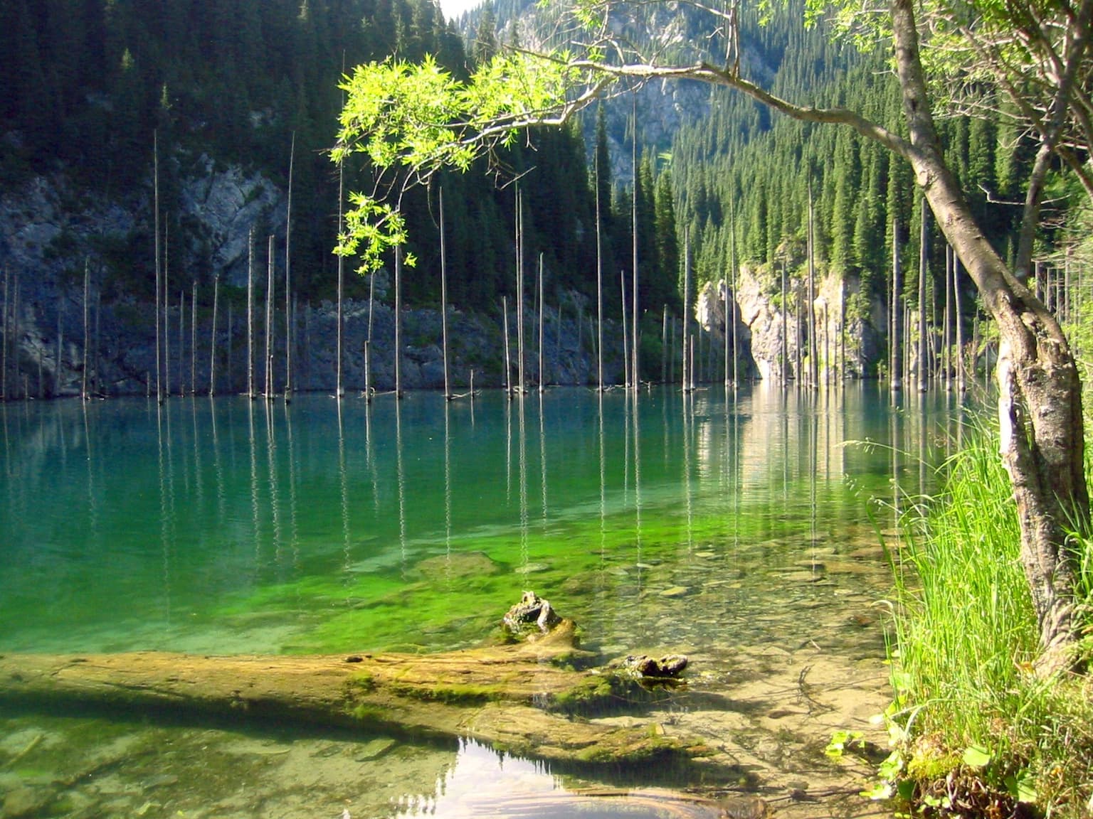
Kolsay Lakes National Park is best known for its spectacular chain of glacial alpine lakes set against the dramatic Tian Shan mountain backdrop. The three Kolsay Lakes form a scenic progression through coniferous forests and alpine meadows, while Lake Kaindy is famous for its haunting stand of dead spruce tree trunks rising vertically from the clear mountain water. The lakes were formed by landslides in 1887 and 1911, creating natural reservoirs of remarkable beauty. The park's reputation as the "Pearls of Tien Shan" reflects its status as one of Central Asia's most picturesque mountain destinations.

A calm mountain lake reflecting surrounding forested mountains, with fallen logs in the foreground
Middle Kolsai Lake with forested mountains and clear reflections on the water

Kolsay Lakes National Park history and protected-area timeline

Kolsay Lakes National Park was officially established in 2007 through a government decree, creating formal protection for what had long been recognized as a remarkable natural landscape. The formation of the lakes themselves dates to the late 19th and early 20th centuries, when major landslides blocked the Kolsay and Kaindy rivers. Lower Kolsay Lake and the Upper Kolsay system were created around 1887, while Lake Kaindy formed in 1911 following a significant earthquake. For decades, the area remained relatively inaccessible and undisturbed, preserving its natural character despite its proximity to populated valleys. The establishment of the national park formalized conservation management, designating the majority of the territory for strict protection while allowing controlled tourism and recreation in specific zones. The park now operates under the Committee of Forestry and Fauna of Kazakhstan's Ministry of Agriculture, with infrastructure developed around the village of Saty near Lower Kolsay Lake.

Kolsay Lakes National Park landscape and geographic character

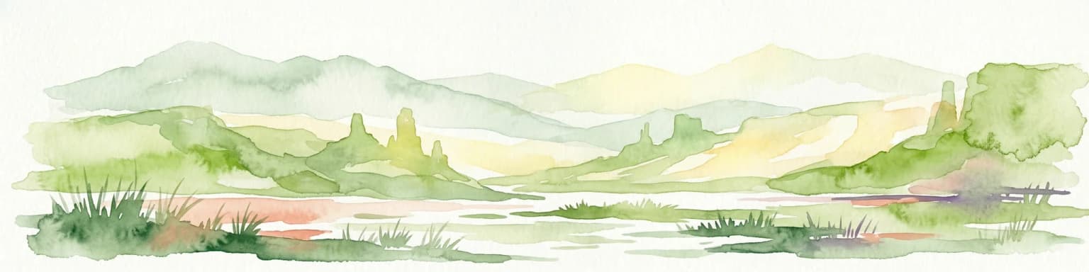
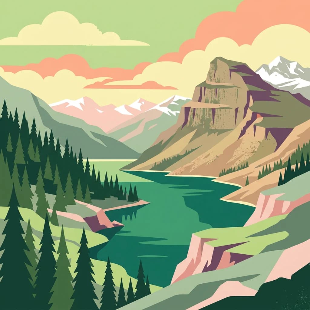
The physical landscape of Kolsay Lakes National Park is defined by the interplay of high Tian Shan mountain terrain, glacial valleys, and the lake basins that create its signature scenery. The park lies at the junction of two major Tian Shan ranges—the Küngöy Ala-Too Range to the east and the Trans-Ili Alatau to the north—creating a complex topography of sharp peaks, steep valleys, and cascading streams. The Kolsay River has carved a south-to-north valley that hosts the three main lakes, each sitting in a basin formed by ancient landslide dams. The landscape transitions dramatically as elevation increases: lower slopes feature mixed forest and scrub, middle elevations are dominated by dense spruce forests, and the highest zones give way to alpine meadows and bare rock. Lake Kaindy occupies a separate valley to the east, its steep gorge walls and the ghostly white trunks of submerged spruces creating an otherworldly atmosphere. The surrounding mountains rise to over 4,000 meters, with permanent snow and glaciers visible on the highest peaks.

A large mountain lake surrounded by forested slopes and mountains with autumn vegetation in the foreground
Panoramic view of one of the Kolsay Lakes surrounded by forested mountains

Kolsay Lakes National Park ecosystems, habitats, and plant life

The park sits within the Tian Shan montane steppe and meadows ecoregion, a biologically diverse zone that spans the middle and upper altitudes of Central Asia's great mountain range. This ecoregion experiences sufficient precipitation to support both meadows and forests, a combination less common in the more arid surrounding regions. The park's relative isolation has allowed many rare plant and animal species to persist, some found nowhere else on Earth. Scientists have documented 704 plant species within the park's boundaries, including 12 classified as rare. The plant community includes apricot trees, ili barberry, hawthorn, and Alberta iris in lower zones, while coniferous forests dominate middle elevations and give way to alpine vegetation at higher altitudes. The area is ecologically clean and supports numerous medicinal plants. After heavy rains, the coniferous forests produce a variety of mushrooms, adding to the ecological richness.

Panoramic view of Kolsay Lake with vibrant turquoise water, flanked by lush green forests and towering mountains, with a road and people visible on the right
Kolsay Lake surrounded by dense forests and mountain ranges

Kolsay Lakes National Park wildlife and species highlights

Kolsay Lakes National Park supports a diverse fauna community adapted to the mountain environment. Mammal species number 50 within the park, including six that are classified as rare in Kazakhstan: the Tian Shan brown bear (a subspecies of the brown bear), Central Asian river otter, Turkestan lynx, snow leopard, Tien Shan argali (a mountain sheep), and stone marten. Birdlife is particularly abundant with 197 species recorded, reflecting the park's varied habitats from forest to alpine meadow. The lakes support fish populations including rainbow trout and Tibetan naked carp. Reptiles and amphibians are represented by two species each—the green toad and the süyirtumsıq frog among the amphibians. The combination of forest, meadow, and aquatic habitats creates ecological niches that support this remarkable diversity despite the relatively harsh mountain climate.

Clear turquoise mountain lake with submerged tree trunks and green vegetation along the shore
Mountain lake with submerged tree trunks and clear turquoise water, surrounded by forested hills

Kolsay Lakes National Park conservation status and protection priorities

Conservation is central to the mission of Kolsay Lakes National Park, with 72% of the territory designated for strict protection and an additional 13% set aside for tourism and recreation. This zoning allows visitors to experience the park's natural beauty while preserving core areas from development pressure. The park's conservation significance extends beyond Kazakhstan through its inclusion in the UNESCO World Network of Biosphere Reserves, recognizing its role in maintaining ecological balance and protecting biodiversity in the Tian Shan region. The protected area strategy aims to preserve the pristine character of the lakes, forests, and alpine meadows while allowing sustainable use of recreational zones. The park's relative newness to tourism—only opening to general access a few years before the Wikipedia article was written—has helped maintain ecological integrity, with nature remaining in a relatively undisturbed state.

Kolsay Lakes National Park cultural meaning and human context

The Kolsay Lakes region lies within the traditional lands of the Kazakh people, and the area maintains cultural connections to Kazakhstan's pastoral heritage. The local toponymy reflects Kazakh language and culture: Middle Kolsay Lake is known as Mynzholky, meaning "1000 years old" in Kazakh, while Lake Kaindy is called "Қайыңды" in Kazakh, referring to birch trees in the area. The nearby village of Saty serves as a base for visitors, maintaining traditional patterns of settlement in the mountain valleys. The region's position near the border with Kyrgyzstan reflects the historical interaction between Central Asian peoples across these mountain landscapes.

Top sights and standout views in Kolsay Lakes National Park

The three Kolsay Lakes forming a vertical chain through alpine scenery represent the park's core highlight, each offering distinct character from the accessible Lower Lake with its facilities to the remote Upper Lake surrounded by spruce forest. Lake Kaindy's submerged tree trunks create one of Central Asia's most photographed natural scenes, a hauntingly beautiful phenomenon resulting from the 1911 landslide that formed the lake. The 25-kilometer hiking route from Lower Kolsay over the Sary-Bulak pass (3,278m) offers a multi-day trek through the park's diverse landscapes. The park serves as one of the most accessible mountain tourism destinations in the region, with trails suitable for beginners while still offering challenge for more experienced hikers. The combination of dramatic mountain scenery, pristine lakes, and relatively untouched nature makes this a distinctive protected area in the post-Soviet landscape.

Best time to visit Kolsay Lakes National Park

The optimal visiting season for Kolsay Lakes National Park runs from April through late September, with the summer months of July and August offering the most reliable access and comfortable conditions for camping and hiking. During these months, daytime temperatures can reach 30°C, though nights remain cool and can drop to near-freezing even in summer. The shoulder seasons of spring and early autumn present different but equally compelling experiences—spring brings snowmelt and rising water levels to the lakes, while autumn offers golden larch forests and fewer visitors. Winter access is extremely limited due to heavy snow and cold temperatures that can plunge well below freezing even in the valleys. The park's high-elevation location means weather can change rapidly, and visitors should be prepared for temperature variations regardless of the season.

Park location guide

Geography guide, regional context, and park location map for Kolsay Lakes National Park

Kolsay Lakes National Park park geography, regions, and map view in Kazakhstan
Understand where Kolsay Lakes National Park sits in Kazakhstan through a broader geographic reading of the surrounding landscape, nearby location context, and its mapped position within the national park landscape.

How Kolsay Lakes National Park fits into Kazakhstan

Kazakhstan is a Central Asian country spanning vast steppes and plains, bordered by Russia, China, Kyrgyzstan, Uzbekistan, and Turkmenistan, with a coastline along the Caspian Sea. It gained independence from the Soviet Union in 1991 and has a population of approximately 20.5 million people. The country is officially secular but predominantly Muslim, with Kazakh and Russian as official languages.

Wider geography shaping Kolsay Lakes National Park in Kazakhstan

Kazakhstan occupies a vast territory in Central Asia, extending into Eastern Europe. Its terrain consists largely of hilly plateaus and plains, with lowlands covering about a third of the area. The southern and eastern regions are mountainous. The country borders Russia to the north and west, China to the east, Kyrgyzstan to the southeast, Uzbekistan to the south, and Turkmenistan to the southwest. It has a coastline along the Caspian Sea.

Map view of Kolsay Lakes National Park

Use this park location map to pinpoint Kolsay Lakes National Park in Kazakhstan, understand its exact geographic position, and read its mapped placement within the surrounding landscape more clearly.

Pigeon | © OpenStreetMap contributors

Location context for Kolsay Lakes National Park

Almaty Region

Immerse yourself in the dramatic alpine lakes, ancient spruce forests, and unique terrain of this protected area in Kazakhstan.

Kolsay Lakes National Park Photos and Landscapes: Visual Exploration of its Mountain Scenery
Explore a curated visual gallery of Kolsay Lakes National Park photos, providing essential insights into its majestic alpine lakes, dense spruce forests, and dramatic Tian Shan mountain terrain. These images help define the protected area's unique landscape character, reveal diverse habitats, and deepen your understanding of this significant Kazakhstan natural preserve.

A calm mountain lake reflecting surrounding forested mountains, with fallen logs in the foreground

Clear turquoise lake waters with visible rocks on the shore, surrounded by forested mountains under a partly cloudy sky

A large mountain lake surrounded by forested slopes and mountains with autumn vegetation in the foreground

Panoramic view of Kolsay Lake with vibrant turquoise water, flanked by lush green forests and towering mountains, with a road and people visible on the right

Clear turquoise mountain lake with submerged tree trunks and green vegetation along the shore

Park atlas

Map the broader network of protected areas, revealing the geographic context of the Tian Shan mountains and surrounding regions.

Explore Nearby National Parks and Protected Areas Beyond Kolsay Lakes National Park
From Kolsay Lakes National Park, trace the geographic spread of other national parks and protected areas across the Tian Shan mountain range and surrounding Kazakh landscapes. This allows for direct comparison of diverse alpine environments, understanding regional conservation efforts, and expanding your atlas-based discovery of Central Asian terrain.
Watercolor painting of a river landscape with green mountains, grasses, and a stream
National parkAlmaty Region

Charyn National Park: Protected Landscape Atlas and Mapped Terrain in Almaty Region

Explore its dramatic canyons and ancient Sogdian ash groves.

Charyn National Park offers a compelling exploration of Central Asia's dramatic natural heritage, centered around its spectacular canyon system. This protected area, situated in Kazakhstan's Almaty Region, features towering red rock walls and unique geological formations carved by the Charyn River. The park is also notable for preserving one of the world's northernmost stands of ancient Sogdian ash trees, a vital link to prehistoric ecosystems. Users can discover the park's mapped boundaries, diverse terrain, and distinct landscape features, making it a key destination for geographic and atlas-based discovery.

Area
1,250 km²
Established
2004
Relief
Mountain
Climate
Arid
Watercolor painting of a river, hills, and trees with pink and yellow sky tones
National parkAlmaty Region

Ile-Alatau National Park: Protected Landscape Atlas and Almaty Region Geography

Mapped boundaries, diverse ecosystems, and mountain wilderness.

Ile-Alatau National Park is a key protected area in the Almaty Region of Kazakhstan, preserving a vast expanse of the Tian Shan mountain system. This national park showcases a dramatic vertical landscape, encompassing everything from lowland woodlands and relict spruce forests to expansive alpine meadows and glacial terrains. Its mapped boundaries define critical habitat for diverse wildlife and offer a profound insight into the complex ecological dynamics of high-altitude environments, making it an essential destination for atlas-based geographic discovery.

Area
2,000 km²
Established
1996
Relief
Mixed relief
Climate
Alpine
Watercolor illustration showing rolling hills, distant mountains, and sparse vegetation
National parkAlmaty Region

Altyn-Emel National Park: A Protected Landscape of Singing Dunes and Lunar Mountains

Explore unique geological wonders and ancient Saka history.

Discover Altyn-Emel National Park, a prominent national park located in Kazakhstan's Almaty Region. This protected area showcases an extraordinary diversity of landscapes, from the echoing Singing Dunes to the otherworldly Aktau mountains, often referred to as the 'lunar mountains' due to their vivid mineral hues. As a vital conservation zone, it safeguards Central Asian steppe ecosystems and significant Iron Age archaeological sites, offering a rich tapestry of natural beauty and historical depth for atlas exploration.

Area
4,600 km²
Established
1996
IUCN
II
Relief
Mixed relief
Watercolor painting depicting a mountain range, lake, and grassy foreground under a pale sky
National parkAlmaty Region

Zhongar-Alatau National Park: Protected Mountain Landscape and Genetic Heritage Atlas

Almaty Region's critical wild apple forest and glaciated terrain.

Zhongar-Alatau National Park in Kazakhstan's Almaty Region is a significant protected landscape renowned for its role in conserving the genetic origins of cultivated apples. The park encompasses dramatic glaciated mountain ranges, deep canyons, and diverse ecosystems within the Dzungarian Alatau. Its mapped boundaries define an area vital for protecting unique wild fruit tree species, including the Sievers apple, and preserving the distinctive alpine terrain of southeastern Kazakhstan, offering rich context for geographic exploration.

Area
36 km²
Established
2010
IUCN
II
Relief
Mountain
National parkEast Kazakhstan Region

Tarbagatai National Park: Protected Landscape and Wild Fruit Tree Forests in East Kazakhstan Region

Explore the mapped boundaries and ecosystem of this national park.

Tarbagatai National Park is a protected area in East Kazakhstan recognized for its unique role in conserving wild fruit tree forests that have maintained genetic isolation. This national park provides a detailed view of a mountain-steppe ecosystem across the Tarbagatai mountain range, Karabas Mountains, and Arkaly Mountains, along with the Urzhar and Emel river valleys. Its establishment in 2018 highlights its importance for biodiversity and the study of natural forest genetics, offering significant geographic context for regional protected land exploration.

Area
1,364 km²
Established
2018
IUCN
II
Relief
Mountain
Watercolor painting of a landscape featuring green hills, grassy foreground, and distant mountains under a soft sky
National parkSouth Kazakhstan Region

Sayram-Ugam National Park: Protected Landscape and Geographic Context in South Kazakhstan

Explore dramatic alpine terrain and ancient juniper forests.

Delve into Sayram-Ugam National Park, a protected national park situated in the South Kazakhstan Region. This expansive area showcases striking mountain topography with seven natural altitude zones, from mountain steppe to permanent snowfields. It is distinguished by its vast juniper forests and serves as a crucial conservation site for wild fruit and nut tree genetic diversity, offering a unique lens for understanding Central Asian mountain ecology and landscape context.

Area
1,490 km²
Established
2007
IUCN
II
Relief
Mountain
Watercolor illustration of a mountainous landscape with green hills, trees, and a river in the foreground
National parkKazakhstan

Karkaraly State National Nature Park: Kazakhstan's Mountain-Forest Protected Area

Discover unique geology, archaeology, and regional landscape context.

Delve into the distinctive protected landscape of Karkaraly State National Nature Park, situated in Kazakhstan's Karaganda Region. This park preserves a rare mountain-forest ecosystem with dramatic granite formations, ancient archaeological sites, and lakes, presenting a rich geographic contrast to the surrounding Kazakh Steppe. MoriAtlas provides structured insights into Karkaraly State National Nature Park's unique terrain, its conservation value, and its position within the broader regional geography of Central Asia.

Area
1,121.2 km²
Established
1998
IUCN
II
Relief
Mountain
National parkKazakhstan

Bayanaul National Park: Kazakhstan's First National Park Mapped Landscape

Explore granite mountains, unique lakes, and striking rock formations.

Bayanaul National Park, situated in Kazakhstan's Pavlodar Province, represents a significant protected area renowned for its extraordinary granite mountain landscape. Established as the country's first national park, it showcases unique erosion-shaped rock formations, diverse vegetation including rare pines, and four significant freshwater lakes. This park offers a distinct visual tapestry of mountainous terrain and geological wonders within the broader Central Asian geography, making it a key destination for atlas-based discovery.

Area
684.53 km²
Established
1985
IUCN
II

Common questions about visiting, size, designation, and location context for Kolsay Lakes National Park

Kolsay Lakes National Park FAQs for park facts, access, geography, and protected area context
Find quick answers about Kolsay Lakes National Park, including protected-area facts, park geography, trail and visitor context, and how the park fits into its surrounding country and regional landscape.
MoriAtlas Explorer

Continue Your Protected Areas Search Across the Global Atlas

Deepen your exploration by continuing the structured search for national parks and protected areas worldwide. Utilize the comprehensive filtering capabilities to compare different conservation landscapes and refine your understanding of global park geography. Discover more about the distribution and characteristics of protected natural areas.

Global natural geography