Mori Atlas logo
National parkSayram-Ugam National Park

Discover the dramatic alpine terrain, ancient juniper forests, and unique fruit tree ecosystems.

Sayram-Ugam National Park: A Mapped Protected Landscape in South Kazakhstan Region

Sayram-Ugam National Park represents a critical protected area within the western Tian Shan Mountains of South Kazakhstan Region, Kazakhstan. This national park spans approximately 149,000 hectares, encompassing seven distinct natural altitude zones from mountain steppe to glaciated peaks. It is renowned for its exceptional plant diversity and as a vital refuge for wild relatives of cultivated fruits, offering rich opportunities for geographic and atlas-based discovery of its mountainous terrain and protected boundaries.

mountain parksjuniper forestsTian Shanprotected areasnational parksCentral Asia
An illustration of a mountainous valley with a winding river, green slopes, and colorful vegetation under a partly cloudy sky

Sayram-Ugam National Park

National park

Park overview

Structured park overview, official facts, and landscape profile for Sayram-Ugam National Park

Sayram-Ugam National Park park facts, protected area profile, and essential visitor context
Review the core facts for Sayram-Ugam National Park, including designation, size, terrain, visitor scale, habitats, and operating context in one park-focused overview.

About Sayram-Ugam National Park

Sayram-Ugam National Park occupies a strategically important position in the protected area network of Central Asia, guarding the westernmost extent of the Tian Shan mountain system where it meets the more arid landscapes of the Kazakh steppe. The park's location on the border between Kazakhstan and Uzbekistan places it at the intersection of different biogeographic provinces, contributing to its high species diversity and the presence of species found nowhere else on Earth. The name derives from two sources: the historic town of Sayram, an ancient settlement whose name appears in records dating back centuries, and the Ugam Range that forms the park's backbone. The park extends approximately 135 kilometers from north to south, encompassing a remarkable range of elevations and associated habitats within this relatively compact area. Beyond its ecological significance, the park serves as a living repository of Central Asian cultural landscape heritage, with evidence of traditional land use practices that have shaped the mountain environment over generations. The combination of significant biodiversity, scenic mountain landscapes, and proximity to major population centers in southern Kazakhstan and Uzbekistan makes Sayram-Ugam an important site for both conservation and environmental education in the region.

Quick facts and research context for Sayram-Ugam National Park

Sayram-Ugam National Park is located in South Kazakhstan Region, approximately 30 kilometers southeast of Shymkent and 50 kilometers northeast of Tashkent. The park occupies the northern slopes and spurs of the Western Tian Shan, including the Ugam Range, Karatau Mountains, Boraldaytau, and Talas Alatau. It is formally divided into four management zones: an environmentally protected zone comprising 55% of the area, a zone of limited economic activity, a recreational and tourist zone covering 13%, and an environmental stabilization area at 9%. The park lies within the Gissaro-Alai open woodlands ecoregion, characterized by a cold semi-arid climate with temperatures ranging from an average of -1.9°C in January to 25.9°C in July and annual precipitation of approximately 362 millimeters. The park is administered by the Committee of Forestry and Fauna of the Ministry of Agriculture of Kazakhstan.

Park context

Deeper park guide and search-rich context for Sayram-Ugam National Park

Sayram-Ugam National Park history, landscape, wildlife, and travel context
Explore Sayram-Ugam National Park through its history, landscape character, ecosystems, wildlife, conservation priorities, cultural context, and seasonal travel timing in a structured park guide built for atlas discovery and search intent.

Why Sayram-Ugam National Park stands out

Sayram-Ugam is particularly distinguished by its extensive juniper forests, which represent some of the most well-preserved juniper woodland in the western Tian Shan. The park is also renowned for its remarkable fruit and nut tree biodiversity, preserving wild genetic stock of apple, pear, walnut, pistachio, almond, and cherry that scientists consider globally significant. The presence of ancient juniper specimens some exceeding 700 years of age adds historical dimension to the forest ecosystems. The protected area encompasses over 11 square kilometers of glaciers and maintains seven natural altitude zones, creating a vertically stratified landscape from steppe foothills to permanent snow and ice. These attributes make the park a living laboratory for understanding Central Asian mountain ecology and a critical refuge for species adapted to these unique conditions.

Wide landscape view of the Ugam River winding through a mountain valley with dry grassy slopes and distant hills
Ugam River flowing through the mountainous valley of Sayram-Ugam National Park

Sayram-Ugam National Park history and protected-area timeline

Sayram-Ugam National Park was officially established in early 2006, with the formal designation confirmed in 2007 as part of Kazakhstan's expanding network of protected areas. The creation of the park reflected growing recognition of the exceptional ecological value of the western Tian Shan region, which had previously lacked comprehensive protection despite its scientific and conservation significance. The establishment also aligned with broader regional conservation efforts, particularly the development of transboundary protected area networks connecting Kazakhstan with Uzbekistan. Prior to national park status, the area had various levels of protection as a nature reserve, but the elevation to full national park status in 2006-2007 brought increased resources for conservation, improved management frameworks, and formal recognition of the area's importance for sustainable development and ecological tourism. The park was incorporated into the Committee of Forestry and Fauna of the Ministry of Agriculture, establishing the administrative structure that continues to oversee its management today. The establishment date is recorded differently in sources—26 January 2006 in Kazakh official documents and 2007 in broader international documentation—reflecting the transition from initial designation to full operational status.

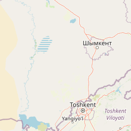
Sayram-Ugam National Park landscape and geographic character

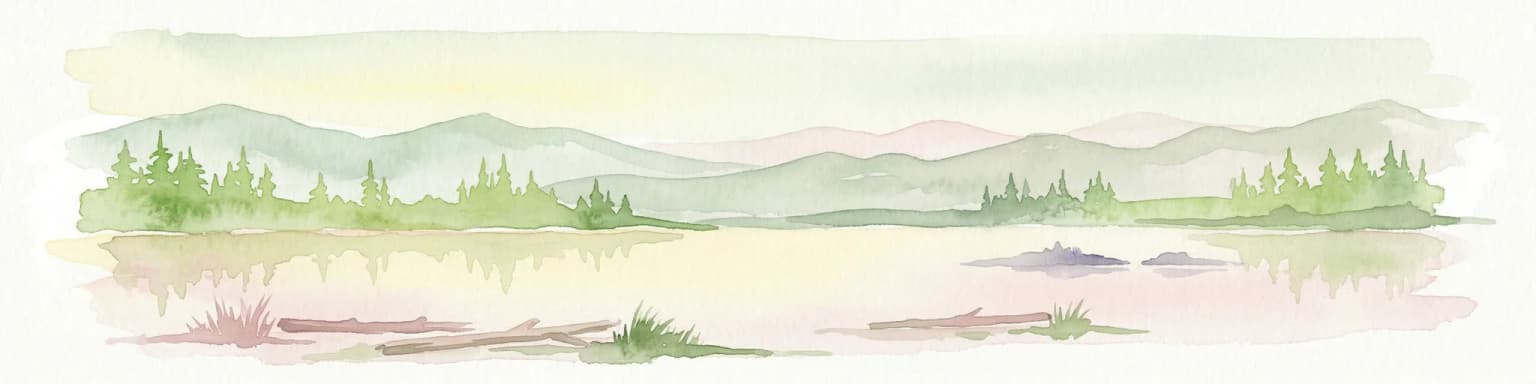
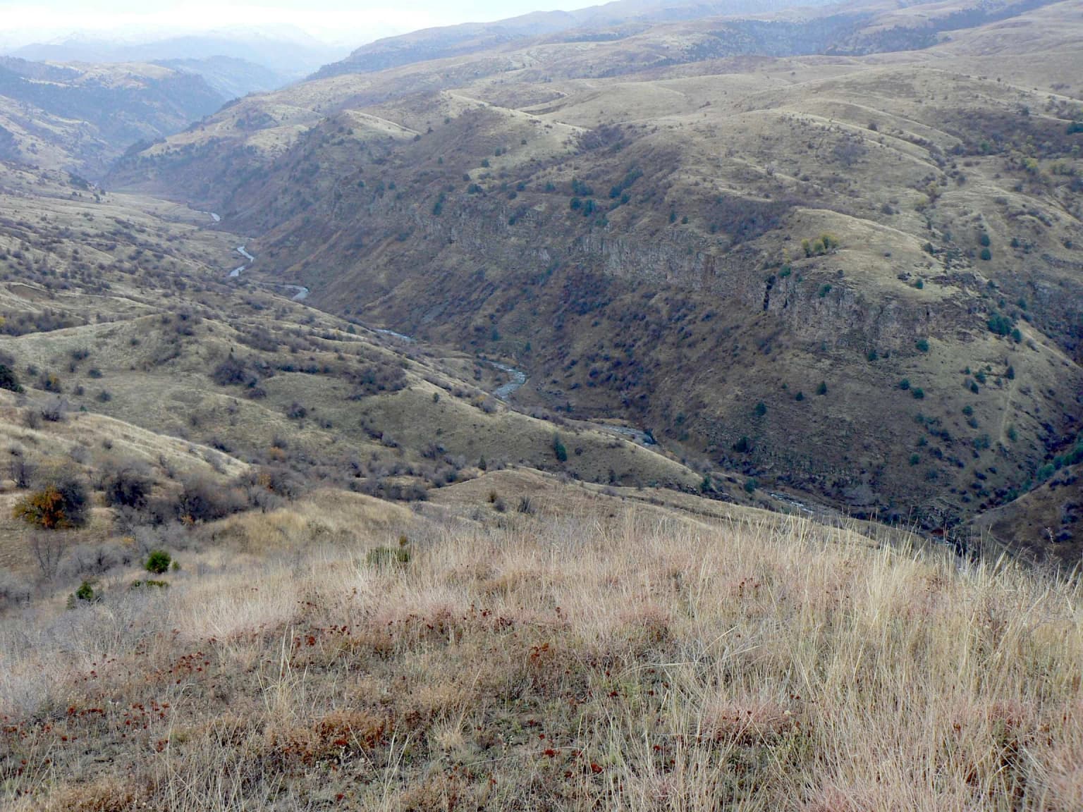
The topography of Sayram-Ugam is characterized by a complex assembly of mountain ranges, valleys, and ridges forming the northern edge of the Western Tian Shan. The Ugam Range provides the principal mountain backdrop, with peaks rising sharply from the surrounding terrain and creating dramatic alpine scenery. The Karatau Mountains contribute additional complexity to the western portions of the park, while the Boraldaytau and Talas Alatau extensions extend the park's mountain framework into the southern sectors. The landscape exhibits the classic features of active mountain terrain, including steep-sided valleys, rocky outcrops, and permanent snow fields in the highest elevations. The park contains over 11 square kilometers of glaciers, which despite their relatively limited extent represent important water sources for the downstream ecosystems and human communities. The Ugam River and its tributaries have carved deep valleys through the mountains, creating diverse microhabitats along their courses. The overall elevation range spans from the lower foothills through alpine zones to glaciated peaks, with the seven natural altitude zones providing physical representation of the park's ecological diversity. Approximately one-third of the park area is covered by forest, predominantly sparse juniper woodland on the more accessible slopes, while the non-forested areas include rocky alpine terrain, meadows, and the glacier zones.

Sayram-Ugam National Park ecosystems, habitats, and plant life

The ecological character of Sayram-Ugam is defined by its position in the Gissaro-Alai open woodlands ecoregion, a WWF-designated ecozone spanning the mountainous intersection of southern Kazakhstan, western Kyrgyzstan, Tajikistan, and Uzbekistan. This ecoregion is distinguished by a climate particularly favorable for fruit and nut tree development, supporting natural populations of walnut, pistachio, pears, almonds, apples, and cherries that represent ancestral stock for these widely cultivated species. Within the park, this manifests as a remarkable plant community that includes wild fruit and nut tree formations unique in the global context. The seven natural altitude zones create a vertically stratified ecosystem ranging from mountain steppe at the lowest elevations through forest zones to alpine meadows and ultimately to glaciated peaks. The juniper forests represent a particularly significant habitat, with three species of juniper documented in the park. The overall plant diversity is exceptional, with 1,635 species recorded, of which 35 are endemic to this region. An additional 62 plant species are protected in Kazakhstan's Red Book, indicating their conservation significance. The park also supports significant fungal diversity with three documented species and 25 moss species, adding to the overall biodiversity profile of the area.

Sayram-Ugam National Park wildlife and species highlights

The fauna of Sayram-Ugam reflects the park's position at the crossroads of different zoogeographic provinces, resulting in a diverse mammalian and avian community. Mammal species number approximately 59, with rodents comprising the largest group at 22 species including house mouse, wood mouse, and Turkestan rat. Predatory mammals include fox, wolf, and jackal, maintaining ecological balance in the park's ecosystems. Larger mammals such as mountain goats (argali), wild boar, and roe deer are present, though historical hunting pressure has reduced their populations in some areas. The Kazakh-language source mentions the presence of the blue marmot (Menzbier marmot) as one of the rare species found in the park, along with argali, wild boar, and brown bear. The avian community is particularly diverse, with approximately 300 bird species documented within the park boundaries. This significant bird population reflects the diverse habitats provided by the park's elevation range and the importance of the Tian Shan flyway for migratory species. The overall vertebrate fauna includes 12 reptile species, 2 amphibian species, and the substantial mammal and bird populations, creating a rich and ecologically functional community.

Sayram-Ugam National Park conservation status and protection priorities

Sayram-Ugam National Park represents a critical conservation asset for Kazakhstan and the broader Central Asian region, protecting some of the most ecologically significant mountain ecosystems in the western Tian Shan. The park's designation as IUCN Category II reflects its primary purpose of protecting natural landscapes while allowing for sustainable use in designated zones. The conservation significance is amplified by the park's position within a transboundary complex that includes Ugam-Chatkal National Park in Uzbekistan and Aksu-Zhabagly Nature Reserve in Kazakhstan, creating an interconnected regional conservation network. The protection of wild fruit and nut tree genetic resources is particularly important, as these populations represent irreplaceable reservoirs of genetic diversity for trees of significant agricultural importance globally. The presence of 35 endemic plant species and 62 species protected under Kazakhstan's Red Book underscores the global conservation value of this area. The park's management structure divides the territory into zones with different permitted activities, with 55% maintained as a fully protected zone where natural processes are allowed to continue with minimal human intervention. Conservation efforts include ongoing monitoring through the "Nature Chronicle" program, which documents ecological changes and supports adaptive management.

Sayram-Ugam National Park cultural meaning and human context

The landscape of Sayram-Ugam is interwoven with human history dating back to ancient times, as evidenced by the park's name derived from Sayram, a historic town in the region with roots extending deep into Central Asian history. The mountain communities inhabiting the surrounding areas have maintained traditional land use practices for centuries, including pastoral activities and orchard cultivation in the foothills and lower slopes. These traditional practices have shaped the cultural landscape and, in some cases, contributed to the establishment of the wild fruit tree populations that now represent such significant ecological value. The proximity to Shymkent, the largest city in southern Kazakhstan, and to Tashkent, the capital of Uzbekistan, places the park within a region of dense human population and long-standing agricultural activity. This historical human presence has created a cultural context in which the park's natural values are understood not as wilderness in the absolute sense but as a landscape where nature and human activity have co-evolved over extended periods. The development of ecological tourism as a park management objective explicitly recognizes this cultural dimension, seeking to share the park's natural heritage while supporting sustainable economic opportunities for local communities.

Top sights and standout views in Sayram-Ugam National Park

Sayram-Ugam National Park offers visitors access to one of the most botanically significant mountain landscapes in Central Asia, with ancient juniper forests, wild fruit tree ecosystems, and dramatic alpine scenery. Ten maintained tourist routes provide opportunities for hiking and horseback exploration along trails ranging from 7 to 72 kilometers in length, allowing visitors to experience the park's diverse elevations and habitats. The park's position on the border between Kazakhstan and Uzbekistan creates opportunities for regional tourism, with the complementary Ugam-Chatkal National Park across the border extending the available wilderness experience. The seasonal climate offers contrasting experiences from the cold, snowy winters with January temperatures averaging -1.9°C to warm summers with July averages reaching 25.9°C, providing distinct visiting conditions throughout the year. Facilities within the park include campsites, viewing platforms, traditional baths and saunas, yurt accommodation, and a hotel, supporting multi-day exploration of this mountainous wilderness.

Best time to visit Sayram-Ugam National Park

The park can be visited year-round, though the optimal period for most outdoor activities runs from late spring through early autumn when the mountain trails are accessible and the weather is most favorable. Summer months offer warm conditions ideal for hiking and exploration, with the alpine meadows displaying their full floral displays and the higher elevation routes accessible without winter equipment. The shoulder seasons of spring and autumn present different but equally compelling experiences, with spring bringing wildflower blooms across the lower elevations and autumn offering the opportunity to observe the fruit trees in their seasonal color. Winter visitation is possible but requires appropriate preparation for cold conditions, with the January average temperature of -1.9°C indicating significant winter cold. The semi-arid climate means that precipitation is relatively limited throughout the year, reducing the likelihood of prolonged weather disruptions to travel plans but also requiring visitors to bring sufficient water supplies for trail activities. The diversity of elevation zones within the park allows visitors to seek out microclimatic conditions suited to their preferences and tolerance for different temperature ranges.

Park location guide

Geography guide, regional context, and park location map for Sayram-Ugam National Park

Sayram-Ugam National Park park geography, regions, and map view in Kazakhstan
Understand where Sayram-Ugam National Park sits in Kazakhstan through a broader geographic reading of the surrounding landscape, nearby location context, and its mapped position within the national park landscape.

How Sayram-Ugam National Park fits into Kazakhstan

Kazakhstan is a Central Asian country spanning vast steppes and plains, bordered by Russia, China, Kyrgyzstan, Uzbekistan, and Turkmenistan, with a coastline along the Caspian Sea. It gained independence from the Soviet Union in 1991 and has a population of approximately 20.5 million people. The country is officially secular but predominantly Muslim, with Kazakh and Russian as official languages.

Wider geography shaping Sayram-Ugam National Park in Kazakhstan

Kazakhstan occupies a vast territory in Central Asia, extending into Eastern Europe. Its terrain consists largely of hilly plateaus and plains, with lowlands covering about a third of the area. The southern and eastern regions are mountainous. The country borders Russia to the north and west, China to the east, Kyrgyzstan to the southeast, Uzbekistan to the south, and Turkmenistan to the southwest. It has a coastline along the Caspian Sea.

Map view of Sayram-Ugam National Park

Use this park location map to pinpoint Sayram-Ugam National Park in Kazakhstan, understand its exact geographic position, and read its mapped placement within the surrounding landscape more clearly.

Pigeon | © OpenStreetMap contributors

Location context for Sayram-Ugam National Park

South Kazakhstan Region

Visual Research into Sayram-Ugam's Diverse Terrain, High-Altitude Habitats, and Protected Area Environment

Sayram-Ugam National Park Photos: Explore Alpine Landscapes, Juniper Forests, and Mountain Scenery
Browse Sayram-Ugam National Park images to visually trace its expansive mountain landscapes, ancient juniper forests, and the ecologically significant alpine habitats of the Western Tian Shan. Understanding these protected-area views offers crucial insight into the park's unique biodiversity, geological formations, and its essential role in Central Asian conservation efforts.

Wide landscape view of the Ugam River winding through a mountain valley with dry grassy slopes and distant hills

Park atlas

Trace the regional park geography of the Western Tian Shan Mountains and Central Asian protected landscapes.

Discover More National Parks and Protected Areas Near Sayram-Ugam National Park
Browse a curated selection of national parks and other protected areas situated near Sayram-Ugam National Park, spanning the Western Tian Shan mountains in Kazakhstan and Uzbekistan. Compare diverse mountain ecosystems, including significant juniper forests and alpine environments, mapping their regional spread across this vital Central Asian conservation landscape.
Watercolor painting of a river, hills, and trees with pink and yellow sky tones
National parkAlmaty Region

Ile-Alatau National Park: Protected Landscape Atlas and Almaty Region Geography

Mapped boundaries, diverse ecosystems, and mountain wilderness.

Ile-Alatau National Park is a key protected area in the Almaty Region of Kazakhstan, preserving a vast expanse of the Tian Shan mountain system. This national park showcases a dramatic vertical landscape, encompassing everything from lowland woodlands and relict spruce forests to expansive alpine meadows and glacial terrains. Its mapped boundaries define critical habitat for diverse wildlife and offer a profound insight into the complex ecological dynamics of high-altitude environments, making it an essential destination for atlas-based geographic discovery.

Area
2,000 km²
Established
1996
Relief
Mixed relief
Climate
Alpine
Watercolor illustration of a mountain lake with forests, distant mountains, and calm water reflecting the scenery
National parkAlmaty Region

Kolsay Lakes National Park: Discover Protected Alpine Lakes in Almaty Region

Mapped Tian Shan mountain geography and glacial lake context.

Kolsay Lakes National Park is a significant protected area within the Almaty Region, celebrated for its breathtaking chain of three alpine lakes, often referred to as the 'Pearls of Tien Shan.' This national park showcases the rugged beauty of the Tian Shan mountains, with dramatic valleys, dense spruce forests, and pristine glacial waters. Understanding its geographic setting and mapped boundaries reveals the unique ecological and landscape value of this protected natural area.

Area
1,619 km²
Established
2007
IUCN
II
Relief
Mountain
Watercolor illustration showing rolling hills, distant mountains, and sparse vegetation
National parkAlmaty Region

Altyn-Emel National Park: A Protected Landscape of Singing Dunes and Lunar Mountains

Explore unique geological wonders and ancient Saka history.

Discover Altyn-Emel National Park, a prominent national park located in Kazakhstan's Almaty Region. This protected area showcases an extraordinary diversity of landscapes, from the echoing Singing Dunes to the otherworldly Aktau mountains, often referred to as the 'lunar mountains' due to their vivid mineral hues. As a vital conservation zone, it safeguards Central Asian steppe ecosystems and significant Iron Age archaeological sites, offering a rich tapestry of natural beauty and historical depth for atlas exploration.

Area
4,600 km²
Established
1996
IUCN
II
Relief
Mixed relief
Watercolor painting of a river landscape with green mountains, grasses, and a stream
National parkAlmaty Region

Charyn National Park: Protected Landscape Atlas and Mapped Terrain in Almaty Region

Explore its dramatic canyons and ancient Sogdian ash groves.

Charyn National Park offers a compelling exploration of Central Asia's dramatic natural heritage, centered around its spectacular canyon system. This protected area, situated in Kazakhstan's Almaty Region, features towering red rock walls and unique geological formations carved by the Charyn River. The park is also notable for preserving one of the world's northernmost stands of ancient Sogdian ash trees, a vital link to prehistoric ecosystems. Users can discover the park's mapped boundaries, diverse terrain, and distinct landscape features, making it a key destination for geographic and atlas-based discovery.

Area
1,250 km²
Established
2004
Relief
Mountain
Climate
Arid
Watercolor painting depicting a mountain range, lake, and grassy foreground under a pale sky
National parkAlmaty Region

Zhongar-Alatau National Park: Protected Mountain Landscape and Genetic Heritage Atlas

Almaty Region's critical wild apple forest and glaciated terrain.

Zhongar-Alatau National Park in Kazakhstan's Almaty Region is a significant protected landscape renowned for its role in conserving the genetic origins of cultivated apples. The park encompasses dramatic glaciated mountain ranges, deep canyons, and diverse ecosystems within the Dzungarian Alatau. Its mapped boundaries define an area vital for protecting unique wild fruit tree species, including the Sievers apple, and preserving the distinctive alpine terrain of southeastern Kazakhstan, offering rich context for geographic exploration.

Area
36 km²
Established
2010
IUCN
II
Relief
Mountain
Watercolor illustration of a mountainous landscape with green hills, trees, and a river in the foreground
National parkKazakhstan

Karkaraly State National Nature Park: Kazakhstan's Mountain-Forest Protected Area

Discover unique geology, archaeology, and regional landscape context.

Delve into the distinctive protected landscape of Karkaraly State National Nature Park, situated in Kazakhstan's Karaganda Region. This park preserves a rare mountain-forest ecosystem with dramatic granite formations, ancient archaeological sites, and lakes, presenting a rich geographic contrast to the surrounding Kazakh Steppe. MoriAtlas provides structured insights into Karkaraly State National Nature Park's unique terrain, its conservation value, and its position within the broader regional geography of Central Asia.

Area
1,121.2 km²
Established
1998
IUCN
II
Relief
Mountain
Watercolor illustration of a landscape with green forests, rolling hills, and distant mountains under a soft sky
National parkAkmola Region

Buiratau State National Nature Park: Kazakhstan National Park within Akmola Region

Explore unique steppe-forest transition ecosystems and geography.

Buiratau State National Nature Park in Kazakhstan's Akmola Region protects a significant transitional zone between dry steppe and semi-arid forest. This national park showcases a diverse landscape of low ridges, plains, and salt lakes, contributing to its rich biodiversity. Discover the mapped boundaries and the unique ecological character of this protected area within the context of the Kazakh Uplands atlas and its regional geography.

Area
890 km²
Established
2011
IUCN
II
Relief
Upland
National parkKazakhstan

Bayanaul National Park: Kazakhstan's First National Park Mapped Landscape

Explore granite mountains, unique lakes, and striking rock formations.

Bayanaul National Park, situated in Kazakhstan's Pavlodar Province, represents a significant protected area renowned for its extraordinary granite mountain landscape. Established as the country's first national park, it showcases unique erosion-shaped rock formations, diverse vegetation including rare pines, and four significant freshwater lakes. This park offers a distinct visual tapestry of mountainous terrain and geological wonders within the broader Central Asian geography, making it a key destination for atlas-based discovery.

Area
684.53 km²
Established
1985
IUCN
II

Common questions about visiting, size, designation, and location context for Sayram-Ugam National Park

Sayram-Ugam National Park FAQs for park facts, access, geography, and protected area context
Find quick answers about Sayram-Ugam National Park, including protected-area facts, park geography, trail and visitor context, and how the park fits into its surrounding country and regional landscape.
MoriAtlas Explorer

Continue Your Protected Areas Search Across the Global Atlas

Deepen your exploration by continuing the structured search for national parks and protected areas worldwide. Utilize the comprehensive filtering capabilities to compare different conservation landscapes and refine your understanding of global park geography. Discover more about the distribution and characteristics of protected natural areas.

Global natural geography