Mori Atlas logo
National parkBroghil Valley National Park

Discover the mapped terrain of glacial valleys, alpine lakes, and significant mountain biodiversity at Pakistan's frontier.

Broghil Valley National Park: Pakistan's Northernmost High-Altitude National Park and Protected Landscape

Broghil Valley National Park represents a significant high-altitude protected area at the northernmost edge of Pakistan, located in the Khyber Pakhtunkhwa region. Spanning approximately 1,348 square kilometers, this national park offers a dramatic landscape of glaciated peaks, extensive freshwater lakes, and expansive alpine plains, serving as a vital habitat for unique mountain biodiversity. The park's remote frontier location near the Afghanistan border makes it a crucial area for understanding regional geography and protected land distribution within the Mountains of Central Asia biodiversity hotspot.

High-Altitude Protected AreaAlpine WildernessSnow Leopard HabitatMountain BiodiversityGlacial LakesPeatland Ecosystems

Broghil Valley National Park

National park

Park overview

Structured park overview, official facts, and landscape profile for Broghil Valley National Park

Broghil Valley National Park park facts, protected area profile, and essential visitor context
Review the core facts for Broghil Valley National Park, including designation, size, terrain, visitor scale, habitats, and operating context in one park-focused overview.

About Broghil Valley National Park

Broghil Valley National Park represents one of Pakistan's most significant high-altitude protected areas, established in 2010 to preserve the extraordinary ecological and cultural values of the Broghil Valley in northern Khyber Pakhtunkhwa. The park occupies a strategically important position at the junction of the Pamir, Hindu Kush, and Karakoram mountain systems, placing it within the globally important Mountains of Central Asia biodiversity hotspot. This positioning endows the area with remarkable ecological diversity despite its extreme elevation and continental climate. The protected area encompasses an extensive array of habitats including alpine meadows, glacial valleys, peatland complexes, and freshwater lake systems. The valley has historically served as a corridor for migration and trade between Central and South Asia, contributing to its rich cultural tapestry. Local communities from Wakhi, Kyrgyz, and Sarikoli ethnic backgrounds maintain traditional land use practices that have shaped the landscape over centuries. The establishment of the park reflects growing recognition of the need to balance conservation with the sustainable development aspirations of these mountain communities.

Quick facts and research context for Broghil Valley National Park

Broghil Valley National Park is located in Upper Chitral District, Khyber Pakhtunkhwa province, Pakistan, approximately 250 kilometers from Chitral town. Established in 2010, the park covers 1,348 square kilometers at elevations between 3,217 and 5,696 meters. The protected area sits within the Mountains of Central Asia biodiversity hotspot and borders the Wakhan corridor of Afghanistan. Residents include Wakhi, Kyrgyz, and Sarikoli ethnic communities. The park supports 23 mammal species, 120 bird species, 3 reptile species, and 1 amphibian species.

Park context

Deeper park guide and search-rich context for Broghil Valley National Park

Broghil Valley National Park history, landscape, wildlife, and travel context
Explore Broghil Valley National Park through its history, landscape character, ecosystems, wildlife, conservation priorities, cultural context, and seasonal travel timing in a structured park guide built for atlas discovery and search intent.

Why Broghil Valley National Park stands out

Broghil Valley National Park is best known for its exceptional high-altitude biodiversity and dramatic alpine scenery at the northern edge of Pakistan. The park protects critical habitat for snow leopards, Marco Polo sheep, Siberian ibex, and other endangered species of the Central Asian mountain ecosystems. Its landscape of glacial valleys, freshwater lakes, and expansive grassy plains provides one of the most remote and ecologically significant protected areas in the region. The park's cultural significance includes traditional Wakhi, Kyrgyz, and Sarikoli communities whose practices shape the region's identity.

Broghil Valley National Park history and protected-area timeline

Broghil Valley National Park was officially designated as a protected area in 2010, representing Pakistan's commitment to conserving its high-altitude mountain ecosystems. The creation of the park responded to growing concerns about habitat degradation and wildlife population pressures in the remote northern mountain regions. Prior to formal protection, the Broghil Valley had long served as a traditional grazing area for local nomadic communities and as a corridor for transboundary movement between Pakistan and Afghanistan. The park's establishment was accompanied by infrastructure improvements including the construction of a 32-kilometer road connecting Kishmanja village to Pechus and Vedin Khot, undertaken by the Aga Khan Rural Support Programme. In October 2019, the park received international attention when British royals Prince William and Catherine, Princess of Wales, visited during their tour of Pakistan, highlighting the region's tourism potential while underscoring conservation challenges in this remote frontier area.

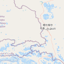
Broghil Valley National Park landscape and geographic character

The terrain of Broghil Valley National Park is characterized by dramatic mountain topography with elevations ranging from 3,217 meters to 5,696 meters above sea level. The landscape features undulating mountain ranges interspersed with broad grassy plains and deep valleys carved by ancient glacial activity. The park contains approximately 30 freshwater lakes distributed throughout the valley, fed by snowmelt and glacial runoff. Nearly 3,400 hectares of peatlands provide critical wetland habitat within this otherwise arid mountain environment. The surrounding terrain is dominated by glaciated peaks and perpetual snowfields that feed the valley's hydrological systems. This combination of high-altitude plains, alpine lakes, and glaciated mountains creates a distinctive visual landscape that differs markedly from the more confined valley systems found elsewhere in the Pakistani mountains. The proximity to the Wakhan corridor to the north and Gilgit-Baltistan to the west places the park at a critical ecological crossroads.

Broghil Valley National Park ecosystems, habitats, and plant life

The ecological character of Broghil Valley National Park reflects its position within the Mountains of Central Asia biodiversity hotspot, supporting a remarkable diversity of habitats despite extreme environmental conditions. The vegetation zones range from alpine meadows at lower elevations to sparse rock and ice at the highest points. Grassy plains support scattered scrub vegetation including Webb's rose, Artemisia brevifolia, and Artemisia maritima. The park's limited forest cover is dominated by juniper species and birch, forming sparse woodland patches in protected microclimates. The extensive lake and peatland systems represent critical wetland habitats in this otherwise predominantly arid mountain landscape, supporting unique aquatic and semi-aquatic communities. These diverse habitats together support the park's remarkable species diversity including 23 mammal species, 120 bird species, three reptile species, and one amphibian species.

Broghil Valley National Park wildlife and species highlights

Broghil Valley National Park supports an impressive mammal fauna adapted to high-altitude alpine environments. The park provides critical habitat for snow leopards and Persian leopards, two of the region's most endangered predators. Large ungulates include Marco Polo sheep, Siberian ibex, and bharal, which occupy the steep mountain slopes and grassy meadows. The park also supports Himalayan musk deer, Himalayan brown bears, and populations of Turkestan lynx and leopard cats. Smaller mammals include Himalayan wolves, golden jackals, red foxes, and long-tailed marmots. The avifauna is equally diverse with 120 species recorded, including chukar partridge, snow partridge, Himalayan snowcock, golden eagles, bearded vultures, and snow pigeons. The reptile community includes species such as the Chitral gecko, plump banded gecko, and Caucasian agama, while the Baltistan toad represents the sole confirmed amphibian species.

Broghil Valley National Park conservation status and protection priorities

The establishment of Broghil Valley National Park reflects its designation within the Mountains of Central Asia, one of the world's biodiversity hotspots, underscoring the global significance of this high-altitude protected area. The park protects critical habitat for several species of international conservation concern, including snow leopards and Marco Polo sheep, both of which face significant population pressures across their ranges. The peatland and lake systems represent increasingly rare wetland ecosystems in Central Asian mountain environments, providing important ecological services and biodiversity habitat. The proximity to Qurumbar National Park in Gilgit-Baltistan creates opportunities for transboundary conservation coordination. Conservation challenges include managing the traditional grazing practices of local communities, addressing infrastructure development pressures, and mitigating human-wildlife conflict in this remote frontier region.

Broghil Valley National Park cultural meaning and human context

The Broghil Valley is home to communities belonging to Wakhi, Kyrgyz, and Sarikoli ethnic groups, whose traditional cultures are closely intertwined with the mountain landscape. These communities maintain traditional pastoralist and agro-pastoralist livelihoods adapted to the extreme high-altitude environment. The annual Broghil Festival celebrates local cultural heritage through events such as yak polo and exhibitions of woolen handicrafts, accompanied by traditional food and music. These cultural practices represent important intangible heritage closely linked to the valley's natural environment. The remote nature of the area has limited infrastructure development, with many communities lacking basic services and facilities. The construction of new roads has improved connectivity while raising questions about balancing development with conservation and cultural preservation.

Top sights and standout views in Broghil Valley National Park

Broghil Valley National Park offers one of Pakistan's most remote and pristine high-altitude wilderness experiences, with dramatic glacial scenery, extensive lake systems, and exceptional biodiversity. The park provides rare opportunities to observe snow leopards and other endangered species in their natural mountain habitat. The cultural heritage of local Wakhi, Kyrgyz, and Sarikoli communities adds depth to the visitor experience, particularly during the annual Broghil Festival. The network of approximately 30 freshwater lakes set against glaciated peaks creates a distinctive and memorable landscape unlike other protected areas in Pakistan. The park's position at the northern edge of Pakistan, bordering Afghanistan's Wakhan corridor, offers a unique frontier experience for adventurous visitors.

Best time to visit Broghil Valley National Park

The summer months from June through September offer the most favorable conditions for visiting Broghil Valley National Park, when temperatures are milder and the high-altitude routes are more accessible. During this period, the grassy plains bloom with wildflowers and the lakes reach their fullest extent with glacial meltwater. Winter visits are extremely challenging due to heavy snowfall and extreme cold temperatures that close access to the valley. The annual Broghil Festival typically takes place during the summer season, providing an opportunity to experience local cultural traditions. Visitors should be prepared for the remote nature of the destination, limited infrastructure, and the need for careful planning given the challenging logistics of reaching this northern frontier area.

Park location guide

Geography guide, regional context, and park location map for Broghil Valley National Park

Broghil Valley National Park park geography, regions, and map view in Pakistan
Understand where Broghil Valley National Park sits in Pakistan through a broader geographic reading of the surrounding landscape, nearby location context, and its mapped position within the national park landscape.

How Broghil Valley National Park fits into Pakistan

Pakistan, officially the Islamic Republic of Pakistan, is a federal parliamentary Islamic republic in South Asia. It is the fifth-most populous country and the 33rd-largest by area. The country gained independence from British India in 1947 and has a diverse history spanning ancient civilizations including Mehrgarh and the Indus Valley Civilisation. Pakistan shares maritime borders with Oman and is bounded by the Arabian Sea, Gulf of Oman, and several neighboring countries.

Wider geography shaping Broghil Valley National Park in Pakistan

Pakistan is located in South Asia, bordered by the Arabian Sea to the south, the Gulf of Oman to the southwest, and shares land borders with India to the east, Afghanistan to the west, Iran to the southwest, and China to the northeast. The country also shares a maritime border with Oman in the Gulf of Oman. The Wakhan Corridor in Afghanistan separates Pakistan from Tajikistan in the northwest.

Map view of Broghil Valley National Park

Use this park location map to pinpoint Broghil Valley National Park in Pakistan, understand its exact geographic position, and read its mapped placement within the surrounding landscape more clearly.

Pigeon | © OpenStreetMap contributors

Location context for Broghil Valley National Park

Khyber PakhtunkhwaUpper Chitral District
Park atlas

Compare high-altitude protected landscapes and trace regional park geography in the Central Asian mountains.

Explore Nearby Protected Areas and National Parks Around Broghil Valley
Explore other national parks and protected areas located within the mountainous terrain and high-altitude landscapes surrounding Broghil Valley National Park, encompassing adjacent regions of Pakistan. Compare distinct alpine ecosystems and trace the broader geographic spread of conservation efforts across this remote Central Asian mountain region, deepening your park discovery.
National parkGilgit-Baltistan

Qurumbar National Park: Pakistan's High-Altitude Protected Landscape and Geographic Atlas Point

Explore mapped alpine terrain, glacial features, and vital wildlife corridors.

Qurumbar National Park, situated in the rugged terrain of Gilgit-Baltistan, Pakistan, offers an unparalleled glimpse into a high-altitude protected landscape. This national park is defined by its dramatic alpine valleys, glacial features, and significant ecological value. As a key atlas point, it showcases the convergence of major Asian mountain systems and provides critical habitat for iconic mountain wildlife within its mapped boundaries.

Area
738 km²
Established
2011
IUCN
II
National parkHunza District

Khunjerab National Park: Pakistan's High-Altitude Protected Landscape and Alpine Terrain

Discover dramatic Karakoram geography, wildlife habitats, and transboundary conservation.

Khunjerab National Park stands as a premier example of a high-altitude protected area, situated in Pakistan's Hunza District. This national park covers an immense territory within the Karakoram range, largely exceeding 4,000 meters. It provides a vital protected landscape for unique alpine wildlife, including critically endangered Marco Polo sheep and snow leopards, and functions as a critical transboundary conservation corridor. Explore the rugged terrain, glacial valleys, and dramatic mountain vistas that define this significant conservation area.

Area
2,269.13 km²
Established
1975
IUCN
II
National parkGilgit-Baltistan

Nanga Parbat National Park: Protected Himalayan Landscape and Geographic Atlas

Explore mapped boundaries and alpine terrain in Gilgit-Baltistan.

Nanga Parbat National Park is a vast protected area defined by its spectacular Himalayan setting and dramatic alpine geography within Gilgit-Baltistan, Pakistan. As a national park, it safeguards the immense Nanga Parbat massif, its surrounding glaciers, and diverse altitudinal landscapes. This page offers an atlas perspective for understanding the park's geographic scope, its mapped natural features, and its significance as a protected mountain wilderness.

Area
1,785.61 km²
Established
2021
IUCN
II
National parkAzad Jammu and Kashmir

Machiara National Park: A Protected National Park in Pakistan's Himalayas

Explore mapped terrain and mountain biodiversity.

Machiara National Park, located in Azad Jammu and Kashmir, Pakistan, is a designated national park preserving unique Himalayan ecosystems. This atlas-focused exploration details the park's protected landscape, encompassing steep slopes, forested ridges, and varied terrain. Discover its significance for wildlife conservation and its position within the broader regional geography, offering a clear view of its mapped natural features.

Area
135.33 km²
Established
1996
IUCN
II
National parkGilgit-Baltistan

Deosai National Park: A Premier High-Altitude Alpine Wilderness and Protected Landscape in Pakistan

Mapped boundaries and unique terrain within Gilgit-Baltistan's geography.

Deosai National Park is a key protected area in Pakistan's Gilgit-Baltistan region, characterized by its high-altitude alpine meadows and expansive plateau terrain. As a national park, it offers crucial insights into mapped landscapes and regional geography, particularly for understanding conservation efforts in extreme environments. The park's setting provides a unique lens through which to explore the distribution and characteristics of protected lands within the broader atlas of natural landscapes.

Area
3,584 km²
Established
1993
IUCN
Ib
National parkAzad Kashmir

Panjal Mastan National Park: High-Altitude Plateau Landscape in Azad Kashmir

Discover mapped terrain and protected area geography.

Panjal Mastan National Park represents a significant protected landscape within the Pir Panjal mountain range of Azad Kashmir, Pakistan. This national park is characterized by its expansive high-altitude plateau, sitting at an average elevation of 2,800 meters, offering a unique regional geography. Known for its dramatic mountainous surroundings and seasonal wildflower meadows that bloom in spring, the park provides valuable context for understanding the natural terrain and protected area distribution in this part of the western Himalayas.

Area
300 km²
IUCN
II
National parkKhyber Pakhtunkhwa

Ayubia National Park: Protected Area Identity and Mountainous Terrain

Discover its mapped geography within Khyber Pakhtunkhwa

Ayubia National Park stands as a key protected landscape within the Himalayan foothills of Khyber Pakhtunkhwa, Pakistan. Its designation as a national park signifies its role in conserving unique temperate coniferous and mixed forests across steep mountainous terrain. This page details the park's geographic setting, its mapped boundaries, and the natural features that define its protected status, offering a structured view for atlas-driven exploration of Pakistan's natural heritage.

Area
33.12 km²
Established
1984
IUCN
V
National parkIslamabad Capital Territory

Margalla Hills National Park: Pakistan's Gateway to Himalayan Foothills Geography

Mapped protected landscape with rich Sino-Himalayan biodiversity.

Margalla Hills National Park, situated in the Islamabad Capital Territory, serves as Pakistan's most accessible national park and a vital entry point to the Himalayan foothills. This protected landscape is defined by its rugged mountain terrain, ranging from lower scrublands to higher pine and oak woodlands, with elevations up to 1,604 meters. The park's geological significance, with ancient marine fossil formations, adds a unique dimension to its natural identity. Discover the mapped boundaries and ecological richness that characterize this important protected area, offering insights into regional geography and diverse habitats.

Area
173.86 km²
Established
1980
IUCN
V

Common questions about visiting, size, designation, and location context for Broghil Valley National Park

Broghil Valley National Park FAQs for park facts, access, geography, and protected area context
Find quick answers about Broghil Valley National Park, including protected-area facts, park geography, trail and visitor context, and how the park fits into its surrounding country and regional landscape.
MoriAtlas Explorer

Continue Your Protected Areas Search Across the Global Atlas

Deepen your exploration by continuing the structured search for national parks and protected areas worldwide. Utilize the comprehensive filtering capabilities to compare different conservation landscapes and refine your understanding of global park geography. Discover more about the distribution and characteristics of protected natural areas.

Global natural geography