
Mori Atlas logo
National parkBurabay State National Nature Park

Explore distinctive pine-birch forests and dramatic rock formations within the Kokshetau Massif.

Burabay State National Nature Park: Kazakhstan's Protected Granite Landscape Atlas

Delve into the protected geography of Burabay State National Nature Park, a significant national park located in Kazakhstan's Aqmola Region. This atlas-focused exploration reveals the park's unique landscape characterized by ancient granite hills of the Kokshetau Massif, dramatic wind-sculpted rock formations, and a network of picturesque lakes. Discover the mapped boundaries and regional context of this celebrated protected area, understanding its ecological significance and geological formations within northern Kazakhstan.

mountain forestsgranite rock formationspine-birch forestslake ecosystemsnorthern KazakhstanKokshetau Massif
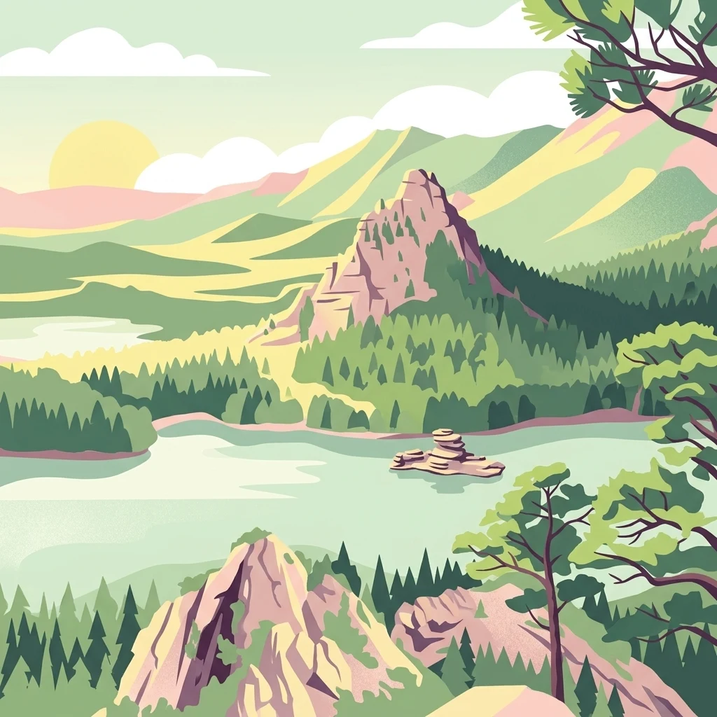
Stylized illustration of mountains, lakes, and forests in Burabay National Park

Burabay State National Nature Park

National park

Park overview

Structured park overview, official facts, and landscape profile for Burabay State National Nature Park

Burabay State National Nature Park park facts, protected area profile, and essential visitor context

Review the core facts for Burabay State National Nature Park, including designation, size, terrain, visitor scale, habitats, and operating context in one park-focused overview.

About Burabay State National Nature Park

Burabay State National Nature Park occupies a mountainous-forest landscape in the eastern part of the Kokshetau Hills in northern Kazakhstan. The Kokshetau Massif, part of the broader Kazakh Uplands, provides the geological foundation for this protected area, with ancient rocks dating back to the Precambrian era and continuing through the Paleozoic. The park's terrain is characterized by rounded hills, deeply incised valleys, and the remarkable granite rock formations that have been shaped by wind erosion into structures resembling towers and fortresses.

The park contains numerous lakes of differing character—freshwater bodies such as Burabay, Shortandy, Greater Shabakty, and Zhoqey alongside saline lakes including Tashshalkar, Kotyrkol, and Lesser Shabakty. These water bodies contribute significantly to the park's ecological diversity and scenic appeal. The combination of forested slopes, open steppe areas, rocky outcrops, and lake basins creates a mosaic of habitats that supports remarkable biodiversity.

Management of the park falls directly under the responsibility of the President of Kazakhstan, reflecting its national significance. The area has evolved through several administrative phases since its initial protection as a state forest in 1898, progressing through status changes as a nationalized spa town, nature reserve, forest management unit, and ultimately as a national park established in 2000 with expanded boundaries in 2010.

Quick facts and research context for Burabay State National Nature Park

Burabay National Park covers roughly 130,000 hectares in northern Kazakhstan's Aqmola Region within the Kokshetau Massif. The area features humid continental climate with warm summers and cold winters, averaging -16°C in January and +19°C in July. The park sits directly under presidential jurisdiction in Kazakhstan. Notable features include the Kenesary Cave and a landscape dominated by pine and birch forests interspersed with numerous lakes of varying salinity.

Protection and recognition

Documenting the official terrestrial boundary classifications and national conservation frameworks

Burabay State National Nature Park Official Protection Status and Land Designation

Standardizing protection metrics for Burabay State National Nature Park helps clarify its official standing as a terrestrial conservation landscape. Geographic records compile documented designations and national management boundaries to assist in comparing global protected area frameworks.

Protection details

Protection scope
Terrestrial
Transboundary protection
No
Park context

Deeper park guide and search-rich context for Burabay State National Nature Park

Burabay State National Nature Park history, landscape, wildlife, and travel context

Explore Burabay State National Nature Park through its history, landscape character, ecosystems, wildlife, conservation priorities, cultural context, and seasonal travel timing in a structured park guide built for atlas discovery and search intent.

Why Burabay State National Nature Park stands out

Burabay is best known for its distinctive pine and birch forests that blanket the granite hills of the Kokshetau Massif, the dramatic wind-sculpted rock formations that rise from the landscape, and the network of lakes including the prominent Burabay Lake. The park's cultural significance centers on Kenesary Cave, believed to be the childhood home of Kenesary Khan, grandson of Ablai Khan, and the rich legends that give the region its poetic reputation as Kazakhstan's pearl.
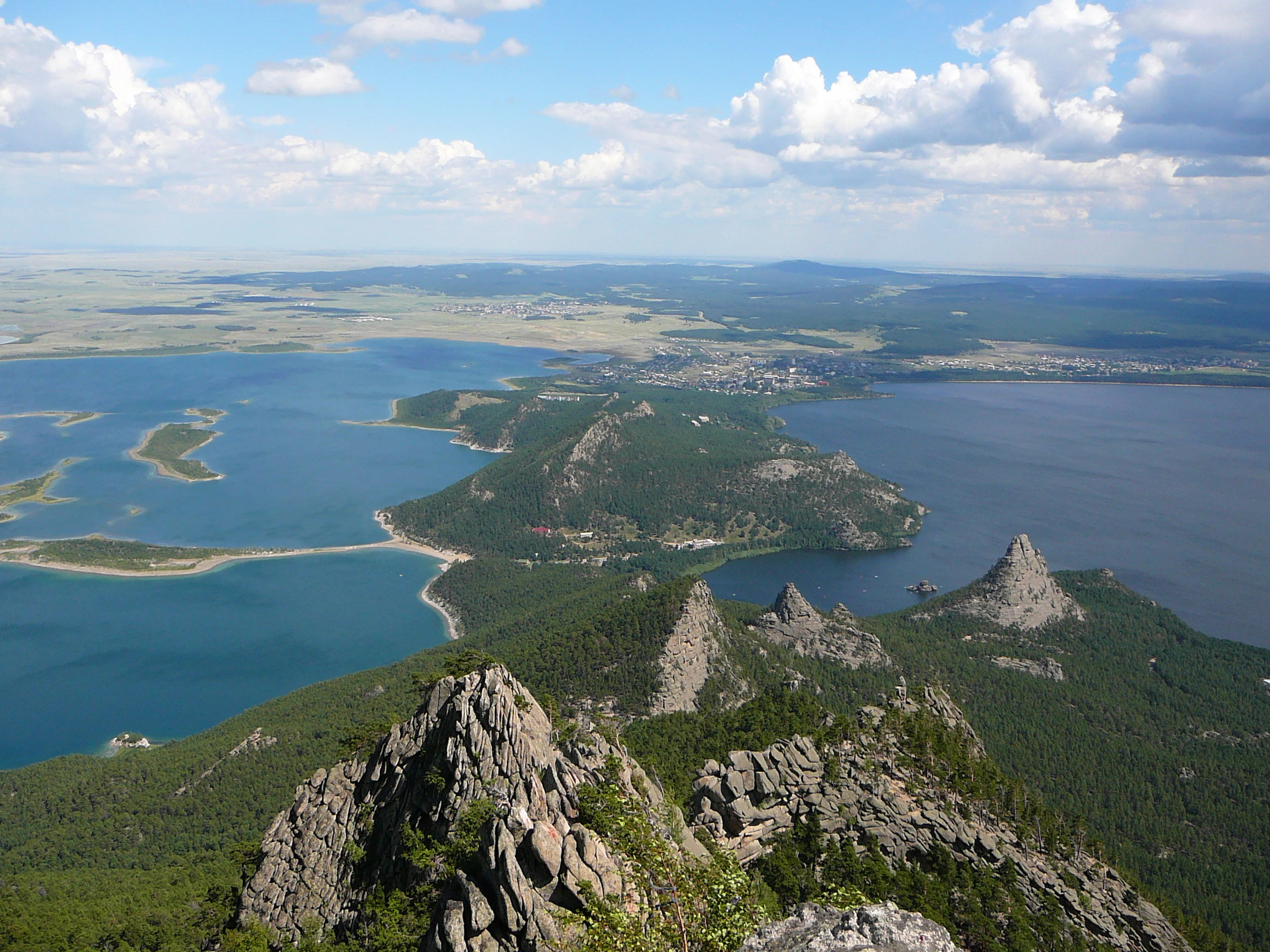
Panoramic landscape view showing two large lakes connected by a narrow isthmus, surrounded by rocky mountain peaks and dense forest under a partly cloudy sky
Panoramic view of Lake Borovoe and Bolshoye Chebachye separated by a narrow isthmus, with rocky peaks and forested terrain under a partly cloudy sky

Burabay State National Nature Park history and protected-area timeline

The foundation of Burabay's protection began in 1898 with the establishment of a state forest in the area. In 1920, Burabay was nationalized and declared a spa town of national importance, recognizing its therapeutic qualities and scenic value. The formal designation as the National Nature Reserve of Burabay came in 1935, providing systematic conservation protection to the region's natural resources.

The reserve was dissolved in 1951 and reorganized as the Burabay Forest, representing a period of shifted management priorities toward forest resource utilization. A significant restoration of protection status occurred through governmental motion N° 787 of May 6, 1997, which transformed the Forest of Burabay into the Natural and Well-being Complex of the Forest of Burabay under state management.

The motion N°1246 of August 12, 2000, created the National Nature Park of Burabay with an initial area of 83,511 hectares, of which 47,600 hectares was covered by forest. In 2010, the park's territory was substantially expanded to 129,935 hectares, and in 2012, 370 hectares was converted to spare lands, reflecting ongoing adjustment of protected area boundaries.

Burabay State National Nature Park landscape and geographic character

The Burabay National Park is set within the Kokshetau Massif, a mountainous region in the northern sector of the Kazakh Uplands characterized by rounded granite hills and distinctive rock formations. The geology includes some of Kazakhstan's oldest rocks, with Precambrian formations over 600 million years old comprising gneiss, quartz, and crystalline formations. The landscape features numerous wind-sculpted rock pillars and outcrops—formed by erosive forces acting on granite—creating memorable formations with names like Okzhetpes, Burkit, Zhumbaktas, and Jeke Batyr that resemble towers and fortress-like structures.

The terrain progresses from undulating steppe at the park's edges toward higher forested hills as one moves eastward into the Kokshetau Massif proper. The park contains an extensive network of lakes ranging from freshwater to saline, their waters reflecting the surrounding forests and granite terrain. Small streams including Sarybulak and Gromovaya contribute to the hydrological network, fed by numerous clear springs throughout the park.
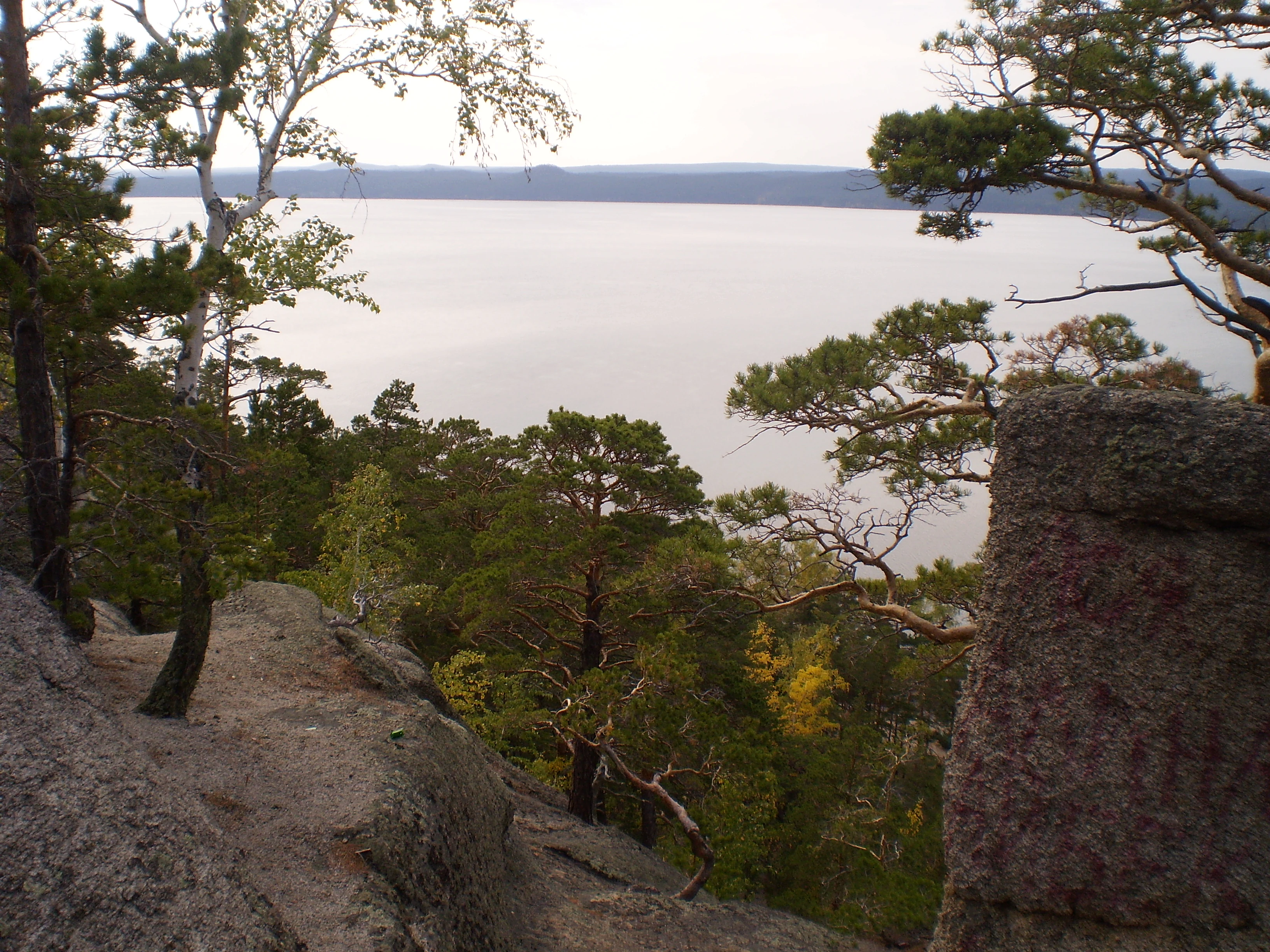
A lake surrounded by forested hills and rocky terrain under an overcast sky
Scenic lake view within Burabay National Park, Kazakhstan

Burabay State National Nature Park ecosystems, habitats, and plant life

Burabay National Park sits within Kazakhstan's steppe landscape zone, yet its mountainous setting creates conditions for diverse forest and wetland ecosystems. The vegetation is dominated by pine forests, which typically grow on granite ridges and rocky slopes, interspersed with birch-covered areas. The forest composition is approximately 65% pine, 31% birch, 3% aspen, and 1% shrubs. The park supports 757 plant species, of which 95 are considered rare or endangered, with many species registered in Kazakhstan's Red Book.

The park's varied terrain—from stony and moss-covered areas to wet depressions dominated by birch and spruce—creates multiple habitat types. Lowland areas support willows, rose hips, red currants, and raspberries, while younger pine forests contain herbaceous ground cover. Northern plant species such as ferns, horsetails, clubmosses, and cloudberries occur in appropriate habitats. Mosses cover tree trunks and rock faces in moist locations. Peat deposits in some wetland areas reach up to three meters in thickness.
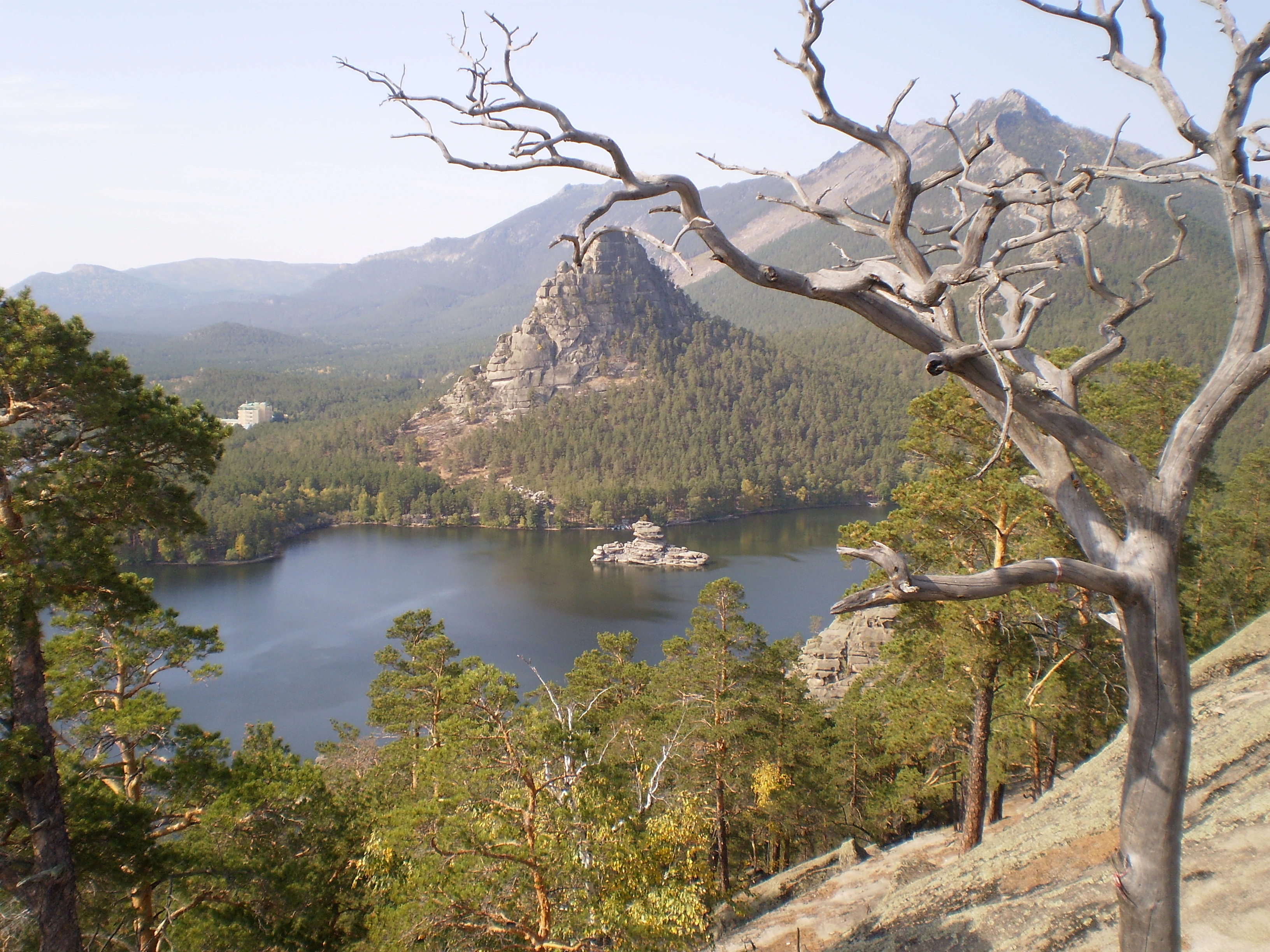
Lake Borovoye with forested mountains in the background and a distinctive rock formation, viewed from a hillside with trees in the foreground
Scenic view of Lake Borovoye surrounded by forested mountains in Burabay National Park

Burabay State National Nature Park wildlife and species highlights

The diverse habitats of Burabay support 305 vertebrate animal species, representing about 36% of Kazakhstan's total fauna diversity, with 40% of these species living at the edge of their natural habitat range in this area. Thirteen of these species are registered in Kazakhstan's Red Book.

Large mammals include several deer species—roe deer, moose, and introduced red deer—as well as wild boar. Small mammals include squirrels, stoats, weasels, and European pine martens. Predators present include wolves and Eurasian lynx, while the steppe and forest edges support various fox species, weasels, European and mountain hares, and European badgers.

Bird diversity is particularly notable, especially waterfowl such as common goldeneye, mallard, gadwall, northern pintail, and ruddy shelduck. Duck populations increase dramatically during autumn migration. Waders including plovers, northern lapwings, common sandpipers, and green sandpipers inhabit lake shores. The dry pine forests and birch woodland edges provide habitat for grey partridge and western capercaillie. Birds of prey including kestrels, hawks, buzzards, golden eagles, and eagle owls also inhabit the park.
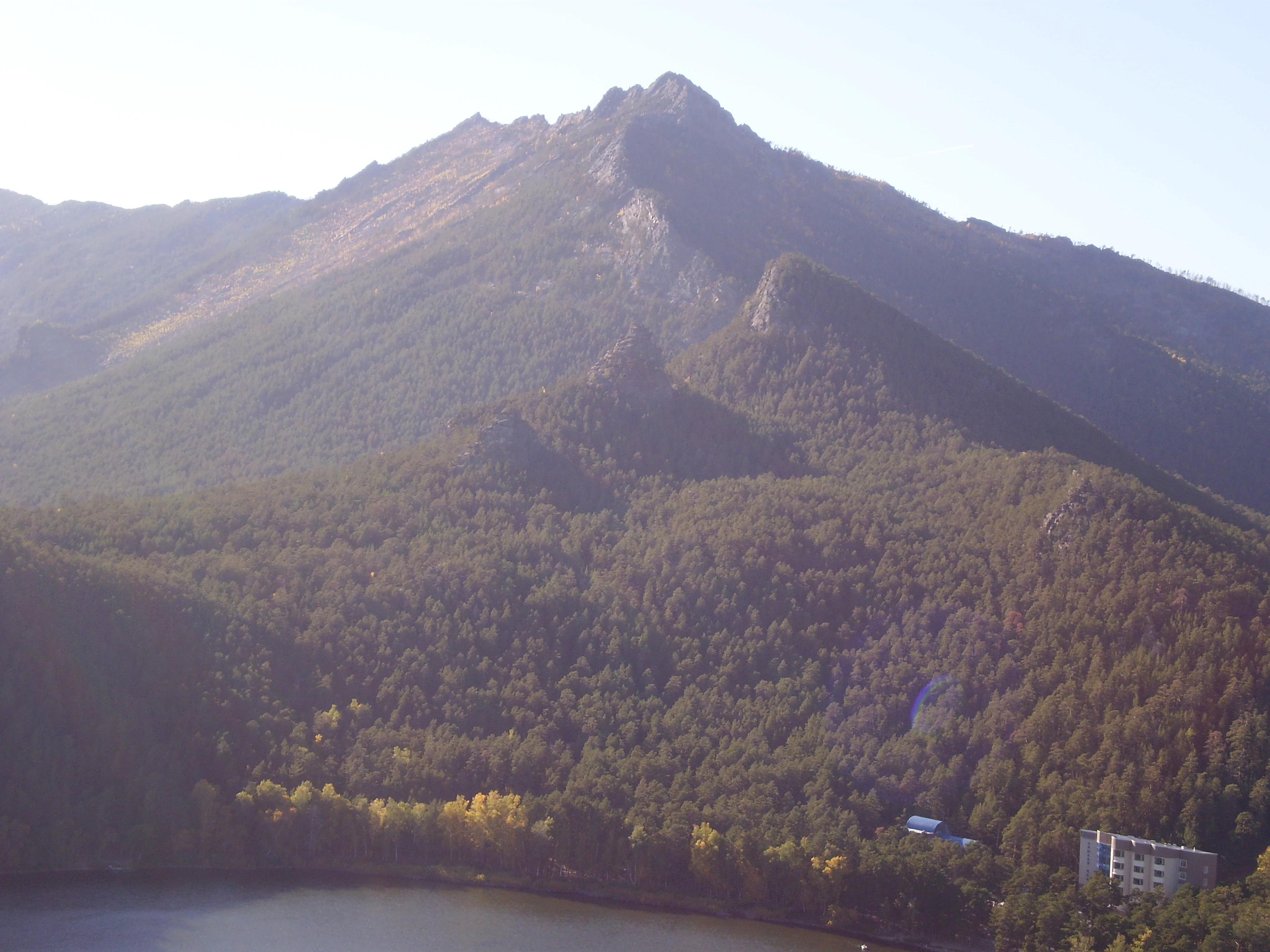
Wide view of a mountainous landscape with dense forests, a lake in the foreground, and distant peaks under clear skies
Panoramic view of Burabay National Park's forested mountains and lake

Burabay State National Nature Park conservation status and protection priorities

Burabay National Park serves as a critical protected area in northern Kazakhstan, preserving representative ecosystems of the Kokshetau mountainous-forest region. The park protects 757 plant species, with 119 protected species and 12 registered in the Red Book, alongside 305 animal species with 13 Red Book species. The protection of old-growth pine and birch forests maintains carbon storage and watershed functions within the Kazakh Uplands.

The park's designation as IUCN Category II reflects its primary purpose of ecosystem conservation while accommodating sustainable visitor use. The direct presidential oversight ensures consistent protection funding and management priority. The conservation significance is enhanced by the presence of species at the edge of their natural ranges, with 40% of the animal species existing at habitat boundaries within this protected area.

Burabay State National Nature Park cultural meaning and human context

Burabay carries significant cultural heritage value tied to Kazakh history and legend. The park is associated with Kenesary Cave, named for Kenesary Khan, grandson of Ablai Khan, who is believed to have spent his childhood in this area. The cave remains a popular tourist destination and photographic location.

The park is intertwined with Kazakh legends explaining the region's distinctive landscape. One legend tells that the Creator, after providing only arid steppes to Kazakh nomads, gathered the remaining mountains, forests, lakes, and rivers and cast them toward the steppes upon hearing the people's prayers—this mythology gives rise to Burabay's reputation as Kazakhstan's pearl.

Historical significance includes the spa tradition, with Burabay recognized as a spa town of national importance since 1920. During World War II, from 1941 to 1944, many distinguished scientists from the former Soviet Union found refuge in the Burabay area. The Burabay sanatorium continues to treat conditions including stomach and joint disorders, utilizing the therapeutic qualities of the local environment.
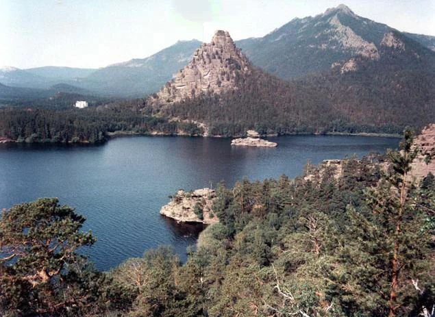
A large lake bordered by dense forest and rugged mountains with a distinctive rocky hill in the center
Lake Burabay surrounded by forested mountains and a prominent rocky hill

Top sights and standout views in Burabay State National Nature Park

Burabay National Park offers a distinctive combination of mountain forest landscapes, granite rock formations, and lake-filled terrain uncommon in central Asian protected areas. The pine and birch forests of the Kokshetau Massif provide seasonal color shifts and habitat for species including capercaillie and lynx. Kenesary Cave connects visitors to Kazakh historical figures and legend. The network of both freshwater and saline lakes creates scenic diversity, while the climate supports comfortable summer visitation. The park's proximity to Shchuchinsk, Kokshetau, and Nur-Sultan makes it accessible for regional tourism.
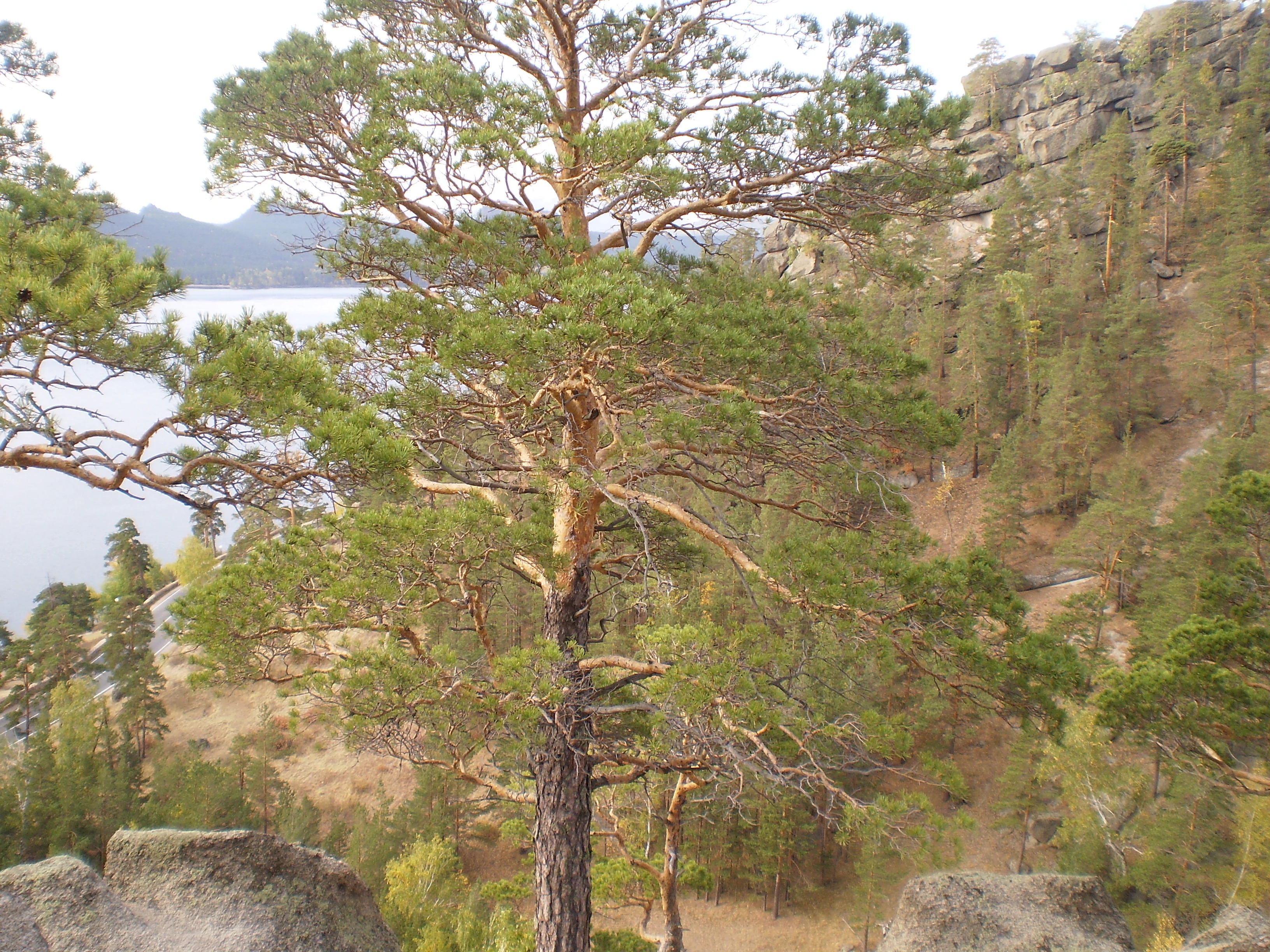
A tall pine tree in the foreground with rocky outcrops and a lake visible in the distance, surrounded by forested hills
Forest landscape with lake in background at Burabay National Park

Best time to visit Burabay State National Nature Park

The most favorable time to visit Burabay National Park is during the summer months of June through August and into early September when warm temperatures allow full access to outdoor activities, trail exploration, and wildlife viewing. July temperatures averaging 19°C provide comfortable conditions for hiking among the forests and rock formations.

Winter visitation offers a different character, with the landscape transformed by snow cover averaging 25 to 35 centimeters from mid-November through April. The cold season presents opportunities for winter photography and experiencing the park's quieter season, though temperatures dropping to -16°C in January require appropriate preparation. The transition seasons of spring and autumn provide intermediate conditions, with autumn particularly notable for increased waterfowl activity during migration periods.
Monthly climate preview

Tracing annual temperature ranges and precipitation variations across the regional terrain

Climate and Monthly Weather Normals for Burabay State National Nature Park

Long term measurements for Burabay State National Nature Park reveal sharp transitions from freezing winters below minus fifteen degrees Celsius to warm summer averages near twenty degrees. Accessing the complete twelve month profile of the Aqmola Region reserve provides detailed daily precipitation averages, historical minimums, and maximum temperatures.
Annual mean2 °C
-17 °C20 °C
Jan-17°
Feb-15°
Mar-7°
Apr
May12°
Jun18°
Jul20°
Aug18°
Sep11°
Oct
Nov-7°
Dec-15°
Warmest month
July

19.7 °C

Coolest month
January

-16.9 °C

Wettest month
July

2.3 mm/day

Driest month
February

0.5 mm/day

Park location guide

Geography guide, regional context, and park location map for Burabay State National Nature Park

Burabay State National Nature Park park geography, regions, and map view in Kazakhstan

Understand where Burabay State National Nature Park sits in Kazakhstan through a broader geographic reading of the surrounding landscape, nearby location context, and its mapped position within the national park landscape.

How Burabay State National Nature Park fits into Kazakhstan

Kazakhstan is a Central Asian country spanning vast steppes and plains, bordered by Russia, China, Kyrgyzstan, Uzbekistan, and Turkmenistan, with a coastline along the Caspian Sea. It gained independence from the Soviet Union in 1991 and has a population of approximately 20.5 million people. The country is officially secular but predominantly Muslim, with Kazakh and Russian as official languages.

Wider geography shaping Burabay State National Nature Park in Kazakhstan

Kazakhstan occupies a vast territory in Central Asia, extending into Eastern Europe. Its terrain consists largely of hilly plateaus and plains, with lowlands covering about a third of the area. The southern and eastern regions are mountainous. The country borders Russia to the north and west, China to the east, Kyrgyzstan to the southeast, Uzbekistan to the south, and Turkmenistan to the southwest. It has a coastline along the Caspian Sea.

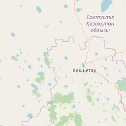
Map view of Burabay State National Nature Park

Use this park location map to pinpoint Burabay State National Nature Park in Kazakhstan, understand its exact geographic position, and read its mapped placement within the surrounding landscape more clearly.

Pigeon | © OpenStreetMap contributors

Location context for Burabay State National Nature Park

Aqmola Region

Explore the unique granite rock formations, Kokshetau Massif forests, and pristine lake ecosystems defining this Central Asian protected area.

Burabay State National Nature Park Photos: Visualizing Kazakhstan's Protected Landscapes

Discover an extensive visual gallery of Burabay State National Nature Park, featuring its iconic granite outcrops, dense pine and birch forests, and diverse lake terrain. These detailed images provide essential context for understanding the park's distinctive geology, unique habitats, and the scenic beauty of its protected environment within the Kazakh Uplands.

Panoramic landscape view showing two large lakes connected by a narrow isthmus, surrounded by rocky mountain peaks and dense forest under a partly cloudy sky

Tall rocky mountain peak with dense forest, lake, and distant mountains under a partly cloudy sky

A lake surrounded by forested hills and rocky terrain under an overcast sky

Lake Borovoye with forested mountains in the background and a distinctive rock formation, viewed from a hillside with trees in the foreground

Wide view of a mountainous landscape with dense forests, a lake in the foreground, and distant peaks under clear skies

A calm lake with a rocky island in the center, surrounded by forested hills

A large lake bordered by dense forest and rugged mountains with a distinctive rocky hill in the center

A tall pine tree in the foreground with rocky outcrops and a lake visible in the distance, surrounded by forested hills

Park atlas

Trace the geographic spread of protected landscapes across Aqmola Region, comparing terrain and conservation value.

Other National Parks and Protected Areas Near Burabay State National Nature Park

Browse a curated selection of national parks and protected areas geographically adjacent to Burabay State National Nature Park, covering similar mountainous regions, granite formations, and lake ecosystems. Continue your park discovery by comparing diverse conservation landscapes, tracing the regional context of protected terrain within the broader Kazakh Uplands.
Watercolor illustration of a landscape with green hills, a body of water, and grassy foreground under a pink-hued sky
National parkAqmola Region
58 km away#1 closest

West

Kokshetau National Park: A Protected Granite Mountain and Forest-Steppe Landscape in Kazakhstan

Explore Aqmola Region's unique protected geography and mapped terrain.

Kokshetau National Park stands as a remarkable protected landscape within Kazakhstan, defined by its ancient granite mountains and its unique position as a forest-steppe island surrounded by open plains. This national park preserves a rich tapestry of boreal forests, lake-filled depressions, and geological wonders, including some of the planet's most ancient rock formations. MoriAtlas provides a structured view of Kokshetau National Park, detailing its mapped boundaries and geographic context within the Aqmola Region, offering users a deep dive into its protected area identity and ecological significance.

Area
1,821 km²
Established
1996
IUCN
II
Relief
Upland
Wildlife reserveAkmola Region
About 219 km away#2 closest

Southwest

Atbasar Wildlife Reserve: Protected Steppe Grasslands and Wildlife Habitat in the Akmola Region

Mapping conservation landscapes of northern Kazakhstan

Explore the geographic scope of Atbasar Wildlife Reserve, a significant sanctuary in northern Kazakhstan. This protected area preserves key steppe ecosystems and habitat for marmots and migratory birds within a unique terrain of rocky spurs and open feather grass plains.

Area
751 km²
Established
1976
IUCN
IV
Relief
Upland
Natural monumentNorth Kazakhstan Region
About 249 km away#3 closest

Northwest

Zhanazhol Pine Forest: Protected Natural Monument in North Kazakhstan Region

Mapped relict pine grove within the forest-steppe transition

Zhanazhol Pine Forest serves as a protected natural monument, preserving an isolated stand of mature Scots pine trees on sandy substrates. This site provides critical insights into the biogeography of the Ishim-Tobol interfluve, maintaining a distinct forest environment far from typical boreal ranges.

Area
0.09 km²
Relief
Lowland
Climate
Temperate
Access
Access unknown
Watercolor illustration of a landscape with green forests, rolling hills, and distant mountains under a soft sky
National parkAkmola Region
About 249 km away#4 closest

Southeast

Buiratau State National Nature Park: Kazakhstan National Park within Akmola Region

Explore unique steppe-forest transition ecosystems and geography.

Buiratau State National Nature Park in Kazakhstan's Akmola Region protects a significant transitional zone between dry steppe and semi-arid forest. This national park showcases a diverse landscape of low ridges, plains, and salt lakes, contributing to its rich biodiversity. Discover the mapped boundaries and the unique ecological character of this protected area within the context of the Kazakh Uplands atlas and its regional geography.

Area
890 km²
Established
2011
IUCN
II
Relief
Upland
Protected areaKostanay Region
About 297 km away#5 closest

West

Koibagar-Tyntyugur Lakes: Protected Wetland Geography in Northern Kazakhstan

Steppe-wetland mosaic and Ramsar-recognized migratory habitat

Located in the Kostanay Region, the Koibagar-Tyntyugur Lakes represent a complex system of shallow, interconnected basins. These protected landscapes illustrate the dramatic hydrological cycles of the Saryarka edge, shifting from open water to reed-filled marshes. The region remains a benchmark for conservation, featuring essential waterbird habitats and rare fragments of pristine feather-grass steppe.

Area
623.45 km²
Established
2005
Relief
Lowland
Scope
Terrestrial
National parkKazakhstan
388 km away#6 closest

Southeast

Bayanaul National Park: Kazakhstan's First National Park Mapped Landscape

Explore granite mountains, unique lakes, and striking rock formations.

Bayanaul National Park, situated in Kazakhstan's Pavlodar Province, represents a significant protected area renowned for its extraordinary granite mountain landscape. Established as the country's first national park, it showcases unique erosion-shaped rock formations, diverse vegetation including rare pines, and four significant freshwater lakes. This park offers a distinct visual tapestry of mountainous terrain and geological wonders within the broader Central Asian geography, making it a key destination for atlas-based discovery.

Area
684.53 km²
Established
1985
IUCN
II
Relief
Mountain
Natural monumentPavlodar Region
About 424 km away#7 closest

East

Gusiny Perelet Natural Monument: Geological Geography and Fossil Site Mapping in Pavlodar Region

An iconic Irtysh River protected area and Neogene research locality

Situated along the Irtysh River bank, Gusiny Perelet functions as a vital reference point for Neogene mammal evolution in Central Asia. The protected site showcases an exposed geological face, providing scientific insight into ancient ecosystems once dominated by Hipparion fauna. Its preserved fossil assemblage and riverside location offer a tangible connection to the region's deep natural history.

Established
1971
Relief
Lowland
Climate
Temperate
Access
Easy access
Nature reserveKaraganda Region
About 425 km away#8 closest

South

Karaagash Nature Reserve: Granite Ridge Landscapes in Central Kazakhstan

Protected forest-steppe habitat in the Karaganda region

Karaagash Nature Reserve stands as a sentinel of central Kazakhstan's geography, protecting a rugged area where granite uplands meet ridge-and-valley plains. This reserve supports a diverse array of flora and fauna, offering a representative look at the forest-steppe transition zone and its role in regional conservation.

Area
68 km²
Established
1986
IUCN
IV
Relief
Mountain

Common questions about visiting, size, designation, and location context for Burabay State National Nature Park

Burabay State National Nature Park FAQs for park facts, access, geography, and protected area context

Find quick answers about Burabay State National Nature Park, including protected-area facts, park geography, trail and visitor context, and how the park fits into its surrounding country and regional landscape.
MoriAtlas Explorer

Continue Your Protected Areas Search Across the Global Atlas

Deepen your exploration by continuing the structured search for national parks and protected areas worldwide. Utilize the comprehensive filtering capabilities to compare different conservation landscapes and refine your understanding of global park geography. Discover more about the distribution and characteristics of protected natural areas.

Global natural geography