Mori Atlas logo
National parkKokshetau National Park

Discover ancient geology, forest-steppe ecology, and mapped protected areas in Kazakhstan.

Kokshetau National Park: Protected Landscape Boundaries and Geographic Context in Aqmola Region

(Kokshetau State National Natural Park)

Kokshetau National Park represents a distinctive protected landscape situated within the Aqmola Region of Kazakhstan, marking a crucial transition between taiga forests and open steppes. This national park preserves an ecologically unique island ecosystem characterized by ancient granite mountains, crystal-clear lakes, and extensive pine forests rising from the surrounding plains. Through MoriAtlas, users can explore the mapped park boundaries, understand its significant geological formations including some of the world's oldest rocks, and appreciate its role as a vital biodiversity refuge and an integral part of regional geographic context.

National ParkKazakhstanForest-SteppeGranite MountainsLake DistrictBiodiversity Refuge
Stylized illustration of a lake surrounded by hills with a waterfall in the background, green vegetation, and a partly cloudy sky

Kokshetau National Park

National park

Park overview

Structured park overview, official facts, and landscape profile for Kokshetau National Park

Kokshetau National Park park facts, protected area profile, and essential visitor context
Review the core facts for Kokshetau National Park, including designation, size, terrain, visitor scale, habitats, and operating context in one park-focused overview.

About Kokshetau National Park

Kokshetau National Park protects a remarkable island of natural heritage in the semi-arid steppe of northern Kazakhstan. The park occupies the Kokshetau Hills, a cluster of low but rugged granite mountains that rise abruptly from the surrounding plains, creating a landscape of considerable topographic and ecological diversity. This mountain-forest-lake complex exists as an ecological island completely surrounded by open steppe, making it a critical refuge for forest-dwelling species in a region otherwise dominated by grassland.

The park's setting in the transition between the Siberian taiga to the north and the southern steppes creates a unique blend of ecological communities. Pine forests dominate the hillsides, with birch and aspen occurring in valley bottoms and lower slopes. The forest cover is interspersed with meadows, rocky outcrops, and a network of streams feeding numerous lakes scattered throughout the park's lacustrine depressions. The five management sectors each offer distinct character: the Zerenda sector centers on Lake Zerenda with holiday facilities, the Shalkar sector features low mountains and granite ridges, the Aiyrtau sector preserves historically managed forest with an arboretum, the Arykbalyk sector protects a mountainous lake area, and the isolated Ormandy Bulak zone provides strict conservation for flora and fauna.

Beyond its ecological significance, the park contains important archaeological heritage. The Zerenda mountain-forest area has yielded artifacts from the Andronovo culture dating to 1500 BCE, evidence of human occupation spanning millennia. These ancient settlement traces, combined with kurgan burial mounds found throughout the park, add historical depth to the natural landscape.

Quick facts and research context for Kokshetau National Park

Kokshetau National Park covers 182,076 hectares of the Kazakh uplands in northern Kazakhstan, established in 1996. The park protects a landscape of low granite mountains, pine and birch forests, and numerous lakes in lacustrine depressions. Located in the transition between Siberian taiga and steppe, the park preserves significant biodiversity including 597 vascular plant species and 363 vertebrate species. The area features archaeological sites including kurgan burial mounds, and offers over 200 kilometers of hiking trails for visitors.

Park context

Deeper park guide and search-rich context for Kokshetau National Park

Kokshetau National Park history, landscape, wildlife, and travel context
Explore Kokshetau National Park through its history, landscape character, ecosystems, wildlife, conservation priorities, cultural context, and seasonal travel timing in a structured park guide built for atlas discovery and search intent.

Why Kokshetau National Park stands out

Kokshetau is best known for its distinctive forest-steppe island ecology, a compact mountain and lake landscape surrounded entirely by open steppe, creating a unique ecological island in northern Kazakhstan. The park preserves some of the oldest geological formations in the country, with granite peaks and ancient rocks dating back over 600 million years, some eclogite formations exceeding 3.5 billion years. Its combination of boreal pine forests, granite cliffs, clear mountain lakes, and archaeological sites makes it one of the most ecologically and scenically significant protected areas in the Kazakh uplands.

Wide landscape of Bear Hill rising from a dense green forest under a partly cloudy sky with pink and blue hues
Bear Hill, the highest point of Kokshetau National Park, viewed across a dense forest under a partly cloudy sky

Kokshetau National Park history and protected-area timeline

Kokshetau National Park was established in 1996 through a decree of the Government of Kazakhstan, designated as a protected area of national significance on April 10 of that year. The park was created with the dual purpose of preserving the unique natural complexes of the Kazakh uplands and maintaining the ecological integrity of this distinctive forest-steppe island ecosystem. Management responsibility falls to the Committee of Forestry and Fauna of the Ministry of Agriculture of Kazakhstan.

The Aiyrtau sector within the park has particular historical significance, representing one of the earliest managed forest areas in the region, with forestry operations beginning in 1898 during the Russian imperial period. This early forest management established the foundation for the sector's contemporary status as an area featuring an arboretum and experimental forestry sections. The park's establishment came during Kazakhstan's post-independence period of expanding protected area coverage, part of broader efforts to preserve the nation's natural heritage in the transition from Soviet-era resource management to modern conservation frameworks.

Kokshetau National Park landscape and geographic character

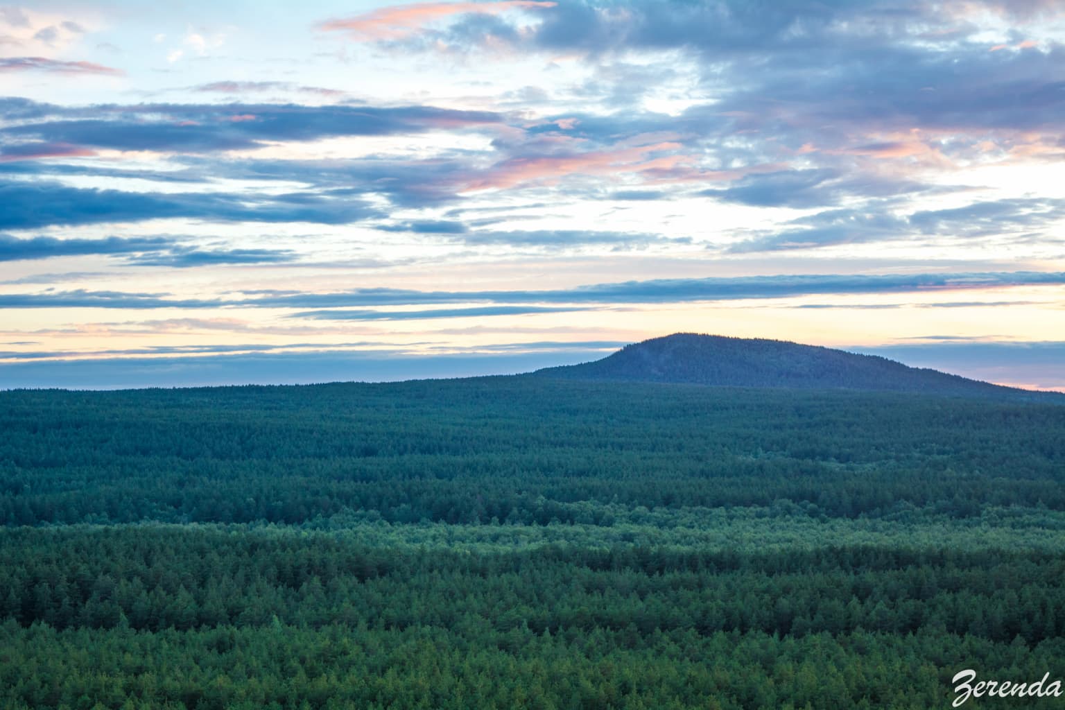
The Kokshetau landscape is defined by its distinctive granite mountains and hills rising from the surrounding steppe plains. The terrain consists of low mountains and ridges with complex networks of streams and valleys, interspersed with lacustrine depressions containing significant lakes. The western part of the park encompasses portions of the Kokshetau Lakes system, a chain of lakes nestled among the hills.

The geological foundation of the park is exceptionally ancient, with rocks dating from the pre-Cambrian period—over 600 million years old. The oldest rocks include gneiss, quartzite, and crystalline fold rocks, while granite formations widespread throughout the park originated approximately 400 million years ago from magmatic intrusions. The most remarkable geological discovery within the park is eclogite, the oldest rock in Kazakhstan, aged approximately 3.5 billion years. This dense, dark green to nearly black rock occurs in scattered formations and reflects the profound geological history preserved in the Kokshetau uplands.

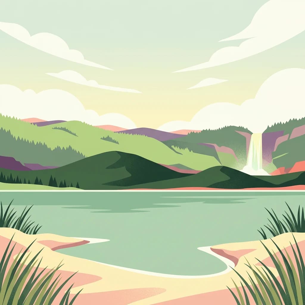
The landscape supports extensive pine forests that blanket the granite ridges and slopes, creating a visually striking contrast with the bare rock outcrops and the open steppe beyond the park boundaries. The mountain-forest-lake combination produces a characteristic scenery of forested slopes descending to lakes surrounded by cliffs and boulder fields, a landscape of considerable aesthetic value and ecological complexity.

Kokshetau National Park ecosystems, habitats, and plant life

Kokshetau National Park occupies a distinctive position in the Kazakh upland ecoregion, one of two isolated patches of this temperate grassland and shrubland ecosystem in northern Kazakhstan. The park represents a critical conservation area within this ecoregion, which has remained relatively isolated from development and serves as a haven for rare species adapted to the forest-steppe transition zone.

The vegetation reflects the park's unique position between taiga and steppe. Pine forests (Pinus sylvestris) dominate the upland areas, with birch and aspen forming mixed stands in lower elevations and valley bottoms. The forest understory features common shrubs including juniper, rose hips, hawthorn, and willow. Meadow steppe vegetation covers open areas, though much of the original steppe has been affected by historical plowing and grazing. Scientists have documented 597 species of vascular plants within the park, including 36 relic boreal species that reflect the forest island nature of this isolated mountain ecosystem. These relict species represent survivors from broader historical distributions when forest cover was more extensive across the region.

Kokshetau National Park wildlife and species highlights

The wildlife communities of Kokshetau reflect the park's position as a forest refuge within the steppe. The park supports 363 documented vertebrate species, including 224 bird species, 51 mammals, 5 reptiles, 1 amphibian, and 19 fish species. This diversity represents a remarkable concentration of wildlife in a relatively restricted area, highlighting the ecological importance of the forest-steppe island habitat.

Mammal communities include a diverse assemblage of rodents representing species from steppe, desert, and forest habitats, including the southern birch mouse, steppe lemming, and Jungar hamster. These abundant small mammals support predator populations including fox, wolf, badger, stoat, and weasel. Larger mammals present in the park include wild boar, elk, and a significant population of Siberian Roe Deer. The lakes support populations of pike, roach, and carp, making the park important for both freshwater fish and the bird species that depend on aquatic habitats. Bird diversity is particularly notable, with over 220 species recorded, including waterfowl using the lake systems and forest-dwelling species inhabiting the pine and birch woodlands.

Kokshetau National Park conservation status and protection priorities

Kokshetau National Park plays a critical role in preserving the Kazakh upland ecoregion, one of the least modified and most ecologically significant grassland ecosystems in northern Kazakhstan. The park protects what remains of a once more extensive forest-steppe landscape that has been largely converted to agriculture across the surrounding region. Its designation as an IUCN Category II protected area reflects its primary purpose of conserving natural ecosystems while permitting compatible recreational use.

The preservation of ancient forest communities within the park is especially significant given the extent of habitat loss in the surrounding steppe. The 36 documented relic boreal plant species represent survivors of historical forest connections to the Siberian taiga and Altai forests, species now isolated in this mountain island and vulnerable to environmental change. The park's managed forest sector, particularly the Aiyrtau area with its 1898 origins, demonstrates long-term commitment to forest stewardship. The isolated Ormandy Bulak sector provides strict protection for plant and animal communities, ensuring reference ecosystems remain undisturbed for scientific study and conservation monitoring.

Kokshetau National Park cultural meaning and human context

The Kokshetau region has a long human history reflected in archaeological sites within the park. The Zerenda mountain-forest area contains evidence of ancient human occupation, with archaeological finds including traces of the Andronovo culture dating to approximately 1500 BCE. These ancient settlements demonstrate that the Zerenda area was inhabited by peoples engaged in livestock breeding, agriculture, and hunting—activities that shaped the landscape over millennia.

Kurgan burial mounds are found throughout the park, representing the burial traditions of ancient steppe peoples. These archaeological features add historical dimension to the natural landscape, connecting contemporary visitors to the long human history of this distinctive landscape. The park also features caves, waterfalls, and recreational complexes developed during the Soviet and post-independence periods, reflecting more recent human engagement with this landscape. Zerenda Resort within the park has been recognized as a notable winter destination in Kazakhstan, representing the ongoing attraction of this mountain and lake landscape for recreation and tourism.

Top sights and standout views in Kokshetau National Park

Kokshetau National Park offers a distinctive combination of ancient geology, forest-steppe ecology, and archaeological heritage unique in northern Kazakhstan. The park's granite peaks contain some of the oldest rocks in the country, including formations over 3.5 billion years old. The forest island ecology supports 597 plant species and 363 vertebrate species in a landscape completely surrounded by steppe. Over 200 kilometers of hiking trails traverse sensitive wetlands, pine forests, and rocky terrain, while archaeological sites including kurgan burial mounds and ancient settlement traces document millennia of human history. The five management sectors provide diverse experiences from developed recreational areas around Lake Zerenda to strict conservation zones protecting rare species and ancient forest communities.

Best time to visit Kokshetau National Park

The park can be visited year-round, though each season offers distinctly different experiences. Summer brings warm conditions ideal for hiking the extensive trail network, with average temperatures around 20°C and the landscape at its most verdant. The lakes and forests are particularly attractive during the warm season, and water-based activities on the park's two routes are available. Winter transforms the landscape dramatically, with snow covering the pine forests and frozen lakes creating a completely different character. The Zerenda resort has been noted as a popular winter destination in Kazakhstan, offering cross-country skiing and winter recreation. Spring and autumn offer transitional experiences—spring brings thawing landscapes and renewed wildlife activity, while autumn features the striking colors of birch and aspen against the dark pines. The continental climate means significant seasonal variation, with winters cold enough for sustained snow cover and summers warm enough for full outdoor recreation.

Park location guide

Geography guide, regional context, and park location map for Kokshetau National Park

Kokshetau National Park park geography, regions, and map view in Kazakhstan
Understand where Kokshetau National Park sits in Kazakhstan through a broader geographic reading of the surrounding landscape, nearby location context, and its mapped position within the national park landscape.

How Kokshetau National Park fits into Kazakhstan

Kazakhstan is a Central Asian country spanning vast steppes and plains, bordered by Russia, China, Kyrgyzstan, Uzbekistan, and Turkmenistan, with a coastline along the Caspian Sea. It gained independence from the Soviet Union in 1991 and has a population of approximately 20.5 million people. The country is officially secular but predominantly Muslim, with Kazakh and Russian as official languages.

Wider geography shaping Kokshetau National Park in Kazakhstan

Kazakhstan occupies a vast territory in Central Asia, extending into Eastern Europe. Its terrain consists largely of hilly plateaus and plains, with lowlands covering about a third of the area. The southern and eastern regions are mountainous. The country borders Russia to the north and west, China to the east, Kyrgyzstan to the southeast, Uzbekistan to the south, and Turkmenistan to the southwest. It has a coastline along the Caspian Sea.

Map view of Kokshetau National Park

Use this park location map to pinpoint Kokshetau National Park in Kazakhstan, understand its exact geographic position, and read its mapped placement within the surrounding landscape more clearly.

Pigeon | © OpenStreetMap contributors

Location context for Kokshetau National Park

Aqmola RegionNorth Kazakhstan Region

Visualize the distinctive forest-steppe island ecology, showcasing ancient granite peaks, boreal pine forests, and clear mountain lakes.

Kokshetau National Park Photography: Discovering Kazakhstan's Unique Forest-Steppe Landscapes and Ancient Granite Terrain
Visually explore the diverse landscapes of Kokshetau National Park, understanding its unique forest-steppe island ecology, ancient granite formations, and varied habitats within northern Kazakhstan. These images provide essential context for comprehending the park's distinctive terrain, from pine-forested ridges and clear lakes to dramatic granite cliffs, revealing its true protected-area character.

Wide landscape of Bear Hill rising from a dense green forest under a partly cloudy sky with pink and blue hues

Sandy beach with sparse grass, a body of water, and distant blue mountains under a partly cloudy sky

Park atlas

Trace the forest-steppe transition zone and compare granite mountain landscapes with other protected areas near the Kazakh uplands.

Discover Nearby Protected Areas and National Parks Around Kokshetau National Park
Explore a curated list of national parks and protected areas geographically close to Kokshetau National Park, revealing Kazakhstan's diverse forest-steppe islands, ancient geological formations, and surrounding regional landscapes. This expanded atlas view provides essential geographic context and enables detailed comparison of conservation efforts across similar ecological zones and unique protected landscapes.
Watercolor painting of a landscape with green forests, hills, and a body of water
National parkAqmola Region

Burabay State National Nature Park: Mapped Granite Hills and Forested Terrain Atlas

Explore protected landscapes in Kazakhstan's Aqmola Region.

Burabay State National Nature Park presents a unique protected landscape within the Kokshetau Massif of Kazakhstan's Aqmola Region. This atlas-focused entry details the park's distinctive terrain, featuring ancient granite outcrops and rolling hills draped in pine and birch forests. Understand the mapped boundaries and geographic setting of this national park, renowned for its scenic lakes and significant geological formations, offering rich context for protected-area discovery.

Area
1,299.35 km²
Established
2000
IUCN
II
Relief
Mixed relief
Watercolor illustration of a landscape with green forests, rolling hills, and distant mountains under a soft sky
National parkAkmola Region

Buiratau State National Nature Park: Kazakhstan National Park within Akmola Region

Explore unique steppe-forest transition ecosystems and geography.

Buiratau State National Nature Park in Kazakhstan's Akmola Region protects a significant transitional zone between dry steppe and semi-arid forest. This national park showcases a diverse landscape of low ridges, plains, and salt lakes, contributing to its rich biodiversity. Discover the mapped boundaries and the unique ecological character of this protected area within the context of the Kazakh Uplands atlas and its regional geography.

Area
890 km²
Established
2011
IUCN
II
Relief
Upland
National parkSverdlovsk Oblast

Pripyshminskiye Bory National Park: Explore its Protected Landscape and Geographic Setting

National Park with mapped boundaries in Sverdlovsk Oblast.

Pripyshminskiye Bory National Park stands as a notable protected area within the vast geography of Sverdlovsk Oblast, Russia. This page serves as a dedicated atlas entry for the park, detailing its protected landscape identity and its placement within the broader regional context. Users can investigate the park's mapped boundaries and understand its significance as a distinct national park, facilitating structured geographic discovery.

Area
490 km²
Established
1993
IUCN
II
Relief
Lowland
National parkKazakhstan

Bayanaul National Park: Kazakhstan's First National Park Mapped Landscape

Explore granite mountains, unique lakes, and striking rock formations.

Bayanaul National Park, situated in Kazakhstan's Pavlodar Province, represents a significant protected area renowned for its extraordinary granite mountain landscape. Established as the country's first national park, it showcases unique erosion-shaped rock formations, diverse vegetation including rare pines, and four significant freshwater lakes. This park offers a distinct visual tapestry of mountainous terrain and geological wonders within the broader Central Asian geography, making it a key destination for atlas-based discovery.

Area
684.53 km²
Established
1985
IUCN
II
National parkChelyabinsk Oblast

Zyuratkul National Park: Protected Landscape Atlas and Regional Geography

Explore national park boundaries and terrain in Chelyabinsk Oblast.

Zyuratkul National Park represents a distinct protected landscape within the Chelyabinsk Oblast of Russia. This page offers an atlas-centric view, detailing its geographic position and significance as a national park. Users can explore the mapped context of Zyuratkul National Park, understanding its terrain and its contribution to the protected areas landscape of the Southern Urals region.

Area
882.49 km²
Established
1993
IUCN
II
Relief
Mountain
Watercolor illustration of a mountainous landscape with green hills, trees, and a river in the foreground
National parkKazakhstan

Karkaraly State National Nature Park: Kazakhstan's Mountain-Forest Protected Area

Discover unique geology, archaeology, and regional landscape context.

Delve into the distinctive protected landscape of Karkaraly State National Nature Park, situated in Kazakhstan's Karaganda Region. This park preserves a rare mountain-forest ecosystem with dramatic granite formations, ancient archaeological sites, and lakes, presenting a rich geographic contrast to the surrounding Kazakh Steppe. MoriAtlas provides structured insights into Karkaraly State National Nature Park's unique terrain, its conservation value, and its position within the broader regional geography of Central Asia.

Area
1,121.2 km²
Established
1998
IUCN
II
Relief
Mountain
Watercolor illustration of a mountain range with purple peaks, green hills, a single tall pine tree, and pinkish foreground vegetation
National parkChelyabinsk Oblast

Zigalga National Park: National Park within Chelyabinsk Oblast's Southern Urals Geography

Mapped protected landscape and regional geographic context for atlas discovery.

Zigalga National Park offers a specific focus for exploring protected natural areas in Russia's Chelyabinsk Oblast. This page provides essential geographic data, detailing the park's mapped boundaries and its position within the Southern Urals region. Understand the park's unique protected landscape identity and its contribution to the atlas of Russian natural areas, fostering detailed map-based exploration and regional geographic understanding.

Area
457 km²
Established
2019
IUCN
II
National parkBashkortostan

Bashkiriya National Park: Karst Geography and Protected Ural Forest Landscape

Explore Ural Mountains national park mapped boundaries and terrain.

Delve into the geography and protected landscape of Bashkiriya National Park, a significant national park within Russia's Bashkortostan region. This detailed page highlights its striking karst topography, extensive cave systems, and over 92 percent forest cover across the southern Ural Mountains. Understand the park's role as a conservation buffer zone and its unique position at the Europe-Asia biogeographical boundary through structured geographic data and mapped context.

Area
920 km²
Established
1986
IUCN
II
Relief
Mixed relief

Common questions about visiting, size, designation, and location context for Kokshetau National Park

Kokshetau National Park FAQs for park facts, access, geography, and protected area context
Find quick answers about Kokshetau National Park, including protected-area facts, park geography, trail and visitor context, and how the park fits into its surrounding country and regional landscape.
MoriAtlas Explorer

Continue Your Protected Areas Search Across the Global Atlas

Deepen your exploration by continuing the structured search for national parks and protected areas worldwide. Utilize the comprehensive filtering capabilities to compare different conservation landscapes and refine your understanding of global park geography. Discover more about the distribution and characteristics of protected natural areas.

Global natural geography