Mori Atlas logo
National parkPripyshminskiye Bory National Park

Understand the mapped boundaries and landscape context of this protected area.

Pripyshminskiye Bory National Park: A Protected National Park within Sverdlovsk Oblast's Geography

Pripyshminskiye Bory National Park represents a significant protected national park within the expansive geography of Sverdlovsk Oblast, Russia. As a key entity in MoriAtlas, this park offers a focused entry point for understanding its specific protected landscape and its relationship to the surrounding regional terrain. Explore the mapped boundaries and discover the unique geographic identity of Pripyshminskiye Bory National Park, providing essential context for atlas-based discovery.

Taiga forestsWetlandsProtected forestsNational parksBoreal ecosystemsSverdlovsk Oblast

Pripyshminskiye Bory National Park

National park

Park overview

Structured park overview, official facts, and landscape profile for Pripyshminskiye Bory National Park

Pripyshminskiye Bory National Park park facts, protected area profile, and essential visitor context
Review the core facts for Pripyshminskiye Bory National Park, including designation, size, terrain, visitor scale, habitats, and operating context in one park-focused overview.

About Pripyshminskiye Bory National Park

Pripyshminskiye Bory National Park occupies a significant position in the protected area network of central Russia, preserving a representative sample of the West Siberian Plain's forest and wetland ecosystems. The park is situated in Sverdlovsk Oblast, approximately 150 kilometers east of Yekaterinburg, Russia's fourth-largest city, and lies about 70 miles west of Tyumen. The landscape is characterized by a gentle topography typical of the West Siberian Plain, with the Pyshma River flowing through the area and providing hydrological context for the park's wetland systems. The protected area encompasses a complex of forests dominated by pine and birch species, with the forest matrix interspersed with approximately ten percent non-forested areas including marshes, ponds, hayfields, and pastures. This heterogeneous landscape supports diverse ecological communities and provides important habitat for various species. The park's location along the route of the Trans-Siberian Railroad, one of the world's longest railway lines, connects this protected area to major population centers and contributes to its accessibility for both scientific study and environmental education.

Quick facts and research context for Pripyshminskiye Bory National Park

Pripyshminskiye Bory National Park is located in Sverdlovsk Oblast, Russia, in the southwestern region of the West Siberian Plain. The park covers 49,050 hectares and was established in 1993 as an IUCN Category II protected area. It is divided into two distinct sections: the Talisky section near the town of Talitsa, and the Tugulymskaya section to the northeast in Tugulymsky District. The park protects pine, birch, spruce, larch, fir, and cedar forests alongside extensive wetland areas. The regional climate is humid continental with warm summers and cold, snowy winters, with average annual precipitation of about 17 inches.

Park context

Deeper park guide and search-rich context for Pripyshminskiye Bory National Park

Pripyshminskiye Bory National Park history, landscape, wildlife, and travel context
Explore Pripyshminskiye Bory National Park through its history, landscape character, ecosystems, wildlife, conservation priorities, cultural context, and seasonal travel timing in a structured park guide built for atlas discovery and search intent.

Why Pripyshminskiye Bory National Park stands out

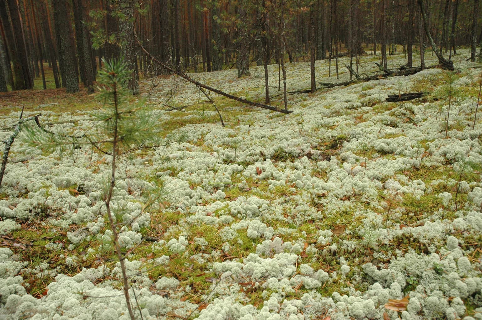
Pripyshminskiye Bory is best known for its representation of the West Siberian taiga, a vast ecoregion of coniferous forests that spans much of northern Asia. The park protects a diverse forest complex featuring pine, birch, spruce, larch, fir, and cedar, set against a landscape of wetlands, marshes, and river floodplains. The two-section structure of the park showcases different ecological character, with the Talisky section offering relatively flat pine, spruce, and larch forests on the right bank of the Pyshma River, while the Tugulymskaya section features more extensive wetlands and swampy floodplain forests of larch, fir, and cedar. The park is notable for preserving the southern fringe of the West Siberian taiga ecosystem.

Pripyshminskiye Bory National Park history and protected-area timeline

Pripyshminskiye Bory National Park was established in 1993 as part of Russia's expanding network of protected areas during the post-Soviet period. The creation of the national park reflected growing recognition of the ecological importance of the West Siberian taiga and the need to preserve representative examples of this vast forest ecosystem. The park was placed under the management of FGBU Pripyshminskiye Bory, the federal state budget institution responsible for overseeing its conservation, research, and visitor management functions. Since its establishment, the park has operated as a Category II protected area under the IUCN classification system, indicating its status as a national park primarily focused on ecosystem protection and recreation. The park's two-section structure reflects the natural geography of the region, with the Talisky and Tugulymskaya sections representing distinct ecological communities within the broader forest complex.

Pripyshminskiye Bory National Park landscape and geographic character

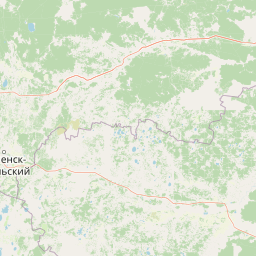
The landscape of Pripyshminskiye Bory National Park reflects the flat to gently undulating terrain characteristic of the West Siberian Plain. The park is bisected by the Pyshma River, which influences the distribution of forest types and wetland areas across the protected area. The Talisky section occupies the right bank of the Pyshma River near the town of Talitsa and features relatively flat terrain covered by forests of pine, spruce, and larch. This section represents the more upland portions of the park where sandy soils support pine-dominated forest communities. The Tugulymskaya section lies approximately 20 miles to the northeast in Tugulymsky District and contains more extensive wetlands and swamps on the floodplains of the Pyshma River. Here, the forest composition shifts to include greater representation of larch, fir, and cedar, particularly on the wetter floodplain sites. Much of the Tugulymskaya section consists of swampy terrain, with higher sandy ridges supporting pine forests. The overall landscape creates a mosaic of forested uplands and wetland depressions that characterizes much of the West Siberian Plain.

Pripyshminskiye Bory National Park ecosystems, habitats, and plant life

The ecological character of Pripyshminskiye Bory National Park is defined by its position within the West Siberian taiga, a terrestrial ecoregion recognized by the World Wildlife Fund as one of the significant forested biomes of the Northern Hemisphere. The park's forests are dominated by coniferous species including pine, spruce, and larch, with birch playing an important role in the forest composition as well. The two distinct sections of the park support somewhat different forest communities, with the Talisky section featuring pine, spruce, and larch on relatively drier sites, while the Tugulymskaya section includes larch, fir, and cedar in wetter floodplain locations. Approximately ten percent of the park consists of non-forested wetlands including marshes and ponds, which add ecological diversity to the forest matrix. The freshwater ecosystems of the region are part of the Ob River Basin, supporting fish communities that include boreal river families such as northern pike, loach, and dace. The humid continental climate with warm summers and cold, snowy winters shapes the seasonal character of these ecosystems.

Pripyshminskiye Bory National Park wildlife and species highlights

The wildlife communities of Pripyshminskiye Bory reflect the boreal character of the West Siberian taiga ecosystem. The forests and wetlands provide habitat for a variety of species associated with the taiga environment, including numerous bird species that utilize the forest for nesting and the wetlands for breeding and foraging. The river systems and ponds support fish populations typical of boreal freshwater environments, including species such as northern pike that thrive in the slower-moving waters of floodplain lakes and marshes. The marsh and wetland areas provide important habitat for waterfowl and other bird species that depend on these productive aquatic environments. While detailed species inventories are not fully specified in the available sources, the park's position within the West Siberian taiga suggests the presence of typical taiga fauna including various species of grouse, woodpeckers, and small mammals adapted to forest environments.

Pripyshminskiye Bory National Park conservation status and protection priorities

Pripyshminskiye Bory National Park plays an important role in conserving the southern fringe of the West Siberian taiga, an ecoregion that has faced pressures from forestry, agriculture, and development across its range. As an IUCN Category II protected area, the park is managed primarily for ecosystem protection while also accommodating sustainable recreational use and environmental education. The protection of the forest-wetland mosaic helps preserve biodiversity values associated with both upland coniferous forests and lowland wetland habitats. The park's location in Sverdlovsk Oblast places it within one of the more densely populated and industrially developed regions of Russia, making protected areas like Pripyshminskiye Bory increasingly important for maintaining ecological connectivity and preserving representative examples of the regional landscape.

Pripyshminskiye Bory National Park cultural meaning and human context

Pripyshminskiye Bory National Park is situated in an area of central Russia with a history of human settlement and land use tied to the region's resources. The park's name derives from the Pyshma River and the forest (bor) that characterizes the landscape, reflecting the Russian language naming conventions for natural areas. The region has been influenced by the historical development of the Trans-Siberian Railroad, which passes by the park and has shaped settlement patterns and accessibility. The park incorporates areas of traditional land use, with hayfields and pastures within its boundaries representing historical agricultural activities that have shaped the landscape. These cultural elements are recognized in the park's management approach, which includes zones for cultural tourism and environmental education.

Top sights and standout views in Pripyshminskiye Bory National Park

Pripyshminskiye Bory National Park offers visitors the opportunity to experience the southern reaches of the West Siberian taiga, with its characteristic coniferous forests and extensive wetland systems. The two-section structure of the park provides different ecological experiences, from the relatively drier pine forests of the Talisky section to the wetter floodplain forests of the Tugulymskaya area. Visitors can explore developed hiking trails, camp at designated campsites with tent sites and huts, and engage with the park's nature museum. The park supports activities including berry-picking and mushroom collecting, connecting visitors to traditional uses of the forest. The proximity to Yekaterinburg and the Trans-Siberian Railroad makes this protected area accessible for day trips and longer visits from major population centers.

Best time to visit Pripyshminskiye Bory National Park

The best time to visit Pripyshminskiye Bory National Park depends on the type of experience sought. Summer months offer warm conditions for hiking, camping, and observing the forest in full leaf, with the wetland areas providing particular visual interest during the growing season. The warm summer climate, characteristic of the humid continental classification, makes June through August the most popular period for outdoor activities. Autumn brings the changing colors of the birch and other deciduous species within the forest matrix, offering a different visual character. Winter provides opportunities for experiencing the park under snow, though the cold Siberian winters require appropriate preparation. The shoulder seasons of spring and fall offer milder conditions and fewer visitors, though access may be affected by seasonal weather patterns.

Park location guide

Geography guide, regional context, and park location map for Pripyshminskiye Bory National Park

Pripyshminskiye Bory National Park park geography, regions, and map view in Russia
Understand where Pripyshminskiye Bory National Park sits in Russia through a broader geographic reading of the surrounding landscape, nearby location context, and its mapped position within the national park landscape.

How Pripyshminskiye Bory National Park fits into Russia

Russia is a transcontinental nation spanning eleven time zones, bordered by fourteen countries. It is the world's largest country by area, covering 17,098,246 km². Moscow is the capital and largest city, while Saint Petersburg is the second-largest and a major cultural centre.

Wider geography shaping Pripyshminskiye Bory National Park in Russia

Russia spans Eastern Europe and North Asia, covering 17,098,246 km². It shares land borders with fourteen countries, more than any other nation, and spans eleven time zones. The landscape includes vast plains, mountain ranges such as the Urals and Caucasus, and extensive coastlines along the Arctic Ocean, Pacific Ocean, Baltic Sea, Black Sea, and Caspian Sea.

Map view of Pripyshminskiye Bory National Park

Use this park location map to pinpoint Pripyshminskiye Bory National Park in Russia, understand its exact geographic position, and read its mapped placement within the surrounding landscape more clearly.

Pigeon | © OpenStreetMap contributors

Location context for Pripyshminskiye Bory National Park

Sverdlovsk OblastTugulymsky District
Park atlas

Explore a curated atlas of protected areas and regional park geography surrounding Pripyshminskiye Bory National Park in Sverdlovsk Oblast, Russia.

Discover Other National Parks Near Pripyshminskiye Bory National Park and the West Siberian Plain
Browse a selection of national parks and protected areas located geographically near Pripyshminskiye Bory National Park, tracing connected taiga forests and wetland ecosystems across the West Siberian Plain. Compare these protected landscapes to understand regional conservation efforts and explore how different areas preserve the boreal forest character of central Russia.
National parkChelyabinsk Oblast

Zyuratkul National Park: Protected Landscape Atlas and Regional Geography

Explore national park boundaries and terrain in Chelyabinsk Oblast.

Zyuratkul National Park represents a distinct protected landscape within the Chelyabinsk Oblast of Russia. This page offers an atlas-centric view, detailing its geographic position and significance as a national park. Users can explore the mapped context of Zyuratkul National Park, understanding its terrain and its contribution to the protected areas landscape of the Southern Urals region.

Area
882.49 km²
Established
1993
IUCN
II
Relief
Mountain
Watercolor illustration of a mountain range with purple peaks, green hills, a single tall pine tree, and pinkish foreground vegetation
National parkChelyabinsk Oblast

Zigalga National Park: National Park within Chelyabinsk Oblast's Southern Urals Geography

Mapped protected landscape and regional geographic context for atlas discovery.

Zigalga National Park offers a specific focus for exploring protected natural areas in Russia's Chelyabinsk Oblast. This page provides essential geographic data, detailing the park's mapped boundaries and its position within the Southern Urals region. Understand the park's unique protected landscape identity and its contribution to the atlas of Russian natural areas, fostering detailed map-based exploration and regional geographic understanding.

Area
457 km²
Established
2019
IUCN
II
Watercolor illustration of a landscape with green hills, a body of water, and grassy foreground under a pink-hued sky
National parkAqmola Region

Kokshetau National Park: A Protected Granite Mountain and Forest-Steppe Landscape in Kazakhstan

Explore Aqmola Region's unique protected geography and mapped terrain.

Kokshetau National Park stands as a remarkable protected landscape within Kazakhstan, defined by its ancient granite mountains and its unique position as a forest-steppe island surrounded by open plains. This national park preserves a rich tapestry of boreal forests, lake-filled depressions, and geological wonders, including some of the planet's most ancient rock formations. MoriAtlas provides a structured view of Kokshetau National Park, detailing its mapped boundaries and geographic context within the Aqmola Region, offering users a deep dive into its protected area identity and ecological significance.

Area
1,821 km²
Established
1996
IUCN
II
Relief
Upland
Watercolor painting of a landscape with green forests, hills, and a body of water
National parkAqmola Region

Burabay State National Nature Park: Mapped Granite Hills and Forested Terrain Atlas

Explore protected landscapes in Kazakhstan's Aqmola Region.

Burabay State National Nature Park presents a unique protected landscape within the Kokshetau Massif of Kazakhstan's Aqmola Region. This atlas-focused entry details the park's distinctive terrain, featuring ancient granite outcrops and rolling hills draped in pine and birch forests. Understand the mapped boundaries and geographic setting of this national park, renowned for its scenic lakes and significant geological formations, offering rich context for protected-area discovery.

Area
1,299.35 km²
Established
2000
IUCN
II
Relief
Mixed relief
National parkUdmurt Republic

Nechkinsky National Park: Protected River Valley Landscape and Archaeological Heritage

Explore Udmurt Republic's National Park Geography and Terrain

Nechkinsky National Park, situated in the Udmurt Republic, is a vital protected area distinguished by its prominent river valley landscape. The park's geography features a stark contrast between steep right-bank slopes and a wide, flat left-bank floodplain, bordered by the Votkinsk reservoir. This unique terrain supports diverse ecosystems and preserves thousands of years of archaeological heritage, making it a focal point for understanding the region's natural and cultural map.

Area
208 km²
Established
1997
IUCN
II
National parkBashkortostan

Bashkiriya National Park: Karst Geography and Protected Ural Forest Landscape

Explore Ural Mountains national park mapped boundaries and terrain.

Delve into the geography and protected landscape of Bashkiriya National Park, a significant national park within Russia's Bashkortostan region. This detailed page highlights its striking karst topography, extensive cave systems, and over 92 percent forest cover across the southern Ural Mountains. Understand the park's role as a conservation buffer zone and its unique position at the Europe-Asia biogeographical boundary through structured geographic data and mapped context.

Area
920 km²
Established
1986
IUCN
II
Relief
Mixed relief
National parkKomi Republic

Yugyd Va National Park: Protected Taiga Wilderness & Ural Mountain Landscape

Explore Europe's largest national park within the Komi Republic.

Yugyd Va National Park is a premier protected area, recognized as Europe's largest national park and a critical component of the Virgin Komi Forests World Heritage Site. This vast wilderness in Russia's Komi Republic showcases a diverse geographic tapestry, from the highest peaks of the Ural Mountains to extensive boreal forests and alpine tundra. MoriAtlas provides detailed mapping and geographic context for understanding the park's unique landscape, its position on the Europe-Asia boundary, and its significance as a protected subarctic ecosystem.

Area
18,917 km²
Established
1994
Visitors
4K annual
Relief
Mountain
National parkTatarstan

Nizhnyaya Kama National Park: Protected Area and Geographic Context in Tatarstan

Discover mapped boundaries and regional landscape insights.

Nizhnyaya Kama National Park serves as a distinct protected area within the republic of Tatarstan, Russia. This detail page provides essential geographic context and map-oriented information, focusing on the park's boundaries and its contribution to the regional landscape. It is designed for users seeking structured data on protected lands, offering a factual entry point for understanding this Russian national park within a broader atlas framework.

Area
265.87 km²
Established
1991
IUCN
II
Relief
Lowland

Common questions about visiting, size, designation, and location context for Pripyshminskiye Bory National Park

Pripyshminskiye Bory National Park FAQs for park facts, access, geography, and protected area context
Find quick answers about Pripyshminskiye Bory National Park, including protected-area facts, park geography, trail and visitor context, and how the park fits into its surrounding country and regional landscape.
MoriAtlas Explorer

Continue Your Protected Areas Search Across the Global Atlas

Deepen your exploration by continuing the structured search for national parks and protected areas worldwide. Utilize the comprehensive filtering capabilities to compare different conservation landscapes and refine your understanding of global park geography. Discover more about the distribution and characteristics of protected natural areas.

Global natural geography