Mori Atlas logo
National parkYugyd Va National Park

Discover the vast mapped boundaries and alpine tundra landscapes within Russia's Komi Republic.

Yugyd Va National Park: Europe's Largest Protected Taiga Wilderness & Ural Mountain Geography

Yugyd Va National Park represents Europe's largest protected national park, a significant geographic expanse covering approximately 18,917 square kilometers in the Komi Republic, Russia. Situated along the western slopes of the Polar Urals and Northern Ural mountains, this protected landscape offers a unique atlas perspective on a vast boreal wilderness, from ancient taiga forests to dramatic alpine tundra and mountain peaks. Its position on the Europe-Asia continental boundary and its inclusion in the Virgin Komi Forests World Heritage Site underscore its critical role in preserving undisturbed subarctic ecosystems.

Boreal forestNorthern UralsTaiga wildernessUNESCO World Heritage SiteMountain ecosystemsEurope-Asia boundary

Yugyd Va National Park

National park

Park overview

Structured park overview, official facts, and landscape profile for Yugyd Va National Park

Yugyd Va National Park park facts, protected area profile, and essential visitor context
Review the core facts for Yugyd Va National Park, including designation, size, terrain, visitor scale, habitats, and operating context in one park-focused overview.

About Yugyd Va National Park

Yugyd Va National Park represents one of Europe's most significant wilderness protection achievements, established in 1994 to safeguard the extraordinary taiga forests of the northern Urals. The park's enormous extent of nearly 19,000 square kilometers makes it the largest protected area on the European continent, a distinction it held until the creation of Beringia National Park in 2013. Located entirely within the Komi Republic, a vast territory of boreal forest and tundra in northwestern Russia, Yugyd Va occupies a transitional landscape where the Ural Mountains reach their northernmost substantial elevations before descending toward the Arctic lowlands. The park's territory spans three distinct physical-geographic zones: mountain terrain rising to the highest peaks of the Urals, foothill regions of rough terrain and forest, and lowland areas of valley bottoms and river plains. This topographic diversity supports an exceptional range of ecological communities, from riparian forests along the major river corridors to alpine tundra on exposed summits. The park's rivers—the Bolshaya Synya, Kozhim, Synja, Vangir, and Kosya—drain westward from the Ural watershed and join the Pechora River system, flowing north to the Barents Sea. This hydrological connection links the park to one of Europe's largest river systems and underlines its importance as a headwater protection area.

Quick facts and research context for Yugyd Va National Park

Yugyd Va National Park occupies a sweeping territory across the Komi Republic in northwestern Russia, extending from the foothills onto the highest peaks of the Ural Mountains. The park encompasses three distinct ecological zones—mountain, foothill, and lowland—that were formed over 200 million years ago. Its eastern boundary follows the main ridge of the Urals, while the Kozhim River marks the northern edge and the Pechora-Ilych Nature Reserve borders to the south. The park protects the highest elevations in the Urals, including Mount Narodnaya at 1,894.5 meters, Mount Karpinsky at 1,878 meters, and the distinctive Manaraga peak. More than half of the park's territory consists of taiga boreal forest, with tundra ecosystems dominating at higher elevations. The region supports approximately 180 bird species and 20 fish species, alongside a full complement of boreal mammals including reindeer, wolverine, bear, wolf, and moose.

Park context

Deeper park guide and search-rich context for Yugyd Va National Park

Yugyd Va National Park history, landscape, wildlife, and travel context
Explore Yugyd Va National Park through its history, landscape character, ecosystems, wildlife, conservation priorities, cultural context, and seasonal travel timing in a structured park guide built for atlas discovery and search intent.

Why Yugyd Va National Park stands out

Yugyd Va is distinguished as Europe's largest national park, a vast expanse of pristine taiga wilderness that represents one of the continent's most significant protected areas. The park protects the mostnortherly high mountains of the Ural range, including a cluster of peaks exceeding 1,600 meters that form the heart of the Polar Urals. Its inclusion in the Virgin Komi Forests World Heritage Site recognizes the outstanding universal value of its ancient, undisturbed boreal ecosystems. The park encompasses dramatic elevation gradients from valley floors to the highest Ural summits, creating a compact representation of the full spectrum of subarctic and boreal environments. Its position spanning the Europe-Asia boundary adds geographic significance, while its remote character has preserved ecological integrity despite decades of protected status.

Yugyd Va National Park history and protected-area timeline

Yugyd Va National Park was established by the Russian Government on April 23, 1994, with the dual purpose of protecting the taiga forests of the northern Urals and providing opportunities for sustainable recreational use. The creation of the park reflected Russia's growing commitment to biodiversity conservation in the post-Soviet period and recognized the exceptional ecological value of the Komi Republic's boreal forests. Within a year of its establishment, the park achieved international recognition when the encompassing Virgin Komi Forests—including both Yugyd Va and the adjacent Pechora-Ilych Nature Reserve—were inscribed as a UNESCO World Heritage Site in 1995. This designation acknowledged the area as one of the largest and most intact remaining tracts of boreal forest in Europe, representing a globally significant ecosystem. The park remained Russia's largest national park for nearly two decades until the creation of Beringia National Park in the Far East in 2013. Management of the park has focused on balancing protection objectives with limited tourism and recreation, though the remote location has naturally constrained visitation rates.

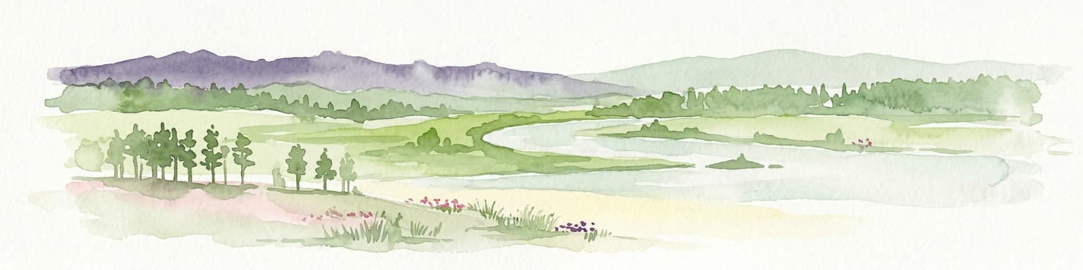
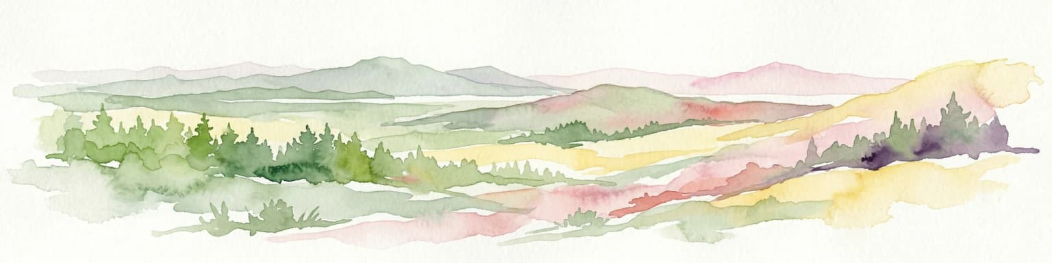
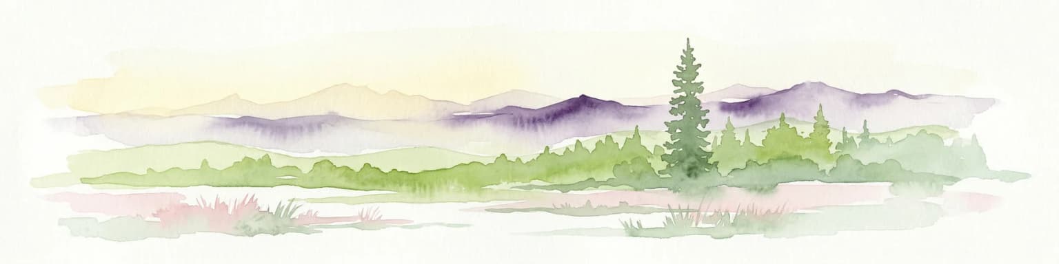
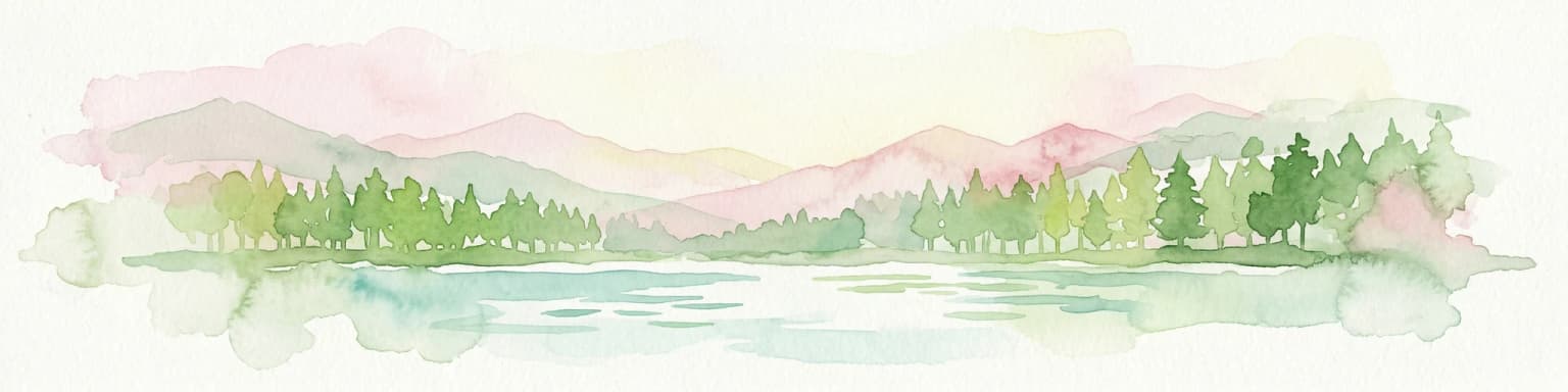
Yugyd Va National Park landscape and geographic character

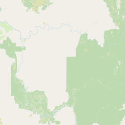
The landscape of Yugyd Va National Park encompasses a remarkable topographic range within a single protected area, from lowland river valleys to the highest peaks in the Ural Mountains. The central portion of the park contains the most elevated terrain, where the Urals reach their maximum heights in the Polar section: Mount Narodnaya rises to 1,894.5 meters, followed closely by Mount Karpinsky at 1,878 meters, the Bell Tower at 1,724 meters, and Manaraga at 1,662 meters. These granite and metamorphic peaks form a dramatic alpine landscape above the tree line, with rocky summits, steep-sided valleys, and permanent snow patches. Below the peaks, the foothills present a landscape of rounded hills, deep valleys, and forested slopes descending toward the western lowlands. The park's rivers—including the Kozhim, Bolshaya Synya, Synja, Vangir, and Kosya—have carved valleys that provide both hydrological corridors and visual breaks in the continuous forest cover. The entire territory lies within the Prepolar-Ural physical-geographical area, a region shaped by more than 200 million years of geological history that has produced the complex terrain now protected within the park.

Yugyd Va National Park ecosystems, habitats, and plant life

The ecological character of Yugyd Va National Park is defined by the transition from boreal taiga forest at lower elevations to alpine tundra at higher elevations, creating a vertical zonation of vegetation that mirrors the latitudinal progression from temperate forest to Arctic conditions. More than half of the park's vast territory is covered by taiga boreal forest, dominated by coniferous species adapted to the harsh continental climate of the Komi Republic. At higher elevations, where temperatures drop and growing seasons shorten, the forest gives way to tundra vegetation—dwarf shrubs, lichens, mosses, and alpine meadows that survive in the short summer months. The park also contains approximately 20 square kilometers of meadow ecosystems, including both alpine meadows on mountain slopes and riparian meadows along river valleys. This variety of habitats supports exceptional biodiversity, with the park serving as a critical refuge for species adapted to cold, northern conditions and providing connectivity across the Europe-Asia boundary.

Yugyd Va National Park wildlife and species highlights

The wildlife communities of Yugyd Va reflect the boreal and Arctic character of the northern Urals, with species assemblages that include both European and Asian elements. More than 180 bird species have been recorded within the park, including numerous species that breed in the tundra and taiga zones during the short summer season. The park's rivers and lakes support 20 fish species, providing important habitat for species adapted to cold, well-oxygenated waters. Among the mammals, the park supports populations of mountain hare, flying squirrel, reindeer, ermine, otter, moose, wolf, fox, wolverine, bear, pine marten, weasel, and Arctic fox. This assemblage represents a complete boreal predator-prey community, with species ranging from small furbearers to large ungulates and apex predators like wolves and bears. The presence of Arctic fox reflects the park's position at the southern edge of tundra ecosystems, while species like the flying squirrel demonstrate the presence of mature forest habitats. The diversity of mammals, combined with the richness of bird and fish communities, makes Yugyd Va one of the most ecologically significant protected areas in northern Europe.

Yugyd Va National Park conservation status and protection priorities

Yugyd Va National Park represents one of Europe's most important conservation achievements, protecting the largest intact boreal forest ecosystem on the continent. The park's inclusion in the UNESCO Virgin Komi Forests World Heritage Site, inscribed in 1995, recognizes its outstanding universal value as a representative example of the boreal forest ecosystem in its most natural and undisturbed condition. The protection of this vast territory ensures the survival of ecological processes that have operated largely without human interference, maintaining genetic diversity and evolutionary potential across numerous species. The park also serves critical hydrological functions, protecting the headwaters of rivers that flow to the Pechora and ultimately the Arctic Ocean, influencing water quality across a broad region. Its position spanning the Europe-Asia boundary adds significance for conservation of species with transcontinental distributions. Despite its protected status, the park faces ongoing challenges related to funding and management capacity, with visitor fees covering only a portion of operational costs.

Yugyd Va National Park cultural meaning and human context

The Yugyd Va National Park occupies territory within the traditional lands of the Komi people, an indigenous Uralic population whose historical presence in the region predates Russian settlement. The park's name itself derives from the Komi language, reflecting the deep connection between the landscape and the indigenous culture of the Komi Republic. While the park's primary designation focuses on ecological protection, the region has a long history of human interaction through traditional activities such as reindeer husbandry, hunting, and fishing. The Komi Republic remains home to substantial Komi-speaking populations, and the protected area exists within a broader cultural landscape where traditional land uses continue alongside modern conservation objectives. The establishment of the park represents a balance between recognition of the region's ecological significance and respect for its cultural heritage.

Top sights and standout views in Yugyd Va National Park

Yugyd Va protects Europe's largest expanse of protected taiga wilderness, a vast territory of forest, tundra, and mountain landscapes that remains largely undisturbed by human development. The park encompasses the highest peaks of the Ural Mountains, including Mount Narodnaya and Mount Karpinsky, which form dramatic alpine scenery above the tree line. Its inclusion in the Virgin Komi Forests World Heritage Site confirms its status as one of the most significant boreal protected areas globally. The park spans the boundary between Europe and Asia, adding geographic and cultural significance to its ecological value. Protected species include complete communities of boreal mammals from wolverine and wolf to moose and reindeer, alongside more than 180 bird species. The remote character of the park ensures continued ecological integrity despite relatively low visitation levels.

Best time to visit Yugyd Va National Park

The most favorable season for visiting Yugyd Va National Park occurs during the brief Arctic summer, typically from June through August, when temperatures are mildest and the landscape is most accessible for hiking and outdoor activities. During this period, the tundra blooms with wildflowers, wildlife is most active, and the midnight sun provides extended daylight for exploration. Winter visitation is possible for Nordic skiing and winter wilderness experiences, though the extreme cold and limited daylight present significant challenges. The shoulder seasons of spring and autumn offer opportunities to witness seasonal transitions but come with variable weather conditions and reduced services. The park's remote location requires careful planning regardless of season, with access typically via the town of Pechora or through specialized tour operators familiar with the region.

Park location guide

Geography guide, regional context, and park location map for Yugyd Va National Park

Yugyd Va National Park park geography, regions, and map view in Russia
Understand where Yugyd Va National Park sits in Russia through a broader geographic reading of the surrounding landscape, nearby location context, and its mapped position within the national park landscape.

How Yugyd Va National Park fits into Russia

Russia is a transcontinental nation spanning eleven time zones, bordered by fourteen countries. It is the world's largest country by area, covering 17,098,246 km². Moscow is the capital and largest city, while Saint Petersburg is the second-largest and a major cultural centre.

Wider geography shaping Yugyd Va National Park in Russia

Russia spans Eastern Europe and North Asia, covering 17,098,246 km². It shares land borders with fourteen countries, more than any other nation, and spans eleven time zones. The landscape includes vast plains, mountain ranges such as the Urals and Caucasus, and extensive coastlines along the Arctic Ocean, Pacific Ocean, Baltic Sea, Black Sea, and Caspian Sea.

Map view of Yugyd Va National Park

Use this park location map to pinpoint Yugyd Va National Park in Russia, understand its exact geographic position, and read its mapped placement within the surrounding landscape more clearly.

Pigeon | © OpenStreetMap contributors

Location context for Yugyd Va National Park

Komi Republic
Park atlas

Compare surrounding protected landscapes, trace the regional spread of boreal ecosystems, and explore more protected areas in Russia.

Discover Other National Parks and Protected Areas Near Yugyd Va, Ural Mountains
After exploring Yugyd Va National Park, continue your geographic journey by discovering other significant protected areas situated across the Northern Ural Mountains and the broader Russian wilderness. Compare varied boreal forests, alpine tundras, and river systems to understand the regional spread of conservation landscapes and their unique ecological features.
National parkKomi Republic

Koygorodsky National Park: Protected Landscape Exploration and Regional Geography

Mapped boundaries and natural landscape context.

Gain a structured understanding of Koygorodsky National Park, a designated national park within the Komi Republic. This entry facilitates exploration of its protected landscape, mapped geographic features, and its role within the broader regional atlas. Focus on the park's identity as a distinct protected area and its contribution to understanding Russian natural geography through detailed, map-centric data.

Area
567 km²
Established
2019
IUCN
II
National parkSverdlovsk Oblast

Pripyshminskiye Bory National Park: Explore its Protected Landscape and Geographic Setting

National Park with mapped boundaries in Sverdlovsk Oblast.

Pripyshminskiye Bory National Park stands as a notable protected area within the vast geography of Sverdlovsk Oblast, Russia. This page serves as a dedicated atlas entry for the park, detailing its protected landscape identity and its placement within the broader regional context. Users can investigate the park's mapped boundaries and understand its significance as a distinct national park, facilitating structured geographic discovery.

Area
490 km²
Established
1993
IUCN
II
Relief
Lowland
National parkUdmurt Republic

Nechkinsky National Park: Protected River Valley Landscape and Archaeological Heritage

Explore Udmurt Republic's National Park Geography and Terrain

Nechkinsky National Park, situated in the Udmurt Republic, is a vital protected area distinguished by its prominent river valley landscape. The park's geography features a stark contrast between steep right-bank slopes and a wide, flat left-bank floodplain, bordered by the Votkinsk reservoir. This unique terrain supports diverse ecosystems and preserves thousands of years of archaeological heritage, making it a focal point for understanding the region's natural and cultural map.

Area
208 km²
Established
1997
IUCN
II
National parkTatarstan

Nizhnyaya Kama National Park: Protected Area and Geographic Context in Tatarstan

Discover mapped boundaries and regional landscape insights.

Nizhnyaya Kama National Park serves as a distinct protected area within the republic of Tatarstan, Russia. This detail page provides essential geographic context and map-oriented information, focusing on the park's boundaries and its contribution to the regional landscape. It is designed for users seeking structured data on protected lands, offering a factual entry point for understanding this Russian national park within a broader atlas framework.

Area
265.87 km²
Established
1991
IUCN
II
Relief
Lowland
National parkChelyabinsk Oblast

Zyuratkul National Park: Protected Landscape Atlas and Regional Geography

Explore national park boundaries and terrain in Chelyabinsk Oblast.

Zyuratkul National Park represents a distinct protected landscape within the Chelyabinsk Oblast of Russia. This page offers an atlas-centric view, detailing its geographic position and significance as a national park. Users can explore the mapped context of Zyuratkul National Park, understanding its terrain and its contribution to the protected areas landscape of the Southern Urals region.

Area
882.49 km²
Established
1993
IUCN
II
Relief
Mountain
Watercolor illustration of a mountain range with purple peaks, green hills, a single tall pine tree, and pinkish foreground vegetation
National parkChelyabinsk Oblast

Zigalga National Park: National Park within Chelyabinsk Oblast's Southern Urals Geography

Mapped protected landscape and regional geographic context for atlas discovery.

Zigalga National Park offers a specific focus for exploring protected natural areas in Russia's Chelyabinsk Oblast. This page provides essential geographic data, detailing the park's mapped boundaries and its position within the Southern Urals region. Understand the park's unique protected landscape identity and its contribution to the atlas of Russian natural areas, fostering detailed map-based exploration and regional geographic understanding.

Area
457 km²
Established
2019
IUCN
II
National parkBashkortostan

Bashkiriya National Park: Karst Geography and Protected Ural Forest Landscape

Explore Ural Mountains national park mapped boundaries and terrain.

Delve into the geography and protected landscape of Bashkiriya National Park, a significant national park within Russia's Bashkortostan region. This detailed page highlights its striking karst topography, extensive cave systems, and over 92 percent forest cover across the southern Ural Mountains. Understand the park's role as a conservation buffer zone and its unique position at the Europe-Asia biogeographical boundary through structured geographic data and mapped context.

Area
920 km²
Established
1986
IUCN
II
Relief
Mixed relief
National park

Kenozersky National Park: Northern Russia's Protected Glacial Landscape and Historic Architecture

Explore mapped terrain, lake systems, and cultural geography.

Kenozersky National Park is a significant protected area in Arkhangelsk Oblast, Russia, notable for its preservation of a distinctive northern landscape. Defined by glacial topography, the park features rolling hills, numerous lakes and wetlands, and extensive boreal forests. Beyond its natural geography, Kenozersky National Park also safeguards a rich cultural heritage, particularly the surviving historic wooden churches and chapels that are integral to its identity. This national park offers a unique opportunity for structured discovery of protected lands and their associated regional context.

Common questions about visiting, size, designation, and location context for Yugyd Va National Park

Yugyd Va National Park FAQs for park facts, access, geography, and protected area context
Find quick answers about Yugyd Va National Park, including protected-area facts, park geography, trail and visitor context, and how the park fits into its surrounding country and regional landscape.
MoriAtlas Explorer

Continue Your Protected Areas Search Across the Global Atlas

Deepen your exploration by continuing the structured search for national parks and protected areas worldwide. Utilize the comprehensive filtering capabilities to compare different conservation landscapes and refine your understanding of global park geography. Discover more about the distribution and characteristics of protected natural areas.

Global natural geography