Mori Atlas logo
National parkNizhnyaya Kama National Park

Explore the mapped boundaries and regional context of this national park in Eastern Europe.

Nizhnyaya Kama National Park: A Protected Landscape within the Geography of Tatarstan

Nizhnyaya Kama National Park represents a significant protected area located in the republic of Tatarstan, Russia. This national park offers users a focused point for atlas-based discovery, highlighting its specific protected landscape boundaries within the broader geography of Eastern Europe. Understanding Nizhnyaya Kama National Park provides valuable insight into the region's natural terrain and its place within a mapped system of conservation lands, encouraging deeper geographic exploration.

coniferous forestsKama RiverTatarstanboreal ecosystemsriver floodplainspine forests
Illustrated scene with waterfall cascading from cliffs, surrounded by coniferous trees, a winding river, and wildflowers

Nizhnyaya Kama National Park

National park

Park overview

Structured park overview, official facts, and landscape profile for Nizhnyaya Kama National Park

Nizhnyaya Kama National Park park facts, protected area profile, and essential visitor context
Review the core facts for Nizhnyaya Kama National Park, including designation, size, terrain, visitor scale, habitats, and operating context in one park-focused overview.

About Nizhnyaya Kama National Park

Nizhnyaya Kama National Park occupies a strategic position in central Russia's Tatarstan republic, protecting vital coniferous forest ecosystems along one of the Volga's major tributaries. The park's establishment in 1991 reflected growing recognition of the need to preserve the region's forest resources, particularly the extensive pine-dominated woodlands that characterize the Kama River valley. The park comprises three disconnected forest clusters, each offering distinct ecological and landscape character. The areas near Yelabuga feature mature pine forests on the right bank of the Kama, where the terrain is higher and cut by ravines, while the Bolshoy Bor cluster on the left bank encompasses a peninsula with more open, meadow-dominated landscapes. The presence of the Nizhnekamsk Reservoir has shaped the hydrology and ecological character of portions of the park, creating wetland habitats and influencing forest composition in riparian zones. The park serves as an important green space between two major urban centers, providing both ecological benefits and recreational opportunities for local communities.

Quick facts and research context for Nizhnyaya Kama National Park

The park is situated in Tukayevsky and Yelabuzhsky Districts of Tatarstan, covering 265.87 square kilometers along the Kama River. The river within the park is dammed to form the Nizhnekamsk Reservoir, while downstream sections meander naturally through floodplain meadows. Two forest clusters, Maly Bor and Tanayavskaya Dacha, lie near Yelabuga on the right bank, while the third cluster, Bolshoy Bor, occupies a peninsula on the left bank near Naberezhnye Chelny. The park was established April 20, 1991 and is managed by Russia's Federal Forestry Service, designated as an IUCN Category II protected area.

Park context

Deeper park guide and search-rich context for Nizhnyaya Kama National Park

Nizhnyaya Kama National Park history, landscape, wildlife, and travel context
Explore Nizhnyaya Kama National Park through its history, landscape character, ecosystems, wildlife, conservation priorities, cultural context, and seasonal travel timing in a structured park guide built for atlas discovery and search intent.

Why Nizhnyaya Kama National Park stands out

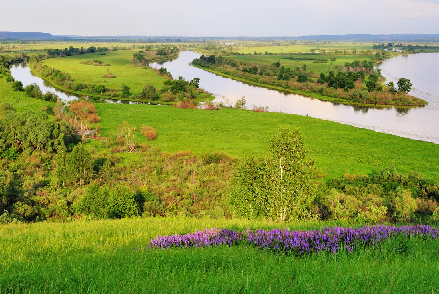
Nizhnyaya Kama is distinguished by its extensive coniferous forests, with pine comprising 65.4% of the forested area, creating one of the more significant pine forest protections in the Volga region. The park's location along the Kama River provides diverse habitats including riverbanks, floodplains, and wetlands that support remarkable biodiversity. The three forest clusters offer different landscape characters: the areas near Yelabuga feature mature pine forests on the elevated right bank with ravines, while Bolshoy Bor encompasses a peninsula landscape with meandering river channels and adjacent meadows on the flatter left bank.

Wide river flowing through green meadows and forests with purple wildflowers in the foreground
River winding through lush green meadows and forests in Nizhnyaya Kama National Park

Nizhnyaya Kama National Park history and protected-area timeline

Nizhnyaya Kama National Park was officially established on April 20, 1991, as part of Russia's expanding network of protected areas during the late Soviet and post-Soviet periods. The park was created specifically to protect the coniferous forests that line the banks of the Kama River in Tatarstan, representing a commitment to preserving boreal forest ecosystems in this part of central Russia. Since its establishment, the park has been managed by Russia's Federal Forestry Service, which oversees its conservation programs, visitor management, and ecological monitoring activities. The creation of this protected area reflected both ecological necessity and the growing environmental consciousness in the region during this period of Russian history.

Nizhnyaya Kama National Park landscape and geographic character

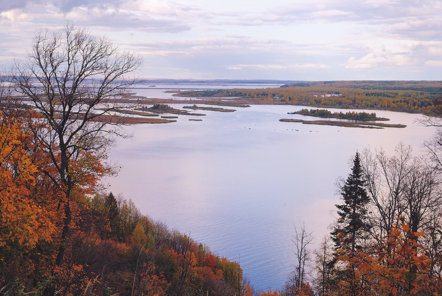
The physical landscape of Nizhnyaya Kama National Park is defined by its position along the Kama River and the contrasting topography of its two banks. The right bank features elevated terrain with numerous ravines, creating a more dissected landscape with steep slopes and sheltered valleys. Here, forests extend from the riverbank up the slopes and into the interior, with mature pine stands dominating the upland areas. The left bank presents a flatter, more open character with extensive meadows that become particularly expansive during spring flooding. The park encompasses sections of the Nizhnekamsk Reservoir, where the river has been dammed, as well as downstream reaches where the Kama meanders naturally through its floodplain. The three forest clusters, though isolated from one another, share the common characteristic of being dominated by coniferous species, particularly pine.

Wide view of the Kama River with autumn-colored trees along the shore and several small islands in the water
Autumn view of Kama River with forested banks and islands in Nizhnyaya Kama National Park

Nizhnyaya Kama National Park ecosystems, habitats, and plant life

The ecological character of Nizhnyaya Kama is defined by its boreal forest ecosystems, with pine forests forming the predominant vegetation cover across approximately 65% of the forested area. Birch woodland comprises about 19% of the forest, with aspen making up roughly 6%, creating a mosaic of coniferous and deciduous forest types. Some forest stands in the park are the result of deliberate replanting efforts, while others represent natural succession. The forest clusters occur both along the reservoir shores and in more isolated interior positions, creating variation in moisture conditions and species composition. The riverine and wetland habitats associated with the Kama and its floodplain add ecological diversity to the forest-dominated landscape, supporting different plant communities than the upland pine forests.

Nizhnyaya Kama National Park wildlife and species highlights

The mammal community of Nizhnyaya Kama includes several species typical of Eurasian boreal forests, with moose and roe deer being common large herbivores throughout the park. Wild boar are present across the forest clusters, while lynx represents the primary large predator species. Smaller mammals include badgers, raccoon dogs, and Eurasian beavers, the latter reflecting the importance of river and wetland habitats. Several species of bats inhabit the park, including some rare species that roost in the older forest stands. The bird fauna is particularly diverse, with over 190 species recorded, indicating the importance of the riverine and forest habitats for avian biodiversity. The reptile and amphibian communities include 6 and 10 species respectively, while at least 16 species of fish inhabit the park's waters, reflecting the aquatic productivity of the Kama River system.

Nizhnyaya Kama National Park conservation status and protection priorities

As an IUCN Category II protected area, Nizhnyaya Kama National Park serves important conservation functions within Russia's protected area network. The park was established to preserve the coniferous forests of the Kama River valley, representing a commitment to maintaining boreal forest ecosystems in this part of central Russia. The protection status helps safeguard habitat for species including lynx, various bat species, and the diverse bird community that relies on the forest-river mosaic. The presence of the Nizhnekamsk Reservoir adds another conservation dimension, protecting riverine and wetland habitats that support fish populations and waterfowl. The Federal Forestry Service manages the park with objectives balancing forest preservation, biodiversity protection, and sustainable visitor use.

Nizhnyaya Kama National Park cultural meaning and human context

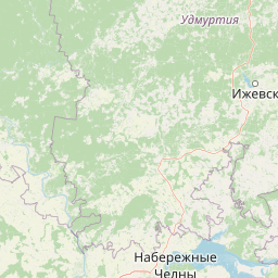
Nizhnyaya Kama National Park is situated within Tatarstan, a republic within the Russian Federation with a distinct Tatar cultural heritage. The park's name appears in both Russian and Tatar languages, with 'Нижняя Кама' in Russian and 'Түбəн Кама милли паркы' in Tatar, both translating as 'Lower Kama.' The region has a long history of human settlement, with nearby Yelabuga being a historic town in Tatarstan. The park lies between the urban centers of Yelabuga and Naberezhnye Chelny, one of Russia's largest cities, placing the protected area within a populated region where conservation of green spaces has particular value for local communities.

Top sights and standout views in Nizhnyaya Kama National Park

The park's primary distinction lies in its extensive pine-dominated forests along a major Russian river, offering a combination of boreal woodland and riverine ecosystems within a populated region. The three forest clusters provide varied experiences: the Maly Bor and Tanayavskaya Dacha areas near Yelabuga offer accessible forest recreation, while Bolshoy Bor on the peninsula provides more remote landscape character. The presence of lynx, beaver, and over 190 bird species, combined with the river's cultural significance in Tatarstan, creates a protected area with both ecological and cultural value.

Best time to visit Nizhnyaya Kama National Park

The park can be visited throughout the year, with each season offering distinct experiences. Summer brings warm conditions ideal for forest hiking and wildlife observation, particularly for birdwatching when migratory species are present and active. Autumn offers colorful forest scenery as the birch and aspen change color, creating visual contrast with the evergreen pines. Winter provides opportunities for experiencing the boreal forest in snow-covered conditions, though access may be more limited in some areas. Spring brings flooding to the river meadows and renewed wildlife activity as species emerge from winter dormancy.

Park location guide

Geography guide, regional context, and park location map for Nizhnyaya Kama National Park

Nizhnyaya Kama National Park park geography, regions, and map view in Russia
Understand where Nizhnyaya Kama National Park sits in Russia through a broader geographic reading of the surrounding landscape, nearby location context, and its mapped position within the national park landscape.

How Nizhnyaya Kama National Park fits into Russia

Russia is a transcontinental nation spanning eleven time zones, bordered by fourteen countries. It is the world's largest country by area, covering 17,098,246 km². Moscow is the capital and largest city, while Saint Petersburg is the second-largest and a major cultural centre.

Wider geography shaping Nizhnyaya Kama National Park in Russia

Russia spans Eastern Europe and North Asia, covering 17,098,246 km². It shares land borders with fourteen countries, more than any other nation, and spans eleven time zones. The landscape includes vast plains, mountain ranges such as the Urals and Caucasus, and extensive coastlines along the Arctic Ocean, Pacific Ocean, Baltic Sea, Black Sea, and Caspian Sea.

Map view of Nizhnyaya Kama National Park

Use this park location map to pinpoint Nizhnyaya Kama National Park in Russia, understand its exact geographic position, and read its mapped placement within the surrounding landscape more clearly.

Pigeon | © OpenStreetMap contributors

Location context for Nizhnyaya Kama National Park

Tatarstan

Visualizing the extensive coniferous forests, Kama River ecosystems, and diverse protected habitats within Tatarstan

Nizhnyaya Kama National Park Photos: Explore Landscapes, Scenery, and Protected Forest Environments
Visually explore the diverse landscapes and unique protected-area character of Nizhnyaya Kama National Park through a comprehensive image gallery. Understand its expansive coniferous forests, the contrasting topography along the Kama River, and the vital riverine and wetland habitats preserved within this significant Russian boreal ecosystem.

Wide river flowing through green meadows and forests with purple wildflowers in the foreground

Open grassy field extending toward a dense forest under a clear blue sky

Wide view of the Kama River with autumn-colored trees along the shore and several small islands in the water

Park atlas

Connect protected landscapes, comparing riverine forests and boreal ecosystems across Tatarstan, Russia.

Explore Nearby National Parks and Protected Areas, Expanding Beyond Nizhnyaya Kama National Park
Explore other national parks and protected areas geographically near Nizhnyaya Kama National Park, including significant forest ecosystems and riverine landscapes in central Russia. This expanded view helps compare conservation approaches, diverse terrain, and regional protected-area patterns beyond a single park's boundaries.
Watercolor illustration of a winding river through a valley with rolling hills and sparse vegetation under a soft sky
National parkUdmurt Republic

Nechkinsky National Park: Protected River Valley Landscape and Archaeological Heritage

Explore Udmurt Republic's National Park Geography and Terrain

Nechkinsky National Park, situated in the Udmurt Republic, is a vital protected area distinguished by its prominent river valley landscape. The park's geography features a stark contrast between steep right-bank slopes and a wide, flat left-bank floodplain, bordered by the Votkinsk reservoir. This unique terrain supports diverse ecosystems and preserves thousands of years of archaeological heritage, making it a focal point for understanding the region's natural and cultural map.

Area
208 km²
Established
1997
IUCN
II
Relief
Mixed relief
Watercolor illustration showing a lake, forested hills, and mountains in the background
National parkRussia

Mariy Chodra National Park: A Detailed Atlas Entry for Russia's Protected Landscapes

Explore the mapped terrain and protected boundaries of this Russian national park

Mariy Chodra National Park stands as a distinct protected area within Russia's vast geographic expanse. This detailed entry provides users with a comprehensive view of the park's mapped landscape, its protected boundaries, and its role within the broader national atlas. Understand the specific terrain and regional context that characterize this significant natural territory, facilitating focused geographic discovery.

IUCN
II
National park

Buzuluksky Bor National Park: An Atlas of Russia's Largest Isolated Pine Forest Ecosystem

Explore mapped boundaries and regional geographic context.

Delve into the protected landscape of Buzuluksky Bor National Park, a significant national park in European Russia. This page provides detailed atlas-level insight into its unique formation as the world's largest isolated pine forest, situated atop deep sandy plains and surrounded by steppe. Understand its geographic setting, the ancient dune geology, and the ecological significance of this remarkable natural reserve.

Area
1,060 km²
Established
2007
IUCN
II
Relief
Lowland
Watercolor painting of a meadow with wildflowers and rolling hills under a soft sky
National park

Sengileevskie Mountains National Park: National Park Protected Area and Mapped Landscape Context

Explore protected boundaries and regional geography.

Uncover the geographic specifics of Sengileevskie Mountains National Park, a designated national park. This entry provides detailed insights into its protected area status, mapped landscape features, and regional context, serving as a foundational element for atlas-based exploration and understanding of Russia's conservation areas.

IUCN
II
Watercolor illustration of a river flowing through a valley with green hills and scattered trees in the background
National parkSamara Oblast

Samarskaya Luka National Park: National Park Geographic Discovery in Samara Oblast

Explore mapped protected landscapes and regional terrain.

Samarskaya Luka National Park offers a focused lens for exploring protected natural areas, specifically detailing the geography and mapped boundaries of this Russian national park. Users can leverage this atlas-centric entry point to understand the park's landscape context within Samara Oblast. MoriAtlas provides a structured approach to discovering such protected lands, emphasizing their placement within regional geography and offering a rich foundation for mapped terrain exploration.

Area
1,340 km²
Established
1984
IUCN
II
Relief
Mixed relief
Protected area

Chuvash Forest Protected Area: Explore Russian Volga Region's Mixed Woodland Ecosystems

Discover mapped boundaries and regional landscape context.

Chuvash Forest stands as a protected area defined by its mixed woodland ecosystems within Russia's Volga region. This entry provides detailed geographic context, highlighting the park's mapped boundaries and its role as a distinct natural landscape. It serves as an essential point for understanding the environmental character and regional significance of protected lands in Eastern Europe, aiding structured atlas exploration of Russia's natural geography.

IUCN
II
Climate
Temperate
Access
Access unknown
Scope
Terrestrial
Watercolor painting showing a scenic landscape with mountains, a river, and trees
National parkBashkortostan

Bashkiriya National Park: Karst Geography and Protected Ural Forest Landscape

Explore Ural Mountains national park mapped boundaries and terrain.

Delve into the geography and protected landscape of Bashkiriya National Park, a significant national park within Russia's Bashkortostan region. This detailed page highlights its striking karst topography, extensive cave systems, and over 92 percent forest cover across the southern Ural Mountains. Understand the park's role as a conservation buffer zone and its unique position at the Europe-Asia biogeographical boundary through structured geographic data and mapped context.

Area
920 km²
Established
1986
IUCN
II
Relief
Mixed relief
Watercolor illustration of a mountain range with purple peaks, green hills, a single tall pine tree, and pinkish foreground vegetation
National parkChelyabinsk Oblast

Zigalga National Park: National Park within Chelyabinsk Oblast's Southern Urals Geography

Mapped protected landscape and regional geographic context for atlas discovery.

Zigalga National Park offers a specific focus for exploring protected natural areas in Russia's Chelyabinsk Oblast. This page provides essential geographic data, detailing the park's mapped boundaries and its position within the Southern Urals region. Understand the park's unique protected landscape identity and its contribution to the atlas of Russian natural areas, fostering detailed map-based exploration and regional geographic understanding.

Area
457 km²
Established
2019
IUCN
II
Relief
Mountain

Common questions about visiting, size, designation, and location context for Nizhnyaya Kama National Park

Nizhnyaya Kama National Park FAQs for park facts, access, geography, and protected area context
Find quick answers about Nizhnyaya Kama National Park, including protected-area facts, park geography, trail and visitor context, and how the park fits into its surrounding country and regional landscape.
MoriAtlas Explorer

Continue Your Protected Areas Search Across the Global Atlas

Deepen your exploration by continuing the structured search for national parks and protected areas worldwide. Utilize the comprehensive filtering capabilities to compare different conservation landscapes and refine your understanding of global park geography. Discover more about the distribution and characteristics of protected natural areas.

Global natural geography