Mori Atlas logo
National parkSamarskaya Luka National Park

Discover the geographic boundaries and natural terrain of this Russian national park.

Samarskaya Luka National Park: Mapped Protected Landscape in Samara Oblast

Samarskaya Luka National Park represents a significant protected landscape within Russia's Samara Oblast, offering a unique focus for atlas-based geographic exploration. This dedicated national park page provides detailed context on its mapped boundaries and natural terrain, allowing users to understand its place within the regional geography of the Volga area. Delve into the atlas view of this protected area to appreciate its distinct landscape characteristics and its role within the structured discovery framework of MoriAtlas.

National ParkKarst LandscapeForest-SteppeVolga RiverZhiguli MountainsEastern Europe
Stylized illustration of a waterfall surrounded by cliffs and trees with a calm lake.

Samarskaya Luka National Park

National park

Park overview

Structured park overview, official facts, and landscape profile for Samarskaya Luka National Park

Samarskaya Luka National Park park facts, protected area profile, and essential visitor context
Review the core facts for Samarskaya Luka National Park, including designation, size, terrain, visitor scale, habitats, and operating context in one park-focused overview.

About Samarskaya Luka National Park

Samarskaya Luka National Park represents one of the most ecologically significant protected areas in the Middle Volga region, encompassing a remarkable diversity of landscapes within a relatively compact peninsula formed by the Volga River's great bend. The park's territory spans the transition between two major geological regions, combining the elevated karst terrain of the Zhiguli Mountains with extensive floodplain areas along the Volga and the surrounding forest-steppe environment. This geographical position creates a unique ecological mosaic where habitats typically found hundreds of kilometers apart exist in close association. The park serves as a critical component of the Middle Volga Integrated Biosphere Reserve, functioning as both a conservation area and a scientific research site. The human history of the Samara Bend extends to ancient times, with archaeological evidence of continuous habitation and cultural development spanning many centuries. This deep historical layer has contributed to the region's significance across multiple epochs, leaving behind a rich heritage of settlements, burial sites, and cultural landmarks that the park now helps preserve.

Quick facts and research context for Samarskaya Luka National Park

Samarskaya Luka National Park covers 134,000 hectares in Samara Oblast, Russia, protecting most of the Samara Bend peninsula created by the Volga River's 180-degree turn around the Zhiguli Mountains. The park is located near the cities of Samara and Zhigulyovsk, with its northern shoreline along the Kuybyshev Reservoir and southern border along the Saratov Reservoir. The terrain consists primarily of karst limestone formations averaging 300 meters in elevation, with 18% in mountainous Zhiguli terrain, 8% in Volga floodplains, and the remainder in forest and forest-steppe habitats. The park supports over 1,500 vascular plant species, with deciduous trees comprising 97% of the forest cover. Established in 1984, the park is categorized as IUCN II and is administered by Russia's Ministry of Natural Resources and Environment.

Park context

Deeper park guide and search-rich context for Samarskaya Luka National Park

Samarskaya Luka National Park history, landscape, wildlife, and travel context
Explore Samarskaya Luka National Park through its history, landscape character, ecosystems, wildlife, conservation priorities, cultural context, and seasonal travel timing in a structured park guide built for atlas discovery and search intent.

Why Samarskaya Luka National Park stands out

Samarskaya Luka is best known for its extraordinary ecological blending, where northern and southern species occupy remarkably close quarters due to the park's position at the transition between the East European forest steppe and distinct habitat zones. The park's karst landscape is distinctive, featuring the limestone promontories of the Zhiguli Mountains and over 500 natural craters in its eastern sector. The Volga River's dramatic 200-kilometer detour around the mountains creates a peninsula of exceptional topographical and ecological diversity. The area also holds cultural importance as the region where painter Ilya Repin created his masterpiece Barge Haulers on the Volga, and the park preserves multiple archaeological and historical sites including burial mounds and ancient settlements.

Cliff with a dirt path winding through green vegetation, overlooking a body of water
Devja Hill in Samarskaya Luka National Park, showing a trail leading to a cliff overlooking the Volga River

Samarskaya Luka National Park history and protected-area timeline

Samarskaya Luka National Park was established in 1984 as a protected area recognizing both the exceptional ecological diversity and the profound cultural significance of the Samara Bend region. The creation of the park reflected growing awareness of the need to preserve the unique karst landscapes, forest-steppe ecosystems, and archaeological heritage found within the Volga's dramatic peninsula. Prior to national park status, the area had long been recognized for its natural and cultural value, with the Zhiguli Mountains serving as an important reference point in Russian geography and history. The park's establishment coincided with broader conservation efforts in the Soviet Union and later Russia, positioning the Samara Bend within the country's network of protected areas. The park is now managed by Russia's Ministry of Natural Resources and Environment and operates as part of the larger Middle Volga Integrated Biosphere Reserve system, coordinating conservation efforts across the region's ecological zones.

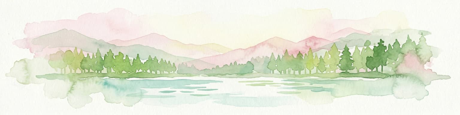
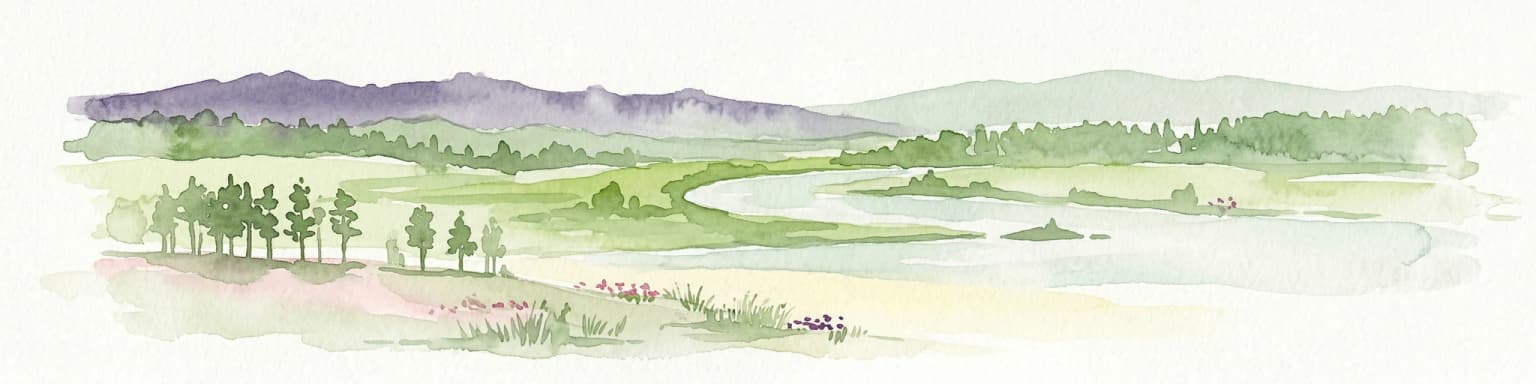
Samarskaya Luka National Park landscape and geographic character

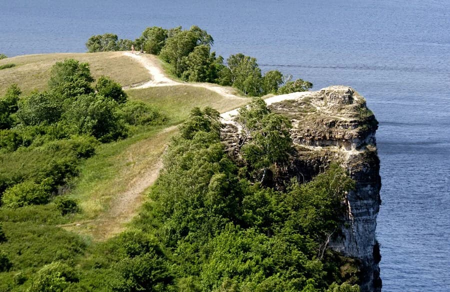
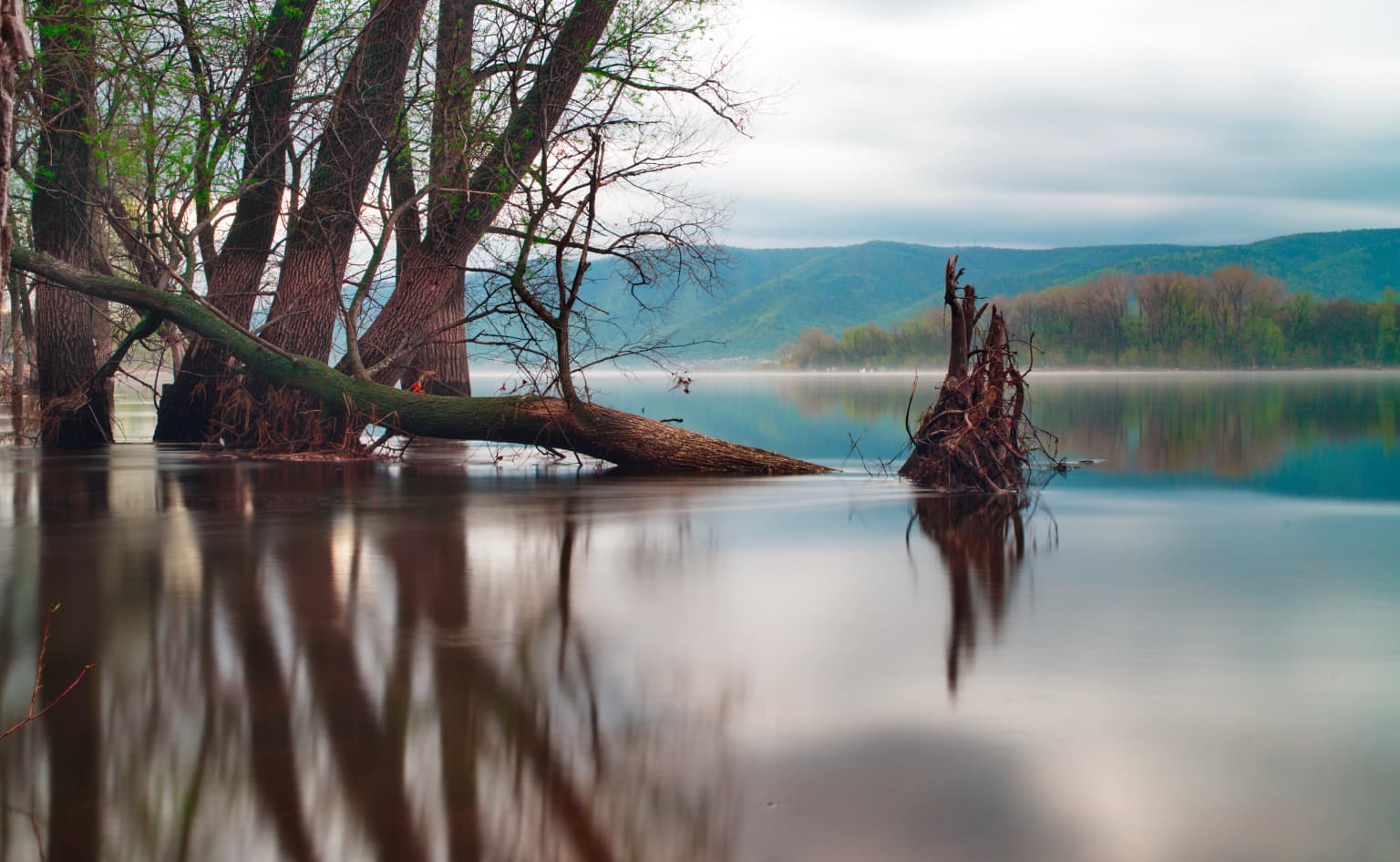
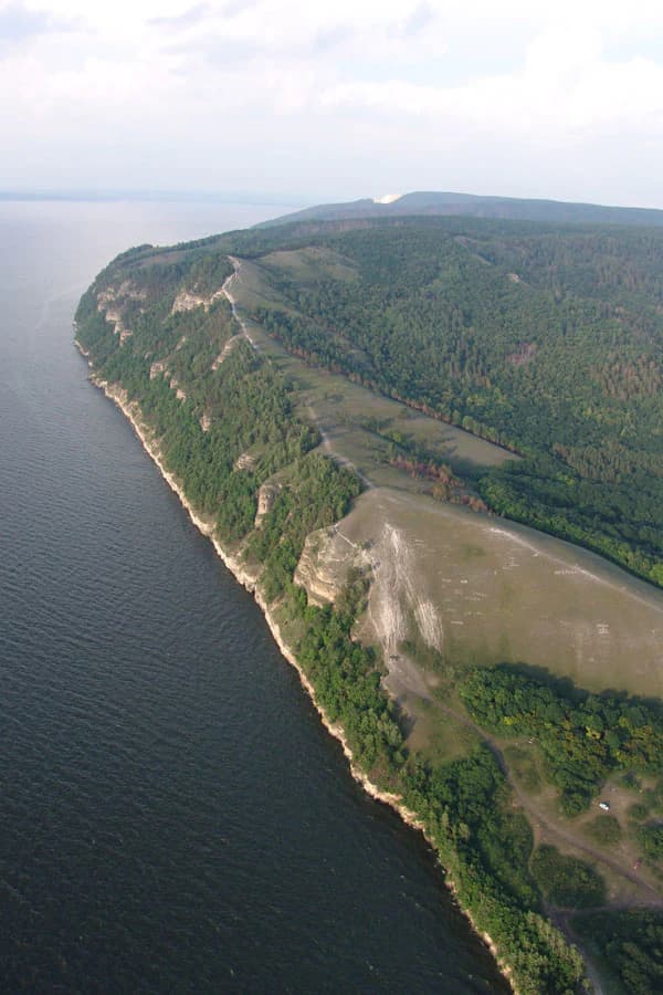
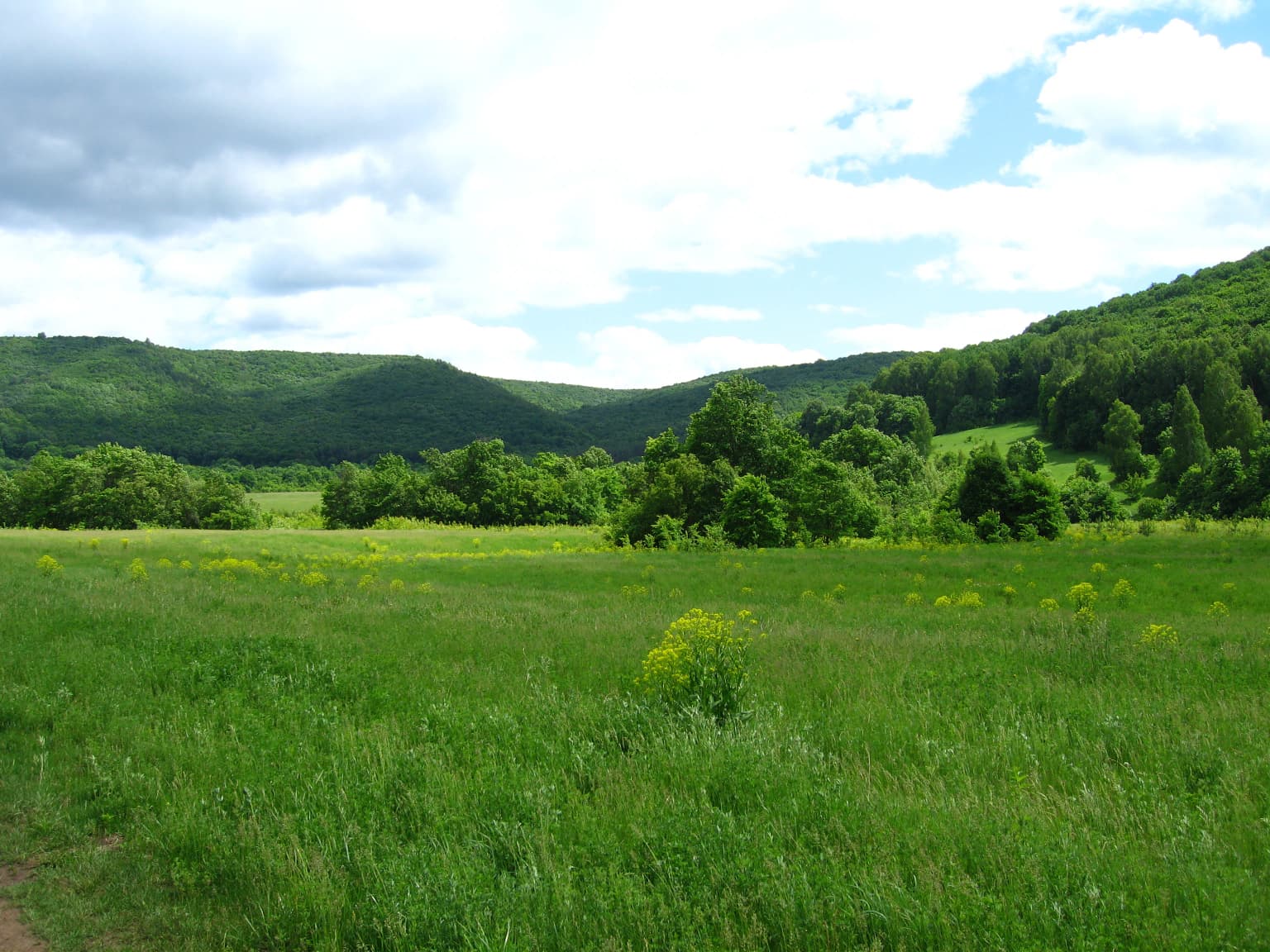
The Samarskaya Luka landscape is defined by the Volga River's sweeping 200-kilometer bend around the Zhiguli Mountains, creating a distinctive peninsula environment where water surrounds the land on three sides. The Zhiguli Mountains themselves represent a karst limestone formation rising approximately 300 meters above the surrounding terrain, their rocky outcrops and ridgelines providing the most prominent topographical features within the park. About 18% of the protected area comprises the mountainous Zhiguli terrain in the north, while roughly 8% consists of the Volga floodplains along the southern reaches. The remaining landscape consists of forested hills and forest-steppe zones. The eastern portion of the park contains a remarkable concentration of karst craters, with over 500 sinkholes ranging from one to one hundred meters in width and one to twenty meters in depth, formed through the weathering of limestone bedrock. The park's boundaries are largely determined by the reservoirs that flank it, with the Kuybyshev Reservoir forming the northern shore and the Saratov Reservoir defining the southern edge.

Submerged trees and fallen logs in calm river water with mountainous background
Freshet on Volga River within Samarskaya Luka National Park showing submerged trees and calm water reflections

Samarskaya Luka National Park ecosystems, habitats, and plant life

The ecological character of Samarskaya Luka reflects its position within the East European forest steppe ecoregion, a transitional zone that spans the middle of Eastern Europe and creates a mosaic of forest, steppe, and riverine wetland habitats. The park's plant communities encompass Eastern European steppe, steppe pine forests, Eastern European deciduous forests, grasslands, and floodplain ecosystems, supporting exceptional biodiversity for the region. Over 1,500 species of vascular plants have been recorded within the park's boundaries. The forest composition is overwhelmingly deciduous at 97%, with linden, oak, and birch serving as the dominant species. The remaining 3% consists of sparse Scots pine stands confined to higher slopes and limestone outcrops. The climate is classified as humid continental with warm summers, featuring average temperatures of -10°C in January and +20°C in July, with an annual precipitation of 556 millimeters and a frost-free period of 156 days.

Aerial view of a river with a forested peninsula and a flat-topped hill identified as Molodetsky Kurgan in Samarskaya Luka National Park
Aerial view of Molodetsky Kurgan along the Volga River in Samarskaya Luka National Park

Samarskaya Luka National Park wildlife and species highlights

The vertebrate fauna of Samarskaya Luka exhibits a remarkable characteristic: approximately 30% of species exist at the edge of their historical ranges, creating an unusual ecological assemblage where northern and southern species occur in close proximity. This phenomenon results in the presence of northern taiga species such as the Ural owl alongside southern steppe species like the European bee-eater within the same general area. This ecological blending reflects the park's position at the biogeographical crossroads and contributes to its significance as a location for studying species distribution patterns and ecological interactions. The diverse habitats within the park, ranging from forested uplands to floodplain wetlands and steppe grasslands, support a corresponding variety of wildlife adapted to these different environmental conditions.

Grassy field with yellow wildflowers, scattered trees, and rolling hills under a partly cloudy sky
Northeast sector of Samarskaya Luka National Park with grassy fields and hills

Samarskaya Luka National Park conservation status and protection priorities

Samarskaya Luka National Park holds significance within Russia's protected area network as an IUCN Category II national park, designating it as a protected area where conservation of ecosystems takes priority while allowing for sustainable visitation and environmental education. The park forms an integral part of the Middle Volga Integrated Biosphere Reserve, a coordination framework that brings together multiple protected areas and conservation initiatives across the broader Volga region. The protection of this landscape preserves both the karst geological features unique to the Zhiguli Mountains and the forest-steppe ecosystems that have been largely converted to agricultural use throughout surrounding areas. The conservation value is enhanced by the presence of the adjacent Zhiguli Nature Reserve, which provides additional strict protection for core areas of biodiversity.

Samarskaya Luka National Park cultural meaning and human context

The Samara Bend has been a center of human activity since ancient times, with the region's strategic position along the Volga River supporting continuous habitation and cultural development across many historical periods. Archaeological sites within the park include burial mounds and ancient settlements that reflect the area's importance to various peoples throughout history. The park contains six museums dedicated to the cultural and natural features of the Samara Bend and its history. Of particular note is the house of painter Ilya Repin in the village of Shiryaevo, located on the right bank of the Volga within the park's vicinity. Repin spent several months in this village and began work there on his renowned painting Barge Haulers on the Volga, establishing an important connection between the landscape and Russian artistic heritage. Traditional pilgrimage routes traverse the park, including paths leading to the small chapel of St. Nicholas at the Stone Bowl Tract.

Top sights and standout views in Samarskaya Luka National Park

The park offers diverse attractions including the Molodetsky Kurgan, a 200-meter ridge running along the Volga's northwestern edge; Deviat Hill, a limestone promontory marking the western terminus of the Molodetsky Ridge; and the Usinsk Mound, known locally as Cake Hill, overlooking a small bay opposite Deviat Hill. The Stone Bowl Tract features limestone depressions, mineral springs, and a chapel included on regional pilgrimage routes. Visitors can explore six museums on-site, notably Ilya Repin's house in Shiryaevo where the famous painter created Barge Haulers on the Volga. The Witch Lake Trail provides a 2-kilometer family-friendly ecological path with interpretive signs about local natural features and ancient myths. Stepan Razin's Caves offer limestone formations tied to historical legend. Hiking and recreation are popular activities, though camping and fires are prohibited along trails and in protected zones.

Best time to visit Samarskaya Luka National Park

The optimal time to experience Samarskaya Luka National Park aligns with the warm summer months of June through August, when average temperatures reach around 20°C and the frost-free period permits full access to the park's trail systems. Summer offers the most favorable conditions for hiking, wildlife observation, and exploring the various landmarks and museums within the park. The spring and autumn seasons also present opportunities to observe the transitional character of the forest-steppe environment, though visitors should anticipate the continental climate's pronounced temperature variations. Winter visitation is possible but limited by cold conditions, with January averages reaching -10°C and significant snow cover typical of the humid continental climate. The park's website provides visitor information and requirements for entry, with group tickets and guided tours available through the Samara office.

Park location guide

Geography guide, regional context, and park location map for Samarskaya Luka National Park

Samarskaya Luka National Park park geography, regions, and map view in Russia
Understand where Samarskaya Luka National Park sits in Russia through a broader geographic reading of the surrounding landscape, nearby location context, and its mapped position within the national park landscape.

How Samarskaya Luka National Park fits into Russia

Russia is a transcontinental nation spanning eleven time zones, bordered by fourteen countries. It is the world's largest country by area, covering 17,098,246 km². Moscow is the capital and largest city, while Saint Petersburg is the second-largest and a major cultural centre.

Wider geography shaping Samarskaya Luka National Park in Russia

Russia spans Eastern Europe and North Asia, covering 17,098,246 km². It shares land borders with fourteen countries, more than any other nation, and spans eleven time zones. The landscape includes vast plains, mountain ranges such as the Urals and Caucasus, and extensive coastlines along the Arctic Ocean, Pacific Ocean, Baltic Sea, Black Sea, and Caspian Sea.

Map view of Samarskaya Luka National Park

Use this park location map to pinpoint Samarskaya Luka National Park in Russia, understand its exact geographic position, and read its mapped placement within the surrounding landscape more clearly.

Pigeon | © OpenStreetMap contributors

Location context for Samarskaya Luka National Park

Samara Oblast

Explore comprehensive imagery to understand the unique terrain, diverse habitats, and ecological identity of this significant Russian protected landscape.

Samarskaya Luka National Park: Visualizing Karst Landscapes, Volga Scenery, and Protected Area Features
Browse a curated collection of photos showcasing the defining landscapes of Samarskaya Luka National Park, including its dramatic Volga River bend, Zhiguli Mountains, and expansive forest-steppe zones. These visual assets provide crucial insights into the park's characteristic karst topography, ecological transitions, and overall protected-area environment, aiding in deeper geographic comprehension.

Cliff with a dirt path winding through green vegetation, overlooking a body of water

Landscape view of calm blue water with hills and vegetation on the shore under a clear sky

Submerged trees and fallen logs in calm river water with mountainous background

Aerial view of a river with a forested peninsula and a flat-topped hill identified as Molodetsky Kurgan in Samarskaya Luka National Park

Grassy field with yellow wildflowers, scattered trees, and rolling hills under a partly cloudy sky

Satellite image showing the Samara Bend peninsula formed by the Volga River, with green landscapes, blue waterways, and urban areas

Park atlas

Explore the broader regional park geography and connected protected landscapes surrounding the Zhiguli Mountains and Volga River region.

Discover Nearby National Parks and Protected Areas Beyond Samarskaya Luka National Park's Unique Volga Bend Landscape
Explore national parks and protected areas near Samarskaya Luka National Park, tracing the geographic spread of Eastern European forest-steppe, karst landscapes, and Volga River ecosystems. Comparing these protected areas offers a richer atlas-style understanding of regional conservation and diverse terrains safeguarded across the broader Samara Bend region.
Watercolor painting of a meadow with wildflowers and rolling hills under a soft sky
National park

Sengileevskie Mountains National Park: National Park Protected Area and Mapped Landscape Context

Explore protected boundaries and regional geography.

Uncover the geographic specifics of Sengileevskie Mountains National Park, a designated national park. This entry provides detailed insights into its protected area status, mapped landscape features, and regional context, serving as a foundational element for atlas-based exploration and understanding of Russia's conservation areas.

IUCN
II
Watercolor illustration of green hills, a body of water, and pink and yellow vegetation
National parkSaratov Oblast

Khvalynsky National Park: Protected Landscape and Regional Geography Atlas

Discover mapped park boundaries in Saratov Oblast

Khvalynsky National Park is a significant protected area designated as a national park within the Saratov Oblast. This entry provides detailed atlas-based insights into its geographic scope, protected landscape features, and its context within the wider regional geography of Southeastern European Russia. Explore the mapped terrain and understand how this park contributes to the conservation landscape of the Volga region.

Area
255 km²
Established
1994
IUCN
II
Visitors
35K annual
National park

Buzuluksky Bor National Park: An Atlas of Russia's Largest Isolated Pine Forest Ecosystem

Explore mapped boundaries and regional geographic context.

Delve into the protected landscape of Buzuluksky Bor National Park, a significant national park in European Russia. This page provides detailed atlas-level insight into its unique formation as the world's largest isolated pine forest, situated atop deep sandy plains and surrounded by steppe. Understand its geographic setting, the ancient dune geology, and the ecological significance of this remarkable natural reserve.

Area
1,060 km²
Established
2007
IUCN
II
Relief
Lowland
Protected area

Chuvash Forest Protected Area: Explore Russian Volga Region's Mixed Woodland Ecosystems

Discover mapped boundaries and regional landscape context.

Chuvash Forest stands as a protected area defined by its mixed woodland ecosystems within Russia's Volga region. This entry provides detailed geographic context, highlighting the park's mapped boundaries and its role as a distinct natural landscape. It serves as an essential point for understanding the environmental character and regional significance of protected lands in Eastern Europe, aiding structured atlas exploration of Russia's natural geography.

IUCN
II
Climate
Temperate
Access
Access unknown
Scope
Terrestrial
Watercolor painting of a river winding through grassy wetlands with distant hills under a pastel sky
National parkRepublic of Mordovia

Smolny National Park: National Park Protected Area and Geographic Context in Republic of Mordovia

Explore the mapped landscape and regional geography of Smolny National Park.

Delve into the specifics of Smolny National Park, a designated national park in Russia's Republic of Mordovia. This detailed atlas view focuses on its protected area identity and geographic setting, providing essential context for understanding its landscape. Discover the mapped boundaries and regional placement that define this protected territory, crucial for any structured exploration of Russian natural areas.

Area
365 km²
Established
1995
IUCN
II
Relief
Lowland
Watercolor illustration showing a lake, forested hills, and mountains in the background
National parkRussia

Mariy Chodra National Park: A Detailed Atlas Entry for Russia's Protected Landscapes

Explore the mapped terrain and protected boundaries of this Russian national park

Mariy Chodra National Park stands as a distinct protected area within Russia's vast geographic expanse. This detailed entry provides users with a comprehensive view of the park's mapped landscape, its protected boundaries, and its role within the broader national atlas. Understand the specific terrain and regional context that characterize this significant natural territory, facilitating focused geographic discovery.

IUCN
II
Watercolor illustration showing a river flowing through a valley with trees and distant mountains
National parkTatarstan

Nizhnyaya Kama National Park: Protected Area and Geographic Context in Tatarstan

Discover mapped boundaries and regional landscape insights.

Nizhnyaya Kama National Park serves as a distinct protected area within the republic of Tatarstan, Russia. This detail page provides essential geographic context and map-oriented information, focusing on the park's boundaries and its contribution to the regional landscape. It is designed for users seeking structured data on protected lands, offering a factual entry point for understanding this Russian national park within a broader atlas framework.

Area
265.87 km²
Established
1991
IUCN
II
Relief
Lowland
Watercolor illustration of a winding river through a valley with rolling hills and sparse vegetation under a soft sky
National parkUdmurt Republic

Nechkinsky National Park: Protected River Valley Landscape and Archaeological Heritage

Explore Udmurt Republic's National Park Geography and Terrain

Nechkinsky National Park, situated in the Udmurt Republic, is a vital protected area distinguished by its prominent river valley landscape. The park's geography features a stark contrast between steep right-bank slopes and a wide, flat left-bank floodplain, bordered by the Votkinsk reservoir. This unique terrain supports diverse ecosystems and preserves thousands of years of archaeological heritage, making it a focal point for understanding the region's natural and cultural map.

Area
208 km²
Established
1997
IUCN
II
Relief
Mixed relief

Common questions about visiting, size, designation, and location context for Samarskaya Luka National Park

Samarskaya Luka National Park FAQs for park facts, access, geography, and protected area context
Find quick answers about Samarskaya Luka National Park, including protected-area facts, park geography, trail and visitor context, and how the park fits into its surrounding country and regional landscape.
MoriAtlas Explorer

Continue Your Protected Areas Search Across the Global Atlas

Deepen your exploration by continuing the structured search for national parks and protected areas worldwide. Utilize the comprehensive filtering capabilities to compare different conservation landscapes and refine your understanding of global park geography. Discover more about the distribution and characteristics of protected natural areas.

Global natural geography