Mori Atlas logo
Protected areaChuvash Forest

Explore the distinct protected landscape and mixed woodland ecosystems of this Russian natural area.

Chuvash Forest Protected Area: Mapped Boundaries and Regional Geographic Context in Russia

Chuvash Forest represents a significant protected area within the Chuvash Republic of Russia, offering a focused look at the region's mixed woodland ecosystems. Situated in the Volga River basin, this protected landscape showcases the transitional environmental characteristics of Eastern Europe. Users can explore its mapped boundaries and understand its role within the broader geography of the Volga region, providing valuable context for atlas-based natural area discovery.

protected forestVolga regionRussiamixed woodlandEastern Europetransitional ecosystem

Chuvash Forest

Protected area

Park overview

Structured park overview, official facts, and landscape profile for Chuvash Forest

Chuvash Forest park facts, protected area profile, and essential visitor context
Review the core facts for Chuvash Forest, including designation, size, terrain, visitor scale, habitats, and operating context in one park-focused overview.

About Chuvash Forest

Chuvash Forest represents a protected area within the Chuvash Republic, one of the constituent republics of the Russian Federation located in the Volga basin. The Chuvash Republic is situated in the eastern part of European Russia, approximately 700 kilometers east of Moscow, and is characterized by its position between the Volga and Sura rivers. The republic's landscape consists largely of forest-steppe and steppe zones, with the protected forest area serving as a representative example of the region's woodland ecosystems.

The Chuvash Republic holds particular significance within Russia as the homeland of the Chuvash people, an ethnic group with a distinct Turkic language and cultural heritage. The region's protected natural areas, including forested zones like Chuvash Forest, contribute to the preservation of the ecological character of this culturally significant territory. The forest ecosystems in this part of the Volga region differ from both the more northern taiga forests and the southern steppe landscapes, representing a transitional zone that supports diverse plant and animal communities adapted to the local conditions.

Quick facts and research context for Chuvash Forest

Chuvash Forest is located in the Chuvash Republic, a federal subject of Russia in the Volga region. The protected area represents the forest ecosystems of this agricultural republic, which lies between the Volga and Sura rivers. The region features a transitional climate between continental and forest-steppe zones, influencing the vegetation patterns found within the protected forested areas.

Park context

Deeper park guide and search-rich context for Chuvash Forest

Chuvash Forest history, landscape, wildlife, and travel context
Explore Chuvash Forest through its history, landscape character, ecosystems, wildlife, conservation priorities, cultural context, and seasonal travel timing in a structured park guide built for atlas discovery and search intent.

Chuvash Forest ecosystems, habitats, and plant life

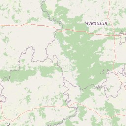
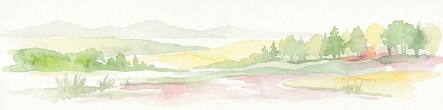
The forested areas within the Chuvash Republic, including the Chuvash Forest protected zone, exist within a transitional ecological zone between the coniferous forests of northern Russia and the steppe landscapes of the south. The vegetation patterns reflect this intermediary position, featuring mixed forest compositions that include both deciduous and coniferous species. The region's climate is characterized as moderately continental, with distinct seasons and moderate precipitation patterns that support woodland ecosystems in this agricultural region.

Chuvash Forest conservation status and protection priorities

The protected forest area in the Chuvash Republic serves to preserve representative examples of the Volga region's forest ecosystems. These conservation efforts are particularly important given the agricultural character of the surrounding landscape, where much of the original vegetation has been converted to farmland. The protected forested zones maintain ecological functions including watershed protection, soil preservation, and habitat provision for wildlife species native to this part of central Russia.

Chuvash Forest cultural meaning and human context

The Chuvash Republic is unique within Russia for its ethnic composition, with Chuvash people comprising the majority of the population. The Chuvash are a Turkic-speaking ethnic group with a distinct cultural identity that developed in this region over centuries. The forested landscapes of the republic have historically provided resources and habitat for the region's inhabitants, and the natural areas remaining under protection today represent the intersection of ecological conservation with the cultural landscape of the Chuvash people.

Park location guide

Geography guide, regional context, and park location map for Chuvash Forest

Chuvash Forest park geography, regions, and map view in Russia
Understand where Chuvash Forest sits in Russia through a broader geographic reading of the surrounding landscape, nearby location context, and its mapped position within the national park landscape.

How Chuvash Forest fits into Russia

Russia is a transcontinental nation spanning eleven time zones, bordered by fourteen countries. It is the world's largest country by area, covering 17,098,246 km². Moscow is the capital and largest city, while Saint Petersburg is the second-largest and a major cultural centre.

Wider geography shaping Chuvash Forest in Russia

Russia spans Eastern Europe and North Asia, covering 17,098,246 km². It shares land borders with fourteen countries, more than any other nation, and spans eleven time zones. The landscape includes vast plains, mountain ranges such as the Urals and Caucasus, and extensive coastlines along the Arctic Ocean, Pacific Ocean, Baltic Sea, Black Sea, and Caspian Sea.

Map view of Chuvash Forest

Use this park location map to pinpoint Chuvash Forest in Russia, understand its exact geographic position, and read its mapped placement within the surrounding landscape more clearly.

Pigeon | © OpenStreetMap contributors
Park atlas

Trace the regional spread of protected forests and mixed woodlands, comparing conservation landscapes surrounding Chuvash Forest in Eastern Europe.

Explore Other Protected Areas and National Parks Near Chuvash Forest in the Volga Region
After exploring Chuvash Forest, browse other national parks and protected areas across the middle Volga River basin and broader European Russia to understand regional conservation efforts. This geographic perspective allows for detailed comparison of diverse protected forest ecosystems and their role in the region's overall environmental atlas.
Watercolor painting of a river winding through grassy wetlands with distant hills under a pastel sky
National parkRepublic of Mordovia

Smolny National Park: National Park Protected Area and Geographic Context in Republic of Mordovia

Explore the mapped landscape and regional geography of Smolny National Park.

Delve into the specifics of Smolny National Park, a designated national park in Russia's Republic of Mordovia. This detailed atlas view focuses on its protected area identity and geographic setting, providing essential context for understanding its landscape. Discover the mapped boundaries and regional placement that define this protected territory, crucial for any structured exploration of Russian natural areas.

Area
365 km²
Established
1995
IUCN
II
Relief
Lowland
Watercolor painting of a meadow with wildflowers and rolling hills under a soft sky
National park

Sengileevskie Mountains National Park: National Park Protected Area and Mapped Landscape Context

Explore protected boundaries and regional geography.

Uncover the geographic specifics of Sengileevskie Mountains National Park, a designated national park. This entry provides detailed insights into its protected area status, mapped landscape features, and regional context, serving as a foundational element for atlas-based exploration and understanding of Russia's conservation areas.

IUCN
II
Watercolor illustration showing a lake, forested hills, and mountains in the background
National parkRussia

Mariy Chodra National Park: A Detailed Atlas Entry for Russia's Protected Landscapes

Explore the mapped terrain and protected boundaries of this Russian national park

Mariy Chodra National Park stands as a distinct protected area within Russia's vast geographic expanse. This detailed entry provides users with a comprehensive view of the park's mapped landscape, its protected boundaries, and its role within the broader national atlas. Understand the specific terrain and regional context that characterize this significant natural territory, facilitating focused geographic discovery.

IUCN
II
Watercolor illustration of a river flowing through a valley with green hills and scattered trees in the background
National parkSamara Oblast

Samarskaya Luka National Park: National Park Geographic Discovery in Samara Oblast

Explore mapped protected landscapes and regional terrain.

Samarskaya Luka National Park offers a focused lens for exploring protected natural areas, specifically detailing the geography and mapped boundaries of this Russian national park. Users can leverage this atlas-centric entry point to understand the park's landscape context within Samara Oblast. MoriAtlas provides a structured approach to discovering such protected lands, emphasizing their placement within regional geography and offering a rich foundation for mapped terrain exploration.

Area
1,340 km²
Established
1984
IUCN
II
Relief
Mixed relief
Watercolor illustration of green hills, a body of water, and pink and yellow vegetation
National parkSaratov Oblast

Khvalynsky National Park: Protected Landscape and Regional Geography Atlas

Discover mapped park boundaries in Saratov Oblast

Khvalynsky National Park is a significant protected area designated as a national park within the Saratov Oblast. This entry provides detailed atlas-based insights into its geographic scope, protected landscape features, and its context within the wider regional geography of Southeastern European Russia. Explore the mapped terrain and understand how this park contributes to the conservation landscape of the Volga region.

Area
255 km²
Established
1994
IUCN
II
Visitors
35K annual
Watercolor illustration showing a river flowing through a valley with trees and distant mountains
National parkTatarstan

Nizhnyaya Kama National Park: Protected Area and Geographic Context in Tatarstan

Discover mapped boundaries and regional landscape insights.

Nizhnyaya Kama National Park serves as a distinct protected area within the republic of Tatarstan, Russia. This detail page provides essential geographic context and map-oriented information, focusing on the park's boundaries and its contribution to the regional landscape. It is designed for users seeking structured data on protected lands, offering a factual entry point for understanding this Russian national park within a broader atlas framework.

Area
265.87 km²
Established
1991
IUCN
II
Relief
Lowland
National park

Buzuluksky Bor National Park: An Atlas of Russia's Largest Isolated Pine Forest Ecosystem

Explore mapped boundaries and regional geographic context.

Delve into the protected landscape of Buzuluksky Bor National Park, a significant national park in European Russia. This page provides detailed atlas-level insight into its unique formation as the world's largest isolated pine forest, situated atop deep sandy plains and surrounded by steppe. Understand its geographic setting, the ancient dune geology, and the ecological significance of this remarkable natural reserve.

Area
1,060 km²
Established
2007
IUCN
II
Relief
Lowland
Watercolor painting of a lake surrounded by trees and distant hills
National parkVladimir Oblast

Meshchyora National Park: A Premier Wetland Protected Area in Vladimir Oblast

Explore its mapped boundaries and intricate floodplain geography.

Meshchyora National Park is a key protected landscape in central Russia, renowned for its expansive wetland ecosystems across the Meshchera Lowlands of Vladimir Oblast. Covering nearly 119,000 hectares, the park preserves a unique glacial terrain of peatlands, lakes, and meandering rivers, supporting remarkable biodiversity. Its role as a vital component of the Oka River basin and its conservation focus on restoring degraded peatlands make it a significant site for atlas-based geographic discovery and understanding protected area landscapes.

Area
1,189 km²
Established
1992
IUCN
II
Relief
Lowland

Common questions about visiting, size, designation, and location context for Chuvash Forest

Chuvash Forest FAQs for park facts, access, geography, and protected area context
Find quick answers about Chuvash Forest, including protected-area facts, park geography, trail and visitor context, and how the park fits into its surrounding country and regional landscape.
MoriAtlas Explorer

Continue Your Protected Areas Search Across the Global Atlas

Deepen your exploration by continuing the structured search for national parks and protected areas worldwide. Utilize the comprehensive filtering capabilities to compare different conservation landscapes and refine your understanding of global park geography. Discover more about the distribution and characteristics of protected natural areas.

Global natural geography