Mori Atlas logo
National parkSmolny National Park

Navigate the geographic context and protected area boundaries of Smolny National Park.

Smolny National Park: A National Park Mapping and Protected Landscape Overview in Republic of Mordovia

Smolny National Park represents a significant protected natural area within the Republic of Mordovia, situated in Eastern Europe's Volga region. This page serves as a dedicated atlas entry, detailing the park's geographic scope and its role as a national park. Users can explore its mapped boundaries and understand its position within the regional geography, contributing to a structured understanding of Russia's protected lands.

national parkprotected areawetlanddeciduous forestriver floodplainbird habitat

Smolny National Park

National park

Park overview

Structured park overview, official facts, and landscape profile for Smolny National Park

Smolny National Park park facts, protected area profile, and essential visitor context
Review the core facts for Smolny National Park, including designation, size, terrain, visitor scale, habitats, and operating context in one park-focused overview.

About Smolny National Park

Smolny National Park occupies a distinctive position in the protected area network of central Russia, preserving a representative sample of the East European forest steppe ecoregion where broadleaf forests transition into grassland environments. The park's fundamental significance lies in its comprehensive protection of the lowland river environment centered on the Alatyr River, which flows along the southern boundary of the protected area. This river system, with its slow current and meandering course, has created an extensive floodplain ecosystem characterized by marshes, bogs, and wetlands that support exceptional ecological diversity. The surrounding landscape features relatively flat terrain with subtle elevation changes, punctuated by a network of ravines in the northern sectors that level out toward the south. Approximately 80 small streams traverse the park grounds alongside 185 kilometers of ephemeral streams and waterways, feeding the wetland systems that are distributed primarily across the Alatyr floodplain. The park's creation in 1995 reflected a growing recognition of the conservation importance of Mordovia's forest and wetland ecosystems, which had faced increasing pressure from agricultural development and forestry operations in the surrounding regions. Today, the park serves as a vital ecological corridor and refuge within the broader agricultural landscape of the Volga basin.

Quick facts and research context for Smolny National Park

Smolny National Park spans roughly 36,500 hectares in northeastern Mordovia, Russia, along the floodplain of the Alatyr River. The park was established in 1995 under the management of Russia's Ministry of Natural Resources and Environment. It lies within the East European forest steppe ecoregion, characterized by a mosaic of broadleaf forests, steppe, and riverine wetlands. The terrain is primarily flat with elevations between 93 and 217 meters, and the park contains approximately 80 small streams, extensive bogs, and marshland covering 157 hectares. The area supports significant biodiversity with over 750 vascular plant species, 206 bird species, and diverse mammal populations typical of forest-steppe environments.

Park context

Deeper park guide and search-rich context for Smolny National Park

Smolny National Park history, landscape, wildlife, and travel context
Explore Smolny National Park through its history, landscape character, ecosystems, wildlife, conservation priorities, cultural context, and seasonal travel timing in a structured park guide built for atlas discovery and search intent.

Why Smolny National Park stands out

Smolny National Park is best known for its representative lowland river environment along the meandering Alatyr River and its extensive wetland complexes that create crucial habitat for internationally significant bird populations. The park protects one of Mordovia's most intact deciduous forest landscapes, with a diverse composition that includes oak, linden, maple, and ash forests in the north, pine forests on terraces in the south, and rich floodplain wetlands. The eutrophic floodplain environment supports exceptional biodiversity and serves as a critical nesting and migratory stopover area for species including the Pallid Harrier, Imperial Eagle, and other birds of conservation concern. The park also preserves significant mired ecosystems with bogs distributed across the floodplain and its tributaries.

Smolny National Park history and protected-area timeline

Smolny National Park was established in 1995 as part of Russia's expanding network of protected areas during the post-Soviet period. The park was created specifically to preserve the deciduous forest and representative wetland ecosystems of Mordovia, a region that had experienced significant landscape transformation through agricultural expansion in the preceding decades. The selection of this area for national park status reflected scientific assessments identifying the floodplain of the Alatyr River as containing some of the most ecologically significant remaining wetlands in the republic. The park was placed under the jurisdiction of the Ministry of Natural Resources and Environment of Russia, which continues to oversee its management and conservation programs. The establishment also recognized the area's importance as a refuge for birds of international importance, particularly species whose populations had declined across their European range.

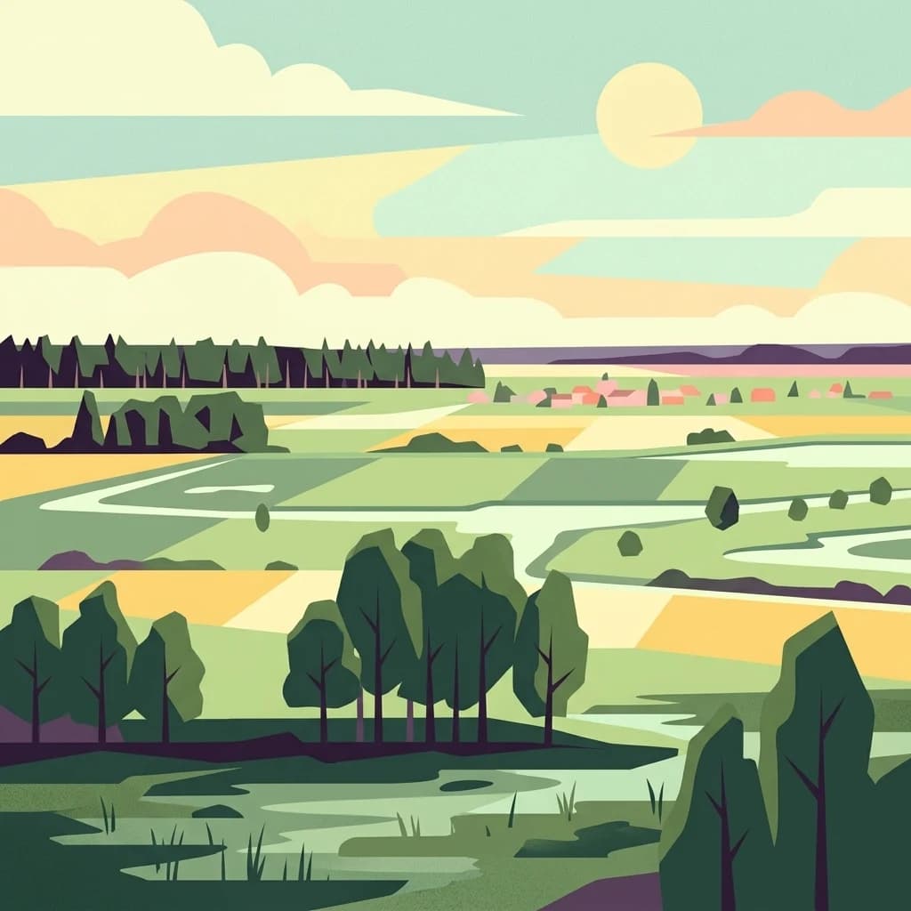
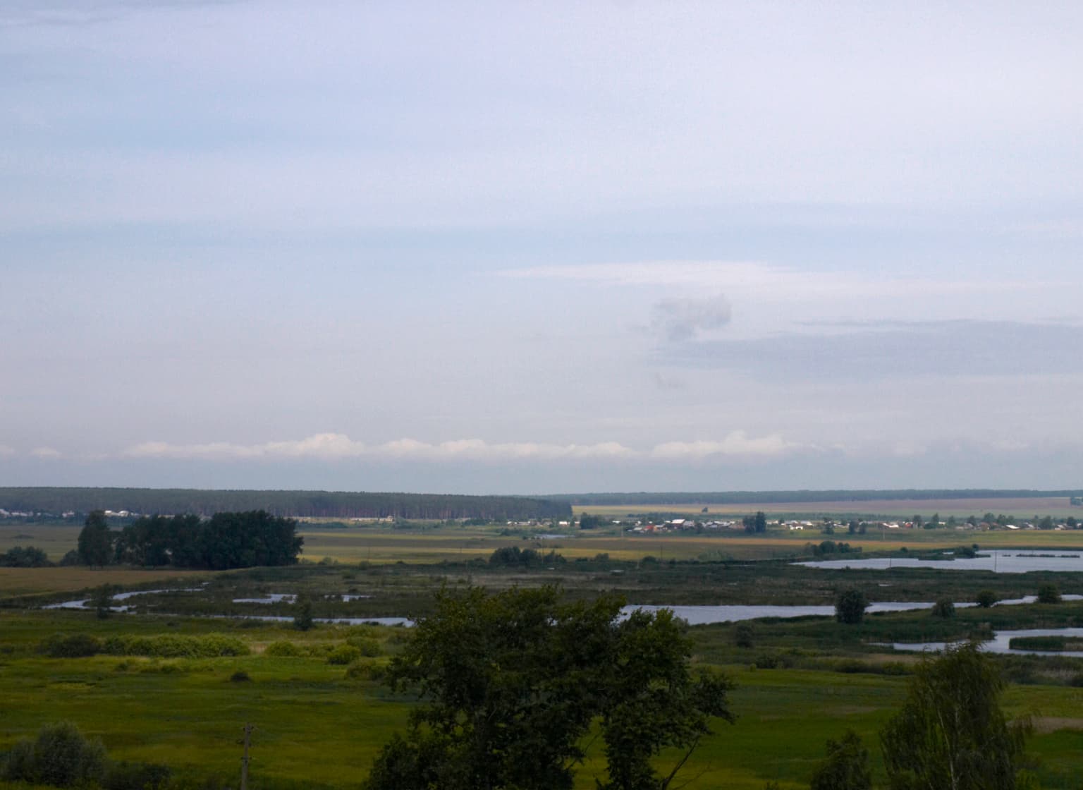
Smolny National Park landscape and geographic character

The terrain of Smolny National Park is characterized by its position at the northwestern edge of the Volga Uplands, where the landscape transitions to the flat expanses of the East European Plain. The park territory is roughly rectangular, extending approximately 35 kilometers from west to east and 20 kilometers from north to south. Elevations within the park range from 93 meters in the lowest wetland areas to 217 meters on the higher ground. The topography is predominantly flat or gently undulating, with a network of ravines developing in the northern sectors that gradually even out toward the southern portions of the park. The Alatyr River floodplain runs along the southern boundary of the park, creating a broad wetland corridor that contains the majority of the park's marshes and bog systems. The park contains approximately 80 small permanent streams and an extensive network of ephemeral streams totaling 185 kilometers in length. Bogs are distributed across the Alatyr floodplain and its tributaries, while marshes covering 157 hectares are interspersed throughout the wetland complexes.

Smolny National Park ecosystems, habitats, and plant life

Smolny National Park exemplifies the ecological character of the East European forest steppe, a transcontinental ecoregion that forms a transitional zone between the broadleaf forests of northern Europe and the grassland steppes to the south. The park's ecosystems reflect this transitional position, featuring a mosaic of forest types, meadowlands, and wetland environments. Forests dominate approximately 95 percent of the park's territory, with coniferous forests covering about 40 percent of the land and consisting primarily of pine and spruce species. The southern portions of the park feature pine forests growing on terraces above the floodplain, while the northern areas support broadleaf forests of oak, linden, maple, and ash. Approximately 12 percent of the park consists of secondary forest resulting from historical disturbance and regeneration. The floodplain of the Alatyr River creates a distinctive eutrophic wetland environment characterized by rich vegetation, warm shallow waters, and high biological productivity. The park has documented over 200 species of mushrooms, 100 species of mosses, and 750 species of vascular plants, reflecting the ecological richness of these forest and wetland habitats.

Smolny National Park wildlife and species highlights

The wildlife communities of Smolny National Park reflect the forest-steppe environment and the presence of significant wetland habitats. The park's rivers and lakes support diverse fish communities including common pike, dace, chub, gudgeon, loach, eel, perch, and silver carp. Mammal populations include species typical of forest-steppe environments across central Russia: elk, wild boar, fox, marten, weasels, and various mice and voles. The park is particularly notable for its bird populations, with 206 species recorded within its boundaries. Nesting birds include the curlew, oystercatcher, various owl species, imperial eagle, and the Pallid Harrier, a species of particular conservation concern in Europe. The wetlands and floodplain environments provide critical habitat for these and many other bird species, supporting both breeding populations and migratory passage. Hunting and fishing are prohibited within the park boundaries to protect these wildlife communities.

Smolny National Park conservation status and protection priorities

Smolny National Park plays a crucial conservation role as a protected representative of the East European forest steppe ecosystem, a ecoregion that has been significantly altered by agricultural development across its range. The park protects extensive wetland systems that serve as biodiversity hotspots within the broader agricultural landscape of Mordovia and the Volga basin. The floodplain ecosystems, characterized as eutrophic environments with high biological productivity, support diverse plant and animal communities that depend on intact wetland conditions. The park's designation as an IUCN Category II protected area reflects its primary objective of conserving natural landscapes and the ecological processes they support. The protection of bird habitat is particularly significant, as the wetlands serve as refuges for species of international importance, including several birds of prey whose populations have declined across their European range. The restriction of hunting and fishing within park boundaries helps ensure the long-term viability of these wildlife populations.

Smolny National Park cultural meaning and human context

Smolny National Park is situated within the Republic of Mordovia, a region in central Russia with a distinctive cultural identity shaped by its position between Russian and Finno-Ugric cultural spheres. The park's name, derived from the Russian word for a type of clearing or open space, reflects historical patterns of land use in the region. While the park itself was established in the modern period, the landscapes it protects have been part of the regional environment that supported human communities throughout history. The park provides recreational and educational opportunities, including a museum dedicated to the ecology and natural history of Mordovia, helping visitors understand the region's environmental heritage.

Top sights and standout views in Smolny National Park

The park's most distinctive features include its extensive Alatyr River floodplain with eutrophic wetland characteristics, the mosaic of deciduous and coniferous forests covering 95 percent of its territory, and the significant populations of nesting and migratory birds including Pallid Harrier and Imperial Eagle. The roughly 35-kilometer stretch of the Alatyr River within the park boundary, together with its tributaries and ephemeral streams, creates a complex hydrological system supporting exceptional ecological diversity. The documentation of over 750 vascular plant species, 200 mushroom species, and 100 moss species within the park demonstrates its botanical significance within the forest steppe ecoregion. The recreational infrastructure includes furnished areas with picnic pavilions, swimming areas, and designated zones for gathering mushrooms and berries, providing accessible nature experiences while maintaining conservation objectives.

Best time to visit Smolny National Park

The optimal period to experience Smolny National Park corresponds to the warm summer months of June through August, when average temperatures reach around 19°C and the frost-free period provides comfortable conditions for outdoor exploration. This season brings the wetland ecosystems to life with active wildlife activity and full forest canopy. Spring and early summer coincide with peak bird nesting activity, offering the best opportunities to observe the park's notable avian species. The transition seasons of spring and autumn provide different but equally valuable experiences, with spring bringing wetland bird migrations and autumn displaying forest coloration. Winter visits are possible but require preparation for continental conditions with temperatures averaging -11°C in January and significant snow cover. The park can be accessed by bus to the village of Smolny at the park's edge.

Park location guide

Geography guide, regional context, and park location map for Smolny National Park

Smolny National Park park geography, regions, and map view in Russia
Understand where Smolny National Park sits in Russia through a broader geographic reading of the surrounding landscape, nearby location context, and its mapped position within the national park landscape.

How Smolny National Park fits into Russia

Russia is a transcontinental nation spanning eleven time zones, bordered by fourteen countries. It is the world's largest country by area, covering 17,098,246 km². Moscow is the capital and largest city, while Saint Petersburg is the second-largest and a major cultural centre.

Wider geography shaping Smolny National Park in Russia

Russia spans Eastern Europe and North Asia, covering 17,098,246 km². It shares land borders with fourteen countries, more than any other nation, and spans eleven time zones. The landscape includes vast plains, mountain ranges such as the Urals and Caucasus, and extensive coastlines along the Arctic Ocean, Pacific Ocean, Baltic Sea, Black Sea, and Caspian Sea.

Map view of Smolny National Park

Use this park location map to pinpoint Smolny National Park in Russia, understand its exact geographic position, and read its mapped placement within the surrounding landscape more clearly.

Pigeon | © OpenStreetMap contributors

Location context for Smolny National Park

Republic of Mordovia
Park atlas

Trace the regional protected landscapes and discover other national parks within Mordovia and the East European Plain.

National Parks and Protected Areas Near Smolny, Mordovia, and the East European Plain
Browse national parks and protected areas geographically connected to Smolny National Park, extending across Mordovia and the broader East European Plain. Compare their diverse wetland, forest, and riverine landscapes to understand regional conservation efforts and distinct ecological zones.
National parkSaratov Oblast

Khvalynsky National Park: Protected Landscape and Regional Geography Atlas

Discover mapped park boundaries in Saratov Oblast

Khvalynsky National Park is a significant protected area designated as a national park within the Saratov Oblast. This entry provides detailed atlas-based insights into its geographic scope, protected landscape features, and its context within the wider regional geography of Southeastern European Russia. Explore the mapped terrain and understand how this park contributes to the conservation landscape of the Volga region.

Area
255 km²
Established
1994
IUCN
II
Visitors
35K annual
National parkRyazan Oblast

Meshchyorsky National Park: Ryazan Oblast Protected Landscape Exploration

National park geography and mapped terrain.

Investigate Meshchyorsky National Park, a key protected area situated in Ryazan Oblast, Russia. This page provides detailed atlas-level context, focusing on the park's geographic identity, its mapped boundaries, and its role as a national park within the regional landscape. Explore the natural terrain and discover the protected land's place in Central Russia's geography through structured data and mapping.

Area
66 km²
Established
1992
IUCN
II
Relief
Lowland
Watercolor painting of a lake surrounded by trees and distant hills
National parkVladimir Oblast

Meshchyora National Park: A Premier Wetland Protected Area in Vladimir Oblast

Explore its mapped boundaries and intricate floodplain geography.

Meshchyora National Park is a key protected landscape in central Russia, renowned for its expansive wetland ecosystems across the Meshchera Lowlands of Vladimir Oblast. Covering nearly 119,000 hectares, the park preserves a unique glacial terrain of peatlands, lakes, and meandering rivers, supporting remarkable biodiversity. Its role as a vital component of the Oka River basin and its conservation focus on restoring degraded peatlands make it a significant site for atlas-based geographic discovery and understanding protected area landscapes.

Area
1,189 km²
Established
1992
IUCN
II
Relief
Lowland
National parkTatarstan

Nizhnyaya Kama National Park: Protected Area and Geographic Context in Tatarstan

Discover mapped boundaries and regional landscape insights.

Nizhnyaya Kama National Park serves as a distinct protected area within the republic of Tatarstan, Russia. This detail page provides essential geographic context and map-oriented information, focusing on the park's boundaries and its contribution to the regional landscape. It is designed for users seeking structured data on protected lands, offering a factual entry point for understanding this Russian national park within a broader atlas framework.

Area
265.87 km²
Established
1991
IUCN
II
Relief
Lowland
National park

Buzuluksky Bor National Park: An Atlas of Russia's Largest Isolated Pine Forest Ecosystem

Explore mapped boundaries and regional geographic context.

Delve into the protected landscape of Buzuluksky Bor National Park, a significant national park in European Russia. This page provides detailed atlas-level insight into its unique formation as the world's largest isolated pine forest, situated atop deep sandy plains and surrounded by steppe. Understand its geographic setting, the ancient dune geology, and the ecological significance of this remarkable natural reserve.

Area
1,060 km²
Established
2007
IUCN
II
Relief
Lowland
National parkYaroslavl Oblast

Pleshcheyevo Ozero National Park: National Park Mapping and Regional Protected Area Atlas

Discover its protected landscape and geographic setting.

Pleshcheyevo Ozero National Park is a key protected area within the geography of Yaroslavl Oblast, Russia. This page offers detailed insights into the park's specific landscape character, its mapped boundaries, and its significance as a national park. It serves as an entry point for understanding the protected lands of the region and exploring its natural terrain within a broader atlas context.

Area
238 km²
Established
1997
IUCN
II
Relief
Lowland
Watercolor illustration of a winding river, trees, and hills in the background
National parkMoscow Oblast

Losiny Ostrov National Park: National Park Protected Landscape in Moscow Oblast

Mapped boundaries and regional geographic context for this protected area.

Uncover the geographic specifics of Losiny Ostrov National Park, a national park situated within the Moscow Oblast. This entry provides detailed insights into the park's protected area designation, its mapped natural landscape, and its position within the regional geography. It serves as a focused point for understanding the protected land's specific features and its atlas value for exploring Russia's diverse natural territories.

Area
116 km²
Established
1983
IUCN
II
Relief
Lowland
National parkUdmurt Republic

Nechkinsky National Park: Protected River Valley Landscape and Archaeological Heritage

Explore Udmurt Republic's National Park Geography and Terrain

Nechkinsky National Park, situated in the Udmurt Republic, is a vital protected area distinguished by its prominent river valley landscape. The park's geography features a stark contrast between steep right-bank slopes and a wide, flat left-bank floodplain, bordered by the Votkinsk reservoir. This unique terrain supports diverse ecosystems and preserves thousands of years of archaeological heritage, making it a focal point for understanding the region's natural and cultural map.

Area
208 km²
Established
1997
IUCN
II

Common questions about visiting, size, designation, and location context for Smolny National Park

Smolny National Park FAQs for park facts, access, geography, and protected area context
Find quick answers about Smolny National Park, including protected-area facts, park geography, trail and visitor context, and how the park fits into its surrounding country and regional landscape.
MoriAtlas Explorer

Continue Your Protected Areas Search Across the Global Atlas

Deepen your exploration by continuing the structured search for national parks and protected areas worldwide. Utilize the comprehensive filtering capabilities to compare different conservation landscapes and refine your understanding of global park geography. Discover more about the distribution and characteristics of protected natural areas.

Global natural geography