Mori Atlas logo
National parkZigalga National Park

Discover the mapped boundaries and geographic context of this significant protected landscape.

Zigalga National Park: A Protected National Park within Russia's Chelyabinsk Oblast

(National Park Zigalga (Национальный парк «Зигальга»))

Zigalga National Park represents a key protected natural area within the Chelyabinsk Oblast of Russia. Situated in the Southern Urals, this national park offers a focused geographic entity for atlas-based discovery. Explore its defined boundaries and understand its place within the broader regional landscape of Chelyabinsk Oblast, a region historically significant at the crossroads of Europe and Asia.

National ParksRussiaSouthern UralsSubarctic EcosystemsTaigaMountain Terrain
Stylized illustration of a mountainous landscape featuring pine forests, alpine meadows, and snow-capped peaks under a pastel sky

Zigalga National Park

National park

Park overview

Structured park overview, official facts, and landscape profile for Zigalga National Park

Zigalga National Park park facts, protected area profile, and essential visitor context
Review the core facts for Zigalga National Park, including designation, size, terrain, visitor scale, habitats, and operating context in one park-focused overview.

About Zigalga National Park

Zigalga National Park occupies a significant position in Russia's protected area network as a newly established preserve safeguarding the ecological integrity of the Southern Ural Mountains. The park's location on the Zigalga Ridge places it at a critical biogeographic crossroads, where European and Siberian ecosystem types meet and intermingle. This geographic position, spanning the boundary between Europe and Siberia, contributes to the park's exceptional ecological diversity and its role as a refuge for species adapted to both continental regions. The park connects two major existing protected areas, forming an important ecological corridor along the main ridge of the Southern Urals. Elevation gradients from foothills through subalpine zones to mountain tundra create a complete vertical zonation of habitats that supports complex ecological communities. The preservation of relatively untouched landscapes throughout most of the park's territory has allowed ancient floristic communities to persist, some dating to the Pleistocene era, making the area a living repository of ecological history.

Quick facts and research context for Zigalga National Park

Zigalga National Park covers 45,662 hectares in the Southern Ural Mountains within Chelyabinsk Oblast, Russia. The park was established in November 2019, making it one of Russia's newer national parks. Its territory includes the headwaters of the Yuryuzan River and Kutkurka River, with Mount Poperechnaya rising to 1,387 meters as the highest point. The park sits at the southern extremity of the Urals montane tundra and taiga ecoregion, surrounded by East European forest steppe to the west, West Siberian taiga to the northeast, and Kazakh forest steppe to the south. Scientists have recorded 500 vascular plant species, 55 mammal species, 160 bird species, and 20 fish species within the park boundaries.

Park context

Deeper park guide and search-rich context for Zigalga National Park

Zigalga National Park history, landscape, wildlife, and travel context
Explore Zigalga National Park through its history, landscape character, ecosystems, wildlife, conservation priorities, cultural context, and seasonal travel timing in a structured park guide built for atlas discovery and search intent.

Why Zigalga National Park stands out

Zigalga National Park is distinguished by its preservation of Ice Age relict flora that survives across the full spectrum of altitude zones, from lowland pine and birch forests through dark coniferous taiga to alpine meadows and mountain tundra. The park contains alpine peat bogs of both mesotrophic and oligomesotrophic character, supporting boreal plant species at their southern range limits. Its position on the Southern Ural ridge places it at the crossroads of European and Siberian biogeographic provinces, creating a unique ecological transition zone. The mountainous terrain and relatively pristine condition of much of the territory make it particularly valuable for conservation of subarctic ecosystems.

Wide landscape view of a forested area with mixed evergreen and deciduous trees, distant mountains, and a partly cloudy sky
Zigalga mountain range with forested hills and distant peaks under a partly cloudy sky

Zigalga National Park history and protected-area timeline

Zigalga National Park was officially established on November 18, 2019, representing a recent addition to Russia's national park system. The creation of the park formalized protection for an area that had long been recognized for its ecological significance within the Southern Ural region. The park is governed by FGBU Zigalga, the federal government body responsible for its management and conservation operations. The establishment of the park also serves to strengthen the network of protected areas along the Southern Ural ridge, linking Zyuratkul National Park to the northeast with the South Ural Nature Reserve to the southwest. This connected corridor approach to conservation reflects contemporary understanding of the importance of landscape-scale protection for maintaining ecological processes and species movement across broader geographic areas.

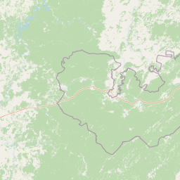
Zigalga National Park landscape and geographic character

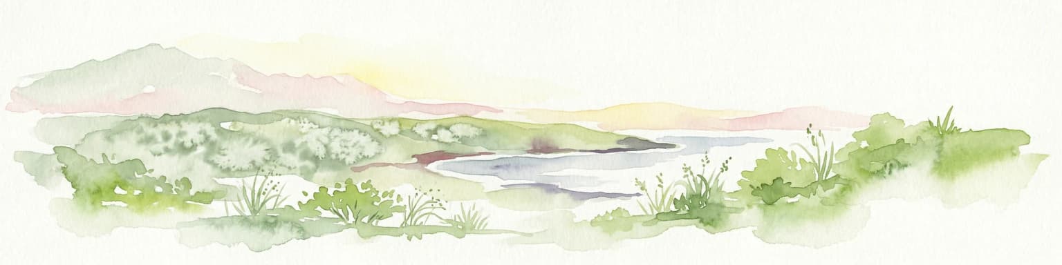
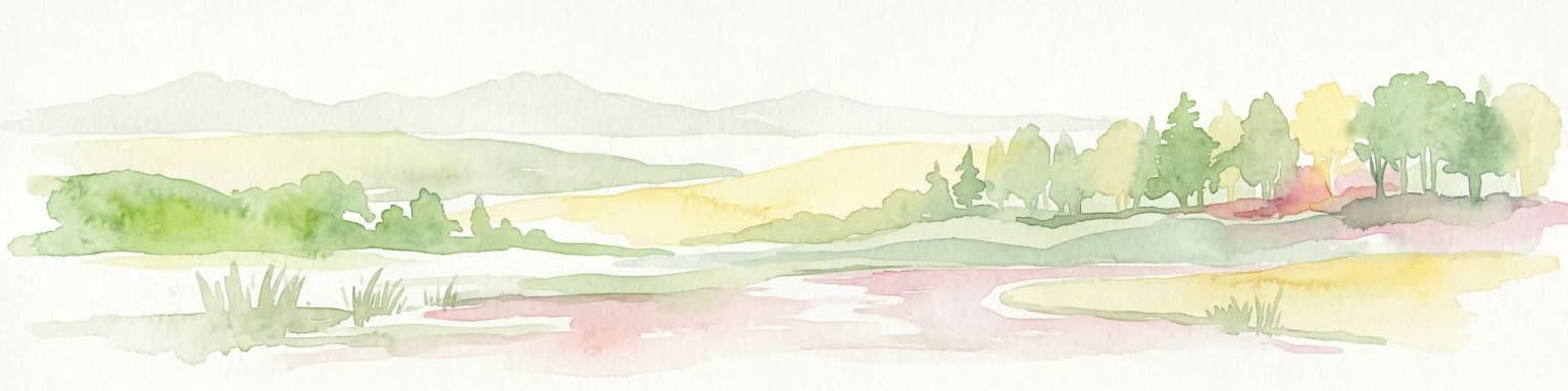
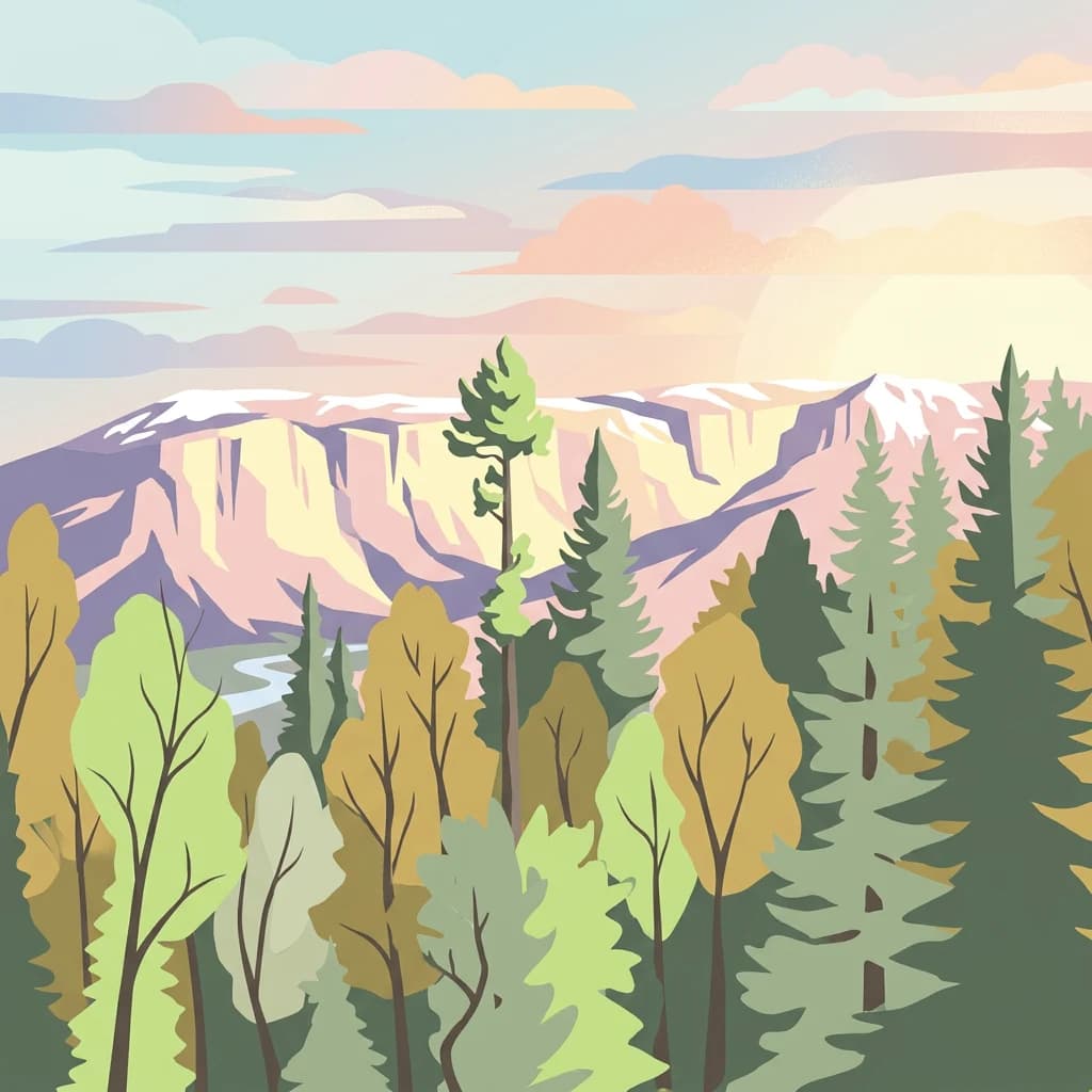
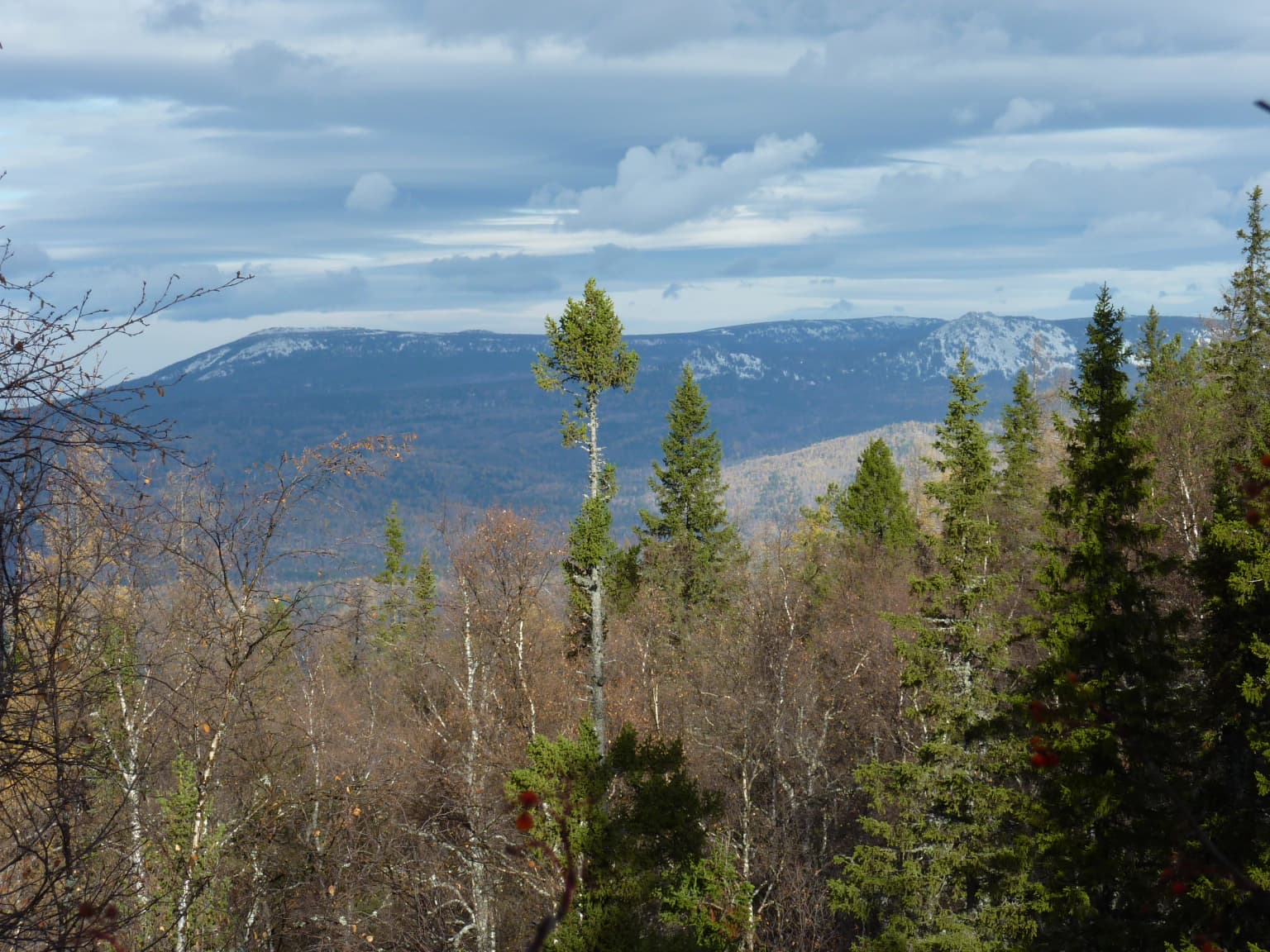
The terrain of Zigalga National Park is defined by the mountainous character of the Southern Ural ridge, with elevations ranging from lower foothills to the summit of Mount Poperechnaya at 1,387 meters. The park encompasses the headwaters of two significant river systems: the Yuryuzan River and the Kutkurka River, both of which originate within the protected area and flow outward through the surrounding landscape. The topography creates distinct altitudinal zones that profoundly influence vegetation patterns and ecological communities throughout the park. Steep slopes, ridgelines, and valley systems characterize the terrain, while the presence of alpine peat bogs adds wetland diversity to the mountainous setting. The landscape remains largely pristine across most of the park's extent, with minimal human infrastructure or development intruding upon the natural terrain.

Zigalga National Park ecosystems, habitats, and plant life

The ecological character of Zigalga National Park is defined by a remarkable vertical zonation of habitats that progresses through distinct vegetation belts from lower elevations to higher ground. Below 750 meters, the forests are dominated by Picea obovata (Siberian spruce), Abies sibirica (Siberian fir), and stands of Tilia sibirica (Siberian linden), creating a rich coniferous forest environment. Above 750 meters, the forest gives way to subalpine meadows characterized by grassland and shrub communities adapted to cooler conditions. At the highest elevations, above 1,000 to 1,200 meters, mountain tundra prevails with sparse vegetation suited to harsh alpine conditions. Alpine peat bogs are common throughout the park, including both mesotrophic and oligomesotrophic types, providing critical wetland habitat within the predominantly mountainous terrain. The park supports numerous boreal plant species that reach their southern range limits here, making the area particularly significant for the conservation of northern flora at the edge of their distributions.

Zigalga National Park wildlife and species highlights

Zigalga National Park supports diverse wildlife communities across its multiple habitat zones, with documented populations spanning multiple taxonomic groups. Scientists have recorded 55 species of mammals within the park boundaries, representing the typical fauna of Southern Ural forest and alpine ecosystems. The avifauna is particularly well-documented with 160 bird species identified, reflecting the park's importance as a habitat for both forest-dwelling and migratory bird species. The aquatic ecosystems, fed by the headwaters of the Yuryuzan and Kutkurka rivers, support 20 species of fish, while 13 species of amphibians and reptiles have been recorded in the park's varied habitats. The vascular plant diversity includes approximately 500 species, with particular significance attached to the boreal species occurring at their southern range limits within the park.

Zigalga National Park conservation status and protection priorities

Zigalga National Park serves an important conservation function as a protected area at the southern boundary of the Urals montane tundra and taiga ecoregion. The park's role in preserving Ice Age relict floral communities across all altitude zones gives it significance beyond its relatively modest area, as these communities represent surviving remnants of ancient ecological systems. The boreal plant species reaching their southern range limits within the park constitute a conservation priority, as these populations represent the southernmost viable populations of species typically found further north. The park's connection of Zyuratkul National Park and the South Ural Nature Reserve creates an important ecological corridor that supports species movement and genetic exchange across a broader protected area network. The subarctic climate, characterized by brief summers and cold snowy winters, creates conditions that have limited human impact and allowed natural ecosystem processes to continue relatively undisturbed.

Zigalga National Park cultural meaning and human context

Zigalga National Park is located within the Katav-Ivanovsky District of Chelyabinsk Oblast, a region with historical ties to mining and forestry industries characteristic of the Southern Urals. The park's territory has been relatively undisturbed compared to lower-lying areas of the oblast that have experienced more intensive human development. The park lies near the city of Chelyabinsk, the largest urban center in the area, and the protected status helps preserve the natural landscape character of this mountainous portion of the region.

Top sights and standout views in Zigalga National Park

The Ice Age relict floral communities spanning all altitude zones represent perhaps the park's most scientifically significant feature, offering a window into ancient ecological conditions. The complete vertical zonation from pine and birch forest through dark coniferous taiga to alpine meadows and mountain tundra provides a natural laboratory for understanding ecological transitions across elevational gradients. The alpine peat bogs, including both mesotrophic and oligomesotrophic types, add wetland habitat diversity uncommon in mountain landscapes. The park's position at the biogeographic boundary between Europe and Siberia creates a unique meeting point for species from both continental regions. The relatively pristine condition of much of the territory, combined with its recent protection status, offers opportunities for ongoing ecological research and monitoring.

Best time to visit Zigalga National Park

The subarctic climate of Zigalga National Park shapes visitor experience significantly throughout the year. Summer months, typically June through August, offer the most accessible conditions for exploration, though the warm season is brief with only one to three months averaging above 10 degrees Celsius. Winter brings extended cold conditions with heavy snowfall, transforming the landscape into a white wilderness but limiting accessibility. The brief summer period coincides with the peak of alpine meadow flowering and offers the best opportunities for wildlife observation and trail exploration. Spring and autumn provide transitional seasons with variable conditions, while the winter months appeal to those interested in snow-covered mountain landscapes and cold-weather ecology.

Park location guide

Geography guide, regional context, and park location map for Zigalga National Park

Zigalga National Park park geography, regions, and map view in Russia
Understand where Zigalga National Park sits in Russia through a broader geographic reading of the surrounding landscape, nearby location context, and its mapped position within the national park landscape.

How Zigalga National Park fits into Russia

Russia is a transcontinental nation spanning eleven time zones, bordered by fourteen countries. It is the world's largest country by area, covering 17,098,246 km². Moscow is the capital and largest city, while Saint Petersburg is the second-largest and a major cultural centre.

Wider geography shaping Zigalga National Park in Russia

Russia spans Eastern Europe and North Asia, covering 17,098,246 km². It shares land borders with fourteen countries, more than any other nation, and spans eleven time zones. The landscape includes vast plains, mountain ranges such as the Urals and Caucasus, and extensive coastlines along the Arctic Ocean, Pacific Ocean, Baltic Sea, Black Sea, and Caspian Sea.

Map view of Zigalga National Park

Use this park location map to pinpoint Zigalga National Park in Russia, understand its exact geographic position, and read its mapped placement within the surrounding landscape more clearly.

Pigeon | © OpenStreetMap contributors

Location context for Zigalga National Park

Chelyabinsk Oblast

Visual Exploration of Southern Ural Mountain Terrain and Unique Ice Age Relict Flora

Zigalga National Park Photos: Explore Landscapes, Habitats, and Mountain Scenery
Browse an extensive collection of Zigalga National Park images to understand its diverse landscapes, from dark coniferous taiga to high alpine meadows and unique mountain tundra ecosystems. Visualizing these protected-area environments provides crucial context for tracing the park's distinct altitudinal zones and its preservation of Ice Age relict floral communities.

Wide landscape view of a forested area with mixed evergreen and deciduous trees, distant mountains, and a partly cloudy sky

Park atlas

Browse the broader geography of national parks and protected areas across the Southern Urals, connecting with Zigalga's unique ecosystems.

Explore Other National Parks Near Zigalga National Park, Southern Ural Mountains
Explore other national parks and protected areas geographically connected to Zigalga National Park within the Southern Ural Mountains, mapping diverse subarctic ecosystems and Ice Age relict flora. Users can compare distinct mountain terrains and conservation landscapes, gaining an atlas-style understanding of protected areas in this critical Europe-Siberia biogeographic transition zone.
National parkChelyabinsk Oblast

Zyuratkul National Park: Protected Landscape Atlas and Regional Geography

Explore national park boundaries and terrain in Chelyabinsk Oblast.

Zyuratkul National Park represents a distinct protected landscape within the Chelyabinsk Oblast of Russia. This page offers an atlas-centric view, detailing its geographic position and significance as a national park. Users can explore the mapped context of Zyuratkul National Park, understanding its terrain and its contribution to the protected areas landscape of the Southern Urals region.

Area
882.49 km²
Established
1993
IUCN
II
Relief
Mountain
National parkBashkortostan

Bashkiriya National Park: Karst Geography and Protected Ural Forest Landscape

Explore Ural Mountains national park mapped boundaries and terrain.

Delve into the geography and protected landscape of Bashkiriya National Park, a significant national park within Russia's Bashkortostan region. This detailed page highlights its striking karst topography, extensive cave systems, and over 92 percent forest cover across the southern Ural Mountains. Understand the park's role as a conservation buffer zone and its unique position at the Europe-Asia biogeographical boundary through structured geographic data and mapped context.

Area
920 km²
Established
1986
IUCN
II
Relief
Mixed relief
National parkUdmurt Republic

Nechkinsky National Park: Protected River Valley Landscape and Archaeological Heritage

Explore Udmurt Republic's National Park Geography and Terrain

Nechkinsky National Park, situated in the Udmurt Republic, is a vital protected area distinguished by its prominent river valley landscape. The park's geography features a stark contrast between steep right-bank slopes and a wide, flat left-bank floodplain, bordered by the Votkinsk reservoir. This unique terrain supports diverse ecosystems and preserves thousands of years of archaeological heritage, making it a focal point for understanding the region's natural and cultural map.

Area
208 km²
Established
1997
IUCN
II
National parkTatarstan

Nizhnyaya Kama National Park: Protected Area and Geographic Context in Tatarstan

Discover mapped boundaries and regional landscape insights.

Nizhnyaya Kama National Park serves as a distinct protected area within the republic of Tatarstan, Russia. This detail page provides essential geographic context and map-oriented information, focusing on the park's boundaries and its contribution to the regional landscape. It is designed for users seeking structured data on protected lands, offering a factual entry point for understanding this Russian national park within a broader atlas framework.

Area
265.87 km²
Established
1991
IUCN
II
Relief
Lowland
National parkSverdlovsk Oblast

Pripyshminskiye Bory National Park: Explore its Protected Landscape and Geographic Setting

National Park with mapped boundaries in Sverdlovsk Oblast.

Pripyshminskiye Bory National Park stands as a notable protected area within the vast geography of Sverdlovsk Oblast, Russia. This page serves as a dedicated atlas entry for the park, detailing its protected landscape identity and its placement within the broader regional context. Users can investigate the park's mapped boundaries and understand its significance as a distinct national park, facilitating structured geographic discovery.

Area
490 km²
Established
1993
IUCN
II
Relief
Lowland
National park

Buzuluksky Bor National Park: An Atlas of Russia's Largest Isolated Pine Forest Ecosystem

Explore mapped boundaries and regional geographic context.

Delve into the protected landscape of Buzuluksky Bor National Park, a significant national park in European Russia. This page provides detailed atlas-level insight into its unique formation as the world's largest isolated pine forest, situated atop deep sandy plains and surrounded by steppe. Understand its geographic setting, the ancient dune geology, and the ecological significance of this remarkable natural reserve.

Area
1,060 km²
Established
2007
IUCN
II
Relief
Lowland
Watercolor illustration of a landscape with green hills, a body of water, and grassy foreground under a pink-hued sky
National parkAqmola Region

Kokshetau National Park: A Protected Granite Mountain and Forest-Steppe Landscape in Kazakhstan

Explore Aqmola Region's unique protected geography and mapped terrain.

Kokshetau National Park stands as a remarkable protected landscape within Kazakhstan, defined by its ancient granite mountains and its unique position as a forest-steppe island surrounded by open plains. This national park preserves a rich tapestry of boreal forests, lake-filled depressions, and geological wonders, including some of the planet's most ancient rock formations. MoriAtlas provides a structured view of Kokshetau National Park, detailing its mapped boundaries and geographic context within the Aqmola Region, offering users a deep dive into its protected area identity and ecological significance.

Area
1,821 km²
Established
1996
IUCN
II
Relief
Upland
National parkSaratov Oblast

Khvalynsky National Park: Protected Landscape and Regional Geography Atlas

Discover mapped park boundaries in Saratov Oblast

Khvalynsky National Park is a significant protected area designated as a national park within the Saratov Oblast. This entry provides detailed atlas-based insights into its geographic scope, protected landscape features, and its context within the wider regional geography of Southeastern European Russia. Explore the mapped terrain and understand how this park contributes to the conservation landscape of the Volga region.

Area
255 km²
Established
1994
IUCN
II
Visitors
35K annual

Common questions about visiting, size, designation, and location context for Zigalga National Park

Zigalga National Park FAQs for park facts, access, geography, and protected area context
Find quick answers about Zigalga National Park, including protected-area facts, park geography, trail and visitor context, and how the park fits into its surrounding country and regional landscape.
MoriAtlas Explorer

Continue Your Protected Areas Search Across the Global Atlas

Deepen your exploration by continuing the structured search for national parks and protected areas worldwide. Utilize the comprehensive filtering capabilities to compare different conservation landscapes and refine your understanding of global park geography. Discover more about the distribution and characteristics of protected natural areas.

Global natural geography