Nature reserveAustria

Lake Neusiedl
An endorheic lake system and critical wetland sanctuary.
Lake Neusiedl, in Austria. Landscapes: lakes, wetlands, and coasts.
315 km²1993TemperateEasy access

Discover the geographic spread and mapped boundaries of protected lands across Austria.
Browse profiles of parks and protected areas in Austria, including Neusiedler See and Hohe Tauern.
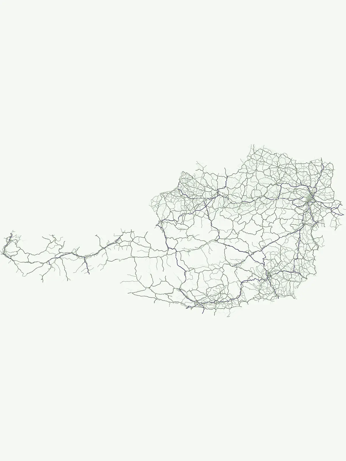
Trace the geographic distribution of Austria's diverse protected landscapes, from Alpine peaks to vital river ecosystems.
Discover a comprehensive listing of Austria's national parks, nature reserves, and various protected areas, encompassing both high Alpine regions and significant river ecosystems. This full country-wide overview provides valuable geographic context for understanding Austria's diverse conservation landscapes and their unique ecological distribution.
Showing 1 to 20 of 22 parks
An endorheic lake system and critical wetland sanctuary.
Lake Neusiedl, in Austria. Landscapes: lakes, wetlands, and coasts.
High-altitude mountain terrain and glacial systems in Austria
Hohe Tauern National Park, in Austria.

Explore mapped boundaries and unique alpine terrain.
Kalkalpen National Park, in Upper Austria, Austria. Landscapes: mountains, forests, and karst.

Explore mapped wetland geography and birdwatching significance.
Neusiedler See-Seewinkel National Park showcases a rare steppe lake environment and extensive wetland habitats at the eastern edge of Austria, within the Burgenland region. This protected area is globally recognized for its exceptional avian diversity and the unique ecological mosaic formed by reed beds, salt marshes, and seasonal pools. Explore its mapped boundaries and distinctive Pannonian geography for a deep understanding of this vital European protected landscape.
Mapped boundaries and vital riparian landscape in Lower Austria.
Danube-Auen National Park, in Lower Austria, Austria. Landscapes: rivers, forests, and wetlands.
Explore Austria's dramatic river gorge and rugged peaks.
Gesäuse National Park, in Styria, Austria. Landscapes: mountains, valleys, and rivers.
Natural terrain and protected boundaries in Lower Austria
The Vienna Woods encompass a distinct geographic region where sandstone ridges meet limestone formations. This protected landscape provides a dense network of forest habitats, river gorges, and significant peaks overlooking the Danube. Its structure traces the edge of the Alps, offering a rich study in regional geology, elevation gradients, and the intersection of natural wilderness with the surrounding basin environment.
Explore the mapped geography of a breakthrough valley and its rich biodiversity.
Thayatal National Park, Austria's smallest national park, offers a concentrated study in protected landscape discovery. Its core feature is the spectacular Thaya River breakthrough valley, a deep gorge cutting through gneiss terrain with steep, forested slopes. This page provides context for its mapped protected area, highlighting its exceptional biodiversity and its role as a transboundary conservation zone with the adjacent Czech Podyjí National Park. Understand the geographic setting and unique landscape character of this significant natural region.
A comprehensive look at the Wilder Kaiser and Zahmer Kaiser ridges
The Kaiser Mountains stand as a monumental feature within the Northern Limestone Alps. This nature reserve offers a unique geographic profile, from sheer, pale Wetterstein limestone walls to broad alpine pastures and pine-covered ridges. Its radial drainage patterns and self-contained massif structure provide an essential case study for understanding the diverse mountain terrain that defines the heart of the Austrian Tyrol.
Major protected area in the heart of the Austrian Alps
Hohe Tauern National Park protects a grand scale of alpine terrain, including towering summits above 3,000 meters and the longest glacial systems in the country. This atlas record provides insights into the park's vertical landscape, encompassing glacial valleys, waterfalls, and diverse ecological zones that define the High Tauern mountain range in Austria.
Riparian forests, oxbow lakes, and historic wetland ecosystems.
Lobau preserves the ecological memory of the Danube through a landscape of slow-moving water bodies and dense forest stands. Situated within Vienna, this protected area features a distinct topography of dry gravel terraces, reedy ponds, and riparian corridors, offering significant insights into the region's natural history and riverine geography.
High mountain geography and protected terrain in Styria, Austria
Zirbitzkogel represents the highest point of the Seetal Alps, characterized by crystalline geology, slate, and gneiss. The landscape features a clear progression from subalpine spruce and larch forests to broad, level summit plateaus covered in ragged sedge grasslands. Beyond its alpine vegetation and glacial tarns, the area serves as a critical protected habitat for diverse alpine fauna, offering an ideal setting for understanding regional alpine ecology and complex mountain landforms.
A dynamic freshwater delta and critical bird habitat in Austria
The Rhine Delta constitutes the largest wetland biotope on Lake Constance, characterized by ongoing sediment deposits and an evolving shoreline. Its geography includes dense riparian forests, alluvial plains, and shallow bays that provide refuge for diverse amphibians and birds. This nature reserve serves as a prime example of large-scale wetland conservation nestled between the Alpine foothills and the open waters of the lake.
A preserved riparian corridor in southeastern Austria
The Lafnitztal protected area serves as a primary reference site for riverine conservation in Austria. It features a complex network of meandering river reaches, alluvial forests, and moorgrass meadows that bridge the gap between the Eastern Alps and the Pannonian basin, creating a unique study of Central European lowland geography.
A historic protected massif in the Austrian Tyrol.
The Arnspitze Group represents a vital limestone ridge ecosystem within the Northern Limestone Alps. This nature reserve, spanning the border region, displays significant karst formations and forested slopes. Gain insight into the ridge layout, summit heights, and the protected status that defines this essential Tyrolean mountain chain through detailed map-based discovery.
A protected alpine landscape and UNESCO Biosphere Reserve in the Austrian Alps
Discover the geographic character of Nock Mountains National Park, where the Gurktal Alps transition into sweeping, grass-covered dome summits. This protected area offers a look at a unique Tertiary land surface that survived the last Ice Age, supporting a mosaic of larch forests, alpine pastures, and high-altitude lakes that define the regional geography of southern Austria.
A limestone plateau mountain at the Alpine-Pannonian transition
Located in Lower Austria, Hohe Wand Nature Park encompasses a distinct limestone plateau and dramatic southeastern cliffs. Its protected status reflects the convergence of Alpine and Pannonian geography, offering a unique opportunity to study karst geology, exposed cliff habitats, and the transition zone between high mountain ranges and the Vienna Basin lowlands.

A mapped conservation zone within the Vorarlberg Alps
Biosphere Reserve Großes Walsertal encompasses a protected valley characterized by significant geological diversity. Explore the transition from the soft flysch ridges of the Walserkamm to the dramatic limestone crests of the Kalkhochalpen, reflecting a modern approach to managing Alpine natural resources and cultural heritage in western Austria.
A cross-border protected area defined by tectonic uplift and deep alpine valleys.
Geopark Karawanken showcases a profound geological record formed by tectonic plate convergence. The protected area features sharp mountain massifs, subterranean karst systems, and deep-cut gorges that reveal the underlying structural complexity of the alpine range, offering a clear view of how tectonic forces shape regional geography.
Mapped dry steppe, karst topography, and pannonian forest habitats
Rising abruptly from the Danube lowlands, Hundsheimer Berg preserves a compact range of crystalline and limestone hills. This nature reserve provides vital insights into the pannonian biogeographic region, featuring a diverse mosaic of rocky slopes and dry grasslands that support a high concentration of rare insects and plants.
Explore Geographic Context and Protected Landscapes from the Austrian Atlas View

Parks and protected areas in Czech Republic, including NP Šumava and KRNAP.

Parks and protected areas in Switzerland, including Swiss National Park and Entlebuch.

Parks and protected areas in Croatia, including Plitvice Lakes and Paklenica.

Parks and protected areas in Hungary, including Hortobágy and Aggtelek.

Parks and protected areas in Slovakia, including TANAP and Poloniny.

Parks and protected areas in Slovenia, including TNP and Škocjan Caves.

Parks and protected areas in Bosnia and Herzegovina, including Sutjeska and Una.

Parks and protected areas in Liechtenstein, including Gampriner See and Ruggeller Riet.
Protected area types
Delve deeper into Austria's conservation landscape by navigating its represented park designations. Understand the nuances of each classification group, from national parks to nature reserves, and their role in defining protected areas across the country. This route provides a structured pathway to investigate Austria's geographic context through its official designation frameworks.
Narrow your search for parks in Austria by environmental characteristics.