
Mori Atlas logo
National parkHohe Tauern

A comprehensive look at the high-mountain geography and glacial terrain within the Eastern Alps.

Hohe Tauern National Park: Mapping the Protected Alpine Landscape of Central Austria

Hohe Tauern National Park represents the largest protected expanse in Austria, defining the rugged heart of the Central Eastern Alps. This geographic analysis covers the park's dramatic radial valley systems, extensive glacier complexes, and extreme elevation gradients that range from dense mountain forests to high-altitude permanent snow zones. The terrain provides a critical study of glacial geomorphology and protected mountain ecosystems within the Austrian federal states of Carinthia, Salzburg, and Tyrol.

Alpine Protected AreasGlacial LandscapesMountain ParksCentral AlpsNational ParksEastern Alps
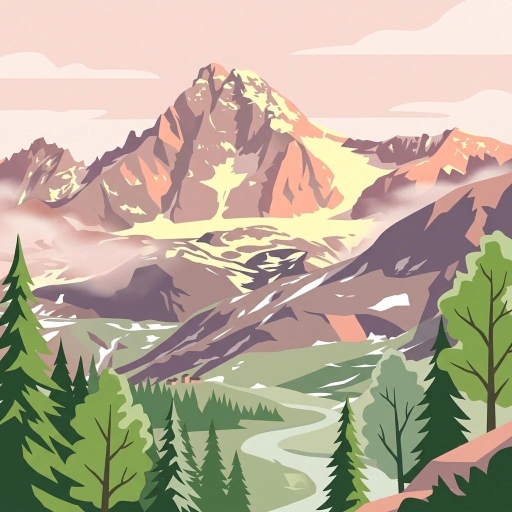
Stylized illustration of a mountain range with glaciers, a winding river, and coniferous forest

Hohe Tauern

National park

Park overview

Structured park overview, official facts, and landscape profile for Hohe Tauern National Park

Hohe Tauern National Park park facts, protected area profile, and essential visitor context

Review the core facts for Hohe Tauern National Park, including designation, size, terrain, visitor scale, habitats, and operating context in one park-focused overview.

About Hohe Tauern National Park

Hohe Tauern National Park stands as Austria's premier alpine protected area, representing the culmination of decades of conservation efforts to preserve the nation's most spectacular mountain landscapes. The park spans a substantial portion of the Central Eastern Alps, creating a coherent protected corridor that traverses multiple Austrian states and encompasses some of the most biologically significant alpine habitats in Europe. The establishment of the park in 1981 marked a pivotal moment in Austrian conservation history, providing formal legal protection to ecosystems that had long been recognized for their outstanding natural value. The protected area is organized into core protection zones where human activity is severely restricted, allowing natural ecological processes to function with minimal interference, and peripheral zones where sustainable uses such as traditional Alpine agriculture continue under carefully regulated conditions. This zoning approach reflects a sophisticated understanding of mountain ecosystem dynamics and the need to balance strict preservation with the cultural practices that have shaped these landscapes over centuries. The park's significance extends beyond its borders as a key node in the European Alps' ecological network, connecting habitat corridors that enable species migration and genetic exchange across the broader Alpine region.

Quick facts and research context for Hohe Tauern National Park

Hohe Tauern National Park occupies the core of the Central Eastern Alps, protecting the highest mountain ranges in Austria. The park's terrain is characterized by dramatic alpine topography with elevations ranging from around 1,000 meters in the valley floors to over 3,700 meters at the summits. The park encompasses numerous glacial valleys, including the famous Großglockner region, and supports extensive glacier coverage that represents a significant component of the Alpine cryosphere. The protected area was formally established in 1981 following decades of conservation advocacy and represents the culmination of protective efforts that began with earlier landscape protection initiatives in the region.

Park context

Deeper park guide and search-rich context for Hohe Tauern National Park

Hohe Tauern National Park history, landscape, wildlife, and travel context

Explore Hohe Tauern National Park through its history, landscape character, ecosystems, wildlife, conservation priorities, cultural context, and seasonal travel timing in a structured park guide built for atlas discovery and search intent.

Why Hohe Tauern National Park stands out

Hohe Tauern is best known for its dramatic alpine scenery, which includes the highest peaks in Austria such as Grossglockner (3,798m) and the Grossvenediger (3,666m). The park protects one of the most extensive glacier systems in the Eastern Alps, with dozens of glaciers descending from the high peaks into the valley basins. The area is renowned for its ecological diversity across dramatic elevation gradients, supporting everything from lush valley forests to sparse alpine tundra. The park also encompasses the Hohe Tauern National Park core zone, which represents strictly protected wilderness where natural processes are allowed to proceed without significant human interference.
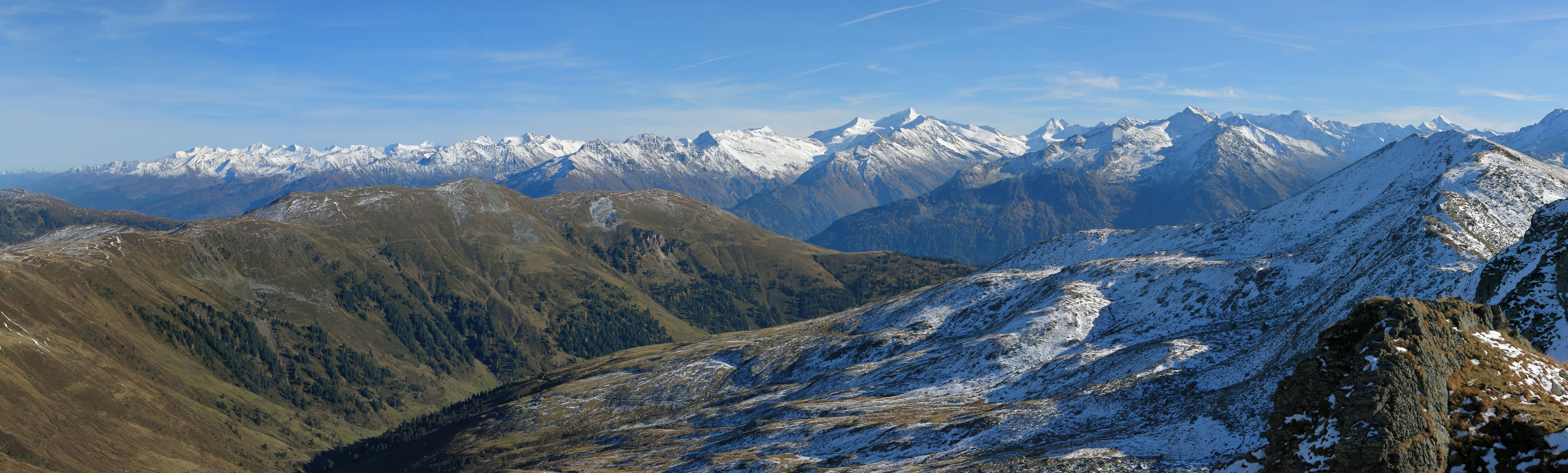
Wide landscape of snow-capped mountains, valleys, and rocky slopes under a clear blue sky
Panoramic view of the Hohe Tauern mountain range including the Glockner and Venediger groups under a clear blue sky

Hohe Tauern National Park history and protected-area timeline

The creation of Hohe Tauern National Park emerged from a long tradition of landscape protection in the Austrian Alps. Early conservation efforts in the region included the designation of smaller protected areas and the recognition of outstanding natural beauty in the high mountain zones. advocacy for a comprehensive national park intensified during the latter decades of the twentieth century as concerns grew about the impacts of increasing development pressure on alpine ecosystems. The formal establishment in 1981 represented a compromise between conservation ambitions and the economic interests of communities traditionally dependent on the mountain environment. The park's creation built upon earlier regional protection initiatives and benefited from growing public awareness of the ecological importance of high Alpine ecosystems. Management of the park has evolved over time, with increasingly sophisticated approaches to balancing visitor access with conservation objectives and refining the zoning system to better protect the most sensitive areas.

Hohe Tauern National Park landscape and geographic character

The landscape of Hohe Tauern National Park is defined by the dramatic geology and geomorphology of the Central Eastern Alps. The terrain is characterized by towering mountain massifs, sharp crests, and deep valleys carved by ancient glaciers. The park encompasses several of Austria's highest peaks, with the Grossglockner group forming a particularly impressive concentration of alpine summits. Glacial valleys radiate from the high peaks, creating a radial drainage pattern that has shaped both the physical geography and human settlement patterns of the region. The park's glacier systems, while diminished from their post-glacial maximum extent, remain significant and include some of the largest glaciers in the Eastern Alps. Rock faces, scree slopes, and alpine meadows create a diverse visual landscape that changes dramatically with elevation and exposure. The transition from forested valley floors through subalpine zones to the bare rock and permanent snow of the high alpine environment represents one of the most distinctive landscape sequences in the European Alps.
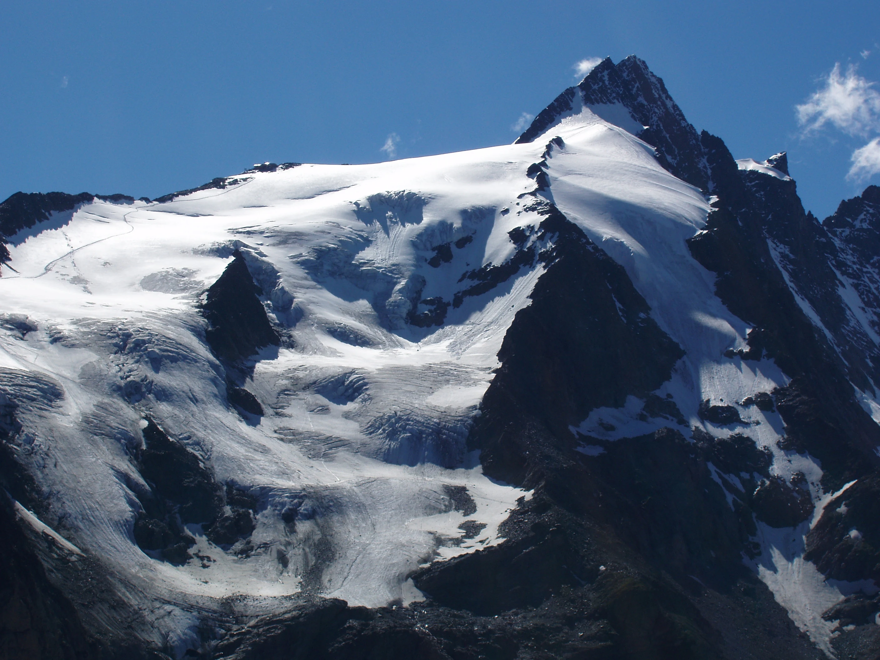
Snow-covered mountain peak with glaciers, rocky slopes, and clear blue sky
Grossglockner mountain peak with glaciers under clear blue sky

Hohe Tauern National Park ecosystems, habitats, and plant life

The ecological systems within Hohe Tauern reflect the diverse environmental conditions created by the park's substantial elevation range and varied topography. The park encompasses a complete altitudinal sequence from montane forests through subalpine and alpine zones to the nival zone above the permanent snow line. Vegetation patterns respond to the strong gradients in temperature, precipitation, and exposure, creating distinct ecological communities at different elevations. The subalpine zone features extensive coniferous forests dominated by Norway spruce and Swiss stone pine, while the alpine zone supports species-rich meadows and heath communities adapted to the short growing season. The high alpine and nival zones are characterized by sparse vegetation adapted to extreme conditions, including cushion plants and specialized rock-dwelling species. The park protects habitats that are increasingly rare in the wider Alpine region, particularly old-growth forest communities and unmodified glacial foreland environments.
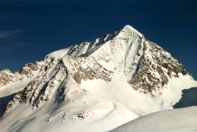
Snow-capped mountain peak with rocky outcrops under clear blue sky
Snow-covered Hochgall mountain peak in the Rieserferner group, Alps

Hohe Tauern National Park wildlife and species highlights

Hohe Tauern provides habitat for a rich alpine fauna, though the harsh environmental conditions at high elevation limit species diversity compared to lower-lying areas. The park supports populations of chamois and Alpine ibex, iconic mountain ungulates that are well adapted to the rocky terrain and steep slopes. Predators including the Golden Eagle and Alpine peregrine falcon hunt across the alpine meadows and cliffs, while smaller mammals such as the Alpine marmot are common in appropriate habitats. The bird community includes species associated with high-altitude environments, with Alpine choughs and Alpine accentors among the characteristic species of the park's open terrain. The严格的保护 status of the core zones provides refuge for species that are sensitive to human disturbance, contributing to the conservation of viable populations of several species of conservation concern.
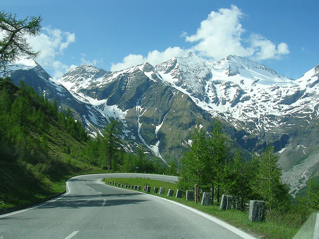
A paved road curves through a mountainous landscape with snow-covered peaks, green trees, and guardrails on a clear day
Winding road through Hohe Tauern National Park with snow-capped mountains and green slopes under a clear sky

Hohe Tauern National Park conservation status and protection priorities

Hohe Tauern National Park represents one of the most important conservation designations in the Austrian Alps, protecting ecosystems that have been significantly altered by human activity in surrounding areas. The park's core protection zones preserve largely unmodified alpine environments where natural processes including succession, disturbance dynamics, and predator-prey relationships can function without significant human interference. These areas serve as reference ecosystems that inform understanding of how Alpine environments function in the absence of intensive management. The park contributes to the conservation of species that require large, contiguous habitat areas and minimal human disturbance, particularly large predators and their prey. Glacier protection within the park is particularly significant given the widespread retreat of Alpine glaciers, as the park's glaciers receive strict protection and are monitored for changes that provide insight into broader climate change impacts.

Hohe Tauern National Park cultural meaning and human context

The Hohe Tauern region has been shaped by centuries of human activity, with Alpine communities developing distinctive cultural practices adapted to the challenging mountain environment. Traditional pastoral activities including Alpine transhumance have influenced the landscape, creating the open meadows and pasturelands that characterize the subalpine zone. Settlements within and adjacent to the park reflect historic patterns of resource use and reflect the adaptation of architectural traditions to local conditions and materials. The relationship between local communities and the mountain environment remains significant, with many residents maintaining connections to traditional land uses that coexist with the conservation objectives of the park. Management approaches recognize these cultural connections and seek to maintain sustainable traditional practices that are compatible with conservation goals.
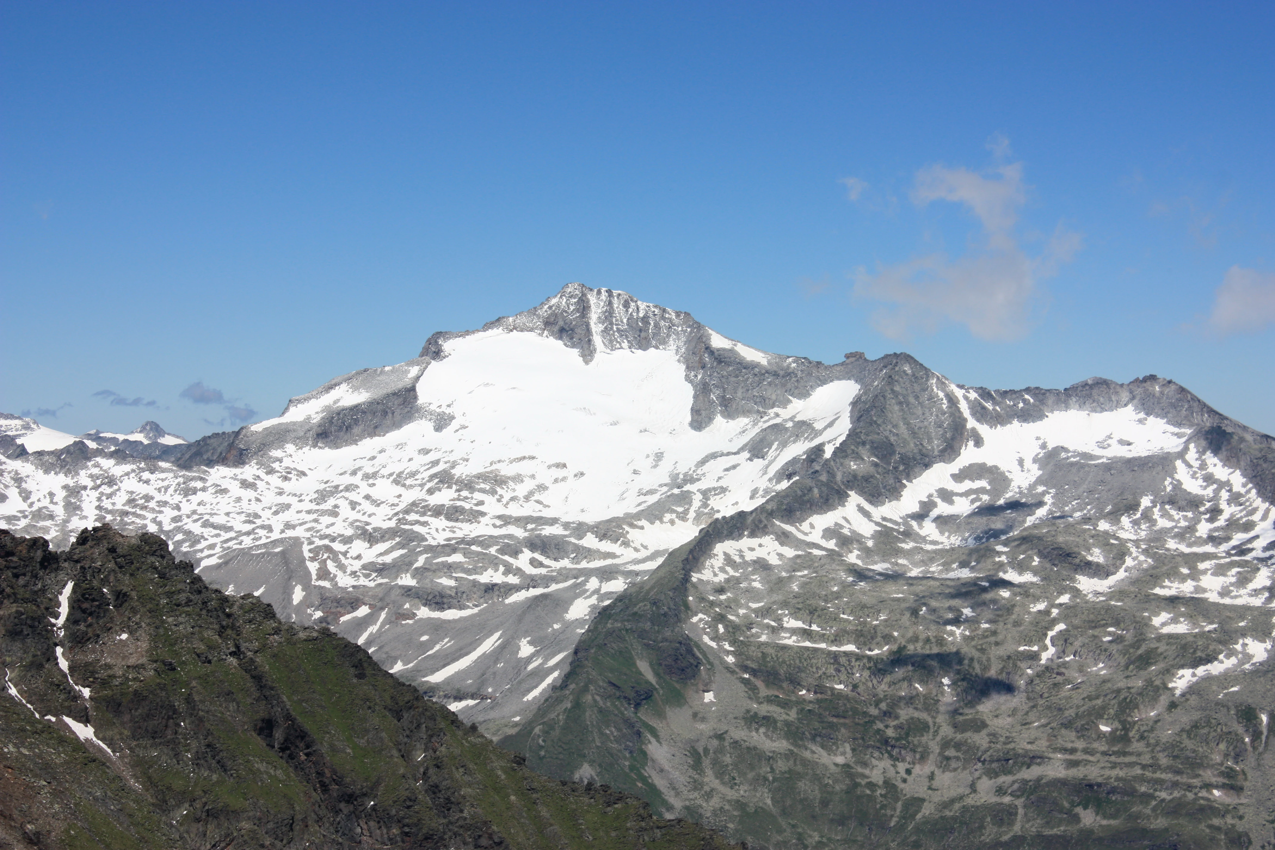
Snow-covered mountain peak with rocky slopes and green vegetation under a clear blue sky
Snow-capped mountain peak in Hohe Tauern National Park under a clear blue sky

Top sights and standout views in Hohe Tauern National Park

The park's highest peaks and glacial landscapes represent its most spectacular natural features, with the Grossglockner region offering exceptional alpine scenery. The extensive glacier systems provide insight into Alpine glaciology and represent significant components of the park's ecological character. The elevation gradient from valley forests to bare peaks creates a remarkable diversity of landscapes within a relatively compact area. The strict protection of core zones ensures that substantial areas of the park retain wilderness character with minimal human infrastructure or disturbance.
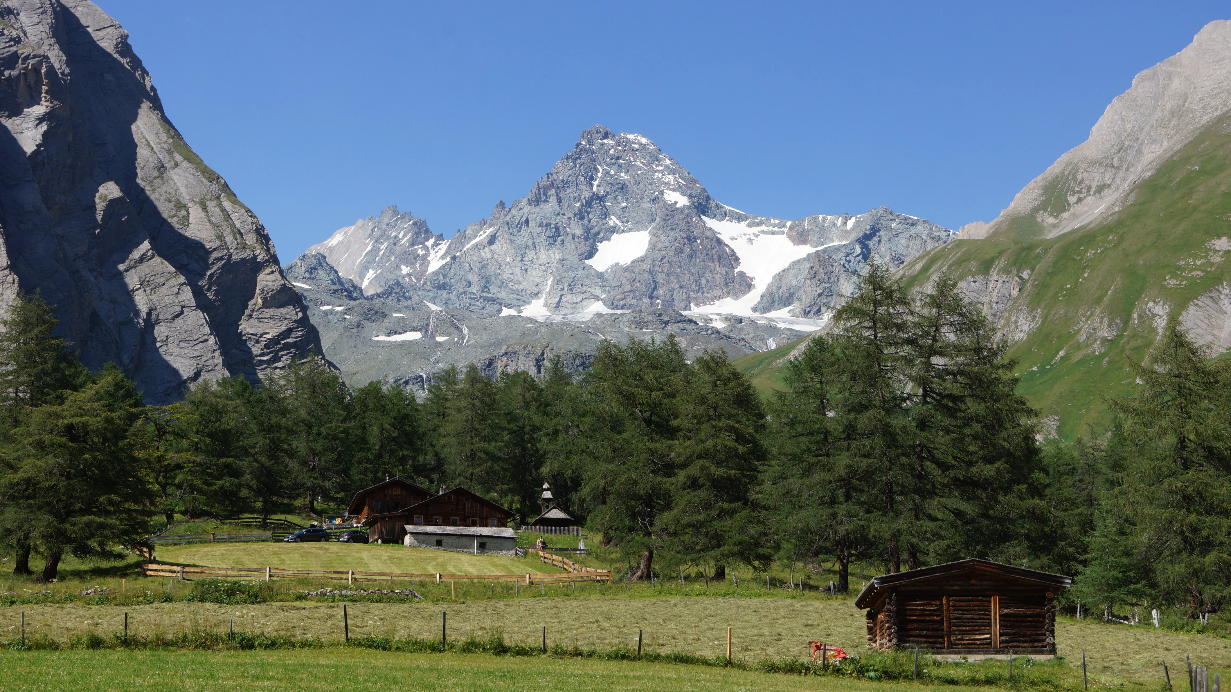
Alpine landscape with mountain valley, wooden huts, and snow-capped mountain peak under clear blue sky
View from Ködnitztal towards Großglockner mountain peak

Best time to visit Hohe Tauern National Park

The summer months from June through September offer the most accessible conditions for exploring the park, with snow-free trails in the lower elevations and comfortable temperatures in the valleys. Winter access is more limited due to heavy snowfall and avalanche risk, though the park's winter landscape offers a very different but equally compelling character for experienced winter mountaineers. The shoulder seasons of late spring and early autumn provide different experiences, with fewer visitors and the opportunity to observe seasonal transitions in the alpine environment. Conditions vary significantly with elevation, and visitors should be prepared for rapid weather changes typical of alpine environments.
Monthly climate preview

Long-term temperature and precipitation records across twelve recorded intervals

Hohe Tauern Climate Normals and Measured Monthly Weather Patterns

Representative baseline coordinates record monthly temperature variations from negative extremes to moderate summer highs alongside fluctuating precipitation rates. Detailed multi-year climate normals clarify long-term atmospheric patterns across the protected landscape.
Annual mean2 °C
-8 °C12 °C
Jan-8°
Feb-8°
Mar-4°
Apr
May
Jun10°
Jul12°
Aug12°
Sep
Oct
Nov-2°
Dec-7°
Warmest month
July

11.9 °C

Coolest month
January

-8.2 °C

Wettest month
July

5.5 mm/day

Driest month
January

1.8 mm/day

Park location guide

Geography guide, regional context, and park location map for Hohe Tauern National Park

Hohe Tauern National Park park geography, regions, and map view in Austria

Understand where Hohe Tauern National Park sits in Austria through a broader geographic reading of the surrounding landscape, nearby location context, and its mapped position within the national park landscape.

How Hohe Tauern National Park fits into Austria

Austria is a landlocked country in Central Europe, bordered by Germany, Czech Republic, Slovakia, Hungary, Slovenia, Italy, Switzerland, and Liechtenstein. The country is a federal semi-presessional republic composed of nine states, with Vienna as its capital and largest city. It has a population of approximately 9.1 million people.

Wider geography shaping Hohe Tauern National Park in Austria

Austria is located in Central Europe, lying in the Eastern Alps. It is bordered by Germany and Czech Republic to the north, Slovakia to the northeast, Hungary to the east, Slovenia and Italy to the south, and Switzerland and Liechtenstein to the west.

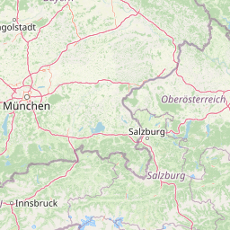
Map view of Hohe Tauern National Park

Use this park location map to pinpoint Hohe Tauern National Park in Austria, understand its exact geographic position, and read its mapped placement within the surrounding landscape more clearly.

Pigeon | © OpenStreetMap contributors

Location context for Hohe Tauern National Park

CarinthiaSalzburgTyrol

Explore protected area views, glacier systems, and high-altitude habitats across the Eastern Alps

Hohe Tauern Landscape Photography and Alpine Scenery Visual Guide

Visual documentation of Hohe Tauern reveals the complex terrain and dramatic elevation gradients that define Austria's largest protected mountain reserve. Detailed imagery captures everything from dense valley forests and glacial valleys to high-alpine tundra and permanent ice fields.

Wide landscape of snow-capped mountains, valleys, and rocky slopes under a clear blue sky

Snow-covered mountain peak with rocky slopes and visible glaciers under clear blue sky

Snow-covered mountain peak with glaciers, rocky slopes, and clear blue sky

Snow-capped mountain peak with rocky outcrops under clear blue sky

A paved road curves through a mountainous landscape with snow-covered peaks, green trees, and guardrails on a clear day

Snow-capped mountain peak with surrounding alpine valleys, forested slopes, and clear blue sky

Snow-covered mountain peak with rocky slopes and green vegetation under a clear blue sky

Alpine landscape with mountain valley, wooden huts, and snow-capped mountain peak under clear blue sky

Snow-covered mountain peaks and valleys in Hohe Tauern National Park, Austria under a clear blue sky

Three mountain peaks with snow on top and rocky slopes, partially obscured by a cloud layer

Map of Hohe Tauern National Park with labeled regions, colored boundary lines, and highlighted central area

Black-and-white photograph of Dreiherrnspitze mountain peak with glaciers and rocky terrain in the Hohe Tauern range

Park atlas

Compare regional mountain terrain and connected high altitude conservation landscapes.

Exploring Parks Near Hohe Tauern and Surrounding Alpine Protected Areas

Browsing other protected areas near Hohe Tauern reveals broader geographic continuity across the Central Eastern Alps. Comparing these neighboring alpine landscapes provides valuable context on regional terrain and interconnected mountain ecosystems.
National parkAustria
Mapped location lies within the park boundary#1 closest

Southwest

Hohe Tauern National Park: Regional Geography and Protected Alpine Mountain Terrain

Major protected area in the heart of the Austrian Alps

Hohe Tauern National Park protects a grand scale of alpine terrain, including towering summits above 3,000 meters and the longest glacial systems in the country. This atlas record provides insights into the park's vertical landscape, encompassing glacial valleys, waterfalls, and diverse ecological zones that define the High Tauern mountain range in Austria.

Watercolor illustration showing mountain ranges, forests, and a river under a light sky.
National parkBavaria
About 46 km away#2 closest

North

Berchtesgaden National Park: Protected Landscape and Regional Geographic Context in Bavaria

Mapped natural terrain and protected area exploration.

Berchtesgaden National Park represents a crucial protected landscape situated in Bavaria, Germany. This entry provides detailed information focused on its protected area status, unique geographic setting, and mapped natural terrain. It serves as a gateway to understanding the park's specific identity within the regional atlas of Germany, offering insights into its boundaries and its significance as a curated natural landscape for discovery.

Area
210 km²
Established
1978
IUCN
II
Relief
Mountain
A pale, minimalist watercolor illustration of layered mountain silhouettes in the background and a green, forested foreground.
Nature reserveTyrol
About 63 km away#3 closest

Northwest

Kaiser Mountains Nature Reserve: Alpine Limestone Landscapes and Regional Geography in Tyrol

A comprehensive look at the Wilder Kaiser and Zahmer Kaiser ridges

The Kaiser Mountains stand as a monumental feature within the Northern Limestone Alps. This nature reserve offers a unique geographic profile, from sheer, pale Wetterstein limestone walls to broad alpine pastures and pine-covered ridges. Its radial drainage patterns and self-contained massif structure provide an essential case study for understanding the diverse mountain terrain that defines the heart of the Austrian Tyrol.

Area
102 km²
Established
1963
Relief
Mountain
Climate
Alpine
Nature reserveGermany
About 68 km away#4 closest

North

Naturwald Kraxenbach: Protected Montane Forest and Alpine Landscape Geography in Bavaria

A comprehensive look at a protected Bavarian mountain reserve

Naturwald Kraxenbach offers a deep dive into the montane ecosystems of the German-Austrian border. This nature reserve protects over 200-year-old forest stands and distinct holly habitats within the steep valleys of the Chiemgauer Alps, providing an essential study of natural forest development in a historical forestry region.

Area
18.01 km²
Established
2020
Relief
Mountain
Climate
Alpine
A watercolor painting showing a wide, panoramic view of rolling, grassy mountain slopes with soft pastel colors and small evergreen trees.
Protected landscapeCarinthia
About 77 km away#5 closest

East

Nock Mountains National Park: Mapping the Rounded Alpine Summits and Glacial Terrain of Carinthia

A protected alpine landscape and UNESCO Biosphere Reserve in the Austrian Alps

Discover the geographic character of Nock Mountains National Park, where the Gurktal Alps transition into sweeping, grass-covered dome summits. This protected area offers a look at a unique Tertiary land surface that survived the last Ice Age, supporting a mosaic of larch forests, alpine pastures, and high-altitude lakes that define the regional geography of southern Austria.

Area
184 km²
Established
1987
IUCN
V
Relief
Mountain
Watercolor illustration showing a mountainous landscape with a waterfall, green hills, and layered colors
National parkProvince of Belluno
About 95 km away#6 closest

Southwest

Dolomiti Bellunesi National Park: National Park, Province of Belluno Protected Landscape

Explore mapped boundaries and regional geography

This entry details Dolomiti Bellunesi National Park, a distinct national park situated within the Province of Belluno. It provides essential geographic context and protected landscape information, enabling users to understand the park's boundaries and its role within the regional terrain. Dive into the mapped features and discover the atlas-driven details of this significant Italian protected area.

Area
32 km²
Established
1988
IUCN
II
Relief
Mountain
Watercolor illustration of a river flowing through a forested valley with mountains in the background
National parkSlovenia
About 96 km away#7 closest

Southeast

Triglav National Park: A Mapped Alpine Protected Landscape in Slovenia

Julian Alps geography, glacial lakes, and karst terrain.

Triglav National Park is Slovenia's premier protected area, covering 880 square kilometers of the Julian Alps. This page details its dramatic alpine geography, including Mount Triglav, glacial valleys, and significant karst features. Understand the mapped boundaries and landscape context of this national park, a key entry in the MoriAtlas geographic discovery resource for understanding protected lands.

Area
880 km²
Established
1981
IUCN
II
Visitors
1.6M annual
A soft watercolor illustration showing a panoramic view of mountain ridgelines in muted green, blue, and faint pink tones against a white background.
Nature reserveSalzkammergut
About 100 km away#8 closest

Northeast

Loser Plateau Nature Reserve: Alpine Karst Geography in the Salzkammergut Mountain Range

Protected high alpine plateau and extensive karst systems

The Loser Plateau is a distinctive high-altitude nature reserve in the Salzkammergut region of Austria. This protected area features expansive limestone pavements, complex karst sinkholes, and massive mountain crags that dominate the skyline above Lake Altaussee. It provides a unique window into high alpine geology, showcasing fossil-rich layers and an intricate network of documented cave systems that rank among the most significant in the Eastern Alps.

Area
12 km²
Relief
Mountain
Climate
Alpine
Access
Easy access

Common questions about visiting, size, designation, and location context for Hohe Tauern National Park

Hohe Tauern National Park FAQs for park facts, access, geography, and protected area context

Find quick answers about Hohe Tauern National Park, including protected-area facts, park geography, trail and visitor context, and how the park fits into its surrounding country and regional landscape.
MoriAtlas Explorer

Continue Your Protected Areas Search Across the Global Atlas

Deepen your exploration by continuing the structured search for national parks and protected areas worldwide. Utilize the comprehensive filtering capabilities to compare different conservation landscapes and refine your understanding of global park geography. Discover more about the distribution and characteristics of protected natural areas.

Global natural geography