
Mori Atlas logo
Nature reserveLoser Plateau

A detailed geographic study of high alpine terrain, limestone massifs, and extensive cave systems.

Loser Plateau Nature Reserve: Exploring the Karst Landscapes of the Salzkammergut Mountains

Loser Plateau represents a dramatic high alpine karst landscape set within the Totes Gebirge of the Salzkammergut region. This nature reserve is characterized by a sprawling upland of pitted limestone, sinkholes, and deep snow-hollows that create an intricate natural terrain. Home to hundreds of catalogued cave systems, the massif serves as a critical geographic study of Eastern Alps geological processes, ranging from Dachstein limestone foundations to rugged Tressensteinkalk summits.

alpine plateaukarst landscapelimestone massifcaves and karstspeleologychamois habitat
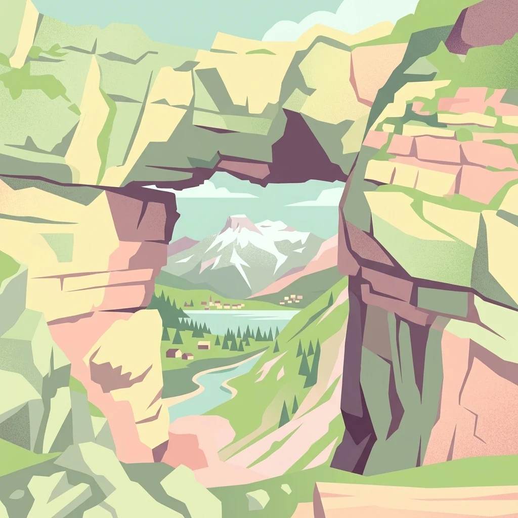
An artistic graphic illustration featuring a natural rock arch in the foreground framing a distant alpine landscape with snowy peaks, a lake, and green valleys.

Loser Plateau

Nature reserve

Park overview

Structured park overview, official facts, and landscape profile for Loser Plateau

Loser Plateau park facts, protected area profile, and essential visitor context

Review the core facts for Loser Plateau, including designation, size, terrain, visitor scale, habitats, and operating context in one park-focused overview.

About Loser Plateau

The Loser Plateau is one of the most distinctive high-altitude landmarks in the Salzkammergut, the lake-rich region of Austria that stretches across Styria, Upper Austria, and Salzburg. It forms the southwestern end of the Augst ridge, a long chain that runs through the Totes Gebirge from Hochanger and Greimuth toward Bräuningzinken and Rinnerkogel. Although the plateau is a broad, gently rising karst upland, it is the dramatic, almost fortress-like Loser summit at 1837 m that gives the entire area its identity.

Geographically, the plateau functions as a transition between the rugged southern escarpment of the Totes Gebirge and the broader, pathless uplands of the range's interior. To the southeast, the Wildenseehütte and path 234 mark a clear route down toward Lake Altaussee (Altausseer See); to the south, the lake itself and the road toward Blaa-Alm frame the plateau's lower limit; to the west, the Grüne Bichl valley forms a boundary; and to the north, the Schönberg ridge crest leads back into the silent expanses of the central Tote Gebirge. The central plateau is exceptionally flat for such an altitude, generally lying between 1500 and 1600 metres and rising gently toward the north and east.

What makes the Loser Plateau distinctive is the contrast between easy reach and genuine wilderness. A toll road, the Loser Panoramastraße, climbs the southern slopes of Loser from Altaussee to a large parking area near 1600 m, where the self-service restaurant Loser-Alm sits just below the Augstsee. From this point, short, well-marked paths lead toward the southern karst slopes of the Vd. Schwarzmooskogel and toward a saddle overlooking the vast central plateau, but the deeper reaches toward Schönberg, Gries Kogel, and Augst-Eck quickly become remote. These are extensive pathless areas of rough karren with almost no surface water during the summer, sustained largely by snowmelt.

Human use of the plateau has been shaped by this contrast. The massifs of the Loser were once vital summer pasture for alpine herders, and the name itself is rooted in this heritage: from the alpine dialect, 'losen' means 'listening', referring to how the sound of grazing cattle and their bells carried up to the high ground. Today, the southern flank has been developed for skiing with lifts and pistes, complemented by a new 10-person gondola, the Panoramabahn Loser, opened in late 2024. The wider plateau itself is a nature reserve, where chamois populations are managed through hunting permits and where caving clubs, including groups from Cambridge and German speleological associations, continue to discover and survey new cave systems.

The plateau is also quietly significant in the cultural history of the region. During the German occupation of Austria, a painting attributed to Anthony van Dyck and belonging to the Rothschild family was hidden in a salt mine near the Loser Plateau, only re-emerging after the war. The Loser also gained a more modern kind of fame when it was used as a filming location for the 2008 action thriller 'The Last Templar', starring Nicolas Cage. These layers of natural, cultural, and modern history sit together unusually closely on one small but dramatic high-altitude stage.

Quick facts and research context for Loser Plateau

The Loser Plateau sits in the Salzkammergut region of Styria, Austria, within the Totes Gebirge limestone massif that overlooks Lake Altaussee. The plateau itself lies around 1500 to 1600 m in altitude and covers roughly 4 square kilometres of central upland, set within a larger massif of about 12 square kilometres. The area is a designated nature reserve, recognised for its alpine karst landscape, extensive cave systems, and controlled chamois hunting. The dominant feature is the Loser peak at 1837 m, whose fortress-like summit gives the plateau its identity and its name.

Protection and recognition

Review verified terrestrial protection measures and international recognition data for Loser Plateau.

Loser Plateau Protection Status and Documented Conservation Scope

Loser Plateau maintains a documented terrestrial protection scope detailing administrative boundaries and conservation governance records. Structured facts outline official designation frameworks and recognized international status attributes for the protected terrain.

Protection details

Protection scope
Terrestrial
Transboundary protection
No
Park context

Deeper park guide and search-rich context for Loser Plateau

Loser Plateau history, landscape, wildlife, and travel context

Explore Loser Plateau through its history, landscape character, ecosystems, wildlife, conservation priorities, cultural context, and seasonal travel timing in a structured park guide built for atlas discovery and search intent.

Why Loser Plateau stands out

The Loser Plateau is best known for its expansive high-alpine karst terrain and its exceptional density of caves. The limestone pavement, sinkholes, dolines, and snow-hollows are textbook examples of Eastern Alps karst, and over 230 caves have been catalogued within the broader plateau area. Several of these caves are internationally significant, including the Raucherkarhöhle, one of the longest cave systems in the world. Equally important is the plateau's visual and geographic identity. The Loser peak itself has become a landmark of the Ausseerland, with a distinctive castle-like summit that rises directly above Lake Altaussee. Visitors come not only for the geology but for the panoramas: from the upper road, parking area, and lifts, the views sweep over the lake, the broader Ausseerland, and the glaciated flanks of the Dachstein massif.
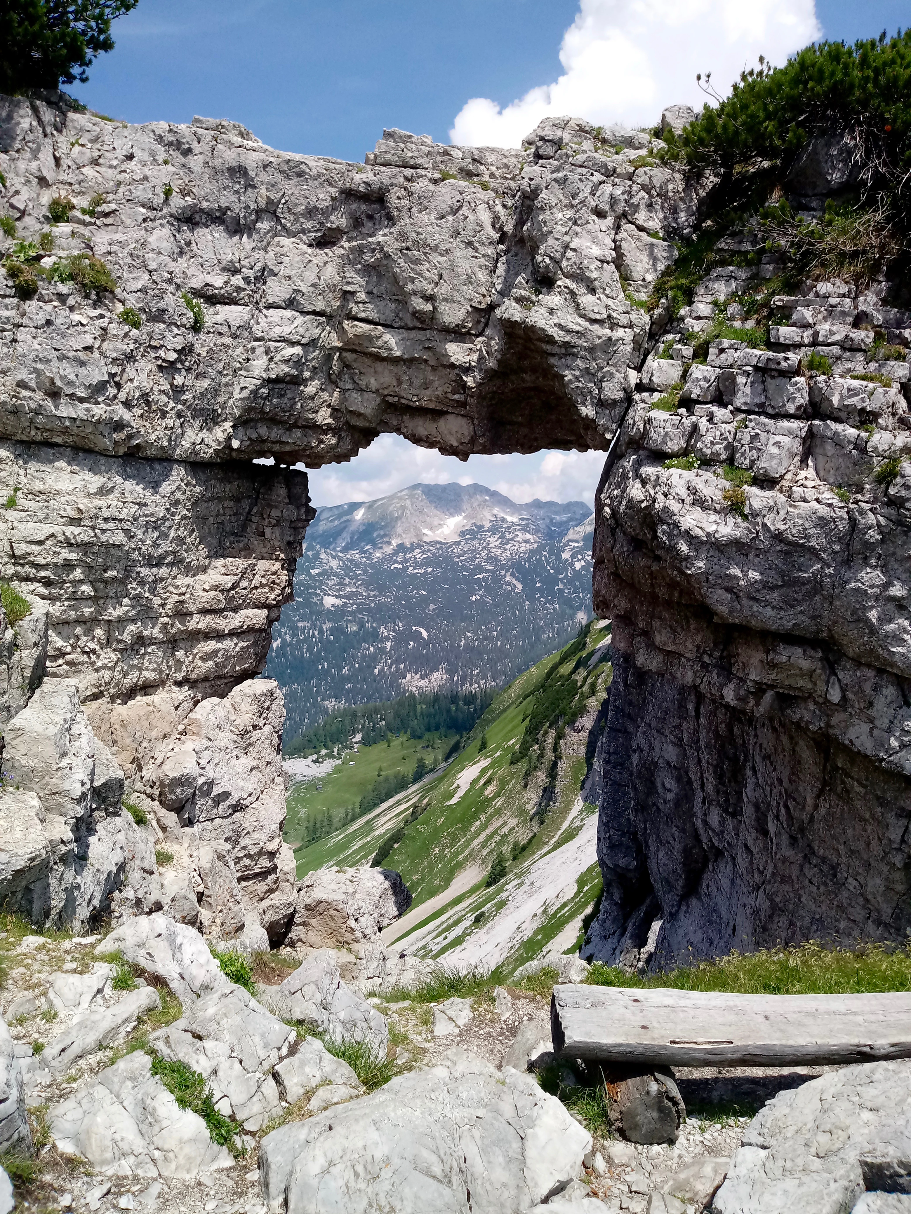
A large natural limestone rock arch framing a distant view of green mountain slopes and a peak under a blue sky.
The natural stone arch known as Loserfenster, framing a view of the Totes Gebirge mountain range.

Loser Plateau history and protected-area timeline

The human relationship with the Loser Plateau stretches back to its use as alpine summer pasture. The traditional explanation for the mountain's name comes from alpine dialect: 'losen' means 'to listen', referring to how the bells and voices of grazing cattle could be heard from the high pastures above. The Loserhütte, at 1498 m, became the oldest refuge hut in the Totes Gebirge, marking the long-standing presence of herders and travellers in the area.

A more modern turning point came with the development of the Loser Panoramastraße, the toll road opened in 1972. It climbs from Altaussee up to around 1600 m and transformed the Loser's accessibility, turning it into a popular viewpoint and family-friendly excursion destination. The southern flanks were subsequently developed for skiing, with successive chairlifts culminating in a new 10-person gondola completed in October 2024.

Caving activity on the plateau has grown steadily since the second half of the twentieth century. Cambridge University Caving Club and German speleological groups have been active in discovering and surveying caves here, and more than 230 caves are now catalogued in the Austrian cave register for the area. The Raucherkarhöhle is internationally notable, ranking among the longest cave systems in the world.

A less well-known but historically significant moment came during the Second World War: a painting by Anthony van Dyck, part of the Rothschild collection, was hidden in a salt mine near the Loser Plateau during the German occupation and only recovered in 1945. The Loser summit cross, erected in 1963 by a local gymnastics club, remains a small but representative piece of post-war mountaineering tradition in the Austrian Alps.

Loser Plateau landscape and geographic character

The Loser Plateau is a textbook example of a high-alpine karst landscape. Its central upland is broad and gently inclined between 1500 and 1600 m, but it is rimmed by dramatic relief: along the south, west, and north, the Loser peak drops in steep, often near-vertical walls, while to the east the plateau blends into the wider Tote Gebirge. The southern face in particular presents a striking fortress-like profile that has become a signature of the Ausseerland.

The surface of the plateau is dominated by karren fields: bare, fluted, and pitted limestone pavements shaped by millions of years of dissolution. Sinkholes, dolines, and snow-hollows interrupt the level ground, and the deeper areas around Schönberg, Gries Kogel, and Augst-Eck feel like rolling, broken moonscapes. Water is scarce in summer here; even small streams are largely absent, with the landscape sustained mostly by snowmelt stored in depressions and underground systems.

The geological base is layered and old. The broad lower flanks of the Loser are built of well-bedded Dachstein limestone, often rich in megalodont fossils and clearly exposed along the toll road up to the Loserhütte. Higher up, roughly 300 m of Jurassic rocks, including red and fine-grained Adneter limestone, radiolarite, and the alternating layers of the Oberalmer Schichten with Barmsteinkalk interbeds, support the massif's bulk. The most dramatic summit towers of the Loser are formed from Tressensteinkalk, a tough, massive limestone that produces the crag-like silhouettes for which the mountain is famous.
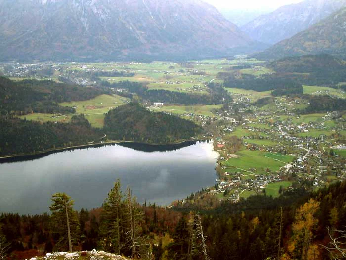
A wide aerial-style view looking down from a high mountain ridge onto a dark alpine lake, a small town with green fields, and surrounding forested mountain slopes.
A high-elevation view of Altaussee village and lake from the Loser Plateau.

Loser Plateau ecosystems, habitats, and plant life

Ecologically, the Loser Plateau belongs to the cold, open world of the high Northern Limestone Alps. Above the tree line, vegetation thins dramatically; what remains is shaped by altitude, exposure, thin soils, and a long snow lie. Low-growing alpine grasses, sedges, cushion plants, and hardy herbs cling to the karren, with patches of krummholz and stunted conifers appearing only where snow lingers longest or where soil has accumulated in depressions. These microhabitats create striking patterns of green and grey across what is otherwise bare white rock.

The plateau functions as an important refuge for alpine fauna, particularly chamois, which move across the rough terrain and through the more remote, pathless interior. The area's protected status as a nature reserve reflects the value of maintaining large, undisturbed expanses of alpine karst, where sensitive species can retreat from human pressure on more accessible slopes.

The caves themselves are an integral part of the plateau's natural value. The hundreds of documented cave systems, including Raucherkarhöhle and Steinbrückenhöhle, support specialised cave-dwelling communities and serve as a natural laboratory for understanding karst evolution. Because the surface is so dry in summer, much of the plateau's ecological activity, including nutrient cycling and invertebrate life, is concentrated around these underground systems and around the few persistent snowfields and meltwater seeps.

Loser Plateau wildlife and species highlights

The dominant large mammal of the Loser Plateau is the chamois, which uses the steep walls and broken karst of both the Loser summit area and the broader plateau interior. Because the area is a protected nature reserve with controlled hunting permits, chamois populations are actively managed, and the plateau remains one of the more reliable places in the region to observe them against the rock.

Alpine birdlife is also characteristic: typical high-altitude species such as Alpine choughs, ravens, and various raptors use the cliffs, snow-hollows, and open uplands. Smaller ground-nesting and rock-loving species find refuge in the more remote, pathless sectors of the plateau, especially around Schönberg and Augst-Eck, where human disturbance is minimal.

The cave ecosystems beneath the plateau support their own specialised fauna, from invertebrates adapted to permanent darkness to the microbial communities studied by speleological groups. While less visible than the surface wildlife, these underground communities are an important part of what makes the Loser Plateau ecologically distinctive.

Loser Plateau conservation status and protection priorities

The Loser Plateau is recognised as a nature reserve specifically because of its exceptional high-alpine karst landscape and its cave heritage. Protection here is not just about scenery; it is about preserving one of the most extensive continuous karst uplands in the Eastern Alps, with intact systems of caves, dolines, and karren fields that are vulnerable to irreversible damage from heavy development.

Conservation management balances recreational use of the southern slopes, particularly skiing, with the need to keep the central plateau and its northern reaches undisturbed. Hunting permits are issued specifically to keep chamois numbers in balance with habitat capacity, an example of active management typical of Austrian alpine reserves.

The plateau's caving resources are also treated as a conservation asset. Continued exploration and survey work by clubs such as Cambridge University Caving Club and ARGE Grabenstetten contributes to scientific understanding of the karst, while Austrian cave registration ensures that fragile underground environments are documented and protected. The result is a protected area where the most dramatic scenic features, the underlying geology, and the wildlife that depends on them are managed as a single, interconnected system.

Loser Plateau cultural meaning and human context

The Loser Plateau sits within the Ausseerland, a sub-region of the Salzkammergut with its own strong sense of identity, shaped by salt mining, alpine herding, and lake culture. The plateau has long been part of this regional life: herders' paths, the old Loserhütte refuge, and the dialects that shaped the mountain's name all reflect a centuries-old working relationship with the high ground.

The plateau is also tied to the broader cultural history of the Salzkammergut through mining. Salt has been extracted near Altaussee for centuries, and during the Second World War the surrounding salt mines served as hiding places for cultural treasures. A painting attributed to Anthony van Dyck and owned by the Rothschild family was concealed in a mine near the Loser Plateau through the occupation and recovered in 1945, an event that briefly placed this remote mountain area into the wider story of European art preservation.

More recently, the plateau has become part of the Ausseerland's identity as a year-round outdoor destination. The Loser summit cross, erected in 1963, and the development of the toll road in 1972 both reflect a shift from purely agricultural use to recreational use. The plateau's appearance as a filming location for international productions, including the 2008 thriller 'The Last Templar', continues that pattern of the landscape being woven into wider cultural narratives.

Top sights and standout views in Loser Plateau

The Loser Plateau's highlights cluster around a few distinct axes. Geologically, it is one of the most richly developed karst landscapes in the Eastern Alps, with more than 230 documented caves and internationally significant systems like Raucherkarhöhle. Visually, the Loser summit with its castle-like profile and the panoramic views from the upper road and Loser-Alm over Lake Altaussee and the Dachstein are defining features of the area. Ecologically, the protected chamois population, the alpine flora clinging to the karren, and the specialised cave fauna add a quieter but equally distinctive layer of value, while the long history of human presence, from alpine herders and salt-mine treasures to modern filmmaking, gives the plateau a strong cultural dimension.

Best time to visit Loser Plateau

Summer and early autumn are the most rewarding times to experience the Loser Plateau. From June through October, the toll road is open, lifts generally operate, and the panoramic viewpoints at the Loser-Alm and around the Augstsee offer their clearest views across Lake Altaussee and toward the Dachstein glaciers. The karst terrain is at its most accessible on foot, and the famous panoramas of the Ausseerland are at their sharpest when the air is clearest, often in early autumn.

Snow cover defines the plateau in winter. The southern face becomes part of the Loser ski area, while the central plateau becomes a remote, silent world of snow and ice, only suitable for experienced winter mountaineers and ski tourers. Because cave exploration continues year-round, conditions inside the cave systems remain a constant feature of the plateau's identity across all seasons.

Seasonal logistics on the plateau can change quickly: snowmelt, fog, and sudden storms are common in the high karst. Visitors planning a trip should allow flexibility for weather windows and treat the central plateau, in any season, as genuinely alpine terrain rather than a simple scenic stop.
Monthly climate preview

Long-term monthly temperature and precipitation patterns across representative terrain

Loser Plateau Climate Normals and Annual Temperature Rhythm

Representative coordinate measurements trace the annual temperature and precipitation rhythm across Loser Plateau from 1991 to 2020. Examining the complete monthly climate profile reveals detailed twelve-month normals for high elevation terrain.
Annual mean5 °C
-5 °C14 °C
Jan-5°
Feb-4°
Mar-1°
Apr
May
Jun13°
Jul14°
Aug14°
Sep10°
Oct
Nov
Dec-4°
Warmest month
July

14.2 °C

Coolest month
January

-5.2 °C

Wettest month
July

5.8 mm/day

Driest month
February

2.3 mm/day

Park location guide

Geography guide, regional context, and park location map for Loser Plateau

Loser Plateau park geography, regions, and map view in Austria

Understand where Loser Plateau sits in Austria through a broader geographic reading of the surrounding landscape, nearby location context, and its mapped position within the national park landscape.

How Loser Plateau fits into Austria

Austria is a landlocked country in Central Europe, bordered by Germany, Czech Republic, Slovakia, Hungary, Slovenia, Italy, Switzerland, and Liechtenstein. The country is a federal semi-presessional republic composed of nine states, with Vienna as its capital and largest city. It has a population of approximately 9.1 million people.

Wider geography shaping Loser Plateau in Austria

Austria is located in Central Europe, lying in the Eastern Alps. It is bordered by Germany and Czech Republic to the north, Slovakia to the northeast, Hungary to the east, Slovenia and Italy to the south, and Switzerland and Liechtenstein to the west.

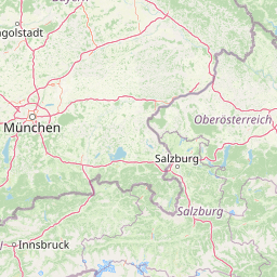
Map view of Loser Plateau

Use this park location map to pinpoint Loser Plateau in Austria, understand its exact geographic position, and read its mapped placement within the surrounding landscape more clearly.

Pigeon | © OpenStreetMap contributors

Location context for Loser Plateau

Salzkammergut

Visual reference guide to high alpine karst terrain, limestone pavements, and protected mountain habitats.

Loser Plateau Photos and Alpine Landscape Scenery

Visual records capture the expansive karst terrain and limestone formations defining the high alpine environment of Loser Plateau. Photographic documentation provides clear insight into remote sinkholes, steep rock faces, and panoramic regional views across the surrounding mountain range.

A large natural limestone rock arch framing a distant view of green mountain slopes and a peak under a blue sky.

A wide, eye-level shot of a large snow-dusted mountain named Loser, which is reflected clearly in the dark, still water of Altaussee Lake under a bright blue sky.

A wide aerial-style view looking down from a high mountain ridge onto a dark alpine lake, a small town with green fields, and surrounding forested mountain slopes.

Park atlas

Compare adjacent limestone massifs and regional mountain terrain.

Explore Protected Areas and Parks Near Loser Plateau

Browse other high alpine karst landscapes and protected areas situated across the surrounding Salzkammergut region. Continued comparison reveals the wider geological patterns and connected terrain extending beyond Loser Plateau.
Watercolor painting depicting layered mountain ranges, forests, and water bodies in green and pink tones
National parkUpper Austria
About 33 km away#1 closest

East

Kalkalpen National Park: Ancient Beech Forests and Karst Protected Landscape

Explore mapped boundaries and unique alpine terrain.

Kalkalpen National Park is a premier protected area in Upper Austria, celebrated for harboring Central Europe's largest remaining ancient beech forests and an extensive karst landscape. This designation underscores its critical role in preserving old-growth forest ecosystems and unique geological formations within the Northern Limestone Alps. Discover the mapped terrain and regional geography that define this significant natural reserve, offering a profound look into the continent's ecological history and protected natural heritage.

Area
208.25 km²
Established
1997
IUCN
II
Relief
Mountain
National parkAustria
About 47 km away#2 closest

East

Limestone Alps National Park: A National Park in Austria's Mapped Protected Landscapes

Explore protected area boundaries and regional geography.

Limestone Alps National Park represents a vital component of Austria's protected lands, contributing to the nation's atlas of natural landscapes. This page details the park's identity as a national park, focusing on its geographic scope and mapped boundaries. Users can delve into the regional context and understand the protected-area significance of Limestone Alps National Park, enriching their exploration of Austria's diverse geography.

Watercolor illustration showing mountain ranges, forests, and a river under a light sky.
National parkBavaria
About 53 km away#3 closest

West

Berchtesgaden National Park: Protected Landscape and Regional Geographic Context in Bavaria

Mapped natural terrain and protected area exploration.

Berchtesgaden National Park represents a crucial protected landscape situated in Bavaria, Germany. This entry provides detailed information focused on its protected area status, unique geographic setting, and mapped natural terrain. It serves as a gateway to understanding the park's specific identity within the regional atlas of Germany, offering insights into its boundaries and its significance as a curated natural landscape for discovery.

Area
210 km²
Established
1978
IUCN
II
Relief
Mountain
National parkStyria
About 58 km away#4 closest

East

Gesäuse National Park: Detailed Protected Landscape and Alpine Geography in Styria

Explore Austria's dramatic river gorge and rugged peaks.

Gesäuse National Park in Styria represents a significant alpine protected area, characterized by the striking Enns river gorge cutting through the Gesäuseberge. This national park offers a unique geographic context, showcasing steep limestone peaks, dramatic rock faces, and a rich hydrological network. Discover the mapped boundaries and protected landscape of one of Austria's most visually striking natural passages, ideal for detailed atlas exploration and understanding alpine conservation.

Area
110 km²
Established
2002
IUCN
II
Relief
Mountain
National parkAustria
About 66 km away#5 closest

Southwest

Hohe Tauern National Park: Regional Geography and Protected Alpine Mountain Terrain

Major protected area in the heart of the Austrian Alps

Hohe Tauern National Park protects a grand scale of alpine terrain, including towering summits above 3,000 meters and the longest glacial systems in the country. This atlas record provides insights into the park's vertical landscape, encompassing glacial valleys, waterfalls, and diverse ecological zones that define the High Tauern mountain range in Austria.

Nature reserveGermany
About 81 km away#6 closest

West

Naturwald Kraxenbach: Protected Montane Forest and Alpine Landscape Geography in Bavaria

A comprehensive look at a protected Bavarian mountain reserve

Naturwald Kraxenbach offers a deep dive into the montane ecosystems of the German-Austrian border. This nature reserve protects over 200-year-old forest stands and distinct holly habitats within the steep valleys of the Chiemgauer Alps, providing an essential study of natural forest development in a historical forestry region.

Area
18.01 km²
Established
2020
Relief
Mountain
Climate
Alpine
A watercolor painting showing a wide, panoramic view of rolling, grassy mountain slopes with soft pastel colors and small evergreen trees.
Protected landscapeCarinthia
About 84 km away#7 closest

South

Nock Mountains National Park: Mapping the Rounded Alpine Summits and Glacial Terrain of Carinthia

A protected alpine landscape and UNESCO Biosphere Reserve in the Austrian Alps

Discover the geographic character of Nock Mountains National Park, where the Gurktal Alps transition into sweeping, grass-covered dome summits. This protected area offers a look at a unique Tertiary land surface that survived the last Ice Age, supporting a mosaic of larch forests, alpine pastures, and high-altitude lakes that define the regional geography of southern Austria.

Area
184 km²
Established
1987
IUCN
V
Relief
Mountain
Protected areaStyria
About 86 km away#8 closest

Southeast

Zirbitzkogel Protected Area: Mapping the Alpine Landscapes and Glacial Terrain of the Seetal Alps

High mountain geography and protected terrain in Styria, Austria

Zirbitzkogel represents the highest point of the Seetal Alps, characterized by crystalline geology, slate, and gneiss. The landscape features a clear progression from subalpine spruce and larch forests to broad, level summit plateaus covered in ragged sedge grasslands. Beyond its alpine vegetation and glacial tarns, the area serves as a critical protected habitat for diverse alpine fauna, offering an ideal setting for understanding regional alpine ecology and complex mountain landforms.

Established
2006
Relief
Mountain
Climate
Alpine
Access
Easy access

Common questions about visiting, size, designation, and location context for Loser Plateau

Loser Plateau FAQs for park facts, access, geography, and protected area context

Find quick answers about Loser Plateau, including protected-area facts, park geography, trail and visitor context, and how the park fits into its surrounding country and regional landscape.
MoriAtlas Explorer

Continue Your Protected Areas Search Across the Global Atlas

Deepen your exploration by continuing the structured search for national parks and protected areas worldwide. Utilize the comprehensive filtering capabilities to compare different conservation landscapes and refine your understanding of global park geography. Discover more about the distribution and characteristics of protected natural areas.

Global natural geography