Mori Atlas logo
National parkHohe Tauern National Park

Mapping the dramatic glacial valleys, vertical terrain, and extensive mountain ecosystems of the central alpine range.

Hohe Tauern National Park: An Atlas of Austria’s Premier Protected High Alpine Mountain Landscapes

Hohe Tauern National Park preserves the geographic heart of the Central Eastern Alps, spanning a vast mountain landscape across Carinthia, Salzburg, and Tyrol. This protected area encompasses Austria’s highest peaks, extensive glacial formations including the Pasterze Glacier, and dramatic valleys carved by historic ice flows. The terrain shifts from deep gorges and coniferous forests to high altitude tundra and nival zones, offering a distinct record of alpine geography and conservation significance in Central Europe.

Alpine MountainsGlacial LandscapeNational ParkAustriaHigh AltitudeNature Reserve

Hohe Tauern National Park

National park

Park overview

Structured park overview, official facts, and landscape profile for Hohe Tauern National Park

Hohe Tauern National Park park facts, protected area profile, and essential visitor context

Review the core facts for Hohe Tauern National Park, including designation, size, terrain, visitor scale, habitats, and operating context in one park-focused overview.

About Hohe Tauern National Park

Hohe Tauern National Park serves as the centerpiece of Austria's protected area network, preserving a unique alpine environment that represents the ecological and scenic heart of the Eastern Alps. The park encompasses the High Tauern range, a 130-kilometer-long mountain chain that forms the main crest of the Central Eastern Alps and includes Austria's highest peaks. The landscape is characterized by massive rock walls, sharp ridgelines, glacial cirques, hanging valleys, and broad alluvial fans descending from the highest summits. Five subgroups of the High Tauern lie entirely within the park: the Venediger Group with the Grossvenediger, the Granatspitze Group, the Glockner Group containing the Grossglockner, the Goldberg Group, and the Ankogel Group with the Hochalmspitze. The park's significance extends beyond its size to include its ecological diversity, geological complexity, and its role in protecting representative examples of Alpine ecosystems from the valley forests through subalpine coniferous zones to alpine meadows and the nival zone above the permanent snow line.

Quick facts and research context for Hohe Tauern National Park

Hohe Tauern National Park covers approximately 1,834 square kilometers, making it by far the largest of Austria's seven national parks. The core zone encompasses about 1,198 square kilometers with complete protection from agricultural use, while a fringe zone of 638 square kilometers permits forestry and alpine meadow farming. The park includes the Grossglockner massif, Austria's highest peak at 3,798 meters above sea level, as well as the Grossvenediger and numerous other three-thousanders. The Pasterze Glacier, Austria's longest glacier, descends from the Grossglockner area. The park is categorized as IUCN Category II and contains five special nature sanctuaries protected from human disturbance.

Park context

Deeper park guide and search-rich context for Hohe Tauern National Park

Hohe Tauern National Park history, landscape, wildlife, and travel context

Explore Hohe Tauern National Park through its history, landscape character, ecosystems, wildlife, conservation priorities, cultural context, and seasonal travel timing in a structured park guide built for atlas discovery and search intent.

Why Hohe Tauern National Park stands out

Hohe Tauern National Park is best known for protecting the most spectacular high-alpine landscape in Austria, centered on the Grossglockner, the country's tallest mountain. The park encompasses the Pasterze Glacier and numerous other glaciers, the impressive Krimml Waterfalls, dramatic glacial valleys and alluvial fans, extended alpine tundra areas, and both coniferous and deciduous forests. The Grossglockner High Alpine Road, one of Europe's most famous scenic mountain roads, traverses the park area and provides access to this remarkable alpine world. The park also protects significant populations of chamois, Alpine ibex, red deer, griffon vultures, and golden eagles, along with successfully reintroduced bearded vultures and Alpine marmots.

Hohe Tauern National Park history and protected-area timeline

The establishment of Hohe Tauern National Park resulted from a declaration signed in 1971 by the participating Austrian states of Carinthia, Salzburg, and Tyrol at Heiligenblut, a village that would become one of the park's main access points. However, the actual implementation of protection took considerable time, with the first areas around the Grossglockner and Hochschober in Carinthia receiving formal protection in 1981. The adjacent territories in Salzburg and Tyrol joined the protected area network in 1992, completing the park's current extent. The Austrian Alpine Club played a crucial role as a major landowner contributing territory to the park, reflecting the long tradition of alpine stewardship in the region. Since the park's establishment, tourism has evolved toward less environmentally harmful practices, with emphasis on protecting and maintaining traditional ways of life in the Alpine region.

Hohe Tauern National Park landscape and geographic character

The landscape of Hohe Tauern National Park represents the dramatic grandeur of high Alpine terrain at its most impressive. The park protects the core of the High Tauern, a mountain range characterized by peaks exceeding 3,000 meters, steep rock faces, and extensive glacial formations. The Grossglockner at 3,798 meters stands as the highest summit in Austria, surrounded by the Grossvenediger at 3,666 meters and numerous other peaks exceeding 3,200 meters in elevation. Glacial valleys carved by ancient ice flows radiate from the main crest, their steep walls and hanging valleys creating spectacular scenery. The Pasterze Glacier, Austria's longest glacier, clings to the slopes of the Grossglockner, while many smaller glaciers persist in high cirques and on shadowed slopes. The northern valleys descending toward the Salzach River feature a staircase structure with impressive waterfalls and dramatic gorges such as the Gasteiner Klamm and Liechtensteinklamm, which have been made accessible to visitors with safe viewing platforms.

Hohe Tauern National Park ecosystems, habitats, and plant life

The ecological systems within Hohe Tauern National Park span a remarkable vertical gradient from valley forests through multiple Alpine zones to the nival level above 2,800 meters. At lower elevations, the park includes both deciduous and coniferous forests, while the subalpine zone features Swiss Pine forests that grow up to the tree line. Above the tree line, the Alpine zone is characterized by alpine meadows and subshrub vegetation dominated by alpenrose, the rust-colored Alpine rose. Among the flora, the endemic Saxifraga rudolphiana represents one of several species specifically adapted to the harsh conditions of the high Alpine environment. The diversity of geological substrates, from ancient gneisses and schists through phyllites and quartzites to younger limestones, creates varied habitat conditions that support this biological richness.

Hohe Tauern National Park wildlife and species highlights

The fauna of Hohe Tauern National Park includes several species characteristic of the Alpine zone that have maintained populations in the protected environment. Chamois and Alpine ibex are common in the rocky terrain above the tree line, while red deer inhabit the forest zones and alpine meadows. The bird community includes the griffon vulture and golden eagle, both of which hunt in the Alpine environment. A notable conservation success story is the reintroduction of the bearded vulture, which had become extinct in the region but has been reestablished through careful conservation programs. Similarly, the Alpine marmot, once locally extinct, has been reintroduced and now thrives in appropriate habitats within the park. These reintroductions demonstrate the effectiveness of the protected area in supporting populations of species that require large, undisturbed Alpine habitats.

Hohe Tauern National Park conservation status and protection priorities

Hohe Tauern National Park represents the highest level of nature protection in Austria and serves as the flagship conservation area for the country's Alpine environment. As the largest national park in Austria and the largest protected area in the Alps, the park preserves representative examples of Alpine ecosystems that would otherwise face pressure from development, tourism infrastructure, and resource extraction. The division between core zones with complete protection and fringe zones allowing controlled use reflects a management approach that balances conservation with traditional Alpine land use. The five special nature sanctuaries within the park receive the highest level of protection, completely excluding human disturbance to preserve particularly sensitive ecological areas. The park's IUCN Category II designation recognizes its role in protecting natural landscapes while allowing for sustainable visitation and environmental education.

Hohe Tauern National Park cultural meaning and human context

The High Tauern have been inhabited and used by Alpine peoples for centuries, with traditional agriculture, particularly alpine meadow farming and forestry, shaping the landscape in the lower elevations. The region has a strong cultural identity tied to Alpine traditions, including the use of mountain pastures during the summer months and the maintenance of historic trails and settlements. The Austrian Alpine Club, founded in 1862, played a pioneering role in Alpine exploration and conservation, and its contributions of land were essential to establishing the national park. The maintenance of traditional ways of life remains an emphasis within the park's management philosophy, recognizing that cultural practices are intertwined with the Alpine landscape. Major transportation routes, including the Grossglockner High Alpine Road opened in 1935 and various tunnels such as the Tauern Railway Tunnel completed in 1906, have historically provided access to this remote mountain region.

Top sights and standout views in Hohe Tauern National Park

Hohe Tauern National Park offers exceptional highlights including the opportunity to experience Austria's highest mountain, the Grossglockner, and to view the Pasterze Glacier from its slopes. The Krimml Waterfalls, among of the most impressive in the Alpine region, cascade from glacial meltwater in the western part of the park. The Grossglockner High Alpine Road provides legendary scenic motoring through the park, including passage through a tunnel beneath the Hochtor Pass at 2,505 meters elevation. Visitors can explore dramatic glacial valleys, witness diverse Alpine flora and fauna, and experience the dramatic vertical landscape from valley floors through forests to the stark beauty of the nival zone.

Best time to visit Hohe Tauern National Park

The summer months from June through September offer the most accessible conditions for exploring Hohe Tauern National Park, with snow-free trails and open mountain passes allowing access to the higher elevations. During this period, the alpine meadows display their full flower displays, wildlife is active at higher elevations, and the scenic drives such as the Grossglockner High Alpine Road operate their full season. The winter season transforms the park into a skiing destination in lower areas, though the high Alpine terrain is then accessible only to experienced winter mountaineers. Spring and autumn shoulder seasons can offer good conditions with fewer visitors, though some facilities and passes may have limited availability.
Monthly climate preview

Long-term monthly temperature and precipitation patterns recorded at a representative coordinate

Hohe Tauern National Park Climate Normals, Annual Temperature, and Precipitation Rhythm

Hohe Tauern National Park exhibits a measured annual rhythm ranging from deep sub-zero monthly minimums to moderate summer maximums alongside varying daily precipitation rates. Examining the full monthly climate normals provides a detailed baseline of long-term temperature and precipitation averages across the representative coordinate.
Annual mean2 °C
-8 °C12 °C
Jan-8°
Feb-8°
Mar-4°
Apr1°
May6°
Jun10°
Jul12°
Aug12°
Sep8°
Oct3°
Nov-2°
Dec-7°
Warmest month
July

11.9 °C

Coolest month
January

-8.2 °C

Wettest month
July

5.5 mm/day

Driest month
January

1.8 mm/day

Park location guide

Geography guide, regional context, and park location map for Hohe Tauern National Park

Hohe Tauern National Park park geography, regions, and map view in Austria

Understand where Hohe Tauern National Park sits in Austria through a broader geographic reading of the surrounding landscape, nearby location context, and its mapped position within the national park landscape.

How Hohe Tauern National Park fits into Austria

Austria is a landlocked country in Central Europe, bordered by Germany, Czech Republic, Slovakia, Hungary, Slovenia, Italy, Switzerland, and Liechtenstein. The country is a federal semi-presessional republic composed of nine states, with Vienna as its capital and largest city. It has a population of approximately 9.1 million people.

Wider geography shaping Hohe Tauern National Park in Austria

Austria is located in Central Europe, lying in the Eastern Alps. It is bordered by Germany and Czech Republic to the north, Slovakia to the northeast, Hungary to the east, Slovenia and Italy to the south, and Switzerland and Liechtenstein to the west.

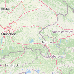
Map view of Hohe Tauern National Park

Use this park location map to pinpoint Hohe Tauern National Park in Austria, understand its exact geographic position, and read its mapped placement within the surrounding landscape more clearly.

Pigeon | © OpenStreetMap contributors
Natural feature types

Browse the Complete Collection of Hohe Tauern National Park Geographic Features

Utilize this structured index to trace the distribution of named natural landmarks across the Hohe Tauern landscape. MoriAtlas enables precise examination of individual glaciers, summits, and alpine water systems to deepen your understanding of this vast protected territory.
Recorded earthquake history

Examine Recorded Earthquake History Near Hohe Tauern National Park

Consult the historical catalogue of seismic events documented in the surrounding region of Hohe Tauern National Park. This MoriAtlas resource organizes recorded epicentres by distance, magnitude, and date to support a better understanding of regional seismic history within these protected alpine lands.

Hohe Tauern National Park Earthquake History

Catalogued events

99 events

Strongest magnitude

Magnitude 4.7

Most recent event

Aug 16, 2021

This history includes earthquakes recorded inside the park or within 50 km of its borders

Park atlas

Compare adjacent mountain reserves and regional protected landscapes across the Central Eastern Alps

Exploring Other Parks Near Hohe Tauern National Park and Surrounding Alpine Protected Areas

Visitors can browse other protected areas near Hohe Tauern National Park to examine matching high-alpine geography and glacial terrain. Comparing adjacent mountain reserves provides broader context for understanding the wider ecological and geological patterns of the region.
Watercolor painting showing mountain ranges with green, yellow, and pink hues, depicting layered peaks and cloud formations
National parkAustria
Mapped location lies within the park boundary#1 closest

Northeast

Hohe Tauern National Park: Alpine Geography and Protected Landscape Atlas

High-altitude mountain terrain and glacial systems in Austria

Hohe Tauern serves as a primary protected area within the Austrian Alps, showcasing a vast sequence of glacial valleys, sharp mountain massifs, and high-alpine tundra. This exploration details the park's physical boundaries and its significance in preserving diverse ecological gradients and wilderness core zones across the Central Eastern Alps.

Area
1,806 km²
Established
1981
IUCN
II
Relief
Mountain
A watercolor painting showing a wide, panoramic view of rolling, grassy mountain slopes with soft pastel colors and small evergreen trees.
Protected landscapeCarinthia
About 27 km away#2 closest

East

Nock Mountains National Park: Mapping the Rounded Alpine Summits and Glacial Terrain of Carinthia

A protected alpine landscape and UNESCO Biosphere Reserve in the Austrian Alps

Discover the geographic character of Nock Mountains National Park, where the Gurktal Alps transition into sweeping, grass-covered dome summits. This protected area offers a look at a unique Tertiary land surface that survived the last Ice Age, supporting a mosaic of larch forests, alpine pastures, and high-altitude lakes that define the regional geography of southern Austria.

Area
184 km²
Established
1987
IUCN
V
Relief
Mountain
Watercolor illustration showing mountain ranges, forests, and a river under a light sky.
National parkBavaria
28 km away#3 closest

North

Berchtesgaden National Park: Protected Landscape and Regional Geographic Context in Bavaria

Mapped natural terrain and protected area exploration.

Berchtesgaden National Park represents a crucial protected landscape situated in Bavaria, Germany. This entry provides detailed information focused on its protected area status, unique geographic setting, and mapped natural terrain. It serves as a gateway to understanding the park's specific identity within the regional atlas of Germany, offering insights into its boundaries and its significance as a curated natural landscape for discovery.

Area
210 km²
Established
1978
IUCN
II
Relief
Mountain
A pale, minimalist watercolor illustration of layered mountain silhouettes in the background and a green, forested foreground.
Nature reserveTyrol
About 35 km away#4 closest

Northwest

Kaiser Mountains Nature Reserve: Alpine Limestone Landscapes and Regional Geography in Tyrol

A comprehensive look at the Wilder Kaiser and Zahmer Kaiser ridges

The Kaiser Mountains stand as a monumental feature within the Northern Limestone Alps. This nature reserve offers a unique geographic profile, from sheer, pale Wetterstein limestone walls to broad alpine pastures and pine-covered ridges. Its radial drainage patterns and self-contained massif structure provide an essential case study for understanding the diverse mountain terrain that defines the heart of the Austrian Tyrol.

Area
102 km²
Established
1963
Relief
Mountain
Climate
Alpine
Nature reserveGermany
About 52 km away#5 closest

North

Naturwald Kraxenbach: Protected Montane Forest and Alpine Landscape Geography in Bavaria

A comprehensive look at a protected Bavarian mountain reserve

Naturwald Kraxenbach offers a deep dive into the montane ecosystems of the German-Austrian border. This nature reserve protects over 200-year-old forest stands and distinct holly habitats within the steep valleys of the Chiemgauer Alps, providing an essential study of natural forest development in a historical forestry region.

Area
18.01 km²
Established
2020
Relief
Mountain
Climate
Alpine
Watercolor illustration of a river flowing through a forested valley with mountains in the background
National parkSlovenia
61 km away#6 closest

Southeast

Triglav National Park: A Mapped Alpine Protected Landscape in Slovenia

Julian Alps geography, glacial lakes, and karst terrain.

Triglav National Park is Slovenia's premier protected area, covering 880 square kilometers of the Julian Alps. This page details its dramatic alpine geography, including Mount Triglav, glacial valleys, and significant karst features. Understand the mapped boundaries and landscape context of this national park, a key entry in the MoriAtlas geographic discovery resource for understanding protected lands.

Area
880 km²
Established
1981
IUCN
II
Visitors
1.6M annual
Watercolor illustration showing a mountainous landscape with a waterfall, green hills, and layered colors
National parkProvince of Belluno
64 km away#7 closest

Southwest

Dolomiti Bellunesi National Park: National Park, Province of Belluno Protected Landscape

Explore mapped boundaries and regional geography

This entry details Dolomiti Bellunesi National Park, a distinct national park situated within the Province of Belluno. It provides essential geographic context and protected landscape information, enabling users to understand the park's boundaries and its role within the regional terrain. Dive into the mapped features and discover the atlas-driven details of this significant Italian protected area.

Area
32 km²
Established
1988
IUCN
II
Relief
Mountain
A soft watercolor illustration showing a panoramic view of mountain ridgelines in muted green, blue, and faint pink tones against a white background.
Nature reserveSalzkammergut
About 66 km away#8 closest

Northeast

Loser Plateau Nature Reserve: Alpine Karst Geography in the Salzkammergut Mountain Range

Protected high alpine plateau and extensive karst systems

The Loser Plateau is a distinctive high-altitude nature reserve in the Salzkammergut region of Austria. This protected area features expansive limestone pavements, complex karst sinkholes, and massive mountain crags that dominate the skyline above Lake Altaussee. It provides a unique window into high alpine geology, showcasing fossil-rich layers and an intricate network of documented cave systems that rank among the most significant in the Eastern Alps.

Area
12 km²
Relief
Mountain
Climate
Alpine
Access
Easy access

Common questions about visiting, size, designation, and location context for Hohe Tauern National Park

Hohe Tauern National Park FAQs for park facts, access, geography, and protected area context

Find quick answers about Hohe Tauern National Park, including protected-area facts, park geography, trail and visitor context, and how the park fits into its surrounding country and regional landscape.
MoriAtlas Explorer

Continue Your Protected Areas Search Across the Global Atlas

Deepen your exploration by continuing the structured search for national parks and protected areas worldwide. Utilize the comprehensive filtering capabilities to compare different conservation landscapes and refine your understanding of global park geography. Discover more about the distribution and characteristics of protected natural areas.

Global natural geography