Mori Atlas logo
National parkGesäuse National Park

Discover the mapped protected landscape of Gesäuse National Park in Styria, Austria.

Gesäuse National Park: Austria's Dramatic Alpine Gorge National Park Detailed Geography

Gesäuse National Park is a premier protected alpine wilderness located in the scenic region of Styria, Austria. This national park safeguards a significant portion of the Gesäuse range within the Ennstal Alps, celebrated for its dramatic water gap where the Enns river carves through steep limestone peaks. Spanning over 12,000 hectares, the park offers a deep dive into rugged alpine terrain and vital protected ecosystems, making it a key destination for atlas-based geographic discovery and understanding regional conservation efforts.

Alpine MountainsNational ParkAustriaEnnstal AlpsEndemic SpeciesProtected Area

Gesäuse National Park

National park

Park overview

Structured park overview, official facts, and landscape profile for Gesäuse National Park

Gesäuse National Park park facts, protected area profile, and essential visitor context

Review the core facts for Gesäuse National Park, including designation, size, terrain, visitor scale, habitats, and operating context in one park-focused overview.

About Gesäuse National Park

Gesäuse National Park occupies a remarkable position in Austria's protected area network, safeguarding one of the most geologically dramatic landscapes in the eastern Alps. The park encompasses the heart of the Gesäuse mountains, a limestone subrange of the Ennstal Alps characterized by towering peaks, sheer rock walls, and the spectacular gorge through which the Enns river has carved its path over millennia. The area stretches across multiple municipalities including Johnsbach, Weng im Gesäuse, Landl, and Sankt Gallen, with the park headquarters located in Weng. The physical geography is defined by extreme relief energy—the difference between valley floors and mountain ridges is often dramatic, creating diverse microclimates and ecological niches within a relatively compact area. Recent expansion announced in October 2023 increased the park by 113 hectares through a cooperation agreement with the Austrian Federal Railways (ÖBB), filling previous gaps in the protected area network. The park's management operates under a dual-zone system, with the vast majority designated as a nature zone where natural processes are allowed to proceed without active intervention, while a smaller preservation zone accommodates traditional land uses and necessary infrastructure.

Quick facts and research context for Gesäuse National Park

Gesäuse National Park spans the Ennstal Alps in Styria, Austria, protecting a dramatic alpine landscape centered on the Enns river water gap between Admont and Hieflau. The park ranges in elevation from 490 meters in the valley floors to 2,369 meters at Hochtor, the highest peak. Over 99 percent of the land is owned by the Steiermärkische Landesforste (Styrian Provincial Forests), and the area was formally designated as an IUCN Category II protected area in December 2003. The park is organized into a nature zone covering roughly 75 percent of the area, which will eventually be left to develop without human intervention, and a preservation zone that permits limited traditional uses such as alpine pastoral farming.

Protection and recognition

Documenting the terrestrial boundaries and international conservation framework of the Austrian park.

Gesäuse National Park Protection Status and Terrestrial Conservation Scope

Geographic researchers can evaluate the official terrestrial classification and documented boundary protections assigned to Gesäuse National Park. Comprehensive mapping of conservation frameworks clarifies how the region aligns with international environmental standards and national preservation criteria.

Protection details

Protection scope
Terrestrial
Transboundary protection
No
Park context

Deeper park guide and search-rich context for Gesäuse National Park

Gesäuse National Park history, landscape, wildlife, and travel context

Explore Gesäuse National Park through its history, landscape character, ecosystems, wildlife, conservation priorities, cultural context, and seasonal travel timing in a structured park guide built for atlas discovery and search intent.

Why Gesäuse National Park stands out

Gesäuse National Park is best known for its dramatic alpine gorge where the Enns river cuts through the Gesäuse mountains, creating one of Austria's most visually striking natural passages. The park has gained particular recognition for its extraordinary biodiversity and endemism, hosting 30 endemic plant species and 195 endemic animal species within its boundaries, making it a recognized hotspot in the northeastern Kalkalpen. The park also stands out for its exceptional darkness, a rare quality in densely populated Central Europe, making it one of the least light-polluted locations in the region and an outstanding destination for stargazing.

Gesäuse National Park history and protected-area timeline

The establishment of Gesäuse National Park represents the culmination of over a century of conservation advocacy in Styria. Early proposals for protecting this landscape emerged in 1913, when the first suggestions for a nature park in the Niederen Tauern region were made alongside plans for hydroelectric development in the Gesäuse. In 1958, the Styrian provincial government declared the Gesäuse and adjacent Ennstal valley as the first nature protection areas in the province, providing initial legal recognition to the area's natural values. The movement toward full national park status accelerated in 1977 when the provincial parliament passed a resolution supporting creation of a National Park Niederere Tauern, followed by years of studies and sometimes contentious public debate. A precursor association formed in autumn 1997 advocated for the national park, while a opposing protection society formed in 1998. Multiple referendums in 2001 produced mixed results, but the provincial parliament passed the National Park Act in March 2002, with the regulations and management plan taking effect in March 2003. International recognition by the IUCN followed in December 2003, confirming the park's Category II status. The tourism association Alpenregion Nationalpark Gesäuse was established in 2006, and the significant expansion announced in 2023 demonstrates continued growth in protection scope.

Gesäuse National Park landscape and geographic character

The landscape of Gesäuse National Park is defined by the dramatic encounter between water and rock in the Ennstal Alps. The Enns river, one of Austria's significant waterways, has carved a spectacular water gap through the Gesäuse mountains, creating a steep-sided gorge that serves as the dramatic centerpiece of the park. The valley floor sits at approximately 490 meters elevation, while the surrounding peaks rise sharply to 2,369 meters at Hochtor, creating a vertical span of nearly 1,900 meters. The Gesäuseberge themselves present a classic alpine character with their jagged limestone summits, precipitous rock faces, and debris-covered slopes. Along the valley floors, the river is fed by tributaries including the Johnsbach and Hartelsgraben, creating a complex hydrological network. The combination of steep terrain, deep valleys, and exposed rock creates a landscape of considerable visual drama, with the changing seasons bringing distinct moods—from the turbulent waters of spring snowmelt to the clear, sharp conditions of winter.

Gesäuse National Park ecosystems, habitats, and plant life

The ecological character of Gesäuse National Park is shaped by four primary habitat types that form the foundation of its biodiversity: water, forest, alpine meadows, and rock. The Enns river and its tributaries create dynamic aquatic environments, while approximately half the park is forested. Valley forests include riparian woodlands and maple-ash communities, while higher elevations feature spruce-fir-beech forests that were historically managed for timber production. At higher elevations, snow-heath pine forests survive as glacial relicts, and the park contains the easternmost populations of Swiss stone pine (Zirbe). Above the tree line, mountain pine (Latsche) forms dense krummholz communities. The extreme topographic variation allows alpine species to descend into lower elevations through avalanche chutes and debris channels, creating unusual ecological mixing. The park's position away from major urban centers has preserved exceptionally dark night skies, ranking it among the least light-polluted sites in Central Europe—a characteristic that also indicates the relatively intact natural darkness of the ecosystem.

Gesäuse National Park wildlife and species highlights

Gesäuse National Park supports a rich fauna that reflects the diversity of its alpine and forest habitats. The park hosts approximately 90 breeding bird species, including 17 species listed under Annex I of the EU Birds Directive and 24 species considered threatened at the national level. Among the notable invertebrates are several butterfly species protected under the FFH Directive, including the Apollo butterfly, thyme ant-blue, Russian bear, dark green fritillary, and scabious fritillary. The Alpenbock longhorn beetle represents another protected invertebrate species. Among vertebrates, the park supports populations of yellow-bellied toad (Gelbbauchunke), bullhead fish (Koppe), Ukrainian brook lamprey, and European otter. Bat species include the common pipistrelle and lesser horseshoe bat. The endemism is particularly striking, with 195 endemic animal species recorded, including the Northern giant eye (a harvestman spider) and the Styrian damselfly beetle, both confined to this portion of the northeastern Kalkalpen.

Gesäuse National Park conservation status and protection priorities

Gesäuse National Park plays a significant role in conserving the biodiversity of the northeastern Kalkalpen, one of Europe's most species-rich alpine regions. The recognition of the area as an endemism hotspot—containing both 30 endemic plant species and 195 endemic animal species—underscores its conservation importance at the European scale. In 2018, approximately 85 percent of the park was formally designated as protection forest under Austrian forestry law, which exempts property owners from mandatory interventions against bark beetle infestations, allowing natural forest dynamics to proceed in most of the park. This approach reflects the park's ultimate goal of achieving complete non-intervention in the nature zone. The presence of numerous FFH Directive species—including butterflies, beetles, amphibians, fish, and mammals—demonstrates compliance with European conservation standards. The park's dark-sky values also represent a conservation dimension beyond biodiversity, protecting the natural nocturnal environment that is increasingly rare in populated Europe.

Gesäuse National Park cultural meaning and human context

The human context of Gesäuse National Park is intertwined with the traditional alpine communities that have shaped the landscape over centuries. The park encompasses settlements including Admont, Johnsbach, Weng, Hieflau, Landl, and Sankt Gallen, which now fall within the national park boundaries and cooperate through the tourism association. Traditional alpine pastoral practices have historically shaped the meadows and grasslands, and the preservation zone explicitly accommodates continued extensive alpine farming. The area has historical connections to mining and resource extraction, as evidenced by the Johnsbach copper mining trail. These communities now find themselves at the heart of a protected area, with tourism and conservation forming new pillars of the regional economy alongside continued traditional land uses.

Top sights and standout views in Gesäuse National Park

Gesäuse National Park offers visitors the experience of walking through one of Austria's most dramatic alpine gorges, where the Enns river thunders through the Gesäuse mountains. The Nationalparkpavillon at Gstatterboden provides panoramic views of the Hochtor group, while the Weidendom near Johnsbach—a living willow structure—offers unique nature education experiences. Several themed trails traverse the park, including the Au-Erlebnispfad through the Lettmair Au wetland, the Wilde John trail, and the Luchs Trail connecting to adjacent protected areas. The park's exceptional darkness makes it a destination for astronomical observation, while the concentration of endemic species in the northeastern Kalkalpen provides unique opportunities for nature study. The recent expansion demonstrates ongoing commitment to completing the protection network in this remarkable alpine landscape.

Best time to visit Gesäuse National Park

The optimal time to experience Gesäuse National Park depends on the desired activities and conditions. Summer months (June through September) offer the most accessible trail conditions and the full range of hiking opportunities, with the valley trails and higher paths generally snow-free. Autumn brings the golden colors of changing foliage and reduced crowds, though higher trails may experience early snowfall. Winter transforms the landscape into a quiet alpine wonderland, though trail access becomes more limited and winter sports activities are concentrated in designated areas outside the core wilderness zone. Spring (May and early June) sees the river running high with snowmelt and wildflowers emerging in the lower meadows. The dramatic scenery of the Enns gorge is compelling year-round, while the exceptional dark-sky conditions make the park particularly rewarding for stargazing on clear nights during any season when visitor activity is minimal.

Monthly climate preview

Track the seasonal temperature transitions and monthly precipitation trends across Styria

Monthly Climate Normals and Average Weather for Gesäuse National Park

Long term observations at a representative elevation of 1055 meters show annual temperatures transitioning from sub zero winter averages to summer peaks near 15 degrees Celsius with increased daily precipitation. Exploring the twelve month profile reveals detailed minimum and maximum variations to help compare monthly climate normals for Gesäuse National Park.
Annual mean6 °C
-4 °C16 °C
Jan-4°
Feb-3°
Mar
Apr
May10°
Jun14°
Jul16°
Aug16°
Sep11°
Oct
Nov
Dec-3°
Warmest month
July

15.7 °C

Coolest month
January

-4 °C

Wettest month
July

4.9 mm/day

Driest month
January

1.6 mm/day

Park location guide

Geography guide, regional context, and park location map for Gesäuse National Park

Gesäuse National Park park geography, regions, and map view in Austria

Understand where Gesäuse National Park sits in Austria through a broader geographic reading of the surrounding landscape, nearby location context, and its mapped position within the national park landscape.

How Gesäuse National Park fits into Austria

Austria is a landlocked country in Central Europe, bordered by Germany, Czech Republic, Slovakia, Hungary, Slovenia, Italy, Switzerland, and Liechtenstein. The country is a federal semi-presessional republic composed of nine states, with Vienna as its capital and largest city. It has a population of approximately 9.1 million people.

Wider geography shaping Gesäuse National Park in Austria

Austria is located in Central Europe, lying in the Eastern Alps. It is bordered by Germany and Czech Republic to the north, Slovakia to the northeast, Hungary to the east, Slovenia and Italy to the south, and Switzerland and Liechtenstein to the west.

Map view of Gesäuse National Park

Use this park location map to pinpoint Gesäuse National Park in Austria, understand its exact geographic position, and read its mapped placement within the surrounding landscape more clearly.

Pigeon | © OpenStreetMap contributors

Location context for Gesäuse National Park

Styria
Natural feature types

Browse the Natural Features and Geographic Index of Gesäuse National Park

Investigate the diverse natural landscape of Gesäuse National Park through a curated index of mapped terrain, alpine peaks, and water features. MoriAtlas provides a structured spatial perspective on the geological and hydrological components that define this mountainous region of the Ennstal Alps.
Recorded earthquake history

Review the Historical Earthquake Catalogue for Gesäuse National Park

Access a structured dataset of recorded seismic activity associated with Gesäuse National Park. MoriAtlas provides a clear chronological overview of historical events and their proximity to the park boundaries, supporting geographic exploration of the surrounding alpine terrain.

Gesäuse National Park Earthquake History

Catalogued events

46 events

Strongest magnitude

Magnitude 4.8

Most recent event

Jan 20, 2021

This history includes earthquakes recorded inside the park or within 50 km of its borders

Park atlas

Trace the broader geographic spread of protected landscapes across Styria and the surrounding Ennstal Alps.

Continue Your Park Discovery: Explore National Parks and Protected Areas Near Gesäuse National Park

Browse other national parks and protected areas within Austria, expanding your view of alpine conservation and river gorge ecosystems around Gesäuse National Park. Gain a deeper understanding of regional park geography and protected-area distribution by comparing diverse landscapes across Styria and beyond.
Watercolor painting depicting layered mountain ranges, forests, and water bodies in green and pink tones
National parkUpper Austria
8.7 km away#1 closest

Northwest

Kalkalpen National Park: Ancient Beech Forests and Karst Protected Landscape

Explore mapped boundaries and unique alpine terrain.

Kalkalpen National Park is a premier protected area in Upper Austria, celebrated for harboring Central Europe's largest remaining ancient beech forests and an extensive karst landscape. This designation underscores its critical role in preserving old-growth forest ecosystems and unique geological formations within the Northern Limestone Alps. Discover the mapped terrain and regional geography that define this significant natural reserve, offering a profound look into the continent's ecological history and protected natural heritage.

Area
208.25 km²
Established
1997
IUCN
II
Relief
Mountain
National parkAustria
About 25 km away#2 closest

Northwest

Limestone Alps National Park: A National Park in Austria's Mapped Protected Landscapes

Explore protected area boundaries and regional geography.

Limestone Alps National Park represents a vital component of Austria's protected lands, contributing to the nation's atlas of natural landscapes. This page details the park's identity as a national park, focusing on its geographic scope and mapped boundaries. Users can delve into the regional context and understand the protected-area significance of Limestone Alps National Park, enriching their exploration of Austria's diverse geography.

Protected areaStyria
48 km away#3 closest

South

Zirbitzkogel Protected Area: Mapping the Alpine Landscapes and Glacial Terrain of the Seetal Alps

High mountain geography and protected terrain in Styria, Austria

Zirbitzkogel represents the highest point of the Seetal Alps, characterized by crystalline geology, slate, and gneiss. The landscape features a clear progression from subalpine spruce and larch forests to broad, level summit plateaus covered in ragged sedge grasslands. Beyond its alpine vegetation and glacial tarns, the area serves as a critical protected habitat for diverse alpine fauna, offering an ideal setting for understanding regional alpine ecology and complex mountain landforms.

Established
2006
Relief
Mountain
Climate
Alpine
Access
Easy access
A soft watercolor illustration showing a panoramic view of mountain ridgelines in muted green, blue, and faint pink tones against a white background.
Nature reserveSalzkammergut
About 58 km away#4 closest

West

Loser Plateau Nature Reserve: Alpine Karst Geography in the Salzkammergut Mountain Range

Protected high alpine plateau and extensive karst systems

The Loser Plateau is a distinctive high-altitude nature reserve in the Salzkammergut region of Austria. This protected area features expansive limestone pavements, complex karst sinkholes, and massive mountain crags that dominate the skyline above Lake Altaussee. It provides a unique window into high alpine geology, showcasing fossil-rich layers and an intricate network of documented cave systems that rank among the most significant in the Eastern Alps.

Area
12 km²
Relief
Mountain
Climate
Alpine
Access
Easy access
A horizontal watercolor painting showing a meandering river flowing through a lush green valley with light pink reeds in the foreground.
Protected areaAustria
About 84 km away#5 closest

East

Lafnitztal Protected Area: River Valley Geography and Floodplain Landscapes

A preserved riparian corridor in southeastern Austria

The Lafnitztal protected area serves as a primary reference site for riverine conservation in Austria. It features a complex network of meandering river reaches, alluvial forests, and moorgrass meadows that bridge the gap between the Eastern Alps and the Pannonian basin, creating a unique study of Central European lowland geography.

Established
2002
Relief
Mixed relief
Climate
Temperate
Scope
Terrestrial
A watercolor painting showing a wide, panoramic view of rolling, grassy mountain slopes with soft pastel colors and small evergreen trees.
Protected landscapeCarinthia
About 94 km away#6 closest

Southwest

Nock Mountains National Park: Mapping the Rounded Alpine Summits and Glacial Terrain of Carinthia

A protected alpine landscape and UNESCO Biosphere Reserve in the Austrian Alps

Discover the geographic character of Nock Mountains National Park, where the Gurktal Alps transition into sweeping, grass-covered dome summits. This protected area offers a look at a unique Tertiary land surface that survived the last Ice Age, supporting a mosaic of larch forests, alpine pastures, and high-altitude lakes that define the regional geography of southern Austria.

Area
184 km²
Established
1987
IUCN
V
Relief
Mountain
National parkAustria
99 km away#7 closest

West

Hohe Tauern National Park: Regional Geography and Protected Alpine Mountain Terrain

Major protected area in the heart of the Austrian Alps

Hohe Tauern National Park protects a grand scale of alpine terrain, including towering summits above 3,000 meters and the longest glacial systems in the country. This atlas record provides insights into the park's vertical landscape, encompassing glacial valleys, waterfalls, and diverse ecological zones that define the High Tauern mountain range in Austria.

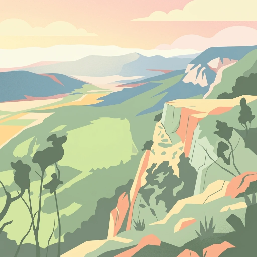
A stylized digital illustration of a mountainous landscape at sunset, featuring prominent steep limestone cliffs in the foreground and a vast valley extending into the distance under a warm-toned sky.
Nature reserveLower Austria
About 100 km away#8 closest

East

Hohe Wand Nature Park: Mapped Geography and Protected Landscapes in Lower Austria

A limestone plateau mountain at the Alpine-Pannonian transition

Located in Lower Austria, Hohe Wand Nature Park encompasses a distinct limestone plateau and dramatic southeastern cliffs. Its protected status reflects the convergence of Alpine and Pannonian geography, offering a unique opportunity to study karst geology, exposed cliff habitats, and the transition zone between high mountain ranges and the Vienna Basin lowlands.

Relief
Mountain
Climate
Temperate
Access
Easy access
Scope
Terrestrial

Common questions about visiting, size, designation, and location context for Gesäuse National Park

Gesäuse National Park FAQs for park facts, access, geography, and protected area context

Find quick answers about Gesäuse National Park, including protected-area facts, park geography, trail and visitor context, and how the park fits into its surrounding country and regional landscape.
MoriAtlas Explorer

Continue Your Protected Areas Search Across the Global Atlas

Deepen your exploration by continuing the structured search for national parks and protected areas worldwide. Utilize the comprehensive filtering capabilities to compare different conservation landscapes and refine your understanding of global park geography. Discover more about the distribution and characteristics of protected natural areas.

Global natural geography