Mori Atlas logo
National parkNeusiedler See-Seewinkel National Park

Discover the unique geography and rich birdlife of Austria's easternmost national park.

Neusiedler See-Seewinkel National Park: A Mapped Steppe Lake and Wetland Protected Landscape in Burgenland

(Nationalpark Neusiedler See-Seewinkel)

Neusiedler See-Seewinkel National Park represents a remarkable protected landscape at the crossroads of Europe, safeguarding the Austrian portion of the shallow, steppe Lake Neusiedl. This national park in Burgenland preserves a distinctive mosaic of reed beds, salt marshes, and seasonally inundated pools, forming one of Europe's most significant wetland ecosystems. As an IUCN Category II national park and UNESCO World Heritage Site, it offers unique opportunities for atlas-based exploration of its Pannonian geography and rich biodiversity.

National ParkWetlandsSteppe LakeBirdwatchingUNESCO World HeritagePannonian Region
Illustration of a lake with a waterfall cascading down cliffs, surrounded by grassy wetlands and trees under a partly cloudy sky

Neusiedler See-Seewinkel National Park

National park

Park overview

Structured park overview, official facts, and landscape profile for Neusiedler See-Seewinkel National Park

Neusiedler See-Seewinkel National Park park facts, protected area profile, and essential visitor context
Review the core facts for Neusiedler See-Seewinkel National Park, including designation, size, terrain, visitor scale, habitats, and operating context in one park-focused overview.

About Neusiedler See-Seewinkel National Park

Neusiedler See-Seewinkel National Park occupies a remarkable position at the geographic and ecological intersection of central Europe's major landscape zones. The park extends across the Austrian portion of the Neusiedler See basin, a shallow steppe lake that represents the westernmost extension of the Eurasian Steppe belt into central Europe. This geological and ecological setting creates an environment fundamentally different from the Alpine landscapes that dominate much of Austria, instead presenting a mosaic of wetlands, grasslands, and salt-affected soils more typical of eastern European steppes.

The park's boundaries encompass diverse habitats that reflect the complex hydrology and geochemistry of the lake basin. The extensive reed belts surrounding the lake's margins provide critical habitat for waterbird colonies, while the underlying mineral-rich soils support specialized salt-tolerant vegetation communities. In the western portions, the low ridges of the Leitha Mountains provide a contrasting backdrop, while the northern Parndorf Plain and eastern Hanság wetlands complete the park's environmental framework. This topographic diversity, combined with the lake's seasonal water level fluctuations, creates an ever-changing landscape that supports exceptional biological diversity.

The park's establishment in 1993 marked a significant milestone in Austrian conservation history, as it was the first national park in Austria to achieve IUCN Category II designation. The 2001 UNESCO World Heritage inscription further elevated the site's international significance, recognizing both its natural values and the traditional cultural landscape shaped by centuries of pastoral use and human interaction with the wetland environment.

Quick facts and research context for Neusiedler See-Seewinkel National Park

Neusiedler See-Seewinkel lies in the Burgenland province of eastern Austria, near the town of Rust. The park protects the westernmost lake of the Eurasian Steppe, a shallow, nutrient-rich body of water with extensive reed belt coverage. The landscape sits at the ecological junction of Alpine and Pannonian bioregions, creating remarkable species diversity. Unlike typical Austrian national parks, the land is privately owned by approximately 1,200 local farmers who receive annual compensation for maintaining their parcels in a natural state. The visitor information centre is located in Illmitz, serving as the primary gateway for park interpretation and orientation.

Park context

Deeper park guide and search-rich context for Neusiedler See-Seewinkel National Park

Neusiedler See-Seewinkel National Park history, landscape, wildlife, and travel context
Explore Neusiedler See-Seewinkel National Park through its history, landscape character, ecosystems, wildlife, conservation priorities, cultural context, and seasonal travel timing in a structured park guide built for atlas discovery and search intent.

Why Neusiedler See-Seewinkel National Park stands out

The national park is renowned as one of Europe's premier birdwatching destinations, hosting over 350 recorded species including 178 breeding species at their westernmost distribution limits. The park supports internationally significant populations of great bustard, pygmy cormorant, ferruginous duck, little crake, and European bee-eater. The steppe lake environment creates ideal conditions for rare vagrant species, with the park recording Austria's first observations of Pacific golden plover, semipalmated sandpiper, and blue-cheeked bee-eater. The blending of Alpine, Pannonian, Asian, Mediterranean, and northern European species within a single protected area makes this a unique ecological crossroads.

Wide view of a large lake with shallow waters and grassy wetlands under a cloudy sky
Wetlands and lake landscape under overcast sky in Neusiedler See-Seewinkel National Park

Neusiedler See-Seewinkel National Park history and protected-area timeline

The Neusiedler See region has served as a ecological and cultural crossroads for millennia, positioned at the boundary between Alpine and steppe environments. For centuries, the area functioned as a buffer zone between the great powers of Europe, a geopolitical role reflected in its position at the eastern edge of the Alps and western edge of the Little Hungarian Plain. The Hanság marsh, once a significant natural component of the lake system, was drained over centuries for agricultural expansion, fundamentally altering the eastern portion of the wetland complex.

The national park's establishment in 1993 represented the culmination of decades of conservation advocacy and negotiation with the complex land ownership structure that characterizes the region. Unlike other Austrian national parks that are state-owned, Neusiedler See-Seewinkel is held in private ownership by approximately 1,200 individual landowners, predominantly local farmers who receive annual compensation for maintaining their parcels according to conservation management requirements. This innovative ownership model has proven essential for maintaining the park's ecological integrity while respecting property rights and traditional land use practices.

The park's international recognition followed rapidly, with IUCN Category II designation achieved in 1994—making it Austria's first formally recognized national park under international standards. The 2001 UNESCO World Heritage inscription recognized the outstanding universal value of the cultural landscape, acknowledging the symbiotic relationship between natural systems and the traditional pastoral practices that have shaped the environment over generations.

Neusiedler See-Seewinkel National Park landscape and geographic character

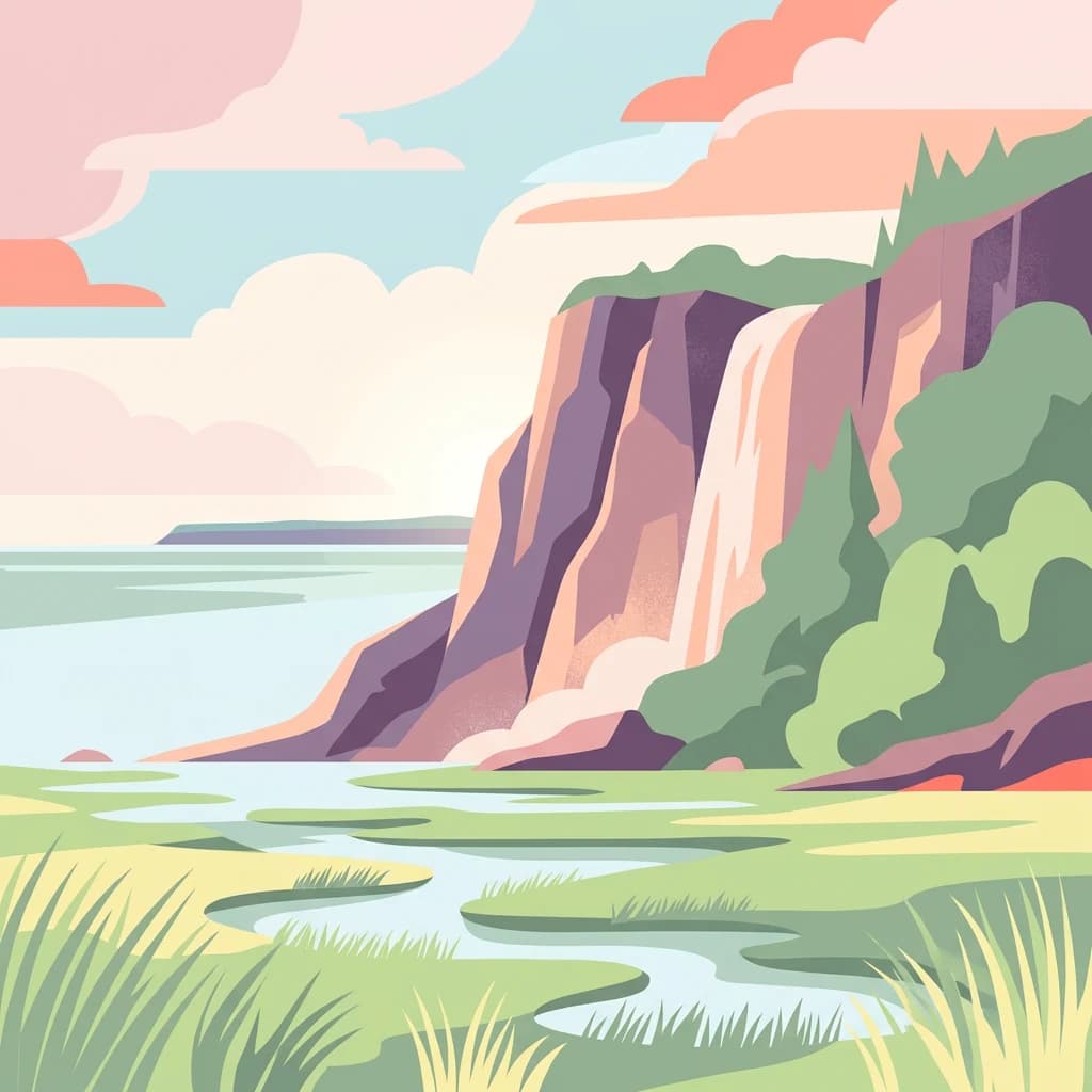
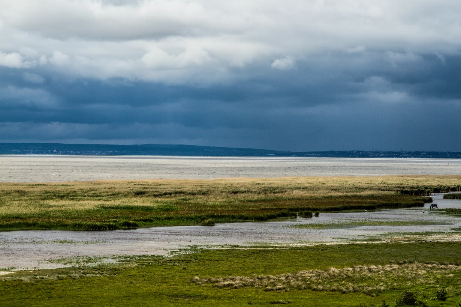
The physical landscape of Neusiedler See-Seewinkel is defined by the interplay between the shallow, reed-fringed Lake Neusiedl and the surrounding steppe grasslands and wetlands. The lake itself covers approximately 315 square kilometers overall, though only the Austrian portion falls within the national park boundaries. With an average depth of just one meter, the lake is highly vulnerable to seasonal water level fluctuations and wind-driven sediment dynamics. The extensive reed belts that fringe the lake's margins represent one of the largest continuous reed marsh systems in Europe, creating a distinctive visual character and providing critical ecological functions.

Beyond the lake margins, the park encompasses a varied terrain of low-lying grasslands, seasonal ephemeral pools, and areas of saline soil that support specialized vegetation communities. The Hanság, a former extensive mire system that was historically connected to the lake, occupies the eastern portion of the park, though much of this area was drained prior to the park's establishment. The Leitha Mountains to the west provide a subtle topographic contrast, their lower slopes meeting the lake plain in a gradual transition. The Parndorf Plain in the north completes the environmental framework, creating a landscape of remarkable internal diversity despite its generally flat character.

Neusiedler See-Seewinkel National Park ecosystems, habitats, and plant life

The ecological significance of Neusiedler See-Seewinkel stems from its position at the confluence of multiple biogeographic regions, creating a unique blend of species from Alpine, Pannonian, Asian, Mediterranean, and northern European origins. This biogeographic crossroads results in an extraordinary concentration of species diversity within a relatively limited area. The wetland complex supports complex food webs and provides critical breeding, feeding, and migratory habitat for hundreds of bird species.

The vegetation communities reflect the complex environmental conditions, with reed beds dominating the lake margins, while transitional grasslands, salt marshes, and sand steppes occur in the drier portions of the park. The seasonal wetting and drying cycles create dynamic habitat conditions that support specialized plant species adapted to fluctuating water tables and high soil salinity. Notable plant species include Suaeda pannonica and Lepidium cartilagineum, two species with Pannonian distribution patterns that reach their western limits here, as well as both blue iris and Siberian iris, which add seasonal color to the wetland margins.

Neusiedler See-Seewinkel National Park wildlife and species highlights

The avifauna of Neusiedler See-Seewinkel represents the park's most internationally significant natural value, with over 350 bird species recorded and 178 species confirmed as breeding within the protected area. Many of these breeding species reach their westernmost population limits within the park, making it a critical conservation site for species whose distributions are centered further east. The great bustard, one of Europe's heaviest flying birds, breeds in the grasslands surrounding the lake, while the pygmy cormorant—a rare breeding species in central Europe—maintains a significant population in the reed beds.

The park's position along the Central European Flyway makes it a critical stopover site for migratory waterbirds, while its diverse habitats attract vagrant species from distant corners of the globe. Rare sightings have included the Pacific golden plover, semipalmated sandpiper, and blue-cheeked bee-eater—all representing first records for Austria. The wetlands support important populations of ferruginous duck and little crake, while the surrounding grasslands provide habitat for the European bee-eater and Syrian woodpecker. This exceptional birdlife makes the park a premier destination for ornithologists and birdwatchers throughout Europe.

Neusiedler See-Seewinkel National Park conservation status and protection priorities

Neusiedler See-Seewinkel holds significant conservation importance at multiple scales, from national priorities to international commitments. The park's designation as Austria's first IUCN Category II protected area established a benchmark for national park management in the country, while its UNESCO World Heritage inscription acknowledges outstanding universal value that transcends national boundaries. The steppe lake ecosystem represents one of the last remaining examples of this habitat type in central Europe, making its preservation critical for regional biodiversity.

The park's unique ownership structure presents both challenges and opportunities for conservation. The arrangement with private landowners, who receive compensation for maintaining their properties according to conservation management plans, has proven effective for balancing ecological objectives with property rights and traditional land use practices. This model recognizes that the park's cultural landscape values are inseparable from the agricultural activities that have shaped the environment over centuries, requiring ongoing investment in the relationship between conservation management and the farming community.

Neusiedler See-Seewinkel National Park cultural meaning and human context

The Neusiedler See region has been shaped by centuries of human interaction with its distinctive environmental conditions. The shallow lake and surrounding wetlands created challenges and opportunities that local communities adapted to through traditional land use practices, particularly pastoral farming and reed harvesting. This long relationship between human communities and the wetland environment resulted in the cultural landscape that led to UNESCO World Heritage designation.

The region's position at the crossroads of European cultural zones is reflected in the local communities, architecture, and traditions that characterize the surrounding area. The town of Illmitz serves as the park's primary access point and houses the visitor information centre, providing interpretation of both natural and cultural values. The traditional practice of maintaining grazing meadows within the park boundaries continues to play a role in habitat management, with the annual compensation to landowners supporting both conservation objectives and the economic viability of small-scale farming operations.

Top sights and standout views in Neusiedler See-Seewinkel National Park

Neusiedler See-Seewinkel stands as a unique conservation achievement in central Europe, protecting the westernmost steppe lake of the Eurasian Steppe within a national park framework that accommodates extensive private land ownership. The park's exceptional bird diversity—with over 350 species recorded and internationally significant populations of great bustard, pygmy cormorant, and ferruginous duck—makes it a landmark destination for ornithological tourism. The blending of species from Alpine, Pannonian, Asian, Mediterranean, and northern European origins within a single protected area creates an ecological crossroads of remarkable significance. The dual recognition as Austria's first IUCN-designated national park and a UNESCO World Heritage Site acknowledges both the natural exceptionalism and cultural landscape values of this distinctive environment.

Best time to visit Neusiedler See-Seewinkel National Park

The park offers distinct seasonal characteristics that influence the visitor experience throughout the year. Spring and early summer bring the peak breeding activity for many bird species, with the reed beds and wetlands alive with vocal activity as species establish territories and raise young. This period offers excellent opportunities for observing breeding waterbirds, including the spectacular colonies of herons and cormorants. Autumn migration brings large numbers of waterfowl moving through the lake basin, creating opportunities to observe significant concentrations of migratory birds. The winter months offer a different character, with the bare landscape allowing easier observation of species that remain year-round, though many bird populations are more dispersed across the region.

Park location guide

Geography guide, regional context, and park location map for Neusiedler See-Seewinkel National Park

Neusiedler See-Seewinkel National Park park geography, regions, and map view in Austria
Understand where Neusiedler See-Seewinkel National Park sits in Austria through a broader geographic reading of the surrounding landscape, nearby location context, and its mapped position within the national park landscape.

How Neusiedler See-Seewinkel National Park fits into Austria

Austria is a landlocked country in Central Europe, bordered by Germany, Czech Republic, Slovakia, Hungary, Slovenia, Italy, Switzerland, and Liechtenstein. The country is a federal semi-presessional republic composed of nine states, with Vienna as its capital and largest city. It has a population of approximately 9.1 million people.

Wider geography shaping Neusiedler See-Seewinkel National Park in Austria

Austria is located in Central Europe, lying in the Eastern Alps. It is bordered by Germany and Czech Republic to the north, Slovakia to the northeast, Hungary to the east, Slovenia and Italy to the south, and Switzerland and Liechtenstein to the west.

Map view of Neusiedler See-Seewinkel National Park

Use this park location map to pinpoint Neusiedler See-Seewinkel National Park in Austria, understand its exact geographic position, and read its mapped placement within the surrounding landscape more clearly.

Pigeon | © OpenStreetMap contributors

Location context for Neusiedler See-Seewinkel National Park

Burgenland

Visual Atlas of Neusiedler See-Seewinkel: Understanding Reed Beds, Wetlands, and Protected Steppe Environments

Neusiedler See-Seewinkel National Park Photos: Explore Landscapes, Habitats, and Steppe Scenery
Visually explore Neusiedler See-Seewinkel National Park through detailed imagery that captures its unique landscapes and critical wetland habitats. Understand the distinctive character of its vast reed beds, shallow steppe lake, and diverse protected environments, providing a deeper sense of this Austrian ecological crossroads.

Wide view of a large lake with shallow waters and grassy wetlands under a cloudy sky

Park atlas

Compare adjacent protected landscapes and trace the regional spread of conservation areas surrounding the Pannonian basin wetlands.

Explore Nearby National Parks and Protected Areas around Neusiedler See-Seewinkel National Park
Deepen your understanding from Neusiedler See-Seewinkel National Park by exploring nearby national parks and protected areas, showcasing diverse wetland, steppe, and lowland landscapes throughout Eastern Austria and the Pannonian Region. Compare these interconnected conservation sites to trace their distinct ecosystems, regional geography, and unique conservation values within a cohesive atlas framework.
Watercolor illustration of a landscape with green hills, a body of water, and trees under a soft sky
National parkGyőr-Moson-Sopron

Fertő-Hanság National Park: Central European Wetland and Salt Lake Protected Area

Mapped Geographic Boundaries and Landscape Context

Fertő-Hanság National Park, situated in Győr-Moson-Sopron, Hungary, is a vital protected landscape renowned for its shallow salt lake and expansive marshlands. This page provides an atlas-focused discovery of its protected area, highlighting the unique interplay of reed beds and alkaline grasslands. Understand the park's geographic setting and its role as a significant wetland ecosystem for bird populations and specialized flora.

Area
235.88 km²
Established
1991
Relief
Lowland
Climate
Temperate
National parkLower Austria

Danube-Auen National Park: Protected Floodplain Ecosystem and Regional Geography

Mapped boundaries and vital riparian landscape in Lower Austria.

Delve into the unique protected landscape of Danube-Auen National Park, a cornerstone of Central European riparian conservation. This page offers detailed insights into its mapped boundaries, the dynamic interplay of river channels, lowland forests, and wetlands, and its significant role within the geographic context of Lower Austria. Understand the atlas value of this protected area, ideal for discovering rich natural terrain and ecosystem context.

Area
93 km²
Established
1996
IUCN
II
Relief
Lowland
National park

Balaton Uplands National Park: Mapped Volcanic Terrain and Protected Landscape Atlas

Explore Hungary's protected volcanic landscape and its regional geography.

Balaton Uplands National Park presents a compelling study in volcanic geography, showcasing dramatic 'witness mountains' and diverse terrains. As a protected national park in Hungary, it offers rich opportunities for atlas-style exploration of its mapped boundaries, unique basalt formations, and significant wetland areas. Discover the distinct geological narrative and landscape context of this protected region, providing a clear point of reference for understanding Hungary's natural heritage through structured geographic data.

Area
569.97 km²
Established
1997
Relief
Highland
Climate
Temperate
National parkSouth Moravian Region

Podyjí National Park: Explore Czech Republic's Intact River Canyon Ecosystem

Mapped Boundaries and Protected Landscape of South Moravia

Podyjí National Park, situated in the South Moravian Region, offers a profound look into one of Central Europe's most ecologically preserved river valleys. This national park is defined by its dramatic 220-meter deep Dyje River canyon, featuring rocky cliffs, stone seas, and a rich mosaic of forest and steppe habitats. MoriAtlas provides structured geographic information to analyze its unique landscape context, biodiversity, and role as a protected natural area within the Czech atlas.

Area
63 km²
Established
1991
National park

Thayatal National Park: Austria's Smallest Protected Landscape and Dramatic River Valley

Explore the mapped geography of a breakthrough valley and its rich biodiversity.

Thayatal National Park, Austria's smallest national park, offers a concentrated study in protected landscape discovery. Its core feature is the spectacular Thaya River breakthrough valley, a deep gorge cutting through gneiss terrain with steep, forested slopes. This page provides context for its mapped protected area, highlighting its exceptional biodiversity and its role as a transboundary conservation zone with the adjacent Czech Podyjí National Park. Understand the geographic setting and unique landscape character of this significant natural region.

Area
13.3 km²
Established
2000
IUCN
II
Relief
Mountain
National parkStyria

Gesäuse National Park: Detailed Protected Landscape and Alpine Geography in Styria

Explore Austria's dramatic river gorge and rugged peaks.

Gesäuse National Park in Styria represents a significant alpine protected area, characterized by the striking Enns river gorge cutting through the Gesäuseberge. This national park offers a unique geographic context, showcasing steep limestone peaks, dramatic rock faces, and a rich hydrological network. Discover the mapped boundaries and protected landscape of one of Austria's most visually striking natural passages, ideal for detailed atlas exploration and understanding alpine conservation.

Area
110 km²
Established
2002
IUCN
II
Relief
Mountain
National parkPest County

Danube-Ipoly National Park: Protected Landscape and Geographic Atlas

Mapping Hungary's diverse terrain and protected natural areas.

Delve into Danube-Ipoly National Park, a significant protected area renowned for its extraordinary ecological diversity. This page explores the park's distinct landscapes, from the volcanic formations of the Börzsöny Mountains to the deep karst cave systems of the Pilis, set against the backdrop of the Danube and Ipoly river floodplains. Understand its geographic placement within Pest County and its role as a vital protected landscape for conservation and atlas-based discovery.

Area
603.14 km²
Established
1997
Relief
Mixed relief
Climate
Temperate
Protected landscapeSouth Moravian Region

Moravian Karst Protected Landscape: Detailed Geographic and Cave System Atlas

Mapped protected boundaries and karst phenomena in the South Moravian Region.

Moravian Karst, designated a Protected Landscape Area, offers a profound look into complex karst geology within the South Moravian Region. This entry within MoriAtlas facilitates a structured discovery of its approximately 92 square kilometers, featuring an intricate network of over 1,100 caves and gorges. Users can explore the mapped extent of this geological treasure, understand its relationship with the surrounding regional geography, and appreciate the unique formations sculpted by underground water systems, including the iconic Macocha Abyss.

Area
92 km²
Scope
Terrestrial
Water
Minor water

Common questions about visiting, size, designation, and location context for Neusiedler See-Seewinkel National Park

Neusiedler See-Seewinkel National Park FAQs for park facts, access, geography, and protected area context
Find quick answers about Neusiedler See-Seewinkel National Park, including protected-area facts, park geography, trail and visitor context, and how the park fits into its surrounding country and regional landscape.
MoriAtlas Explorer

Continue Your Protected Areas Search Across the Global Atlas

Deepen your exploration by continuing the structured search for national parks and protected areas worldwide. Utilize the comprehensive filtering capabilities to compare different conservation landscapes and refine your understanding of global park geography. Discover more about the distribution and characteristics of protected natural areas.

Global natural geography